19th April, 2026
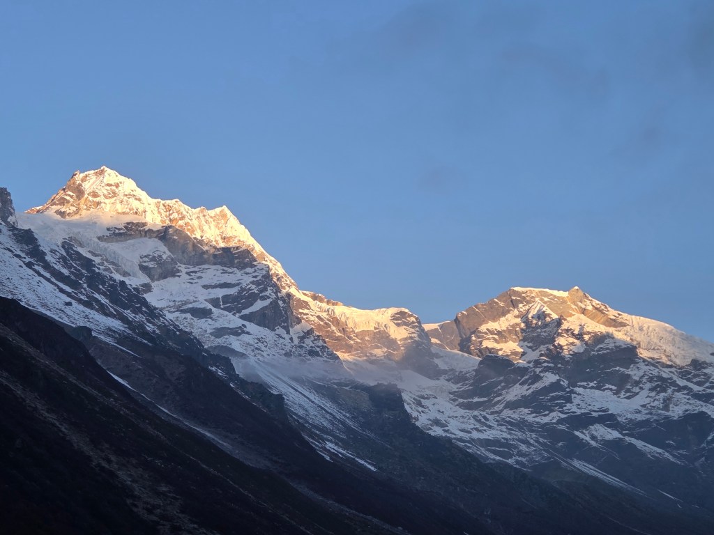
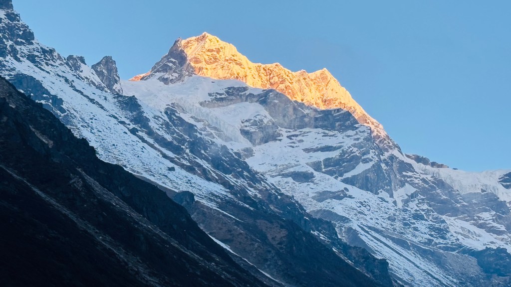
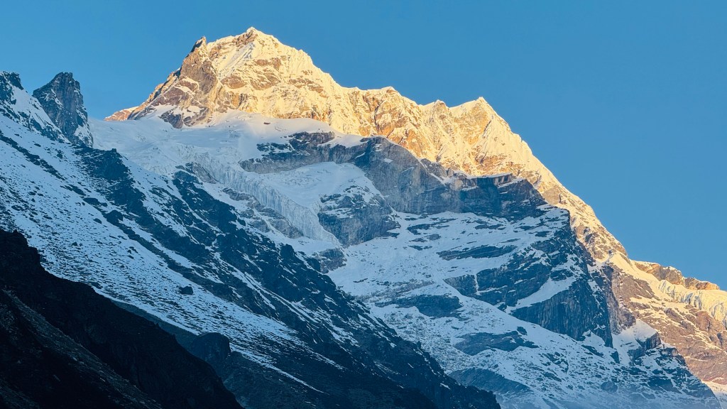
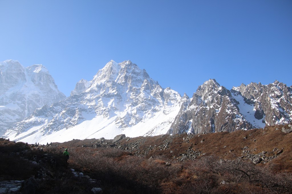
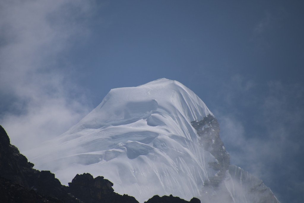
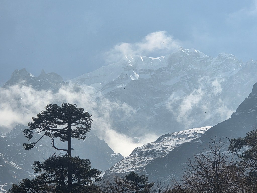
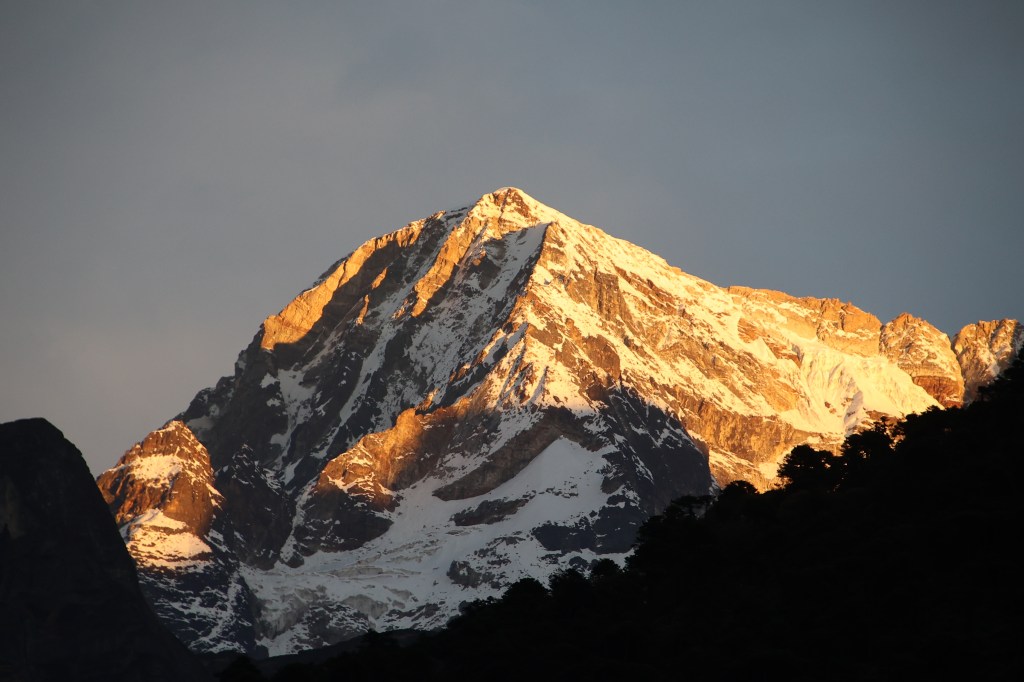
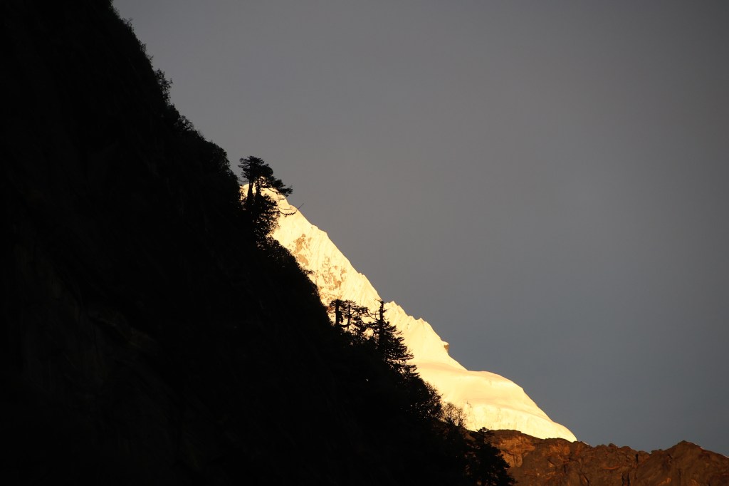
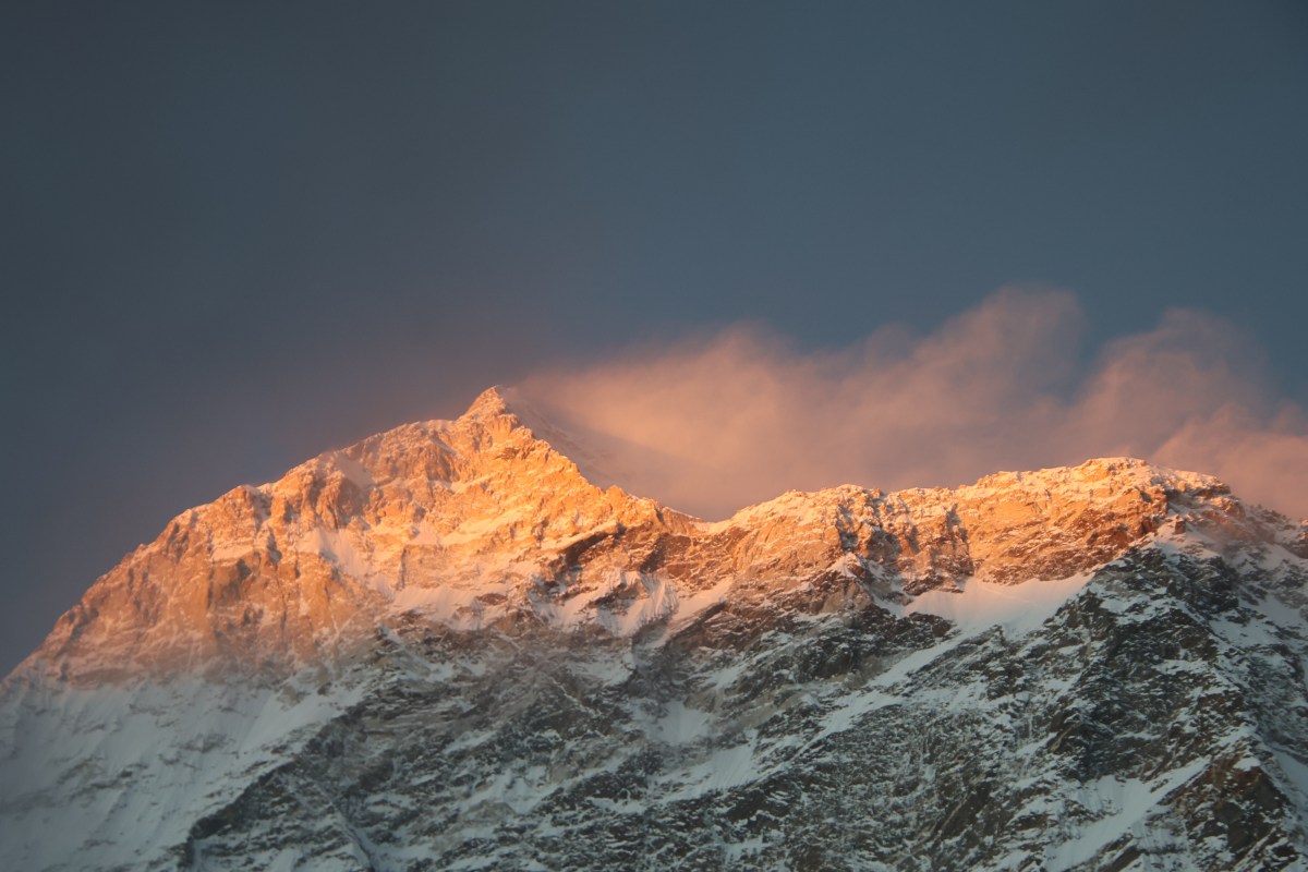
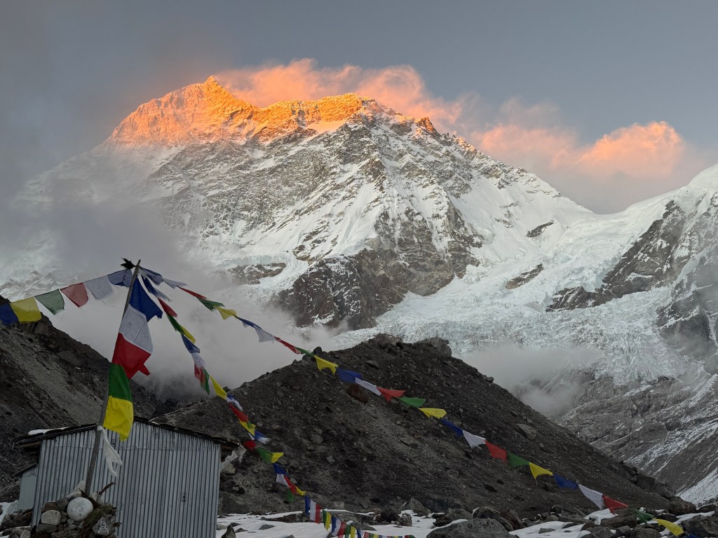
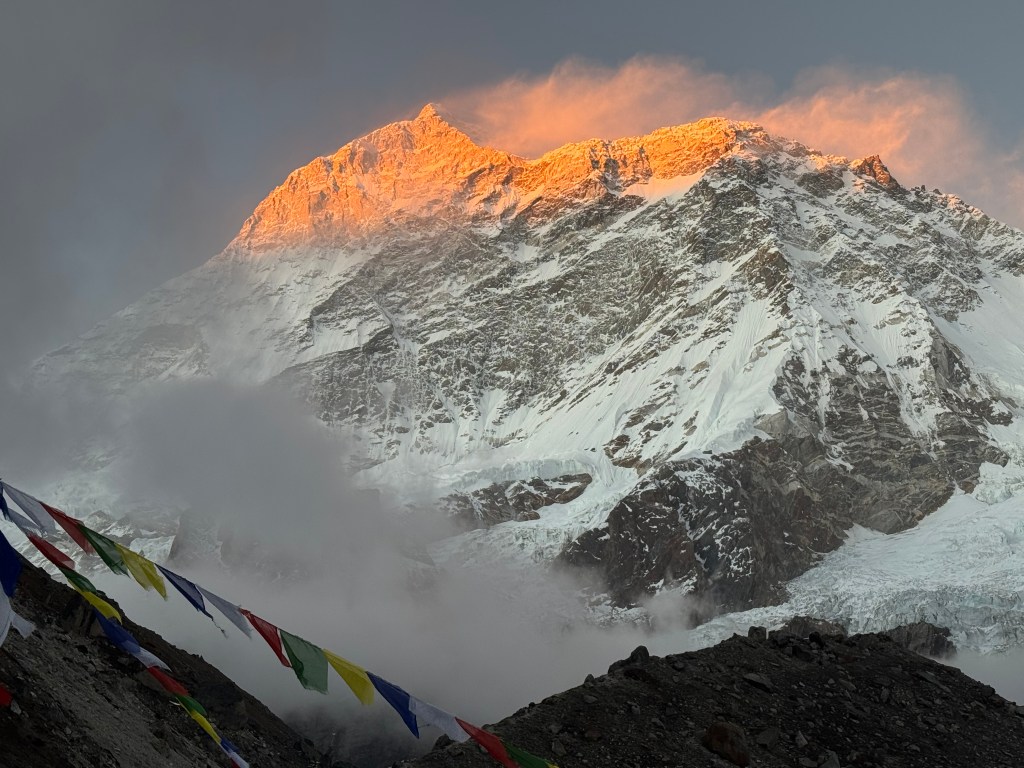
There was more time for sleep. Our slated time for departure moved back to 7.30 AM. The distance to traverse was within limits. Going by what Dilal had to say, it wasn’t more than 6 hours. But we were warned about an extended landslide area on the way. Khambachhen woke up to yet another clear morning. There was a similar display of golden showers on the mountain peaks. I thought of enjoying just with my eyes without bothering about cameras since we already captured these scenes the day before. However, when the scenes started to unfold, our hands automatically went to our cameras. We kept taking snaps despite being the repetition.

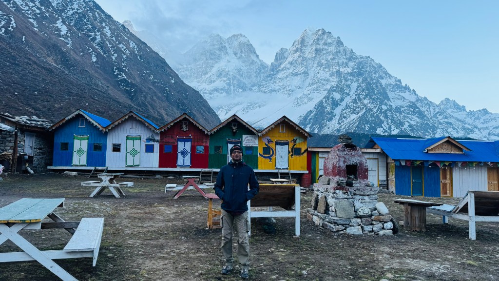
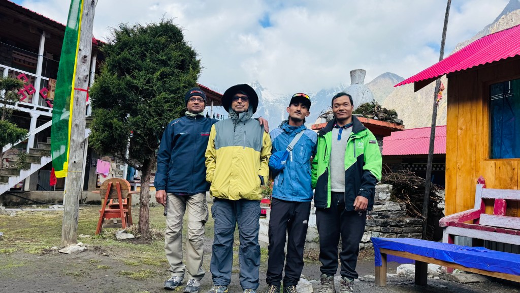
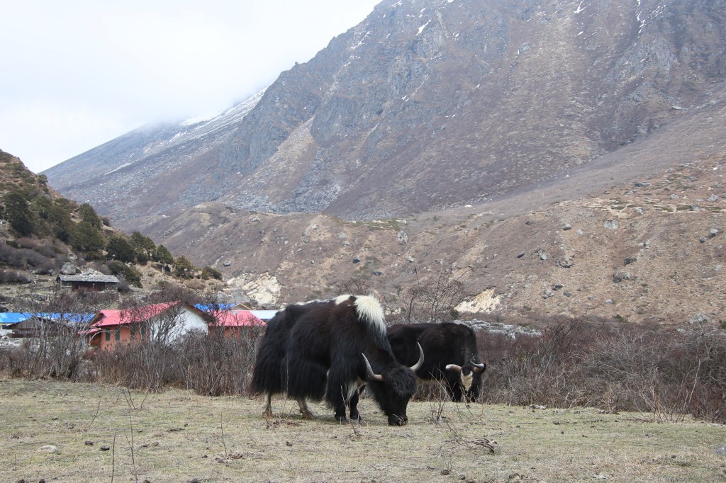
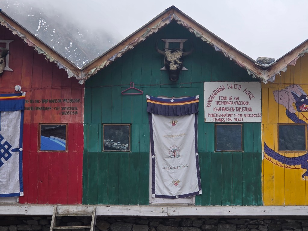
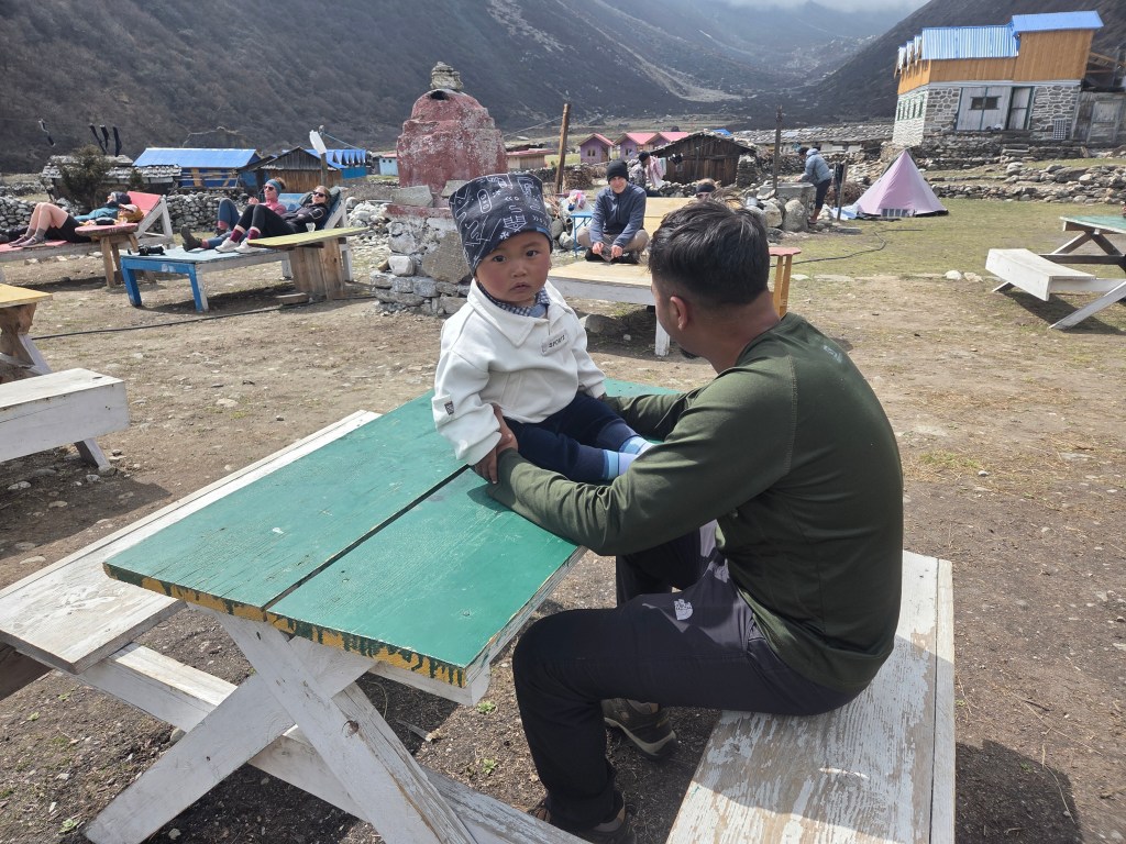
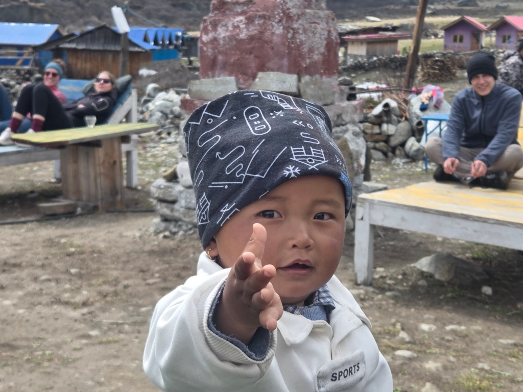
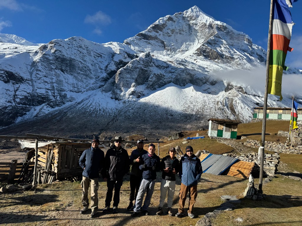
I recalled a similar experience at Samagaun during our Manaslu trek. Similar to Khambachhen, we had an extra stay there for acclimatization. On both the days we spent the morning taking snaps of sunrise views on the double edged peak of Mt Manaslu. At the breakfast table, the chapatis were better prepared, they were “Churum Churum” as the Nepalese would call it. Once ready, it was time for a group photograph. There were wooden rooms stacked together in a row. The entrance of each was decorated with a head of a yak. We saw it in Ghunsa as well as Khambachhen. Yesterday, we were pleased to meet Nupu’s father, who came all the way up from Ghunsa. He was carrying a one year old kid, his grandson (Nupu’s son) on his back, wrapped up in a shawl. His age was more than seventy five years but showed no signs of it while carrying around his beloved grandson. He was at the same duty on the early hours of the day. The chilling cold weather didn’t seem to affect the kid, who rode comfortably on his grandfather’s back. After the photographs, we bade goodbye to all and resumed our hike.

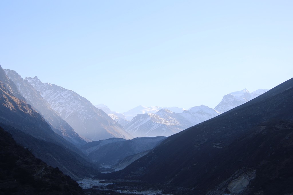
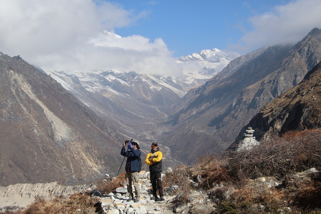
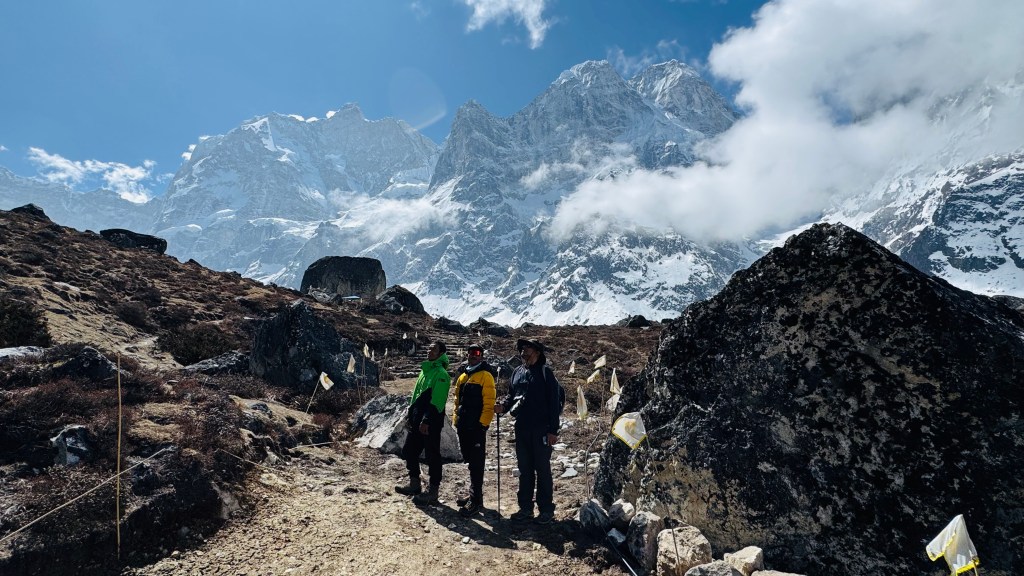
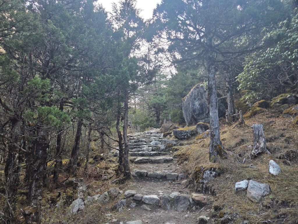
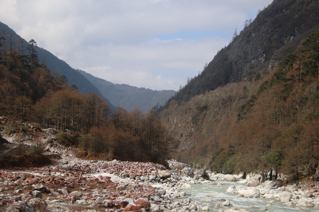
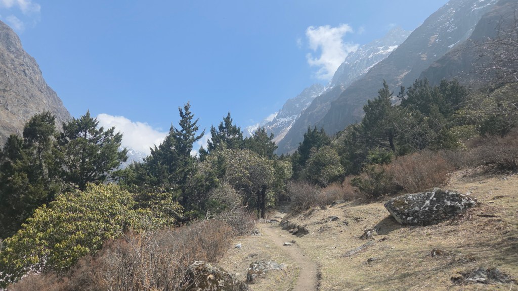
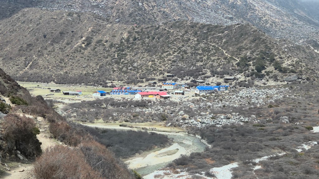
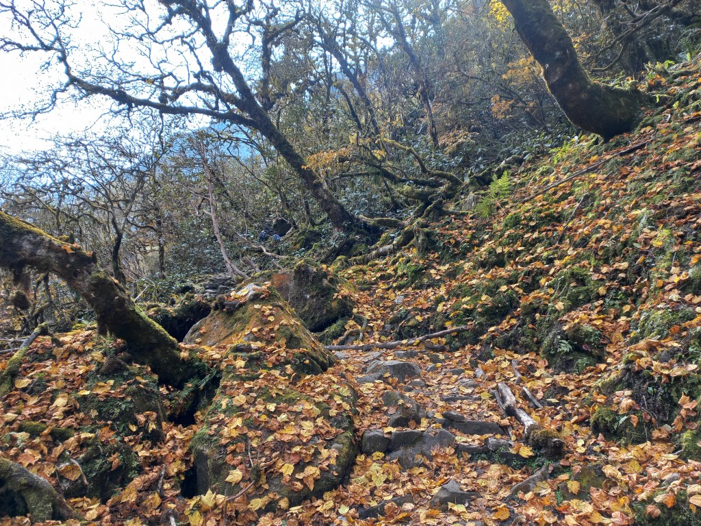
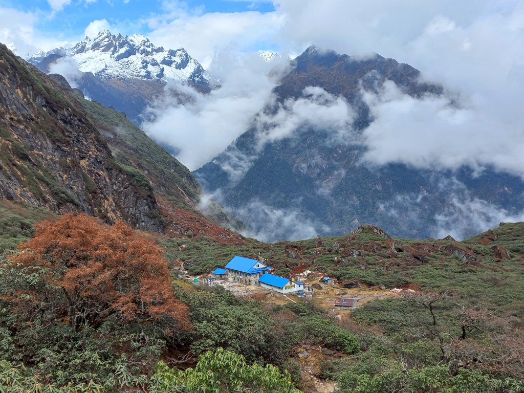
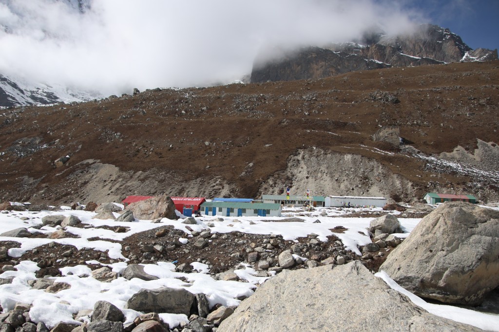
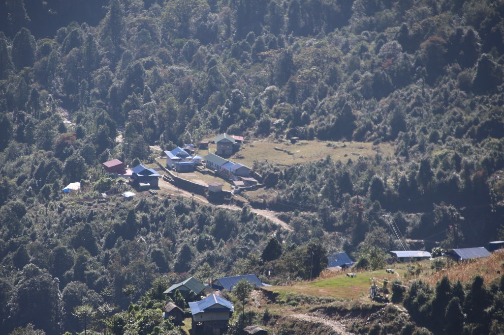
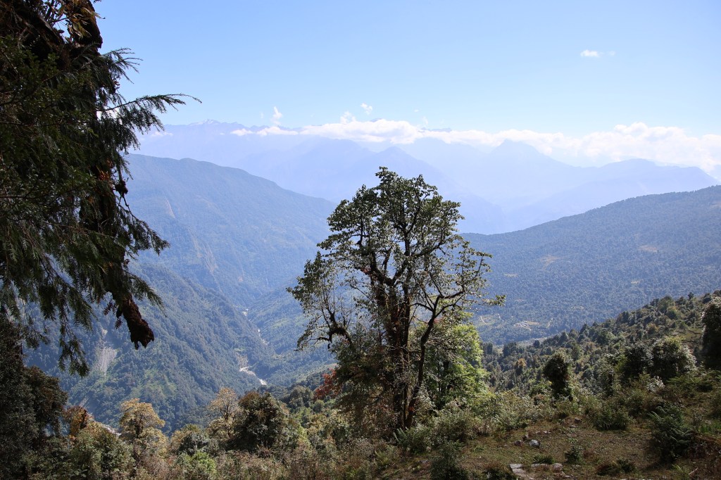
Limbu led the way out of the lodge premises. The trail moved up from the lawn and soon we found ourselves at a vantage point from where the entire valley of Khambachhen and it’s lodges were visible. After a turn to the north, we started walking along the edge. The Ghunsa river was to our right. Mountains rose steadily on the other side of the Ghunsa. That side was entirely devoid of green. It was all rock and snow. On our side, there were still some bushes and shrubs but they were diminishing fast. The trail was relatively level at the start of our walk but gradually it started moving down and after sometime we found ourselves walking beside the flowing Ghunsa.


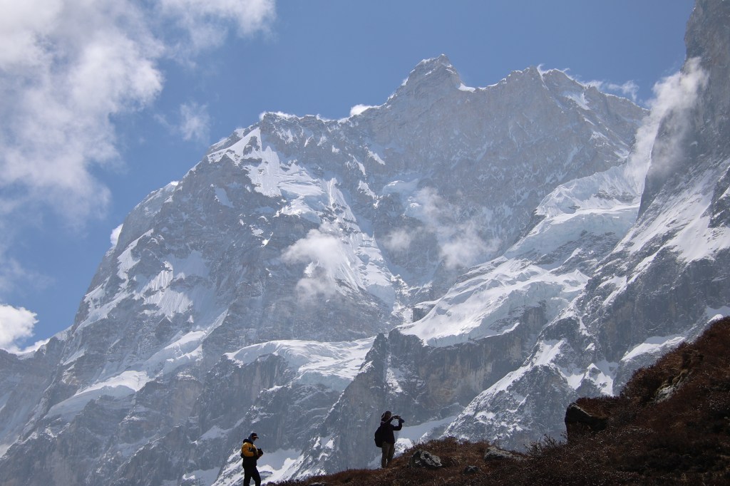
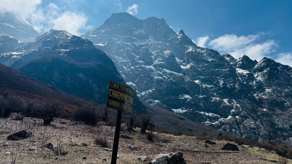
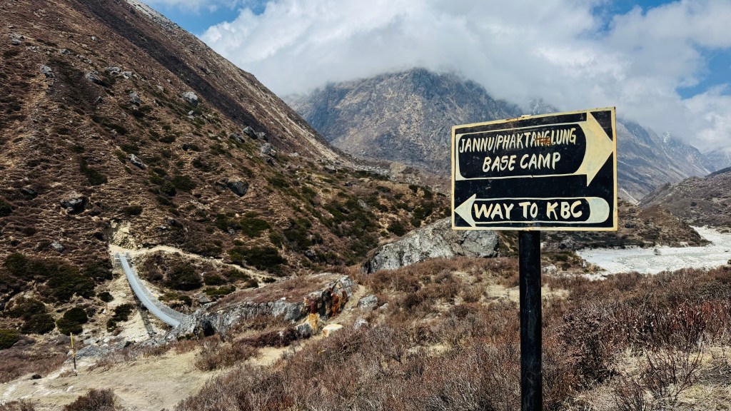
After sometime, we met Carole. She had been traveling extensively in Nepal. On this ocassion, she was on her way to the Pangpema base camp. Unlike us, she was traveling without a porter or a guide. After this trip, she had plans to descend to Ghunsa and then embark on the route towards Olangchung Gola via Nango La. That reminds me, that most of the international travelers we met, were on a combined trek that covers both the Pangpema (North) and the Yalung (South) base camps of Kangchenjunga. On the way down from this route, they had plans to rest at Ghunsa and then embark on the route towards Ramjer via Selele pass. Turning back to the story, we saw Carole standing near a sign board that read “Landslide area”.


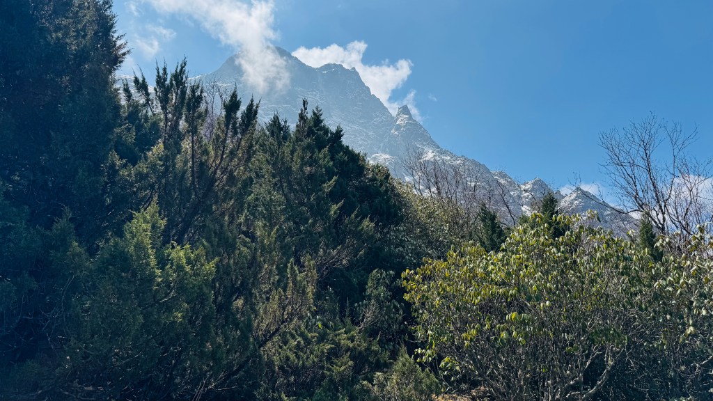
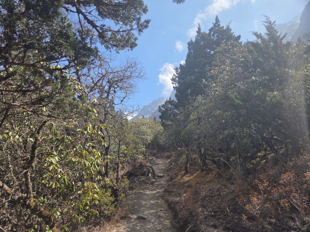
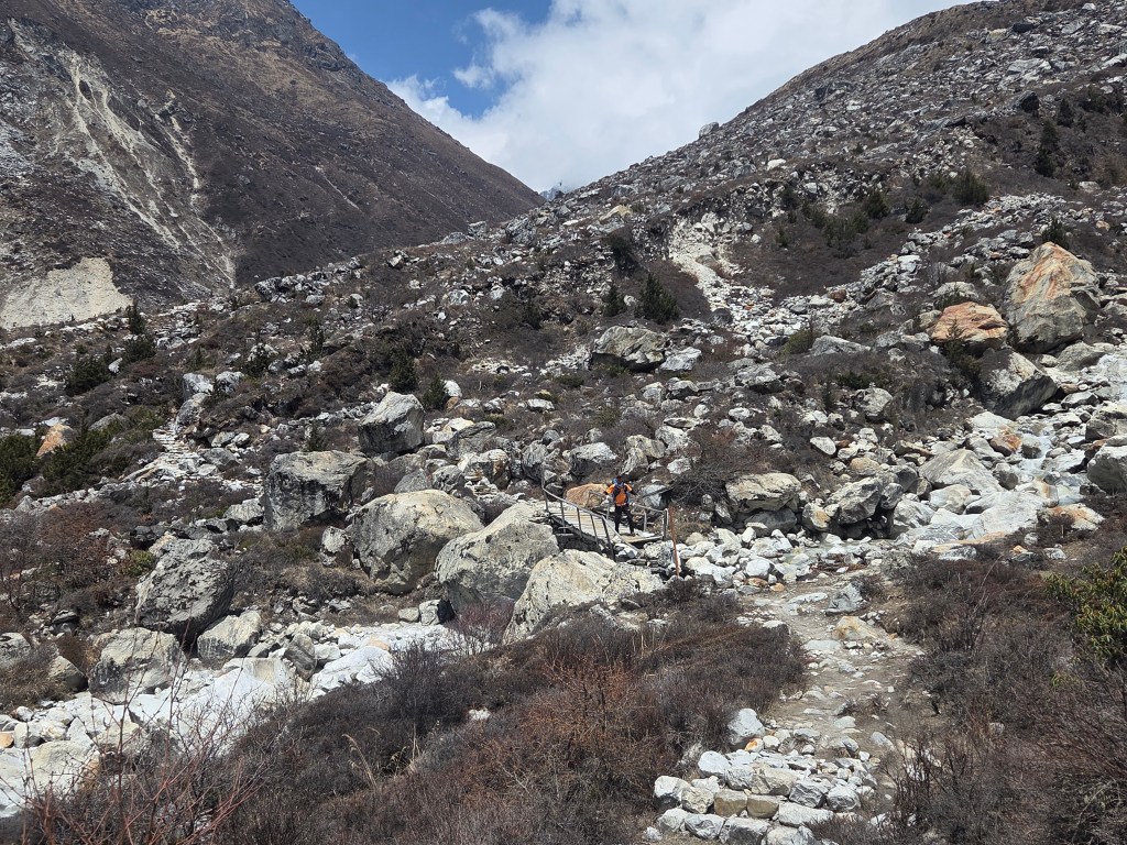
This was the first such board. She started later than us, crossed us along the way. Now that she was standing there, there was a reason (because otherwise, with her speed, we couldn’t have met her again). Apparently, she wanted us to shoot her sprinting along these tracks. After handing me her camera, she explained her plan. She’d hike along the track which started to elevate from that point, stop a few meters ahead (which is when I’d start the camera) and then she’d come sprinting down towards us (the camera should stop as soon as she’d reach us). After all the explanation, she hiked to the designated point and the shoot was executed as planned. She was thrilled like a child, looking at the recording and praised us immensely. She resumed her normal hike and soon disappeared from our sights. I gave a good look at the track that lay ahead. A narrow trail moved upwards. It was just wide enough for keeping a pair of feet. It appeared as a narrow line amidst the slopes which was entirely covered with loose stones. A single look at it would reveal the unstable nature of the heap of such rocks. Dilal cautioned us to keep moving fast, regularly casting a glance above to watch out for falling rocks. It reminded me of the trail towards Tilicho base camp, especially the section after Sreekharka. The challenge on such tracks is to maintain enough pace on unstable grounds. I started treading with careful steps. There was just enough space to keep my feet, but the pebbles constantly shifted grounds under them. Despite Dilal’s warning, I could hardly look above to my left. I decided to rely on Dilal’s vigil and kept my focus on the ground.


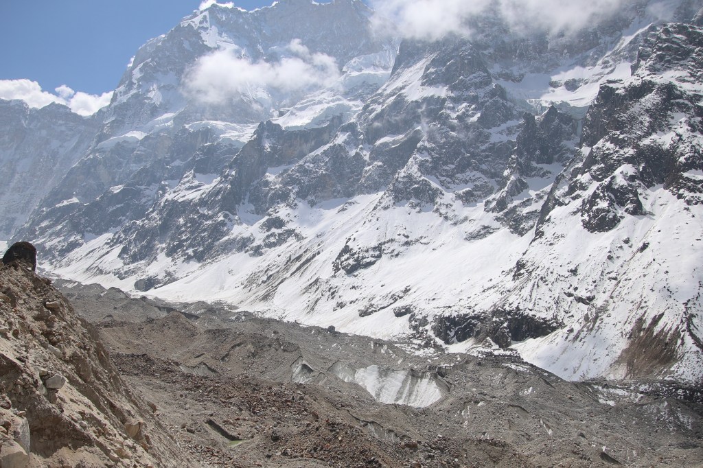
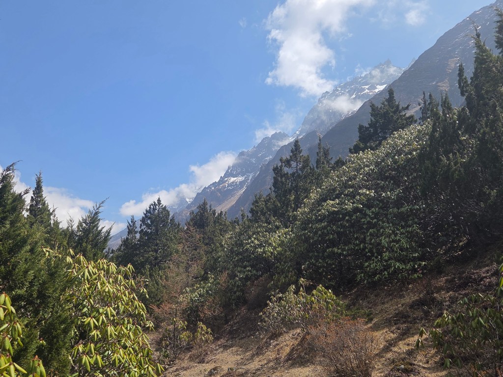
To the right, the dusty slopes went down towards the gorge where the Ghunsa was roaring down between the walls. Though not advisable, I stopped for a moment to soak in the dangerous beauty. The entire landscape was nothing but a huge heap of loosely stacked rocks, always at the cusp of tumbling at the slightest of triggers. Blowing winds, melting snow between rocks at higher altitudes or even rapidly moving mountain goats – any of these could act as triggers, sending down a stream of pebbles or rocks.
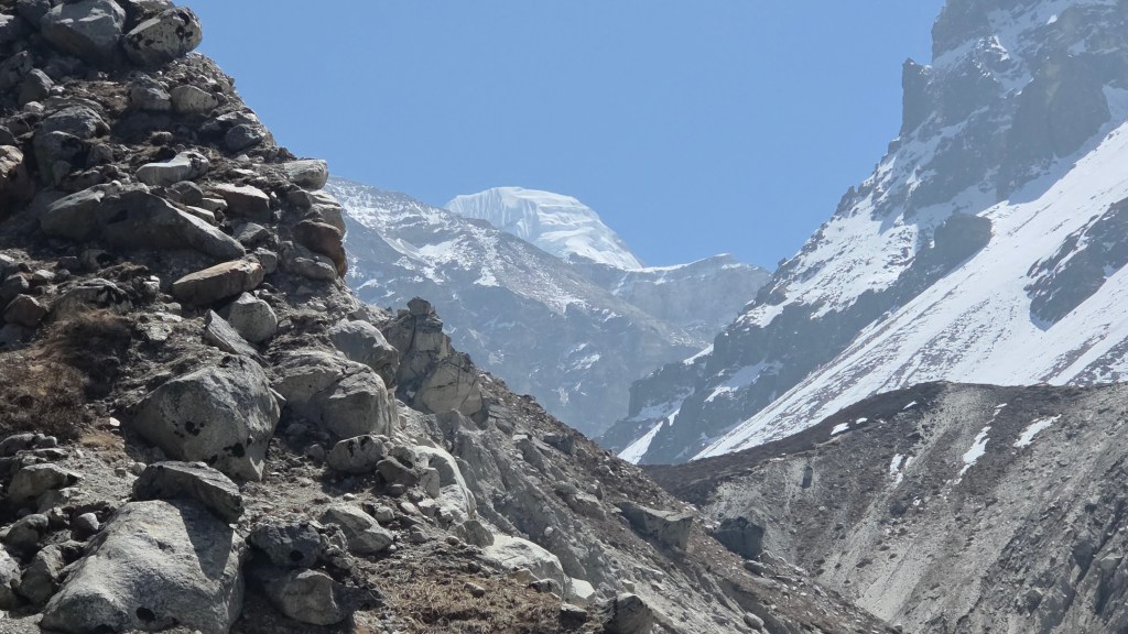

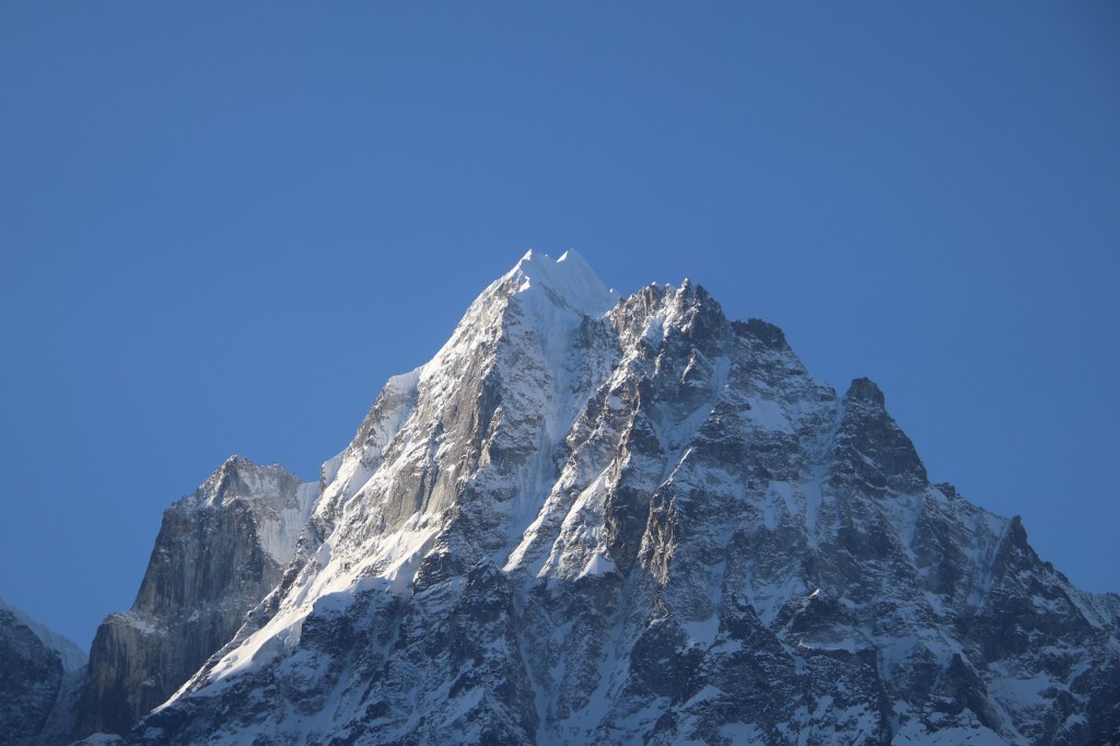
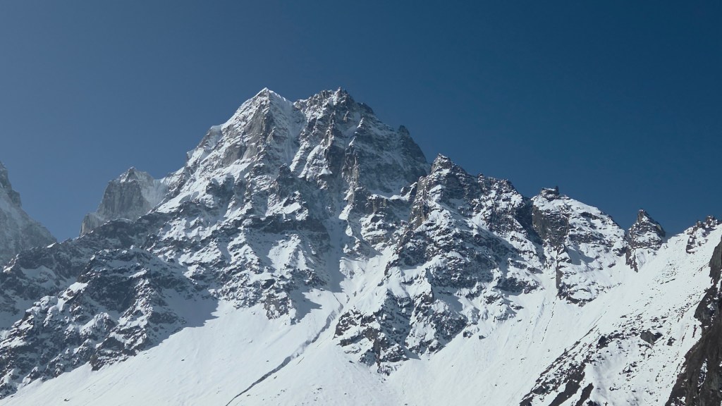
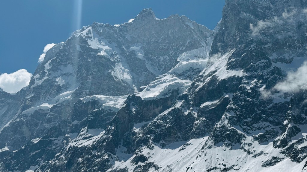
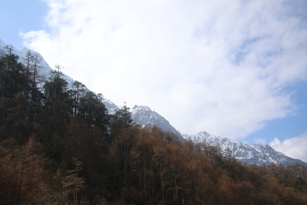
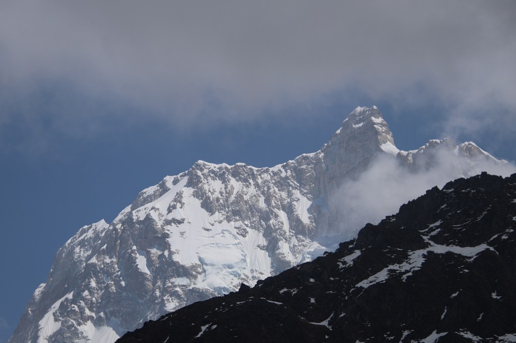
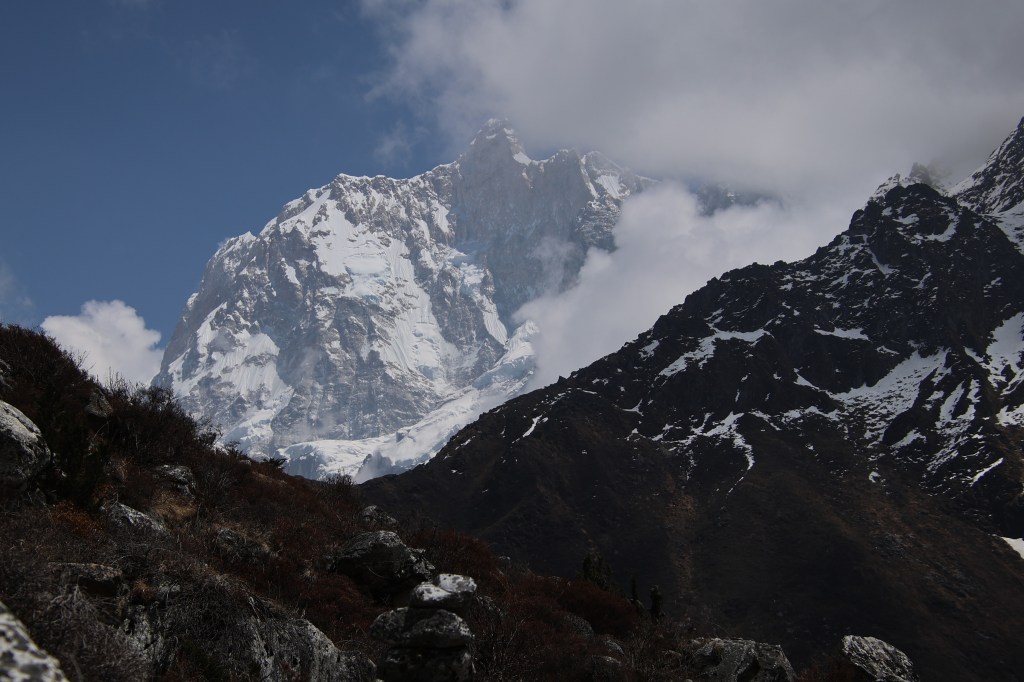
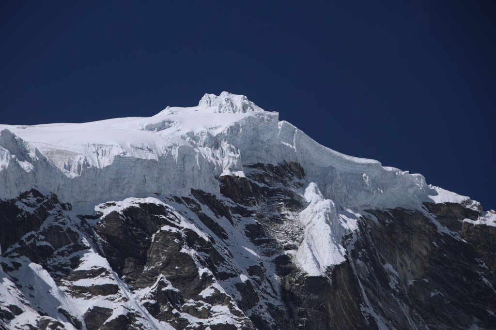
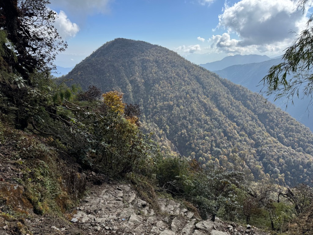
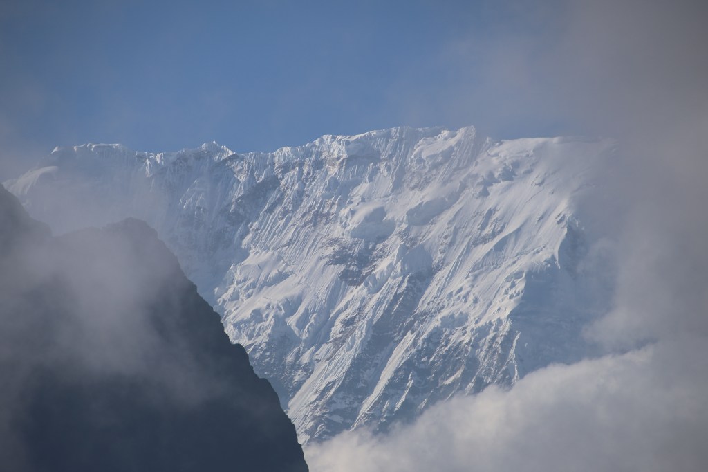
On the other side, the skyline was dominated by snow peaks. These were permanent abodes of snow. Streams of ice and glaciers lined their slopes. There was a cracking sound which drew our attention to the mountains, but we missed the sight of the avalanche and could only see the white dust and clouds generated by them where tumbling blocks of ice met the river stream. After treading cautiously for about 1.5 km, the track just lost itself amidst hude boulders. At that point, there was a frozen waterfall that came down the slopes to our left. We could see the drops and falls of the waterfall, just that it was frozen in time and state. The traverse now began by crossing the boulders. The trick was to find a route amidst the jumble via rocks that were stable at their bases avoiding the tempting ones which could dislodge you. After treading many such routes in the Himalayas, I somehow could identify most of these, while I had to rely on Dilal’s experience for the rest. I had to use my limbs as well as hands to climb or descend them to make my way through. Finally, as everything else, the maze ended and came up to a flat open space. We were breathing heavily and took time to rest our knees and lungs.
En-route Lhonak

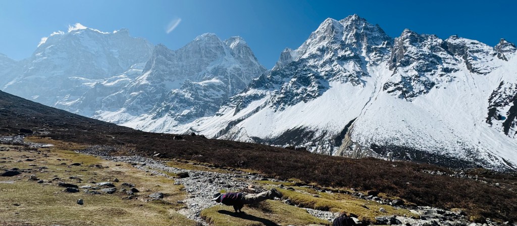
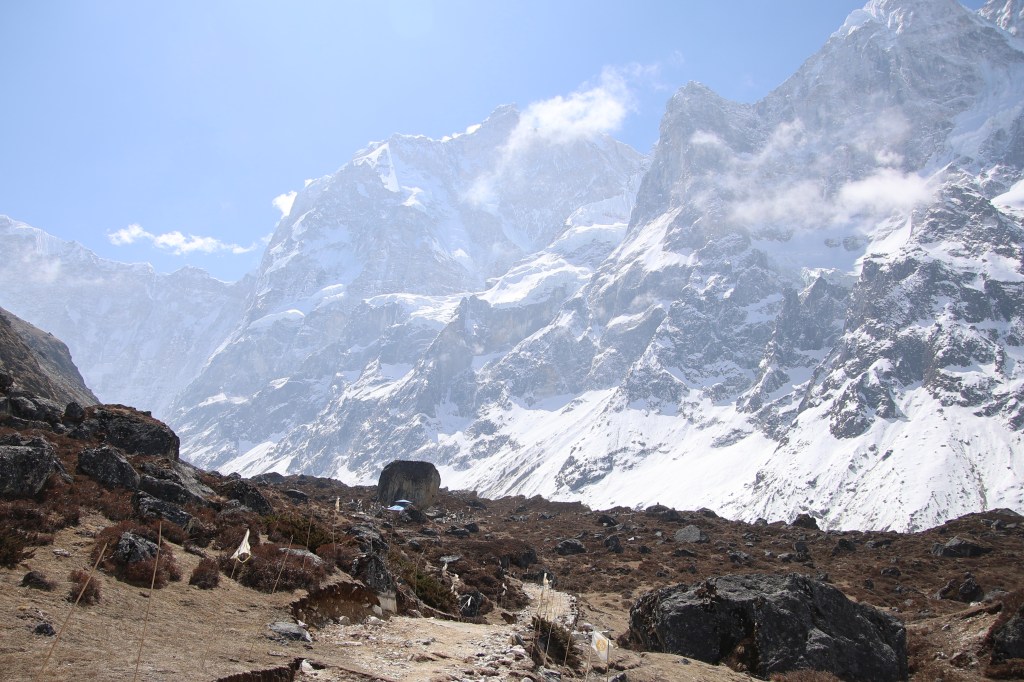
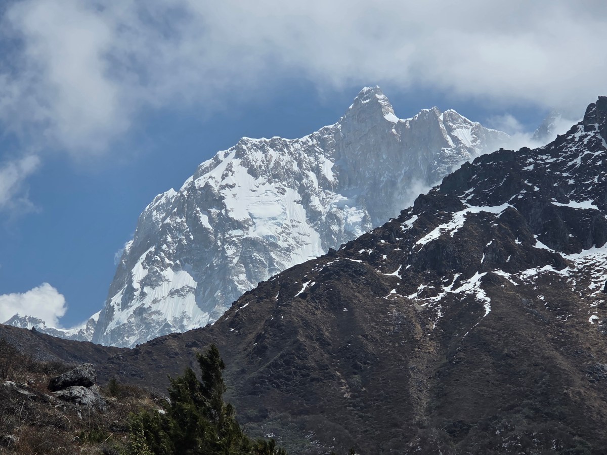
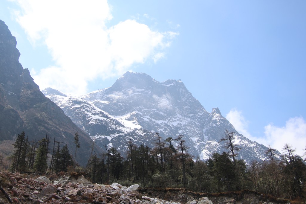
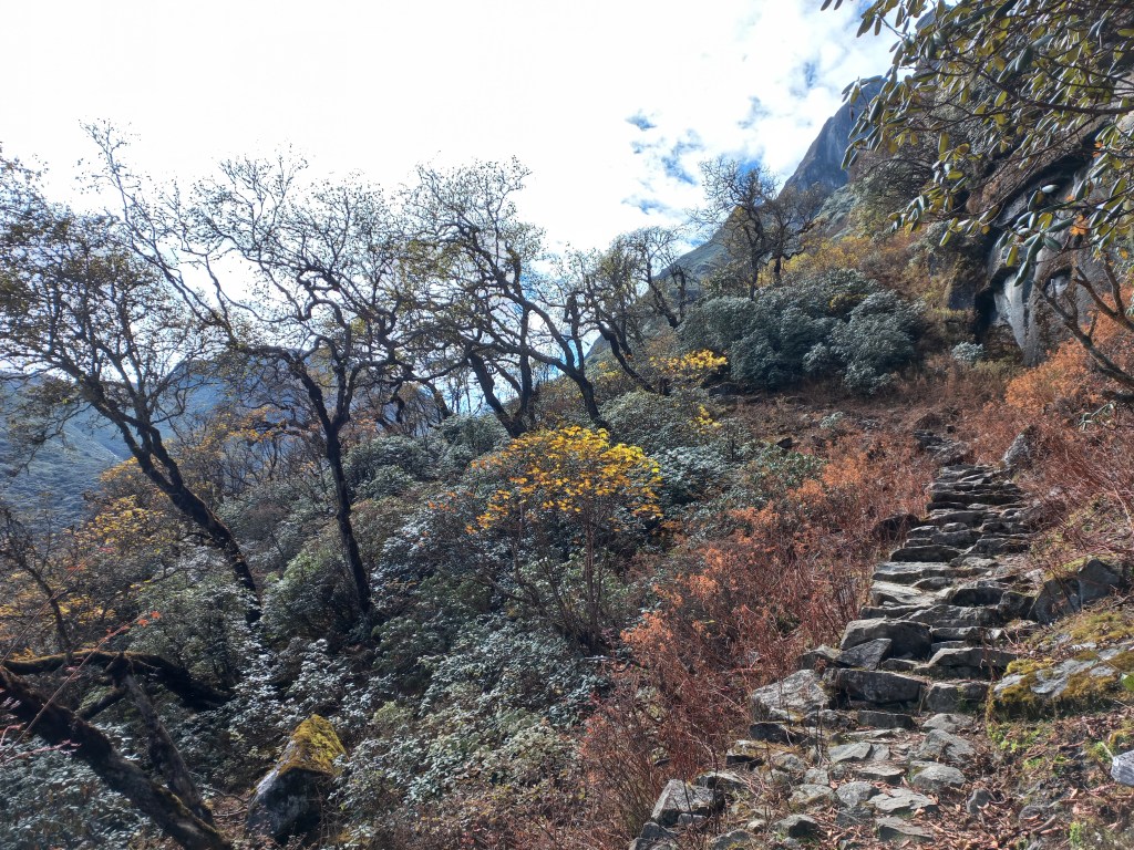
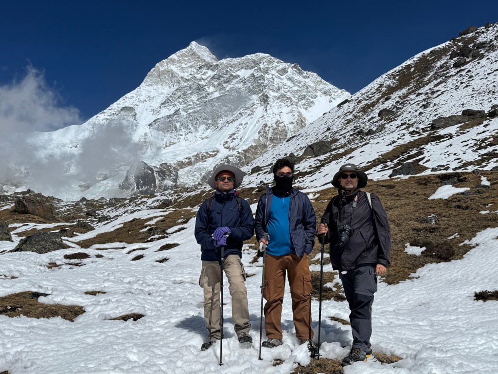
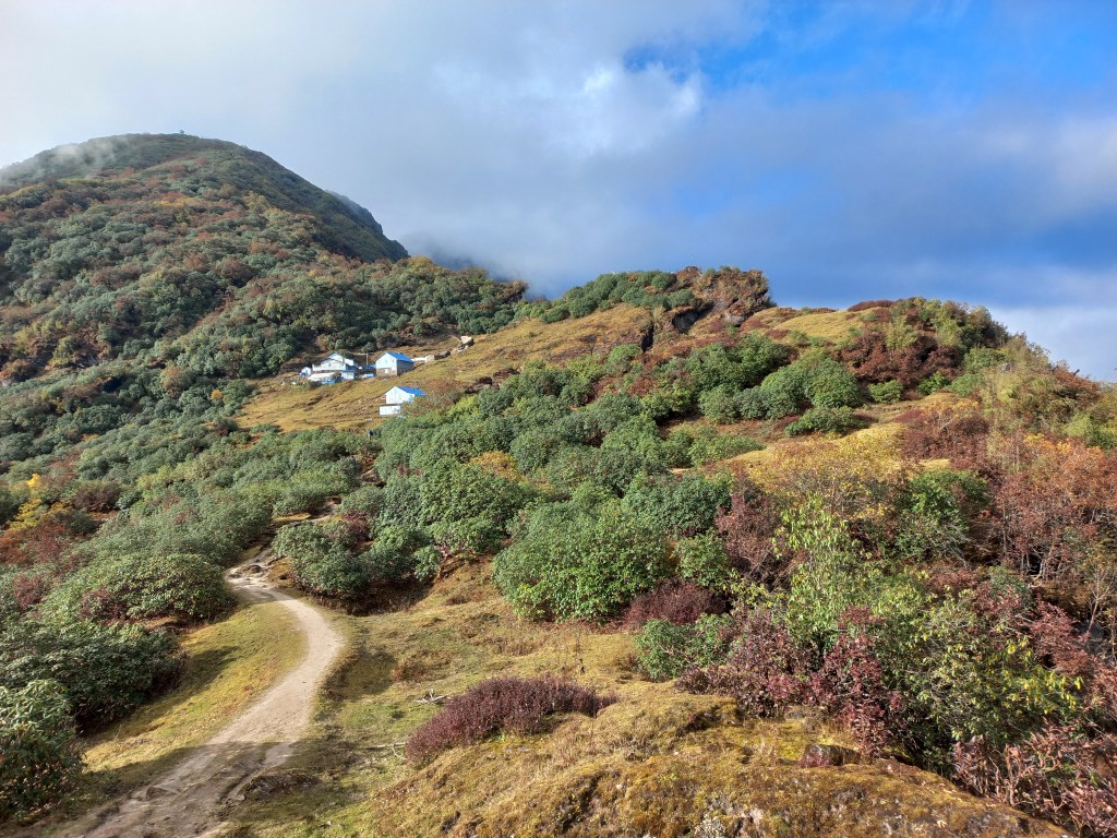
The breathlessness made the view of the surrounding mountain peaks even more enjoyable. From thereon, the trail moved up gradually and we entered a huge and widely spread valley. There were a few wooden rooms with slanted roofs. A few benches were laid out in front of them. "Ramdang (4596 m)" declared a sign board. We removed our backpacks and rested for sometime. Tea was served. The warm sips were more enjoyable because of the chilling winds which started to blow through the valley. The skyline on all sides was dominated by snow.


Ramdang
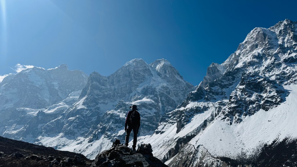
As we were soaking in the beauty with awe, Limbu drew our attention towards North. After some careful look, a structure started to emerge that resembled a standing human being with a hat. It was dark silhouette amidst the white background of peaks and glaciers, made up of rocks stacked up in a manner that resembled a human being.


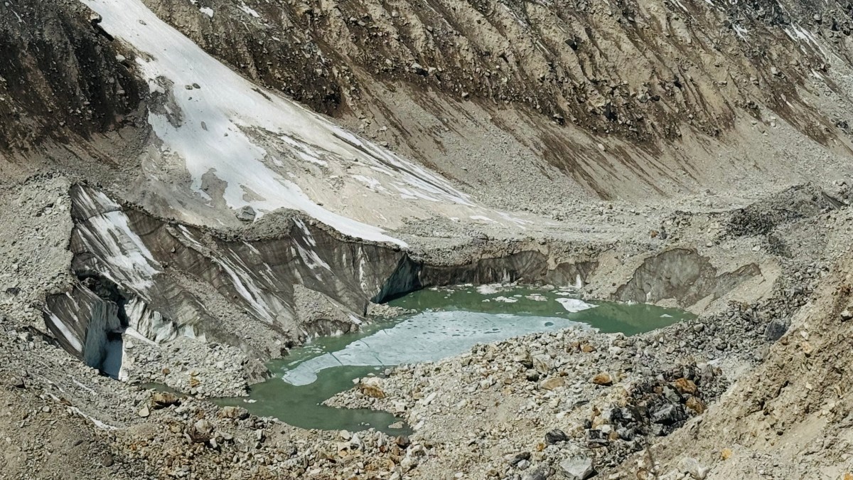
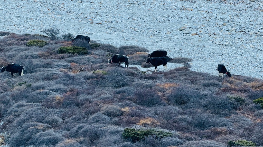
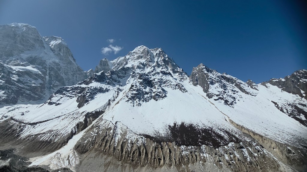
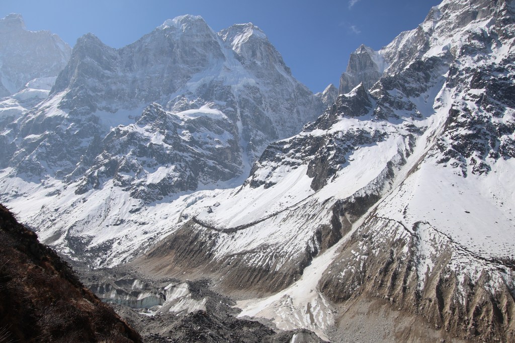
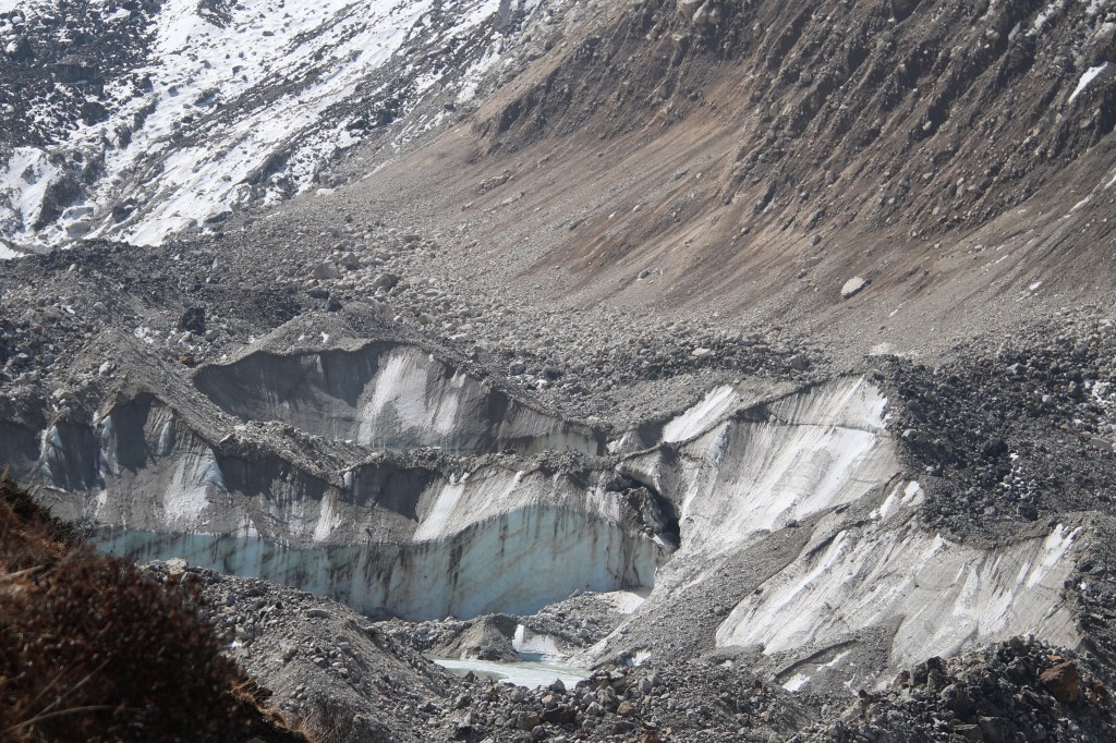
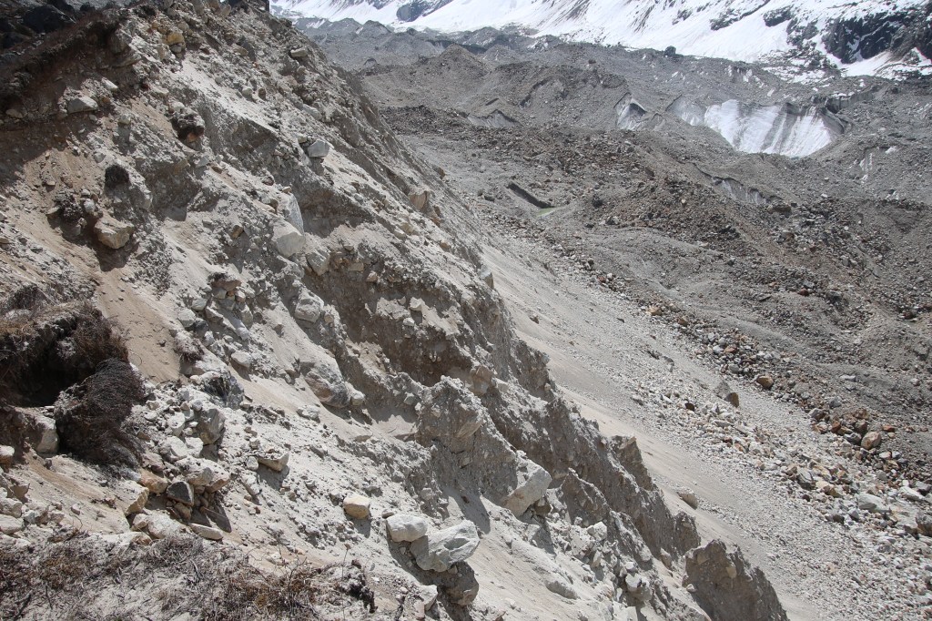
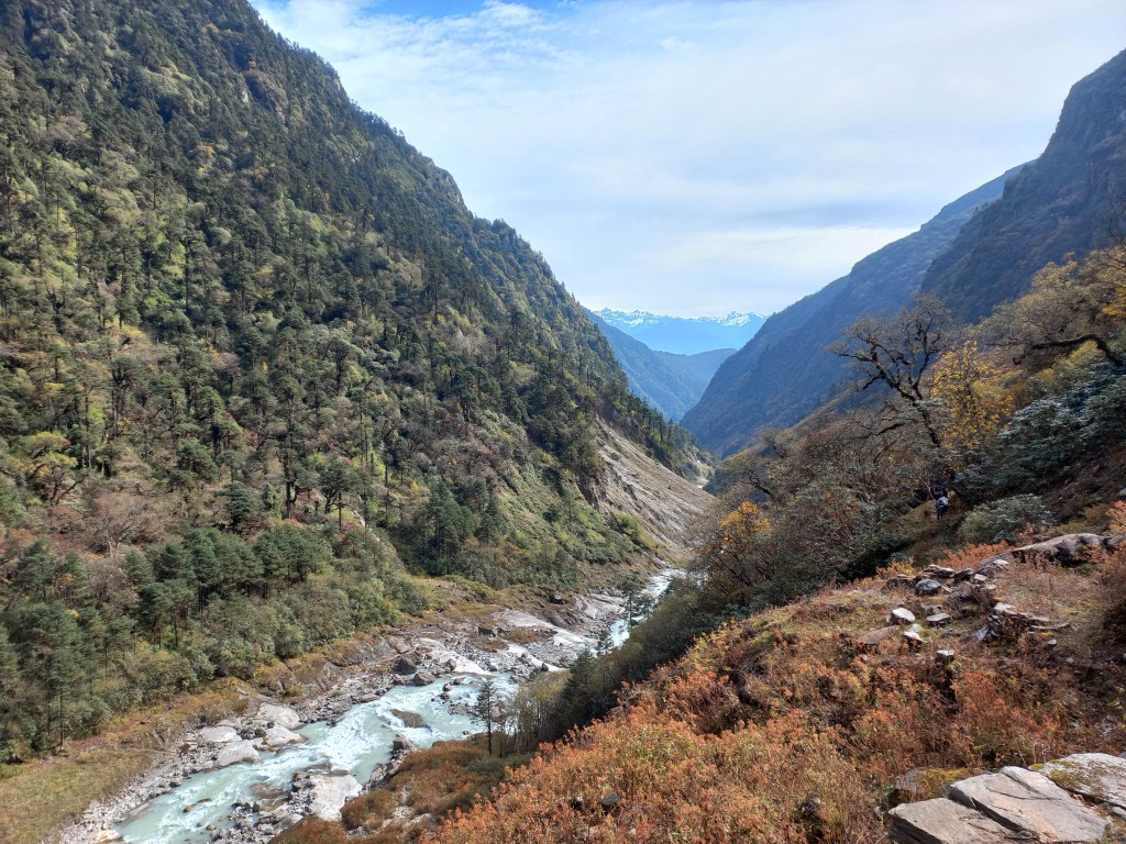
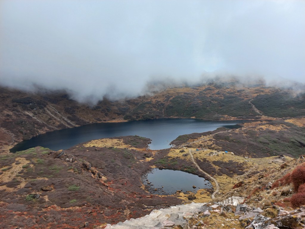
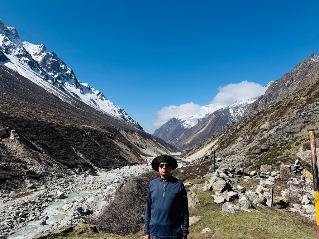
Our walk resumed through the valley. After exiting it, we entered an old landslide area. I call it old because a clear and relatively gradual path had been worked out through the rocks. We could see the stream of debris along the slopes. But on the ground, the rocks were wide apart from each other, firmly placed, with some mosses growing under them. Despite walking on relatively gradual trail, we could feel the thin air. We had to take mouthful of breaths as we walked. But nevertheless, walking was by and large comfortable. The valley narrowed and after sometime we exited it to come to a bend. The trail moved towards left with an abrupt turn from there. Another sign-board cautioned us about a landslide area in that direction. To our front, a huge drop went down towards the bed of a huge glacier where there was a big glacial lake. This is the Kangchenjunga glacier coming all the way down from the Pangpema base camp. It is the source of the Ghunsa river. We had our chances to know more about this lake and the danger it poses to the area in its current state, but that's a story to be told later.


Lhonak
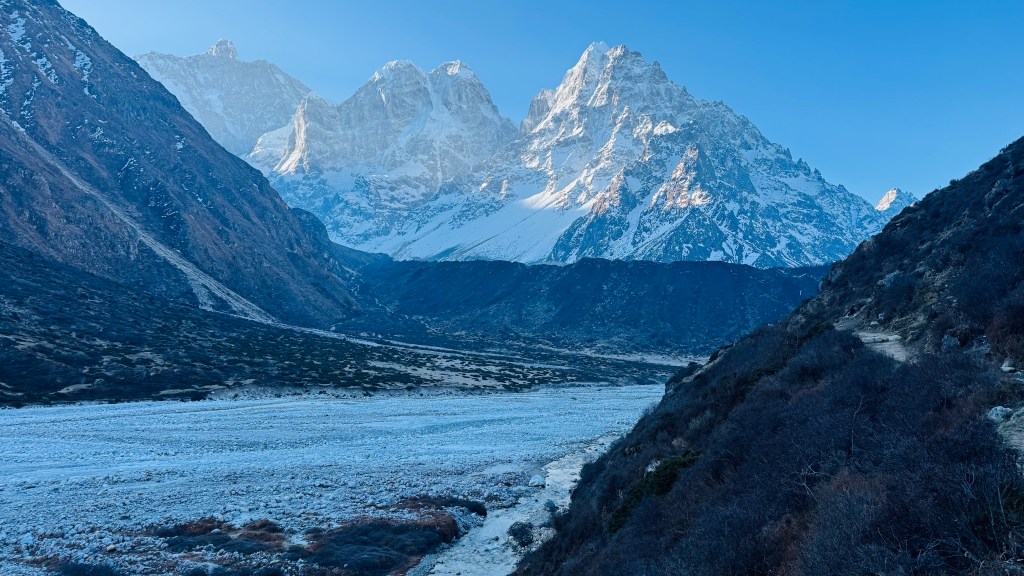
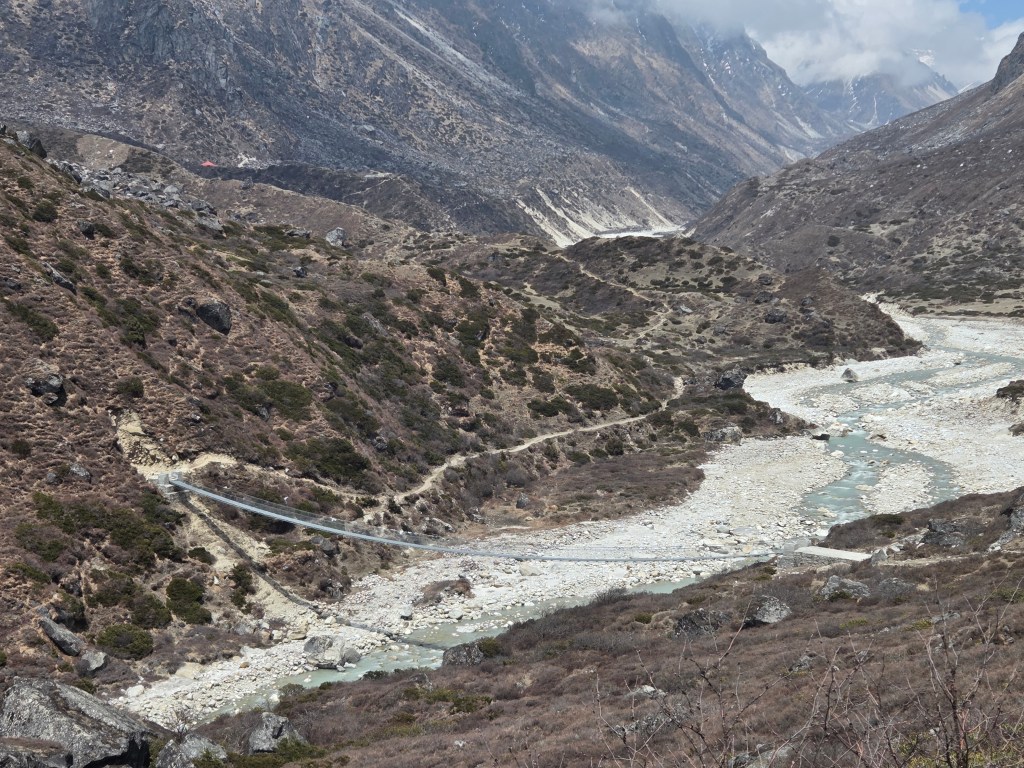
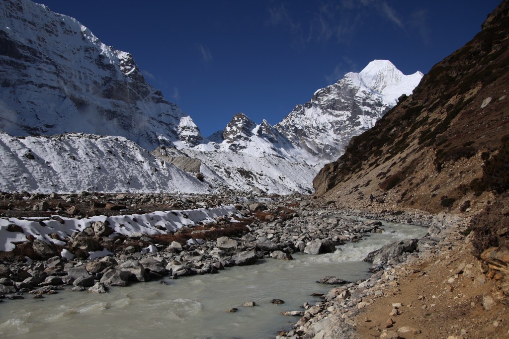
Winds were rising from the glacial bed which raised dust. The bright sunshine of the morning was giving way to clouds. We turned left and moved down through the landslide area. On this ocassion, the track was relatively wider and stable, though under constant threat of streaming boulders and stones from the slopes to our left. The trail finally led us to a small wooden bridge. The Lhonak river flowed under the bridge to descend in leaps and bounds to meet the Ghunsa near that glacial lake which we left sometime back. There were patches of snow on the trail on the other side of the bridge.


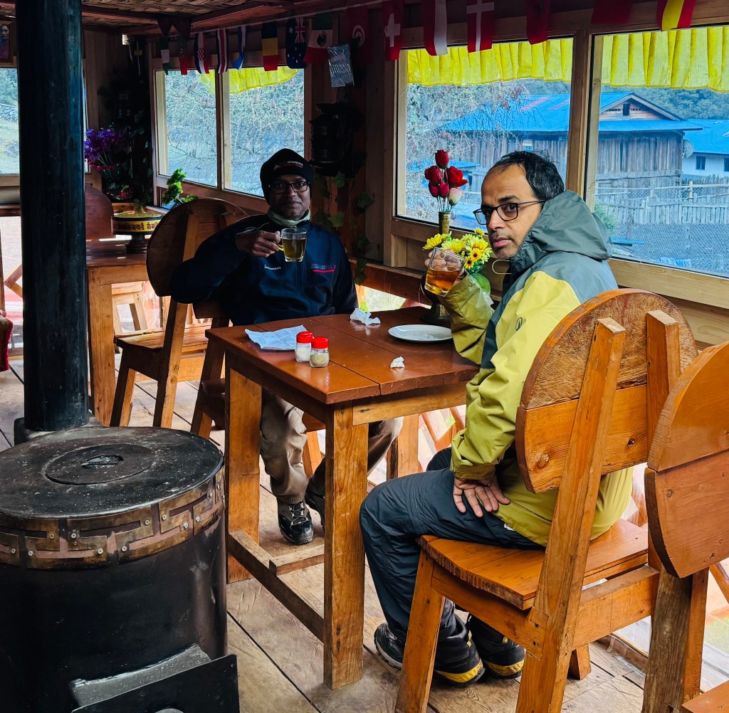
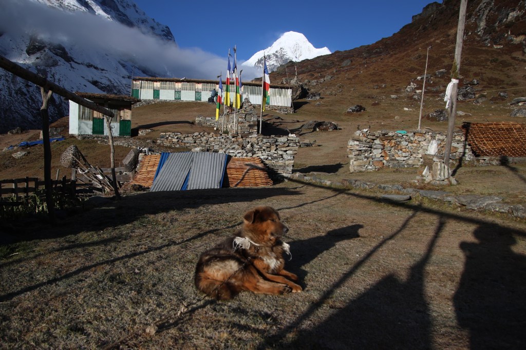
After crossing over, we went along the trail. There was a wide and open valley to our left. The Lhonak came down through the valley floor to exit it at the point where we crossed the wooden bridge. After walking for sometime, we saw the slanting tin roofs of a few lodges. That was Lhonak. It was about 13.30, when we reached the lawn of the Lhonak guest house, our place of stay. After entering through the main gate, there was a corridor that ran left to right. There were rooms on both sides of it. The only toilet was at the left extreme end of the corridor and our room at the opposite end. There were two beds aligned against the two walls with some space between them. A table was placed near the only window between the beds. There was some gap between the door and the beds. To our relief, some nails were fixed to the walls to allow hanging our clothes. A descent place under the circumstances. One good thing was that the toilet was within a covered area. There wasn't any need to venture outside for it. We had the entire afternoon at our disposal. A descent dal bhat meal filled our stomachs. Carole was allotted our neighboring room. Lhonak is just a few tea houses that are erected on an elevated ground beside the Kangchenjunga glacier.


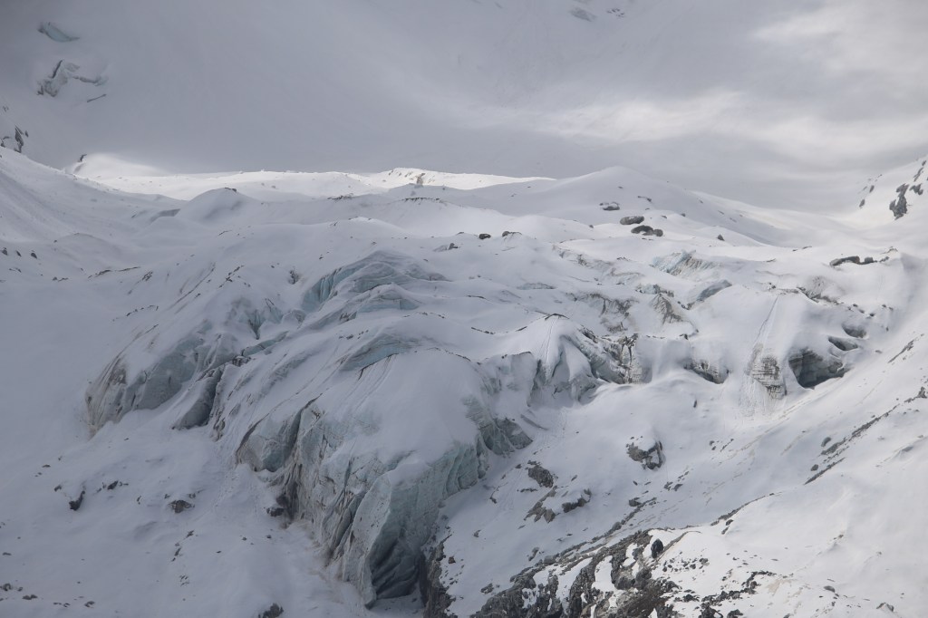
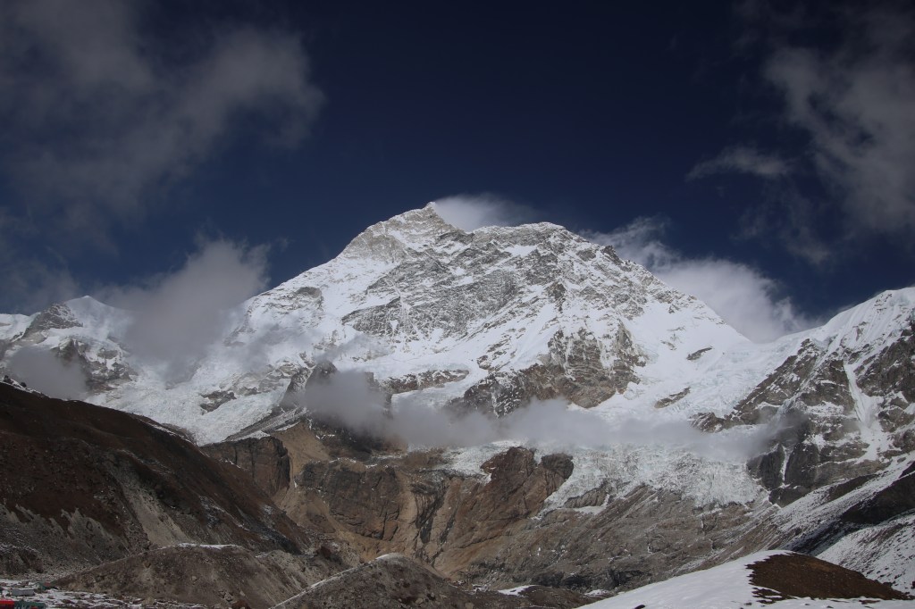
Small deposits of snow lay under the shades of the slanted roofs of the neighboring tea houses. That told us that the area was under snow cover only a few days before pur arrival. In the front of our tea house, the ground gradually elevated to a point. In the afternoon, we went to that point. Beyond it, there was a steep drop into the glacial bed. The huge Kangchenjunga glacier made its way down to the lower valleys through the gorge. The bed split up into large crevasses and lakes. We were looking at a large lake which contained a few islands of ice within it. I just had my rubber slippers on, which made me walk cautiously on the elevated slopes.

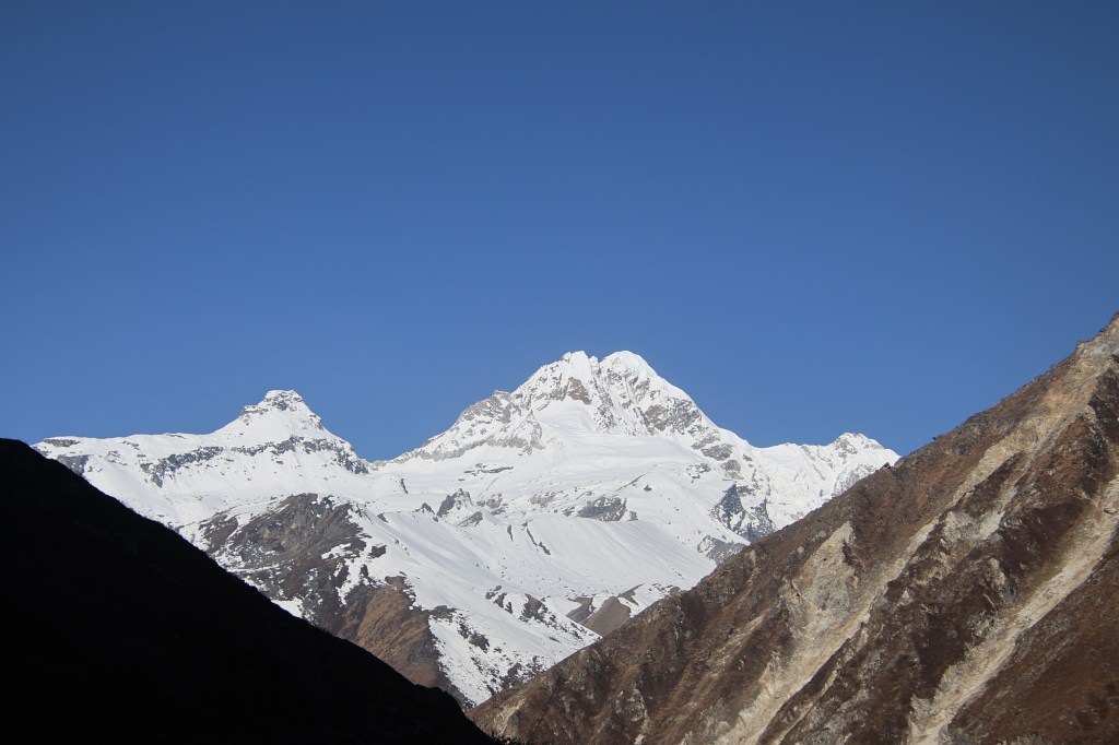
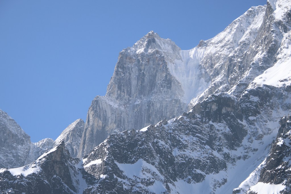
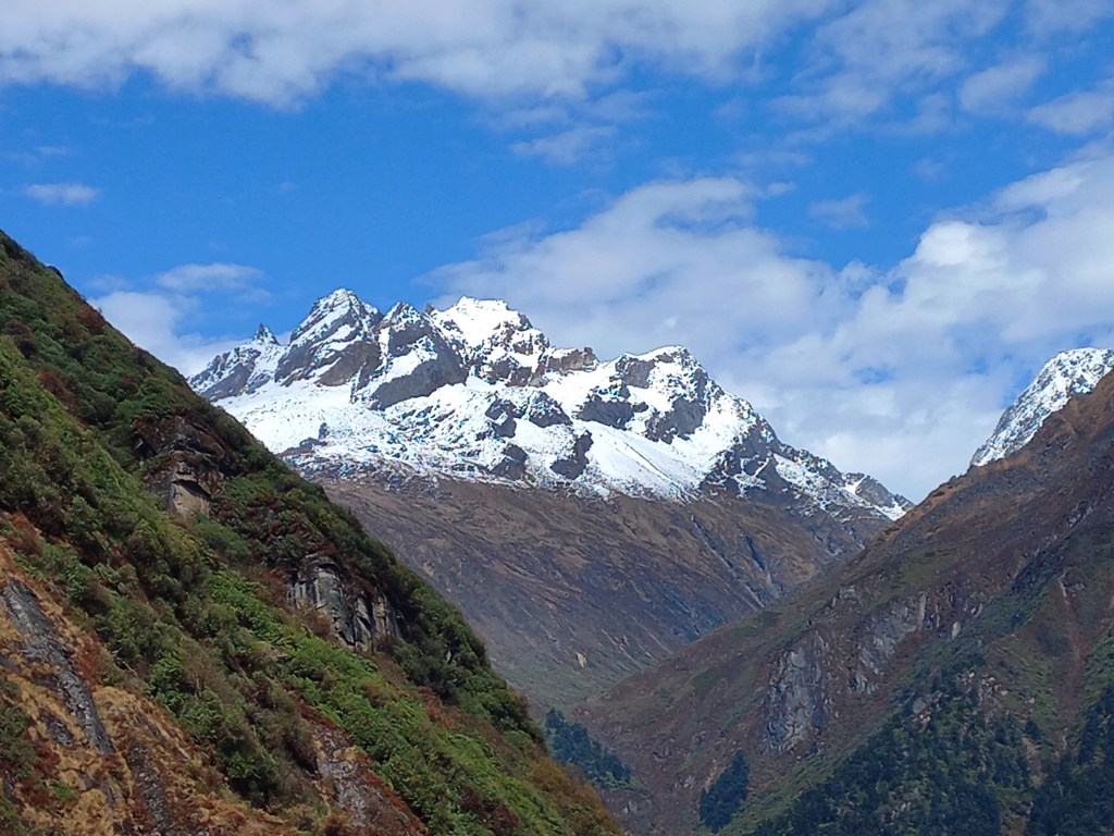
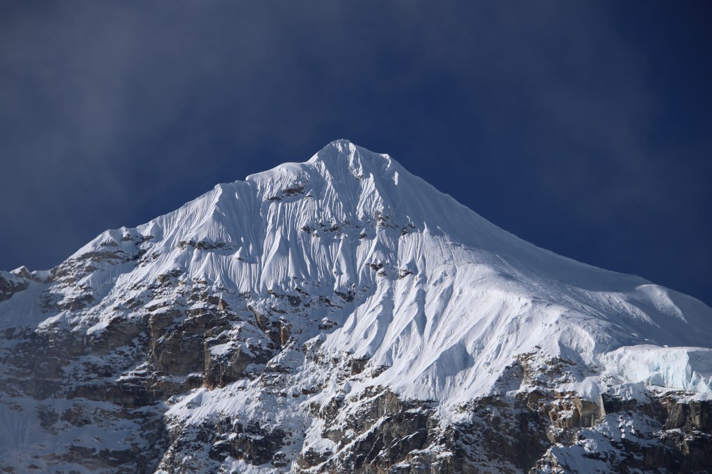
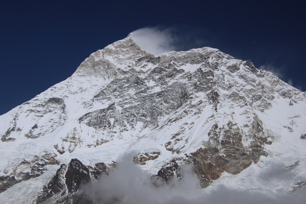
On the other side of the glacier, the slopes rose to reach the snowy peak of Mt Gimmigela I. It's top was still visible. While we fixed our gaze at it, awestruck by its closeness, clouds quickly covered it and the entire place turned windy and temperatures dropped sharply. This prompted us to enter the dining place. As evening wore on, other travelers poured in. Some 0layed cards, others (like us) enjoyed their evening tea. Lhonak was to be our place of stay for next few days. Going by our initial plan, we were supposed to stay at Pangpema, the next day. On the day after, we were supposed to hike to Drohmo Ri, descend all the way down to Lhonak and stay overnight. But I wasn't feeling comfortable climbing till Drohmo Ri. There wasn't any established trail and most of it was ascending through unstable rocky terrain. Chances were ripe of having them covered with snow. That would imply a steep descent over snow covered rocks (by that time, half melt by the sun, making them slippery). That prospect made me rethink my plan. I opted for visiting the Pangpema base camp and returning to Lhonak on the same day. Based on that, our entire team would hike to the Pangpema base camp. The team would then split into two. Me and Limbu would come down to Lhonak, while Dhananjoy and Dilal would stay on for attempting Drohmo Ri, the next morning. After that, they roo would descend to Lhonak and meet us. Dhananjoy tried to convince me to stick to the original plan, but I didn't feel comfortable. With this plan, I should be back at Lhonak by around 14:00 ,or 15:00. With the plan sorted, we had our dinner and retired to our room. We were sleeping at 4756 m.