

20th April, 2026
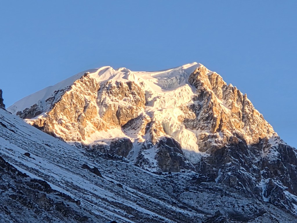
I didn’t sleep well. For the first time on the trail, I felt the thinness of the air. Initially, I wrapped my face under the blankets just Keeping my nostrils out. But, increasingly I felt better only by keeping my entire face open, breathing through my mouth. After tossing around for sometime, tiredness got the better of me. Keeping to the weather pattern, we woke up once again to a clear sky. There was some precipitation on the previous night. When I went out in the lawn, the ground was covered with white with frost. The dripping dew from previous night froze in the wee hours and the drops solidified mid air while falling from the roofs. Icicles of different lengths hung in the air. Carole was already on her way towards the base camp. We also wanted to hit the trail as early as possible. Afternoons get very windy as the entire trail is along the edge of the Kangchenjunga glacier. Gusts of winds start rising from the glacial bed to fill the valley with dust and cold. The surrounding peaks were ready to mermerize us with their crowns of gold.
We entered the dining space to have our breakfast. After some quick photographs at the lawn, we hit the trail. Based on the discussions we had with Dilal and Limbu, there were at least two large and active landslide areas to cover on the way. According to Limbu (who has been there umpteen times), one of these were just before the base camp. There is a steep descent followed by an equally steep ascent. All of that over unstable ground under the constant threat of falling stones. It seemed that Kangchenjunga wasn’t going to allow easy access to its premises. This is where it differs from the Everest base camp trail. At no point in that trail there’s any section that one could call as risky. Yes, there are places where it can he tiring, altitude can play it’s part, but if one is fit enough and keeps precautions (like regular intake of enough fluids), it’s only a matter of time to reach your destination. In every venture in the Himalayas, there are such trails. On earlier ocassions, they kept bearing upon my mind. On this ocassion, I chose not to. The trail went behind the dining space of our lodge. The ground was covered with frost but was level. We crossed some rubber pipes on our way. These pipes supply water to the lodges. They carry water from springs or waterfalls high up in the mountains.
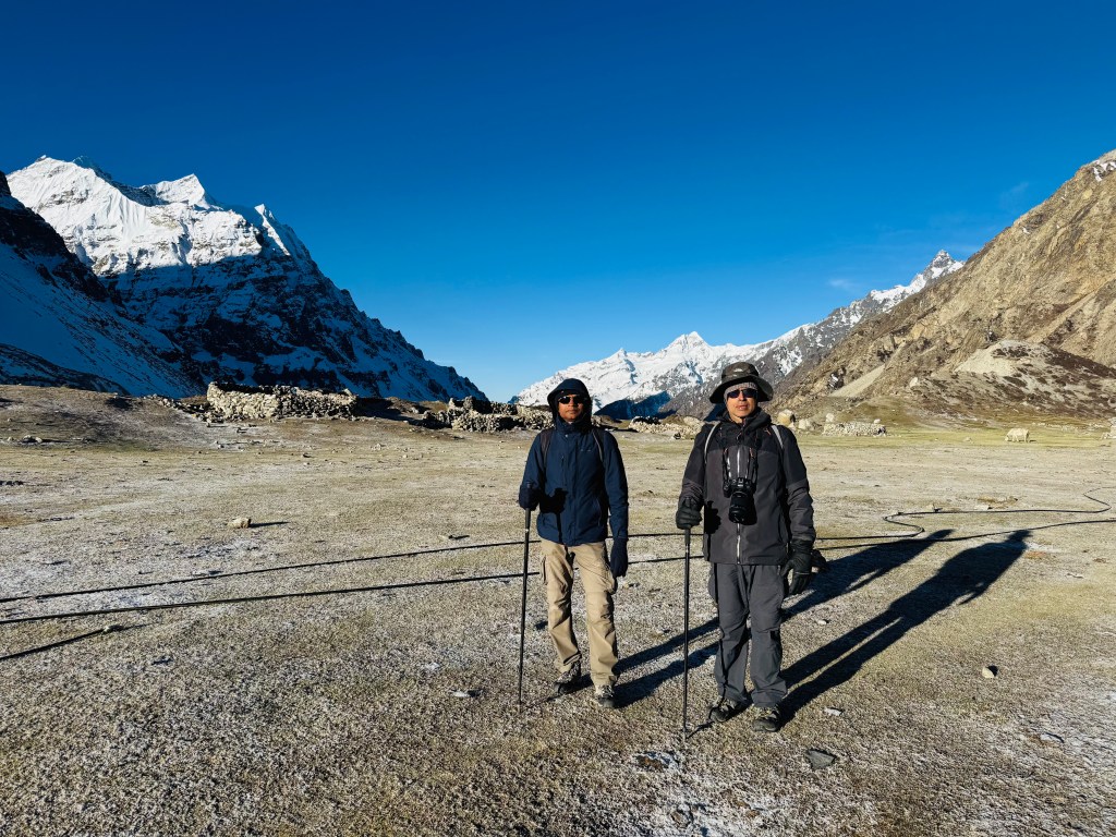
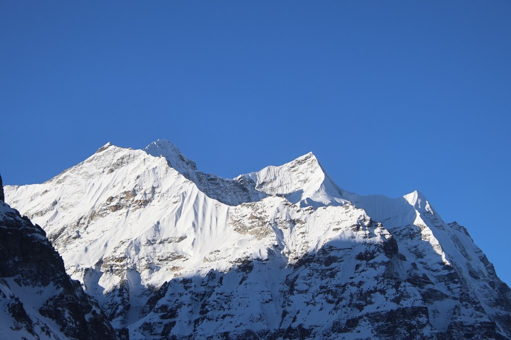
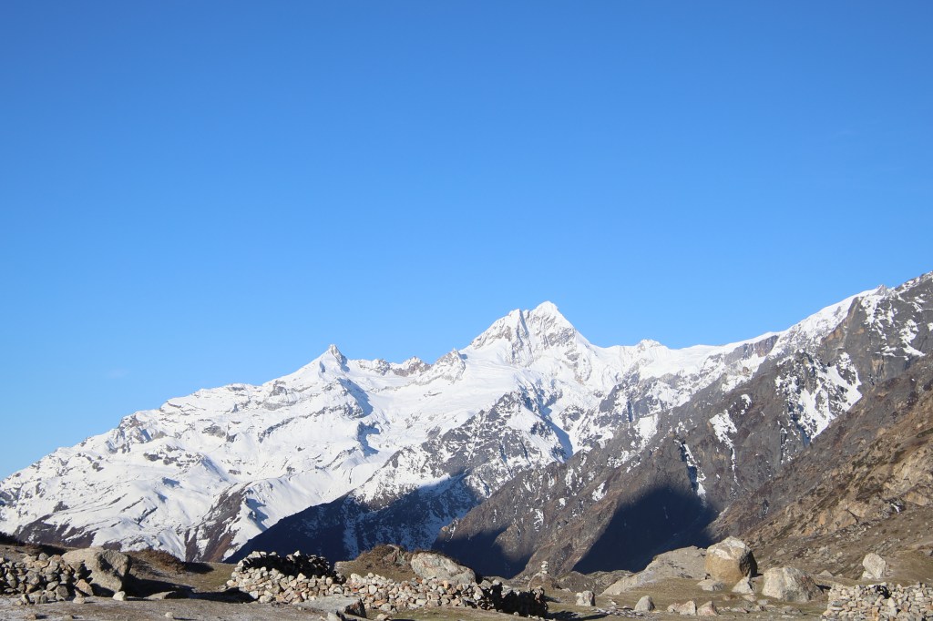
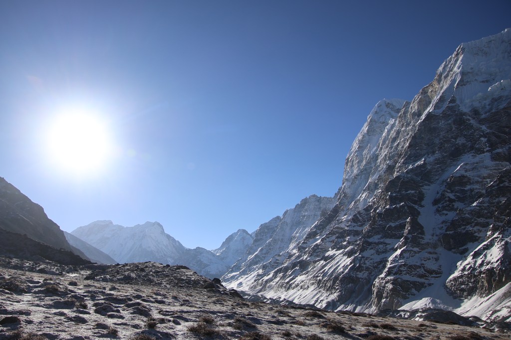
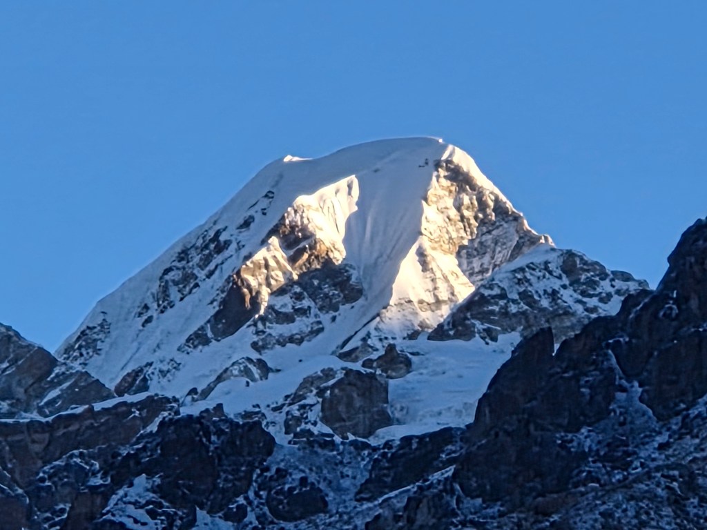
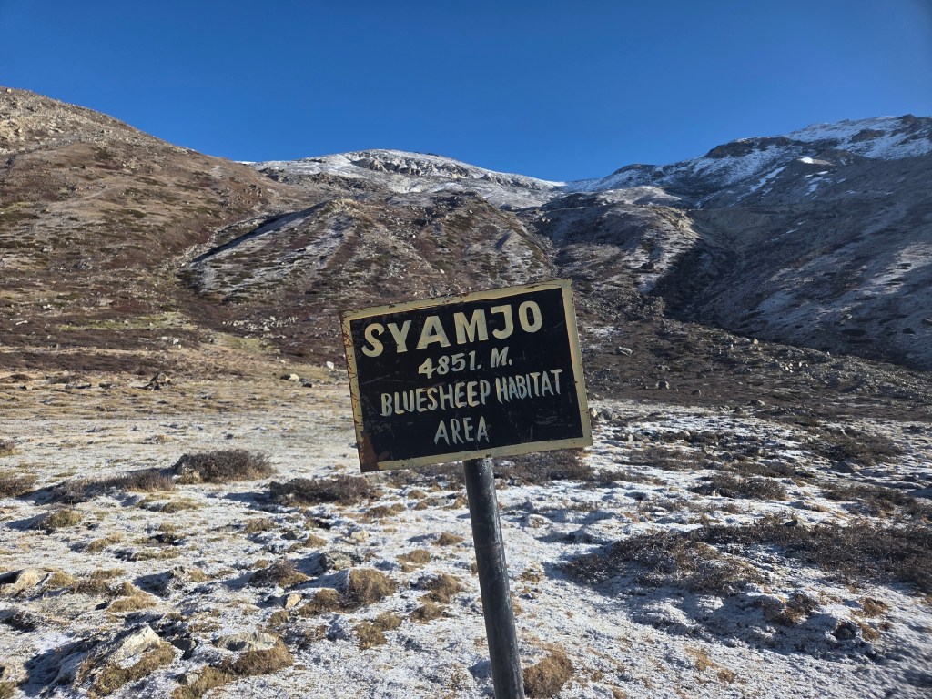
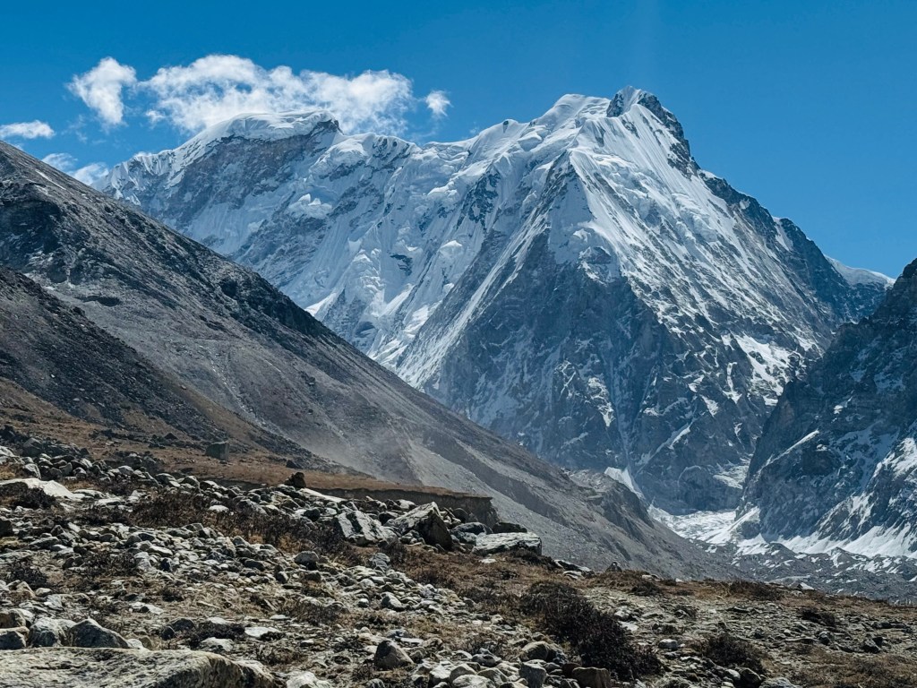
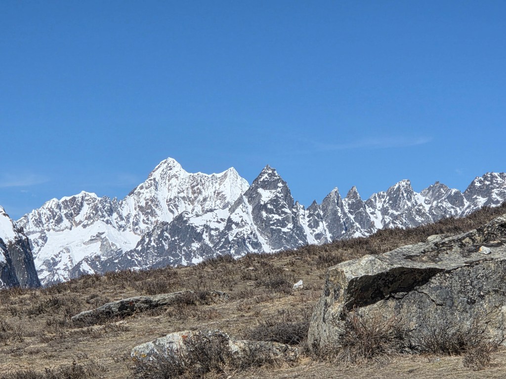
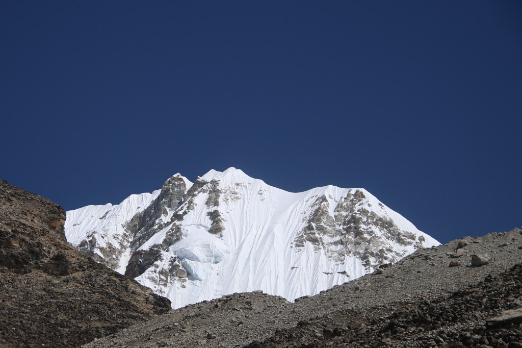
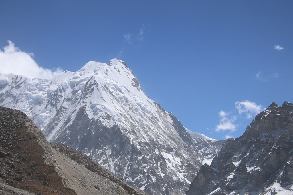
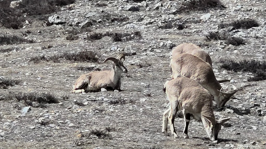
The ground was white because of the frost, but some sections of it was moist. We also had to cross a few narrow streams of water. These were a result of melting of the frost by the rising sun. To our right, beyond the ridge, the ground dropped steep into the bed of the Kangchenjunga glacier. Beyong the glacier, the walls rose steep all the the way up where Mt Gimmigela stood guard. The northern sky was dominated by another awe inspiring mountain, the Nepal peak. There were many other mountains, all dazzling in the bright sunshine. Their glaciers and ice falls, ever more prominent. We reached a sign-board that read “Syamjo”. It was also labeled as a blue sheep habitat area. We couldn’t spot any of those animals around.
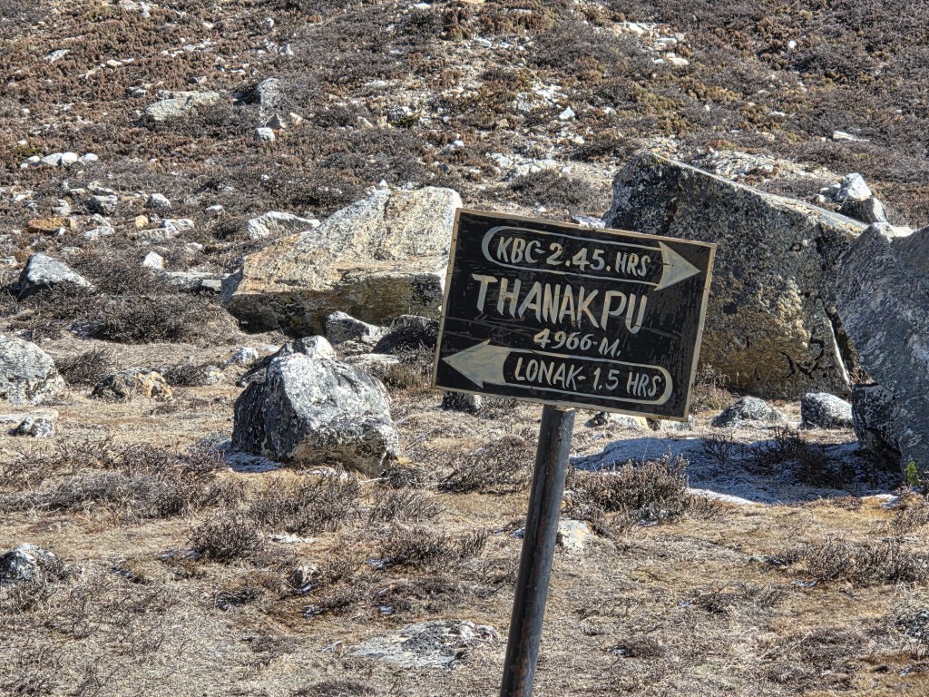
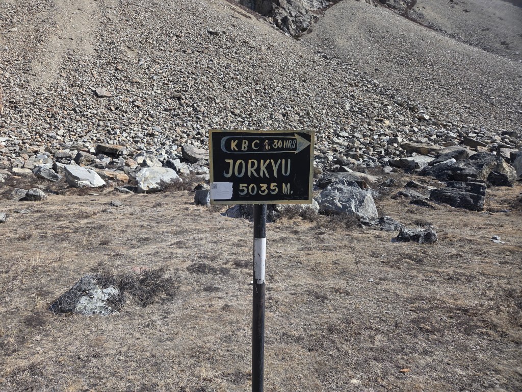
We kept plodding ahead. The trail still wasn’t steep. Though we walked on relatively level ground, the thin air had its impact on our lungs which had to work harder. We made sure to stop intermittently to gulp down sips of water or pop in lozenges. After about 1.5 hours, another sign-board appeared – “Thanakpu 4966 m”. Two arrows on that board pointed in opposite directions. One towards the Pangpema base camp, still 2.5 hours ahead. The opposite arrow pointed towards Lhonak with an estimated time of 1.5 hours. The displayed time on our respective mobile phones tallied with that duration when calculated from our starting time.
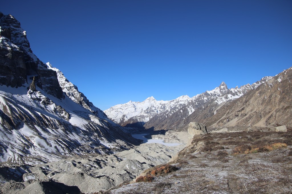
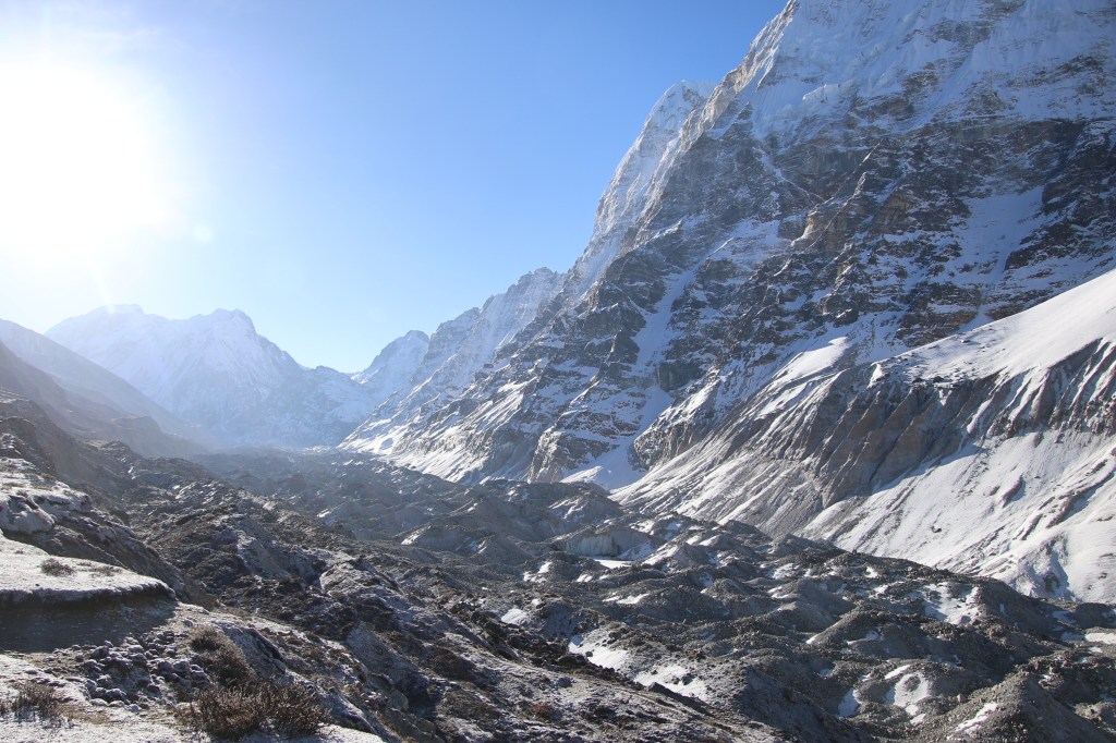
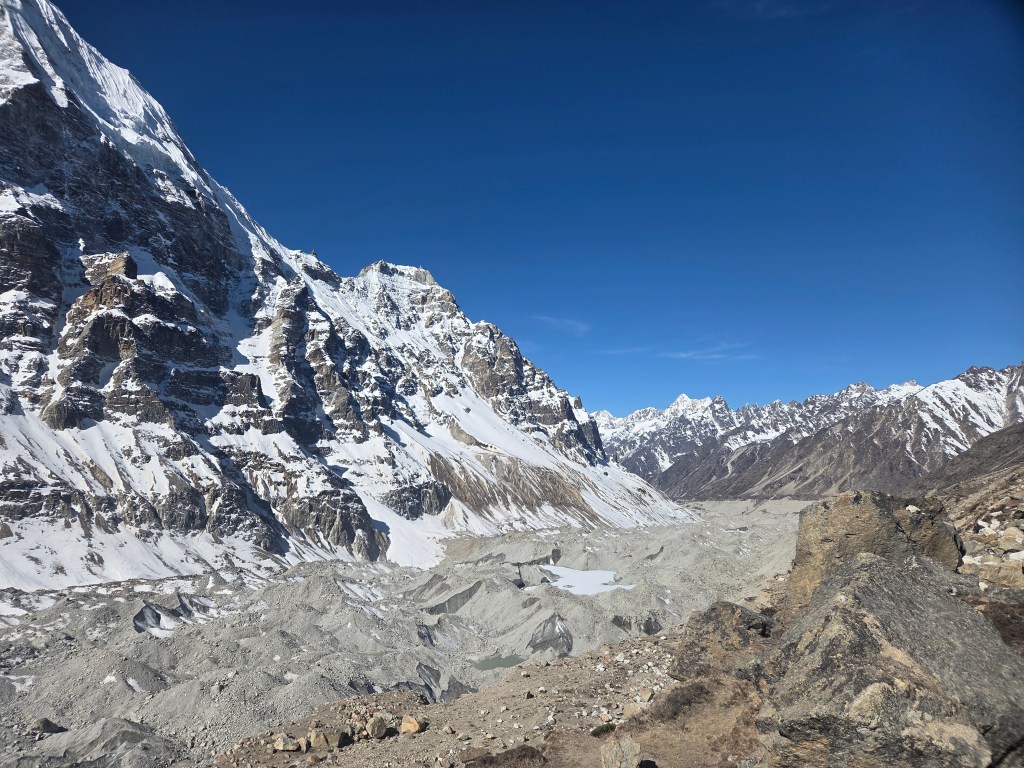
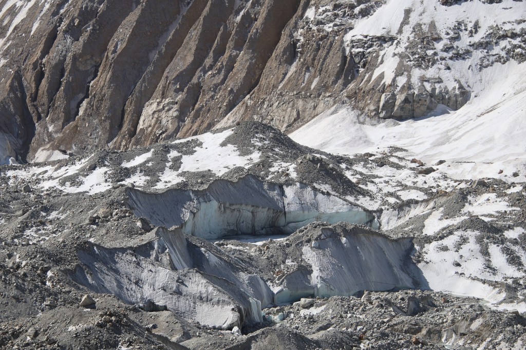
The track moved towards the edge of the glacier and we reached another sign-board, this time not advertising the name of a place, but to mark the start of the first landslide area with a caution to watch out for falling stones. The trail abruptly ended at the edge. From thereon, a narrow line moved through pebbles, rocks and dust. That line was created by travelers barely making their way through this debris. We started treading down the path carefully, keeping a vigil on the ground above. But the unstable ground below our feet also made us look down to our right where the bed of the glacier lay bare. It appeared as a stream of rocky dunes filled with cracks and crevasses that revealed the icy interior. There were pools (many small and some large) of greenish or muddy waters.
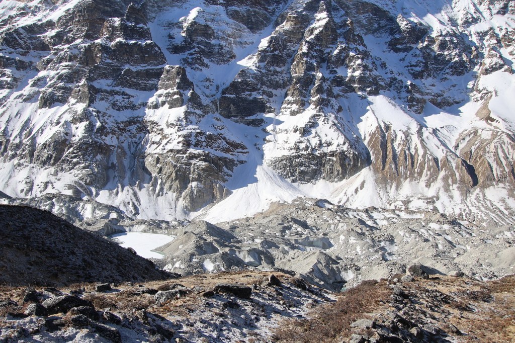
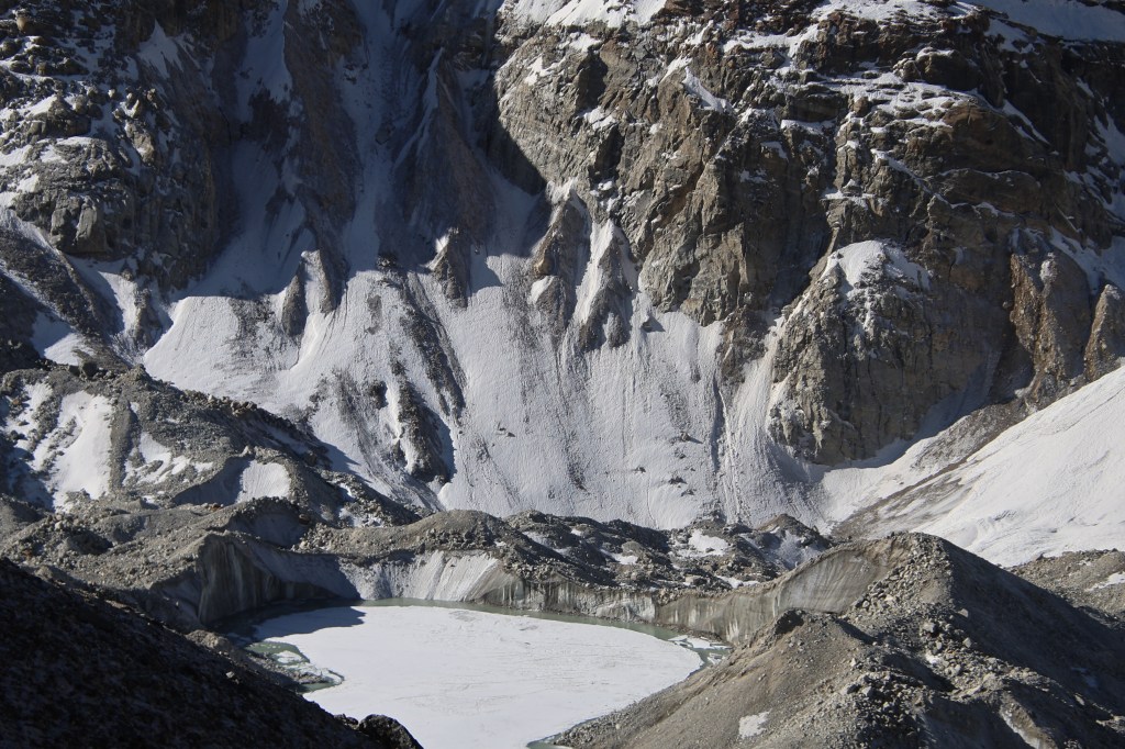
It was a beautiful sight but we couldn’t afford much time as the landscape gave enough motivation to quickly get over it and regain the higher stable grounds. While gravity pulled us down towards the glacial bed, the unstable ground kept conspiring to dislodge our feet. I gladly accepted the supporting hand of Dilal. Getting a hand of support on such terrains offer more of mental peace rather than anything else. A strong enough slide could lead you down fast enough and no hand of support can help. The descent almost took us to the glacial bed, where it leveled out only to ascend once again. The way up was through unstable heaps of pebbles and stones. I always found ascents to be safer than descents. After working our way up, we regained the higher ground once again. We took some rest to allow our breaths to settle down. That also allowed us to look back at the terrain we just covered. It weighed somewhat in my mind that the same traversal would be repeated in the afternoon on my way back. We continued our push towards the base camp, which was getting nearer but still there were no signs of it. Neither did we get even a glimpse of Mt Kangchenjunga. It was like the head of a nation delegating responsibilities to the beurocrats (the other mountains on the route) to escort us to its base. After giving some respite, another landslide area started. On this ocassion there was no going down but a scramble to go up amidst the loosely stacked rocks. Iron poles were placed along the entire trail at regular intervals, acting as milestones. We saw them here too, some of them about to be dislodged from their positions by rocks which fell from above. They were just about holding out. Nevertheless, they continued providing direction amidst the maze of rocks. After sometime our ordeal came to an end.
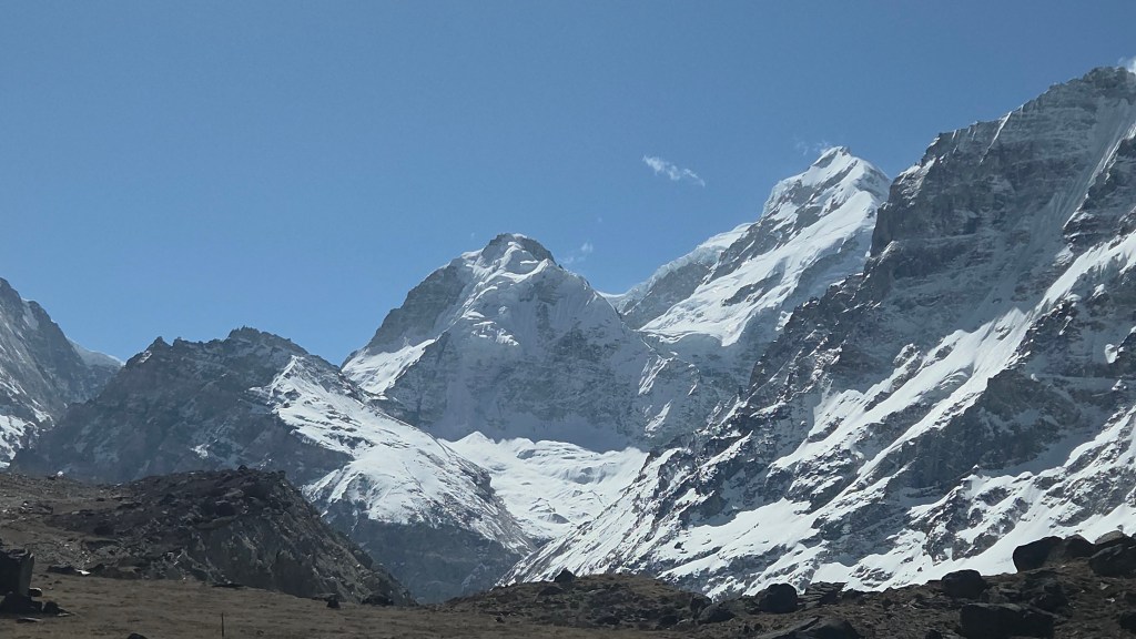
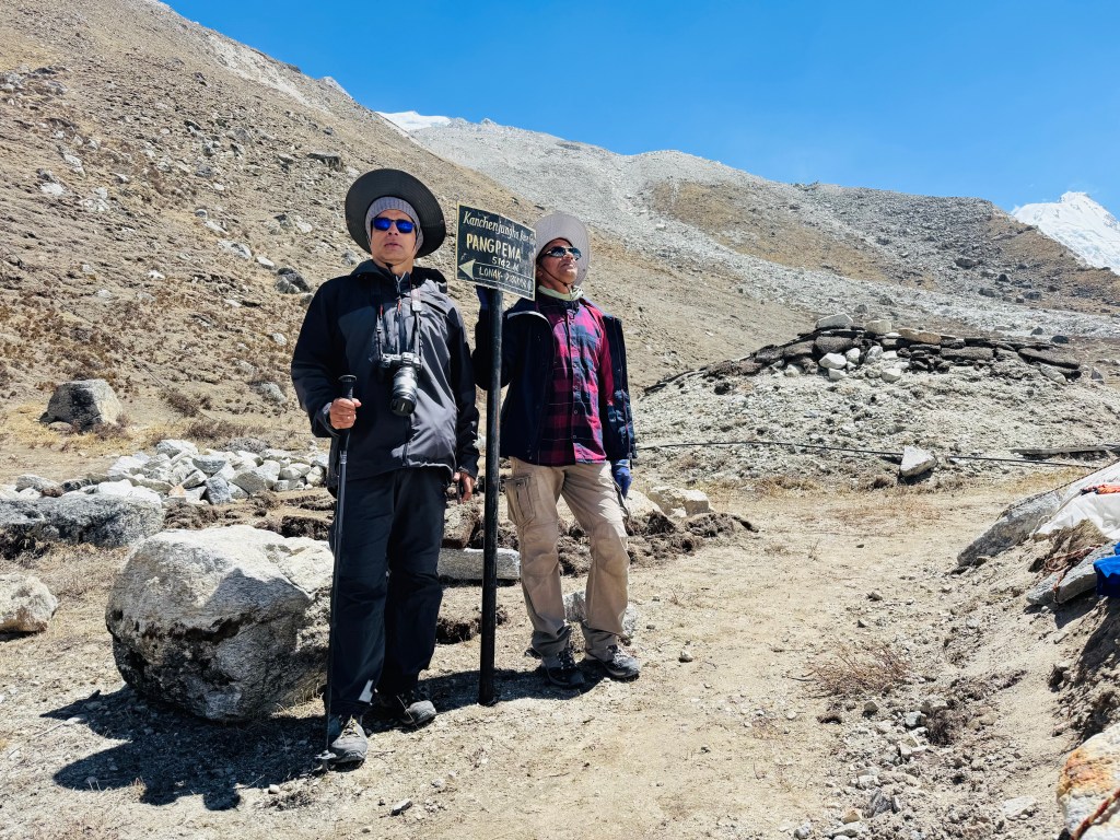
En-route Pangpema (north) base camp
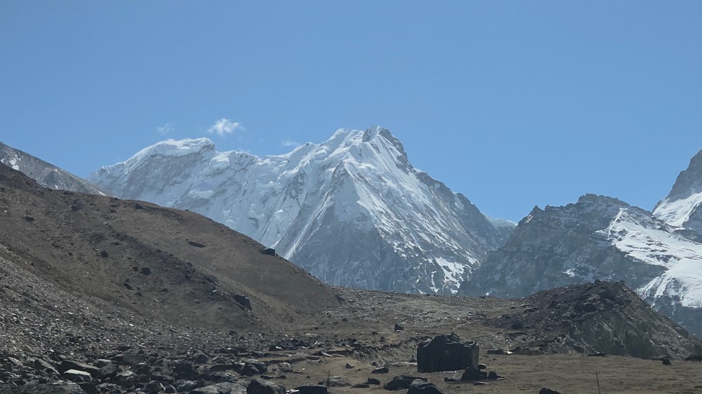
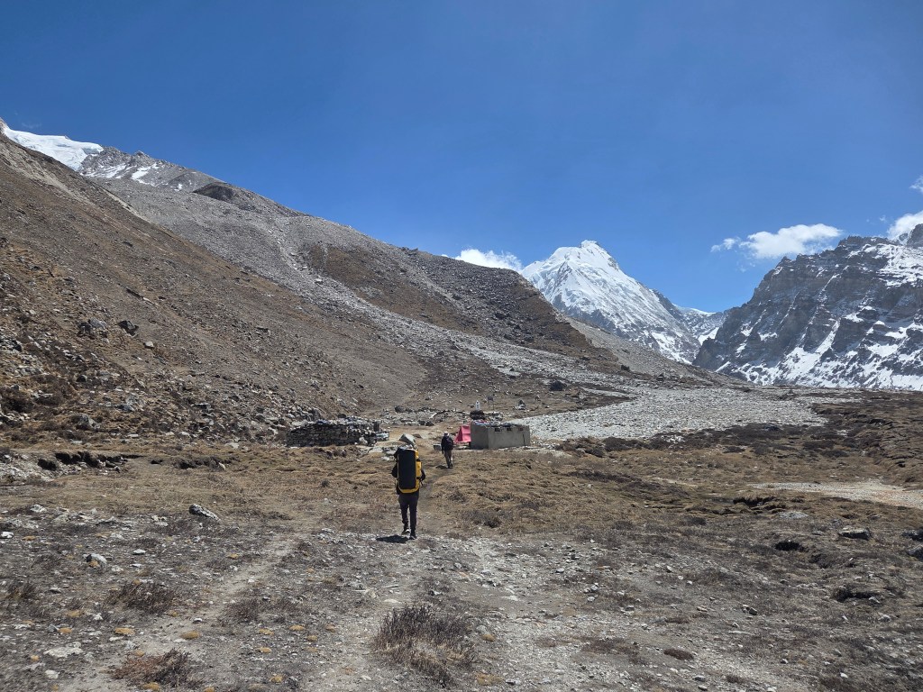
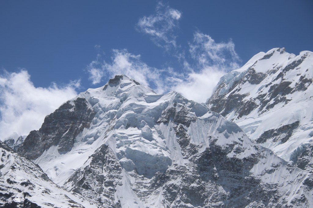
We saw almost level ground stretching to the horizon. Nepal peak increased in its stature but Kangchenjunga continued to elude us. "Jorkyu, 5035 m" - another sign-board declared. The base camp was another 100 m above. Going by the estimated time displayed by the board, we had another 1.5 hours left of the trail. The valley widened and the trail went through the middle of it. The sky was devoid of clouds except floating small white puffs. The mountains had the entire canvas to them and they justified it. We were walking towards the base of the eastern most mountain that reached above 8000 m. The Himalayas which traverse from the north western corner of India to its north east, gets closest to the sea in this area. That causes more precipitation in this area from moisture laden winds than any other parts of the Himalayas. A small hut appeared on the horizon. As we moved closer, another became prominent. From this distant place we could faintly see a few flags. Beyond the huts and near the flags, there were a few tents whose flaps were floating in the winds. Pangpema (5143 m) was finally in sight! That prompted me to turn to my right and there was the lord, in its full glory. The north face of Mt Kangchenjunga with Mt Yalung Kang to its east.
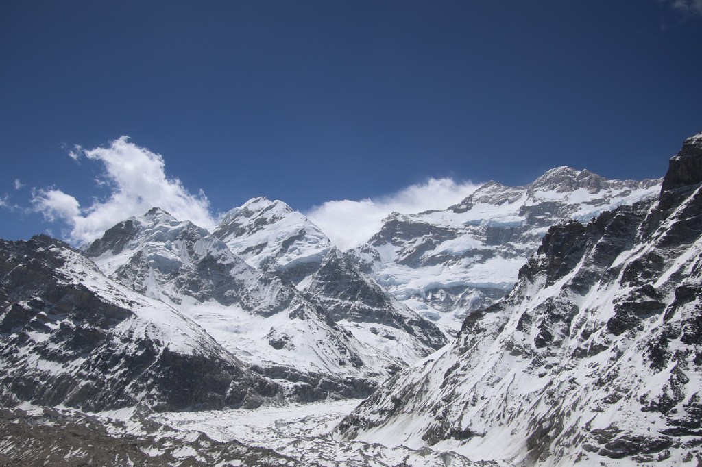
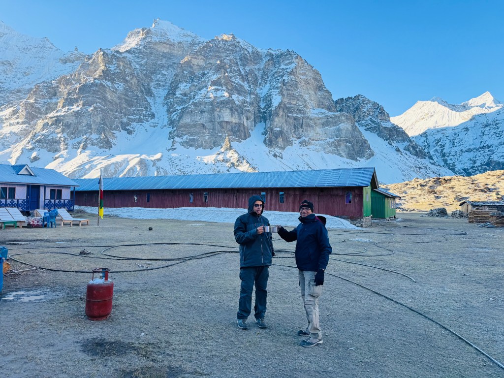
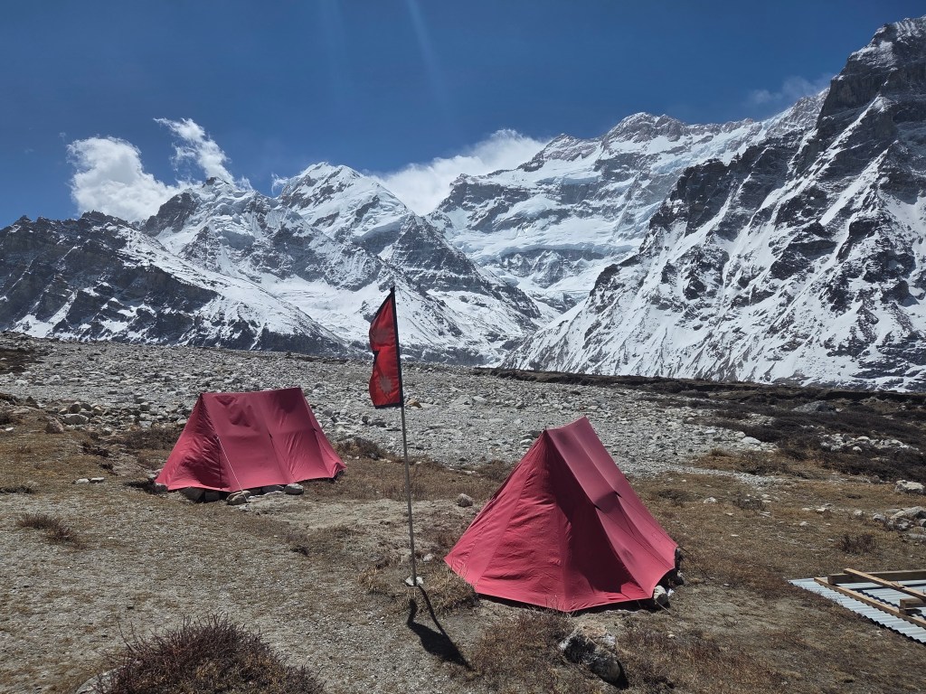
We increased our pace and reached the base camp almost in no time. Pangpema just has two tea houses. One of them has its room underground. But that was closed. The other tea house has a dining place but the staying option was in tents. Two tents were setup. Looking at them, they appeared spacious, at least enough for two. I tried to soak in the beauty of the place. Looking around, the horizon in every direction was dominated by snow peaks. On the extreme right, there is Mt Gimmigela.
Pangpema (north) base camp
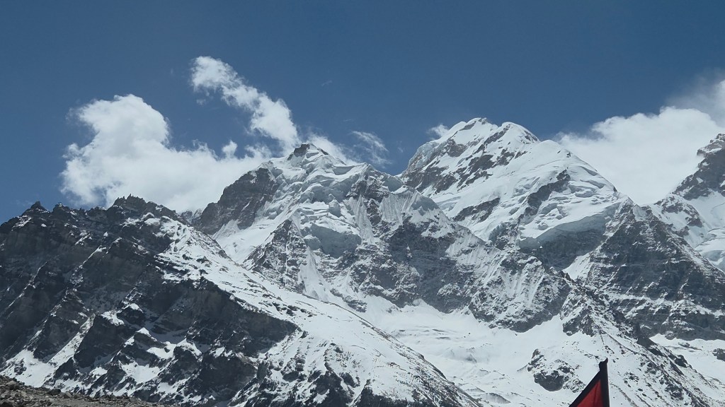
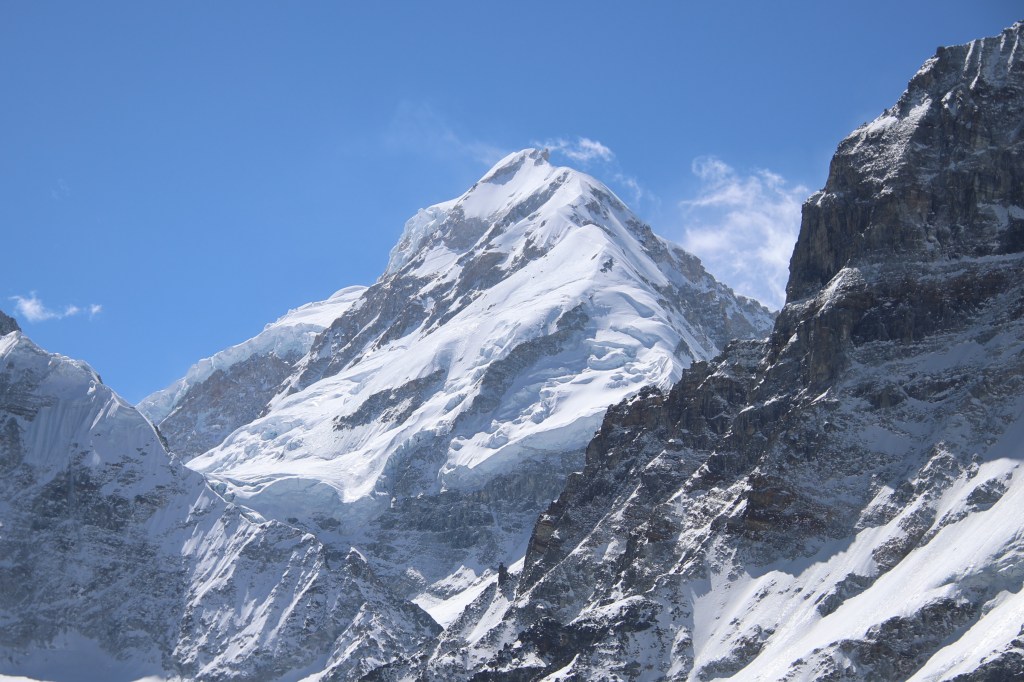
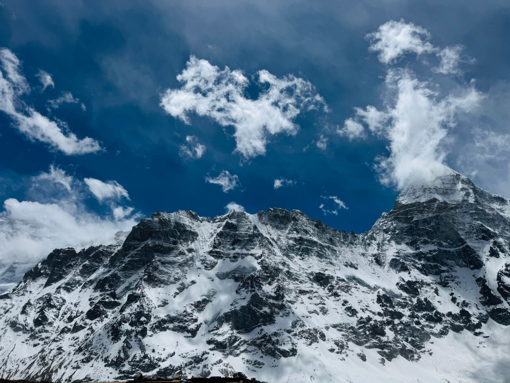
As one turns anti-clock wise, one encounters other peaks and then the gaze gets fixed at the center. That's where the huge triangular massif of Mt Kangchenjunga appears. We kept looking at it, awestruck. The mountain rises from the base of the glacier in different phases, each marked by hanging bodies of snow and ice. The pyramid gets narrower as the vision goes up along the slopes and finally ends in two distinct peaks, Mt Yalung Kang (8085 m, alternatively known as Kangchenjunga West) stands on the right. To its left, rises the main summit of Kanchenjunga (8586 m), the third highest mountain of the world. On this ocassion, bathing in bright sunshine. Dense white clouds formed its background, but the summit of both the mountains stayed clear.
A stream of ice and snow came down its slopes, carrying the discharge of other surrounding mountains to merge with other such streams to form the Kangchenjunga glacier, which went all along the trail towards Lhonak and further down into the valley to give birth to the Ghunsa river. This huge massif was the source of multiple glaciers which drained its different slopes to form many other rivers and fed their respective valleys. Just as the Kangchenjunga glacier on this side, Yalung glacier lay on its southern slopes. Other than Ghunsa, the glaciers originating from this massif gives birth to the Tamor amd Teesta rivers.
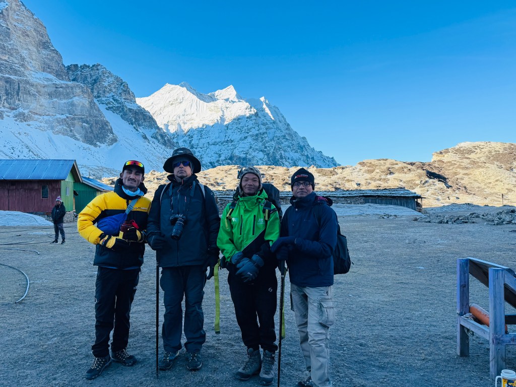
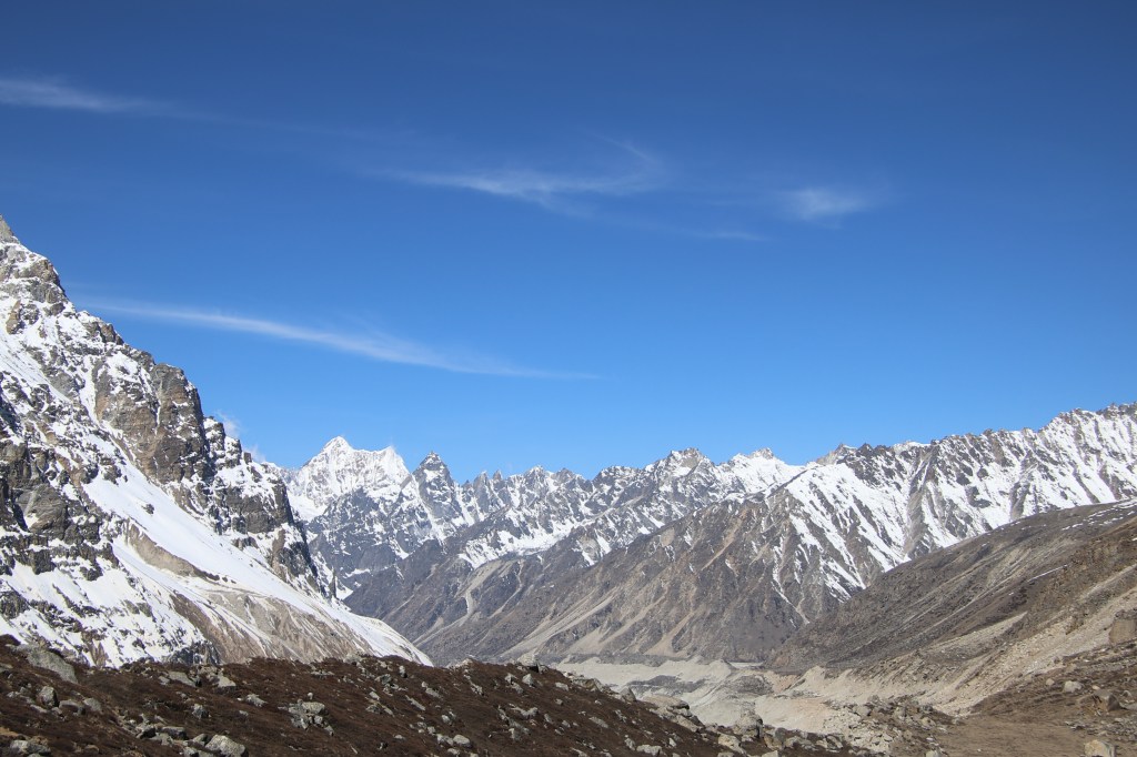
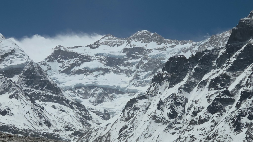
Nepal peak stood firm, guarding the northern horizon. Unlike the Everest base camp, the entire place just had a handful of people. There were no expedition camps. This is because, the north base camp gets used to climb the northern face of a Kangchenjunga, which is dangerous and requires more technical climbing. The climbers attempting the north face typically advance further to setup higher camps. Most of the climbing happens via the southern (Yalung) base camp. Time flew by and we were reminded that our lunch was ready. We went inside the small dining hut and made ourselves comfortable at the table. Dal bhat was served. This meal was a result of sweat and toil of innumerable porters and yaks who carried all the raw materials (rice, vegetables, even the cooking utensils, oven, fuel etc.) to the base camp all the way up from the lower valleys. We, as urban dwellers, cannot even realize the necessity of such people in sustaining this trail.
After lunch, I started to prepare for our return. As planned earlier, Limbu was to accompany me. I bade a temporary goodbye to Dhananjoy and Dilal. They'd stay at the base camp to attempt a hike to Drohmo Ri (~6000 m) for the next day. I cast a final look at the surrounding mountains from the base camp, especially, Mt Kangchenjunga as it will go hiding again behind other mountains as soon we exit Pangpema. The sky was still clear, though more clouds started closing in towards the mountains.
Limbu kept ahead of me, but was within reach. We soon reached the first landslide area and started moving down the slopes. For a change, this didn't seem as dangerous as while we crossed it on our way up. The place started to get windy. By the time, we reached the second landslide area, strong winds started to rise from the Kangchenjunga glacier. I had my jacket, hat and gloves on my body. Even then, it seemed insufficient. The strong gales also raised the risk of stones sliding down. I took support of Limbu's hand and started the descent. He was moving fast and I had to keep up with the pace. At times, I almost felt getting dragged down. With unstable ground under my feet, it proved difficult. The sight of the glacier with gaping crevasses below also added to the stress. Instead of trying to get a conscious grip on my steps, I chose to let go, despite some minor slides on the way. Fortunately, such minor slides got arrested quickly. Finally, we reached a level track that ran parallel but very close to the glacial bed. Then came the ascent. I scrambled up through the broken slopes and crossed the sign-board that warned about the start of the landslide area. After regaining high ground, I stopped for a moment to gulp down some sips of water. My mouth ran dry. The strong gales of wind dashed against my body. The constant sound made it impossible to hear anything else. Limbu was way ahead of me. I tried calling him but my shouts died amidst the blowing gales. I met Carole, who was resting at Syamjo (the place labeled as habitat for mountain goats). When I reached there, I found the reason. Herds of goats were roaming around the slopes nearby. They gave ample time for some stills as well as videos.
Reaching Syamjo made me feel at home as Lhonak was just about 1.5 hours away (distances are always mentioned in terms of hours, rather than kms, in the Himalayan trails of Nepal). I felt a few raindrops on my body. That caused me to pace up. The drops increased in their frequency. The sight of the distant tea houses of Lhonak gave me immense relief. I was finally back at the tea house at 14.30.
Stay at Pangpema base camp
This section has been described based on experiences of Dhananjoy and Dilal.
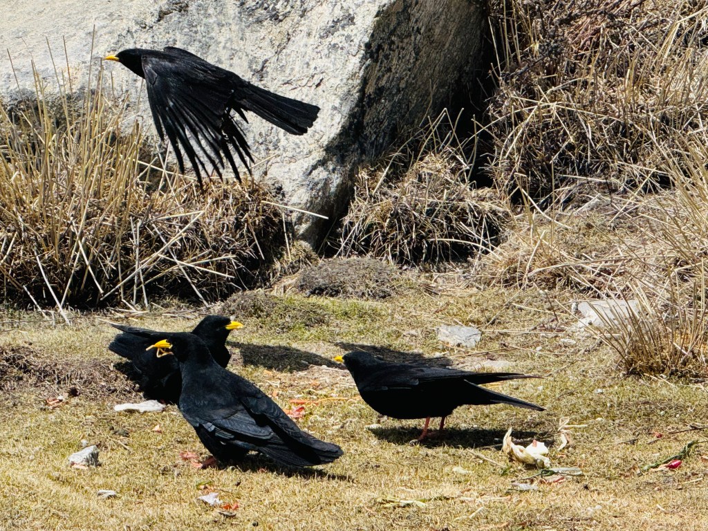
After lunch, Dhananjoy and Dilal explored the interior of the tent. It had decent space for two persons. Enough matrices were laid out. There were warm blankets too. Regardless of the bedding, they realized that they needed to keep their warm wears on while sleeping. The weather still stayed clear. As afternoon wore on, winds started getting chillier. They knew as soon as the sun goes down behind the mountains, temperature would plummet. A set of Alpine Chough's (a bird that looks like a crow, but has yellow beaks) kept searching for some food in places nearby the tea houses.
Pangpema (north) base camp
In later afternoon, a herd of blue sheep came and started roaming quite close the base camp tents. Dhananjoy looked at the slopes to the opposite side to search for the trail of Drohmo Ri. There wasn't any formal trail. Just a track that could be identified by traces left by earlier travelers. The entire hike was through boulders. Every year, it changes. Only local guides who've been there before, could find their way through. Even Dilal was going for the first time. Fortunately, there was another guide from a different team, who've been there before. They decided to team up for the morrow. As darkness started setting in, they moved inside the tea house to have some tea. They stay put to have the warmth of the kitchen till dinner got served. After that, they slid to their tent under the warmth of the blankets with their jackets on. The next day, at about 3.45, their hike to Drohmo Ri would start over the surface of loosely placed boulders, likely to be covered with snow. They were sleeping at 5143 m.

2 thoughts on “Kangchenjunga north (Pangpema) base camp”