Featured

Hello travelers

One thing I never liked doing since my childhood was to see off someone at the railway station! I still don’t. As the carriages moved out of the platform with me helplessly waving my hands, I used to think that the traveler is the luckiest one on this planet. When my friends went back to their hostels after their vacations, I used to think they were very happy to ‘travel’ back to their places of study where it might well have been to the contrary.

Such views have evolved with age. Destination and purpose of travel does have a bearing now. For example, when I travel to my native place for a vacation, I’m all too excited but same can’t be said for the reverse.

Just like many other Bengali families, travel started in my childhood with trips to Puri (Odisha). Whenever there was scope and time, that was the only destination to aim for. My parents never wasted time to choose places as that was always settled. So was the itinerary. It almost got to a point where I started to prefer staying at home rather than going there.

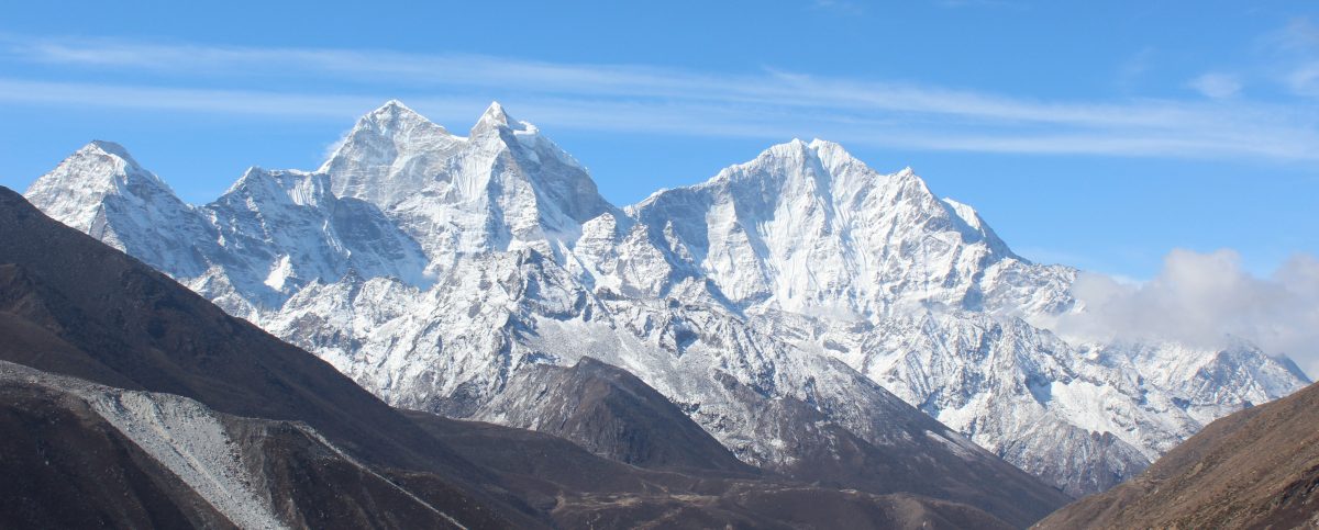
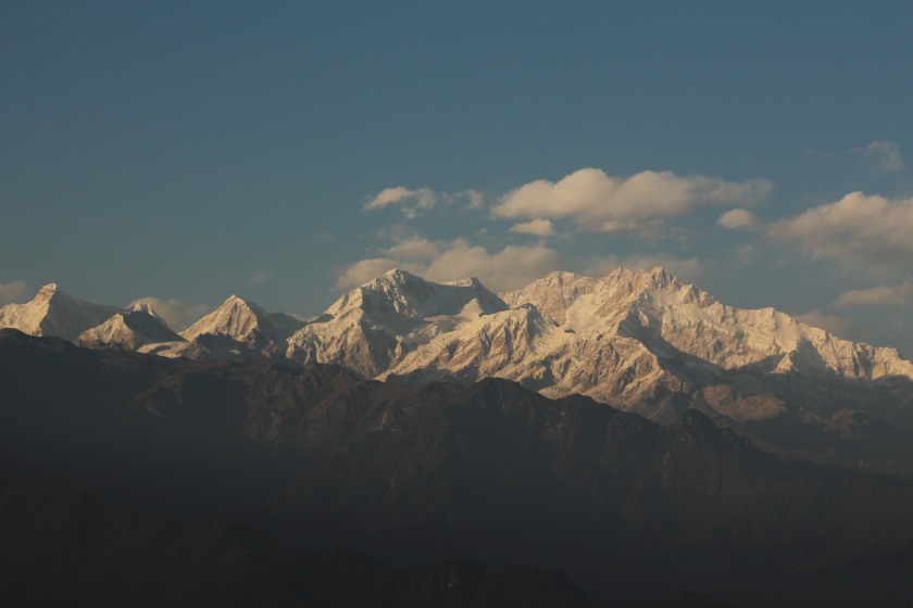
That pattern changed in our first ever trip to Darjeeling after my class X exams. That was the time I was introduced to the misty bends of the mountain roads. For the first time, I came to know that clouds could hover around me and I could swim in and out of them. The first ever view of Kanchenjunga from the mall was to change the way I looked at travel forever.

img_3529
The Kanchenjunga range

Then came the eventful trip to the Garhwal Himalayas in 1999. Events that occurred during the build up to that trip or even during it almost threatened to it, but we somehow managed to pull it off at the end. Nowhere in this world, you get to see a temple at the backdrop of the snow-capped Himalayas. I was thrilled to travel through places like Rudraprayag, the place where Corbett shot the man-eating leopard way back in 1925.  I plan to share the details of this trip sometime in future on this site.

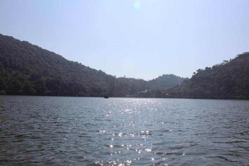
Then my profession brought me to the city of Delhi. Every year, when my company published the holiday calendar, our (me and my wife) first job was to look for long weekends. They were my windows to venture out to the corners of The Himalayas. Many such weekends took me to places of seclusion in Kumaon, Garhwal and Himachal Pradesh.

14
Naukuchiataal, Kumaon, Uttarakhand


Mountain roads have always fascinated me. In more than one ways, they resemble the journey of life. After every bend, you’re presented with a view that is different from the previous one. It’s like a play with its scenes unfolding. You never know what surprise awaits you at the next bend. Mountains are probably the only places which let you to be with yourself. When you walk the trails up or down the slopes, you’re always with yourself and no one else. You’re responsible for the decisions you take, the speed at which you travel and hence, how soon you reach your destination.

I wish to share these experiences with you with my posts about my voyages. If they interest you, I’ll be more than happy to answer any queries you may have about those trips. Looking forward to interact with you all.


Kangchenjunga north base camp – the zenith

Earlier

Drohmo Ri, 21st April, 2026

Based on experiences of Dhananjoy Dey and Dilal

The alarm went off which set the tent abuzz with activities. Considering the settings, sleep wasn’t that bad. The tent was reasonably comfortable under the conditions. The people of Nepal work so hard to make such things happen. Such arrangements are unheard of in other parts of the Himalayas. It didn’t take much long for Dhananjoy And Dilal to get ready. Minimal stuff was to be carried along (a bottle of water, the required warm wears and of course, the head lamp). As they ventured out of the tent, the sky was pitch dark, but was studded with stars. Despite multiple layers of warm wear, the cold was biting. Members from other group also started coming out. Though few people were around (most of them went back to Lhonak on the previous afternoon and others were to reach much later in the morning), but the place was alight with head lamps. Beams of torches moved around the place. Dhananjoy and Dilal cast a quick glance to the surrounding mountains. Their dark silhouettes were clearly visible. Beyond which, innumerable stars dotted the sky. They started moving towards the slopes behind the tea houses. Despite being from different groups, they kept together like a flock. At this stage, memberships don’t matter and everyone relies upon each other. It’s not a normal trail, even by the mountain standards. Drohmo Ri reaches almost to a height of 6000 m and there’s no proper trail, except for some traces left by earlier travelers. These signs (via cairns) get dismantled often because of falling rocks and tracks change on a seasonal (if not daily/weekly) basis. Starting at the wee hours reminded Dhananjoy of the Kalapathhar and the Roopkund hikes. On both occassions, height was lesser and there was an established trail. Fortunately, one of the guides from another group had been to Drohmo Ri on multiple occassions. He led the group. Soon after the tea houses, the trail started moving up and the incline changed drastically. Walking poles became necessary to have some grip. As they moved up, pebbles started coming into play and steps had to be careful. The air was already thin at the base camp and would get thinner with every inch gained. Travelers moved close to each other (maintaining just enough space to avoid tumbling upon the person lower down the order, in case of a slide) to keep company and help others, if needed. Sounds of breaths became louder with increasing altitude. The ground wasn’t just unstable, but was covered with frost. With gain of height, steepness increased. So did the size of the stones and their snow cover. One couldn’t call it frost anymore. It was proper snow. After a hike of about 40 minutes, the sky started acquiring a brighter shade. They stopped and turned back. The Kangchenjunga and its colleagues also rose in height, but the gap of heights seemed to reduce. At the base camp, they were awestruck visitors, but now the mountains seemed to extend their hands towards them. Early rays of sun started to remove the darkness from the Kangchenjunga massif. The twin summits of Mt Kangchenjunga and its neighbor Yalung Kang, started to emerge out of darkness. The entire flow of the glacier from Kangchenjunga’s slopes started to reveal itself.

En-route Drohmo Ri, picture courtesy, Dhananjoy Dey

Small puffs of snow blew from the summits. The daylight wasn’t yet strong enough to wipe off the stars from the canvas. The ground below will still dark. Mounths ran dry frequently and they had to keep them moist with frequent sips from the bottles. The sun (still invisible) kept changing its angles and its rays started spreading in the valley. When they turned their heads towards Lhonak, they could see the faint outline of the stream of ice and snow from the Kangchenjunga glacier. Its uneven bed of rocks had greater shades of white as compared to its lower reaches at Lhonak. Its huge expanse was still hidden in darkness but the solar rays gradually started invading. Prior experience in the Himalayas told Dhananjoy that the drama of colors was about to unfold. The stage was set. But they couldn’t afford to stop as Drohmo Ri was still further ahead. The entire ascent and descent required at least 6 hours. By that scale, they still had 2 hours to reach the destination. Ideally, the target was to reach there just when the sun was about to rise. But the height, terrain and the cold was deterring. The size of the boulders increased. More often, they had to use their hands to get over them. After sometime, they had to do away with the walking poles as they needed the support of their limbs as well as hands to negotiate the terrain. The crust of snow over the rocks weren’t a factor yet but that would change as soon as solar rays touched their surfaces. That was another reason for not to stop much, despite the appealing views. One would like to cover as much ground as possible to give a chance to reach the top. All said and done, there needs to be a hard turnaround time based on the calculated risk. Multiple factors went into that algorithm – the remaining distance, the shape and incline of the slopes, the cover of snow and ice on their surface and above all, the position of the sun. The last factor decides the risk of descent. As they say, ascent is only half of the story. The trick is to come back down safe. But they left all that to the experienced guide who’ve been there before. Despite the rush, they couldn’t ignore the canvas behind their backs where scenes were changing fast.

En-route Drohmo Ri, picture courtesy, Dhananjoy Dey

Turning back, they saw the entire valley was out of darkness. The full course of the Kangchenjunga glacier was now visible right from its inception from the slopes of the Kangchenjunga massif, all the way down where it followed a curved track to meet the main stream of ice. It was all monochrome. But that was about to change soon. The summit of Yalung Kang was the first to receive the touch of gold. It then started spreading to the neighbors. The main Kangchenjunga summit acquired a golden outline, but the color of flying plumes of snow from behind its summit indicated that it received its share of golden shower on that side which wasn’t visible from Pangpema.

En-route Drohmo Ri, picture courtesy, Dhananjoy Dey

They kept plodding ahead, but it started setting on them that it was going to be a tough ask to reach the top. Time wasn't the problem, terrain was. Even if one was fit enough to overcome the effects of altitude, but they kept thinking about the descent. The snow now covered almost the entire trail. It gave an uneasy levelness hiding the gaps amidst the loosely stacked rocks. They'd have to descend over the same surface during a period, when the solar rays would call the shots. The crust of snow covering the surface would melt and reveal the hard and shiny ice, making it ripe for slides. The incline of the slope made it more dangerous to arrest such slides during descent.

En-route Drohmo Ri, picture courtesy, Dhananjoy Dey

By now the sun was at its full display. The colors on the mountain slopes changed to dazzling silver. It had been 3 hours since they started. At about 7 AM, it was decided the risk of going further was not worth. Dhananjoy usually doesn't budge so easily, but when it came from the mouth of the local expert, he had to heed. Though the actual top of Drohmo Ri remained beyond limits, but nature was generous enough to fill their laps with ample display of it's beauty. Just as they were about to start their descent, Dhananjoy's gaze got fixed at a growing cloud of white coming down the slopes of Mt Kangchenjunga. An avalanche! The avalanche wasn't big, going by the standards at Kangchenjunga, but the mountain was kind enough to reveal itself in its all forms. Despite having to turn around, there was no reason to complain.

The descent was challenging enough because of its slope, uneavenness and the cover of snow. There were a few slides on their way down, but fortunately, arrested within limits. Apart from the wetness caused by the ice, there wasn't any other cause of concern. The incline eased with descent and with careful steps they made it down to the base camp by 8 AM. They reached the limits that were permissible under the circumstances.

En-route Drohmo Ri, picture courtesy, Dhananjoy Dey

After breakfast, it was time to bid goodbye to the Pangpema base camp. For one last time, Dhananjoy cast a glance at the Kangchenjunga massif as it was about to disappear from sight. As they were leaving Pangpema, their eyes kept going back to the Kangchenjunga massif for one last view before it disappeared from sight. They turned their attention and headed towards Lhonak.

En-route Lhonak, picture courtesy, Dhananjoy Dey

Lhonak, 21st April, 2026

I had better sleep on the previous night. Some of it may have had to do with getting adjusted to the altitude, but the rest of it was about the prospect of havignng a full day's rest at Lhonak. There was no hurry to get up early as there was nowhere to go (or so I thought). The alarm went off, but I kept lying on my bed, enjoying the warmth of the blanket. But after sometime, looking at the sunlight through my window, I felt it was criminal to lie down while the sun played the painter on the mountain tops. I came out to the lawn and quite expectedly, the colors started unfolding on the canvas.

Lhonak

As the day before, there was frost on the ground, but the lawn was bathing in sunshine. I had my breakfast and chose to lie down on the benches spread out in the lawn. Carole was out there too. She would be leaving for Khambachhen in the morning. She had been interviewing people at different locations on this route about the changing climate and its effect on their lives. She had interviewed Nupu's brother at Ghunsa. She was now planning to interview the current lodge owner and had plans to interview Nupu at Khambachhen. The owner, who was roaming around in the lawn, holding the little hands of his small kid, trying to make him learn to walk. The kid would creep on the frost, try to rise up taking support of the chairs, walk on his feet for some steps, tumble down, only to rise up again to repeat the same cycle. It was a treat to watch while his father kept vigil. Carole asked me to record her interview. I had to walk up to the edge of the glacier, where she had the conversation in its backdrop. She wanted to show the big lake. According to the owner, that lake had multiplied over the years at an alarming rate. It was supposedly at a risk of bursting and if that happened, it would wash out places all the way till Taplejung! During construction of lodges or repairs, they have seen layers of permafrost beneath the ground. It shows signs of cracking. Which means that the ground on which the tea houses stood, could also be slipping away, literally, moving under their feet! The officials of the Kangchenjunga conservation area visit their site regularly to collect taxes (for being allowed to run lodges on the land owned by the Kangchenjunga Conservation Area), but their complain was such funds are not being used for sustenance of the environment. Carole did a heart wrenching commentry, while I assisted with the video. She was pleased with my effort and we hoped that the video, when circulated, would raise the right ripples. After sometime, Carole strapped up her backpack and hit the trail towards Khambachhen. I spent the rest of the morning, lying down on the armchair, enjoying the sun. Time passed lazily. I didn't expect Dhananjoy and Dilal to return before 14.00, or possibly later. To my surprise, they turned up at 11.30 and immediately declared about a change of plan. "With the entire afternoon at our disposal, what's the point of staying at Lhonak? Let's get down to Khambachhen instead and enjoy our stay there!" I had no problem since I had a full day of rest since my return yesterday. It was a welcome suggestion, but I asked for confirmation of his health, to which Dhananjoy replied affirmatively. After rising at 4 AM, completing a hike for about 4 hours, then another trail down to Lhonak for another 2.5 hours, he was still ready to venture further down for 2.5 hours! I packed my bag and after lunch, we hit the trail. Clouds covered the mountains by that time. Under overcast conditions, we walked down to the bridge over the Lhonak river and started hiking through the landslide area. Winds were blowing, we crossed the area, casting regular glances towards the upper slopes. At the familiar bend where we saw the Kangchenjunga glacier for the first time on our way up, we turned around. We walked through the plateau of Ramdang and started descending the landslide area. Familiarity to the trail and prospect of reaching Khambachhen removed my anxiety and I descended carefully but steadily to reach the banks of the roaring Ghunsa. The narrow line of steps along its banks didn't seem scary (just that we had to keep looking up the slopes at regular intervals. After crossing the warning sign-board, we started hiking up towards the trail towards Khambachhen. It started to drizzle and we had to put on ur rain covers. Just as we covered our bodies, the drizzle stopped. As we neared Khambachhen, we saw yaks grazing along the mountain slopes. Some were up on the slopes, some on the down, while others roamed freely on the trail itself, munching the leaves. As I neared, they were courteous enough to make way for me by either moving up or down the slopes.

En-route Khambachhen, picture courtesy, Dhananjoy Dey

We kept walking along the trail and reached the familiar bend towards Khambachhen. The sight of the tea houses, the flowing stream and the trail on the other side were all familiar and gave a sense of security and relaxation. Nupu alloted the room to the right of the one he gave us on our way up. After changing, we went to the dining room. Meeting the French group was pleasing. Suddenly, someone attracted our attention towards the lawn. The clouds started clearing and amidst their dark background, the fading sunlight fell on the summits of Mt Jannu, Mt Khabur, Mt Phole Sobithonje. The golden summits floated amidst the dense and dark clouds.

Mt Khabur, Khambachhen
Mt Phole Sobithonje, Khambachhen
Mt Tanga and Mt Sharphu Li, Khambachhen
Mt Jannu, Khambachhen

The window of colors lasted for just a few minutes and then the entire area was covered with mist. We went inside the dining space and enjoyed the rest of the evening. Since it was one our way down, beer was permissible. Dilal didn't complain, probably because he was made a party to it. Didi (Nupu's wife) obliged us with a bowl of complementary popcorn. After a dinner with pizza, we slid under the blankets. Our plans for the next day was to skip Ghunsa and get down to Gyabla. The prospects of staying at the comfortable Singhi Namjong hotel once again, made us excited.

Earlier

Kangchenjunga north (Pangpema) base camp

Earlier

20th April, 2026

I didn’t sleep well. For the first time on the trail, I felt the thinness of the air. Initially, I wrapped my face under the blankets just Keeping my nostrils out. But, increasingly I felt better only by keeping my entire face open, breathing through my mouth. After tossing around for sometime, tiredness got the better of me. Keeping to the weather pattern, we woke up once again to a clear sky. There was some precipitation on the previous night. When I went out in the lawn, the ground was covered with white with frost. The dripping dew from previous night froze in the wee hours and the drops solidified mid air while falling from the roofs. Icicles of different lengths hung in the air. Carole was already on her way towards the base camp. We also wanted to hit the trail as early as possible. Afternoons get very windy as the entire trail is along the edge of the Kangchenjunga glacier. Gusts of winds start rising from the glacial bed to fill the valley with dust and cold. The surrounding peaks were ready to mermerize us with their crowns of gold.

Merra peak, Lhonak
Lhonak, picture courtesy, Dhananjoy Dey

We entered the dining space to have our breakfast. After some quick photographs at the lawn, we hit the trail. Based on the discussions we had with Dilal and Limbu, there were at least two large and active landslide areas to cover on the way. According to Limbu (who has been there umpteen times), one of these were just before the base camp. There is a steep descent followed by an equally steep ascent. All of that over unstable ground under the constant threat of falling stones. It seemed that Kangchenjunga wasn’t going to allow easy access to its premises. This is where it differs from the Everest base camp trail. At no point in that trail there’s any section that one could call as risky. Yes, there are places where it can he tiring, altitude can play it’s part, but if one is fit enough and keeps precautions (like regular intake of enough fluids), it’s only a matter of time to reach your destination. In every venture in the Himalayas, there are such trails. On earlier ocassions, they kept bearing upon my mind. On this ocassion, I chose not to. The trail went behind the dining space of our lodge. The ground was covered with frost but was level. We crossed some rubber pipes on our way. These pipes supply water to the lodges. They carry water from springs or waterfalls high up in the mountains.

En-route north base camp, picture courtesy, Dhananjoy Dey
En-route north base camp

The ground was white because of the frost, but some sections of it was moist. We also had to cross a few narrow streams of water. These were a result of melting of the frost by the rising sun. To our right, beyond the ridge, the ground dropped steep into the bed of the Kangchenjunga glacier. Beyong the glacier, the walls rose steep all the the way up where Mt Gimmigela stood guard. The northern sky was dominated by another awe inspiring mountain, the Nepal peak. There were many other mountains, all dazzling in the bright sunshine. Their glaciers and ice falls, ever more prominent.  We reached a sign-board that read “Syamjo”. It was also labeled as a blue sheep habitat area. We couldn’t spot any of those animals around.

En-route north base camp

We kept plodding ahead. The trail still wasn’t steep. Though we walked on relatively level ground, the thin air had its impact on our lungs which had to work harder. We made sure to stop intermittently to gulp down sips of water or pop in lozenges. After about 1.5 hours, another sign-board appeared – “Thanakpu 4966 m”. Two arrows on that board pointed in opposite directions. One towards the Pangpema base camp, still 2.5 hours ahead. The opposite arrow pointed towards Lhonak with an estimated time of 1.5 hours. The displayed time on our respective mobile phones tallied with that duration when calculated from our starting time.

En-route north base camp

The track moved towards the edge of the glacier and we reached another sign-board, this time not advertising the name of a place, but to mark the start of the first landslide area with a caution to watch out for falling stones. The trail abruptly ended at the edge. From thereon, a narrow line moved through pebbles, rocks and dust. That line was created by travelers barely making their way through this debris. We started treading down the path carefully, keeping a vigil on the ground above. But the unstable ground below our feet also made us look down to our right where the bed of the glacier lay bare. It appeared as a stream of rocky dunes filled with cracks and crevasses that revealed the icy interior. There were pools (many small and some large) of greenish or muddy waters.

En-route north base camp

It was a beautiful sight but we couldn’t afford much time as the landscape gave enough motivation to quickly get over it and regain the higher stable grounds. While gravity pulled us down towards the glacial bed, the unstable ground kept conspiring to dislodge our feet. I gladly accepted the supporting hand of Dilal. Getting a hand of support on such terrains offer more of mental peace rather than anything else. A strong enough slide could lead you down fast enough and no hand of support can help. The descent almost took us to the glacial bed, where it leveled out only to ascend once again. The way up was through unstable heaps of pebbles and stones. I always found ascents to be safer than descents. After working our way up, we regained the higher ground once again. We took some rest to allow our breaths to settle down. That also allowed us to look back at the terrain we just covered. It weighed somewhat in my mind that the same traversal would be repeated in the afternoon on my way back. We continued our push towards the base camp, which was getting nearer but still there were no signs of it. Neither did we get even a glimpse of Mt Kangchenjunga. It  was like the head of a nation delegating responsibilities to the beurocrats (the other mountains on the route) to escort us to its base. After giving some respite, another landslide area started. On this ocassion there was no going down but a scramble to go up amidst the loosely stacked rocks. Iron poles were placed along the entire trail at regular intervals, acting as milestones. We saw them here too, some of them about to be dislodged from their positions by rocks which fell from above. They were just about holding out. Nevertheless, they continued providing direction amidst the maze of rocks. After sometime our ordeal came to an end.

En-route north base camp, picture courtesy, Dhananjoy Dey
Nepal peak, en-route north base camp, picture courtesy, Dhananjoy Dey
En-route north base camp

We saw almost level ground stretching to the horizon. Nepal peak increased in its stature but Kangchenjunga continued to elude us. "Jorkyu, 5035 m" - another sign-board declared. The base camp was another 100 m above. Going by the estimated time displayed by the board, we had another 1.5 hours left of the trail. The valley widened and the trail went through the middle of it. The sky was devoid of clouds except floating small white puffs. The mountains had the entire canvas to them and they justified it. We were walking towards the base of the eastern most mountain that reached above 8000 m. The Himalayas which traverse from the north western corner of India to its north east, gets closest to the sea in this area. That causes more precipitation in this area from moisture laden winds than any other parts of the Himalayas. A small hut appeared on the horizon. As we moved closer, another became prominent. From this distant place we could faintly see a few flags. Beyond the huts and near the flags, there were a few tents whose flaps were floating in the winds. Pangpema (5143 m) was finally in sight! That prompted me to turn to my right and there was the lord, in its full glory. The north face of Mt Kangchenjunga with Mt Yalung Kang to its east.

Mt Kangchenjunga and Yalung Kang, Pangpema (north) base camp

We increased our pace and reached the base camp almost in no time. Pangpema just has two tea houses. One of them has its room underground. But that was closed. The other tea house has a dining place but the staying option was in tents. Two tents were setup. Looking at them, they appeared spacious, at least enough for two. I tried to soak in the beauty of the place. Looking around, the horizon in every direction was dominated by snow peaks. On the extreme right, there is Mt Gimmigela.

Pangpema (north) base camp, picture courtesy, Dhananjoy Dey
Pangpema (north) base camp

As one turns anti-clock wise, one encounters other peaks and then the gaze gets fixed at the center. That's where the huge triangular massif of Mt Kangchenjunga appears. We kept looking at it, awestruck. The mountain rises from the base of the glacier in different phases,  each marked by hanging bodies of snow and ice. The pyramid gets narrower as the vision goes up along the slopes and finally ends in two distinct peaks, Mt Yalung Kang (8085 m, alternatively known as Kangchenjunga West) stands on the right. To its left, rises the main summit of Kanchenjunga (8586 m), the third highest mountain of the world. On this ocassion, bathing in bright sunshine. Dense white clouds formed its background, but the summit of both the mountains stayed clear.

Mt Kangchenjunga and Yalung Kang, Pangpema (north) base camp

A stream of ice and snow came down its slopes,  carrying the discharge of other surrounding mountains to merge with other such streams to form the Kangchenjunga glacier, which went all along the trail towards Lhonak and further down into the valley to give birth to the Ghunsa river. This huge massif was the source of multiple glaciers which drained its different slopes to form many other rivers and fed their respective valleys. Just as the Kangchenjunga glacier on this side, Yalung glacier lay on its southern slopes. Other than Ghunsa, the glaciers originating from this massif gives birth to the Tamor amd Teesta rivers.

Nepal peak, Pangpema (north) base camp

Nepal peak stood firm, guarding the northern horizon. Unlike the Everest base camp, the entire place just had a handful of people. There were no expedition camps. This is because, the north base camp gets used to climb the northern face of a Kangchenjunga, which is dangerous and requires more technical climbing. The climbers attempting the north face typically advance further to setup higher camps. Most of the climbing happens via the southern (Yalung) base camp. Time flew by and we were reminded that our lunch was ready. We went inside the small dining hut and made ourselves comfortable at the table. Dal bhat was served. This meal was a result of sweat and toil of innumerable porters and yaks who carried all the raw materials (rice,  vegetables, even the cooking utensils,  oven, fuel etc.) to the base camp all the way up from the lower valleys. We, as urban dwellers, cannot even realize the necessity of such people in sustaining this trail.

Pangpema (north) base camp

After lunch, I started to prepare for our return. As planned earlier, Limbu was to accompany me. I bade a temporary goodbye to Dhananjoy and Dilal. They'd stay at the base camp to attempt a hike to Drohmo Ri (~6000 m) for the next day. I cast a final look at the surrounding mountains from the base camp, especially, Mt Kangchenjunga as it will go hiding again behind other mountains as soon we exit Pangpema. The sky was still clear, though more clouds started closing in towards the mountains.

Pangpema (north) base camp, picture courtesy, Dhananjoy Dey

Limbu kept ahead of me, but was within reach. We soon reached the first landslide area and started moving down the slopes. For a change, this didn't seem as dangerous as while we crossed it on our way up. The place started to get windy. By the time, we reached the second landslide area, strong winds started to rise from the Kangchenjunga glacier. I had my jacket, hat and gloves on my body. Even then, it seemed insufficient. The strong gales also raised the risk of stones sliding down. I took support of Limbu's hand and started the descent. He was moving fast and I had to keep up with the pace. At times, I almost felt getting dragged down. With unstable ground under my feet, it proved difficult. The sight of the glacier with gaping crevasses below also added to the stress. Instead of trying to get a conscious grip on my steps, I chose to let go, despite some minor slides on the way. Fortunately, such minor slides got arrested quickly. Finally, we reached a level track that ran parallel but very close to the glacial bed. Then came the ascent. I scrambled up through the broken slopes and crossed the sign-board that warned about the start of the landslide area. After regaining high ground, I stopped for a moment to gulp down some sips of water. My mouth ran dry. The strong gales of wind dashed against my body. The constant sound made it impossible to hear anything else. Limbu was way ahead of me. I tried calling him but my shouts died amidst the blowing gales. I met Carole, who was resting at Syamjo (the place labeled as habitat for mountain goats). When I reached there, I found the reason. Herds of goats were roaming around the slopes nearby. They gave ample time for some stills as well as videos.

En-route Lhonak

Reaching Syamjo made me feel at home as Lhonak was just about 1.5 hours away (distances are always mentioned in terms of hours, rather than kms, in the Himalayan trails of Nepal). I felt a few raindrops on my body. That caused me to pace up. The drops increased in their frequency. The sight of the distant tea houses of Lhonak gave me immense relief. I was finally back at the tea house at 14.30.

Stay at Pangpema base camp

This section has been described based on experiences of Dhananjoy and Dilal.

After lunch, Dhananjoy and Dilal explored the interior of the tent. It had decent space for two persons. Enough matrices were laid out. There were warm blankets too. Regardless of the bedding, they realized that they needed to keep their warm wears on while sleeping. The weather still stayed clear. As afternoon wore on, winds started getting chillier. They knew as soon as the sun goes down behind the mountains, temperature would plummet. A set of Alpine Chough's (a bird that looks like a crow, but has yellow beaks) kept searching for some food in places nearby the tea houses.

Pangpema (north) base camp, picture courtesy, Dhananjoy Dey

In later afternoon, a herd of blue sheep came and started roaming quite close the base camp tents. Dhananjoy looked at the slopes to the opposite side to search for the trail of Drohmo Ri. There wasn't any formal trail. Just a track that could be identified by traces left by earlier travelers. The entire hike was through boulders. Every year, it changes. Only local guides who've been there before, could find their way through. Even Dilal was going for the first time. Fortunately, there was another guide from a different team, who've been there before. They decided to team up for the morrow. As darkness started setting in, they moved inside the tea house to have some tea. They stay put to have the warmth of the kitchen till dinner got served. After that, they slid to their tent under the warmth of the blankets with their jackets on. The next day, at about 3.45, their hike to Drohmo Ri would start over the surface of loosely placed boulders, likely to be covered with snow. They were sleeping at 5143 m.

Earlier

Kangchenjunga north base camp – Lhonak

Earlier

Next

19th April, 2026

There was more time for sleep. Our slated time for departure moved back to 7.30 AM. The distance to traverse was within limits. Going by what Dilal had to say, it wasn’t more than 6 hours. But we were warned about an extended landslide area on the way. Khambachhen woke up to yet another clear morning. There was a similar display of golden showers on the mountain peaks. I thought of enjoying just with my eyes without bothering about cameras since we already captured these scenes the day before. However, when the scenes started to unfold, our hands automatically went to our cameras. We kept taking snaps despite being the repetition.

Khambachhen

I recalled a similar experience at Samagaun during our Manaslu trek. Similar to Khambachhen, we had an extra stay there for acclimatization. On both the days we spent the morning taking snaps of sunrise views on the double edged peak of Mt Manaslu. At the breakfast table, the chapatis were better prepared, they were “Churum Churum” as the Nepalese would call it. Once ready, it was time for a group photograph. There were wooden rooms stacked together in a row. The entrance of each was decorated with a head of a yak. We saw it in Ghunsa as well as Khambachhen. Yesterday, we were pleased to meet Nupu’s father, who came all the way up from Ghunsa. He was carrying a one year old kid, his grandson (Nupu’s son) on his back, wrapped up in a shawl. His age was more than seventy five years but showed no signs of it while carrying around his beloved grandson. He was at the same duty on the early hours of the day. The chilling cold weather didn’t seem to affect the kid, who rode comfortably on his grandfather’s back. After the photographs, we bade goodbye to all and resumed our hike.

Khambachhen, picture courtesy, Dhananjoy Dey

Limbu led the way out of the lodge premises. The trail moved up from the lawn and soon we found ourselves at a vantage point from where the entire valley of Khambachhen and it’s lodges were visible. After a turn to the north, we started walking along the edge. The Ghunsa river was to our right. Mountains rose steadily on the other side of the Ghunsa. That side was entirely devoid of green. It was all rock and snow. On our side, there were still some bushes and shrubs but they were diminishing fast. The trail was relatively level at the start of our walk but gradually it started moving down and after sometime we found ourselves walking beside the flowing Ghunsa.

En-route Lhonak
En-route Lhonak, picture courtesy, Dhananjoy Dey

After sometime, we met Carole. She had been traveling extensively in Nepal. On this ocassion, she was on her way to the Pangpema base camp. Unlike us, she was traveling without a porter or a guide. After this trip, she had plans to descend to Ghunsa and then embark on the route towards Olangchung Gola via Nango La. That reminds me, that most of the international travelers we met, were on a combined trek that covers both the Pangpema (North) and the Yalung (South) base camps of Kangchenjunga. On the way down from this route, they had plans to rest at Ghunsa and then embark on the route towards Ramjer via Selele pass. Turning back to the story, we saw Carole standing near a sign board that read “Landslide area”.

En-route Lhonak, picture courtesy, Dhananjoy Dey

This was the first such board. She started later than us, crossed us along the way. Now that she was standing there, there was a reason (because otherwise, with her speed, we couldn’t have met her again). Apparently, she wanted us to shoot her sprinting along these tracks. After handing me her camera, she explained her plan. She’d hike along the track which started to elevate from that point, stop a few meters ahead (which is when I’d start the camera) and then she’d come sprinting down towards us (the camera should stop as soon as she’d reach us). After all the explanation, she hiked to the designated point and the shoot was executed as planned. She was thrilled like a child, looking at the recording and praised us immensely. She resumed her normal hike and soon disappeared from our sights. I gave a good look at the track that lay ahead. A narrow trail moved upwards. It was just wide enough for keeping a pair of feet. It appeared as a narrow line amidst the slopes which was entirely covered with loose stones. A single look at it would reveal the unstable nature of the heap of such rocks. Dilal cautioned us to keep moving fast, regularly casting a glance above to watch out for falling rocks. It reminded me of the trail towards Tilicho base camp, especially the section after Sreekharka. The challenge on such tracks is to maintain enough pace on unstable grounds. I started treading with careful steps. There was just enough space to keep my feet, but the pebbles constantly shifted grounds under them. Despite Dilal’s warning, I could hardly look above to my left. I decided to rely on Dilal’s vigil and kept my focus on the ground.

En-route Lhonak

To the right, the dusty slopes went down towards the gorge where the Ghunsa was roaring down between the walls. Though not advisable, I stopped for a moment to soak in the dangerous beauty. The entire landscape was nothing but a huge heap of loosely stacked rocks, always at the cusp of tumbling at the slightest of triggers. Blowing winds, melting snow between rocks at higher altitudes or even rapidly moving mountain goats – any of these could act as triggers, sending down a stream of pebbles or rocks.

En-route Lhonak

On the other side, the skyline was dominated by snow peaks. These were permanent abodes of snow. Streams of ice and glaciers lined their slopes. There was a cracking sound which drew our attention to the mountains, but we missed the sight of the avalanche and could only see the white dust and clouds generated by them where tumbling blocks of ice met the river stream. After treading cautiously for about 1.5 km, the track just lost itself amidst hude boulders. At that point, there was a frozen waterfall that came down the slopes to our left. We could see the drops and falls of the waterfall, just that it was frozen in time and state. The traverse now began by crossing the boulders. The trick was to find a route amidst the jumble via rocks that were stable at their bases avoiding the tempting ones which could dislodge you. After treading many such routes in the Himalayas, I somehow could identify most of these, while I had to rely on Dilal’s experience for the rest. I had to use my limbs as well as hands to climb or descend them to make my way through. Finally, as everything else, the maze ended and came up to a flat open space. We were breathing heavily and took time to rest our knees and lungs.

En-route Lhonak, picture courtesy, Dhananjoy Dey

The breathlessness made the view of the surrounding mountain peaks even more enjoyable. From thereon, the trail moved up gradually and we entered a huge and widely spread valley. There were a few wooden rooms with slanted roofs. A few benches were laid out in front of them. "Ramdang (4596 m)" declared a sign board. We removed our backpacks and rested for sometime. Tea was served. The warm sips were more enjoyable because of the chilling winds which started to blow through the valley. The skyline on all sides was dominated by snow.

En-route Lhonak
En-route Lhonak, picture courtesy, Dhananjoy Dey
En-route Lhonak

As we were soaking in the beauty with awe, Limbu drew our attention towards North. After some careful look, a structure started to emerge that resembled a standing human being with a hat. It was  dark silhouette amidst the white background of peaks and glaciers, made up of rocks stacked up in a manner that resembled a human being.

En-route Lhonak
En-route Lhonak, picture courtesy, Dhananjoy Dey

Our walk resumed through the valley. After exiting it, we entered an old landslide area. I call it old because a clear and relatively gradual path had been worked out through the rocks. We could see the stream of debris along the slopes. But on the ground, the rocks were wide apart from each other, firmly placed, with some mosses growing under them. Despite walking on relatively gradual trail, we could feel the thin air. We had to take mouthful of breaths as we walked. But nevertheless, walking was by and large comfortable. The valley narrowed and after sometime we exited it to come to a bend. The trail moved towards left with an abrupt turn from there. Another sign-board cautioned us about a landslide area in that direction. To our front, a huge drop went down towards the bed of a huge glacier where there was a big glacial lake. This is the Kangchenjunga glacier coming all the way down from the Pangpema base camp. It is the source of the Ghunsa river. We had our chances to know more about this lake and the danger it poses to the area in its current state, but that's a story to be told later.

En-route Lhonak

Winds were rising from the glacial bed which raised dust. The bright sunshine of the morning was giving way to clouds. We turned left and moved down through the landslide area. On this ocassion, the track was relatively wider and stable, though under constant threat of streaming boulders and stones from the slopes to our left. The trail finally led us to a small wooden bridge. The Lhonak river flowed under the bridge to descend in leaps and bounds to meet the Ghunsa near that glacial lake which we left sometime back. There were patches of snow on the trail on the other side of the bridge.

En-route Lhonak, picture courtesy, Dhananjoy Dey
En-route Lhonak

After crossing over, we went along the trail. There was a wide and open valley to our left. The Lhonak came down through the valley floor to exit it at the point where we crossed the wooden bridge. After walking for sometime, we saw the slanting tin roofs of a few lodges. That was Lhonak. It was about 13.30, when we reached the lawn of the Lhonak guest house, our place of stay. After entering through the main gate, there was a corridor that ran left to right. There were rooms on both sides of it. The only toilet was at the left extreme end of the corridor and our room at the opposite end. There were two beds aligned against the two walls with some space between them. A table was placed near the only window between the beds. There was some gap between the door and the beds. To our relief, some nails were fixed to the walls to allow hanging our clothes. A descent place under the circumstances. One good thing was that the toilet was within a covered area. There wasn't any need to venture outside for it. We had the entire afternoon at our disposal. A descent dal bhat meal filled our stomachs. Carole was allotted our neighboring room. Lhonak is just a few tea houses that are erected on an elevated ground beside the Kangchenjunga glacier.

Lhonak, picture courtesy, Dhananjoy Dey
Lhonak

Small deposits of snow lay under the shades of the slanted roofs of the neighboring tea houses. That told us that the area was under snow cover only a few days before pur arrival. In the front of our tea house, the ground gradually elevated to a point. In the afternoon, we went to that point. Beyond it, there was a steep drop into the glacial bed. The huge Kangchenjunga glacier made its way down to the lower valleys through the gorge. The bed split up into large crevasses and lakes. We were looking at a large lake which contained a few islands of ice within it. I just had my rubber slippers on, which made me walk cautiously on the elevated slopes.

Lhonak, picture courtesy, Dhananjoy Dey

On the other side of the glacier, the slopes rose to reach the snowy peak of Mt Gimmigela I. It's top was still visible. While we fixed our gaze at it, awestruck by its closeness, clouds quickly covered it and the entire place turned windy and temperatures dropped sharply. This prompted us to enter the dining place. As evening wore on, other travelers poured in. Some 0layed cards, others (like us) enjoyed their evening tea. Lhonak was to be our place of stay for next few days. Going by our initial plan, we were supposed to stay at Pangpema, the next day. On the day after, we were supposed to hike to Drohmo Ri, descend all the way down to Lhonak and stay overnight. But I wasn't feeling comfortable climbing till Drohmo Ri. There wasn't any established trail and most of it was ascending through unstable rocky terrain. Chances were ripe of having them covered with snow. That would imply a steep descent over snow covered rocks (by that time, half melt by the sun, making them slippery). That prospect made me rethink my plan. I opted for visiting the Pangpema base camp and returning to Lhonak on the same day. Based on that, our entire team would hike to the Pangpema base camp. The team would then split into two. Me and Limbu would come down to Lhonak, while Dhananjoy and Dilal would stay on for attempting Drohmo Ri, the next morning. After that, they roo would descend to Lhonak and meet us. Dhananjoy tried to convince me to stick to the original plan, but I didn't feel comfortable. With this plan, I should be back at Lhonak by around 14:00 ,or 15:00. With the plan sorted, we had our dinner and retired to our room. We were sleeping at 4756 m.

Earlier

Next

Kangchenjunga north base camp – acclimatization, Jannu Himal base camp

Earlier

Next

18th April, 2026

When I ventured out of the room in the wee hours to go to the washroom, I gave a quick glance to the sky. It was studded with stars. The dark silhouette of the surrounding mountains of Khambachhen was etched out clearly in that backdrop. When I returned to my bed to complete my remaining quota of sleep, my mind was peaceful. The weather seemed to have changed for better. Just as they say, big teams peak in their performance in later stages of a competition, the weather started to clear up when it mattered the most. The warm blanket caressed me but time flew and the alarm went off. It was half an hour earlier than the usual time. Darkness was starting to fade away. The sky was devoid of clouds. A few stars still twinkled. The snow peaks started becoming clearer.

Khambachhen
Khambachhen, picture courtesy, Dhananjoy Dey

The twin peaks of Sharfu Li and Tanga started to acquire a tinge of gold. The atmosphere was chilling. It proved painful for the fingers to operate the camera, but our experience in the Himalayas told us that the scenes of a colorful drama were about to unfold. Hence, the pain was worth withstanding. The shower of gold started to acquire larger space. The rays of the sun slipped along the icy slopes to trickle down and ultimately the twin peaks wore the crown of gold.

Khambachhen, picture courtesy, Dhananjoy Dey

On the other side, there were the peaks of Khabur, Phole Sobithonje and the famous Mt Jannu. They didn’t have the fortune of bathing in gold, but they were making their presence felt. Jannu was only partially visible from the compound of the lodge. It was only a matter of time before Jannu would expose itself in its full glory. The day’s trail would lead us to its feet. We turned to our rooms and started getting ready.

Khambachhen, picture courtesy, Dhananjoy Dey

A quick peek at the dining space & kitchen revealed that lights were already on there. Shadows were pacing the closed windows. They buzzed with activities. We had our breakfast with chapatis and curry. To our dismay, the chapatis were not fully baked and their dough was thick & soft. I had to gulp them down with a few sips of water. It turned out that Nepalese were used to having chapatis like that. Nevertheless, we somehow managed and were ready to hit the trail. For the first time I put on my jacket and gloves. That gave some respite to the body, especially the fingers. The pain in the knuckles gradually subsided. But that relief was temporary as we had to remove our gloves frequently to capture nature’s glory. We retraced our track of yesterday to go towards the suspension bridge. As we moved along the track, Mt Jannu kept changing its angles and gradually appeared in its full glory. We crossed the bridge and reached the same junction. This time we turned left and followed the track which was well laid out by stacking the rocks and leveling them. It moved along gradually on an adulating terrain. Walking was easy but we could feel the terrain rising.

Khambachhen
Khambachhen, picture courtesy, Dhananjoy Dey

To be fair, the route had mercy on our knees. Because of the altitude our mouths kept getting dry and we continued popping lozenges into them. Limbu acquired the role of a guide as he was well acquainted with the terrain, being local. The initial section of trail was amidst shadows of the surrounding mountains. However, at the end of the stretch we could see a set of cairns which acted like a gate.

En-route Jannu Himal base camp

From thereon the trail took a turn to the left. That section was entirely lit up by the bright sunshine. We stopped for a while to sip some water. After crossing the cairns we entered into a wide valley and the track moved through its center. While there weren’t any trees, but bushes were scattered on both sides. To our right, the peaks of Khabur, Phole Sobithonje and Jannu rose above hills and were visible in their awe inspiring display.

En-route Jannu Himal base camp, picture courtesy, Dhananjoy Dey

On the left side, the sloping hills displayed their repertoire of rocks. We kept moving. After sometime, something on these slopes caught our attention. We saw some objects moving. Some minor pebbles and stones came down from high above from where we saw the moving objects. A closer look revealed a flock of Himalayan blue sheep. Some also refer to them as mountain goats. They were grazing in the higher areas. I wondered what was there to graze in the stack of rocks. There wasn’t much vegetation up there. Looking at them through the zoom lenses revealed the details of the terrain on which they were roaming. These animals are swift to move along narrow rocky trails by moving from one rock to another by jumping along or tiptoeing. We’ve seen them in different parts of Nepal. At times, they send down streams of pebbles or rocks by their movements, causing problems for travelers treading the narrow paths below them. Males have thick, curly horns decorating their heads. It was a large group.

En-route Jannu Himal base camp

We continued on our trail. The entire path was shining bright since we were out of the shadows of the mountains. The ground was more or less flat and walking was easy. There was a gradual gain of elevation, but we couldn’t feel it on our knees. Though the ground was flat, but we could see its edge. The trail gradually moved towards the edge. Beyond it, there was an abrupt drop to the bed of a huge glacier. It was the first sight of a glacier on this trail. It brought back memories of our walk along the moraine of the Khumbu glacier on our way to Gorakhshep. The sight was similar. A huge river of ice camouflaged by rocks and debris. It was intespersed with small and large glacial pools that revealed the underlying ice blocks along their edges. We started walking along the edge of the glacier.

En-route Jannu Himal base camp

Suddenly, I heard a series of creaking sound. Was it an avalanche? I looked at the slopes of the mountains on the other side of the glacier but couldn’t see anything. The sound came again and I looked here and there along the glacier, along its slopes but couldn’t correlate the source. From thereon, that creaking and cracking sound accompanied us for the entire route till the base camp. It turned out that these were caused by the weight of ice, snow and rocks weighing down upon the glacier causing cracks and crevasses in its internal body. The place, which was otherwise marked with a pin drop silence, was filled with this surreal sound. I don’t recall hearing such sounds from the Khumbu glacier on our way to Gorakshep. The reason is simple. That route was much more crowded and the combined sound of so many travellers going towards Gorakshep/Everest Base Camp suppressed the sounds generated by the glacier. But we were the only visible travelers on this route, hence, the entire environment was available to us. Everest hogs the limelight because of its tag of the being the highest or should we say that it suffers because of it. There’s everything on that route except solitude. Kangchenjunga has so far been spared from that curse. Its region has the proper balance of trekking infrastructure and solitude (unlike Makalu , which just has the latter). The north face of Mt Jannu kept increasing in stature.

En-route Jannu Himal base camp

Its neighbors (most them reaching higher than 7000 m) also kept raising their heads. The flow of the glaciers along the slopes of these mountains became clearer. some of them came down along rough beds causing ice falls. Their cracks started revealing bluish or greenish colors. The sun was benevolent, clouds stayed clear off the mountain tops, except for a few puffs here and there. Earlier, we had to make our way though thorny bushes, but now even they disappeared from our tracks.

Jannu Himal base camp
Jannu Himal base camp, picture courtesy, Dhananjoy Dey
Jannu himal base camp

Limbu pointed towards a huge rock at some distance. That was our destination. It grew in stature as we moved towards it. When we finaly reached near it, it turned out to be as big as a house. Tibetan prayer flags dotted the place and the rock was covered with Tibetan mantras. The area around it was cordonned off by a wired boundary and one had to enter it through a gate (also decorated with prayer flags). We found ourselves standing at the center of an amphitheatre surrounded by Himalayan peaks, Mt Jannu being the most prominent.

Jannu Himal base camp
Jannu Himal base camp, picture courtesy, Dhananjoy Dey
Jannu Himal base camp

The illusion of a human head was even more apparent from this point. This place sees a lot of visitors during the month of October and November when people from villages near Ghunsa or even from lower valleys come for worshipping what they regard as a deity. There was also a small house with a tinned roof. It was devoid of inhabitants, but there were ample signs of regular use of it. We went beyond the place and up to the edge of the glacier. Looking down upon it, the steep drop of broken rocks went all the way to the glacial bed.

Jannu Himal base camp

Jannu Himal base camp, picture courtesy, Dhananjoy Dey

The entire bed was filled with cracks and crevasses. It bore a look of a stream of debris, dotted with rocks of different sizes. The only proof of presence of snow and ice were its innumerable crevasses that revealed the underlying ice formed over thousands of years of precipitation. Some cracks were wide enough to form small and large green pools of glacial water.

Our phones and cameras were busy capturing the snapshots and videos. We even posed with a banner of "Nepal Alternative Treks" against the backdrop of the surrounding mountains. It turned out to be an easy hike with heaps of rewards. Clouds started making their way towards the mountain tops. That told us, it was time for us to head back. We were satisfied to the brim. But nature had more surprises in store for us. The bright sunshine disappeared when we started going down. Walking was fast and easy. As we kept losing height, oxygen supply increased and we felt less thirsty than while going up. We descended fast and almost in no time, we reached the junction where the route merged with the main route towards Khambachhen.

Just when we were about to take a left turn towards the suspension bridge towards Khambachhen, a herd of mountain goats crossed the trail a few meters ahead of us. Dhananjoy was able to shoot a marvellous video of them sprinting along the path. One of the males even obliged to turn around to give a gorgeous pose for a still photograph.

En-route Khambachhen, picture courtesy, Dhananjoy Dey

We crossed over the Ghunsa river and started the gradual hike towards Khambachhen along the familiar trail. We were just in time for lunch. After lunch, I relaxed by lying down on the comfortable armchairs laid out in the lawn and kept watching Nupu and his associates, who toiled hard with their yaks to prepare the fields for potato farming. Limbu also led his hand. In these parts of the world, no one cares about the kind of work. They do whatever it takes to get things done without depending on others. Others (like Limbu) also lend their hand of help.

The evening was more colorful as we met more groups coming up from Ghunsa. The French group of aged people, the group from the USA, all were present at the dining area. It was buzzing with conversations. The group from the USA was planning to go to Nupchu Pokhari (a distant lake) for their acclimatization. It was good to reunite with the French group. Instead of acclimatizing for the next day, their plan for the morrow was to proceed to Lhonak (just like us). They'd spend an extra day at Khambachhen on their way down. After dinner, when we were giving orders for breakfast, Dhananjoy brought up the topic of chapatis once again. He stressed that they should be roasted more to make them crispy. He had challenges explaining it to Nupu and his wife, but by observing his gestures, they guessed it and asked, "You want them to be Churum Churum (the Nepali word for crispy)?" We jumped at this suggestion, though it was subject to scrutiny for the next day. Our rest at Khambachhen was drawing to a close. We felt at home at this place, so I was a bit disappointed to leave, but the propect to get nearer to the basecamp was exciting.

Earlier

Next

Kangchenjunga north base camp – Khambachhen

Earlier

Next

17th April, 2026

We had the leisure of rising late as there was no scramble for washrooms. We woke up to clear skies for the first time on the trek. Sounds of hens filled the morning air. Prayer flags flapped around in the houses. The day was going to mark our first hike above the forests. In the latter part of it, we’d even move beyond the tree line into the world of boulders & snow. In the next few days, we’d be presented with a very different landscape from what we’ve been experiencing so far. It’s going to be all monochrome. The grounds will become unstable, paths narrower and the air, thinner. For a change, we sat in the outer section of the dining room to have our breakfast. We made calls to our respective homes before start. Many other groups were planning for an extra day of acclimatization at Ghunsa. So, we’d lose contact with them for a day. Contacts would resume at Khambachhen, our next destination. That was going to be our place of acclimatization.

Ghunsa, picture courtesy, Dhananjoy Dey

We moved out of the premises of the lodge. The track moved on level ground till we reached a dry river bed. It’s actually the path of a dried stream that drains into the Ghunsa river. We moved down the slopes and climbed up on the other side to regain the trail. It was still a comfortable stroll amidst rhododendron forests. They were getting sparse and their foliage, less dense. The blue sky hovered above us. Mountains started showing traces of snow along their slopes. The track moved gradually in and out of the forests.

En-route Khambachhen

En-route Khambachhen

Rhododendrons were still there. Their colors were getting lighter. Some were light pink, others almost white with traces of pink. But their numbers kept reducing, many of them were yet to bloom. We'd see them in a very different state on our way down, but that's for a later time. The Ghunsa river kept flowing at a distance. Our porter Limbu was not in sight. He had no restrictions and was given a free run. The only change I noticed in him (when we started from the lodge at Ghunsa) was that he was wearing a windcheater and a pair of boots. That was a strong indication of upcoming terrain and the accompanying weather. After about an hour of walking, we reached a place with a field. There was only a single hut at its center. Beyond the field, there were trees that marked its boundary. Above the trees, went up the slopes culminating in a snowy top. A sign board declared the name of the place.

En-route Khambachhen

Tartang (3583 m). By and large,  the trail was flat. Ocassionally, it was interspersed with minor landslides which we crossed cautiously. So far, we've been seeing traces of snow along the upper reaches of the surrounding hills. But they can't be classified as snow peaks as the snow cover they had, was only seasonal. However, for sometime, a body of perpetual snow started appearing beyond the dark hills. Dilal told, it was Mt Nyukla. Its structure didn't look extraordinary but the first view of a snow peak brings its own excitement.

En-route Khambachhen

Moreover, the colorful forests that filled the lower slopes, the blue sky and the overall ambience of the place was enhanced by the presence of the mountain. The trail gradually moved out of the forests to enter the valley floor. The Ghunsa river flowed along the remote corner. A path of boulders led to its bank. The stream flowed slowly on a flat bed. Unlike on a previous day,  we didn't have to tip toe over the boulders. That told us, we've gained altitude to catchup with the level of the Ghunsa river. Sometime was spent on photography. The track beyond this point went along flat ground for some distance to re-enter the forests. The boulders beside the river had a crimson touch on their surface. We saw similar colors in the boulders along the trail towards Dobato in Makalu base camp route.

En-route Khambachhen

After spending sometime with the river, we resumed our walk. The trail went amidst boulders and after a point, it gradually moved up to enter the forests. With the canopy above us, walking was comfortable. We shot many videos along the way to capture the wonderful trail. Walking within forests makes you feel secure. Though we realized that it was getting less dense with altitude and we frequently encountered broken trails where landslides tore away significant sections of the soil. There were sections where one could barely put two feet side by side. By and large, such sections were small. We reached another open section with only a single hut. No one was around. There was a sign-board that read "Chermalung" (3740 m). I wondered what was the purpose of these single huts in these remote places.

En-route Khambachhen, picture courtesy, Dhananjoy Dey
En-route Khambachhen

The sky was still clear and we could see distant hills with their slopes lined with snow. On one side the snow peak of Nyuk La still towered above the hills. We kept moving along the trail, which was still gradual. From what we learnt from Dilal, the initial half of the trail is gradual. Things change in the latter half after a place called Labuk. That's when it starts moving up. That's also the phase where one goes beyond the tree line when the true alpine landscape starts. It's the end of the greenery and rocks start dominating.

Labuk
Labuk, picture courtesy, Dhananjoy Dey

We reached Labuk, the midway of today's trail. Labuk has a single tea house. The place lay beside the streaming Ghunsa river. It lies on the border where greenery starts depleting. Standing in front of the tea house, we could see a large part of the trail which we just came through. It was covered with forests. Turning around, when we looked towards north, the color of green depleted gradually, giving way to a barren track that kept moving up and disappeared behind a bend. After having tea at Labuk,  we resumed our walk, which started to convert into a hike. The density of the trees started reducing. We saw many birch trees. One can identify them by their trunks. Reddish brown skins peeled off their trunks. These skins were dried and used for writing. Many of the Indian epics were written on birch skins before paper came into being.

En-route Khambachhen

En-route Khambachhen

After sometime, we reached a place that was cleared out of the surrounding forests. A set of stones were stacked up with prayer flags hanging around them. We were told that people from Ghunsa and villages around it, use this as a place of worship during a specific time of the year. It was named "Hazare". Some of the stones were smeared with Vermillion.

En-route Khambachhen, picture courtesy, Dhananjoy Dey

After Hazare, the track moved up in the form of staircases made of stones. The steps were gradual and long to start with. Prayer flags were placed at regular intervals along the track. Gradually, the length of the steps shortened and their numbers increased. As we climbed the staircases, tree cover vanished. The trail moved up through multiple switchbacks. There were poles planted at regular intervals. Casting a look on one side, the entire slope was made of loosely stacked boulders. On the other side, a stream of boulders went all the way down to the banks of the Ghunsa river. For the first time in the day, our knees were put to some stress as the staircases gained steepness. The sky was still clear but the snow peaks hid behind the hills. The trail moved in some pattern. There were stretches of it moving up to a point where there was a pole by its side. After a switch in direction, another stretch followed till the next pole and thus it continued.

En-route, Khambachhen
En-route, Khambachhen, picture courtesy, Dhananjoy Dey

The poles served as small milestones and we moved from one pole to the next till we reached a point where there was a sign-board. "Jannu viewpoint- Phaktanglung". Dilal pointed his finger up towards our right. Moving our heads in that direction led to our first surprise. Mt Jannu presented itself in a blazing display of silver. Bright sunlight reflected from its body of snow. A clear outline of its ridge that resembles the head of a sleeping human. One could correlate the outline of the forehead, nose and even closed lips. It was only half of it that was visible beyond the hills but that didn't diminish the aura. A few plumes of light clouds rose from the mountain.

En-route, Khambachhen

That was an indication that it's ridge was been dashed by strong winds. It also meant that this marvelous display was  likely to be shielded by the clouds within a short time. After getting over our initial awe, shutters kept rolling. Satisfaction never comes regardless of the number of pictures taken. Mt Jannu (or Kumbhakarna, as it is called in Nepal) forms the head of the famous formation of "The sleeping Budhha" - a combination of many mountain peaks that resembles a full figure of a sleeping human body. There are other mountains which are part of this formation with Mt Kangchenjunga forming the highest point (the tip of the belly). None of the other members of this formation is visible from this point. In fact, the formation is not visible from anywhere on this trail. This says that it is more of an illusion that is visible from distant places. These mountains are situated quite apart from each other (some of them are on the Singalila ridge, that forms the border between Nepal and the Indian state of Sikkim). Hence, the closer one gets to them, wider they drift and the formation starts disappearing. Our speed of walking slowed down as Mt Jannu kept us captivated. As we moved along, it appeared in different angles and every view appeared better than the one before.

En-route, Khambachhen

We crossed a wooden bridge. A stream came down from above, flowed beneath the bridge to move below in leaps and bounds over the rocks to meet the Ghunsa river down below. After crossing a few switchbacks, we reached a bend. A breeze was blowing. On one side we could see the trail coming up through multiple switches to reach this point. It was a summary of the path crossed thus far. Turning to the other side, I saw the trail getting narrower and entering a big landslide zone. The broken track moved through brittle rocks, loose pebbles and unstable ground. After a quick look, we entered the trail and kept moving as fast as we could. My feet skid at a few places as treacherous pebbles under my feet conspired to dislodge me. A careful but brisk walk took us beyond the landslide and I was relieved after regaining stable ground. The trail from hereon was gradual and it moved down slightly. We could see a suspension bridge across the wide river gorge.

En-route Khambachhen, picture courtesy, Dhananjoy Dey

Once we reached the base of the bridge, the straight track moved towards the Phaktanglung base camp of Mt Jannu. That would be our destination for the next day as part of an acclimatization hike. For now we turned left and started to cross the bridge. Winds now blew thick and fast. The bridge oscilated with every step that we placed on it. The place where it joined the other bank, the trail resumed from there. It was adulating and moved up and down till we reached another bend. A stream came down the valley from our left to meet the stream of the Ghunsa river. Ghunsa was now reduced to a few small streams that came down another valley from the north. That was the direction towards Lhonak and further on, to Pangpema (the north base camp). As we moved towards left, the lodges of Khambachhen became visible. They still appeared as a set of matchboxes, indicating that we still had some distance to cover.

Khambachhen

As we moved downwards, the valley opened up. Yaks grazed freely. We crossed over a few narrow streams and entered the compound which was home for a few tea houses. On our way, we saw many sign boards, one of them was of Shingi Namjong (the same owner who owned the fabulous lodge at Gyabla). We finally entered the "Kanchenjunga White House". It was owned by Nupu Sherpa. It turned out later that the lodge "Dzonga Family House" at Ghunsa was owned by Nupu's elder brother. The place had facilities for charging as well as WiFi, but both were paid facilities. WiFi was to be charged at 1000 NPR per day for a single device. Since we were to stay for a couple of days, Dhananjoy negotiated a good deal with Didi (Nupu 's wife). We were to pay 1500 NPR each for two mobile phones and our charging would be free. It took a lot of cajoling from Dhananjoy to nudge Didi and she finally relented. To her credit, she was jovial and so was Nupu. I referred to the YouTube video which introduced me to Nupu for the first time. It was made by TraverArt. He instantly recognized it. After settling in our rooms, we went for our dal bhat lunch. We reached Khambachhen in good time. It left the entire afternoon at our disposal. Clouds started hovering in, but sunlight still retained some power. A widespread lawn had some benches spread out where one could relax under the sun. Dhananjoy, as usual, went to visit the local monastery, which was some distance above our place of stay. He tried enticing me but I preferred relaxing under the sun on the laid out benches. It was too difficult to resist the temptations.

Kanchenjunga White House lodge, Khambachhen

As sun started to get covered by the clouds, the winds started blowing. I moved into the dining space, which was filled with members from other groups. Dhananjoy came back disappointed. The monastery was closed and so was the snow leopard research center. As evening wore on, the dining place livened up. We took out some snacks from our reserves as tea got served. There was a French traveler who sat lonely, dressed up in red attire. He was totally focused on his devices and accessories. Once they were sorted, he delved into a book. Pizzas formed our dinner. They were amazing in their tastes. Sitting in the middle of nowhere, surrounded by mountains, enjoying a dish prepared as immaculately as done in a proper restaurant, added to the charm. After distilling the speach from Dilal, we figured out our trail for the morrow. We would need to start at 6.30 AM. It should take us around 4 hours to hike to the Jannu base camp and about 2.5 hours to get down. We should be reaching back by the lunch time. After filling our bottles with warm water, we headed to our room with our headlamps on. Extra blankets were laid out as per our request. We slept over one of these and sandwiched ourselves within another. With that arrangement, sleep overcame us in no time. Our first sleep above the tree line was at 4145 m.

Earlier

Next

Kangchenjunga north base camp – Ghunsa

Earlier

Next

16th April, 2026

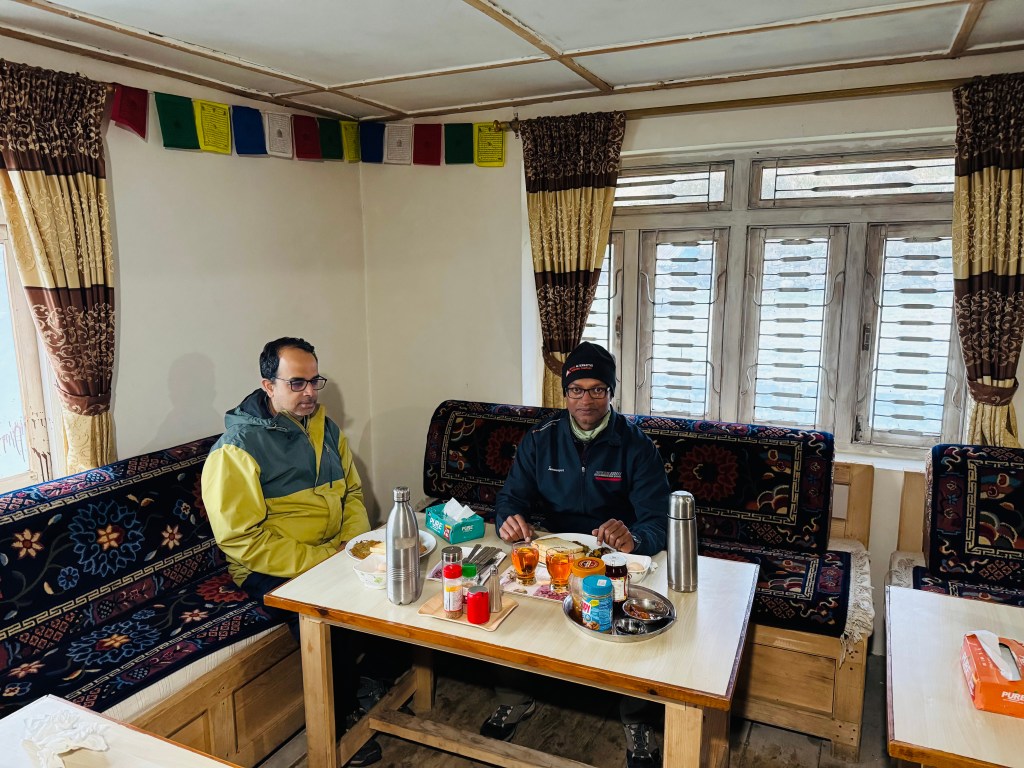
The comfortable room helped having a sound sleep. When the alarm went off, the temptations were to stick to the bed a bit longer. The weather was pleasant but cloudy. The mornings have been cloudy since last few days. When I asked a guide from the French team about possibilities of clearer weather in the coming days, he jokingly said “I’m trying hard for it”. The kitchen staff were already active. When we reached the dining place, it was already buzzing with activities. Trekkers from different groups were in different stages of having their breakfast. Our menu was “American set breakfast”. That translated to bread toast, jam/peanut butter, honey, hash browns (a dish made out of mashed potatoes, resembling the Indian dish if “Aloo tikki”), fried/scrambled eggs, tea/coffee, bacon/sausage and fruit juice. We customized it to exchange bacon/sausage with extra bread toasts. When it was served, it was indeed a candidate for photograph. It drew comparison with the “Everest base camp trekkers breakfast” at Namche Bazar. On both ocassions, it drew awe from us and we enjoyed to the fullest.

Hotel Sindhi Namjong, Gyabla, picture courtesy, Dhananjoy Dey

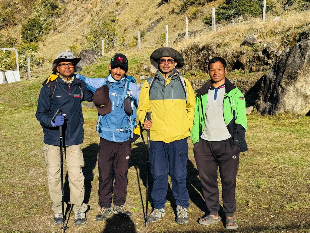
Gyabla got entrenched in our minds and a lot of that had to do with “Shingi Namjong”. It was decided that we were to have lunch at the place on our return journey. On that ocassion, the leg of our journey would be from Ghunsa to Amjilosa. But that changed for better and we got our second chance to stay at Shingi Namjong. Another story for a later date. Sonam bade us goodbye and after a group photograph at the lawn, we started off for Ghunsa. This was what Dilal had to say about the day’s trail on the previous night:

Dilal speach: “We go down, then little up & down (read level), then we up, up and reach Phale. It takes 2 hrs, may be 3 hrs, depend speed. After Phale, flat flat for 2.5 hrs, we crossed bridge and then Ghunsa. I will already book the Dzonga Family House lodge”.

That should roughly translate to 5-6 hours of walk, the initial part of it should involve some uphill climb but the latter half should be a light stroll. Our slated stay was at the lodge which carries the name “Dzonga Family House”.

After moving beyond the lawn the trail moved into a field surrounded by bushes and trees with the same colorful foliage which we encountered earlier. They forced us to stop here and there to capture the beauty through our lenses (both human and optical).

En-route Ghunsa
En-route Ghunsa, picture courtesy, Dhananjoy Dey

It was a pleasant walk on level ground. Then the track moved downwards. The descent went through a set of stairs. Multiple switchbacks took us down fast to the base of an iron bridge. We crossed a stream and started hiking gradually. The trail moved close to the Ghunsa river. We came closer to its banks. There were many ocassions where we shot videos of the meandering trail under the canopy.

En-route Ghunsa

En-route Ghunsa

We came out into an open area where the Ghunsa was flowing ferociously below our feet. A set of boulders led into its bed from where we stood on its banks. We couldn't resist the temptations and made our way to the river bed over the boulders. The milky torrent made its way around the boulders to jump into the gorge. The sun was sneaking through the clouds.

En-route Ghunsa
En-route Ghunsa, picture courtesy, Dhananjoy Dey
En-route Ghunsa

En-route Ghunsa

Blooming rhododendrons dotted the banks, floating white clouds made their way through the sky and the valley was at it's best. We forgot about the destination and indulged in photography. But such landscapes seriously expose the limitations of technology. We try as much as possible to capture the beauty through the optical lenses, but they can't capture even a fraction of what gets etched in our memory. As we moved along, the number of rhododendron trees increased. The color was mostly dark pink and scarlet.

En-route Ghunsa

We came across a few tea houses. We stopped there briefly to unstrap our backpacks and gulp down some sips of water. The entire preriphery of the place was surrounded by blooming rhododendron trees. While we quenched our thirst, cool winds brushed our face as we watched the Ghunsa flow through leaps & bounds into the valley below. The sun continued to play hide and seek with the clouds.

En-route Ghunsa

Our track continued beside the Ghunsa river, it gradually started moving up and we found ourselves walking along an exposed ridge. The forests temporarily removed their covers and we reached a point from where a set of rocky staircases moved up. Dilal confirmed that this was the start of our hike to Phale. As soon as we started our hike, forests closed in, the coulds too moved in fast and we found ourselves walking under the shades. Nature did it's best to give us comfort. The steps were a bit high. I felt a slight pain in my right knee. Though still nascent, but it wasn't a good sign. With most of the walking still remaining, this could only increase in intensity. Time for a painkiller tonight. But for the moment, I kept those thoughts at bay and concentrated on the trail. The switchbacks led us to a gate. It was a gate made out of stones and decorated with prayer flags.

Phale

Phale

Reaching the place gave us comfort. Going by Dilal's account, this was our last hike for the day. Rest of the route should just be "flat flat". After moving through a forest of rhododendron trees we entered into a wide valley floor. Large fields reached out wide on both sides to reach the bases of distant hills which encircled the valley. A track moved through the middle of the valley floor towards some distant houses. Phale was in our sights. It was a descently large village with a local monastery.

Phale
Phale, picture courtesy, Dhananjoy Dey

Phale

The track moved through an alley. Tea houses and normal huts bordered it on both sides. It was time for some tea. The entrance of the village as well as its exit were guarded by rhododendron trees. Winds started blowing hard under the cloudy sky. That forced me to put on the windcheater. After tea, the track moved on flat ground. Small streams interspersed it at multiple places. One of these were routed to a prayer wheel. It's a common practice to use the energy of flowing streams for different purposes. Rotating prayer wheels is one of them. The track moved under the shade of dwarf rhododendron trees.

Phale

That told us, we gained significant heights from lower reaches where these trees had greater heights. This stroll continued for another hour. The sky was considerably darker than before. I felt a few drops of rain on my exposed hands but Dilal confirmed that raincoats were not needed. The Ghunsa river reappeared beside us and it's stream was not far below the trail. We reached a junction. A sign-board pointed towards left.  It read "Nangola pass". It pointed to an uphill trail that went up through rocky staircases. The Nango La (4820 m) serves as a connection between the Kangchenjunga base camp region to the remote village of Olangchung Gola. Another arrow pointed in the forward direction that read "KBC".

En-route Ghunsa, picture courtesy, Dhananjoy Dey

We followed that direction and after sometime the Ghunsa opened up as a wide stream. The trail went through a few landslide areas, some of these were bridged with logs. Beyond a certain distance, a suspension bridge went over its stream. On the other bank, roofs of the lodges were visible. Ghunsa was within our sights.

En-route Ghunsa, picture courtesy, Dhananjoy Dey
Ghunsa

Ghunsa

Winds swept us while crossing the bridge. After reaching the other side of the Ghunsa, we went along a narrow alley amidst the cultivation fileds and tea houses. The Dzonga Family House greeted us through its gates. On the right side, there was a two-storeyed house. The top floor was the kitchen and dining place. To our left, another two-storeyed house hosted the living rooms. We were taken to our room and we loved it instantly. Though much smaller in size than the one at Gyabla, it was neat. The beds were evenly laid. It had a balcony and guess what, an attached washroom! For the first time on the trail, we could rise later as we wouldn't have to race for common washrooms. There were charging points and for the first time on the trail, a proper WiFi connection. After changing our clothes, we took the chance to inform our homes about our safe arrivals. Dal bhat awaited us at lunch. Though not as tasty as in Phedi, it was good enough. WiFi was charged at a rate of 750 NPR for every device. For the first time in the trail, warm water was also getting charged. These told us that we were at the last place of stay within the tree-line.

Hotel Dzonga Family House, Ghunsa

Ghunsa is an important place in this route. It is where the permits get checked (both on the way up and down). Officers of the Kangchenjunga conservation area (which contains the entire route) make entries about every individual in their registers. One the way down, they check the returning travelers ro tally against their entries to ensure there are no instances of disappearance. Dilal went to complete the formalities. Ghunsa is also the place where routes diverge between the north & south base camps of Kangchenjunga. The northern route goes forward via Khambachhen and Lhonak. Another route goes via Selele pass (4390 m), Sinion La (4450 m), Mirgin La (4480 m) and Sinelapche Bhanjyang (4830 m) to reach Cheram. From thereon, one can go to the southern base camp via Ramjer. Trekkers who combine the two base camps, use this route to transfer to the south base camp route. As usual, after lunch, Dhananjoy went out for a village stroll. I declined his offer as the "drying of clothes" occupied my mind. I waited for the fire place to start up. But unlike Gyabla, there weren't many places to sit around, neither enough strings to hang the clothes. The place was much smaller than the one at Gyabla, but that was an unfair comparison. I kept tossing between the tables and the fire place to try and find a place to hang my clothes. The best I could find was a stool. I layed some of my clothes there and the rest on a table that stood quite far from the fire place. Despite changing the face to allow different parts of the clothes have exposure to heat, the best it could give was consolation. I gave up and settled down on the table. Dhananjoy returned from the stroll and filled me with his experiences in the village. He even found time to play volleyball with a Swiss group of travelers! These came along with some rebukes for me being "lazy" and "over-obsessed" with drying of my clothes (there's some truth to this, I have to admit).

Ghunsa

Hotel Dzonga Family House, Ghunsa, picture courtesy, Dhananjoy Dey

After some negotiations, we convinced Dilal to extend the "Beer line" to include Ghunsa (at the expense of having to include him in the sessions). This was indeed to be our "last" while going up. We stuck to this on the condition that the guideline was to be much more linient while coming down (though the rationale sugests similar guidelines for both - if there's risk in going up the slopes in a "toxic" state, so will it be while coming down as steepness goes eitherways). After beer, it was dinner time and then it was time for

Dilal Speach: "Tomorrow, we go small up and down for 2 hrs, may be 3 hrs, depend speed till Labuk. Some rest, then no tree, only boulder, rock, hike. Open area, landslides. Another 2 hrs, may be 2.5 hrs, depend speed, we reach Khambachen."

It'll take about 5-6 hours to reach Khambachen. But the important thing is that we'd go beyond the tree line into the zone of rocks and boulders and the latter part beyond Labuk is likely to be steeper and possibly, through some landslide zones. We retired to our room after dinner. For a change, I set the alarm at 5.30 AM for the next day. It was still a bit early, as we were slated to start at 7.30 AM. We were sleeping at 3475 m.

Earlier

Next

Kangchenjunga north base camp – Gyabla

Earlier

Next

15th April, 2026

We woke up to another cloudy morning, but there was no drizzle. A member of the French team jokingly said “If you see dogs anywhere on the route, slit their throats”. I knew the reason. Dogs kept barking throughout the previous night which must have been a nuisance for their sleep. After breakfast, it was time for group photographs and then we started off.

Amjilosa, picture courtesy, Dhananjoy Dey

A gradual stroll led us out of the village. The sun started peeping out amidst the clouds. In a few moments, we were walking in bright sunshine. Ferns lined up on both sides of the trail. Their fresh leaves were bright green. Bushes and trees gave way to yellow grasses which filled the slopes. We now started walking along an exposed ridge. The valley was wide open in front of us. Looking back, the huts of Amjilosa were visible at some distance. Waves of yellow grasses went up along the slope on our left till they reached the boundary beyond which forests start. Looking to our right, successive wave of grasses went down towards the valley floor.

En-route Gyabla

Few rhododendron trees started appearing. The trees had a scarlet bloom. The place was windy because it was exposed. The winds created waves among the grass fields. After sometime the trail started descending and once again we entered the forests. The colorful foliage reappeared. What started after Phedi on the previous day, continued in this part of the trail too. The track moved through multiple bends, many of which were graced by waterfalls which came down from the slopes above, in leaps and bounds.

En-route Gyabla, picture courtesy, Dhananjoy Dey

The accumulated snow from the winters had just started to melt causing such waterfalls. The larger streams had iron bridges laid over them, while we tip toed over the rocks for crossing the smaller ones. While starting from Amjilosa, I had a windcheater on my body, but profuse sweating forced me to remove it. Sunlight played hide and seek with the porous canopy.

En-route Gyabla, picture courtesy, Dhananjoy Dey

Gradually we came to an valley. It was shaped like a bowl and at the bottom of it, there were a few tea houses. The place was called Thyangam. Some boarders were enjoying their tea in the bright sunshine. We stopped for sometime. That allowed us to unstrap our backpacks. A few sips of water was gulped down. It turned out that one of the tea houses belonged to the same owner who also owns a lodge at Gyabla, our destination for the day.

Thangyam

Without wasting much time, we resumed our walk. The Ghunsa river came nearer. We came near a waterfall. A wooden bridge went over it. The stream descended in leaps & bounds in its eagerness to join the Ghunsa river. The place where the bridge joined the other side, the track was broken. Loose soil came off and pebbles rolled down under our feet as we climbed it to regain the trail. After crossing this section, the trail eased out.

En-route Gyabla
En-route Gyabla, picture courtesy, Dhananjoy Dey

After walking sometime on level tracks, we reached a base from where the trail moved up a steep slope. We stood there and looked up. A series of rocky staircases went up in multiple switchbacks and disappeared amidst the forest. Each of the steps had a significant height and it required us to take large leaps to scale them. A small stream came down along the stairs which made them moist. Since the stairs went under the shade of the canopy, they were damp and the moss cover made them slippery.

En-route Gyabla

En-route Gyabla

We started climbing them gradually, giving many breaks to breathe through our mouths. The switchbacks continued and after a significant hike, we reached at the end of the stairs. The walk from hereon was gradual. After sometime, the roofs of the lodges could be seen. Gyabla was in sights. There were three tea houses. One of them was really big. It was two storeyed, placed in an open valley, on level ground. Hills surrounded it from all sides. "Shingi Namjong" welcomed us with open arms.

Gyabla

Gyabla

We were awestruck by the quality of the room. There were two beds placed adjacent to its walls, spread wide apart. A center table, wide enough to hold sufficient number of items. On another corner, there was a shelf where fluffy warm blankets were placed. The beds were wrapped with another set of warm sheets. We were overwhelmed by the facilities. The kitchen itself was very big. On one side of it, was the cooking area. It's walls were equipped with wooden shelves. Different utensils filled these. On the opposite side, there was a small window which opened towards the dining space.

Hotel Singhi Namjong, Gyabla, picture courtesy, Dhananjoy Dey
Hotel Singhi Namjong, Gyabla

The window was used as a counter to hand over the meals after preparation. Porters or guides of different groups served them to their respective members. As our meals got prepared, we went out to the lawn and hung our clothes to dry them up. The lawn was big. A wire was strung up along its length to allow people to dry their clothes. At the end of the lawn, a trail went up towards the upper regions of Gyabla. There was a monastery nestled in the upper Hills. Long strings of colorful prayer flags were hung from its top. It was at the lawn we met a staff of the lodge.

Gyabla

He was from Darjeeling. Every year,  during the trekking/expedition season, he comes to Gyabla for work. The walking trail takes him to Sekathum/Itahari, then a shared jeep to Taplejung. A drive for a few hours takes him down to Fikkal (we saw it on our way towards Taplejung). From Fikkal, a separate route goes towards Pasupati market, which lies on the border with the Indian state of West Bengal. From there, Darjeeling is just a couple of hours away by jeep. The spring or summer season lasts till mid of May, after which lodges close down. They reopen again in the month of September for the autumn season. They close again in late November or early December for the winters which lasts till February. We were told that our lunch was ready. The dining space was a huge square area. There were some doors on its left wall, which opened towards the rooms. Members of the owners' family stayed there. We occupied one of the tables and meal got served. Dal bhat (with its usual elements) and egg curry. We pounced on the meal but I lost control and ended up filling my stomach with rice, lentils and "saag" by a disproportionate amount. That left little room for the eggs. It was a shame that I couldn't do justice to the egg curry. I somehow stuffed it inside.

Hotel Singhi Namjong, Gyabla, picture courtesy, Dhananjoy Dey

Clouds came on and off and they sent me in a tizzy. To be honest, I often get obsessed with getting my clothes dry. I was in two minds about the clothes.  Should I leave them in the open to allow the sun (which was ever elusive) and the winds to dry them or should I bring them over to the dining space, where there was a fire place. We met the French group again. There was an American couple too. Many others were present at the dining space, which was bustling. Finally, the staff started opening the lower chamber of the chimney and started putting in cakes made from dried yak dung with supplements of wood splinters. That prompted me to bring my clothes inside and hang them near or above the central fire place.

Dhananjoy went out for some exploration in the local village. He tried enticing me into the initiative. However, the incentive wasn't strong enough to dislodge me from the comfort of the warm dining room. After he came back from his excursion, he showed the pictures. He ventured into the open fields, spent time with the local farmers. They obliged him with photographs, posing along with their sickles.

Gyabla, picture courtesy, Dhananjoy Dey

We enjoyed our beers along with popcorn, which was provided by the lodge as a free supplement. We asked them to delay our dinner, but it came in earlier. When asked about the reason, the owner (a lady named Sonam) said we'd need time to digest the dinner, especially after beer. She was smart enough to put it on us. Thin crust pizza was on the menu. I keep getting amazed with the cuisines on offer in these remote areas. There was more surprises on offer at even a more remote place higher up on the trail. That's a story for later. Dilal informed us that the walk for the next day to Ghunsa would be similar as today's. We're likely to reach there by lunch time. That would be the last place of stay within the tree line.

After dinner, we retired to our room. The comfort and warmth soon engulfed us. We were sleeping at 2730 m.

Earlier

Next

Kangchenjunga north base camp – Amjilosa

Earlier

Next

14th April, 2026

The sound of the torrent kept reaching our ears through the night, but that didn’t interrupt the sleep. The alarm kept its promise. There was a nip in the air and the natural temptation was to wrap the blanket even tighter to embrace its warmth but I resisted that. The day before, in the afternoon, we met two locals who descened from Ghunsa. They skipped two halts, Gyabla and Amjilosa, to reach Itahari directly. Their homes were in the Terai town called Dharan. Pictures from their mobile enticed us. I had a mixed feeling looking at them. On one hand, they were through with the tough part. All that lay ahead, was an easy ride to Taplejung, followed by a descent to the plains over the smooth Mechi highway. I looked forward to the day when we will reach that state. But I also looked forward to the exciting hike spanning the next few days that’d take us to the base camp, the views of the trail and above all, standing below the feet of the third highest mountain of the world. The colorful rhododendrons in the forests that lined the lower areas, the glacial moraines over which we’d be walking, the ever changing face of the Ghunsa river right up to the snout of the Kangchenjunga glacier where it originated from and the surprises & challenges the trail might have in store for us. In such trails, I have no feelings of sadness even while returning. A sense of completion fills my mind and a relief of not having to negotiate challenging terrains. But, at times, human made disruptions, aided by weather, have played spoilsport at places with easiest of accessibility. I’m talking about the domestic flights in Nepal. It happened in Luk La as well as Tumlingtar. I didn’t know at that time, what was in store at Bhadrapur. Limbu was at our doors, ready to pickup our bags. After a hearty breakfast with roti and chana curry (it’s called “ghugni” in the state of West Bengal), it was time for a group photograph. On every trek, the first day carries a unique excitement. After months of staying in civilization, you get the first opportunity to strap your backpack, take up your hiking pole and hit the trail. This was no exception. After moving out, we started hiking along a strip of path that went beside the goat shelters. It moved up through multiple switchbacks and soon we were walking amidst cardamom fields.

Picture courtesy, Dhananjoy Dey
En-route Amjilosa

The leaves glowed bright in the clear sunshine. Cardamom seeds were visible near the roots of the plants. Just as I focused to take some photographs, I got sprayed with drops of water. I was taken aback by the suddenness of it. That’s when our guide urged us to move quickly to escape this water spray. Once we were off the limits, we turned back to see the source of it. Sprinklers were rotating to spray water on the fields. The tea houses of Itahari were visible below us.

En-route Amjilosa

They appeared as matchboxes from the height. The flowing Ghunsa river was clearly visible behind the lodges. Fertile fields were lush green. Most of the cultivation was of cardamom. The track was adulating and after sometime we faced our first suspension bridge on the route. After crossing over, we went along the right bank of the Ghunsa river.

En-route Amjilosa
En-route Amjilosa, picture courtesy, Dhananjoy Dey

Limbu kept ahead of us. Right after starting from the lodge, Dhananjoy drew my attention to the feet of Limbu. He was wearing rubber slippers! Hiking the slopes while carrying a load of 20-22 kg, wearing slippers, Limbu appeared unfazed. While we were wearing two layers clothes, Limbu was down to a T-shirt. Very soon he went out of our sights. The villages on the other side were no different. Cardamom fields, houses nestled among them with sloping roofs, animal sheds – and sight of a contained life.

En-route Amjilosa

The Ghunsa river showered its blessings in the form of water & sediments over these villages. It’s violent torrent with multiple rapids told us that it was moving over a rough bed. We came to a village called Jaubari. The name sounded familiar. The name also features in the famous Sandakfu trail in the neighboring state of West Bengal in India. Could it be possible that a route exists towards Sandakfu from here? The fact that the Sandakfu trail passes along the Nepal border, increased that possibility. It was revealed to me later that this assumption was wrong. There are multiple places in Nepal with the same name in its different regions. For example,  there are many Deuralis & Tatopanis. This was one such example. My wrong assumption was corrected, incidentally, by a man from none other than the Darjeeling district, which is where Sandakfu lies.

Picture courtesy, Dhananjoy Dey
En-route Amjilosa

We climbed some stairs to reach an elevated field and guess what. We saw Limbu resting by leaning against a rock, basking in the bright sunshine. We continued along. The trail started descending under a huge overhanging rock. It exited at a place where the Ghunsa river was flowing just under our feet. We stood over a a wooden bridge made up of loosely strewn logs. We literally walked above the gushing stream. The makeshift bridge led us from one rock to another, while the torrent roared below our feet.

Picture courtesy, Dhananjoy Dey
En-route Amjilosa

En-route Amjilosa

After one rock, it climbed up to regain the trail on the other side. We breathed a sigh of relief. But I didn't lose the chance of filming a video. I asked Dhananjoy to shoot the video. When I moved, he shot. He then went back to the starting point to follow the trail once more. This time, Dilal played the cinematographer. After reaching the other side, the trail continued. After sometime, we reached Lamatar. It was initially planned that if time permitted, we would have tried to reach here the day before. We rested there for sometime and resumed our journey. The trail now started to rise and we started climbing stairs. These set of stairs went up through a few swirls to reach the base of a bridge. After crossing over, the trail descended. It was a bit steep so we had to be careful. It was broken at places but was manageable. Descending such trails require more care than ascending. We went down to the banks of the Ghunsa river, deep into the gorge. After crossing over, we looked at the path that lay beyond the bridge. It went up through a set of rocky stairs. There were multiple switchbacks as the stairs moved up through the dense forest.

Picture courtesy, Dhananjoy Dey

We started climbing. From hereon, we walked under the canopy of a dense forest. After sometime we reached Phedi. This is another common name in Nepal. Every trail in Nepal has a Phedi. It means the bottom of a hill or a mountain. There are two Phedis on either side of the Thorong La on the Annapurna circuit. There's a Phedi after descending from the Larkya La on the Manaslu circuit. Just like others, this place too justified its name.

En-route Amjilosa

There was a small lodge. After removing our backpacks, we sat in its lawn for some rest, while our dal-bhat meals were being prepared. A dog was sleeping in the sunlight. Cool breeze flowed through the leaves of the surrounding trees. Chickens roamed around the place searching for grains. A goat was also there giving curious looks at Dhananjoy's bag. An old saying goes that there's nothing in this world that goats can't eat. We kept a cautious look while it inspected the bag from a distance. Finding it to be uninteresting, it's attention turned elsewhere. The lady of the lodge fetched some freshly harvested leafy green vegetables (called Rai Saag in local language). That raised our interest in the lunch. We're aware of this delicious dish of Nepal. It takes time to prepare lunch as they prepare it afresh. After about 40 minutes, we were invited to the dining place. Rice, lentils, Rai Saag, a vegetable curry and some pickles. Coupled with freshly cut onions & green chillies, the lunch was perfect. We pounced upon it and were quite satisfied at the end. A hike for another 2.5 hours awaited us after the lunch. Though not tough, hiking after lunch can be tiring. We strapped our backpacks & resumed our hike. By that time clouds started taking over. We navigated the stairs. A few rhododendron trees appeared.

En-route Amjilosa

Flowers were few but bright red in color. We saw some trees with foliage of different colors (similar to what we saw on our way before reaching Taplejung. Though light was less, but we couldn't resist taking photographs. Such trees increased in numbers. We would see many more on successive days. Though time was passing by, there was no hurry as the total duration of walk was not to exceed 6 hours. We stopped at every bend for photographs. Just when we thought we saw the most beautiful color, another one turned up at the corner. The trunks & branches were covered with thick moss.

Picture courtesy, Dhananjoy Dey
En-route Amjilosa

These forests must be a treat for eyes during monsoons. It's a separate aspect though, that most of the areas become inaccessible due to the swelling torrents of the Ghunsa river or the landslides brought on by incessant rains. We kept moving up under the canopy. The sky also bore a dark appearance. I was wondering whether we need our rain covers but Dilal assured that it won't be necessary.

En-route Amjilosa

En-route Amjilosa

After hiking for a couple of hours we came out in the open. The track now moved along flatly. The lodge (there was only one) of Amjilosa was now visible at some distance. It was still some way to go, but the sight of destination always gives satisfaction and energy. The lodge was spread across terraced slopes. It's dining room & kitchen was at the lowest level, the next level had some rooms for porters and guides. The room for us was at the highest rung. There was a flat ground. To the left, lay the rooms, the toilets lay to the right. When we were unlocking the room keys, we heard sounds of thunder. We thanked our luck for arriving just in time as a light drizzle started immediately. After changing to our room wears, we hung our trekking clothes in the balcony. There were some clips (which reminded me of forgetting to pack them, despite planning to do so much earlier). Then we headed to the dining space (as is the norm for tea house treks in Nepal).

Amjilosa, picture courtesy, Dhananjoy Dey

We met a group of French trekkers there. They were a group of aged friends who have been coming to Nepal for at least 30 years. Every year they bring & distribute "items of relevance" to the inhabitants of every village they stop along the route. This time around, they were distributing sunglasses which could protect against ultra violet radiation and snow blindness. Their target recipients were porters, guides and potentially yak/sheep herders who often travel to higher echelons of the Himalayas in search of pastures for feeding their animals. Such routes often involve crossing high passes, traversing glaciers and sometimes climbing as well. The Frencg group always travel with the same set of guides & porters. They've worked out a reciprocal program where these porters & guides travel to France and work there for a few months. This time, this travel has been adversely affected because of shooting costs of air travel due to the ongoing West Asian crisis. This cultural exchange was apparent from the fluent bidirectional French conversation between the French travelers and their porters and guides. We'd meet many other French groups as well as travelers from other countries during the trek but not any other Indian. I was talking to one of the members. They've been on every known trail of Nepal, even in the Dolpo area of Western Nepal about 20 years ago. Dolpo was the hotbed of Maoist insurgency in those days. There weren't any tea houses in those days, all was about camping or residing in local village homes or schools. They visited the Shey Phoksundo lake, stayed at the Rimgmo village on its banks and even at Saldang. That's an area of immemse interest of mine. Hence, I spent a lot of time discussing this topic with him. The previous evening, while having beer, Dilal cautioned against alcohol consumption in the higher areas.

Dilal speach:

"You will having beer in low place. You will not having beer in high place. Not good."

Here's one small addition to Dilal's English grammar, just so it doesn't sound like an order, which wasn't his intention. "Will" here equates to "can". Got it? Wonderful, rest is a cake walk for you. When asked to provide a concrete boundary that separates low from high, he put Amjilosa at high. Immensely disappointed with that decree, we negotiated hard and were able to trade in Amjilosa. We were able to shift the boundary further by another two by inviting Dilal to join us, but it came at a price. With that somewhat weak "trade deal", he stuck to us for the rest of the trek for the drinks sessions, which we found hard to escape from. Coming back to the current phase, we enjoyed a few beers. Dinner was served at 7.30 PM and we retired to our rooms after that. By this time, the drizzle has transformed to proper rain. I tossed around the bed, thinking about it. I normally don't like rains in these parts of the world (however selfish it may sound). They could wreck havoc by closing trails, adding to delays, thereby upsetting plans. We faced it at Goecha La as well as the Annapurna circuit. On the latter ocassion, it cost my visit to the Tilicho lake (by playing on my fear of snow), but the plan somehow survived its onslaught after some adjustments. Could Goecha La repeat here? Is Kangchenjunga still not ready to accept me at her premises? The sound of the rain on the roofs sounded strong. I silently ventured out of the room to check the situation as well as visit the toilet. Coming out in the open, removed many of my concerns. The rain didn't feel that strong as it sounded on the roofs. But what if it continues raining throughout the night? Though I scaled down the intensity apparent from the sounds by the factor observed by me by going out, the concern remained about the duration. Also, rains at lower altitude implies snow at higher. There was a contrast between my states of mind at Itahari and here. It was at a high there driven by expectations. It dipped somehow by the rains but I forced them out to concentrate on sleep. We were at 2400 m.

Earlier

Next

Kangchenjunga north base camp – Sekathum

Earlier

Next

13th April, 2026

Bread toast, omelet & black tea. That constituted a good filling breakfast at the “Mountain Hotel” of Taplejung. There was time before our departure. Dhananjoy & I went out for some local surfing. Taplejung is an important town in this part of Nepal. Just as it was a stop before embarking on Kangchenjunga base camp trails, it also formed the base for a pilgrimage, the “Pathibhara temple”, one of the famous shrines of Nepal. It takes about a few hours drive followed by a hike of about 3 hours. A lot of pilgrims flock to Taplejung for this reason. While roaming around in the local market, we saw many of them. It’s a bustling town with different people heading for different destinations. Our bags were already packed. After returning from the market, we waited for some time before the arrival of our vehicle. We had the privilege of boarding first.

Taplejung, picture courtesy, Dhananjoy Dey

After that, the jeep went through the bylanes of the town, often through narrow, bumpy alleys, which never looked like proper roads. We were told that the jeep was to collect passengers on its way, but initially, we went into the backyard of someone’s home. There were sheds for herding chickens & pigs. The animals peeped at as through the gaps in the bamboo walls. The driver dumped some goods & returned to the main market through the alleys. We realized it was his home and this detour was to dump some goods there. It then stood at the main junction while passengers started piling in. We sat in the middle row, Dilal sat beside the driver. Two other passengers boarded in the front row. By that time, the back row was already stuffed to the brim. When we thought the jeep was filled beyond its capacity,  people started climbing to its roof. It was supposed to be a journey lasting for 5-6 hours and we were already sandwiched from either side. However,  once the jeep started it’s journey, we somehow got used to it and turned our focus outside. The jeep initially went downhill along the same road by which we came to Taplejung. After about an hour, it diverted to a different road from a junction. From there on, our route followed the Tamor river. The road wasn’t paved, but wide enough. Work was going on at different places to widen it. JCBs were at work. Their mechanical hands were collecting and dumping debris of blasted rocks & boulders on to trucks, which were clearing them away. Green fields lined the slopes of the surrounding hills. A huge hydro electric power project is being executed. Large tracts of land were cleared on both banks of the Tamor river,  with its flow diverted at multiple places. In some places it’s torrent ran violently, while at others it was tamed by creating artificial diversions to channel it into a huge reservoir. The mountain’s were ripped bare, which gave a disturbing feeling. Are these sustainable at all? What appearances would these places acquire in the months of monsoon? Villages kept flying by with lush greenery in the fields with ripe crops. Dense forests interspersed the villages which had thick foliage. At this time of the year, they acquired different colors ranging from light brown, light green, golden yellow, scarlet red to dark maroon, depending on the variety of the trees and the age of their leaves. Ocassionally, houses with slanted roofs were nestled amidst the cultivation fields.

En-route Sekathum, picture courtesy, Dhananjoy De

The road, though not paved, was level enough. The jeep stopped at multiple places to allow passengers to get down or embark upon the journey. At times, also to load or dump goods. In such remote parts of Nepal, these private shared vehicles are a medium for both passenger as well as cargo transit. With the luggage & surplus passengers on its roof, the vehicle was plying with cautious speed but surprising stability. But that was put to ultimate test after lunch. The Tamor river kept flowing in the opposite direction of our travel through gentle as well as turbulent torrents. It is one of the main rivers that forms the Koshi river system, which also leads its name to the province. The breeze was still cool though we were approaching noon. After sometime the vehicle left the main road to take a detour through an upper village and halted at a local hotel. It was time for lunch. The passengers off boarded and made their way inside the hotel. We gave orders for dal bhat. While that got prepared, we enjoyed a couple of beers. We had company as many others did the same. I was hesitant to drink just before lunch but other passengers seemed unfazed. So I went along with them.

En-route Sekathum
En-route Sekathum, picture courtesy, Dhananjoy De

The hotel was two-storeyed with residential rooms in the top floor. Loads of corn hung from the balcony to dry them in the sunlight. The place was filled with noise from the dining passengers as well as cluckings of poultry. Cardamom fields lined the slopes of the surrounding hills. After lunch, the journey resumed and the vehicle descened to rejoin the main road. With that, changed the road surface. What was seemingly level, now disintegrated into a series of potholes. We were scuttled around randomly as the driver carefully negotiated the “climbs”. It needed immense skill to navigate through the maze with an overloaded vehicle. Skills were demanded from the passengers who graced the roof. On some treacherous stretches they had to off board to reduce the weight and walk patiently behind the vehicle. Afternoon wore on quietly and the solar rays acquired a tinge of gold. The vehicle kept plying on, but the ride wasn’t smooth anymore. Passengers kept getting down at their destinations, goods continued to get dispatched or loaded at the village stops. We reached a junction called Ranipul.

En-route Sekathum, picture courtesy, Dhananjoy De
En-route Itahari

It’s here the road diverges to two directions. One trail goes towards Torangden. This is the trail that goes towards Oktang, which is also known as the Yalung/South base camp of Kangchenjunga. Trekkers who cover both the base camps use that trail to descend to Ranipul. We went along the other road that headed towards Sekathum. After sometime we reached a confluence. We left the Tamor river and followed the other river which came down from the upper valleys to meet Tamor. From here on, we followed the Ghunsa river (known as Ghunsa khola locally) into its valley. The entire route towards the North base camp would follow the Ghunsa river. Dilal was speaking to one of the co-passengers but we couldn’t decipher much of it. Just when we were nearing Sekathum, the jeep took a turn in the opposite direction. The plan changed. Instead of Sekathum, we would be staying at Itahari, a local village. That would allow us to stay at an advanced location on the route. Though Sekathum had more options for stay and the tea houses are likely to be better, we were told Itahari also had decent lodges. The jeep went through an area that was undergoing massive construction for a hydro electric power project. The terrain was filled with stones and dust, thanks to the construction activity. After sometime our bumpy ride finally came to an end. We disembarked. It gave us relief. We were finally out in the open. It was a landslide area. A massive stream of debris came down the slopes of the nearby hills.

Sekathum

Ghunsa river, en-route Itahari

After our luggage was handed over, we met our porter. "M. Bahadur Limbu", was his name. A simple but sturdy man. He picked up our luggage and we started off on foot along a narrow path along the banks of the Ghunsa river. I was very happy about the prospects of getting detached from vehicular traffic for about a fortnight. The trail went through dense bushes and cardamom fields. After walking for about 2 kms through minor ups & downs we saw the sloping roofs of the houses of Itahari. It is a village nestled amidst a deep gorge of the Ghunsa river, surrounded by high hills with near vertical walls on both sides.

En-route Itahari
Itahari

Though sun was still up in the sky but darkness was about to set in, thanks to the overhanging shadows of the high hills. When we entered our rooms, daylight was receding fast from the valley. After enjoying cups of tea,  we went out for some local excursion in the village. We went through a narrow path that went besides local houses. Some of the cultivation fields were planted with brinjal plants. They looked like a lush green carpet. Purple flowers dotted the fields. Many of the homes had bamboo sheds. These were shelters for pigs. The animals kept peeping through the gaps of the walls. They raised a sound that resembled snoring.

Itahari

We went through the the narrow alleys and started descending towards the banks of the Ghunsa river. It was roaring down the gorge in leaps and bounds forming multiple rapids and pools. The bluish green stream flowed amidst large boulders. Its rocky bed created multiple rapids that looked like frothing milk. A set of logs joined multiple rocks across the stream to form a pool that joined its banks.  While walking over the pool, the sight of the roaring stream amidst the gaps between the logs gave us a thrilling feel. We went over the pool and then tip toed over the rocks to find a place to sit on one of them. Camera shutters kept rolling as the river gave ample scope for it. 

Ghunsa river, Itahari

Ghunsa river, Itahari

As darkness started setting in, we returned to the tea house. Limbu (our porter) went back to his village for the evening. He would return the next morning when to join us on our trail. Our next destination would be Amjilosa. Dilal gave an idea of the trail. A gradual hike would lead us to Phedi. After that, it's an uphill climb to Amjilosa.

Dilal speach: "I will book tea house at all place - Amjilosa, Gyabla, Ghunsa, Khambachen everywhere already".

Tension was building up all through this statement only to be released after the last word. If you apply the rules of "inverted tense" (as explained in one of my earlier posts about this journey, you'd be able to decipher that all lodges were booked and there was nothing to worry. The owners of the tea house reared goats. There were some kids in the goat shelters. One of these was standing on trembling legs. It even had a trace of a dangling umbilical cord. We learnt that it was born on the same day. Soft chapati and country chicken curry formed a delicious dinner. We retired to our room. After segregting the clothes for the next day, setting an alarm for 4 AM, we slid under the blankets. The climate was somewhat warm despite being in the Himalayan foothills. The reason probably was the closed narrow valley with very little winds. The sound of the flowing Ghunsa river, amplified by the mountain walls, filled the air. I thought about our successive destinations and felt excited about the prospects of the views. We were told, snow views could be seen after Gyabla. The beds were comfortable and sleep overpowered us. Itahari is at an altitude of 1570 m.

Earlier

Next

Kangchenjunga north base camp – Taplejung

Earlier

Next

Ten years ago when we were at the Luk La airport, awaiting our return flight (which never took off), I recall looking at a poster that read “The Limbu trail”. It had a picture of the Kangchenjunga group of mountains. The captions were enticing. They spoke about the picturesque views & an opportunity to witness the local culture of the Limbu tribes who inhabit that corner of Nepal. This far-eastern corner of Nepal is home to the Limbu, Rai & Tamang tribes. While the latter two are also found in lower areas of other parts of Nepal, it’s the Limbus who are native to this area. Later on, we found that in the extreme high altitudes, it’s not even the Limbus, but Sherpas who are the primary inhabitants. This is especially true about the tea house owners. We found it at Gyabla, Ghunsa, Khambachhen & Lhonak. This was the case even on the Makalu route where Sherpas were the primary dwellers in places like Tashigaon,  Khongma,  Langmale etc. On this ocassion, I was interested to meet Nupu Sherpa, the owner of the “Kangchenjunga White House” lodge at Khambachhen. I saw his interview on YouTube and found it very interesting. He & his father have been running this lodge from those days when this trek required extensive camping at other places. He was jovial and spoke with a lot of enthusiasm about the surrounding area, the snow leopards & of course, like any other Sherpa, about the illusive Yeti. It’s a common trend in the Sherpas to talk about legends surrounding this mythical bipedal animal. Even in his autobiography, Tenzing Norgay spoke about instances where his ancestors had the (mis) fortune of meeting this creature and the unfortunate bearings it had upon their lives. Anyways,  I hoped to stay at the same lodge and meet “Nupu Dai” as he is fondly known in this trail.

11th April, 2026

With my hopes running high, I started from my home at 10.30 AM for the airport. However,  I dozed off soon and was only woken up after reaching terminal 3 of Indira Gandhi International Airport. Dhananjoy was already staying at Kanyam since the previous day. He has been posting pictures of the picturesque tea gardens & the adulating hills of the area. I wish I could have traveled by that route. Now I’d have to spend a night at the congested tourist area of Thamel, but there’s no point regretting, now that the decision has been taken. The flight took off on time but I didn’t have a seat by the window. Hence,  the Himalayan views were out of my reach. But a quick sneak revealed that clouds shielded much of the famed views. The plane touched down at the runway of the Tribhuvan International Airport. We off boarded the aircraft and reached at the arrival terminal where the familiar statue of Budhha greeted us. After the usual formalities at the airport, I stopped at a counter of Nepal Telecom to buy a local SIM. As I moved outside, I was relieved to see a cab driver standing outside holding a placard of “Karma Hotel”. It’s comforting to see the dots getting joined. The cab drove through the familiar streets of Kathmandu. We went past the Pasupatinath shrine area, the gates of the Narayanhiti royal palace and then entered the streets of Thamel. I got a message from Tej Gurung asking for a slot to meet at my hotel. I shared the location and mentioned the expected time of arrival. Just about when I was settling in my room, I was informed by the front desk that Tej was waiting at the reception along with the guide. I was meeting Tej physically after 2019. On that ocassion, we met him on our way towards Manaslu circuit. Since then,  we’ve done other treks with his company, but all of them were via Gorakhpur and Pokhra/Besisahar. All our communication with Tej have been through online channels. I also met Dilal (our guide for this trek) for the first time. It turned out that our special permits (required to visit the Kangchenjunga area,  which is a restricted area) were not yet prepared. But to my relief, Tej mentioned he’d get them prepared & send them online to the guide’s number, just in time before they get checked at Ghunsa. Tej handed over the trekking maps and T-shirts.  There was a change suggested in the itinerary. Instead of staying three nights at at Lhonak, the guide suggested staying at Pangpema (the North base camp) on the second night, hiking to Drohmo Ri from there & descend to Lhonak on the third day. The reason for not staying at Pangpema was lack of proper facilities but that would have meant hiking again to the base camp and Drohmo Ri on third day only to descend again. It made no sense and I agreed to the suggested change,  but only after confirmation that it was possible to sleep on a bed under a blanket. We could adjust to the rudimentary food facilities, as long as lodging options were warm enough. It was fixed that Dilal would pick me at 5 AM. The rest of the evening was spent by roaming around the streets of Thamel. After returning to the hotel, I segregated the luggage to leave some clothes at Kathmandu for use during my return. This was also to keep the luggage within limits during the trek. The hotel agreed to provide some breakfast at those early hours even though it was outside  normal working hours of their kitchen. With the operational aspects sorted, I went to sleep with a comfortable mind. I compared my state of mind at Kathmandu before the start of the Makalu trek. It gave comfort that this time, it was more professionally arranged. The guide too, was well versed with the area. His comments during our brief discussion made it apparent. There was one question yet to be resolved. That was to hire a private jeep from Bhadrapur to Taplejung. Relying on shared transportation would add a lot of overhead to the travel. It takes at least eight hours to reach there. A shared transportation could add many more hours to the journey. To add to the delay, domestic flights in Nepal are notorious and we may anyways be looking at a delayed start from Bhadrapur. Going by flight history data, a delay of an hour was more than expected. I kept those thoughts at bay, set the alarm at 4 AM and went for my last comfortable sleep, at least for a fortnight.

12th April, 2026

With the alarm, I set off with the proceedings. After a comfortable hot shower, I headed downstairs & woke up the person on duty. A quick breakfast of bread toast, jam & omelet was prepared. While I was at it, Dilal arrived with a taxi. I invited him to join me for breakfast. After the meal, I handed over the spare luggage at the front desk, they returned a tag in lieu of that. The taxi started off for airport through the dark sleepy streets of Thamel. Cool morning breeze swept across my face. These are all too familiar. I recalled a similar journey just a few months ago. The destination at that time was Tumlingtar. This time it was Bhadrapur. We were three of us at that time. This time I was alone. The cab went past the Pasupatinath shrine, took a turn and entered the domestic terminal. The terminal was the same with its resemblance more to a bus terminus than an airport.

After checking in, we waited at the departure terminal. For a change,  we boarded the aircraft on time. While that lifted my spirits, the wait for more than an hour, just sitting in the aircraft, started deflating it. Apparently, heavy air traffic at Kathmandu Airport was the cause. Initially, announcement was for a delay of 15 minutes. After 30 minutes, when asked, another such “15 minutes” took the tally to an hour, which is when it started taxying through the runway and followed by a short run, it took off.

Mt Everest, Kathmandu-Bhadrapur flight
Mt Makalu, Kathmandu-Bhadrapur flight

Immediately, the amazing vista of the Himalayas emerged. Despite a partial cloud cover, one couldn’t miss their identities. The Langtang range was followed by Cho Oyu, then the famous pyramid of Mt Everest, Lhotse, Makalu & others. Before the Kangchenjunga group could appear, the aircraft took a turn towards the plains & started it’s descent and we landed at the Chandragarhi airport at Bhadrapur. A small airstrip in the Terai region of Nepal, Bhadrapur runway was picturesque.

Dilal shared some information about the transportation arrangements. “Private transport, difficult finding. Shared transport, long time. Private transport, I will arrange.”. I tried to make sense of this “unique grammar”. It was difficult to understand what has been done and what remains to be. The reason for spending much time in explaining Dilal’s English is to establish some patterns for the audience to understand his statements. There will be regular excerpts of these in future episodes, which I’d mark with labels of “Dilal speach“. On this ocassion, after exiting the Airport, we waited beside some local shops. A jeep pulled in and Dilal signalled me to get in by saying “I will already arrange private jeep”. The word “already” was crucial to decipher the pattern. Almost like the accidental discovery of the ancient Egyptian language, I found out that in Dilal’s grammar, “will” indicates past tense. So this translated to “I have arranged a private jeep”. The road went through the plains. Initially we went amidst fertile fields followed by the dense lush green forests of the Terai. Then came a place named Charali, a square junction from where four roads diverted. One came from Bhadrapur, one on the right went towards Kakarbhita (the border near the Indian town Siliguri), the left road went towards the town of Dharan and in the north, it went towards Ilam, the district headquarters. The jeep went in that direction and soon, the tea gardens started on both sides. Almost immediately, the road started moving up gradually. The sights of tea gardens pleasantly reminded me of similar landscapes of the Dooars & Darjeeling regions of North Bengal. That reminded me that we were traveling through regions close to those areas of India. It gave a strange feeling of homecoming despite being in a foreign land. I called up Dhananjoy to inform our location. As we moved upwards, the bright sunshine gave way to mist & clouds. Though we couldn’t see the picturesque landscape in its full glory, but the mist added its own charm.

Kanyam, picture courtesy, Dhananjoy De

The adulating hills were covered with tea gardens. The lush green gardens with a blanket of mist resembled familiar landscapes of the Darjeeling hills. When I met Dhananjoy at the Hotel Green Carpet at Kanyam, I was relieved. This was more to have some company from theron. Our trekking group has reduced to just two in this ocassion, so I was eager to reach that number. Kanyam appeared to be a popular weekend tourist destination for people from adjoining areas of India. A lot of tourists flocked the mall.

Kanyam, picture courtesy, Dhananjoy De

Our vehicle traveled through these and we gradually crossed Fikkal and other towns. As we moved upwards, the sun appeared again. We stopped for lunch at 11.30 AM, quite early by our standards. But we were told that the next big town Phidim was quite far and by Nepalese standards, it was already time for lunch. We had our first “dal bhat” of this trip. As expected, the vegetables were fresh. To top it off, we were presented with fresh fish from the nearby river flowing through the valley. After a neat lunch, our journey resumed through the villages of the rural Limbu heartland. The Mechi highway started to move downwards and we reached the town of Phidim,  which was a big junction in this area. After that we started moving up again through the winding roads. The quality of roads were good. The foliage started to assume multiple colors.

En-route Taplejung

After sometime, our guide pointed towards a flowing river way below in the valley. It was the Tamor river, one of the many tributaries of the SaptaKoshi river. Evening wore on as we continued progressing and after sometime we entered the town of Taplejung. The jeep meandered along the serpentine roads through the marketplace and after sometime we arrived at "The Hotel Mountain". After settling in the rooms, a dal bhat meal awaited us along with fish curry (with big pieces of Rohu fish). Along with lentils, fresh vegetables and ghee, the meal was satisfying. It was planned we would leave at 7.30 AM, the next morning. This time around it would be a shared jeep. The beds were comfortable, blankets were warm and we went to sleep. Taplejung was at an altitude of 1820 m.

Earlier

Next