The Barun valley – spirits chased us out?

Earlier

29th October

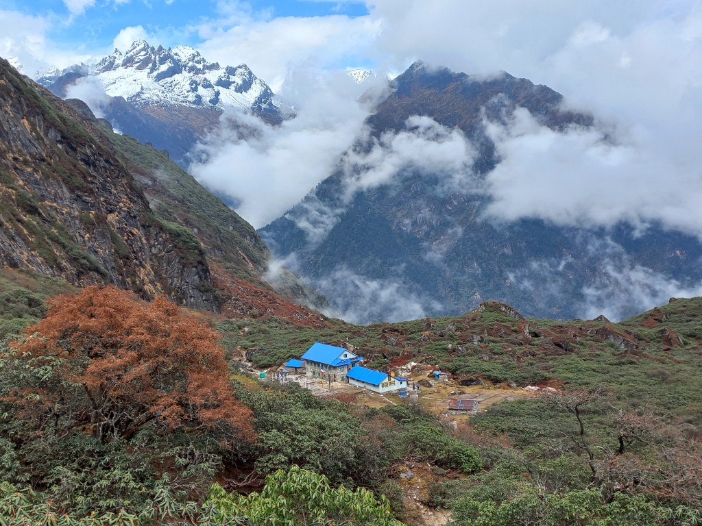
When I woke up, rain was falling hard on the roof. As I made my way to the toilet via the dining space to venture into the backyard, I found it filled to the brim. Members from other groups sneaked in every corner of it to find space to sleep. As we readied ourselves, rain kept falling incessantly. It was still falling thick and hard when we went for breakfast. Fortunately, our clothes were dried up to wear them on. We covered us with our ponchos, took up our sticks and ventured out into the rain. By now it had reduced in intensity. The track went down through stair cases towards Tashigaon, which wasn’t visible today, thanks to the dense clouds. Just as we went down a bend, I realized we missed the payment for a dish. We had it the previous evening. The lodge was still visible and so was its owner. I shouted out to her mentioning that. She replied that she waved that as a complimentary offer to us.
Picture courtesy, Dhananjoy De

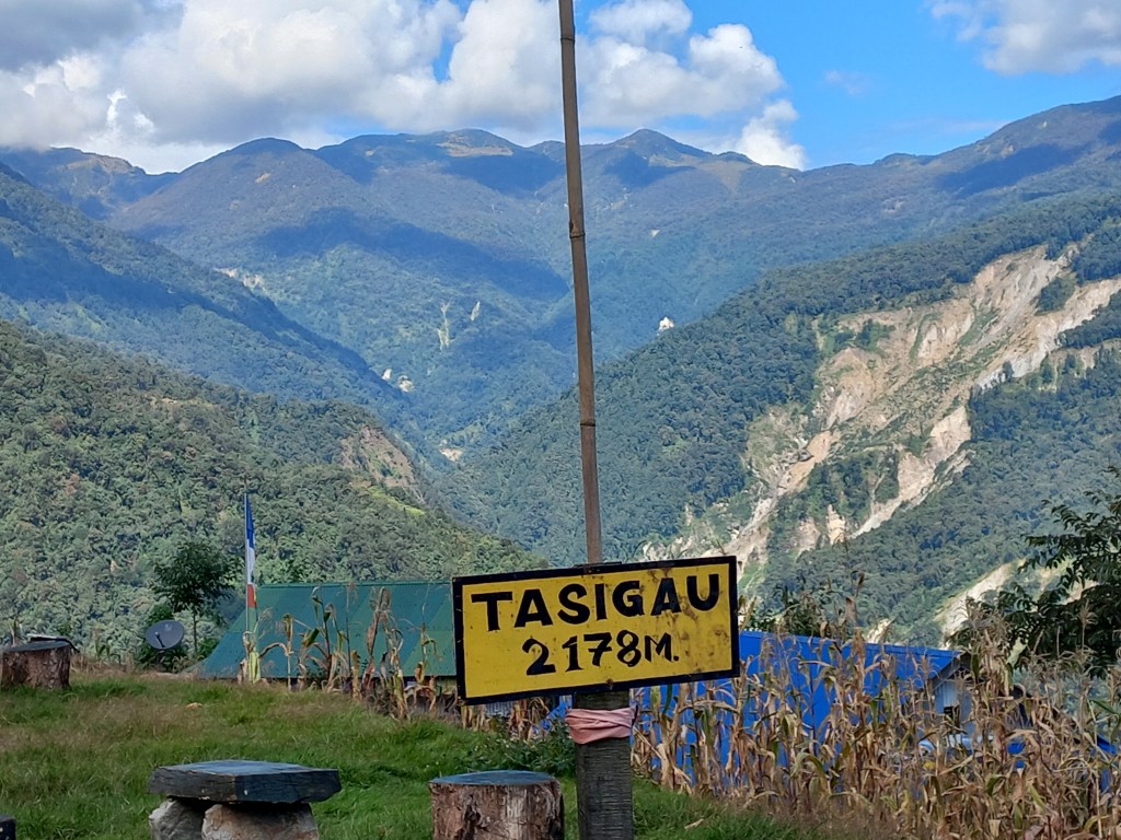
With that jovial mood, we almost ran down the stairs to reach Tashigaon as fast as possible. We were eager to reach there. We haven’t seen Raju since he left the lodge at Shipton La. Kunal jokingly said that he’d meet us straight at Kathmandu, not before that. Nevertheless, he was there to greet us when we finally reached Tashigaon! We had plans to spend a day here to bask in the sunshine. But now our focus was to get out of the area as fast as we could to get beyond the reach of the clouds. Last evening, at the lodge, we heard many members speaking about abandoning their treks looking at the weather conditions. We heard that the weather forecast wasn’t great for next few days. More rain and snow was in store. We wondered, what would be the fate of the Sherpani Col expedition.
Picture courtesy, Dhananjoy De

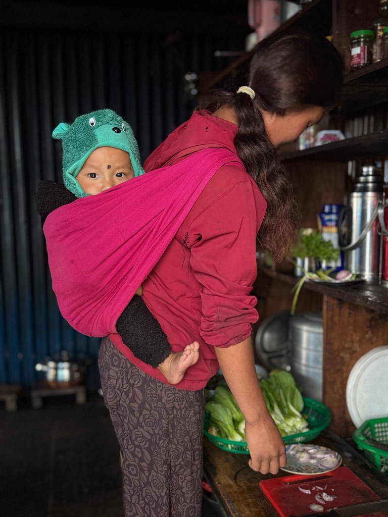
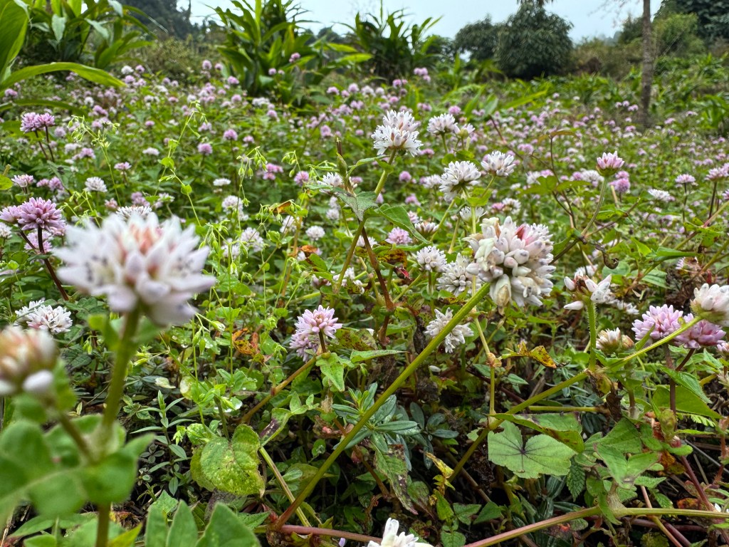
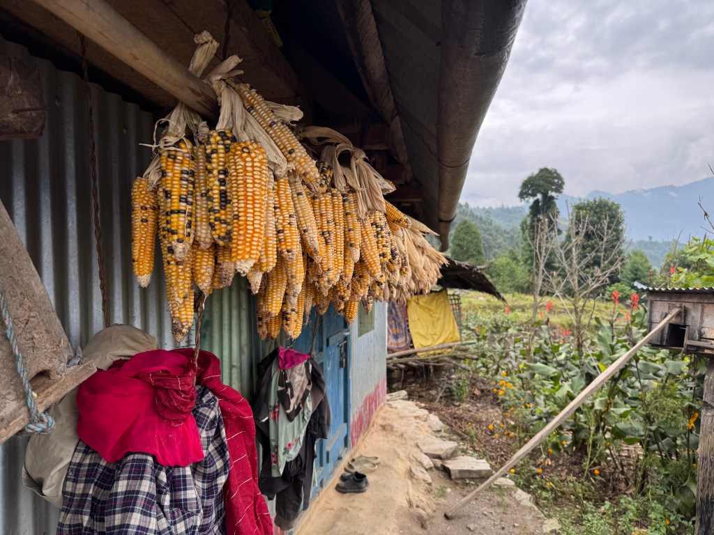
Lunch at Tashigaon was cosy & comfortable. While having lunch, Raju shared his experience. He didn’t stop at Danda Kharka as the “spirits were still with him”. He felt so suffocated that a Lama from the local Tashigaon monastery had to be summoned. He pronounced that spirits inhabited his body and had to be extracted out. Apparently it was the Lama’s magic which made them leave. Only that made him feel better. Raju vowed never to embark on such treks again! The rain by now turned into a drizzle and then stopped. We saw the room where we stayed on our way up. Memories came back. The lodge owner informed us about their relative who owned a lodge at Seduwa. It was said to have charging facilities as well as hot showers. Her younger daughter Dzangmu was going back to her hostel. She went along with us on our way down. She was to guide us to the lodge at Seduwa. Our trail went through the alleys and fields of Tashigaon.
Picture courtesy, Dhananjoy De

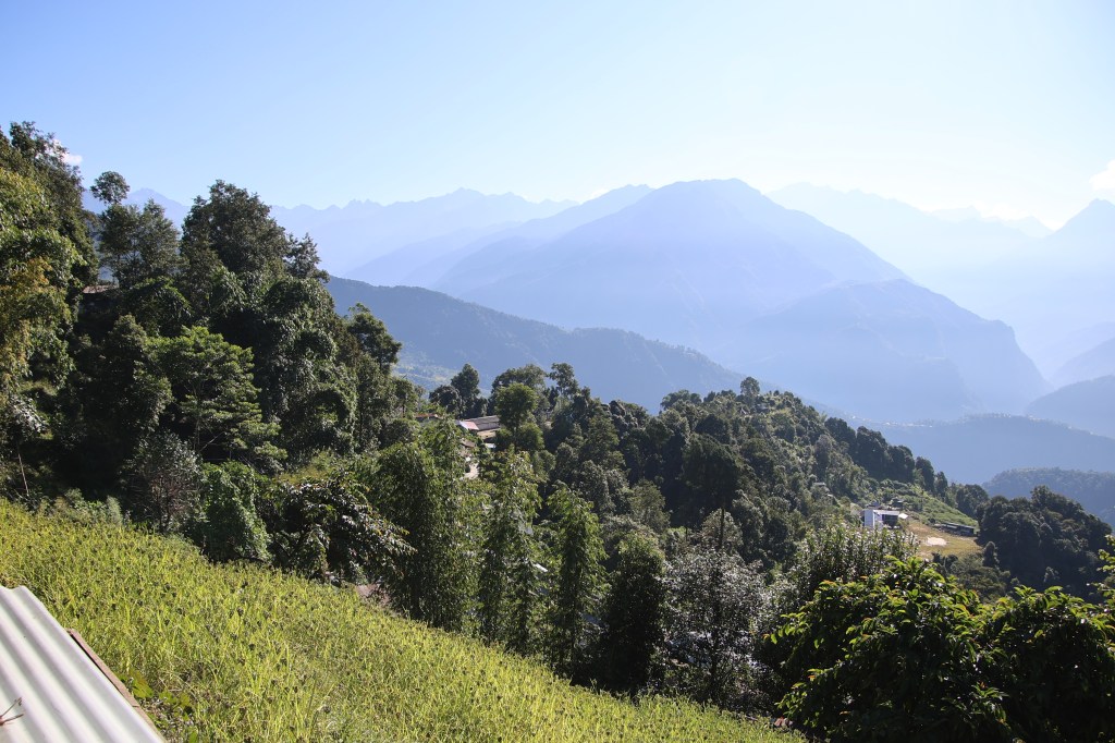
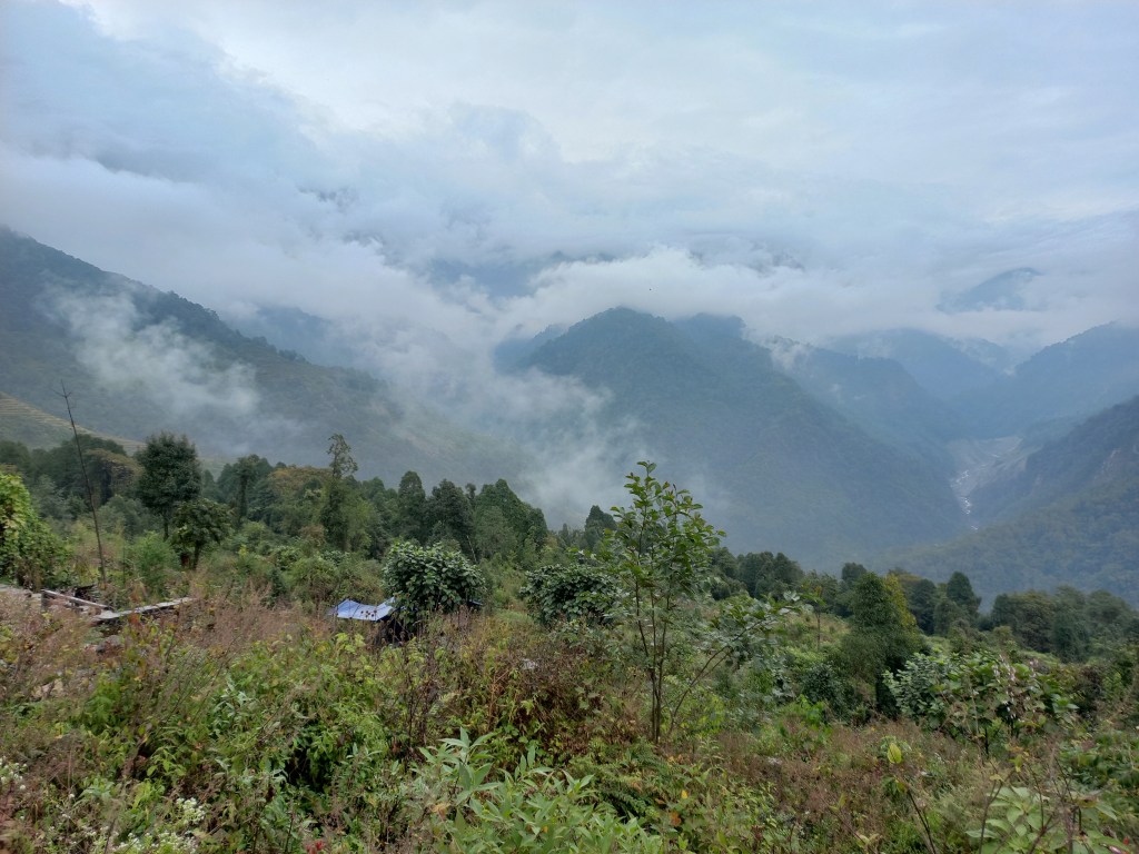
We watched along while the villagers went about their daily cores. The trail moved up & down and finally joined the main trail to Seduwa. Afternoon wore on as we walked past the villages on the route. We came upon a bunch of sheep & goats who were scattered in the surrounding forests, feasting on the leaves. Their shepherd was trying to herd them together to take them to their shed before darkness set in. We stopped for photography. They were scattered in the bushes. Some were even atop the branches. The whole place buzzed with their bleats. Clouds hung over the fields. They looked ominous with their darkened looks but also provided a spectacular background for the ripened millet. These millet swayed in the flowing breeze.
On our way down, we met a traveler. He was one of the members of the group we met at Khongma, the day before. We were taken aback to see him turn his back. Looking at the weather, anticipating heavy snow at the higher altitudes, he took his decision to turn around. While the rest of his friends kept going. From him, we came to know about other groups who dropped their plans.
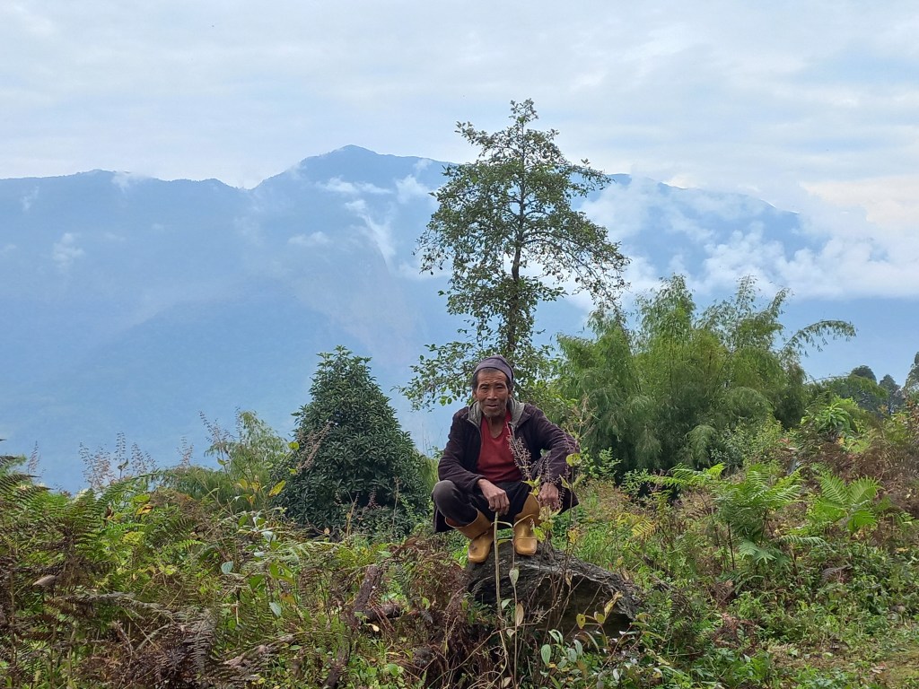
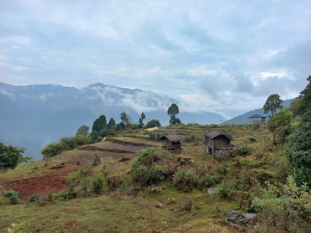
We took the same shortcuts, passed by that volleyball field and the familiar alleys of Seduwa. That’s when suddenly my right knee got a cramp! Thereafter, the rest of the trail I kept limping along. A walk that should have taken hardly 30 minutes, took me 1.5 hrs. Kunal, Raju & Anil kept company with me. When we reached the lodge, a disappointed Dhananjoy declared that none of what was told to us at Tashigaon about the lodge, held true. But the good thing is he had already discovered another lodge which was much better. Though it meant walking down another 20 minutes, it also meant a comfortable stay closer to the road head. We finally entered into the lodge. Thus our walk came to an end for this trek. My legs almost gave up. After changing into room wears, cleaning our faces & applying moisturizers, energy returned. I made calls to my home & some friends. They were eager to hear about our experience & I was happy to oblige them. The evening just flew by partying & dancing. Beer kept flowing like the Arun river & we finally went to our rooms.
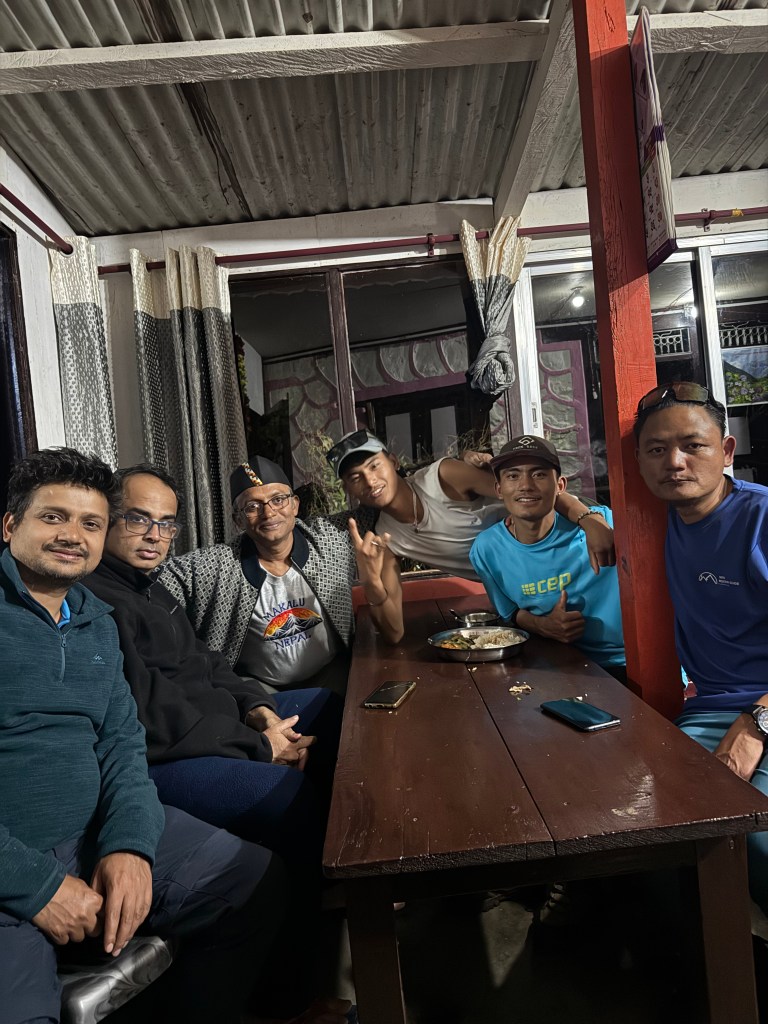
Picture courtesy, Dhananjoy De

We called Raju & the porters to hand out tips. They happily accepted our offers & went away. The story wasn’t over though. After sometime Raju knocked at our door. Apparently, porters weren’t happy with the tips and requested some more. I had every reason to believe that it was Raju, rather than porters, who caused this. We didn’t complain and he got what he wanted. We brushed it away & went under the blankets.

30th October

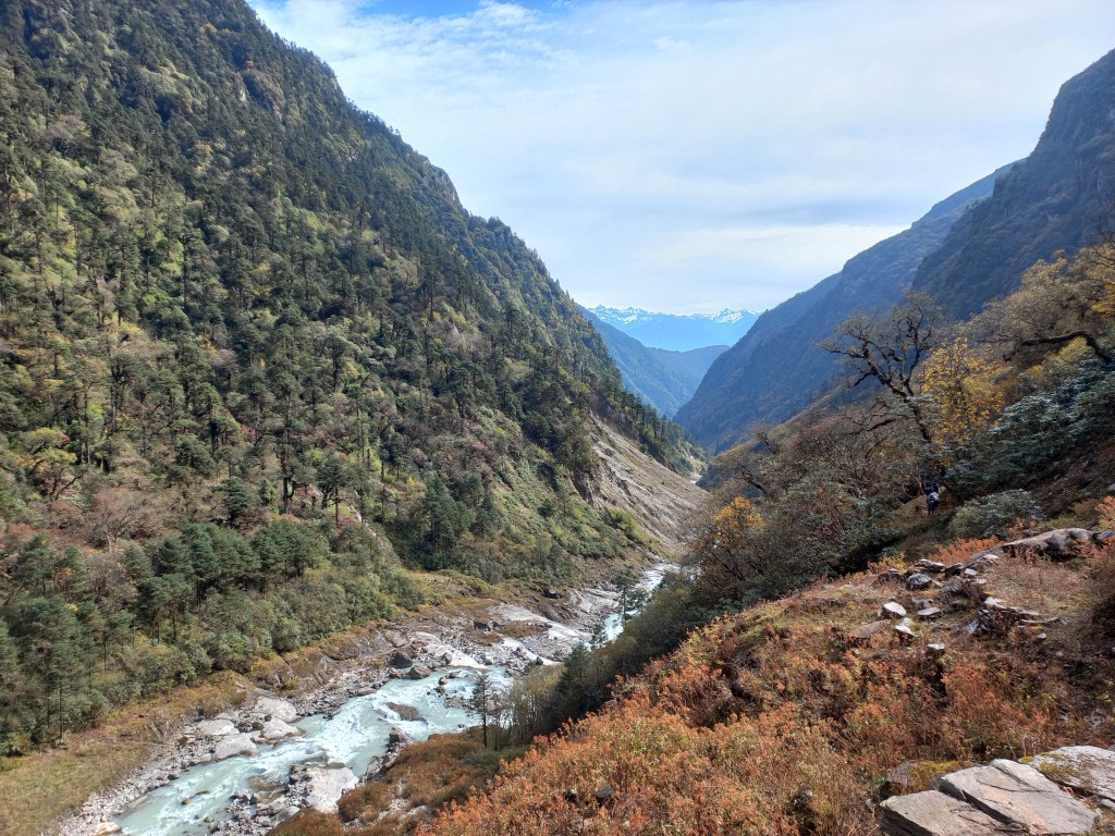
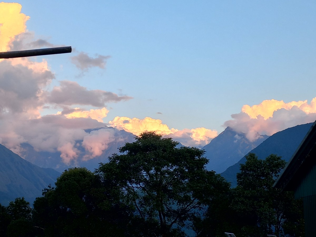
We woke up to a misty morning. Fog engulfed the entire landscape. The good news was that our vehicle was ready to ply. We could hear its sound. After loading it with our luggage, we embarked on our journey through the bumpy roads on a misty morning. The driver carefully negotiated the rough terrain. He made stops along the way. He asked the locals if they needed anything to be fetched from the lower regions of Khandbari or Tumlingtar. Connectivity is challenging for these remote areas and many items of daily needs have to fetched from lower regions. So, if anyone traveled, its an unspoken rule that he/she would fetch items needed by others. On this time though, multiple call outs fell on deaf ears. We moved on. After sometime, the horrendous stretch of the road ended and we entered a relatively less bumpy (though still rough) section. We started moving down the slopes. We reached the section where we got our first glimpse of the mighty Arun river. A wide and mad stream of torrent made its way through the gorge with a ferocious sound. Dangerous beauty as they call it. It has swollen further due to the incessant rains for the past few days. We stopped the vehicle and moved out to soak in this awe-inspiring beauty!

After sometime, we stopped at Num to have breakfast. Then came Khandbari and our bumpy road ended. The smooth serpentine road now moved through the green fields, freshly bathed in the rains. The anticipation of reaching Tumlingtar, the sole airstrip in the area, lifted our spirits. As we neared Tumlingtar, cultivation fields gave way to forests. The trees appeared rejuvenated with greener foliage. The vehicle finally reached the town of Tumlingtar. There lies the little building near the airstrip! As it turned out, our place of stay was right behind the wired boundary of the runway. But with that came the bad news. No flight has landed at Tumlingtar today. Though we suspected this, but this was the first confirmation. If flights haven’t landed today, they won’t do tomorrow either, given the weather forecast. That led us to look for other options. We canceled the air tickets and booked tickets for a bus instead. It would start at 2 PM tomorrow. After an entire night’s travel, it would take us to Kathmandu at around noon, the next day. A travel for about 15 hours. But this would allow us to have a comfortable sleep at the Kathmandu hotel. We would get the much needed rest before boarding the international flight on 2nd November. After almost 2 weeks, we got a chance to take showers and we utilized the opportunity to the fullest. Decent washrooms, warm showers and a good lunch cheered us up. After lunch, we ventured out to roam around Tumlingtar, its local shops, the market and of course, the airstrip. Nowhere else in the world, one can see such an airstrip. With no flights expected, the airport staff locked up their offices. They walked out of the premises to head for their homes. Compare that to airports at Delhi or any other Indian city or even to that of Kathmandu. We had ice creams. It was great to taste such “delicacies”. It started raining in the evening and the drizzle converted into a heavy shower. News came from other groups about abandonment of their attempt for Makalu base camp. My worries increased. Thunders and lightning also joined the forces of the rain at night. With flights abandoned, roads were our last resort. Such rains could derail our plans. We were at the end of our leaves. We had to resume our work from the 3rd (a Monday). There was absolutely no room left. After a good night’s sleep (at 401 m), we woke up to another gloomy morning. The drizzle was still on. The room next to ours’ was occupied by two Chinese persons. They accumulated a huge dump of Rudraksh beads (seeds from the Elaeocarpus Ganitrus tree). These beads are strung into a garland and are then used as prayer flags among Hindus and Buddhists. They fetch a high price as they’re considered sacred by the devotees. The Chinese were here to tap into that business.

We resumed our journey at 4 PM (instead of 2, as stated earlier). We were told that seats were reserved for us in the front. However, we soon found out that it had no meaning. The bus stopped at multiple places in Tumlingtar and people started pouring in. We had to rebuff requests to make way for others. Since we stood our grounds, we sat with “relative” comfort, while others were stashed in like poultry. The bus made its way through the streets of Tumlingtar and entered the highway. It winded down the serpentine roads amid the cloudy afternoon. As we moved along the bends, a wide valley opened beside us. The Arun river made its way through the valley to the lower regions. The Arun river’s flow amid the valley under the cloud cover created a picture that still stays on. We’ve never visited this Eastern part of Nepal, which was very different from its other parts. Gradually, evening wore on. The bus kept moving. We halted at multiple places for tea, fuel and dinner. The night went by in half-sleep. When we hit the familiar streets of Kathmandu, relief set in.

1st November

It was at 9 AM, we reached our hotel. It was so pleasing to see the same staff. We were in a different world for the last fortnight and were now returning among our friends! The mutton curry at lunch was so delicious, that we ordered extra quantities. All of that vanished in no time! The balance settlement of payment with Raju turned unpleasant. Apparently, he estimated and quoted less. We expected to get some returns. This was especially true when our return by flight got converted into a bus ride. However, he had none for us. We let it go to avoid further unpleasantness, but the incident didn’t leave a good taste. We brushed aside and went for a temple visit near the Pasupatinath shrine.
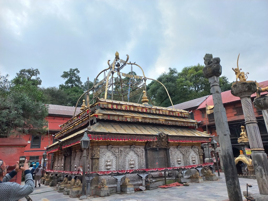
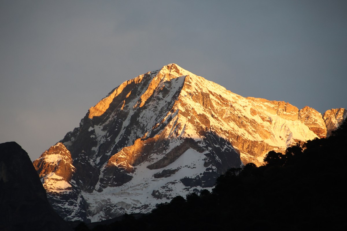
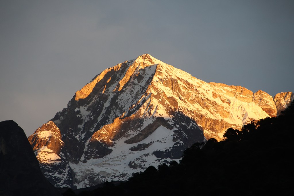
We finally bade goodbye to Raju over a table of beers. I had a mixed feeling towards him. Was it the same Raju who accompanied us to the Everest and Annapurna base camps? But things do change and not always for good. He may have had his share of troubles. Nevertheless, a long awaited trail was completed and we must thank him at least for that. News started trickling in. Weather conditions have forced a shut down at the Makalu base camp. At least one trekker went missing. Did we offend Makalu in some ways that it let its agents loose at us? It may not have been the spirits as Raju thought, but at least the clouds, the incessant rain and the heavy deposits of snow. It felt as if it was saying, “You’re the last ones I’ve tolerated. You better move out fast. I want some tranquility in my premises.”. We bowed respectfully and followed its orders. We bade goodbye and hoped to receive a call again in some other parts of the Himalayas.
Earlier

The Barun valley – the spirits of Shipton La

Earlier

Next

27th October

As planned earlier, Manoj went off for Dobato at 7 AM with the hopes of reserving our stay. He was equipped with enough money and a packed breakfast. Quite assured about his success, we had our breakfast. For a change, we sat in the kitchen. Though it was smoky, the warmth was enjoyable. By & large the sky was clear, but clouds weren’t that far. The distant mountains played hide & seek with them. But that didn’t deny us the colors of sunrise. Phemathang has its own charm. Being situated within the gorge, it’s nestled between the high mountain walls that guards the flowing Barun river. The sounds of its violent torrent keep ringing in your years. They’re amplified by the mountain walls that close in from both sides. The valley opens up with a V-shaped sky on the northern horizon. The roof of the Makalu massif peeps above the hills. This is the last time one can see it in the Barun valley. It’s next appearance is at the Shipton La, provided the clouds stay clear. Thereafter, it makes it’s final appearance at the Khongma La. Beyond that, Mt Makalu disappears from your view. The stretch between Phemathang and Dobato goes through the deep ravines of the Barun river’s gorge. Consequently, the distant mountains stay out of view.

Phemathang
Phemathang, picture courtesy, Dhananjoy De

After a brief view of the sunrise, we exited Phemathang. This was the first time we were seeing the surrounding valley in bright sunshine. On our way up, we entered Phemathang amid darkness. At that time, relief was the predominant emotion. After spending days above the snowline, the sight of the lush green forests was refreshing for our eyes. Unlike other trails, one has to rise above the tree line again to cross the four passes to reach Khongma. Depending on how you look at this aspect, it can be a double bonanza or unnecessary hardship. We enjoyed crossing the passes and passing by the two “Pokharis” between them. But that trail was slated for the next day (or so we thought). After exiting the gates of Phemathang, the trail moved amid green vegetation. These remote Sherpa villages have decorated gates at both ends. We knew this won’t last long as the large stretch of landslides would soon takeover. They gave us a tough time on our way up. I was preparing myself for these extended sections of debris. The ferocious torrent of the Barun river kept moving in leaps and bounds forming massive rapids and waterfalls.

The Barun river, picture courtesy, Dhananjoy De

We made our way through the labyrinth of boulders along the banks. Giving a careful look, one can make sense of a desired way through the abyss. Sometimes by tracking foot marks and other times by common sense. Depending on the challenges thrown at us, we had two options. We either circumvented the obstacles by taking a longer route. Or, we shortened them by tiptoeing. One has to be careful in these areas as some of the boulders can give in under body weight. That’s where guides & porters come into play. But this time around, panic didn’t set in. Firstly, it was in broad daylight & secondly, we now knew the trail & the destination. Today’s walk wasn’t supposed to last beyond 4 hours. While crossing the landslide zones, we kept looking up along the slopes at regular intervals. There are no reasons to think that these streams of boulders have frozen in time and space. Nevertheless, we carefully negotiated them to reach the base from where the hike was to start for Dobato. It was the same set of stairs amid dense forests that moved constantly up through multiple switchbacks. On the earlier occasion, we traversed these amid hovering darkness & accumulating moisture. At that time, caution was the watchword. On this occasion, in bright sunlight, “tiring” was the predominant emotion.

En-route Dobato

At this junction, we bade adieu to the Barun river. It continued its journey down into the valley. There, it meets the Arun river.  After giving a look at the ensuing staircases, we embarked on the hike. The usual tactics of setting small milestones did help with the cause. I used phrases like, “The next set of 10.” Or, “Till the next switchback.” Even, “Till the place where Dhananjoy is resting.” There were many expressions like these. For sometime, I noticed that Raju was lagging behind. It’s normal for him to walk behind the last person. He usually brings up the rear. That typically doesn’t leave a gap of many steps. I was the slowest, but Raju was keeping at least a couple of switchbacks behind me. He stopped often and that wasn’t normal.

En-route Dobato

At that time, I thought he was taking it easy because the trail wasn’t supposed to last long. It was only later in the day, I realized the impact. Nevertheless, we continued our hike through the forest. On our way up, we saw some construction going on. By the looks, it appeared to be a tea house in the making. In another few years, this route is likely to get traction and Dobato may not be a bottleneck anymore. The slopes started to gentle out. After a few more switchbacks, we could see the roofs of the tea house at Dobato from a distance. Checking on a passer-by, it was revealed that our stay at Dobato could not be confirmed. Manoj &  Raju’s efforts went in vain. We entered the lodge premises with this depressing news. I tried to find out if sleeping at the dormitory was an option. That too, was exhausted. That leaves out the dining place or the kitchen. Apparently, none was available. We tried to think about the impact of this. There’s a remote chance to stay at one of the lodges at Shipton La. Their conditions weren’t very encouraging. We’d have to sleep at 4200 m at the top of a mountain pass. It can be paralyzing in the cold amid the winds that sweep that place in the evening. But there was no choice. Even grabbing that choice required us to ask the lodge owner at Dobato. We requested him to inform one of the two lodges at Shipton La via walkie talkie. With that sorted, we looked at the positive aspects of this development. That would advance us by at least 2.5 hours for the next day’s trail. Reaching Danda Kharka would be easier. We may not have the comforts of Dobato, but it was just for a night. At that time, the bargain seemed to be in our favor. But nature had other plans and so did the “spirits” at the Shipton La. Once staying options were sorted, we ordered lunch and relaxed in the sunshine. There was enough time to reach Shipton La and the trail, though tiring after lunch, was not difficult.

Dobato, picture courtesy, Dhananjoy De

After a comfortable lunch at Dobato, we resumed our hike. The trail moved up gradually amid rhododendron forests. After a certain point, we got a wonderful areal view of the Dobato tea house amid the forests. Though it didn’t offer us sleep, but that didn’t resist us from enjoying the view of the sole tea house. A guide from another team informed us that certain lodges at Tashigaon have connections with this tea house. Staying there could have ensured a stay here. It was apparent that despite the claims, our place of stay at Tashigaon didn’t have that privilege. A lesson learnt too late.

Dobato

But little did we know at that time. This would prove as a blessing. The weather conditions for the next day made it so. The trail moved gradually up towards the Ke Ke La, the first of the four passes between Dobato & Khongma. It all seemed familiar when we reached the pass. The stupas and chortens greeted us amid the gloomy weather (by that time, the clouds started dominating). During both the ways, we reached the passes at a time where no views were possible. Wasting no time, we started our descent. The stair cases went all the way down through red & brown slopes to the banks of the Thulo Pokhari. We went down the stairs. We kept an eye on the dark waters of the lake. It kept growing in stature with every step down. Gentle winds created ripples on its surface. In no time, we were walking by the sides of it. It felt like a homecoming as we traversed the same route in the opposite direction.

Thulo Pokhari
En-route Shipton La, picture courtesy, Dhananjoy De

After sometime, the hike resumed for the Shipton La & switchbacks reappeared. But on this side, they were less frequent and gentler. With every step upwards, the pass kept revealing itself and finally we reached the stupas at its top. Our lodge was just below it. When we entered it’s premises, dense fog & clouds engulfed outside. We were allocated a single room. Later on, after ensuring that no other traveler was expected, another adjacent room was allocated. We took turns to change to our home-wears and settled at the small dining space. The kitchen was located at the end of the same space. The burning wood served both purposes. To prepare the dinner as well as offer warmth. We hung our trekking wears around it with hopes of drying them up. We felt comfortable, now that we were under cover and had a shelter for the day. After sipping steaming tea, we spent time by playing cards and conversing with the family that owned the lodge. They were from Seduwa. They keep stocking this lodge with resources. Resources come from that village. It is at least a 2-3 day walk from this place by our standards. After dinner we settled into the rooms. The blankets were fluffy & warm. Raju & the porters slept in a room in the upper floor. Everything went quiet and we hoped for some sleep. Just then, we heard Raju talking with the porters and there were sounds of many steps above our roof. It seemed Raju was pacing the floors, talking to the porters in Nepali. We couldn’t understand much. After sometime, Raju came knocking at our door. Dhananjoy came in too. Raju was feeling heaviness in his chest and couldn’t sleep. He felt someone was pressing against his chest causing nightmares for him. I correlated this with his slow hike towards Dobato. That pointed towards high altitude sickness. Raju had regular addiction to cigarettes and alcohol. Despite warnings, he had been consuming both throughout the trek. Regardless of what science says, Raju thought it was down to the spirits who were playing foul with him. Otherwise why would he get nightmares? Reasoning was difficult and Raju was determined to go down to lower altitudes immediately. That also is the scientific remedy under such circumstances. What’s triggered by lack of oxygen can only be remedied by increasing it’s supply. The only way to achieve that is to go down. But at this hour? It was 23.45. Raju suggested taking along Anil to go down to Khongma. He handed over some money to repay the debt at the lodge, brought out his warm wears and started off for Khongma at the dead of the night. Anil followed him. When we saw them off, it had started snowing.

While going back under the blanket, different thoughts plagued my mind. On one hand, I was irritated with Raju. Being a guide, he should have been more responsible. At these altitudes, one needs to control their cravings. With Anil, he had taken along the most experienced of the porters. That left us with Manoj, the younger of the two locals. He now has to guide us down the tracks from Shipton La all the way through to Khongma and beyond. Looking at the weather, chances were high that we will have to traverse through snow filled tracks. Another part of my mind said that this could happen to anyone. It’s good that he decided to go down instead of putting his life at risk. Sleep eluded me for most of the night. While tossing over to a side, I felt the bed to be wet. The torchlight revealed that an entire section of it was covered with grains of snow. It must have been from my cap which accumulated some snow while we were seeing off Raju. But the extent of snow kept increasing. That’s when I realized that the room had some gaps between its walls and the roof. Snow flakes kept streaming in through them. Fortunately it was localized and I shrinked myself towards the center. The rest of the night elapsed without any further drama. We were sleeping at 4210 m.

Earlier

Next

The Barun valley – the ordeal of Dobato

Earlier

Next

23rd October

Equipped with an assurance for an accommodation at Dobato, we started off for the first of the four passes. The day was expected to be long. I had my skepticism but everyone else didn’t think much about it. It came as a surprise. On every trek, the day of crossing a high pass is considered crucial (kind of a D-day). This is because that day tests the limits and once you’re through, rest becomes easy. Such days are physically demanding and usually comes with risky terrains either while going up or down. For example, we started at 3:45 from Dharamsala to cross Larkya la during the Manaslu circuit trekking. The descent from the pass gave me a tough time. It was entirely through a rockfall zone. Getting a purchase on a steeply descending terrain was challenging, especially with loose pebbles conspiring under your feet. For Thorong La, it was the loose snow during the descent to Muktinath. You had to move fast enough to prevent the treacherous snow dragging you into the abyss. And who can forget the Cho La? Walking through narrow snow filled track, barely wide enough to place one foot at a time. A loss of footing there and you don’t want to think about the consequences. For the treks done so far, we had one such day at the most. This time it had four (most of them around 4000 m) and that too, in a single day. Moreover, it was not on the penultimate day. We would be going down into a valley to reach Dobato only to regain altitude to reach places like Yangle Kharka, Langmale, and finally, the base camp. The return journey would also need us to repeat these same passes. That made this trail unique. I had my doubts about the return journey. There was a day where we were supposed to travel from Yangle Kharka to Khongma. If going to Dobato takes a day, how can one cover the return journey which was even longer? This is normal when you gain height while going and lose while returning. But this was not a stretch which uniformly moved up. After crossing four passes, the trail would leave us at almost the same altitude where we started from. We would gain just about 100 m. The story for return journey would be the same. But locals seemed unfazed by this. We didn’t even start before 7.30. It actually turned out much worse while going up and return was no different. The planned itinerary went for a toss. In hindsight though, that saved us. However, reasons for that were different.

En-route Khongma La

The first pass Khongma La (3890 m) was already familiar. We went there the day before to witness the sunrise and were presented with the first view of Mt Makalu. That familiarity gave some relief. Comparable to an easy examination where all questions are expected from a known textbook. It’s like “Oh, it’s that same set of twists & turns. Just a few mouthfuls of breaths, and there you are at the watch tower.” It didn’t quite play out that way. The trail seemed longer, now that we were hiking in daylight and the route was visible. Hence, the feeling “what remains” also started kicking in. We crossed the upper tea houses. Then, we climbed the winding set of stairs and switchbacks. It took us about 2 hours to reach there. The views were familiar but equally amazing. Skies were clear. Makalu and its neighbors were devoid of cloud cover, appearing majestic. The trail after the pass gradually descended. After a bend, I suddenly heard the sound of a notification on my cellphone. Network! At this place! Our quick fingers dialed our homes. They had a bonus of knowing our whereabouts for an extra day. The gradual decline continued and I wasn’t feeling good about acquiring this debt which we’d have to repay. The more it takes down, more have to be regained.

En-route Ghungru La, picture courtesy, Dhananjoy De
En-route Ghungru La

We could see the “repayment” going up the slopes in winding trails towards a distant top. It went towards a small dip on the contours of the mountain we were about to hike. It wasn’t clearly visible at first and only became clearer after we moved up through a few bends. Switchbacks started early on, indicating that this slope was steeper than the ascent of Khongma La. The distant mountains kept rising with us. After sometime, we saw the outline of a small stupa. That was Ghungru La (4055 m), the next pass. During our return, this same trail would turn monochrome. The bright sunshine & greenery would be hidden by dense clouds amid incessant snowfall. That’s a story to be told later. In the meantime, the switchbacks increased in frequency. Our knees and lungs bore the brunt. At least on the way down, lungs would have some respite. The slope gradually reduced in gradient and we finally reached Ghungru La. It was akin to any other pass with stupas and hanging prayer flags. The trail from Khongma to this point was well laid and safe.

En-route Ghungru La
Trail from Khongma-La
Ghungru La

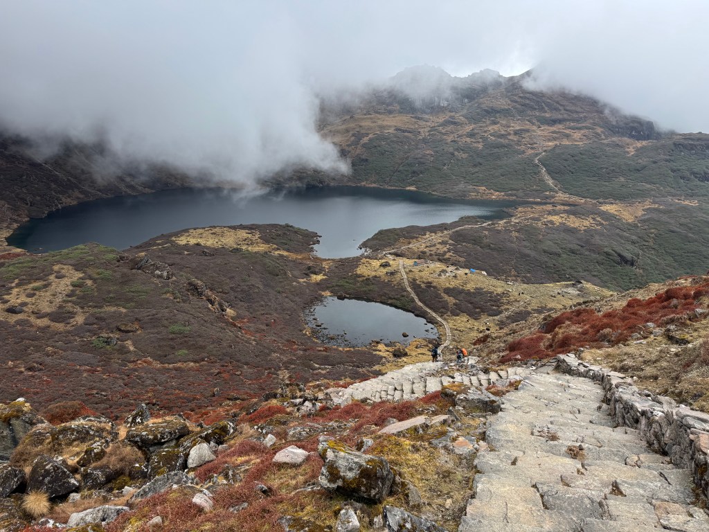
There were even guardrails on some sections on the way up to Ghungru La. We took sometime at the pass for photography. This also was a chance to gulp down water, a crucial element at higher altitudes. Lack of it can allow high altitude sickness quietly sneak in to strike you unprepared. Once it strikes, the only medicine is to come down. It could jeopardize not just your plans, but your life. We saw an instance of it within our team in later days. The trail moved gradually down from the pass. Walking was easy. After losing some altitude, a beautiful lake appeared. By this time, clouds started to cover the sun. The lake was small. It had dark waters because of the reflection of the black rocky surfaces of the hills that formed its bowl. The water surface was mostly still with small ripples created by a gentle breeze flowing through the valley. We saw the finely laid trail lined by rocks. It went all the way down to the banks. Then it moved up again and disappeared among the hills in front.

Sano Pokhari
Sano Pokhari, picture courtesy, Dhananjoy De
Sano Pokhari

Somewhere up there, among the V-shaped gap between two hills, lay the famous Shipton La (4200 m). The lake is called Sano Pokhari. In the Nepalese language, “Sano” means small & “Pokhari” means lake. If this is the “small lake”, there must be an elder sister sitting somewhere. She lies on the other side of Shipton La. We spent sometime at the lake. There was a prayer flag on its bank. The entire place presented no other noise or movement other than ours. The walk resumed along the other side and the trail started moving up. Though the slope was gradual, but the easy stroll turned into a hike once again. Staircases and switchbacks reappeared. I started my usual tactic. I set local milestones like “the next bend” or “the base of the next set of stairs.”, “Just a few more and you can take in a mouthful” etc. What looks like a top, becomes a base for the next, which only reveals once you reach there. As everything comes to an end, so did this and we saw the prayer flags and a few lodges.

Shipton La

The pass is named after the famous British mountaineer & explorer, Eric Shipton. He first came to this area in 1951. It was part of his reconnoitering expedition to the Southern routes of Mt Everest. He was also accompanied by Edmund Hillary at that time. He returned to the area in 1952 with Hillary, Charles Evans and George Lowe. They explored the Makalu base area after crossing what became known as the Shipton La. Shipton’s exploration opened up the Makalu Barun valley for mountaineering & trekking. Shipton La (locally called Tutu La) is an important geographical milestone on this route. It is the gateway to the high alpine Barun river valley. By this time, clouds held their sway. Basic dal bhaat along with khursani (green chilies) greeted us at the dining table.

Lodge at Shipton La, picture courtesy, Dhananjoy De
Shipton La
Thulo Pokhari

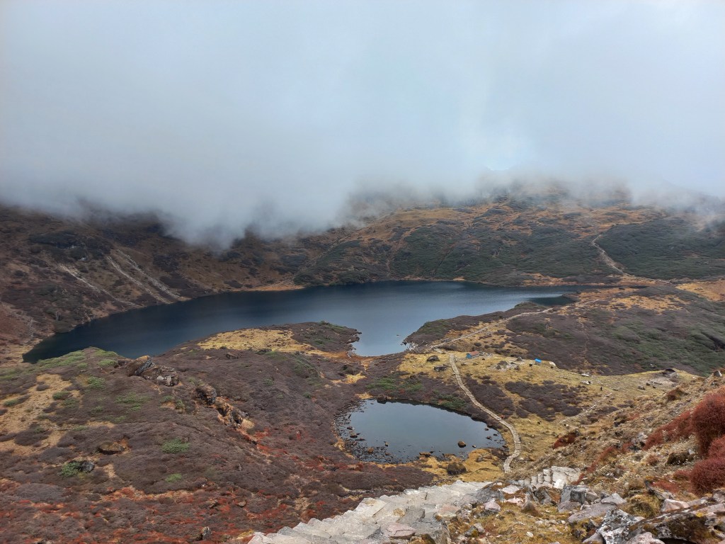
It was about 1 PM, when we started our descent from Shipton La. The trail led us down to the bank of another lake, the Thulo (meaning big in Nepalese) Pokhari. On this occasion, there were two lakes. A big and a small with their water bodies connected by a small stream. The bird’s eye view of these two lakes was mesmerizing. The well led trail went all the way down to the bank. It then rose up and beyond to reach the last of the four passes, the Keke La (4170 m). All of the serpentine trail to that pass was visible.

Thulo Pokhari
En-route Ke Ke La

Dobato lay beyond that, after an hour’s descent. While going down, I was thinking if it was possible to stay at Shipton La on our way back. But it’s height predicted severe cold at nights. The lodges there were rusty and promised to give a tough time. Someone high up in the mountains must have watched me and had a laugh at that time. The sights of Thulo Pokhari and our destined pass kept us going and we reached the Keke La.

Ke Ke La

Cloudy weather didn’t offer much for photography at the top. We wasted no time and started our descent to Dobato. Trees started appearing again as the trail moved towards Dobato. Dhananjoy went ahead and the rest followed him. We started imagining a satisfying stay. We envisioned a warm dining place with steaming tea. There would be plenty of recollection of the day’s trail. Relaxation was the primary feeling occupying our minds. We saw the single lodge of Dobato.

Dobato, picture courtesy, Dhananjoy De

As we entered its arena, Dhananjoy (who reached earlier) declared “There is no accommodation available”. I saw our guide Raju in conversation with the lodge owner, trying to work out something, but without any success. Dobato is an important break in this trail, but the place only has a single Lodge. I’ve dreaded this possibility long before the trek and have been insisting our guide Raju to make advance booking. That didn’t happen. Ming’s assurance (the Sherpa boy at Khongma) proved futile. The lodge was full with earlier reservations for a few large groups coming from both Khongma and Yangle Kharka. It transpired much later (from another guide) that some lodges at Tashigaon have tie-ups with this lodge. It seemed the lodge we were coaxed away from by the little girls at Tashigaon, had a contact here. Staying there could have ensured a stay up here. We were staring at two options. Sleeping at the dining place (not guaranteed as far as blankets are concerned) or trekking further ahead for about 2.5 hours to stay at Phemathang, which has a lodge. I preferred the former since traveling another 2.5 hours seemed an uphill task. It was already 3 PM, clouds hovered around and darkness falls quickly in the valleys. We faced the possibility of having to trek in the dark, at least towards the last phase. Much against my wishes at that time (and I admit, I was wrong), it was decided to move ahead.

Once the decision was made, we wasted no time and resumed our trail. It now entered dense forests. The path started moving downwards through a seemingly endless set of rocky staircases. Since it was already cloudy, the forest trail was even more dark. The rocks were moist and some grew mosses over their surfaces. We kept going down carefully. It became clear that we were heading towards the river, probably the Barun river. We should have been excited to see it for the first time, but circumstances were very different. “Why does the trail look so desolate with no one around? Did we lose track and head the wrong way?” Asking Raju proved futile as he wasn’t aware either. The cost of taking a wrong trail in these areas at the end of the day can be fatal. Only Dhananjoy was firm. “Did we see any other way till now? Was there a junction anywhere that could have led us the wrong way? Since none of these happened, keep moving.” My doubts were raised because till Dobato, we saw other trekkers, but not anymore. We should at least have seen someone coming up towards Dobato. “Everyone must have reached their destination by this time. No one is on the trail. That’s the reason.” – declared Dhananjoy. Looking at the steepness and length of the downward trail, I had another thought. There was no way we can travel from Yangle Kharka to Khongma in a single day. This was especially true with four pass crossings involved. Our own itinerary was flawed. The sounds of the Barun river increased. After a long descent from Dobato, we exited the forests and reached the banks of the Barun.

The Barun river

A thunderous torrent moved through the gorge creating massive rapids on its way. “Scaring but beautiful!” is how I describe it. At this time of the day, with tiring legs, fear was the more prominent feeling in my mind. To add to our problems, we now entered a huge landslide area. Large swathes of boulders lay along the sides of the hills, going all the way down to the banks. The trail was lost amid this destructive debris. We moved cautiously by tiptoeing over loosely placed boulders. We regularly glanced towards the top from where the stream of debris originated. It seemed never-ending. One landslide zone led to another with a brief spell in between. We kept plodding ahead, trailing Raju’s steps. Our porters were asked to go ahead to Phemathang to ensure our stay there. I thought one of them should have stayed with us. They’re locals and have been on this route before. As daylight kept fading, we kept looking at the distance for signs of houses of Phemathang, but none were visible. It was all the roaring river, its numerous rapids and never-ending landslide zones. At times we mistook rock surfaces as roofs of houses from a distance. The landscape, the almost nonexistent daylight and our states of mind, all played hide and seek as we kept moving with tired legs. “Was that a human being? Oh yes, it’s Anil, one of our porters!” I’d be ever grateful to him for his decision to come ahead from Phemathang to guide our way. By that time we were already walking with our head torches. We had to spare one for the porters earlier. Raju managed with his cellphone. This didn’t go down well with me. A guide on a trail without even a fundamental item like a head torch! I kept quiet. Anil relieved me by taking on my day pack. We finally reached Phemathang in another 30 minutes.

Picture courtesy, Kunal Kishor
Picture courtesy, Dhananjoy De

The lodge was basic but who cares? It had a room, a warm kitchen & blankets. It also had charging facilities! What more one needs? Intense planning went on between us before and after dinner. Dhananjoy was of the opinion “Now that we’ve moved ahead of other groups on the trail, let’s keep that advantage”. He had a point. There were a few main groups en-route Makalu base camp. The French group is headed for Sherpani col with about 6-7 members. A Spanish group has about 18 members. They met us on the way to Tashigaon. A Slovenian group has about 5 people. There were other small groups, but these were the ones whose itinerary aligned with us. Since number of lodges are limited in this route, they’re likely to stay at same locations as ours. Hence, we’d always compete for spaces and our fate at Dobato can repeat at other places. Dhananjoy’s idea was to break that using the advantage we gained today by advancing to Phemathang. According to the current itinerary, our next stop was Yangle Kharka, hardly 2 hours from here. His proposal was to advance to Langmale instead, the penultimate stop before base camp. That should advance our itinerary by a day. It made sense. I proposed to stay at Phemathang again (instead of Yangle) on our way back. That was for two reasons. We wanted to gain on the trail covered. We also wanted to be closer to Dobato, to have a better chance at getting accommodation on our way back. At that time, we held the idea that earlier arrivals at Dobato increased chances of reservation. Both of which proved untrue as I’d reveal in later posts. We sorted this out with Raju, Anil and Manoj. It was decided that porters would go ahead of us to guarantee our stay at Langmale. We’d follow after that. With planning done, we headed to our room. For the first time after Seduwa, I got a chance to charge my camera batteries. Our room was next to the kitchen and the wall had gaps. That allowed smoke to enter our room from the kitchen. Its walls were black with soot. We had to be careful while choosing places to hang our clothes, which were scarce to find anyways. We ignored all that as we considered ourselves fortunate to be sleeping on a bed, under blankets. We were sleeping at 3500 m.  

Earlier

Next

The Barun valley – acclimatization

Khongma Dobato

22nd October

I was breathing heavily while taking the steps upwards. Pressure was gradually building up on my knees with increase in steepness. It was stairs all the way, going up through a series of switchbacks. The head torch showed the way amid darkness all around. We started from the lodge at 4 AM and were on our way to the viewpoint. I was sweating inside but despite that I couldn’t remove my jacket. As soon as I stopped for a few mouthful of breaths, coldness set in promptly. My hands were gloved and my head, covered. This journey in the dark reminded me of our hike to the Mardi Himal viewpoint. Just like then, I kept focus on the traveler in front. Incidentally, it was Dhananjoy again. I rested where he did. Consciously, I didn’t look up and focused on the stairs, letting the trail guide us. The distance between switchbacks kept getting shorter. Their increase in frequency indicated that the top was nearing. We saw the watch tower now. With every bend it kept rising and increasing in stature. Finally, we stepped on a flat ground where a stupa greeted us. Prayer flags hung all around it. The dawn was breaking. Darkness was gradually giving way to a soft light.

Picture courtesy, Kunal Kishor

Taking hands out of the gloves proved painful but without doing that, camera operations were difficult. We had to ignore the pain as time was running out. The eastern horizon was acquiring a crimson hue. Sharp edges of rays flew around the distant mountain ranges. Mild stretches of clouds floated above the mountains. The reflected solar rays colored them with crimson and gold.

Picture courtesy, Dhananjoy De

It was literally a crowning glory. To our left, beyond the hills, a mountain peak was partially visible. It’s shape resembled a distorted bowl with elevated edges and a depression at the center. It’s a very well recognized contour. There was no problem in recognizing the mountain, thanks to many photographs of it that I’ve seen before. That’s the mountain that has brought us to this corner of the Himalayas. Over the next few days, we’d reach at its base. 

Mt Makalu
Mt Nepo

This was our first overland view of the fifth highest mountain in the world, Mt Makalu. Though still half concealed by the hills in front, but nevertheless, it’s “the mountain”. It is one of the illustrious neighbors of Mt Everest in the Mahalangur himal. It took some time for me to absorb the moment of looking at it physically. Before that, my interactions with this mountain was all through photographs or videos, i.e. through someone else’s lens. Now, it was an opportunity to frame it in my own lenses.

Picture courtesy, Kunal Kishor

That I did in abundance. The numbness in my naked fingers became irrelevant. We’ve come across thousands of kilometers just to see this. No matter how many snaps we took, it still felt insufficient. The perpetual abode of snow appeared bright against a sky which was yet to acquire it’s full brightness. A thin slice of cloud floated above it as a roof. The golden hue gradually infected Mt Makalu and its neighbors. The edges of the bowl acquired tinges of gold but its inner walls remained in the dark. This presented a unique contrast of colors. The crimson ball popped up beyond the mountains on the eastern horizon and started it’s journey upwards. The solar rays changed colors by the minute.

Mt Makalu

In this drama, the actors stayed still, while colors of their costumes kept changing. Makalu and its neighbors dazzled as silver in the full morning glory. When we look at the photographs later, it becomes a challenge to select the ones to keep among many duplicates. Many of us posed in front of this canvas. I’m a bit skeptical about this. Though we relish the proofs of our presence in such theaters, but nevertheless, it’s nothing more than a proof. I find myself to be a mismatch in such portraits. Hence, I keep myself restricted to framing pure landscapes most of the time. The prime subjects are Makalu and its neighbors. Also featured are the glaciers that decorate its slopes and the valley with its diverse flora and fauna. With the sun fully up, the cold was tolerable.

After some more video shoots and photographs, we headed down. The route now appeared to be longer in broad daylight. The lodges of Khongma appeared tiny at start, but kept increasing in stature as we went down. The meadows bathed in bright sunshine. After breakfast we brought out the chairs and sat in the sprawling lawn. There wasn’t much to do except to enjoy gazing at the distant hills and the snow peaks beyond them. I kept dozing off. Dhananjoy brought out a mat and spread it over the ground. We quickly lay down with the sun warming our backs. The French group (who were headed to Sherpani col) also stayed at the lodge. Their porters joined us in the gossip. Dhananjoy entertained the crowd with a demonstration of his yoga skills. The porters joined him too with their own unique antics. After sometime, we were told that lunch was ready.

The routine for post lunch session wasn’t much different, except for playing cards. The angle and color of the solar rays kept us informed about the time. As afternoon wore on, the sunlight acquired a touch of gold. The distant bushes acquired the hue. We were sitting beyond the tree line. The valley below kept getting darker, while sun continued to shower its rays over the hill tops. We inquired about our stay at Dobato. Ming assured us that he had already informed the owner of the sole lodge there. We shouldn’t face any problem in getting an accommodation there. Our hike for the next day was supposed to be longest with four passes to cross. Our route lay along the same trail traveled today and went beyond the watch tower.

A sudden look at my phone revealed a feeble network. We called our homes. We informed them that this was probably the last time they would hear from us for the next few days. We didn’t expect to talk again till we reached here on our way back. Diwali was just a few days back and festivities continued with the locals. They have unique festivities in Nepal around this time. At Seduwa, we saw a few kids wearing masks and shouting like crows. They came door to door and people gave them money or gifts. Apparently, that was a day to worship crows. The next morning, on our way to Tashigaon, we saw garlanded dogs. It was their turn of respect. Today, we learned that porters and guides from different teams would assemble in the evening and dance. They’d visit all the lodges in the area to repeat the same. Darkness fell as soon as the sun went down below the hills. We could still see the distant mountain peaks shine in the fading sun, but darkness reigned supreme around us. Card pay resumed at the dining table. The guide from the French group was a Sherpa mountaineer. He had climbed Mt Everest. That made him the second person on this trail who had the honor. Their plan was to travel beyond Makalu base camp to higher regions. They carried tents and other allied equipment and ration. Beyond the base camp, there are no lodges. They’d need to setup successive camps for a few days at ever increasing altitudes. The highest crossing point Sherpani col pass lay at 6155 m. After crossing over, one would reach at the Solu-Khumbu district in the Chukhung region. The rest of the route lay through the villages of Pangboche, Namche Bazar and finally terminated at Luk La. This route requires climbing skills and hence, the group carried the necessary equipment with them. This route traverses through one of the most remote regions of Nepal.

The festivities started after dinner. The locals started dancing to the musical tunes playing from their mobile phones. They danced in circles around the center. A few bottles of beer were placed there. There were also nuts, sweets, chocolates, and a few currency notes. The guests at the hotel donated money and so did we. They kept singing with a phrase “Deusi Re”. It is a phrase used in songs sung during Tihar festival in Nepal. It is also celebrated in parts of India like Sikkim, Darjeeling and Assam. During this festival, groups of boys or young men visit neighboring homes in their community. They sing and dance. They exchange blessings in return for food and money. The group left our lodge to visit the neighboring tea houses. The process would continue late into the night. After they moved out, we went under our blankets. Thus ended a wonderful day of leisure and rest in a remote Himalayan village. The terms “leisure” and “rest” would vanish from our lives for the next few days, rather unexpectedly. I imagined myself sleeping at Dobato in the next night. The cold increased and for the first time on this trek, I had to use warm inner wears.

Khongma Dobato

The Barun valley – Tashigaon

Earlier

Next

20th October

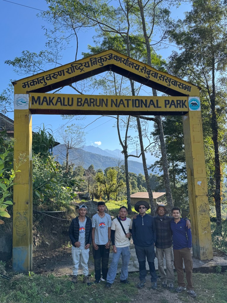
Food options at the lodge weren’t great. We ate noodles at dinner last night. They were thick. We had challenges to gulp them down our throats. Breakfast was somewhat better. Yet, Seduwa offered the last chance to charge my camera batteries. The next available choice was at Phemathang, which we reached much later, that too, unplanned. But that’s a story to be told later. After Raju settled the bills, we assembled in front of the lodge for a group photograph. Anil, Manoj and Raju joined us with all our trekking gears. Another was taken at the entrance gate of the Makalu Barun National park.

Picture courtesy, Dhananjoy Dey

Going by the plan, we would return here after another 10 days. We started hiking up the stairs amid bright sunshine, a clear sky & sweeping greenery. Seduwa is a relatively large village. While moving up the slopes through the alleys amid the terraced fields, we watched the village life. People were gradually getting on with their daily routine. The bright green crop of millet had a hue of yellow.

Seduwa

Children were either playing at the fields or on their way to school or some work. Some villagers were in a huddle of gossip. In one of the village homes, we saw a barber at work. He wrapped his client in a sheet while his scissors were working through the hair. In the balcony of yet another home, a harvest of ripened corns were hung up for drying in the sunshine. The trail went up amid the serpentine lanes, alleys & fields.

Picture courtesy, Kunal Kishor
Seduwa, Picture courtesy, Dhananjoy Dey
Seduwa

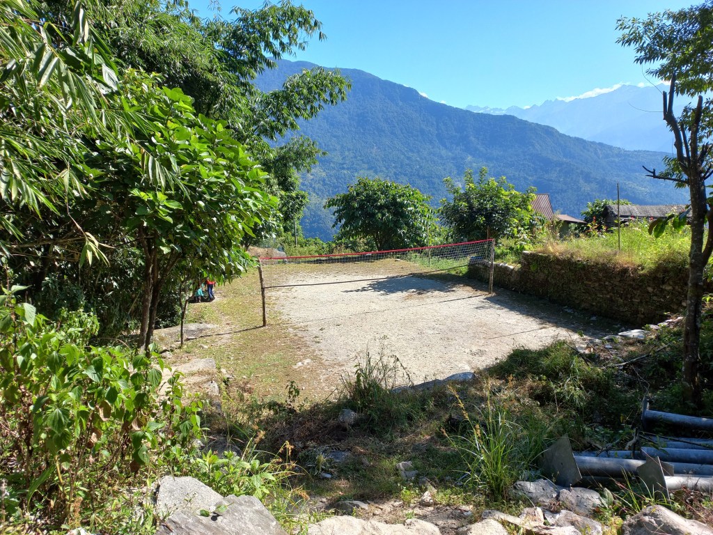
At every junction, the locals were in huddles, engaging in leisurely conversations. No one seemed to be in a hurry. At onetime we went past a volleyball court. It was a small strip of flat ground split into halves by a net. It was slightly larger than a terraced field, surrounded by sloping hills covered by thick forests. It was probably the most picturesque volleyball court ever seen in this world. When we passed beside it on our way back, it came up as a nostalgic recollection.

Seduwa

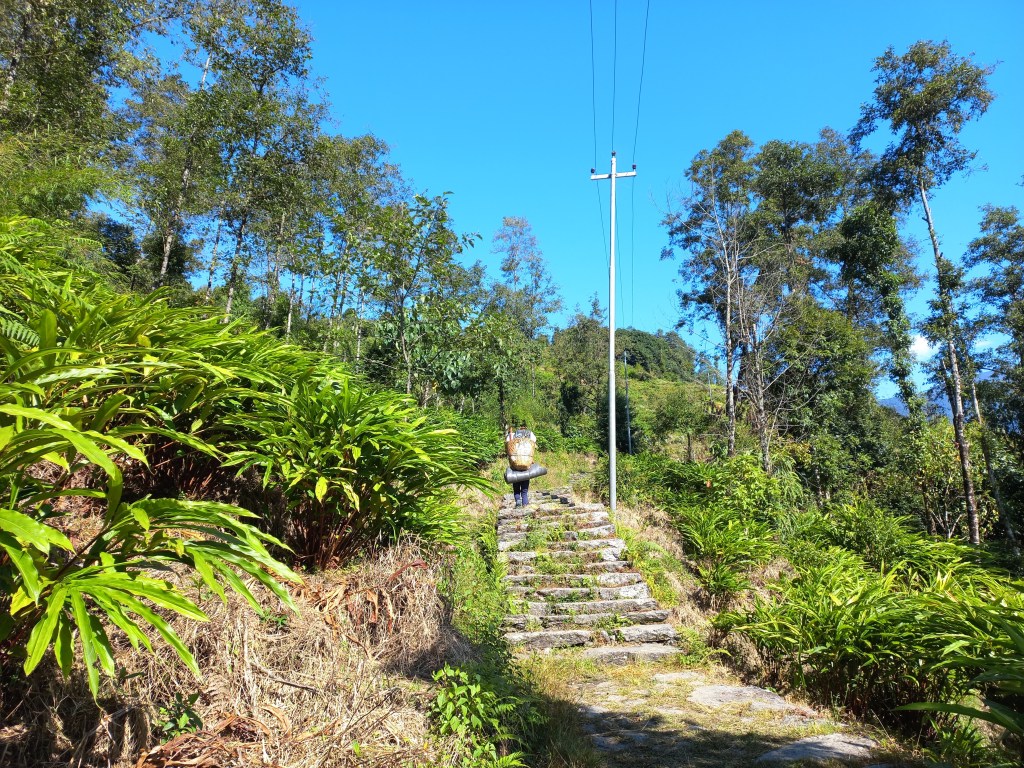
The trail gradually moved upwards. We crossed multiple streams flowing across our path, some by careful tip toeing over boulders, others by bridges. Then we came at the base of a set of stairs. After ascending them (there were many of these), we reached another village. A group of 15 -17 trekkers were resting at a tea house. We chatted with them for a while. They were a European group with many aged people. While coming along we saw cultivation of cardamom. These plants are abundant in the Eastern Himalayan region. We saw them in Sikkim. This region of Nepal is not very far from there. Hence, it wasn’t surprising that it had a similar cultivation pattern. The flora & fauna is also similar. For example, the elusive animal Red Panda is known to live in the forests of the Singalila range. This range is in West Bengal & Sikkim. It can also be found in the forests of the Makalu Barun National Park. One can as well find a goldmine but not see a Red Panda in the wild. Freshly harvested cardamoms were laid over the roof village homes for drying.

En-route Tashigaon

We now moved along a narrow path through the hills, barely enough for a single person to walk. Thick bushes closed in from both sides. It was obvious that we were taking a short cut. The trail moved up and down, unlike the wide track which we came across earlier. I now realized that the place where we left the wide track to ascend the staircase, was a junction. The trail now moved down and merged with the main track. Once again we were on level ground (as far as it can be, in a mountainous area). But instead of villages, we were now walking amid forests.

En-route Tashigaon

Raju & Dhananjoy spotted trees of wild berries. The fruits were ripe & orange. There were thick bunches of these fruits that hung from the trees. They were up for grabs and we feasted on them. I recalled seeing locals selling these in and around streets of Pokhara. The forests acquired different colors of foliage. I remembered that it was autumn, which is known as fall in Western countries in temperate zones. Forests in such climates acquire colors in this season, famously known as “fall color” in the Western world. We kept strolling along the trail amid such wonderful colors. Thick bunches of ripe berries kept drawing our attention towards the bushes and slowed down our speed. No one was worried because the hike for the day was supposed to last only for about 3 hours. We were expecting to reach our destination Tashigaon before lunch.

En-route Tashigaon

Tashigaon is a Sherpa village. Just like the neighboring district of Solu-Khumbu, members of the Sherpa community also inhabit the higher altitudes of this area. The word ‘Tashi’ in the Tibetan language (from which the Sherpa language derives) means good fortune. The Sherpas often greet others by the phrase ‘Tashi delek” which conveys well wishes to others. The phrase is often heard not just in the Sherpa inhabited villages. It is also common in other high altitude areas of Nepal that border with Tibet. It is very commonly heard in the Khumbu region. We stayed at a lodge in Tengboche. Tengboche is the next halt after Namche Bazar on the Everest base camp route. The lodge was named “Tashi delek”. This phrase is widespread in the higher areas of Manaslu and Annapurna as well. You can hear it in places like Samagaon or Manang. Most of the Sherpas live in the districts of Eastern Nepal e.g. Dolakha, Sindhupalchok, Rasuwa, Solu-Khumbu (the Everest area), Sankhuwasabha (the Makalu area) & Taplejung (the Kangchenjunga area). Some also live in the Helambu region. It is to the North of the Kathmandu valley. This area is near the Lang Tang area. Sherpas can also be found in Bhutan, Sikkim & Darjeeling. The Sherpas originated from nomads who came from Tibet. They settled in the Himalayas of the Everest region. They are a mountainous tribe accustomed to living in high altitude areas. Life in these areas is tough and made them toil hard for the limited agricultural activities that were possible. They often herd yaks and the grazing of these animals require them to find pastures in the high Himalayas. It is this lifestyle that adapts them to higher altitudes. Their immense strength and natural ability make them indispensable in many mountaineering expeditions, where they serve as guides and porters. They can breathe in rarefied air. Without their support, many climbers can’t even dream of reaching the higher camps of mountain expeditions, let alone summiting them. Many of the Sherpas are legendary mountaineers holding astonishing records of ascents. We met few of them in the lodges of this route. In the early days, all of the Everest expeditions happened from the northern routes as Nepal was inaccessible to foreigners. Since most of these expeditions were organized by the British, they all started from Darjeeling. It’s the British who started the tradition of hiring Sherpas as porters and guides. This caused many Sherpas to migrate to Darjeeling in search of work as expedition porters. Even Tenzing Norgay was one of them.

While walking, I suddenly noticed a moving object wriggling through the breadth of the track. I drew attention of the others. It was a baby snake. Dhananjoy was quick to capture that movement in a video. A closer look at it revealed a small hood which it was occasionally flapping. That told us that it was of a poisonous breed. We thanked nature that it was still a baby.

Courtesy, Dhananjoy Dey

After walking for some more time, we took a short detour through a village and regained the main track. We waited beside a house for our porters to catch-up with us. After that point the track moved up a little and the homes of Tashigaon started appearing.

Tashigaon, Picture courtesy, Dhananjoy Dey

We went through the terraced fields and narrow alleys besides the houses. A few lodges were visible. While on our way, we were scouted by two little sisters. They kept pleading to stay at their tea house. We had our gaze on another lodge but their insistence and their little age tilted our judgment in their favor. One of them also mentioned that the other lodge was expecting almost 20 guests. It turned out later that this was a false statement aimed at creating a bias in their favor. Nevertheless, the girls appeared innocent. The elder sister’s name was Doma and the younger was named Dzangmu. They quickly navigated the twisting trail and led us to their lodge. Little did we know, that this decision would have a crucial impact on the trek’s itinerary. On one hand we could say it impacted us badly. But on the other, we could also say that it saved us from bad weather.

Tashigaon

The lodge was located on an elevated ground. There was a kitchen and a dining space on one side. On the other side there were some newly created wooden rooms. They were clean, airy (a little too bit of that, as Dhananjoy found later), wide enough beds with thick blankets. The fluffy blankets almost embraced us, but I resisted the temptation. The main trail went between the kitchen and rooms. Beyond the rooms, a grassy lawn stretched wide open as a balcony that overlooked the valley.

Tashigaon

A few wooden trunks were laid in the lawn which acted as chairs. Another one was placed in front, acting as a table. We stretched our legs and sat on these amid bright sunshine. The surrounding hills wore a thick vegetation. We enjoyed a few beers in the perfect weather. While our phones didn’t work, but local phone calls were possible using a landline. They charged 50 NPR for each call. We informed our respective homes about our safe arrival. We were tempted by prospects of a mutton curry, but that turned out to be non edible. We finished the rest of the lunch. After that, Dhananjoy mustered enough energy for an afternoon village stroll but me and Kunal preferred to rest our legs. Sitting in the lawn in perfect leisure, I dozed off. When I woke up, I found the afternoon sun was showering its rays on the distant hills. The sun illuminated the clouds above them.

Tashigaon

Kunal’s seat was empty. I entered the room and found him asleep, wrapped under the comfort of blanket. That tempted me to follow suit. When I woke up, the sun was already down, though there was light in the sky. In the evening, we went to the dining place. We managed to lay our hands over a deck of cards. Our porter Manoj was taught by us to play some games. This was to repeat for the rest of the trail. The walls of the dining room were decorated with many photographs of expeditions. The owner of the lodge featured in all of them. There were photographs from Everest, Makalu, K2 and many other 8 thousanders. There was also a rack with mountaineering gear on display. It was obvious that the owner of the lodge is an accomplished mountaineer and has many summits to his credit. He has climbed Mt Everest & others on multiple occasions. The most recent was Mt Makalu in the current year. In the year 2025, multiple siblings set a record by climbing Mt Makalu on the same day. The lodge owner is one of them. Dinner was served with noodles and chicken soup. While the taste was good, but in the name of chicken mostly bones were served. We still enjoyed it. We were happy knowing that on our way down, we would have an entire day at Tashigaon. We looked ahead to it but that never happened. As night drew down, the cold increased. The wind also intensified. It passed through open cracks in the wooden wall of our room. That wall was erected recently. Dhananjoy tried to draw our attention to the sky studded with stars and constellations but sleep closed our eyelids down. We were sleeping at 2178 m.

Earlier

Next

The Barun valley – reaching the starting point

Earlier

Next

19th October

As discussed among ourselves, I woke up at 4 AM and went for a bath. Dhananjoy and Kunal were to follow after me. It was a pattern that was followed throughout the trip except for a few exceptions. Warm water was not yet available. The water heating system was based on solar power. The trick was to let out significant volumes of water (more than a bucket). After that, lukewarm water started flowing. While all that was underway, I completed shaving, probably the last chance to do before we returned to Kathmandu. We left the hotel premises, hired a cab and started for the Pasupatinath shrine. There was a slight chill in the air as the vehicle went through the streets of Kathmandu in the darkness. As we entered the temple complex, the familiar sounds of bells and the fragrance of incense and candles greeted us. I’m not a religious person. However, I enjoy the serene atmosphere of this temple complex. I find the cremation ground at the back of the temple particularly peaceful. The ones who leave this world, are brought here for their last rites on the banks of the Bagmati river. Their lifeless bodies get bathed in the waters of Bagmati before they are taken to the cremation pyres.

The cremation ground, Pasupatinath shrine, Kathmandu, picture courtesy, Dhananjoy De

After visiting the shrine, we crossed over the Bagmati to its other bank. Stair cases go up towards a park full of trees and more temples. We ascended them to reach a top. We had cups of teas at a tea house there. Scores of people were on their morning stroll, some even engaged in exercises. A barrage of monkeys followed the pedestrians, many of whom gave them food. Observing such incidents, it was clear that the monkeys expect this every morning. They are well acquainted with the human givers. After a quick look at the watch, we returned the same way. A cab ported us back to our hotel at Thamel. We headed for the breakfast table for the buffet. A lot was on the offering – breads, butter, jam, puri-sabzi, omelets of different variations, tea, coffee, fruit juice etc. It was a problem of plenty and we ate more than usual.

At 8 AM, a cab entered the gates and Raju alighted from it. That was a pleasant sight and it drove out a lot of skepticism from my mind. After loading our main baggage at the rear, we entered inside with our daypacks. Off we went for the domestic terminal of the Kathmandu airport. The streets bathed in bright sunshine as we followed almost the same route for the Pasupatinath shrine. The pleasant weather made me dose off. I woke up just in time as we entered the gates of the domestic terminal. It appeared the same as we saw it during our Everest base camp trek. It resembled a bus terminus more than an airport.

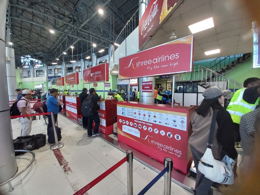
Check-in counters, domestic terminal, Kathmandu airport

The small baggage check-in counters don’t have the sophisticated conveyor belt system. Airline employees accept the baggage. They dump the bags on to a trolley. A carrier drags the trolley over the runway to the aircraft. After baggage check-in, we waited in the departure gate. We fixed our gaze on the electronic screen used for displaying flight departures. Flights were leaving for various destinations in Nepal. These include Pokhara, Biratnagar and Bhadrapur, which is the base for the Kangchenjunga trek. Additionally, flights were going to Nepalgunj. This city is a gateway to the areas of Western Nepal. Flights were also going to Luk-La. Luk-La is the base for the Everest region. Our destination was Tumlingtar. The flight was to depart at 9:40 AM. That kept getting delayed, first by 20 minutes, then by another 15 minutes. I inquired at the information desk and was told that the incoming flight from Tumlingtar was delayed. Apparently, heavy air traffic wasn’t allowing it to land and the pilot was taxiing in the air! They also showed me the flight map. The plane already made two concentric circles and now was heading towards the runway. We hoped for announcements, but suddenly, the electronic screen showed the flight status as “boarding”. I hurried up the rest and we headed for the bus. A ride took us to the waiting plane with an open belly. The trolley carrying the baggage was already there and the airline staff were loading them into the plane. Even after we boarded the plane, announcements were made for further delays. I kept checking the time. A delay would affect our arrival in Seduwa, which is the starting point for our trek. It takes 7-8 hours by drive to reach Seduwa from Tumlingtar. Add to that, another hour in between for baggage reclaim. You also need to scout for the vehicle. According to inputs received from fellow passengers, one also needs to break the journey at Khandbari. Direct transit is not possible.

Flight to Tumlingtar

Finally, we took off at 12 PM. As the flight took to the air, the Himalayas were up for display from close quarters. This time it was the Everest, Lhotse and our destination, Makalu, who made their appearances.

Mt Everest and the Nhuptse ridge, from the flight to Tumlingtar, picture courtesy, Dhananjoy De

After about 30 minutes, we started our descent to Tumlingtar. The lush green valley bathed in bright sunshine. The hills had a thick green cover interspersed with terraced cultivation fields. The fields had a golden yellow hue formed by ripe paddy and millet. Then came the wide and serpentine expanse of the Arun river. All along, the size of the picture kept increasing. As soon as we crossed the Arun, the plane touched the Tumlingtar runway. Its speed decreased after it reached the other end of the runway. It then turned around and came to a halt after a short stroll. We alighted to the runway and stood outside to soak in the beauty of this small air strip.

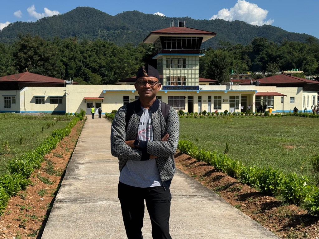
Tumlingtar airport, picture courtesy, Dhananjoy De

The Tumlingtar airport (rather air strip) has a small runway surrounded by green hills on all sides. It is an important gateway to the Sankhuwasabha district. Generally, there are 1-2 flights in a day between Kathmandu and Tumlingtar, but it varies based on traffic. It can even be zero (as we found during our return) based on weather conditions. Occasionally, they also increase the operations (especially during festival times). They are operated by Budhha air.

Tumlingtar, picture courtesy, Dhananjoy De

After some photo shoots at the air strip, we headed for the terminal. There were just a few rooms. Raju went out in search of a vehicle while we waited for our baggage to arrive. After sometime, we boarded a vehicle which would take us to Khandbari. From thereon, we need to scout for another ride. Many vehicles were absent from the road. This was due to Bhai duj, a festival where sisters pray for the well being of their brothers. We headed to the parking lot and boarded the vehicle. It started its journey through the low areas of the Arun valley. The road was lined by dense forests on both sides. Villages appeared with terraced fields filled with the ripened crop of paddy or millet waiting to be harvested. It was full of greenery as we moved up the serpentine roads. We stopped at Khandbari for lunch. It was an important town on this route. As we moved into the hotel, Raju got in touch with a few drivers for our next commute. After lunch, we heard that our luggage was already in another vehicle. This would take us to Seduwa. I purchased an international roaming pack from my cellphone provider. I informed my home about our progress and embarked on our post-lunch journey. The road condition was still good and the vehicle made decent progress. A full stomach and the serene greenery made me doze off once again. We halted at a place called Num at around 5 PM to have some tea. The golden due of the evening reflected off the distant clouds. This indicated that the sun was on its downward journey.

Num, en-route Seduwa

After Num, the road condition deteriorated. Though it was wide enough, but the potholes increased along the surface. After sometime, the paved road disappeared and was reduced to a dusty and rocky surface. With that, the comfort of ride also disappeared. This kept true to the facts known about this route. This applies to many routes in Nepal where vehicles ply, but paved roads don’t follow them. In earlier itineraries for Makalu base camp, Num was the starting point for hikes. Though uncomfortable, this bumpy ride would save us at least two days of walk. While this gives some relief for the current trek, it also highlights that trekking routes are decreasing. This is happening in different areas of Nepal. Almost in every circuit, treks have shortened by 2-4 days because of road construction. For example, it takes 2 days lesser today than what it took for us in the Manaslu circuit. We kept plodding on. After sometime, darkness set in and the headlights came on. We realized we were traveling beside a fast moving river torrent. We asked the driver to stop the ongoing music. That’s when the roaring sound of the Arun river reached our ears. In the darkness, its roar gave a chilly feeling as the driver negotiated the bumpy road. There were many switchbacks where the driver had to go back and forth using reverse gear to negotiate the bends. The road was so rough that many times our heads bumped with the ceiling. We had to keep a watch. The travel seemed never ending and we kept gaining altitude. After many such switchbacks, we finally reached Seduwa. The last ride before the vehicle came to a halt seemed vertical (well, almost). I saluted the driver’s skill as without it, its impossible to drive a vehicle on such terrains. We stayed at the first available lodge at Seduwa. It was basic, but had the necessaries. At least it had facilities to charge our batteries and phones. We’d find this rarely in the lodges at higher altitudes. Wi-Fi wasn’t available and thanks to the international roaming pack, we could inform our homes about our arrival. We changed to our home wears and moved to the dining area. This is where we met other groups who were embarking on the trail. There was a French group, who were embarking on the Sherpani col pass trek. This involved traveling to the Makalu base camp and moving further up through multiple passes (more than 6000 m) to reach the Chukhung village. From there on, one enters the Solu-Khumbu region and descends via Tengboche and Luk-La. It was a group which would accompany us to Khongma. We got friendly with the porters and guide of that team. We also met our own porters, Anil and Manoj. They were from villages in the regions further down from Seduwa. They were two brothers (aged 22 and 19 years, respectively) and appeared simple and jovial. They’d prove to be vital cogs in this trek’s wheel. The next day’s trek was supposed to last about 3 hours, taking us to the next halt, Tashigaon. We reclined to our beds under comfortable blankets. We were sleeping at approximately 1500 m.

Earlier

Next

The Barun valley – reaching Kathmandu

Earlier

Next

18th October

It was Diwali. Working migrants who live in the Delhi area were on the move. They were heading towards their homes to spend time with their families. This is an auspicious time of the year and the greatest festival of North India. During this time, we were also leaving Delhi. In fact, we were departing from the country and heading towards the Nepalese capital. It meant competing with the rush. Even in the early hours of the day, one expects heavy traffic towards the exit points from the city, i.e. railway stations or airports. For international flights, one must arrive at least three hours in advance. This time frame allows for security procedures, which are typically more exhaustive than those for domestic flights. Though our flight was at 11:45, I started from home at 6. Dhananjoy started from Lucknow on the previous evening and reached a friend’s place in the morning. He was on his way to airport via metro. I also decided to use metro railway to travel to terminal 1. After my wife dropped me at the starting station, it took about 45 minutes to reach there. A shuttle transported me to terminal 3 in about 15 minutes. I met Dhananjoy and Kunal there. For some reason, web check-in was disallowed for Dhananjoy, so he had to complete it at the terminal. After baggage check-ins, it was time for security checks. As usual, we had to unravel a lot of our belongings only to reassemble them again. After arriving at the boarding gate, we finished our breakfast with chicken sandwiches provided by my wife, Anindita. Dhananjoy ensured window seats for all of us.

As the flight took off, Delhi turned into a city map, highways turned into lanes, vehicles reduced to toys. We focused our gaze on the Northern horizon, hoping to view the Himalayas. It was the very reason for booking window side seats. It started with the Uttarakhand Himalayan peaks. The view of the awe-inspiring Dhaulagiri massif and the Annapurna range indicated that we’ve entered the Nepalese skies. We glided past the major regions of Nepalese Himalayas: Dhaulagiri, Annapurna, Manaslu, Ganesh Himal, and finally Langtang. Then the aircraft started its descent towards the Tribhuvan international airport.

Kathmandu valley from aircraft, picture courtesy, Dhananjoy De

After landing, we descended the airstairs to exit the aircraft. Standing on the runway in the bright afternoon sunshine, I looked around. It was surrounded by hills on all sides. Snow capped peaks of the Langtang region were visible beyond the hills on the northern horizon. A bus carried us to the arrival terminal.

Tribhuvan International Airport

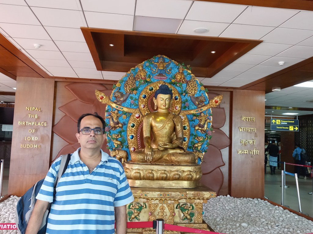
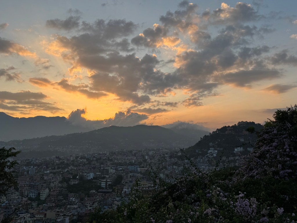
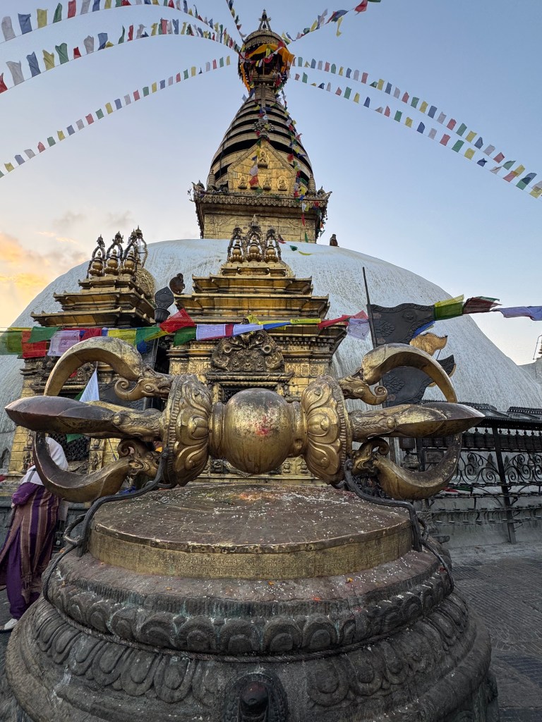
A statue of Budhha greeted the arriving tourists. We posed for photographs in front of it. Immigration formalities in Nepal are one of the simplest that can be found in the world, especially for Indian citizens. In fact there are dedicated counters for Indian passport holders. While traveling in a cab to Thamel, we went past the famous Pasupatinath shrine. It’s golden top, styled like a pagoda, glittered in the afternoon sunshine. Durbar residency is a decent hotel with comfortable rooms. After getting fresh, we sat over glasses of beer at the hotel’s bar. We spoke to Raju over phone and asked him to meet at our hotel in the evening. Since it was still early afternoon, we ventured out to visit Swayambhunath. The breeze was cool at the top of hill at Swayambhu. The views are all familiar as it was the third visit for me. The bird’s eye view of the Kathmandu valley from the top is awe inspiring.

Kathmandu valley from Swayambhu top, picture courtesy, Dhananjoy De
Swayambhunath, Kathmandu, picture courtesy, Dhananjoy De

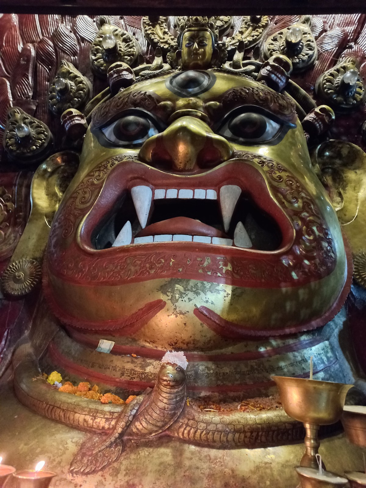
The gymnastics of the monkey brigade is ever enchanting. One can spend an entire afternoon by watching their antics. We then went to Basantapur Durbar square. The ancient wooden temples are mesmerizing. The Shwet and Kal-Bhairav idols captivated with their presence. The scores of burning incense sticks and candles transport one back hundreds of years. This was to the age when the Kathmandu valley was ruled by local kings. This was before the Gorkha ruler Prithvi Narayan Shah attacked and conquered the area. He leaves behind a mixed legacy. Some credit him for consolidating the Nepalese kingdom by defeating the warring chieftains. Others loathe him for his cruelty towards the defeated forces.

Shwet-Bhairav, Basantapur Durbar Square, Kathmandu
Kal bhairav, Kathmandu, picture courtesy, Dhananjoy De

The Shah dynasty occupies a significant position in the Nepalese history. After Prithvi Narayan Shah, the dynasty was immersed into a succession struggle between warring factions conspiring against each other. This mayhem was capitalized by the powerful prime ministers, the Ranas. They took control of affairs and reduced the Shah kings to puppets. They continued their iron grip over Nepal for centuries. The Ranas maintained a warm relationship with the colonial rulers of India, to the south of their border. They even stood by the British East India Company to help them suppress the revolt of 1857. When the British left India, almost abruptly in 1947, the situation changed dramatically. At that time, Nepal was ruled by its prime minister Mohan Shamsher Jung Bahadur Rana. The king Tribhuvan was it’s ceremonial ruler (who was crowned at the age of five). Inspired by the ideals of the Indian National Congress, the Nepalese Congress party was formed and it started it’s struggle for Democracy in Nepal. But they were suppressed by the Ranas with a strong hand. Tribhuvan sensed an opportunity and started liaising with them, promising to free them from the autocratic rule. He escaped from the Royal palace and took refuge in the Indian embassy. From there he was flown to New Delhi, where Jawaharlal Nehru, the first prime minister of independent India, greeted him. Nehru was in favor of a democratic Nepal, but under the watchful guidance of the monarch. The Rana was forced to relinquish the rule and an accord was signed where Nepal was turned into a semi democracy with power shared between a democratically elected government headed by a prime minister and the monarch. Tribhuvan returned to Nepal, a hero. Seen as the king who ushered in democracy to his country, it could have been a happy ending for Nepalese politics from here on. But Tribhuvan’s successor, King Mahendra, had other ideas. He abolished the Parliament and introduced a Panchayat system where the Panchayat heads directly reported to him. Discontent started brewing against his policies. Rural Nepal witnessed the Maoist insurgency. Protests erupted on the streets of Kathmandu. After the sudden demise of Mahendra, Birendra became the king. He inherited not just the throne, but the political turmoil too, much of which was a result of his father’s repressive policies. Despite relentless loss of civilian lives due to Maoist insurgency, the Army was not called upon. It is said that much of it had to do with Birendra’s reluctance to allow the army to fire upon his own countrymen. He took the unprecedented step of relinquishing much of his power. The power then shifted to the elected government. In doing so, he effectively converted himself into a constitutional monarch. But some say, this neither pleased the insurgents on the streets, much less the royal family members, many of whom favored his father’s policies. Finally, on the fatal night of 1st June, 2001, he was assassinated at the Royal Narayanhithi palace along with his queen and other members of the family by his heir Deependra who later shot himself. Many reasons and conspiracy theories float around, but the official record puts the responsibility on Prince Deependra. As the funeral pyres burnt at the cremation ground on the banks of the Bagmati river behind the Pasupatinath shrine, a mythological legend surfaced from the rears of history.
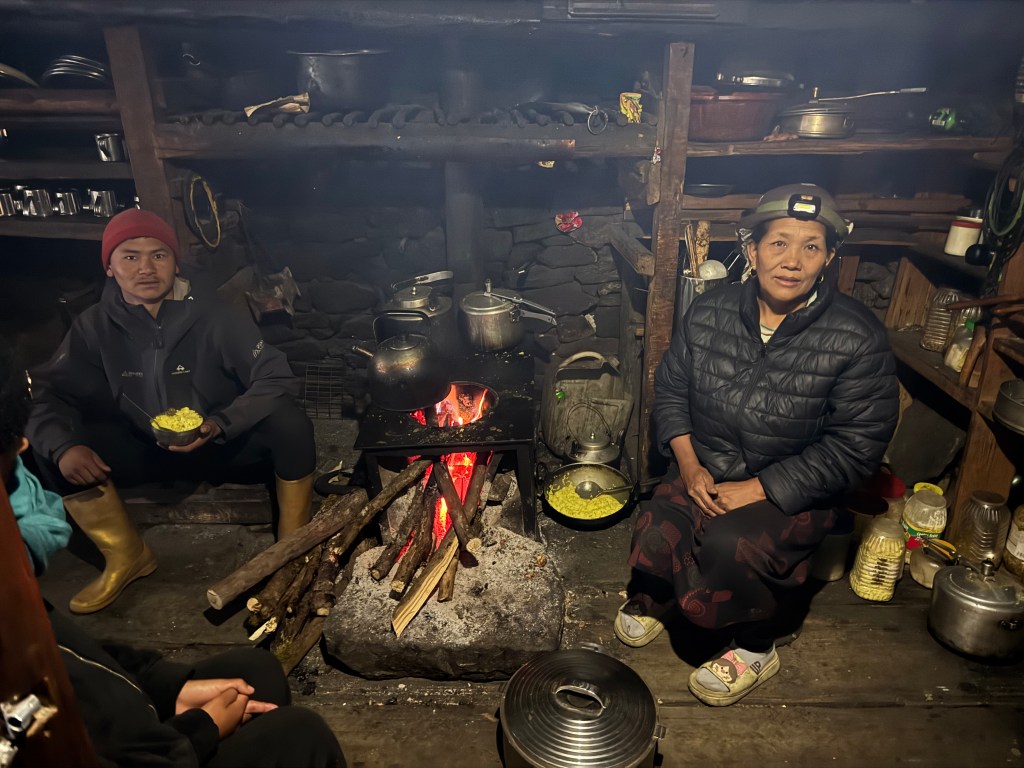
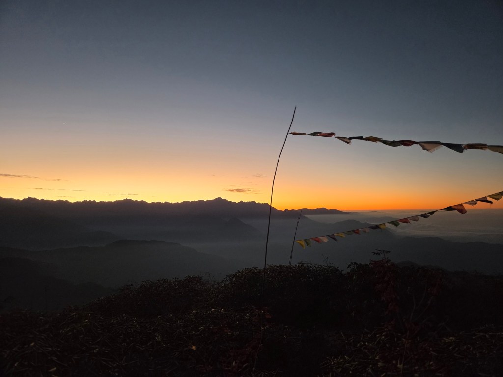
It is said that Prithvi Narayan Shah, the founder of the Shah dynasty, once met with the saint Gorakhnath (believed to be an incarnation of Lord Shiva). He somehow ended up enraging the saint who cursed him and predicted the destruction of the dynasty during the reign of the 11th Shah king. Birendra was the 11th. After this massacre, younger brother Gyanendra succeeded him. He too, like Mahendra, tried to dissolve the Parliament under the pretence of saving the country from rampant corruption of the political class. This proved to be the final blow to the monarchy and he was forced to abdicate. Monarchy was abolished in Nepal. The country turned into a secular democracy. The monarchs, who once were viewed as incarnations of the revered Hindu God Vishnu, now moved into oblivion. But since then, the political class plunged into one controversy after another. Corruption ran rampant. In a few years, Nepal saw approximately 20 prime ministers come and go. This led to the public protests led by the young generation (called gen-Z) in the month of  September 2025 (just a month before our departure). Police firing led to the deaths of 20 young people. Angry mob burnt down every possible signs of the current establishment. It forced the incumbent government to resign. These developments threatened to disrupt our plans but finally, sense prevailed. Things calmed down with a caretaker government taking over under the leadership of a former chief justice of the supreme court. Fresh elections are slated for early next year.

Anyways, let’s get back to our story. After returning to the hotel, we tried to call up Raju but he didn’t pick up the phone. We tried this multiple times while rearranging our baggage (to leave some elements at Kathmandu). Raju’s silence increased our tensions. Normally, we expect a guide to have a conversation about the plan. They should fix the timing of departure. A guide should also give a sense of responsibility and purpose. We started thinking about alternative courses of action. Ideas of reporting to the police also crossed our minds as it was now 8.30 PM. This was late night by the standards of a hill station. Chances of Raju’s appearance seemed to dwindle by the minute. All our payments were already made and we didn’t know about his address. We almost gave up hopes and let our fates rest upon his mercy. Then, suddenly, late at night, his face appeared. As if a fever subsided from our bodies after running high temperatures for hours! Apparently, his phone discharged while he was busy printing our T-shirts. Nevertheless, all’s well that ends well. Raju would arrive at the hotel with a hired cab. We would start for the airport no later than 8 AM. It was already planned to visit the Pasupatinath shrine at 4 AM in the morning. I went to sleep with mixed feelings. On one hand I was relieved that the trip wasn’t jeopardized. On the other hand, Raju’s casual attitude didn’t bode well for the upcoming days. Did he make the necessary arrangements as claimed by him or there could be unpleasant surprises along the way? Little did we know then that many such fears will turn out to be true. Because of these thoughts, sleep eluded me for long. It was our last comfortable stay before embarking on a fortnight long trip, but I couldn’t enjoy it. The route wasn’t known to be as developed as other parts of Nepal. It demanded more experience and preparedness from a guide but Raju’s attitude seemed on the contrary. I hope he turns up the next day on time! Was it wise to not engage a tour operator? We were planning a trek that lies in a desolate corner of Eastern Nepal. All my thoughts turned to the negative territory. Finally, some factor in my brain resisted. There wasn’t any point pondering over something yet to materialize. It’s wise to cross the bridges as they come along. Why not live in the present? Why not enjoy the moment of being away from work for a fortnight, away from the corporate rat race? Didn’t I wait long enough to embark on the Makalu trail? This itinerary was impossible to attempt a few years ago due to its duration. Now, it seems within our reach! Why not grab the opportunities with both the hands (rather limbs as well). The Himalayas don’t beckon so easily.  Whatever comes our way, we will tackle it. We will return to the same hotel after a fortnight with Makalu base camp added as a feather to our illustrious cap!

Earlier

Next

The Barun valley

Next

To reach the base of the Everest region, one has to fly North-East from Kathmandu to reach Luk La. Today, it is a prominent destination, thanks to the popularity of the Everest region. It is popular both for trekking and expedition purposes. Luk La acts as an entry point to the higher reaches of the Khumbu region. Solu forms the lower sections of it and is mostly bypassed by flights to Luk La. This region is crowded with trekkers and climbers alike in Spring and Autumn seasons. Though the views are admirable on this route, some feel the lack of tranquility due to the crowd. If you’re seeking solitude in the remote Himalayas, Everest might not be the ideal region anymore. This can be said for some other famed regions of Nepal too, like the Annapurna region.

Next to the Solu-Khumbu district lies Sankhuwasabha. It is located in the eastern most province of Nepal, the Koshi. It borders with the Tibetan Autonomous region of China to the north. Two main rivers form the mainstay of this district and drain most of its mountains and slopes. One of them is Arun. It originates in Tibet and flows south across the district. This flow creates one of the deepest valleys. It is situated between Mt Makalu (8485 m) to the west and Mt Kanchenjunga in theeast.

The Arun River

The other river is Barun, Arun’s main tributary. It originates from the Barun glacier at the base of Mt Makalu, the fifth highest mountain of the world. Both of these belong to the Koshi or Sapta-Koshi river system. This system drains the Eastern part of Nepal before reaching the plains of India. The other rivers in this system include Sun Koshi (or Indravati). Dudh-Koshi is the famous river flowing through the Solu-Khumbu valleys. The Tamor is in the Kangchenjunga area. The river Barun freezes entirely in winter. The upper section of its valley is one of the richest in flora and fauna. Yet, it is one of the least accessed regions of Nepal by tourists. It is so close to the famed Everest (aka Solu-Khumbu) region, yet so unknown among the travelers. It is right under the light of its more famous counterpart to the west. It is one of the richest habitats for birds in Nepal, also the home of the illusive Red Panda. The valley shelters the Snow Leopard as well. The extreme lucky can occasionally get glimpses of these. The landscape varies from the tropical to the alpine. It ultimately reaches the base of its guardian, Mt Makalu, which oversees the valley.

Barun river, en-route Makalu base camp

The Barun valley lies entirely within the Makalu Barun National Park, which was established in 1992, as an extension to the Sagarmatha National Park (that covers the southern slopes & valleys of Mt Everest). In the early and mid 1980s, some members of The Mountain Institute were intrigued by the enigma of Yeti. They conducted surveys into the sections of the Barun valley. Their aim was to find an explanation of this mystic (rather mythical) phenomenon. In their attempts of doing so, they ended up revealing extraordinary biological richness of the area. That led to the need to protect one of the last remaining pristine forests and the alpine meadows (called kharkas) in the Himalayan regions. The Makalu-Barun Conservation Area Project began as a result. Over time, this led to the creation of the Makalu Barun National Park. The region is inhabited by people of the Limbu, Sherpa and Yakkha ethnic groups. It is also home to the Gurung, Tamang, and Magar communities. Additionally, Newar, Brahmin, and Chhetri people mainly engage in subsistence farming.

Seduwa

The lush green fields that line the slopes of mountains are obvious. This is clear as one makes way through the villages in the lower reaches of the region. The greenery appears to be much more than the neighboring villages of Solu-Khumbu and it’s very soothing to the eyes.

Entrance, Makalu Barun National Park, Seduwa

Let’s now turn our attention to the mountain which lends its name to this national park, Mt Makalu. At an altitude of 8485 m, it is the fifth highest mountain in the world. It is part of a section of The Himalayas known as the Mahalangur Himal. This section also includes Mt Everest, Lhotse and Cho Oyu. Many other peaks in this area are at or above 7000 m. It lies 19 km south-east of Mt Everest on the Tibet-Nepal border.

Mt Makalu, from Khongma La (3603 m)

Despite lying so close to Mt Everest, Makalu receives much less attention from the climbers or trekkers. Sights of long queues extending up to the summit of Mt Everest are common nowadays. Climbs to Makalu are rare. The first climb was attempted by an American team led by Riley Keeganin 1954. It was called the California Himalayan expedition. It was attempted via South-East ridge, but was forced to retreat from 7100 m when they encountered with storms. Another team from New Zealand including Sir Edmund Hillary also attempted it during the same season (i.e. the spring of 1954), but were deterred by illness and injuries. Finally, on 15th May, 1955, Lionel Terray and Jean Couzy reached the summit. They were part of a French expedition team led by Jean Franco. Like Mt Annapurna, it was a French team, who tasted the first success on Makalu. The next two days saw three and four members of the expedition team summit the peak respectively. It was a major achievement at that time with most of the expedition team members summiting. This was unusual in those days. Typically, at most one or two members would summit. The rest of the team provided logistical and infrastructural support. This was done via the North face and the North-East ridge. In 2009, an Italian named Simone Moro accomplished the first winter ascent. He was joined by a Kazakh mountaineer named Denis Urubko. Before that, in 2006, the French mountaineer Jean-Christophe Lafaille disappeared on its slopes. He was attempting a winter ascent. In 2022, Adrian Ballinger made the first ski descent. He skied from 15 m below the summit to the foot of the glacier.

We had our sights trained on this region from a very early phase. Still, we couldn’t venture out because of its remoteness. We scoured the internet for itineraries. We found many, but none were less than three weeks. This included a flight from Kathmandu to Tumlingtar. In the past, just reaching the starting point of the trek required at least 2-3 days. This was even after the flight from Tumlingtar. The duration proved to be a deterrent, keeping us at bay. We turned our attention to other areas of Nepal. After ticking off Everest, Annapurna, and Manaslu areas over the last nine years, we returned our focus to Makalu. By this time the road reach had extended further. This extension allowed us to fit the schedule to a window of two weeks. Now, reaching Seduwa, the starting point, is possible in a single day. This is achieved with a 30 minutes flight from Kathmandu to Tumlingtar, followed by a 7 hour drive.

Conversations started with our friends and Raju Gurung, our guide from Everest base camp and Annapurna base camp treks. Raju became a close friend of ours from these two treks. We wanted him to join us as a guide on this venture. After exchanging ideas, we fixed the itinerary. We made advance payments to him. These payments were for making arrangements for porters. They also covered advance lodge bookings and, most importantly, the flight bookings for Kathmandu to Tumlingtar and back. As per plan, we were to reach Kathmandu on 18th October, Tumlingtar on the 19th and arrive at Seduwa the same day. Successive nights would see us stay at Tashigaon, Khongma, Dobato, Yangle Kharka, Merek to finally reach at Makalu base camp. On our way down, we were to stay at Yangle Kharka, Khongma and Tashigaon. The last day would need us to trek to Seduwa, followed by a drive down to Tumlingtar. The itinerary looked good overall. Only one day raised doubts in my mind. It was the day we were supposed to get down from Yangle Kharka to Khongma. On the way up, the trek from Khongma to Dobato was 14 km long. It required crossing four different mountain passes, including the famous Shipton La (4170 m). This involved gaining elevation only to lose it. The final gain of height to Dobato was just about 100 m. After Dobato, it is about 12 km to Yangle Kharka. So, it involves descending a total of 26 km from Yangle Kharka to Khongma. This descent was supposed to happen in a single day. The stretch from Yangle to Dobato is mainly descent. Thus, it should take less time than ascent. The rest of the section was similar while going up. It would involve crossing the same set of passes. All these factors combined, I felt it was going to be difficult with tired legs during our descent. It seemed almost impossible. I asked Raju the same question. He seemed okay with it. It seems most of the standard itineraries suggest that. I agreed to it at that time with crossed fingers. It’s another story that much of this itinerary went for a toss due to a multitude of reasons. Another cause of concern was the stay at Dobato. It has a single tea house. All texts on the internet suggested booking it in advance. This would avoid hassles after a long crossover across four mountain passes from Khongma. I often reminded Raju to ensure booking at that place. He assured us that everything was sorted. He had already informed local porters from that area to arrange for advance bookings. Apparently, there wasn’t any cause to worry (well, apparently).

Further inquiries revealed that this route could pose challenges unlike other areas of Nepal. Charging electronic devices or camera batteries may prove difficult. Access to telephone or Wi-Fi networks could also be problematic. This meant we had to equip ourselves with power banks and extra batteries. We also needed to set expectations with our homes. For a large section of the route, keeping them informed about our whereabouts could be a challenge. They should expect us to be off network for a sizable section of the travel. To be honest, this shouldn’t be surprising in a trek. However, in other established trails of Nepal like the Everest or Annapurna regions, the infrastructure support is improved. Because of this, our expectations for connectivity went higher. This was a trail which brought us down to earth. Still, when we went there, it didn’t turn out that bad in terms of connectivity. Though it was not as sophisticated when compared to the more famed trails of Nepal, it fared quite well.

Seduwa

Our last few treks in Nepal has been in the Annapurna region, the most recent was to the Khopra ridge. All of these travels involved entry and exit via Sonauli border (reachable from the nearest Indian railway station, Gorakhpur). This time, after a long period, we entered and exited Nepal via flights. The flights were to and from Kathmandu, the Nepalese capital. The team boiled down to three – me, Dhananjoy and Kunal. Dhananjoy would start on 17th evening via a train from Lucknow to Delhi. Rest of us were to join him at the Indira Gandhi International Airport for a flight to Kathmandu. Our return was going to be similar, except for Dhananjoy to take an onward flight from Delhi to Lucknow. A visit to Kathmandu would allow us to renew our ties to that city. We would probably visit the Pasupatinath shrine again. I always find this refreshing before starting over a trek.

Next