
17th April, 2026
We had the leisure of rising late as there was no scramble for washrooms. We woke up to clear skies for the first time on the trek. Sounds of hens filled the morning air. Prayer flags flapped around in the houses. The day was going to mark our first hike above the forests. In the latter part of it, we’d even move beyond the tree line into the world of boulders & snow. In the next few days, we’d be presented with a very different landscape from what we’ve been experiencing so far. It’s going to be all monochrome. The grounds will become unstable, paths narrower and the air, thinner. For a change, we sat in the outer section of the dining room to have our breakfast. We made calls to our respective homes before start. Many other groups were planning for an extra day of acclimatization at Ghunsa. So, we’d lose contact with them for a day. Contacts would resume at Khambachhen, our next destination. That was going to be our place of acclimatization.
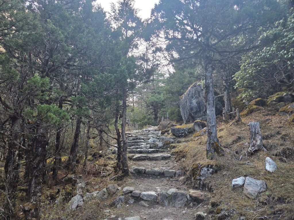
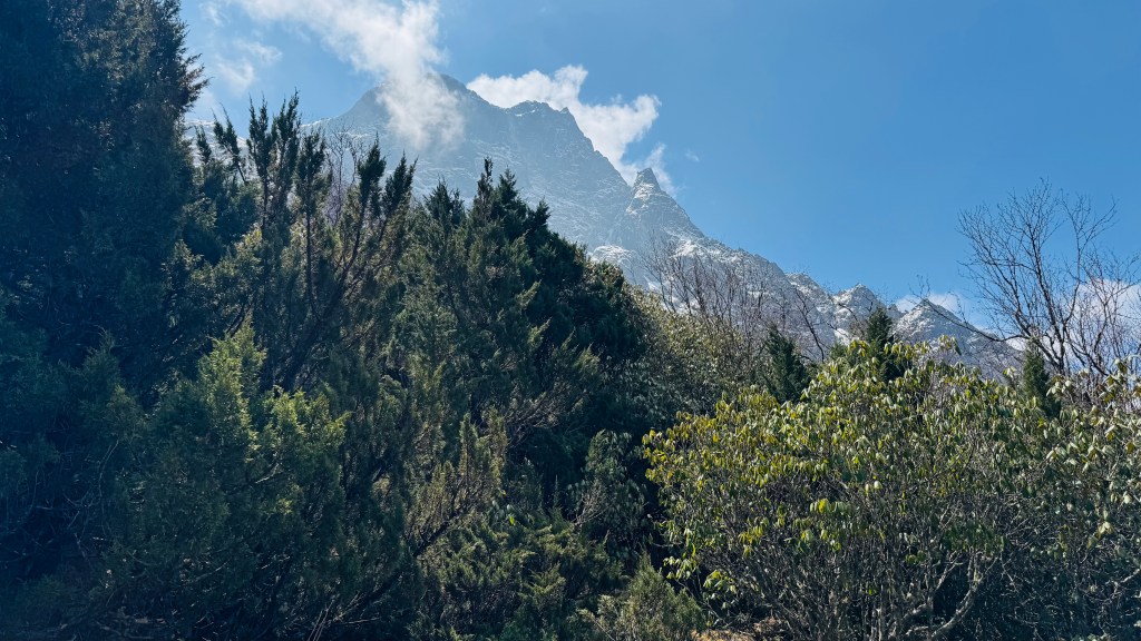
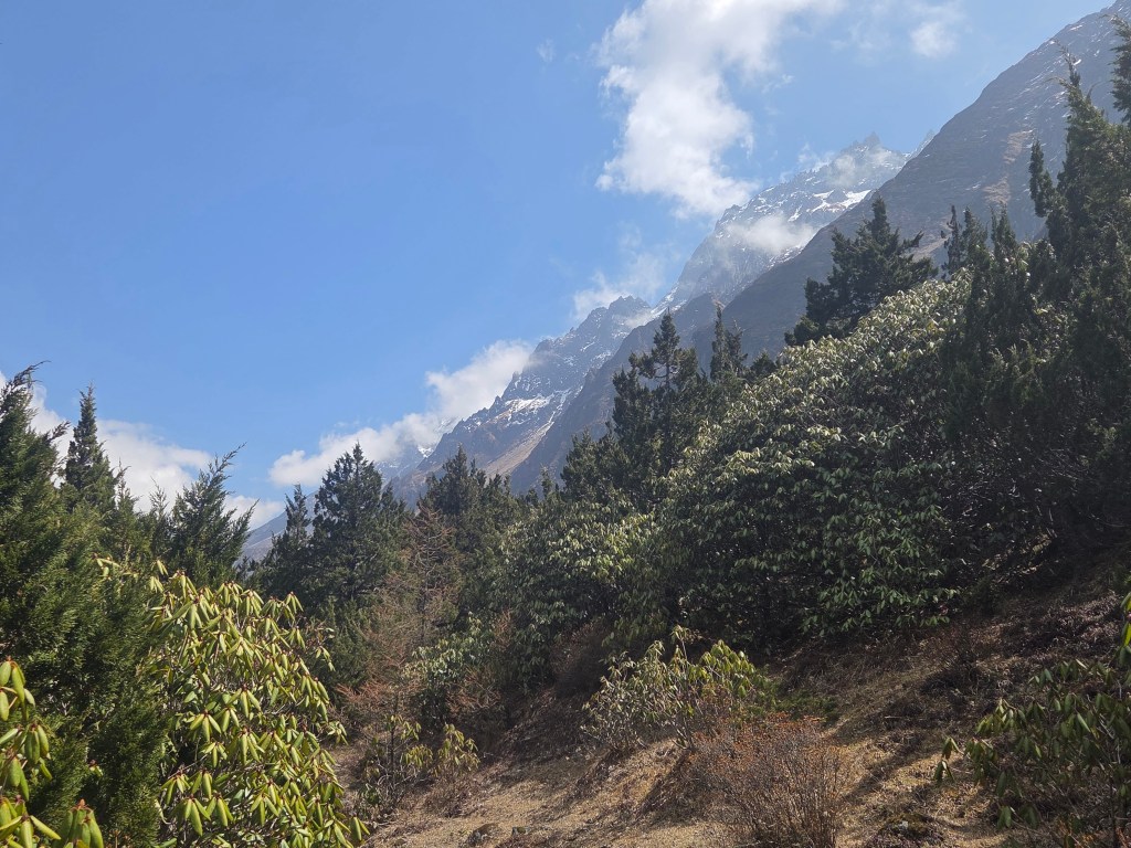
We moved out of the premises of the lodge. The track moved on level ground till we reached a dry river bed. It’s actually the path of a dried stream that drains into the Ghunsa river. We moved down the slopes and climbed up on the other side to regain the trail. It was still a comfortable stroll amidst rhododendron forests. They were getting sparse and their foliage, less dense. The blue sky hovered above us. Mountains started showing traces of snow along their slopes. The track moved gradually in and out of the forests.
En-route Khambachhen
Rhododendrons were still there. Their colors were getting lighter. Some were light pink, others almost white with traces of pink. But their numbers kept reducing, many of them were yet to bloom. We'd see them in a very different state on our way down, but that's for a later time. The Ghunsa river kept flowing at a distance. Our porter Limbu was not in sight. He had no restrictions and was given a free run. The only change I noticed in him (when we started from the lodge at Ghunsa) was that he was wearing a windcheater and a pair of boots. That was a strong indication of upcoming terrain and the accompanying weather. After about an hour of walking, we reached a place with a field. There was only a single hut at its center. Beyond the field, there were trees that marked its boundary. Above the trees, went up the slopes culminating in a snowy top. A sign board declared the name of the place.
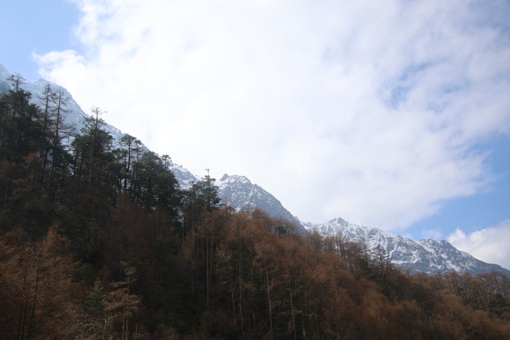
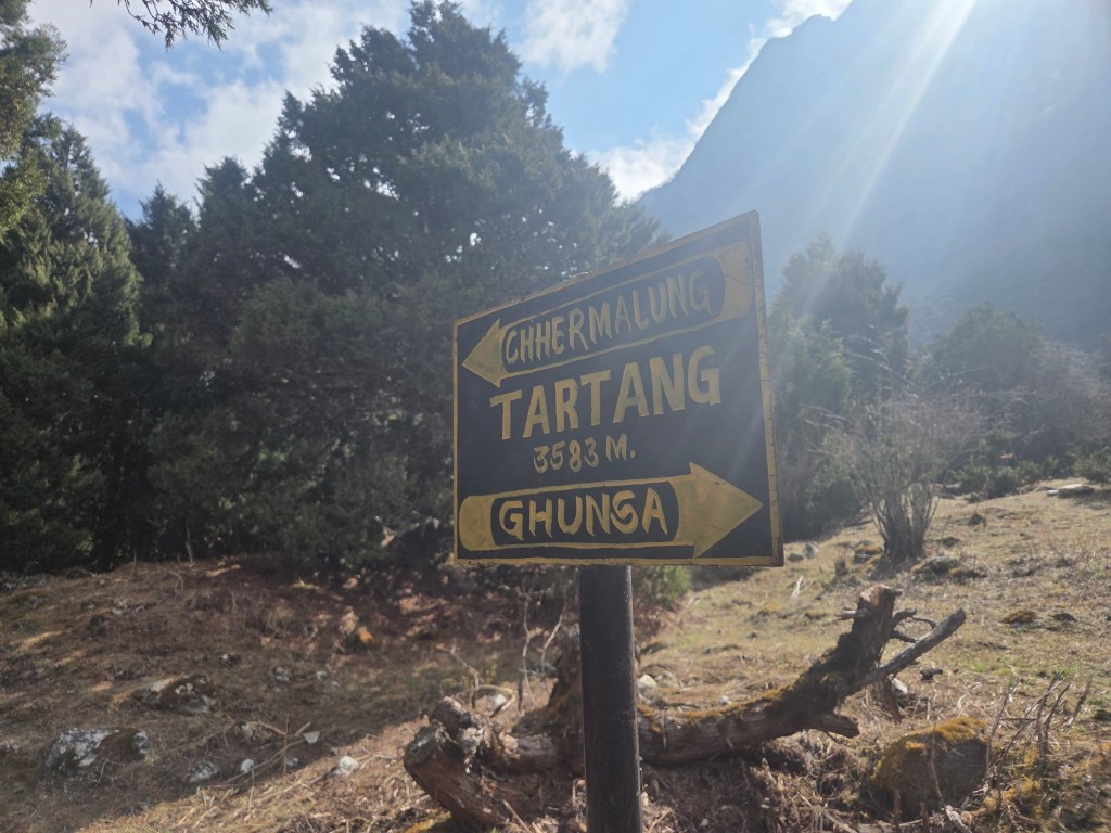
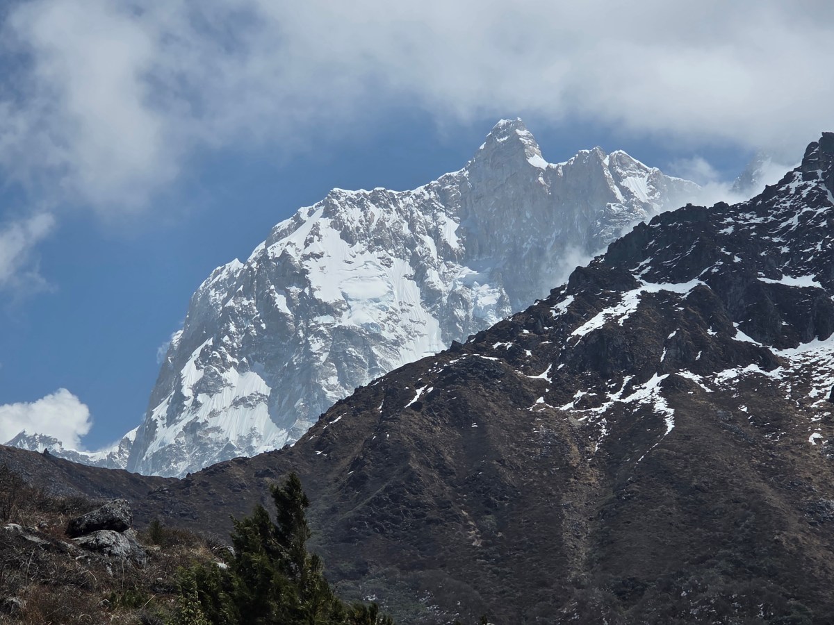
Tartang (3583 m). By and large, the trail was flat. Ocassionally, it was interspersed with minor landslides which we crossed cautiously. So far, we've been seeing traces of snow along the upper reaches of the surrounding hills. But they can't be classified as snow peaks as the snow cover they had, was only seasonal. However, for sometime, a body of perpetual snow started appearing beyond the dark hills. Dilal told, it was Mt Nyukla. Its structure didn't look extraordinary but the first view of a snow peak brings its own excitement.
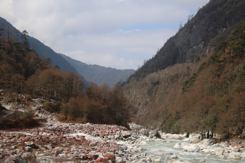
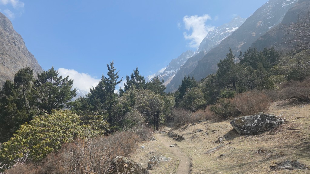
Moreover, the colorful forests that filled the lower slopes, the blue sky and the overall ambience of the place was enhanced by the presence of the mountain. The trail gradually moved out of the forests to enter the valley floor. The Ghunsa river flowed along the remote corner. A path of boulders led to its bank. The stream flowed slowly on a flat bed. Unlike on a previous day, we didn't have to tip toe over the boulders. That told us, we've gained altitude to catchup with the level of the Ghunsa river. Sometime was spent on photography. The track beyond this point went along flat ground for some distance to re-enter the forests. The boulders beside the river had a crimson touch on their surface. We saw similar colors in the boulders along the trail towards Dobato in Makalu base camp route.
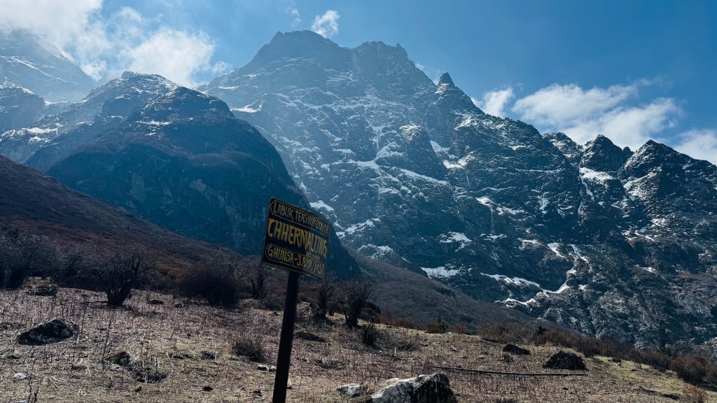
After spending sometime with the river, we resumed our walk. The trail went amidst boulders and after a point, it gradually moved up to enter the forests. With the canopy above us, walking was comfortable. We shot many videos along the way to capture the wonderful trail. Walking within forests makes you feel secure. Though we realized that it was getting less dense with altitude and we frequently encountered broken trails where landslides tore away significant sections of the soil. There were sections where one could barely put two feet side by side. By and large, such sections were small. We reached another open section with only a single hut. No one was around. There was a sign-board that read "Chermalung" (3740 m). I wondered what was the purpose of these single huts in these remote places.
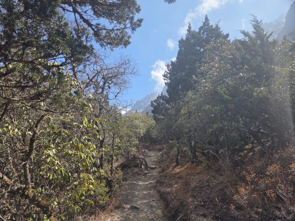
The sky was still clear and we could see distant hills with their slopes lined with snow. On one side the snow peak of Nyuk La still towered above the hills. We kept moving along the trail, which was still gradual. From what we learnt from Dilal, the initial half of the trail is gradual. Things change in the latter half after a place called Labuk. That's when it starts moving up. That's also the phase where one goes beyond the tree line when the true alpine landscape starts. It's the end of the greenery and rocks start dominating.
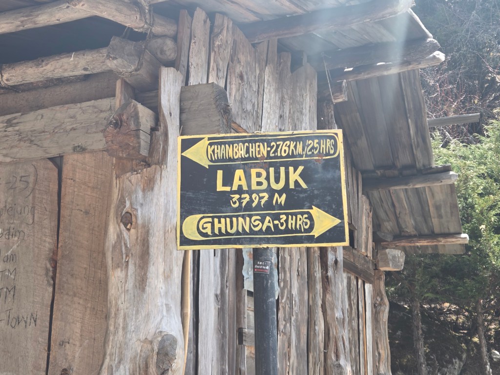
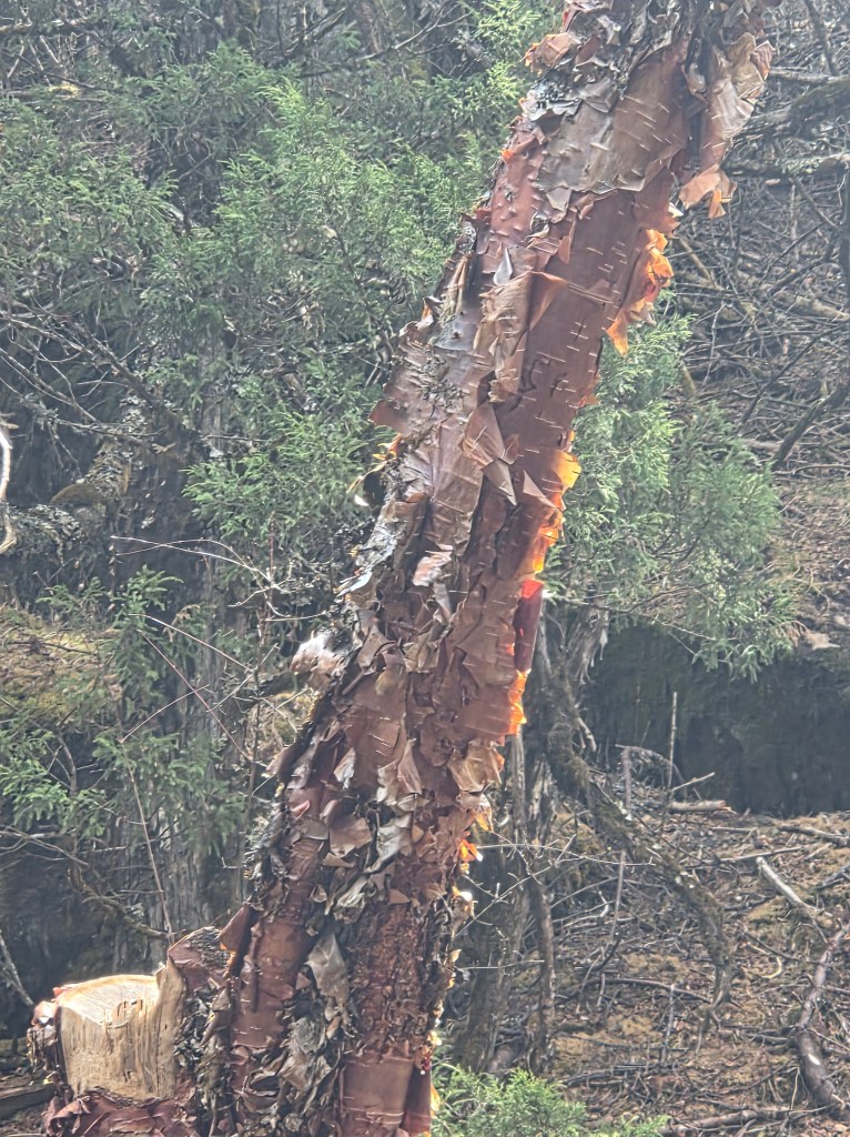
We reached Labuk, the midway of today's trail. Labuk has a single tea house. The place lay beside the streaming Ghunsa river. It lies on the border where greenery starts depleting. Standing in front of the tea house, we could see a large part of the trail which we just came through. It was covered with forests. Turning around, when we looked towards north, the color of green depleted gradually, giving way to a barren track that kept moving up and disappeared behind a bend. After having tea at Labuk, we resumed our walk, which started to convert into a hike. The density of the trees started reducing. We saw many birch trees. One can identify them by their trunks. Reddish brown skins peeled off their trunks. These skins were dried and used for writing. Many of the Indian epics were written on birch skins before paper came into being.
En-route Khambachhen
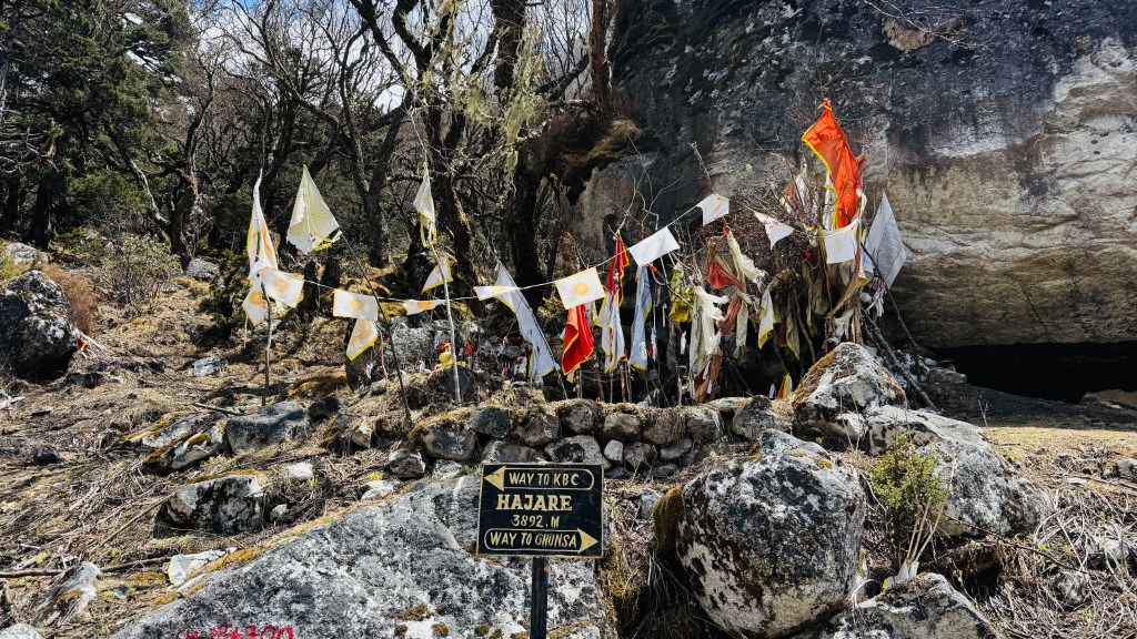
After sometime, we reached a place that was cleared out of the surrounding forests. A set of stones were stacked up with prayer flags hanging around them. We were told that people from Ghunsa and villages around it, use this as a place of worship during a specific time of the year. It was named "Hazare". Some of the stones were smeared with Vermillion.
After Hazare, the track moved up in the form of staircases made of stones. The steps were gradual and long to start with. Prayer flags were placed at regular intervals along the track. Gradually, the length of the steps shortened and their numbers increased. As we climbed the staircases, tree cover vanished. The trail moved up through multiple switchbacks. There were poles planted at regular intervals. Casting a look on one side, the entire slope was made of loosely stacked boulders. On the other side, a stream of boulders went all the way down to the banks of the Ghunsa river. For the first time in the day, our knees were put to some stress as the staircases gained steepness. The sky was still clear but the snow peaks hid behind the hills. The trail moved in some pattern. There were stretches of it moving up to a point where there was a pole by its side. After a switch in direction, another stretch followed till the next pole and thus it continued.

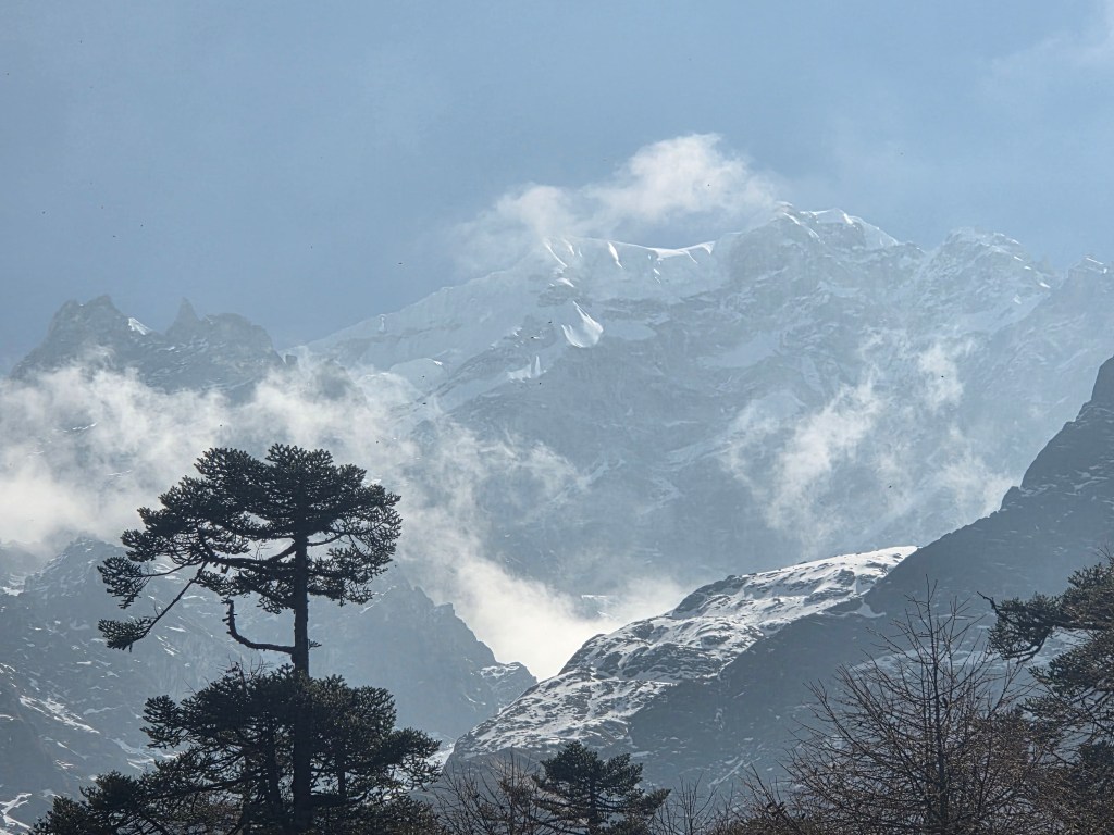
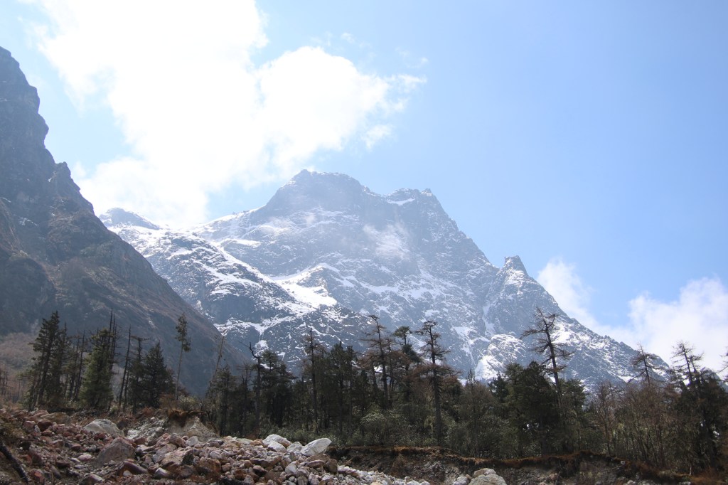
The poles served as small milestones and we moved from one pole to the next till we reached a point where there was a sign-board. "Jannu viewpoint- Phaktanglung". Dilal pointed his finger up towards our right. Moving our heads in that direction led to our first surprise. Mt Jannu presented itself in a blazing display of silver. Bright sunlight reflected from its body of snow. A clear outline of its ridge that resembles the head of a sleeping human. One could correlate the outline of the forehead, nose and even closed lips. It was only half of it that was visible beyond the hills but that didn't diminish the aura. A few plumes of light clouds rose from the mountain.
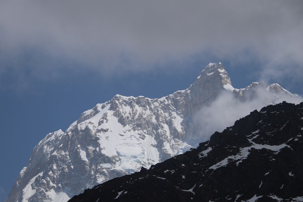
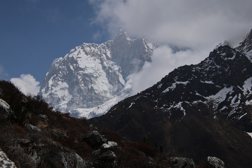
That was an indication that it's ridge was been dashed by strong winds. It also meant that this marvelous display was likely to be shielded by the clouds within a short time. After getting over our initial awe, shutters kept rolling. Satisfaction never comes regardless of the number of pictures taken. Mt Jannu (or Kumbhakarna, as it is called in Nepal) forms the head of the famous formation of "The sleeping Budhha" - a combination of many mountain peaks that resembles a full figure of a sleeping human body. There are other mountains which are part of this formation with Mt Kangchenjunga forming the highest point (the tip of the belly). None of the other members of this formation is visible from this point. In fact, the formation is not visible from anywhere on this trail. This says that it is more of an illusion that is visible from distant places. These mountains are situated quite apart from each other (some of them are on the Singalila ridge, that forms the border between Nepal and the Indian state of Sikkim). Hence, the closer one gets to them, wider they drift and the formation starts disappearing. Our speed of walking slowed down as Mt Jannu kept us captivated. As we moved along, it appeared in different angles and every view appeared better than the one before.

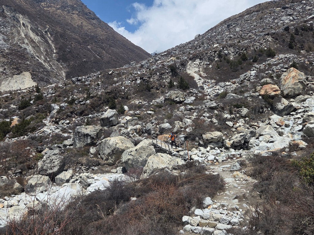
We crossed a wooden bridge. A stream came down from above, flowed beneath the bridge to move below in leaps and bounds over the rocks to meet the Ghunsa river down below. After crossing a few switchbacks, we reached a bend. A breeze was blowing. On one side we could see the trail coming up through multiple switches to reach this point. It was a summary of the path crossed thus far. Turning to the other side, I saw the trail getting narrower and entering a big landslide zone. The broken track moved through brittle rocks, loose pebbles and unstable ground. After a quick look, we entered the trail and kept moving as fast as we could. My feet skid at a few places as treacherous pebbles under my feet conspired to dislodge me. A careful but brisk walk took us beyond the landslide and I was relieved after regaining stable ground. The trail from hereon was gradual and it moved down slightly. We could see a suspension bridge across the wide river gorge.
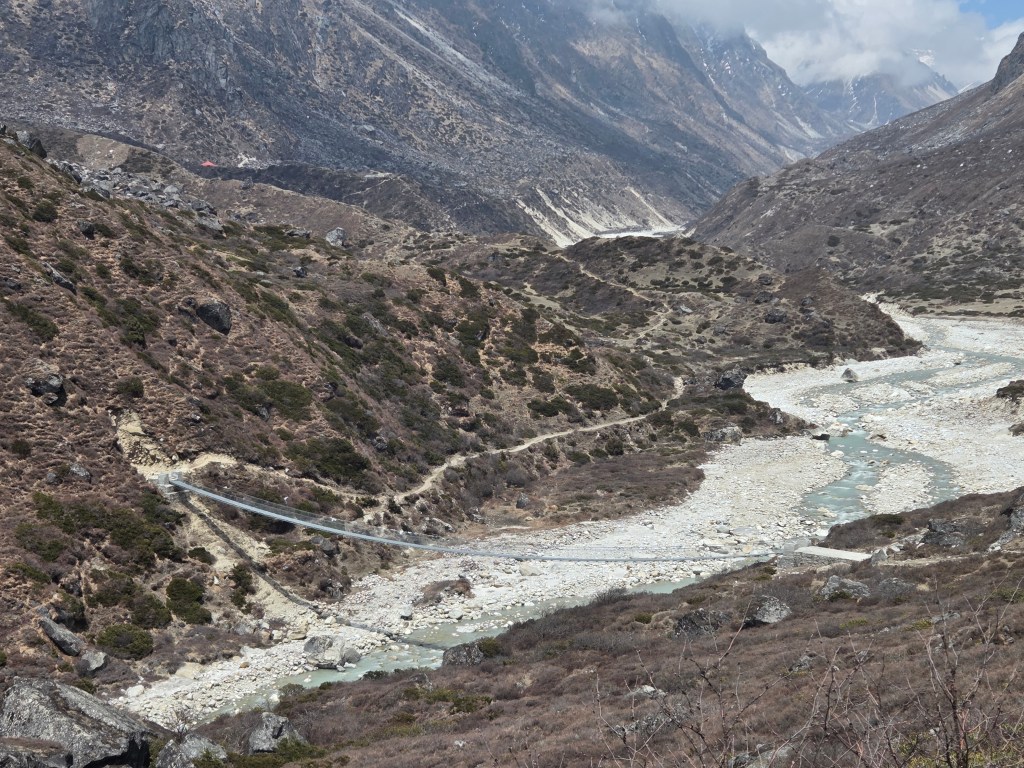
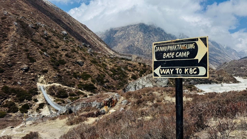
Once we reached the base of the bridge, the straight track moved towards the Phaktanglung base camp of Mt Jannu. That would be our destination for the next day as part of an acclimatization hike. For now we turned left and started to cross the bridge. Winds now blew thick and fast. The bridge oscilated with every step that we placed on it. The place where it joined the other bank, the trail resumed from there. It was adulating and moved up and down till we reached another bend. A stream came down the valley from our left to meet the stream of the Ghunsa river. Ghunsa was now reduced to a few small streams that came down another valley from the north. That was the direction towards Lhonak and further on, to Pangpema (the north base camp). As we moved towards left, the lodges of Khambachhen became visible. They still appeared as a set of matchboxes, indicating that we still had some distance to cover.
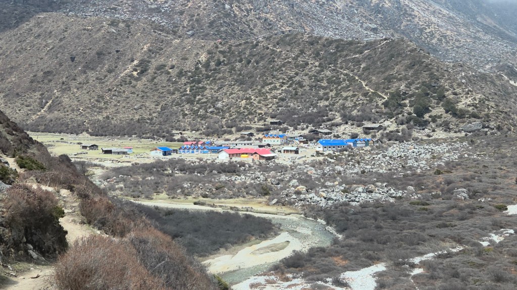
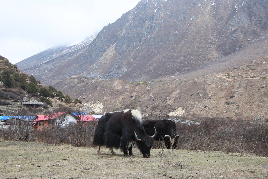
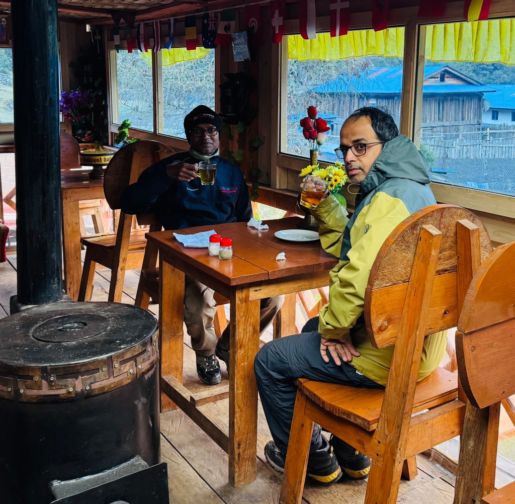
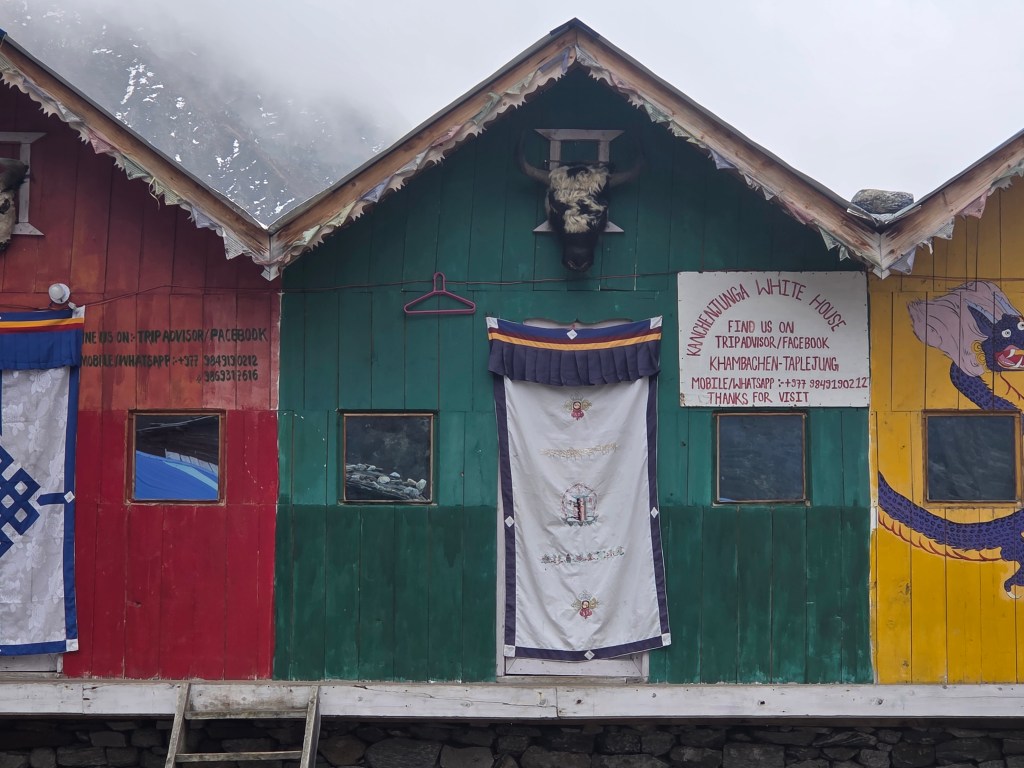
As we moved downwards, the valley opened up. Yaks grazed freely. We crossed over a few narrow streams and entered the compound which was home for a few tea houses. On our way, we saw many sign boards, one of them was of Shingi Namjong (the same owner who owned the fabulous lodge at Gyabla). We finally entered the "Kanchenjunga White House". It was owned by Nupu Sherpa. It turned out later that the lodge "Dzonga Family House" at Ghunsa was owned by Nupu's elder brother. The place had facilities for charging as well as WiFi, but both were paid facilities. WiFi was to be charged at 1000 NPR per day for a single device. Since we were to stay for a couple of days, Dhananjoy negotiated a good deal with Didi (Nupu 's wife). We were to pay 1500 NPR each for two mobile phones and our charging would be free. It took a lot of cajoling from Dhananjoy to nudge Didi and she finally relented. To her credit, she was jovial and so was Nupu. I referred to the YouTube video which introduced me to Nupu for the first time. It was made by TraverArt. He instantly recognized it. After settling in our rooms, we went for our dal bhat lunch. We reached Khambachhen in good time. It left the entire afternoon at our disposal. Clouds started hovering in, but sunlight still retained some power. A widespread lawn had some benches spread out where one could relax under the sun. Dhananjoy, as usual, went to visit the local monastery, which was some distance above our place of stay. He tried enticing me but I preferred relaxing under the sun on the laid out benches. It was too difficult to resist the temptations.
As sun started to get covered by the clouds, the winds started blowing. I moved into the dining space, which was filled with members from other groups. Dhananjoy came back disappointed. The monastery was closed and so was the snow leopard research center. As evening wore on, the dining place livened up. We took out some snacks from our reserves as tea got served. There was a French traveler who sat lonely, dressed up in red attire. He was totally focused on his devices and accessories. Once they were sorted, he delved into a book. Pizzas formed our dinner. They were amazing in their tastes. Sitting in the middle of nowhere, surrounded by mountains, enjoying a dish prepared as immaculately as done in a proper restaurant, added to the charm. After distilling the speach from Dilal, we figured out our trail for the morrow. We would need to start at 6.30 AM. It should take us around 4 hours to hike to the Jannu base camp and about 2.5 hours to get down. We should be reaching back by the lunch time. After filling our bottles with warm water, we headed to our room with our headlamps on. Extra blankets were laid out as per our request. We slept over one of these and sandwiched ourselves within another. With that arrangement, sleep overcame us in no time. Our first sleep above the tree line was at 4145 m.

2 thoughts on “Kangchenjunga north base camp – Khambachhen”