6th April, 2024
When the alarm went off at 4.30 AM, it didn’t cause any excitement, rather it spelt the inevitable. It was the day of our departure from the beautiful city of Pokhara of this beautiful landlocked Himalayan country of Nepal. Today was going to be the last time (at least on this occasion) when we’d have a glimpse of Fishtail beyond the green outline of the hills of the town. I rubbed my eyes & made my way towards the washroom in tiring steps. Dhananjoy was still wrapped in his blanket, but was awake. After the morning duties I went about packing my 70l bag, but this time nothing was to be placed in a backpack. Every item had to find a place in the main bag, even the walking pole because we were about to board a vehicle that was to take us to the plains en-route Sonauli border & finally, out of Nepal to the hot & dusty city of Gorakhpur. From there on, a train would take us to our work places. While I was tackling the bag, Niladri knocked at the door. I went up to his room to bid goodbye to his daughter Mishti & his cousin Sagar (who were welcome new additions to this trip), who were also my walking companions for most of the trail. About an hour later, they, along with a few other members, would be heading for the bus stand to board a bus for Birganj, another border town, to enter India & board a train from Raxaul for Kolkata.
As we headed downstairs, the group assembled for one final time to have the complimentary breakfast of bread toast, boiled eggs, tea/coffee & fruits – the same menu was on the offering exactly a week ago, when we were about to embark for the Australian camp, the starting point of this trip. After breakfast, we filled our bottles and headed towards the Scorpio waiting at the gate. Seven of us bid goodbye to the rest of the group as the vehicle meandered out of the 8th street, following the lakeside for one last time to hit the serpentine roads heading out of Pokhara. As the vehicle made its way through the roads, I recalled our journey on our way up the same route. As if the scenes were being played out in reverse order. We stopped at the same tea house on the banks of the Kali Gandaki river to have some tea, where we had our dinner on our way up. Today we could see the river valley in clear daylight, while we could feel its presence only by the sound of flowing water in the darkness of night while having dinner, a week ago. It is the same Kali Gandaki that comes down from the distant town of Muktinath in the remote & rugged district of Mustang.

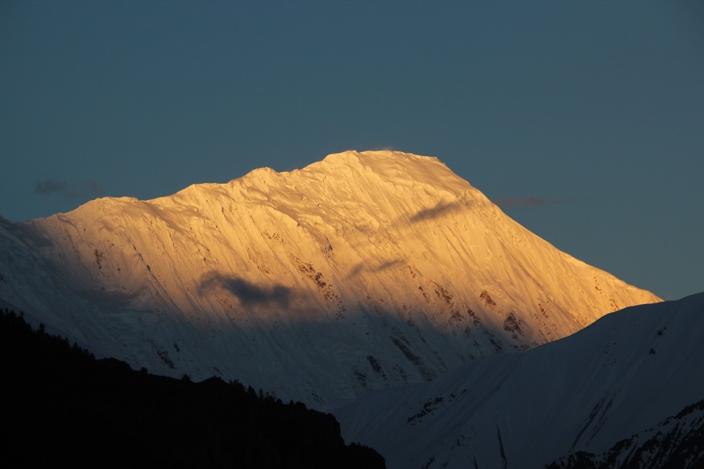
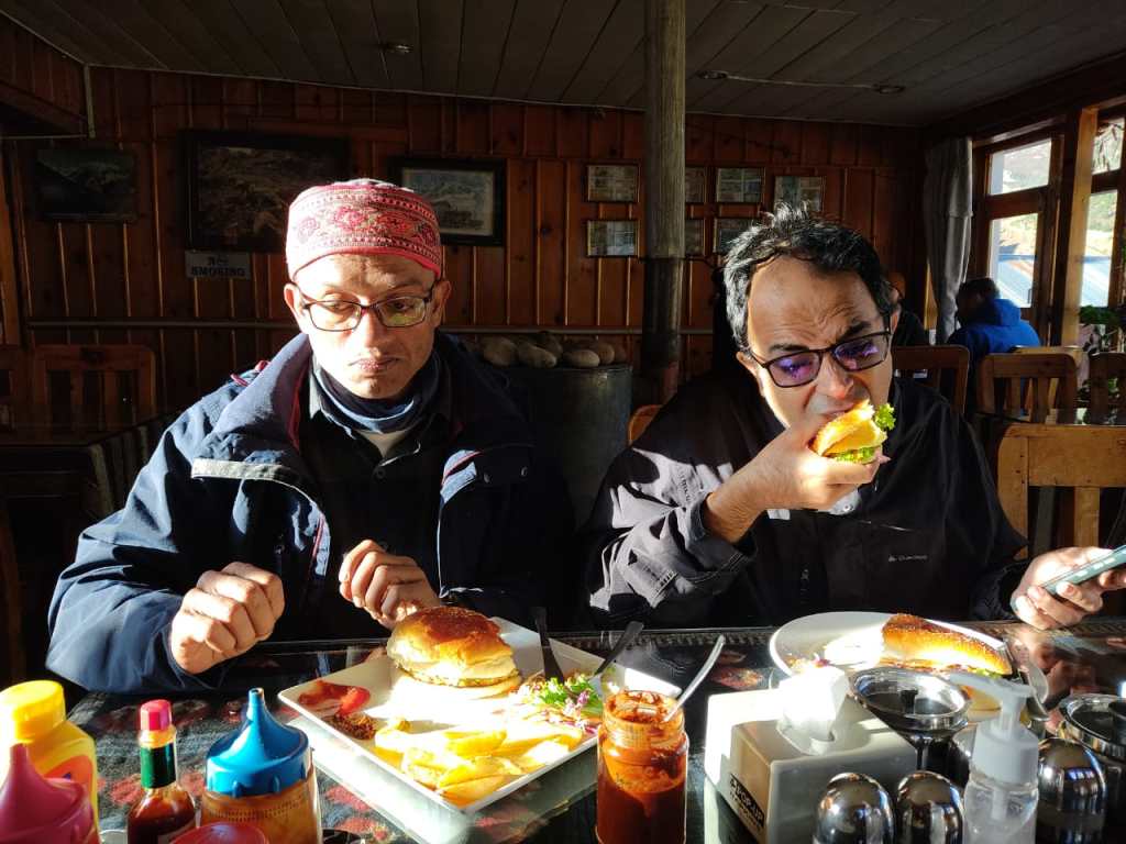
The weather was cool in these hills on our way up as it was dark, but now the heat of the mid day sun was telling on us or it could also be a lack of excitement of the upcoming trail & togetherness which was there when we were going up. Whatever may be the cause, we felt the heat & fatigue, causing some of us to dose off. I kept on thinking about the day before, which was our last night out at the lakeside area of Pokhara, its vibrant atmosphere, live music, nights at its pubs and the beers we gulped down reminiscing about our trip. The Fewa lake glittered with the reflection of the lights on its banks, the cool breeze coming off its surface and everything else that added to the romance. The evening appeared special to us probably because it was the last of this trip. It was my fourth time at the place and I hope it won’t be the last.
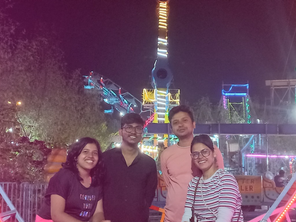
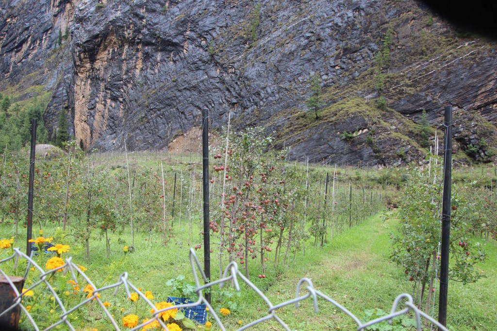
A significant part of Pokhara centers around its prime attraction, the Fewa lake. It is the second largest fresh water lake in Nepal (after Rara lake). Memories of it kept coming back to me. The boating ride in the lake in the morning before, was my third but it never fails to impress. There were many in our team who did it for the first time. Though the day was cloudy and the Annapurna family was firmly behind them, but the cool breeze kept the mood going. The serene atmosphere of the Tal Barahi temple in an island amidst the lake and the playful fishes that dotted its banks – all of these are familiar yet so fresh. The day went by in a flash with a significant time during the day being spent at the markets of Prithwi Chawk and Mahendrapul with a lot of our members spending their time purchasing warm wears and souvenirs for their beloveds. Finally, the mountain roads gave way to the highways in plains and the vehicle raced towards the Sonauli border. The ride ended at the border at the same place where it started a week ago.
29th March, 2024
The train Humsafar express entered Gorakhpur railway station right on time (much to my surprise, given it’s track record on earlier occasions). Four of us (myself, Geeta, Kunal and Dhananjoy) landed on the platform. The day was warm and our bags weighed heavy on our backs. Dhananjoy was already in touch with Projnesh (another member of our group), who was responsible to book a ride for all of us (that included Supriyo, Surovi and their son “Chotu”) for the Sonauli border, which should take around two and half hours to reach, but we’d also have to stop for lunch, which should add another hour to the travel.

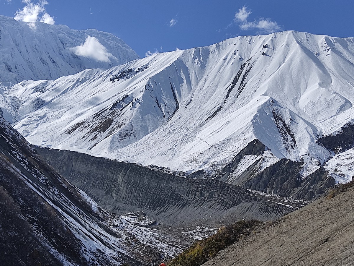
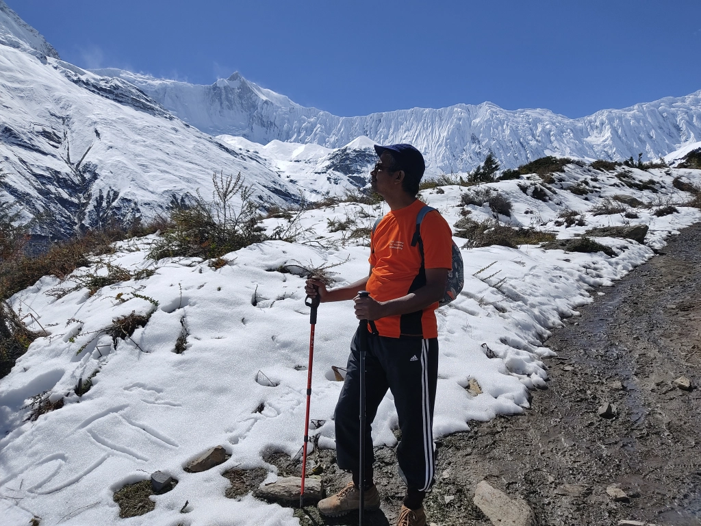
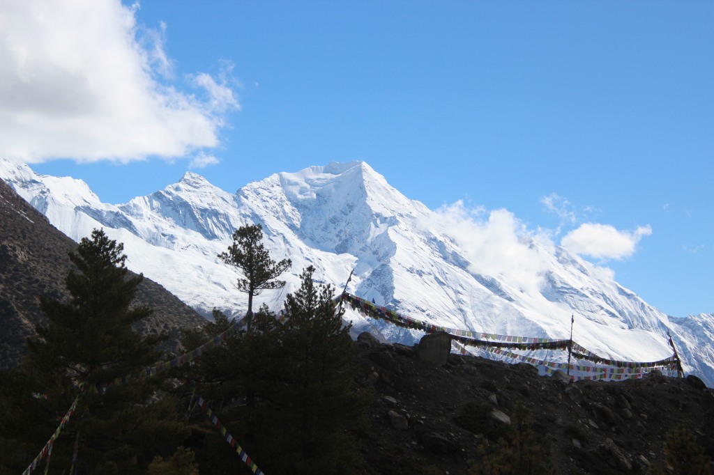
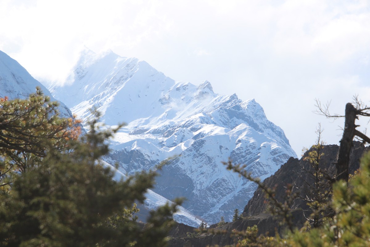
When we met them outside the railway station, it was sort of a reunion. Most of us were from the Mathematics department of Jadavpur University. I was meeting Supriyo and Surovi after almost 23 years (i.e. for the first time after exiting college). After riding for about an hour, we stopped for breakfast and resumed our ride towards Sonauli border. We reached there at about 1 PM. Our ride for Pokhara was already booked earlier. However, it took us sometime to exchange Indian currency to get the Nepalese equivalent. Time was slipping away like sand and some of us were getting restless because the plan was to reach Pokhara as early as possible and spend sometime scouting for crampons and snow gaiters for some of the team members (the feedback was to expect snow at the higher reaches of Mardi viewpoint and Mardi basecamp). So yes, we were off for Mardi Himal trekking in the famed Annapurna region of the Himalayas of central Nepal. The idea was also to spend some quality time at the famous lakeside area of Pokhara.

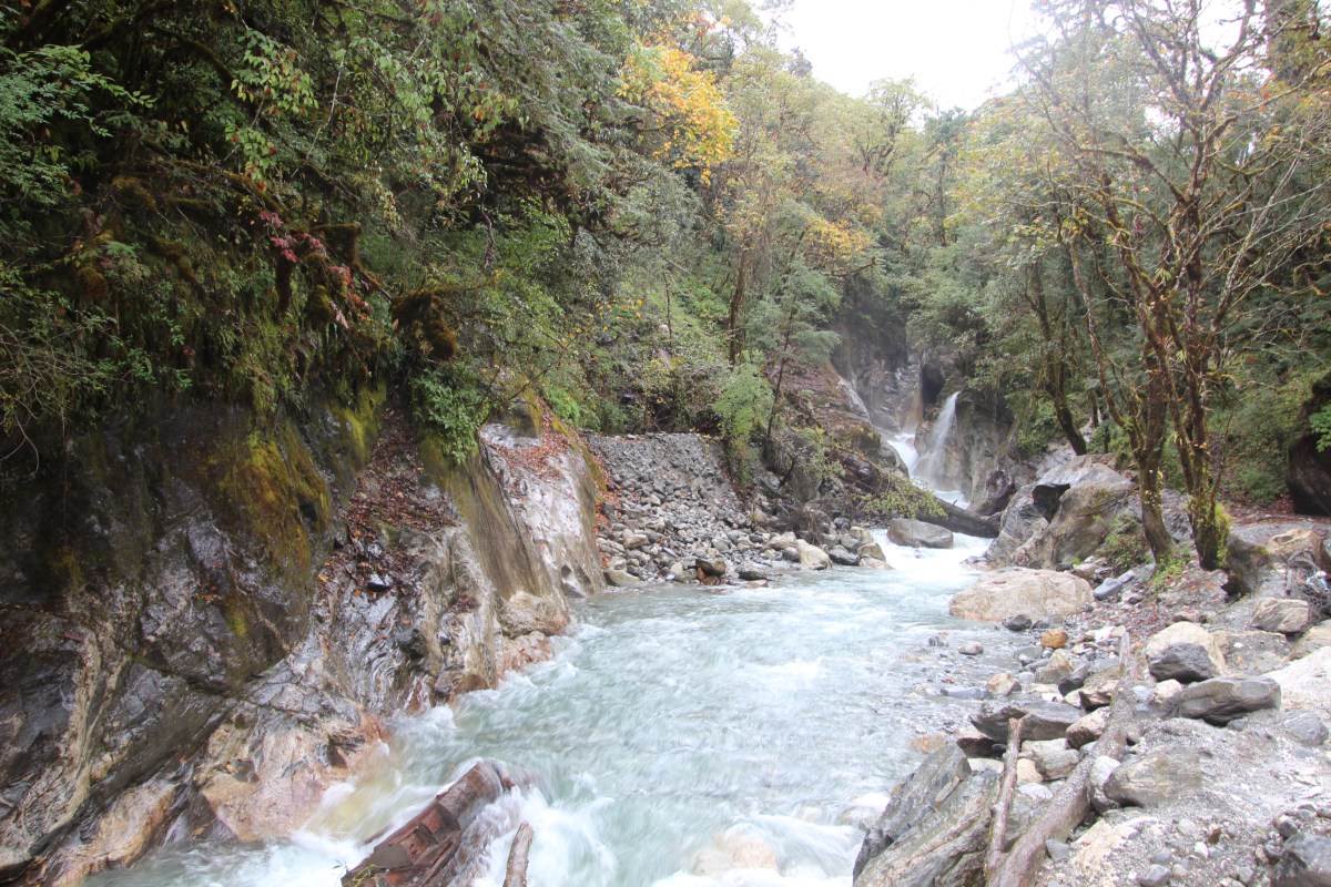
However, it turned out that the vehicle was driven by electric battery and it needed charging. Hence, right after starting from Sonauli, it had to spend about 30 minutes to recharge before it could resume its journey. It was already 3 PM by then. But we had more troubles in store. Being driven by electric power, it imposed constraints on its acceleration and to top it off, one of its tires burst which brought it to an unexpected halt. While that gave us sometime to venture outside the vehicle to inhale some fresh mountain air, but the delay was piling on. By the time we resumed our journey, it was already dark and we weren’t even half way through. After covering about half of our journey, we halted to have our lunch, which had already turned into dinner. The place was by the side of Kali Gandaki river.

The rest of our group containing five members were coming from Birganj, but we couldn’t get any information from them. While having dinner, Dhananjoy gave some feedback to the driver, which resulted in some acceleration. By the time we reached Pokhara, it was already 10.40 PM. We could see Niladri and others (who came from Birganj), had already reached the slated hotel. We checked into our allotted rooms and got busy with splitting our luggage into two sets – one to keep at Pokhara and the other, to take along with the trek. We took the opportunity to bathe (as we weren’t sure of getting that facility up above, on the trail). Our team of guides and porters also met with us, but we couldn’t have a briefing session with them, given the late hours. Our guide was Kumar Gurung (we met him in one of our earlier treks to Manaslu circuit, way back in 2019). Though he was managing a different trekking group, but he struck a chord with us and for this trip, I personally requested Mr Tej Bahadur Gurung (our trip operator from Nepal Alternative Treks) to have Kumar as our guide. The shopping for trekking gears also had to be postponed for the morrow. That would add to the delay in the start, but thankfully, the trail wasn’t long. Tiredness took the better of us and we gave in and headed to the beds with the hope of a clear morning for the next day.