
9th October, 2022
The alarm went off at 4 AM in the morning & I started with the morning duties. That included shaving & bathing (probably for the last time till we reach Pokhara after completing the circuit). I took ample time for both the activities, given that warm water was available at our disposal. After that, I woke up Dhananjoy (this was a pattern that’d repeat throughout the trip). After waking up, he takes about half an hour for activities like exercise & meditation. As we got ourselves prepared, the day broke gradually. The drizzle stopped & the sun made its appearance. Weather definitely has an impact on human minds, especially on trips like this, where it holds all the aces. We packed our bags & backpacks by segregating necessary items. Our guide Brian came along. We were meeting him physically for the first time & he seemed to be a jovial person.
A quick enquiry at the local jeep stand revealed that jeeps have started plying on the route till Taal. I advised Brian to leverage that (instead of walking from Besisahar). That should save us a day. He wasn’t keen to change the itinerary, but we insisted. Finally, I had to call up Tej Gurung to convince. According to him, the road was still risky for vehicular traffic, but he left it to us to take the risk. Despite his caution, we stuck with the plan to take a jeep ride till Taal. Brian arranged for a jeep, but went to get more cash from local ATM. In the meantime, we had our breakfast with noodles & black tea. As we were about to leave, the hotel owner asked for breakfast bill payment. That was contrary to the clauses of online booking (which claimed to include breakfast in the charges). We called up customer care & after a lot of deliberation, we had to pay for food. It didn’t go down well with us but we didn’t want to waste more time & boarded the vehicle.
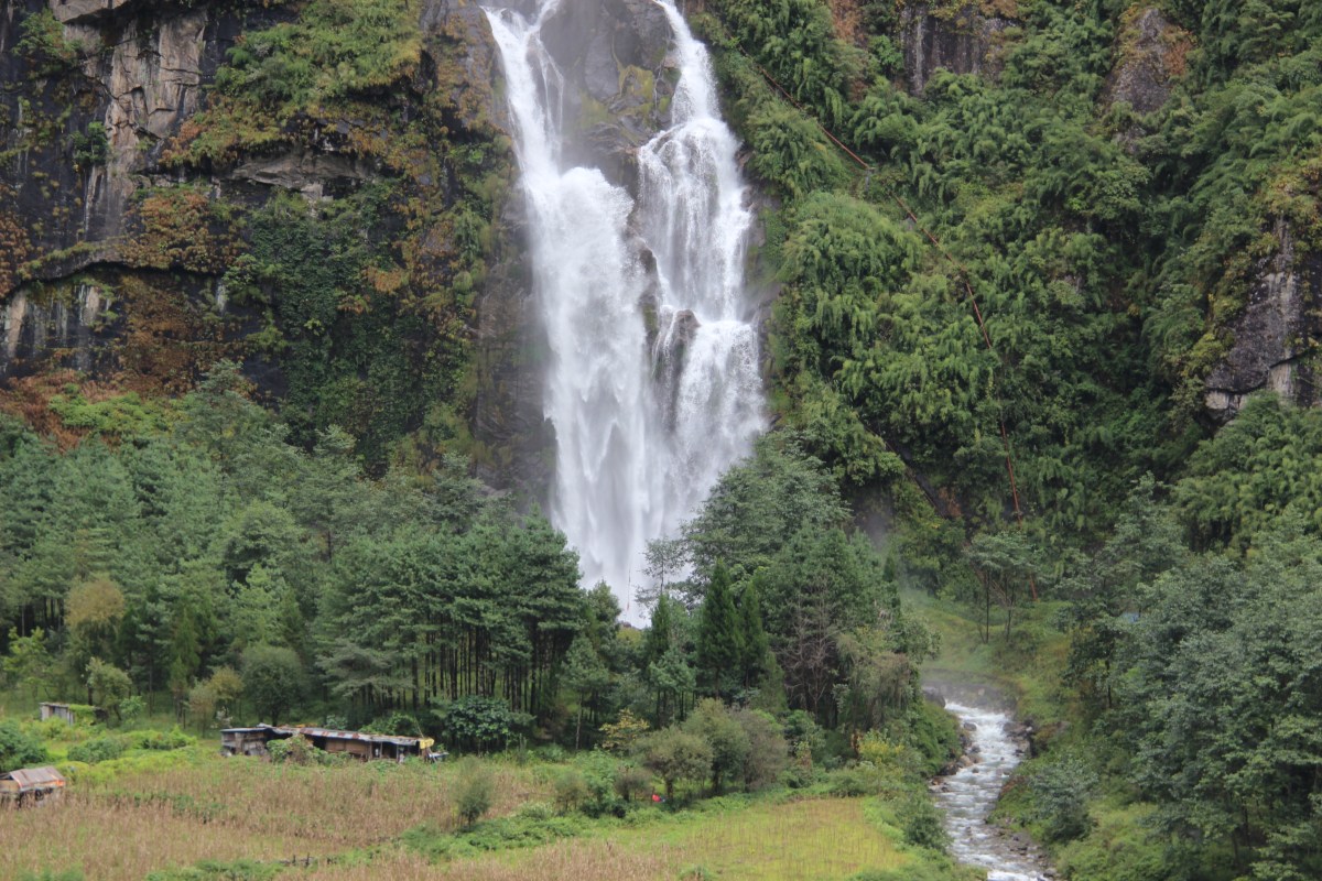
The vehicle moved ahead out of the main town area & hit the road towards Dharapani (this road goes straight up to Manang). The road wasn’t new to us. We came by this road to Besisahar from Dharapani on our way down from the Manaslu circuit trek, back in the year 2019. Dharapani is an important town in this area. It’s the place where two different trekking routes converge (the Manaslu & Annapurna circuits). As soon as we moved out of Besisahar, paved roads disappeared. This was we expected. The road from thereon right up to Manang was rocky & only four wheel drive vehicles can ply. Though the sun was out, we could see the damage that was inflicted on the road by the recent showers in last few days. It was broken at many places & the driver had a tough time negotiating it. The recent rains gave birth to many new waterfalls, many of which flowed over the road with considerable force. One can’t judge the underlying terrain below the flowing current. At many places, the dumps of boulders heaped on the road by landslides seemed unsurmountable by a vehicle. The driver used a combination of accelerator & hand brake to crossover these sections. The vehicle tossed around like a pendulum, precariously close to the steep drops on the other side. A quick look on these sections took our vision straight down the deep gorge where the Marshyang di river roared down reacting furiously towards the resistance offered by the rocks on its bed. It fumed & foamed with anger. We heard that this river has its source in the glaciers around the Thorong la. It’d keep company all our way through to that mountain pass. After crossing it over, when we’d descend to the Muktinath valley, Kali Gandaki would join us on our way down. We were still going through areas that had enough forest cover and were treated with enough greenery. That told us we were still going through the sub tropical forests and the Annapurna rain shadow area was still far beyond. As the jeep continued with its topsy turvy ride, we went through the bends and turns. On the other side of the river, a parallel track ran through the mountains and we could see distant villages and houses. That was the old trail for Annapurna circuit and some trekkers who walk all the way from Besisahar, use that route. We were also supposed to take it, if we hadn’t boarded the jeep. We could see Bahundanda on that side (that’d have been our first halt). Clouds started closing in as the day bore on. After plying for about four hours, we halted at a roadside tea house at Chamche for lunch. The tea house was located on the banks of the Marshyang di river and just beyond the river, on the other side, a huge waterfall roared down the slopes into the river gorge. It was so close, water droplets filled the air all around, making the atmosphere moist.
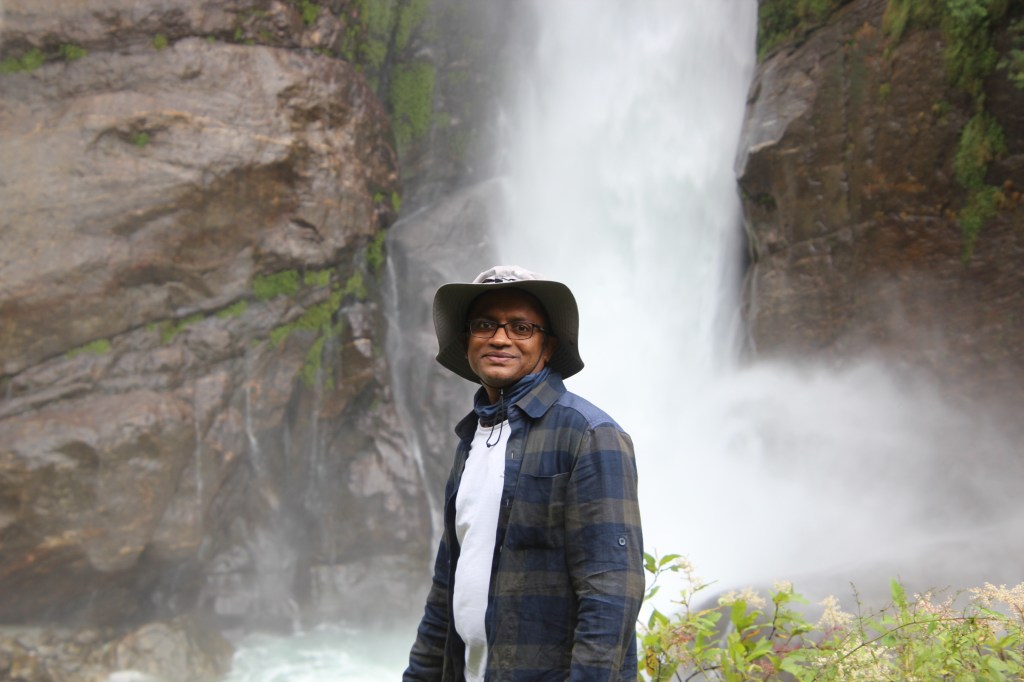
The halt gave us some respite from the tough jeep ride and we ordered “Dal bhat” for all of us. As lunch was being prepared, we descended the slopes to get as close as possible to the waterfall to get a closer glimpse of it. As we moved down, the roar increased and we got sprayed with droplets. A look at the sky revealed that rains were about to unleash any moment. After lunch, we had to reach Taal, beyond which there was at least two-three hours of walk before Dharapani. Our guide assured us that slight drizzle was the max we could expect and raincoats should suffice. Getting drenched is the last thing you want as clothes were limited and keeping them dry in moist mountain weather always poses a challenge. The meal was delicious with rice, lentils, vegetables & pickles. Green and hot raw chilies added to the delicacy. After lunch, jeep ride resumed and we reached Taal in about an hour.
The surroundings were covered with lush green forests with villages nestled within them.
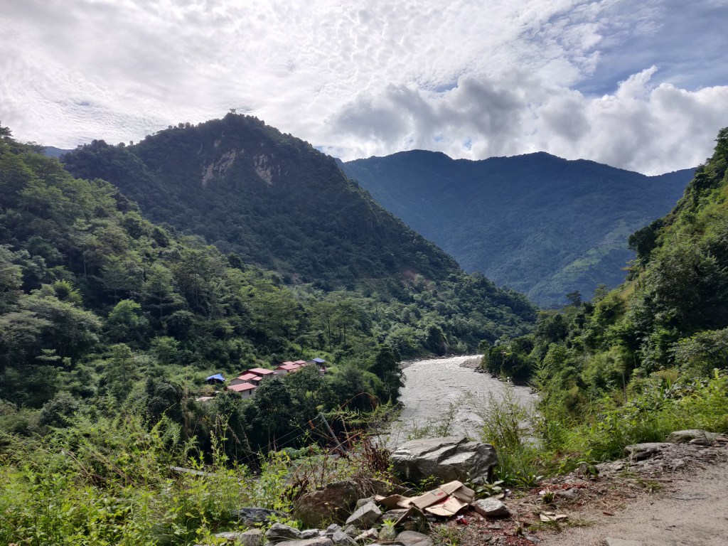
The place where the jeep stopped was called Taal Danda (Danda in Nepali means a hill top). Looking at the other side, we saw another settlement, low in the valley, on the other bank of the Marshyang di. That was Taal. The village of Taal appeared to be very cosy, nestled amongst the high mountain walls. Our guide revealed, a few years back, a sudden burst of flood in the Marshayng di, caused the entire place to be cordoned off by the high flowing water currents and many trekkers were stranded for many days. They had to be evacuated by helicopter. With that context, when we looked at it again, the river seemed to flow dangerously close and such flash floods are quite common in these areas. Slightly higher precipitation (rains or snow) could very well result in swelling of the currents in these lower reaches wreaking havoc in no time. Waterfalls were abundant in the route and many of them have been recently created by the rains in last few days. We were relieved to be off the jeep. After disembarking, we strapped our backpacks, held our poles and started walking.


After a few bends, we were encountered with another waterfall, this time, on our side of the road and the currents flowed above the walking trail. There was no other option but to remove our shoes and enter the torrent barefoot. As we contemplated the move, my thoughts were around the torrent speed and how to negotiate it while crossing. I entered the water and immediately the primary problem to address was the biting cold. I was forced to pace up to get rid of the pain induced on my legs by the ice cold water. Relentless flow of water made the underlying rocks slippery and it was difficult get purchase on them. I somehow managed to reach the other side and rested on the roadside, sitting on a dry rock. As I waited on the other side, other members of our group crossed over. In this whole saga, our guide lost one of his slippers as the torrent carried it away down the slopes.
Just as I put on my shoes, the guide said there was another fall shortly down the way which would require us to repeat this activity again! Anyways, walking barefoot all along wasn’t feasible, so we continued and had to repeat the same sequence of events at the following waterfall, though this was less severe.

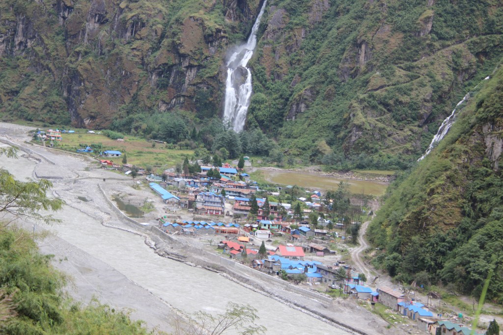
Beyond the falls, we came across two huge landslide areas where debris of rocks and mud blocked our way. A narrow way was etched out beside the main trail, marked by footsteps of the forbearers. It moved up the slopes but overhanging rocks hovered over our head and we had to bend our bodies to squeeze ourselves through the narrow passage. As we passed along, we saw JCBs at work to clear up the road. It gave an indication that jeeps shall soon start plying to Manang. In these remote areas, they can’t afford to keep roads blocked for long as people living in the remote areas get cutoff from basic needs for which they need to travel to towns like Besisahar in the lower areas. Small droplets started to fall as clouds made their move towards the valley. After crossing a few bends, we got to see the roofs of distant tea houses of Dharapani. As we moved ahead, they came nearer and more of the lodges became visible. Finally, we entered our destined lodge at about 4 PM in the afternoon. It took us about four hours to reach Dharapani from Taal. By the time we reached the lodge, a moderate drizzle started. We were allotted a three bed room with an attached toilet, a luxury in these areas. To his delight, Dhananjoy came to know that hot shower was available for free (i.e. included in the room charges). But there was a queue in front of the shower room. Despite waiting for considerable time, his turn never came and out of desperation, he settled for bathing in cold water in the attached toilet. I tried to dry my shoes and socks (thanks to the waterfall crossings on our route to Dharapani, they were soaked with water). Niladri and Dhananjoy took out tea bags and prepared tea (hot water was fetched from the dining place). This was a pattern to be repeated every morning and evening throughout the trip and it contributed to saving a lot of money (food gets costlier as one moves higher up on the slopes). The dining place was warm and bustling with many people (as is always the case in these tea houses). We gave our orders for dinner as well as breakfast for the next morning by 6 PM. We made Wi-Fi calls to our homes to inform about our safety to our family members. After dinner, we retreated to our rooms, sorted out clothing for the next day and subsided under the blankets. Sounds of water on the roofs indicated a moderate drizzle was on. We prayed for better weather for the morrow as we went to sleep. We were now, officially in the district of Manang and were sleeping at an altitude of 1860m. The next day’s destination was Chame. According to the guide, that would require about seven hours to reach. That raised a question in my mind. How come the initial plan (shared by Tej Gurung) was to reach Chame in a single day from Besisahar (a drive to Dharapani, followed by walk)? Was it even feasible (even if jeeps plied to Dharapani)? Anyways, such thoughts were anyways futile, now what we’ve already changed to plan B, thanks to the road closures. Not sure what weather had in store for us, but if forecasts were to be believed, improvements were not to be expected for another three days. We kept praying for not having to face heavy rains, even if that meant walking in a drizzle. We couldn’t afford further delays.

2 thoughts on “Around Annapurna – Dharapani”