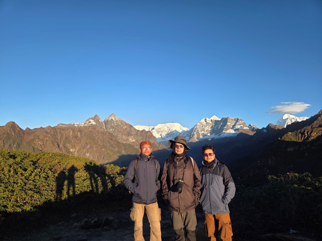
25th October
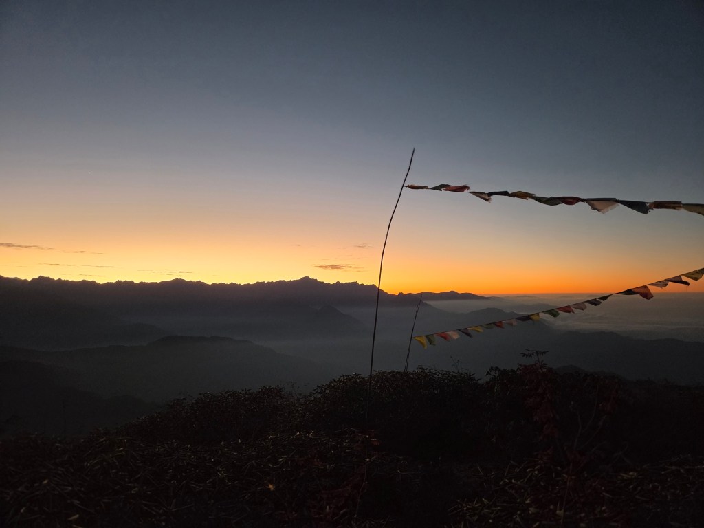
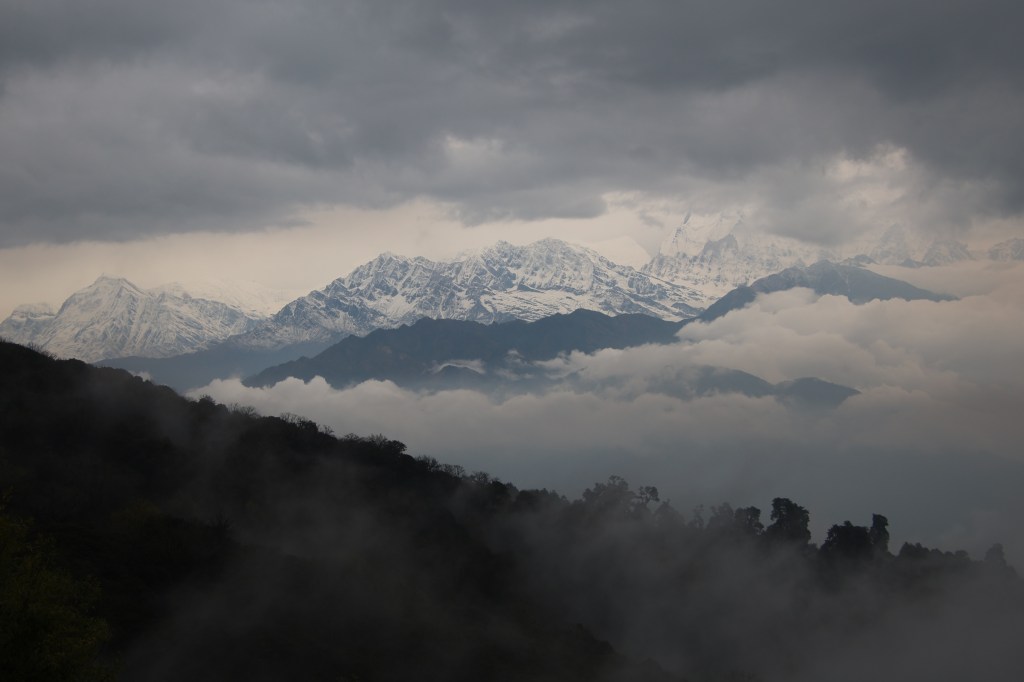
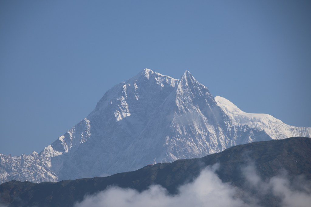
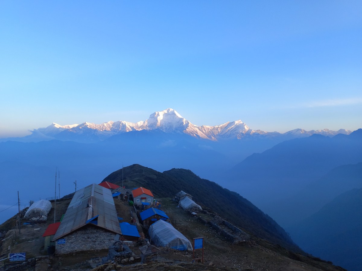
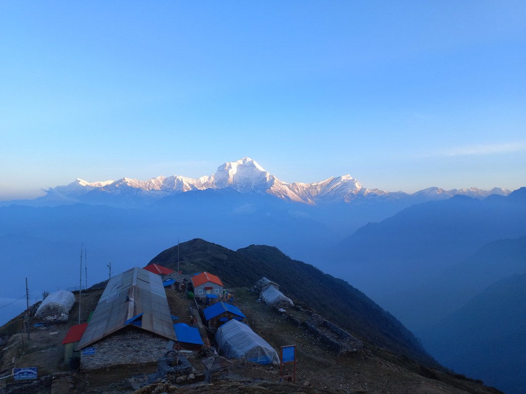
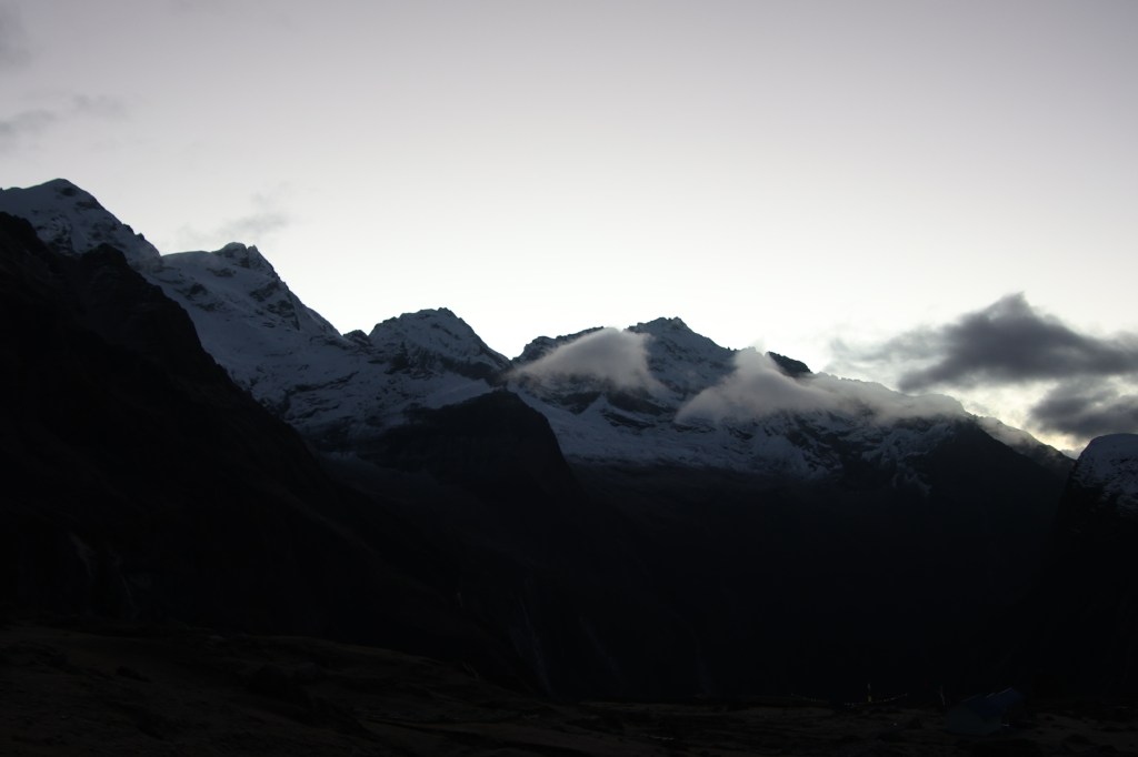
There were different reports about the expected amount of snow en-route base camp. So far the route has been devoid of snow. But on this last leg, it’d be surprising if Makalu didn’t throw up some challenge. After all its the fifth highest mountain in the world. I recalled the videos of the base camp. I have seen them multiple times over the years and hoped to reach there someday. Today would give us that opportunity. I yearned to reach that final little wooden bridge. It lay over the frozen stream of the Barun river. Beyond that, the lodges of the base camp welcomes the travelers. Unlike the Everest base camp, where one can’t get to see the summit, Makalu is visible from its base camp in full glory. It’s areal distance from the base camp is even lesser than that of Mt Annapurna from its southern base camp. I suspected that Langmale would offer a panoramic view of the peaks. Clouds deprived us yesterday. But I entered the lawn at the early hours of dawn. I could see the sky littered with stars. The dark silhouette of the surrounding mountains corroborated my understanding. Mt Makalu isn’t visible from here but others dominated the sky. There was a trail that gradually moved up from the lawn towards another set of rooms. The trail circumvented around them, went beyond and disappeared in the darkness. That’s the trail towards Makalu base camp. Despite enough warm wear the cold was biting. We kept our vigil on the dark edges of the surrounding peaks. We watched on as the drama of colors was about to play out.
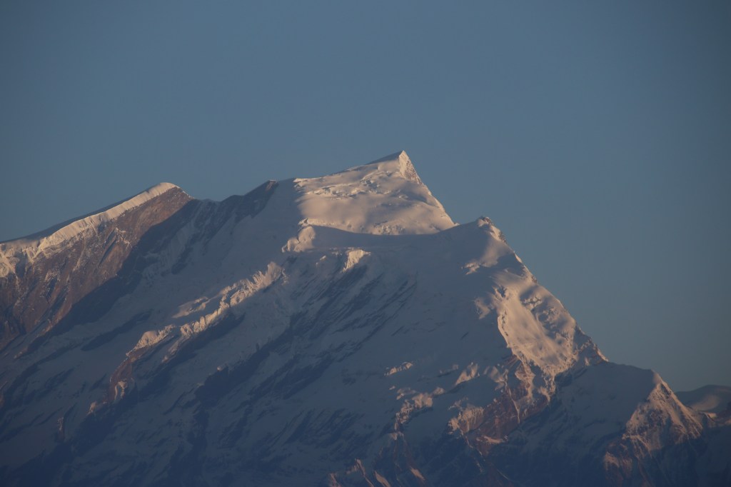
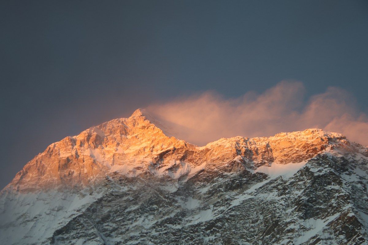
It started with a soft light gradually diluting the darkness. The silhouette became more prominent. Beyond the point where the trail to base camp disappeared into oblivion, rose Mt Chamlang dominating the horizon. Moving anticlockwise from there, there was Mt Nepo, Mt Sersong and other Himalayan peaks, still dark in their appearance. Winds dashed our faces but we persevered.

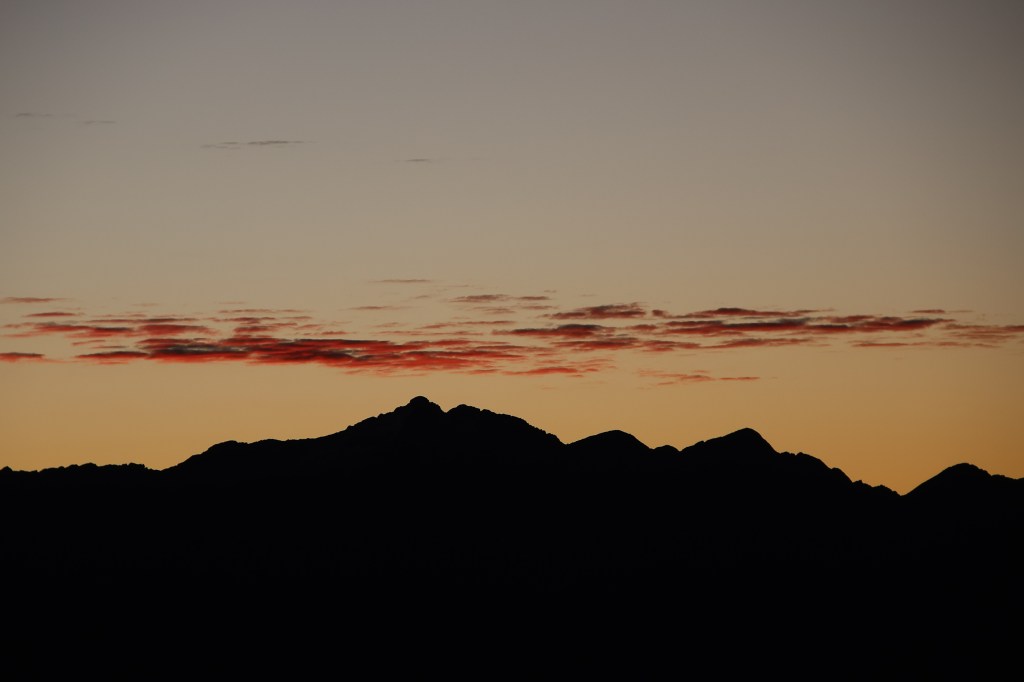
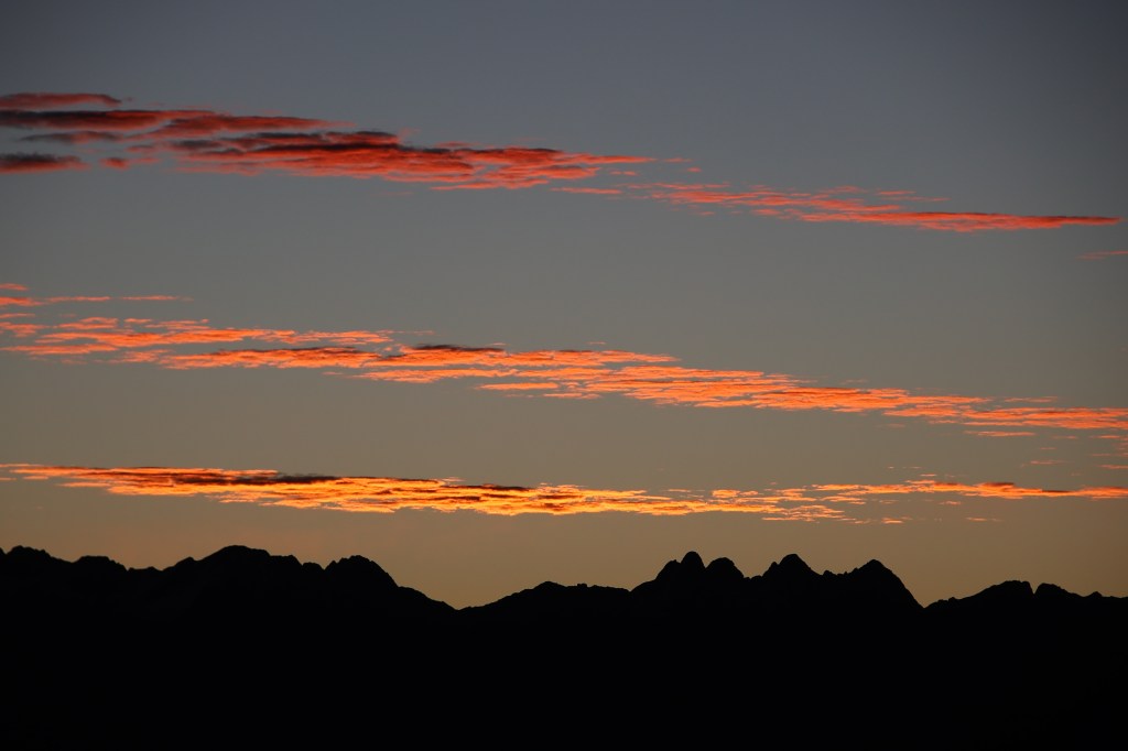
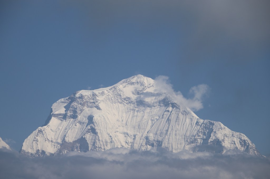
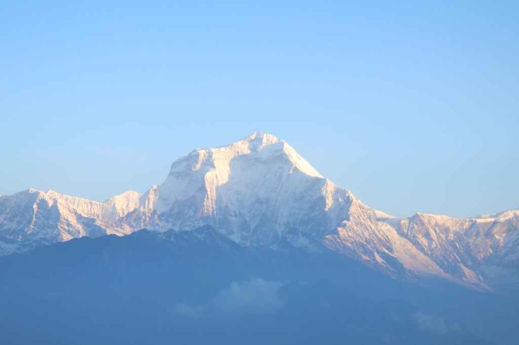
Mt Chamlang absorbed the first brush of gold. Mt Nepo wasn’t far behind either. Nature’s paintbrush worked wonders in the canvas of the mountains. Their slopes, glaciers and ice falls struck gold. The canvas changed colors by the minute. Gold gradually faded out giving way to a silver blaze. The mountains basked in their full morning glory amid clear skies. Small fluffy clouds floated along their edges. All of the mountain summits were wrapped in white scarves. These were plumes of snow particles sent out into the sky by gales of strong winds dashing at their summits.


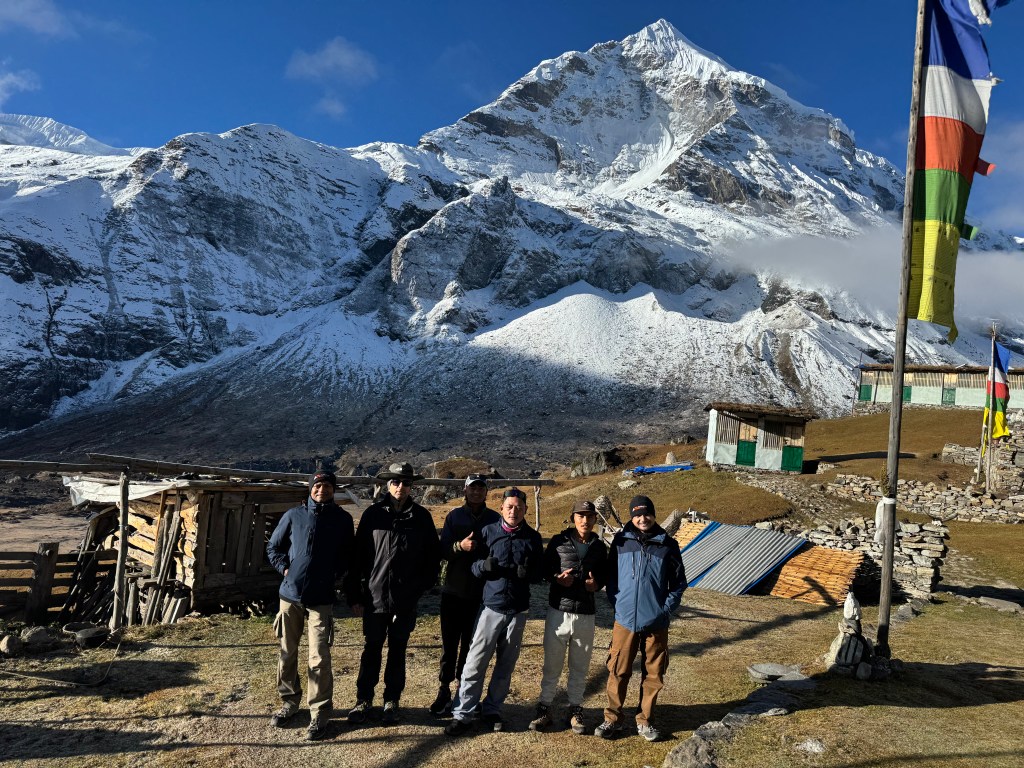
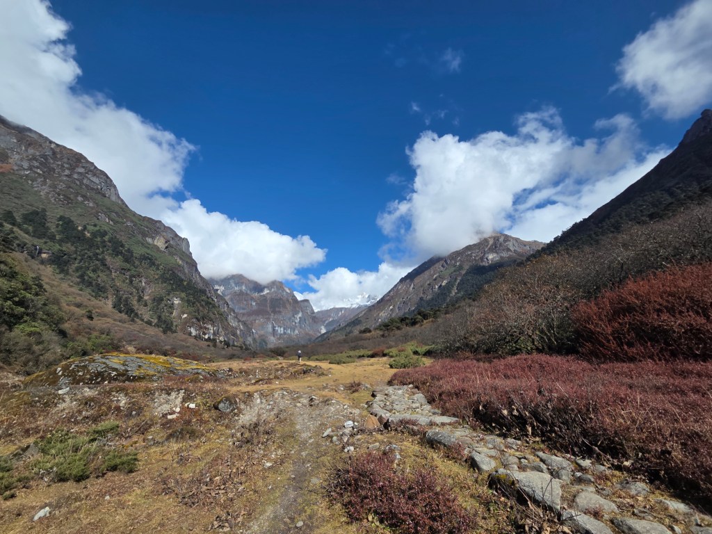
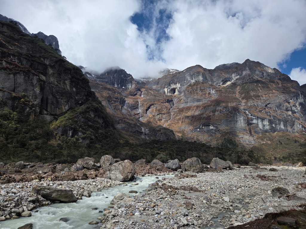
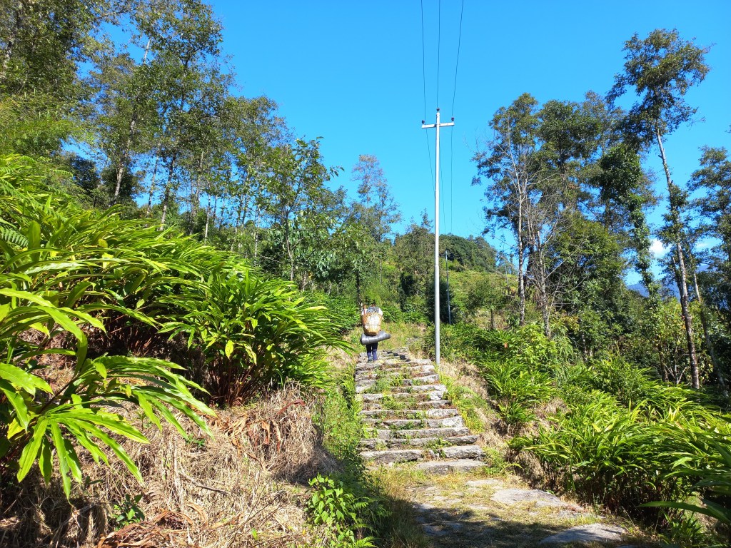
After breakfast, there were some group photographs taken. Then we started off for the base camp. The trail left the lodge and gradually moved up. Walking was easy. We stopped often as the mountains offered ample scope of photography as they kept changing angles with each step ahead. After reaching a height the trail moved down into a wide valley. Barun river reappeared and our trail went by its side.


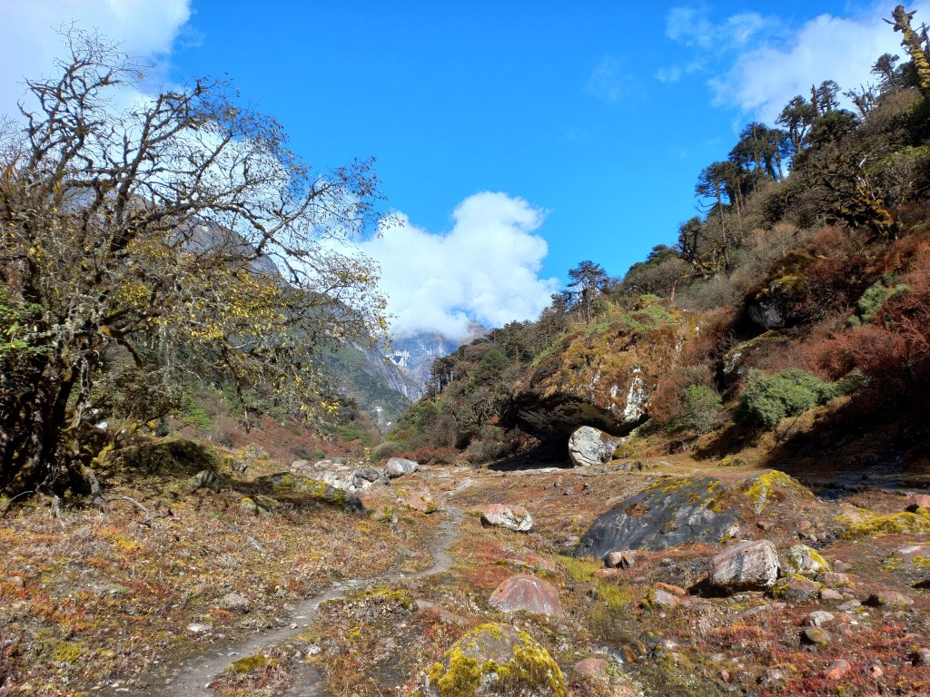
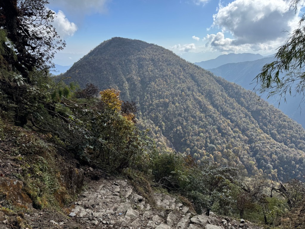
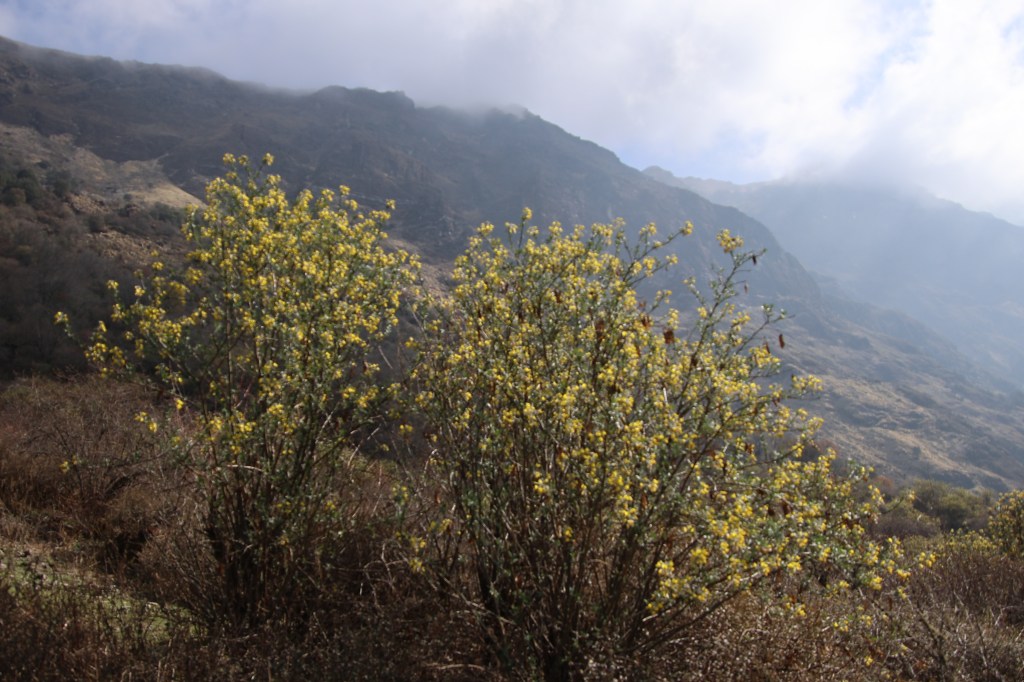
Its torrent was less violent in the valley. The streams started to freeze. They flowed amid frozen ice. The valley was barren and wide, strewn with boulders. The Barun river formed its outer rim. Beyond that, rose the mountains. The ground was almost flat during the first part of our journey. The glaciers along the mountains were getting clearer and so did the contours of their slopes. With every step ahead, the mountains drew nearer and increased in stature. The landscape was totally devoid of any vegetation. It was all about snow and rocks.


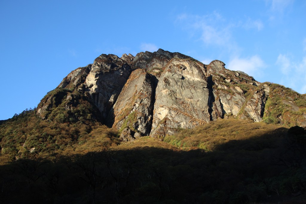
The rocks stood on top of another in a loosely stacked aggregation. It gave an impression that a moderate wind or any such similar trigger could roll them over at anytime. Everything seemed so temporary and transient. It could so happen that next year, these formations might get replaced by others. After about 1.5 hours, we reached an area surrounded by mountains. Their slopes were barren and broken. They were literally stripped to the bare.


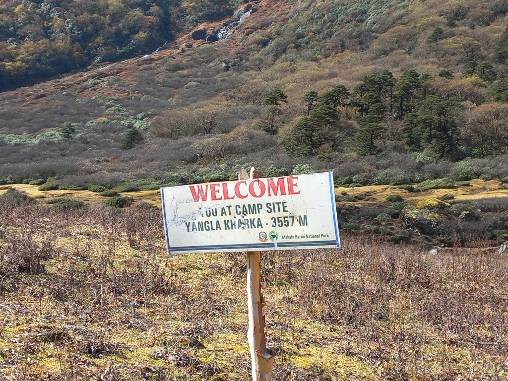
A signboard displayed the name of the place. It was called “Merek”. This is the name that was mentioned in our itinerary as a place of halt before reaching the base camp. However, we were informed at the very start of our trek that it was not suitable for a halt. This was due to the threats of impending landslides. Looking at the site, we realized that they were correct. The path went beside the stream of the Barun river at some places. It was now almost fully frozen with very thin streams of water flowing from melting snow.

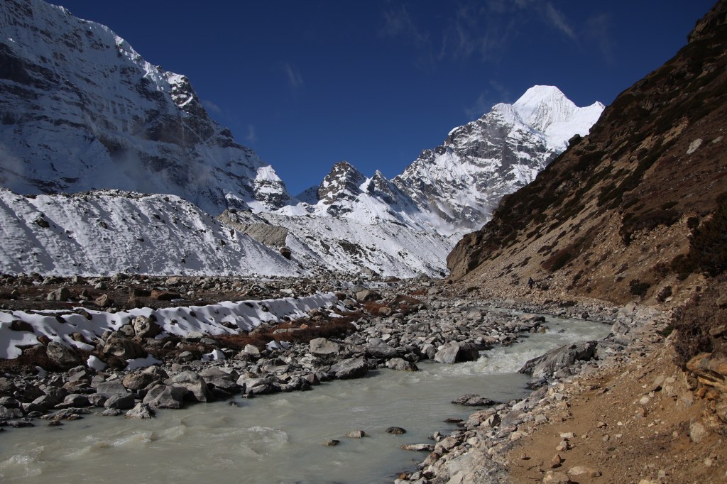


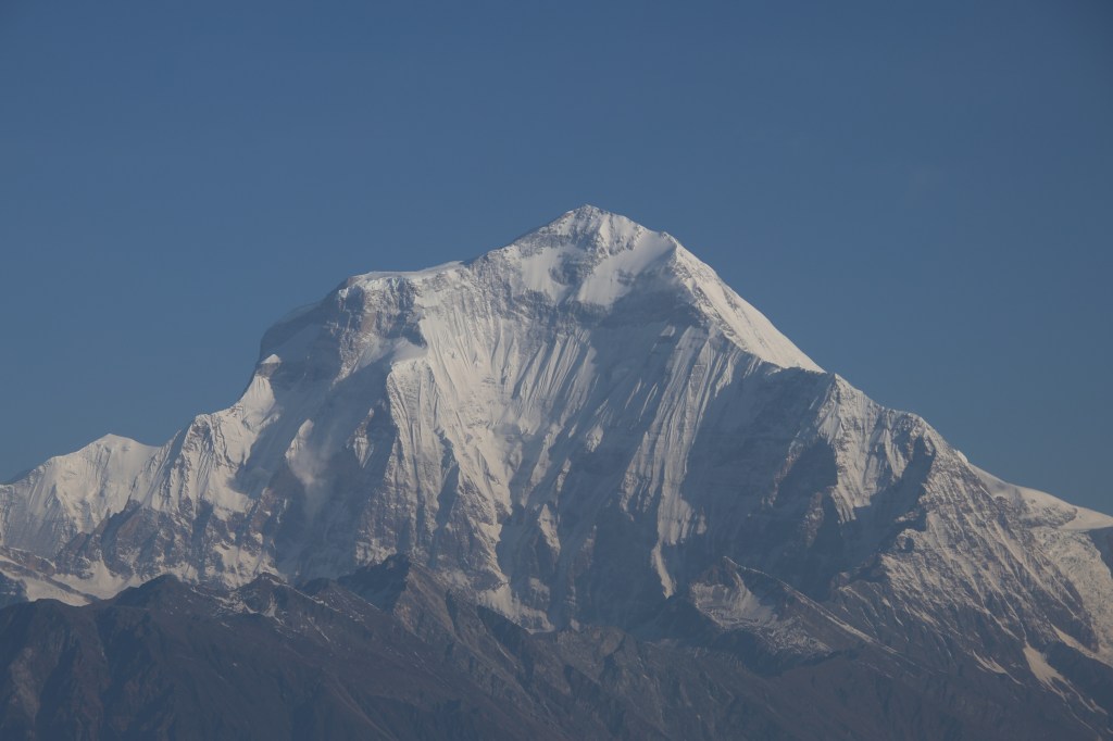
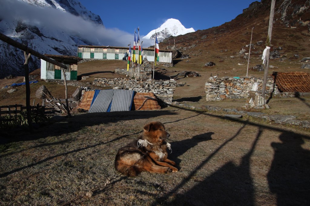
The valley started to turn to the right. That’s when Makalu appeared beyond the hills. The route started to move up and the trail went through a maze of boulders. We started to cross another landslide zone. Gradually, we started seeing rocks with their tops covered with snow. Small and medium sized patches of snow were scattered on our route. But we were still capable of circumventing them to move ahead. We had to find our way through them as there was no clear trail available. At some distance, we saw some green roofs – a tea house! There was a small lawn in front of it where other trekkers lay around leisurely. Some even sat on chairs sipping hot tea. We entered the lawn and removed our day packs to have some rest. The surrounding was magnificent. The tea house was right below Mt Sersong and that’s why the place also bore its name. We were sitting at the base of a bowl and its edges were formed by mighty mountain peaks all around. We felt so insignificant amid the huge surroundings. Lemon tea was ordered and we took the time to soak in what nature placed at our disposal. Shutters kept rolling but they couldn’t do justice. The sun was shining bright and the clouds stayed away. Some of the trekkers started to move out (the ones who reached earlier than us). I followed their trail as far as I could see. The valley narrowed from hereon and the trail moved steadily up. Base camp was another 2.5 hours away. The snow started covering larger tracts of the route. I had a feeling that I’d have to rely on micro-spikes very soon.

We resumed our hike. Sersong was left behind and after sometime, it turned into a small dwelling. There wasn’t any clear trail but a network of paths moved in a general direction. Snow started to close in from both sides and after sometime, it wasn’t possible to circumvent it. So I sat on a dry section to put on the layer of micro-spikes onto my boots. It’s a web of sharp spikes woven into a cage made of hard rubber. One had to insert their boots into that cage and pull the rubber strap behind the heels. Once the cage fits in, a Velcro strap needs to be fastened to make it hold tight. The act took about 15 minutes. With micro-spikes now fastened, I didn’t have the headache to find out a trail devoid of snow. Instead of that, I’d rather step over them to get me acquainted. As I moved over the snow tracts, my boots made small dents.

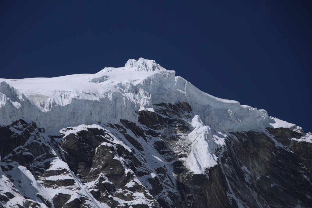
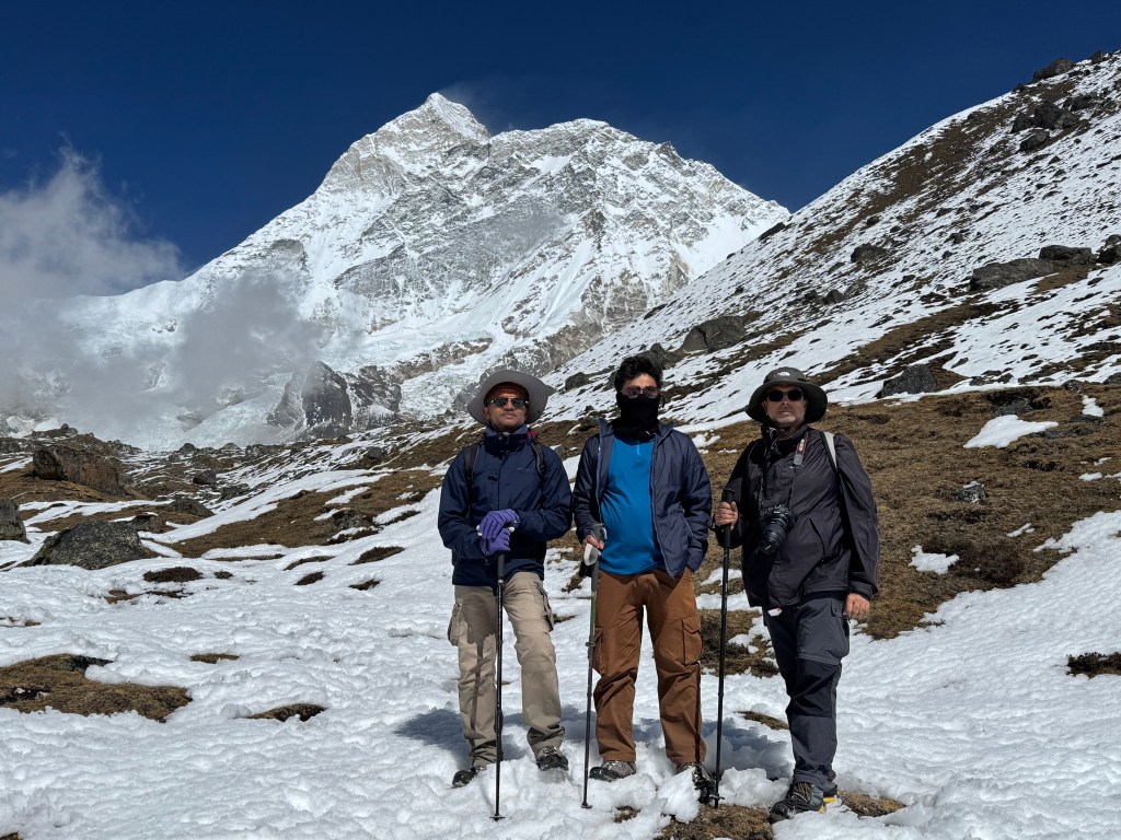

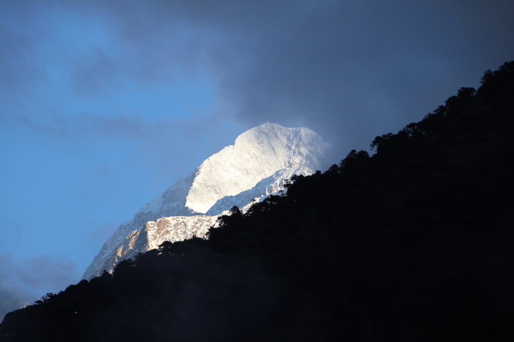
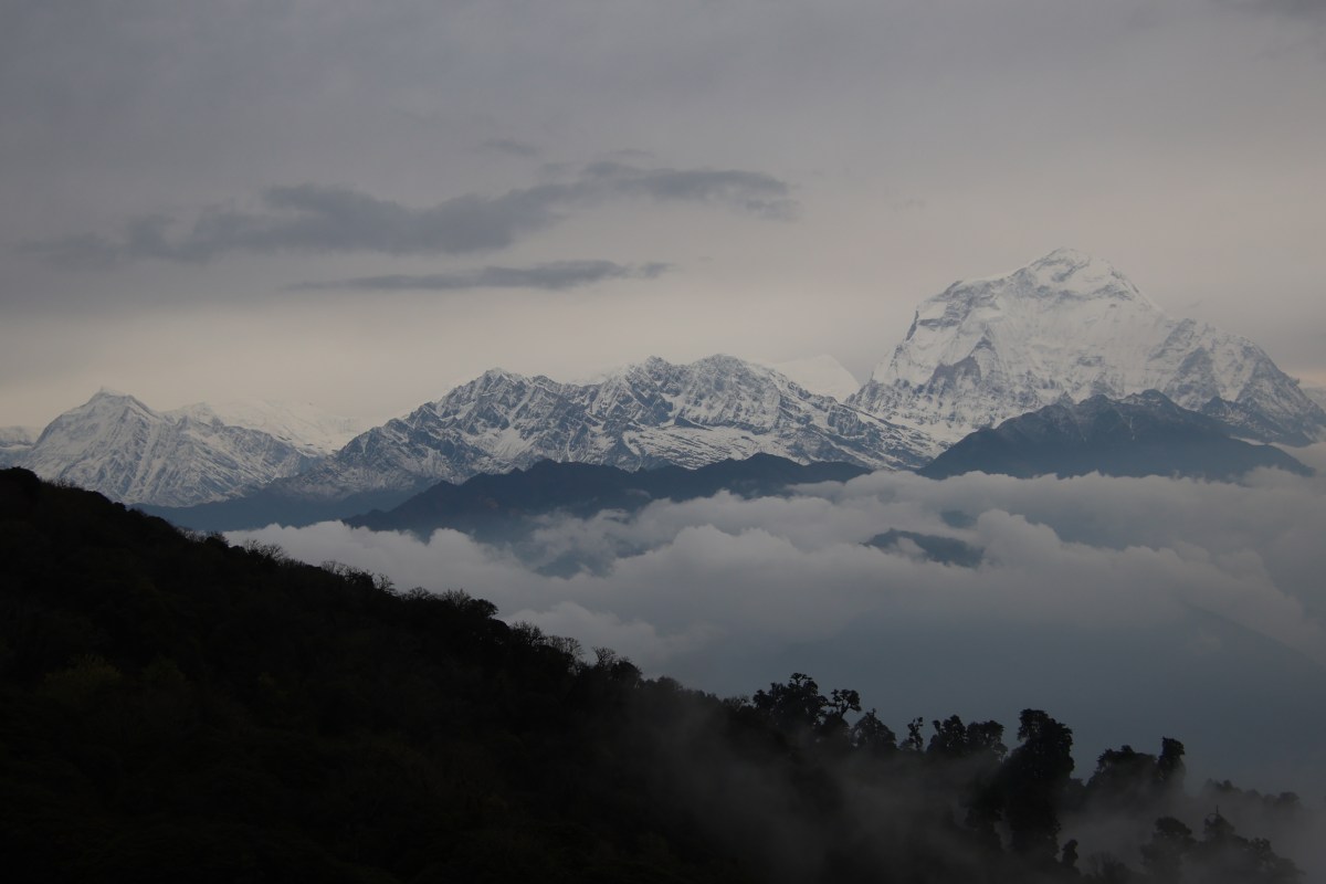
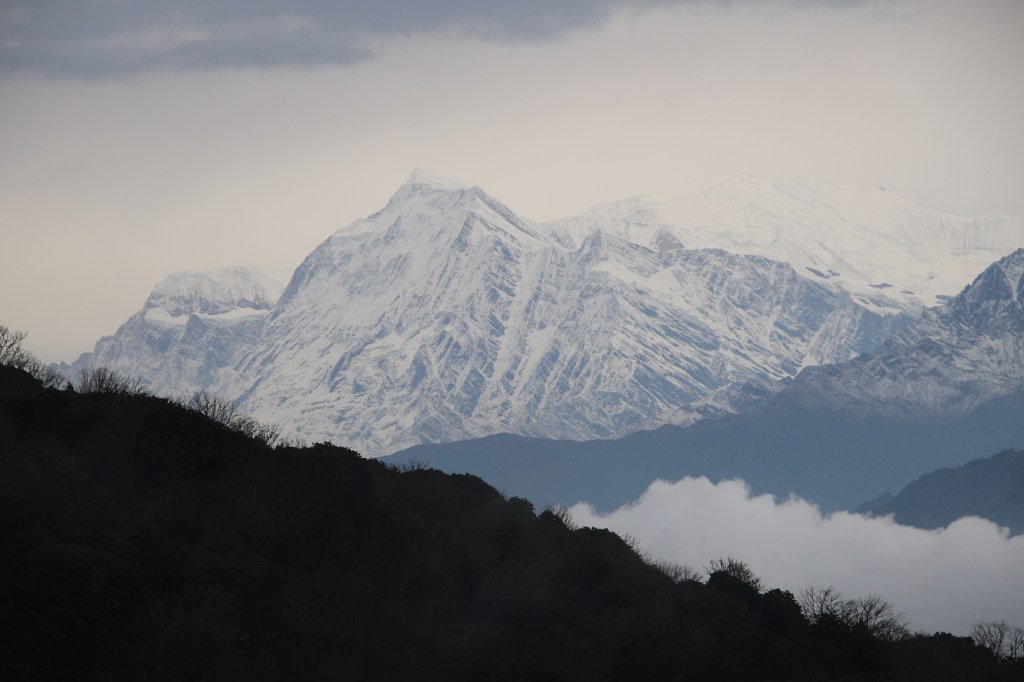
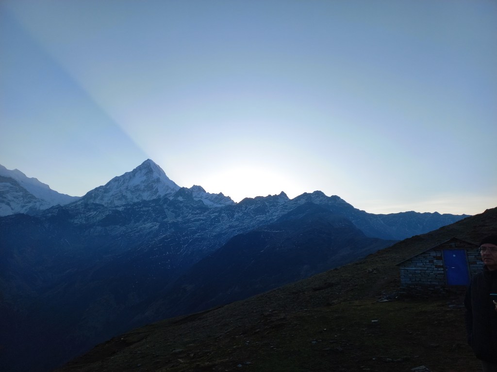
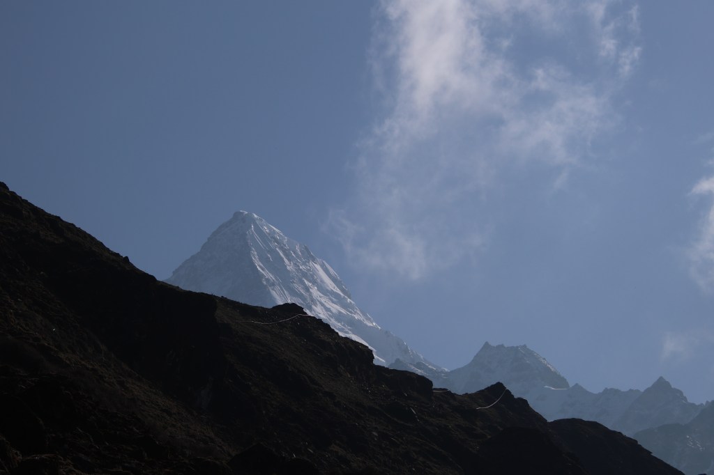
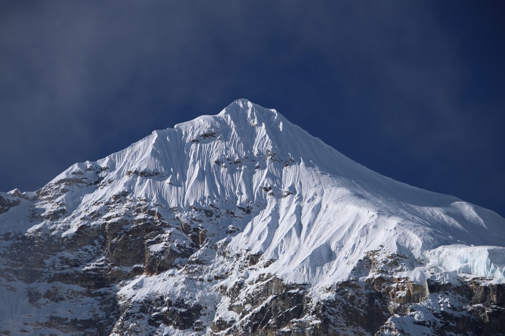
I saw similar dents made by others on the track and tried to keep my feet in them. It’s an act of literally filling in the shoes. It’s important to follow such foot marks, especially when the snow gets deep. They give an indication of hard ground. Snow can be treacherous and there are sections of soft, fresh snow which gives in easily. One could get knee-deep or even waist-deep in no time and it can be come difficult to negotiate the track. I retained this act of following into others’ steps right up to the base camp. Though the snow was getting deeper, the ground was still wide. There was enough space on both sides to give confidence. But that was to change soon. Mt Makalu emerged from the hiding. It was now visible in its full glory on the northern horizon in front of us.
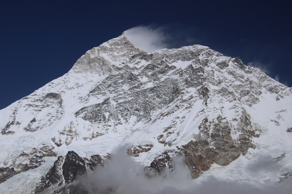
The trail now gradually moved towards the left edge. There was just enough space for a single person to move at a time. To our left, the slope went steeply down to the banks of the Barun river. To our right, the steepness was the same, but upwards. Our porters and guide Raju were leading the way. Anil moved in front of the group. Raju was behind or in front of me, depending on the incline and the support I needed. Manoj was guarding the rear. Thus, our small train navigated the steep slopes. It was now completely filled with deep snow. We kept an eye out for the signs of the base camp. The entire landscape was dazzling white. The sunlight reflected from the surface and increased the glare. We couldn’t see anything on the LED displays of our cameras and mobile phones. It’s tempting to remove the glasses. We wanted a clearer view, but we were aware of its impact on our eyes. The views were mesmerizing. We had to rely on guesswork while training our lenses because the LED displays let us down. The entire massif of Mt Makalu dominated the northern horizon.
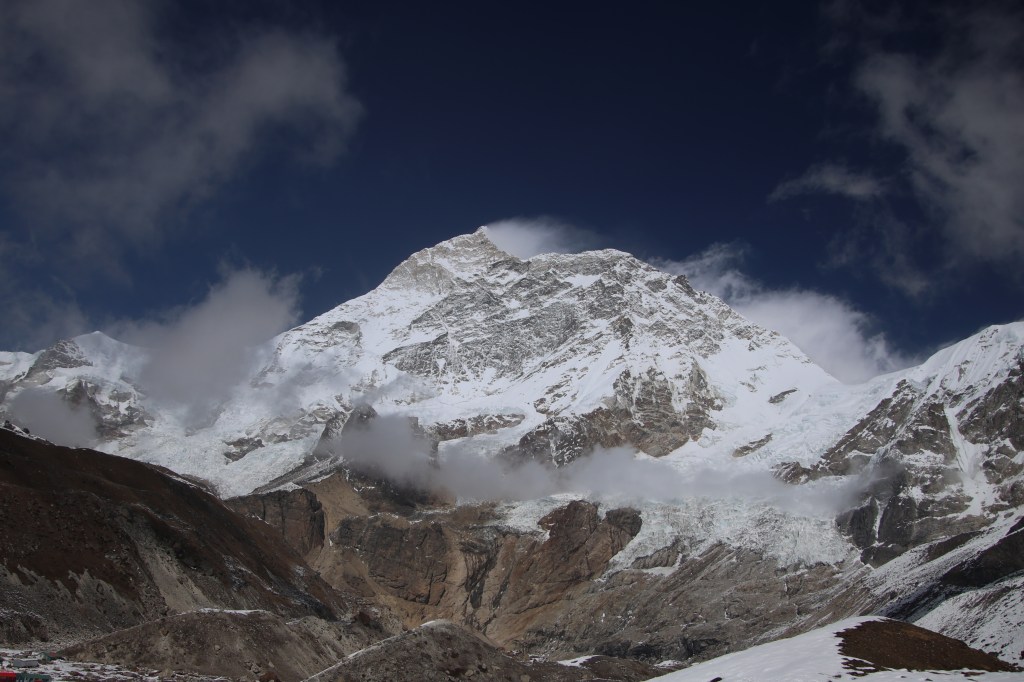


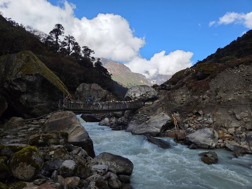
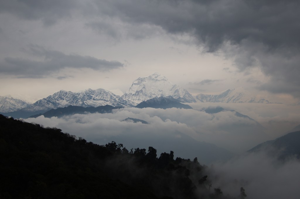
Other mountains were equally imposing and they kept closing in as we moved along the slope. We saw a patch of red in the distance amid vast swathes of snow deposits. Then there was another one, followed by a few other colors. They were the roofs of the tea houses at the base camp. With that in sight, we were ecstatic. That prompted a few more photographs with the distant base camp at the background. We now sensed the slope moving downwards. Descending is even trickier on such narrow snow filled slopes. I thanked the micro-spikes because of the grip they provided. More than physical, its the mental peace which they bring in. Carefully negotiating the track, we finally came down to level ground. The serpentine trail moved along the valley floor towards that coveted wooden bridge!

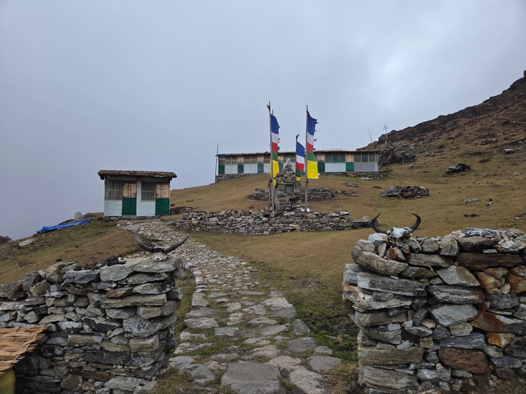
As I walked over and stood on the bridge, it gave a sense of coming to a “known” place. It was a unique feeling, given that we were visiting the place for the first time in our lives. The Barun river was flowing beneath it. It came down from the glaciers along the southern slopes of Mt Makalu, which stood right in front of us. Beyond the bridge, we took a few more steps on the accumulated snow. Then we entered the premises of the base camp. There were about 4-5 tea houses at the base camp.
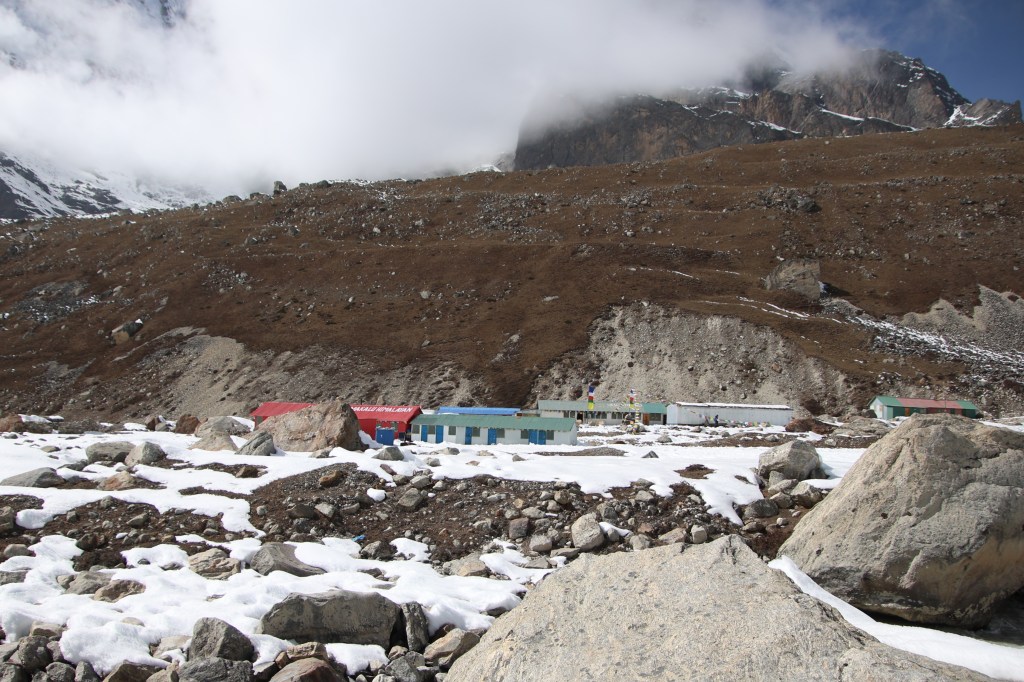

All of them were rectangular and were oriented north to south. Our room was right at the end. We took off our shoes. I retained the cage of micro-spikes on the boots. This was to save the effort of putting them on tomorrow. The entire compound was filled with heavy deposits of snow. They have been cleared in between to make ways. Long icicles hung from the roof of the tea houses.


The weather was warm. The tea-house was excellent. It had enough reserves of every type of food items and drinks. The lunch was comfortable in the closed dining area. After lunch, we stayed in the dining area, playing cards. By that time, it started getting cloudy and the cold increased in leaps and bounds. On our request, the owners of the tea house started the chimney fire earlier. Dried yak dung cakes were filled in its chambers and the fire was started. It took time to set in, but after that, the room was comfortable. The Slovenian group also stayed at this tea house and they sat by our side. One of their senior members have been coming to Nepal for the last 35 years. He has been to more areas in Nepal than any of us. He’s in awe of this country. Not just the landscape, but also the people and their diverse culture. I developed a slight headache. My tongue went dry often. This forced me to keep it moist by sipping water regularly. The headache gave me a mild tension. Headaches at such altitudes always raises fear of high altitude sickness. They sneak in unnoticed and remove ground under your feet in no time. Could the snow glare have caused it? Or was it the altitude? I kept pondering, while sipping water continuously. Dhananjoy suggested a simple formula to keep ailments under check. “Keep drinking water until your urine gets colorless”. Having multiple sips of water also forced me to the toilet multiple times. It was a tough ask. Now that I was down to rubber slippers, I had to find a snow-less track to the toilet. It was right at the end of the lawn. I also had to ensure that my socks didn’t get wet from the melting streams from the snow deposits. Though inconvenient, it also gave me a chance to keep an eye on the northern horizon. Clouds covered Makalu and chances of a sunset view were getting slimmer.

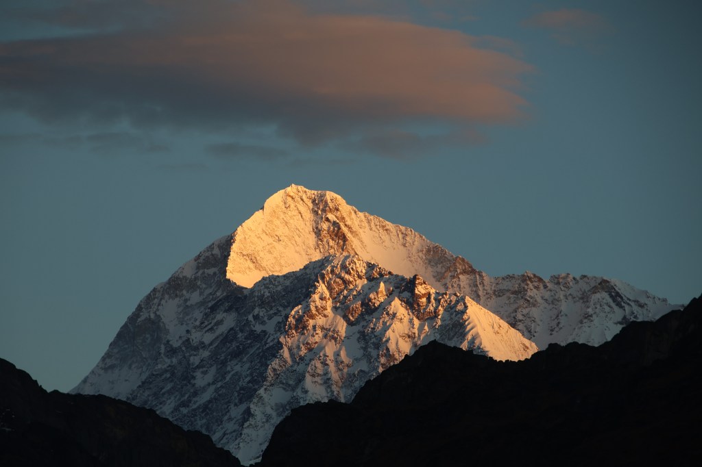
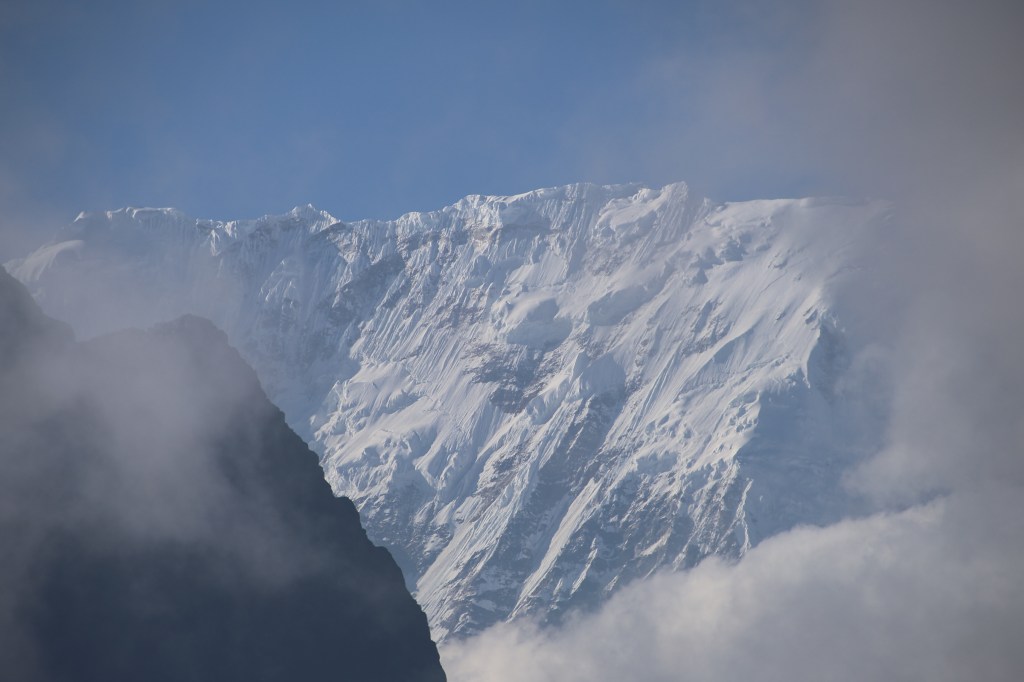
We were playing cards in the dining room. While we played, I saw one of the members of the Slovenian group quickly come inside. They informed their group promptly. The members dashed out of the room with cameras. We followed them outside and there it was, Mt Makalu, colored with crimson-gold in the fading light of the sun. The clouds still held sway but the view cleared just enough to unveil the glorious show. It was nature’s way of bidding goodbye to a splendid day. The winds were strong. We were grateful to the ladies of the Slovenian group. They kept vigil in the biting cold while we enjoyed the warmth of the dining room. It was tough to take the snaps. Operating the camera was impossible with gloves. We had to remove them. We kept taking the snaps ignoring the numbness of our fingers. The pain was worth. The upper section of the massif wore the crown of gold. Plumes of snow flew up from its summit because of the strong gales. The rest of the massif was shielded behind the clouds. The upper massif was floating amid the clouds with a crown overhead. We remained there and continued taking snaps till the last tinge of color faded away like a dying ember.

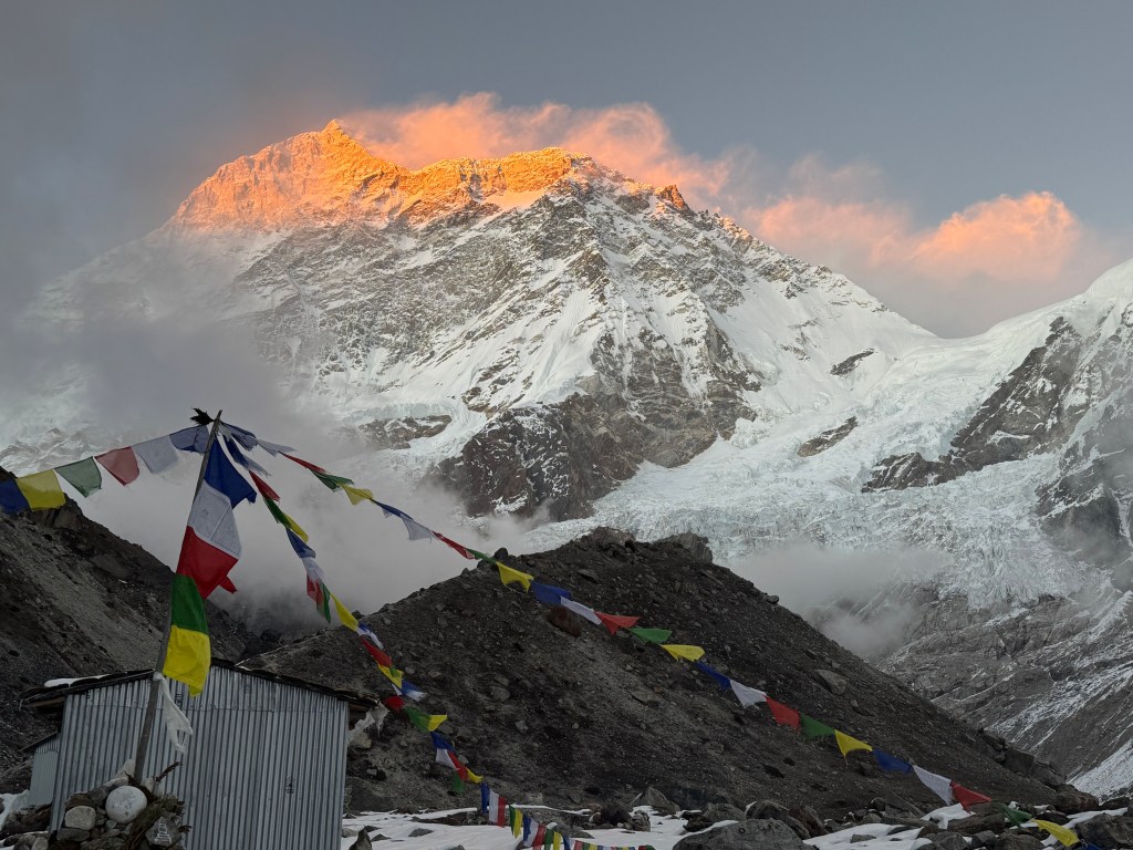
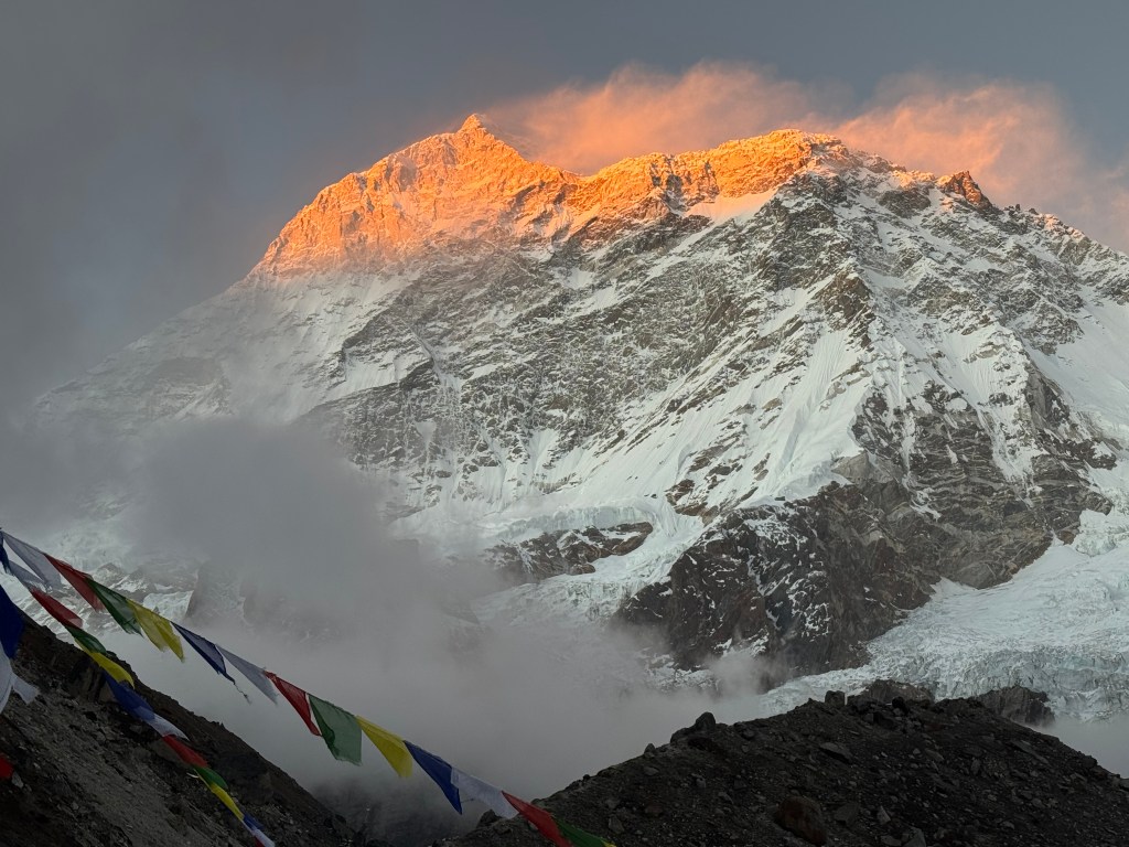
Thus ended a splendid day. We went back into the dining room and continued our play and gossip. The day ended successfully at the base camp. Members of all groups were happy. They were filled with a sense of accomplishment. That poured out in the form of song, dance and party around the chimney fire. All of them danced around to the tunes of rural Nepalese songs. Such scenes are often seen at the tea houses of Nepal. Why can’t the world live like this? It seemed there are no conflicts in this world. Everyone touched the hearts, understood the feelings of others and bode no ill-treatment towards anyone else. Language isn’t a barrier, neither is culture. Everyone is equal. All they care about is a successful and safe day of trek. The support staff goes to any end to make it happen and the travelers are grateful to them for that. We were satisfied while going under the blankets. Our minds were hopeful of a spectacular sunrise for the morrow. At 4870 m, we were sleeping at the highest altitude of this trek.