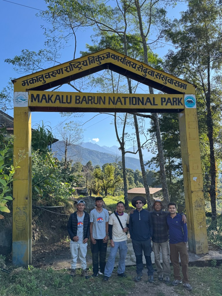
22nd October
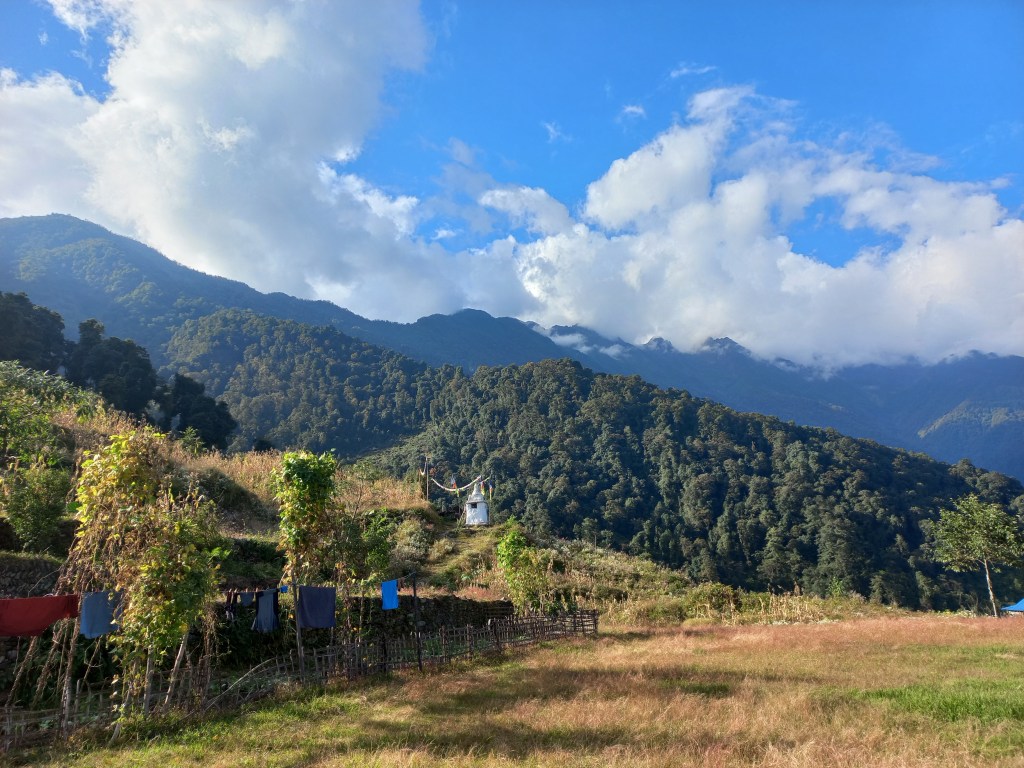
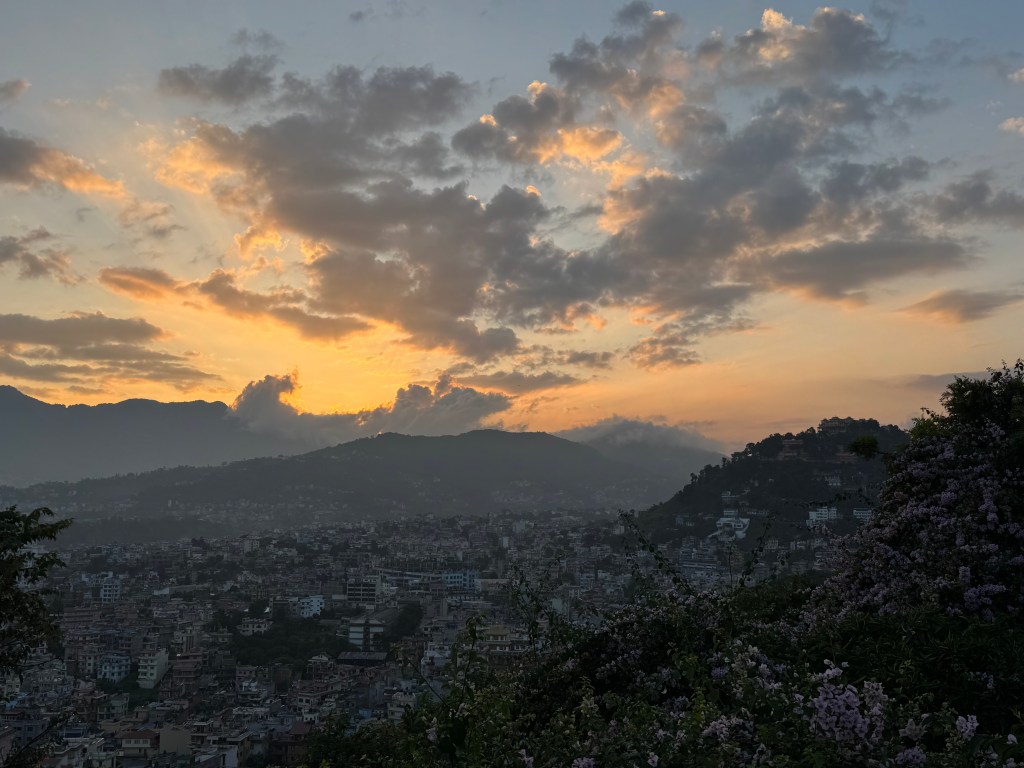
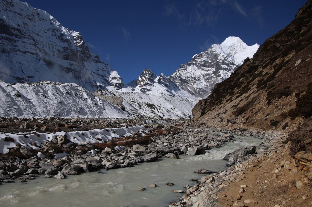
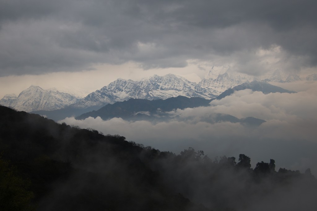
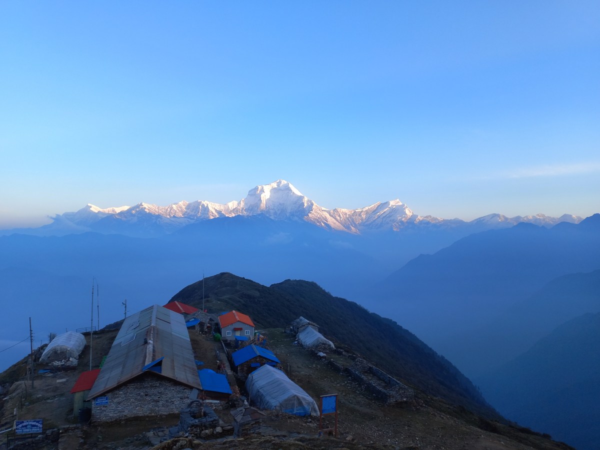
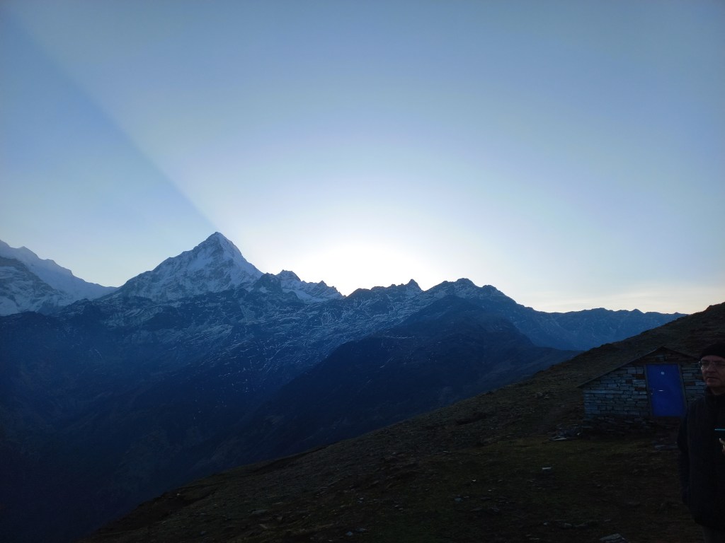
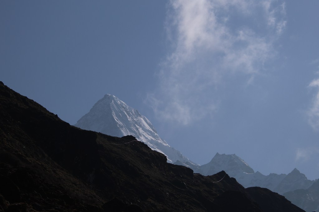
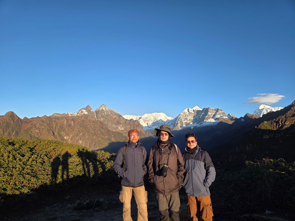
I was breathing heavily while taking the steps upwards. Pressure was gradually building up on my knees with increase in steepness. It was stairs all the way, going up through a series of switchbacks. The head torch showed the way amid darkness all around. We started from the lodge at 4 AM and were on our way to the viewpoint. I was sweating inside but despite that I couldn’t remove my jacket. As soon as I stopped for a few mouthful of breaths, coldness set in promptly. My hands were gloved and my head, covered. This journey in the dark reminded me of our hike to the Mardi Himal viewpoint. Just like then, I kept focus on the traveler in front. Incidentally, it was Dhananjoy again. I rested where he did. Consciously, I didn’t look up and focused on the stairs, letting the trail guide us. The distance between switchbacks kept getting shorter. Their increase in frequency indicated that the top was nearing. We saw the watch tower now. With every bend it kept rising and increasing in stature. Finally, we stepped on a flat ground where a stupa greeted us. Prayer flags hung all around it. The dawn was breaking. Darkness was gradually giving way to a soft light.
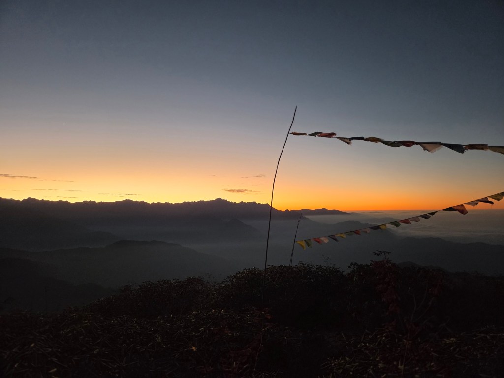
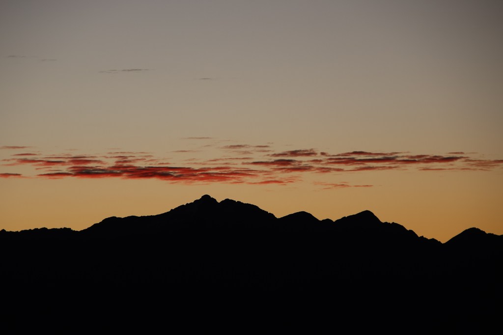
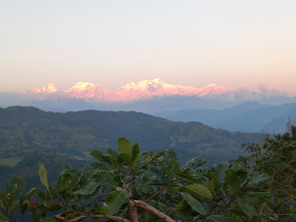
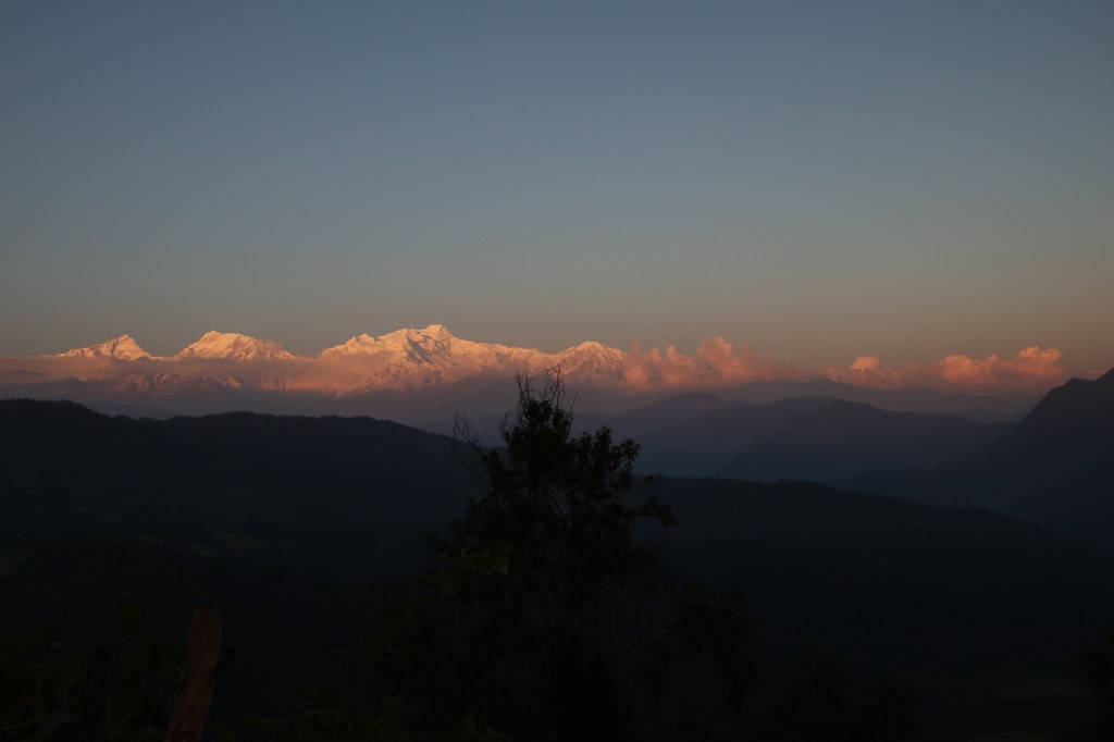
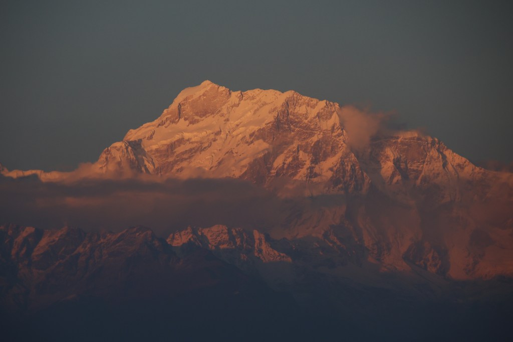
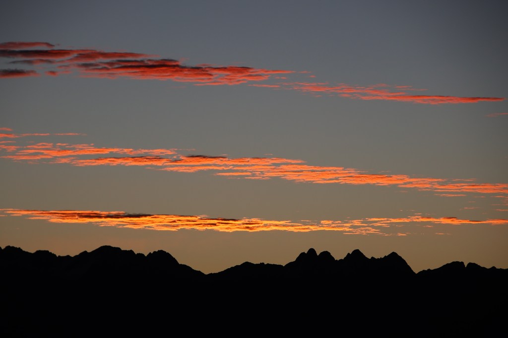
Taking hands out of the gloves proved painful but without doing that, camera operations were difficult. We had to ignore the pain as time was running out. The eastern horizon was acquiring a crimson hue. Sharp edges of rays flew around the distant mountain ranges. Mild stretches of clouds floated above the mountains. The reflected solar rays colored them with crimson and gold.

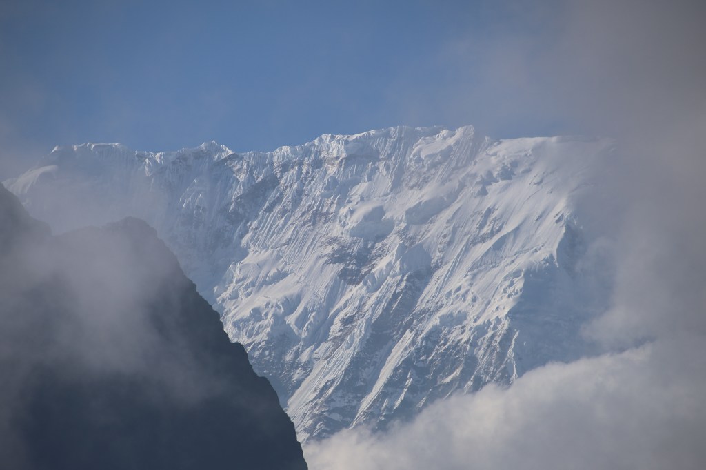
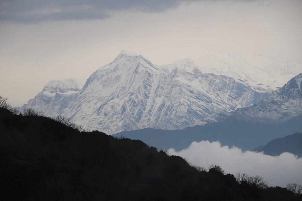
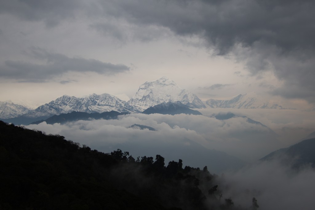
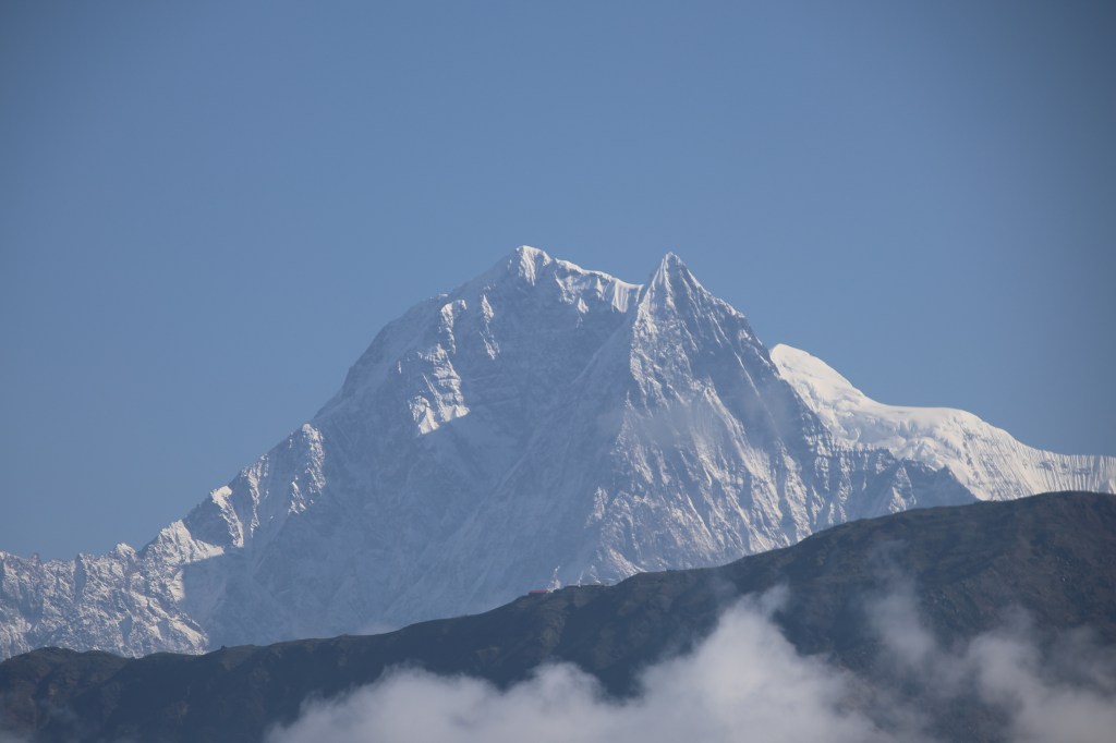
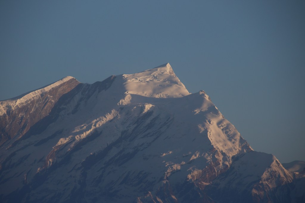
It was literally a crowning glory. To our left, beyond the hills, a mountain peak was partially visible. It’s shape resembled a distorted bowl with elevated edges and a depression at the center. It’s a very well recognized contour. There was no problem in recognizing the mountain, thanks to many photographs of it that I’ve seen before. That’s the mountain that has brought us to this corner of the Himalayas. Over the next few days, we’d reach at its base.
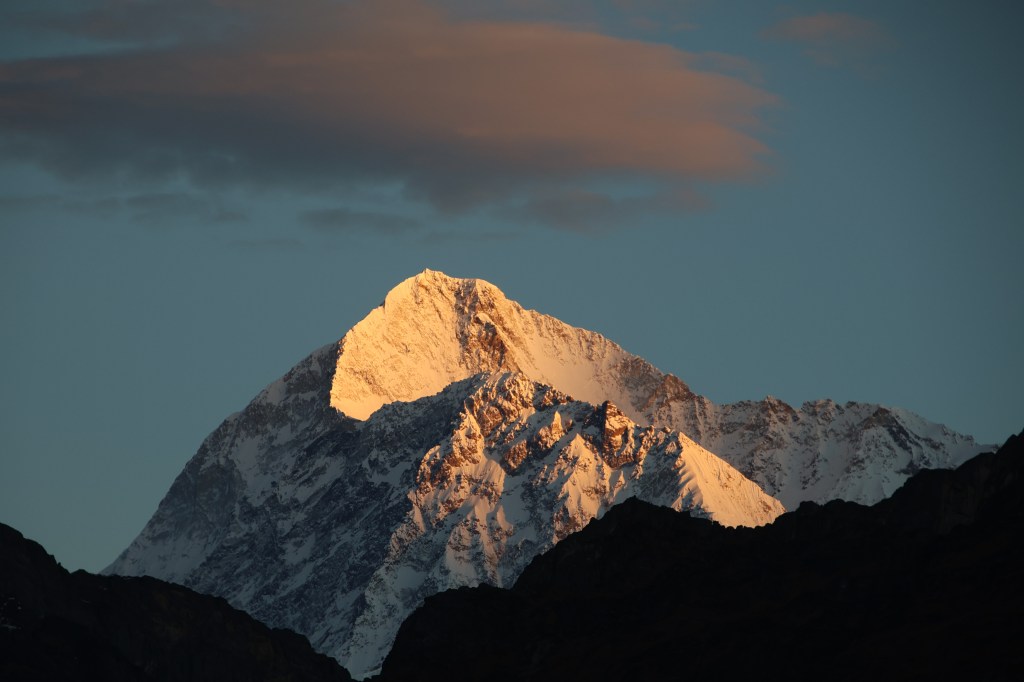

This was our first overland view of the fifth highest mountain in the world, Mt Makalu. Though still half concealed by the hills in front, but nevertheless, it’s “the mountain”. It is one of the illustrious neighbors of Mt Everest in the Mahalangur himal. It took some time for me to absorb the moment of looking at it physically. Before that, my interactions with this mountain was all through photographs or videos, i.e. through someone else’s lens. Now, it was an opportunity to frame it in my own lenses.


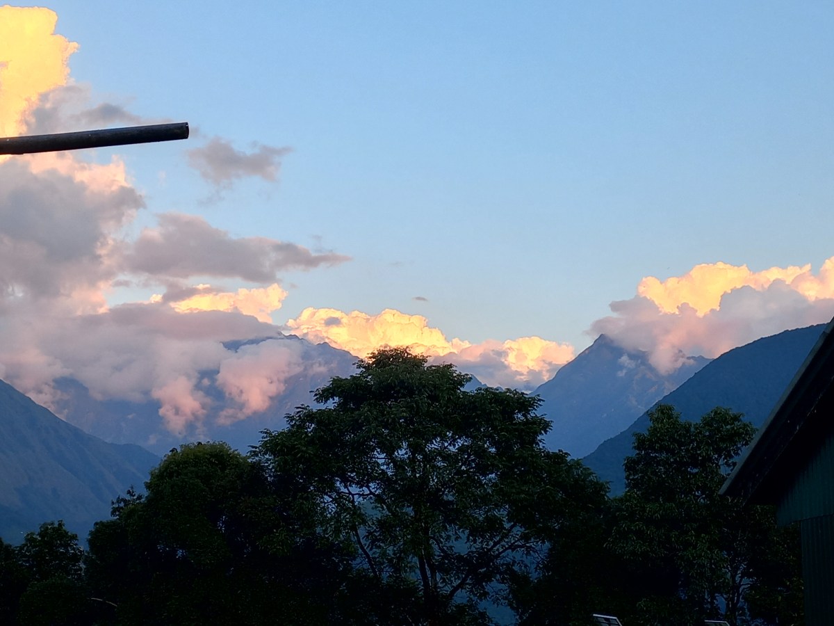
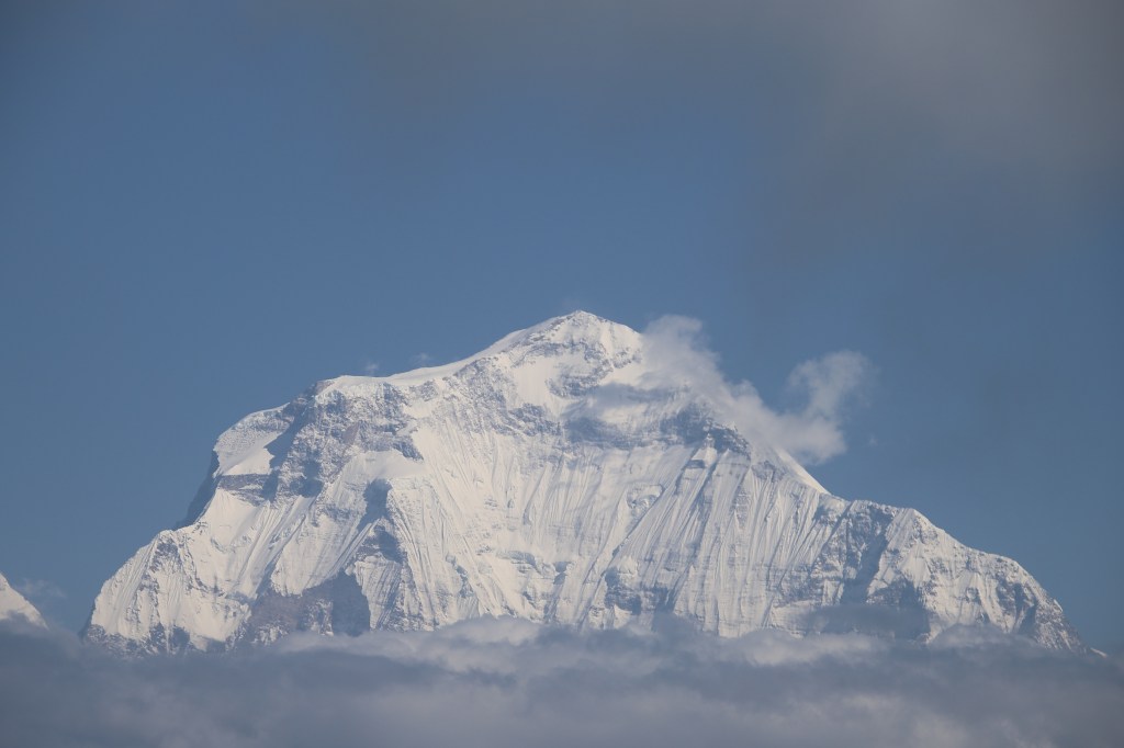
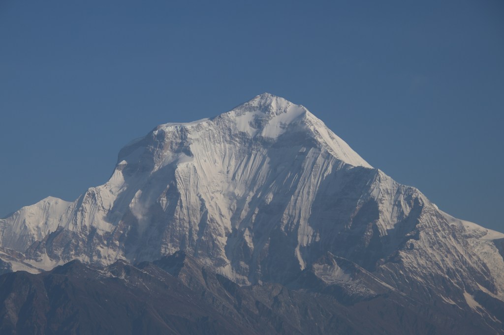
That I did in abundance. The numbness in my naked fingers became irrelevant. We’ve come across thousands of kilometers just to see this. No matter how many snaps we took, it still felt insufficient. The perpetual abode of snow appeared bright against a sky which was yet to acquire it’s full brightness. A thin slice of cloud floated above it as a roof. The golden hue gradually infected Mt Makalu and its neighbors. The edges of the bowl acquired tinges of gold but its inner walls remained in the dark. This presented a unique contrast of colors. The crimson ball popped up beyond the mountains on the eastern horizon and started it’s journey upwards. The solar rays changed colors by the minute.

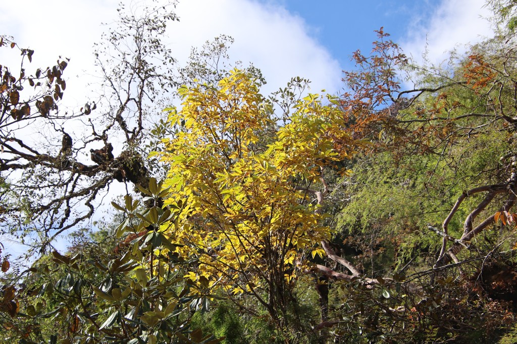
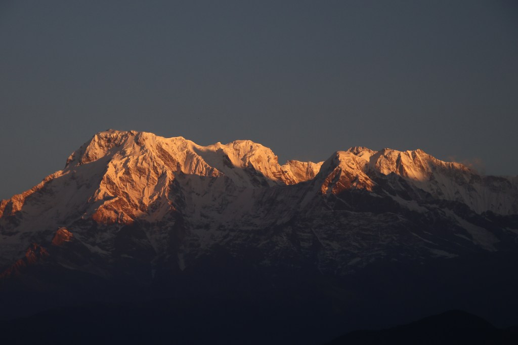
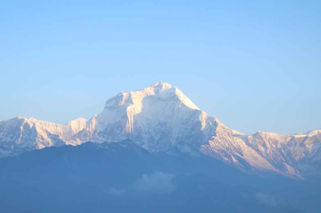
In this drama, the actors stayed still, while colors of their costumes kept changing. Makalu and its neighbors dazzled as silver in the full morning glory. When we look at the photographs later, it becomes a challenge to select the ones to keep among many duplicates. Many of us posed in front of this canvas. I’m a bit skeptical about this. Though we relish the proofs of our presence in such theaters, but nevertheless, it’s nothing more than a proof. I find myself to be a mismatch in such portraits. Hence, I keep myself restricted to framing pure landscapes most of the time. The prime subjects are Makalu and its neighbors. Also featured are the glaciers that decorate its slopes and the valley with its diverse flora and fauna. With the sun fully up, the cold was tolerable.
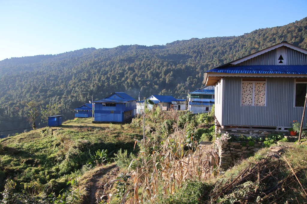
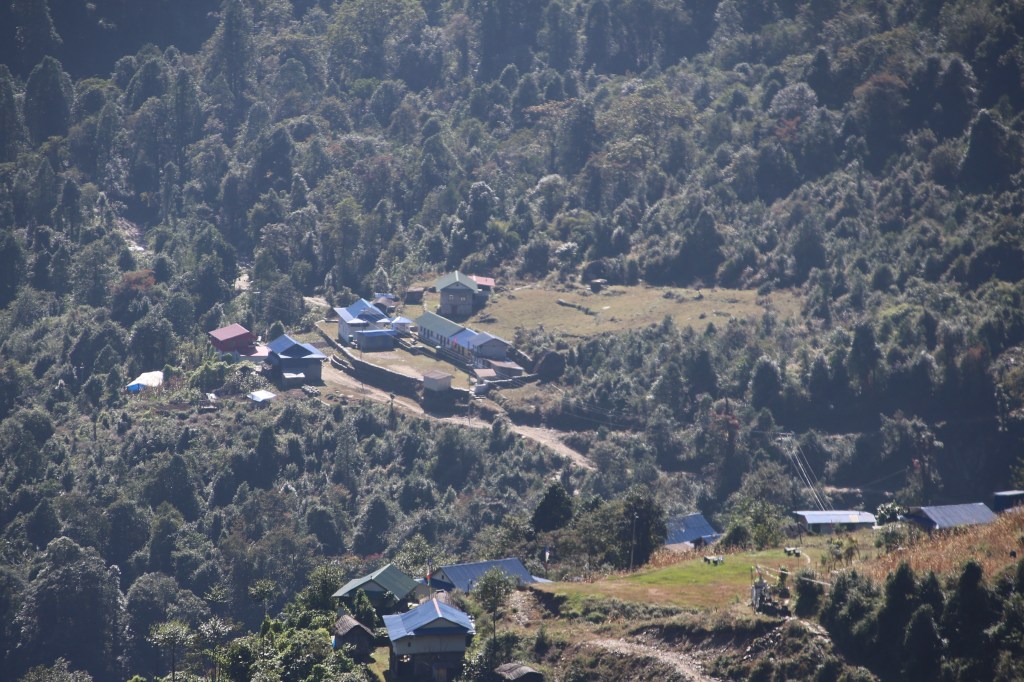
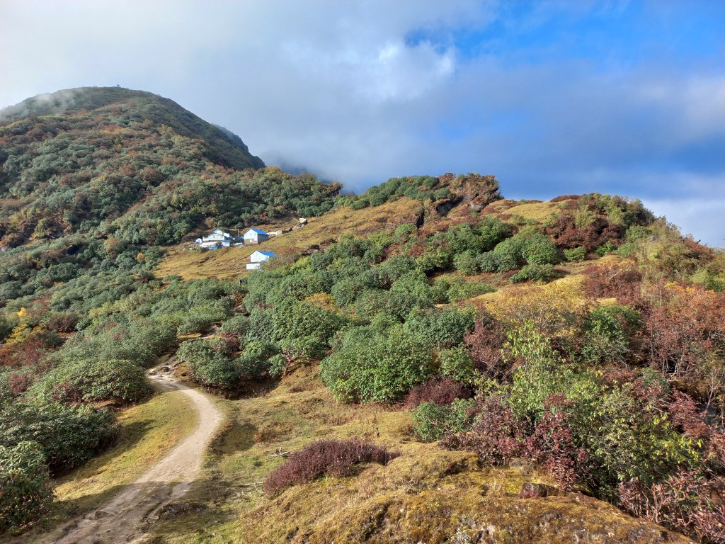
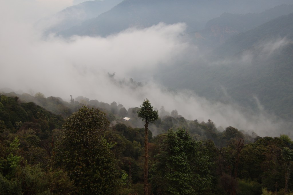
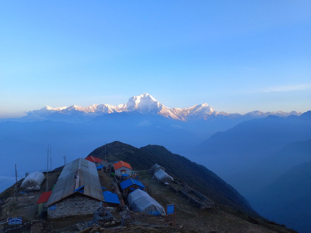
After some more video shoots and photographs, we headed down. The route now appeared to be longer in broad daylight. The lodges of Khongma appeared tiny at start, but kept increasing in stature as we went down. The meadows bathed in bright sunshine. After breakfast we brought out the chairs and sat in the sprawling lawn. There wasn’t much to do except to enjoy gazing at the distant hills and the snow peaks beyond them. I kept dozing off. Dhananjoy brought out a mat and spread it over the ground. We quickly lay down with the sun warming our backs. The French group (who were headed to Sherpani col) also stayed at the lodge. Their porters joined us in the gossip. Dhananjoy entertained the crowd with a demonstration of his yoga skills. The porters joined him too with their own unique antics. After sometime, we were told that lunch was ready.
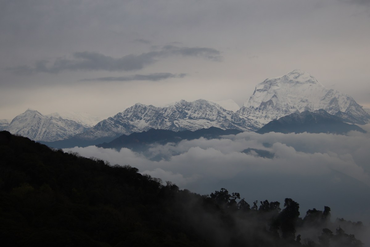
The routine for post lunch session wasn’t much different, except for playing cards. The angle and color of the solar rays kept us informed about the time. As afternoon wore on, the sunlight acquired a touch of gold. The distant bushes acquired the hue. We were sitting beyond the tree line. The valley below kept getting darker, while sun continued to shower its rays over the hill tops. We inquired about our stay at Dobato. Ming assured us that he had already informed the owner of the sole lodge there. We shouldn’t face any problem in getting an accommodation there. Our hike for the next day was supposed to be longest with four passes to cross. Our route lay along the same trail traveled today and went beyond the watch tower.
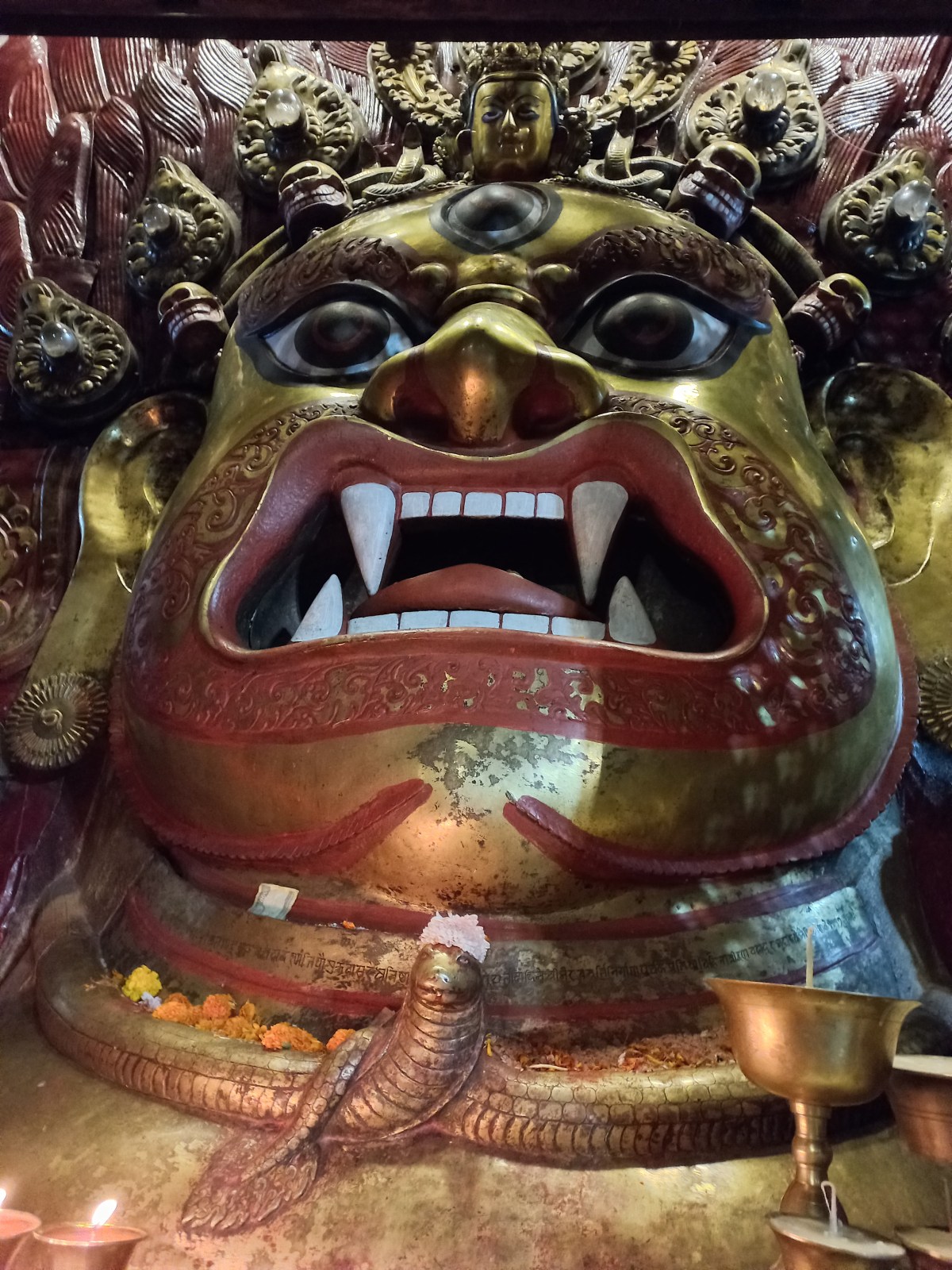
A sudden look at my phone revealed a feeble network. We called our homes. We informed them that this was probably the last time they would hear from us for the next few days. We didn’t expect to talk again till we reached here on our way back. Diwali was just a few days back and festivities continued with the locals. They have unique festivities in Nepal around this time. At Seduwa, we saw a few kids wearing masks and shouting like crows. They came door to door and people gave them money or gifts. Apparently, that was a day to worship crows. The next morning, on our way to Tashigaon, we saw garlanded dogs. It was their turn of respect. Today, we learned that porters and guides from different teams would assemble in the evening and dance. They’d visit all the lodges in the area to repeat the same. Darkness fell as soon as the sun went down below the hills. We could still see the distant mountain peaks shine in the fading sun, but darkness reigned supreme around us. Card pay resumed at the dining table. The guide from the French group was a Sherpa mountaineer. He had climbed Mt Everest. That made him the second person on this trail who had the honor. Their plan was to travel beyond Makalu base camp to higher regions. They carried tents and other allied equipment and ration. Beyond the base camp, there are no lodges. They’d need to setup successive camps for a few days at ever increasing altitudes. The highest crossing point Sherpani col pass lay at 6155 m. After crossing over, one would reach at the Solu-Khumbu district in the Chukhung region. The rest of the route lay through the villages of Pangboche, Namche Bazar and finally terminated at Luk La. This route requires climbing skills and hence, the group carried the necessary equipment with them. This route traverses through one of the most remote regions of Nepal.
The festivities started after dinner. The locals started dancing to the musical tunes playing from their mobile phones. They danced in circles around the center. A few bottles of beer were placed there. There were also nuts, sweets, chocolates, and a few currency notes. The guests at the hotel donated money and so did we. They kept singing with a phrase “Deusi Re”. It is a phrase used in songs sung during Tihar festival in Nepal. It is also celebrated in parts of India like Sikkim, Darjeeling and Assam. During this festival, groups of boys or young men visit neighboring homes in their community. They sing and dance. They exchange blessings in return for food and money. The group left our lodge to visit the neighboring tea houses. The process would continue late into the night. After they moved out, we went under our blankets. Thus ended a wonderful day of leisure and rest in a remote Himalayan village. The terms “leisure” and “rest” would vanish from our lives for the next few days, rather unexpectedly. I imagined myself sleeping at Dobato in the next night. The cold increased and for the first time on this trek, I had to use warm inner wears.