
14th April, 2026
The sound of the torrent kept reaching our ears through the night, but that didn’t interrupt the sleep. The alarm kept its promise. There was a nip in the air and the natural temptation was to wrap the blanket even tighter to embrace its warmth but I resisted that. The day before, in the afternoon, we met two locals who descened from Ghunsa. They skipped two halts, Gyabla and Amjilosa, to reach Itahari directly. Their homes were in the Terai town called Dharan. Pictures from their mobile enticed us. I had a mixed feeling looking at them. On one hand, they were through with the tough part. All that lay ahead, was an easy ride to Taplejung, followed by a descent to the plains over the smooth Mechi highway. I looked forward to the day when we will reach that state. But I also looked forward to the exciting hike spanning the next few days that’d take us to the base camp, the views of the trail and above all, standing below the feet of the third highest mountain of the world. The colorful rhododendrons in the forests that lined the lower areas, the glacial moraines over which we’d be walking, the ever changing face of the Ghunsa river right up to the snout of the Kangchenjunga glacier where it originated from and the surprises & challenges the trail might have in store for us. In such trails, I have no feelings of sadness even while returning. A sense of completion fills my mind and a relief of not having to negotiate challenging terrains. But, at times, human made disruptions, aided by weather, have played spoilsport at places with easiest of accessibility. I’m talking about the domestic flights in Nepal. It happened in Luk La as well as Tumlingtar. I didn’t know at that time, what was in store at Bhadrapur. Limbu was at our doors, ready to pickup our bags. After a hearty breakfast with roti and chana curry (it’s called “ghugni” in the state of West Bengal), it was time for a group photograph. On every trek, the first day carries a unique excitement. After months of staying in civilization, you get the first opportunity to strap your backpack, take up your hiking pole and hit the trail. This was no exception. After moving out, we started hiking along a strip of path that went beside the goat shelters. It moved up through multiple switchbacks and soon we were walking amidst cardamom fields.
The leaves glowed bright in the clear sunshine. Cardamom seeds were visible near the roots of the plants. Just as I focused to take some photographs, I got sprayed with drops of water. I was taken aback by the suddenness of it. That’s when our guide urged us to move quickly to escape this water spray. Once we were off the limits, we turned back to see the source of it. Sprinklers were rotating to spray water on the fields. The tea houses of Itahari were visible below us.
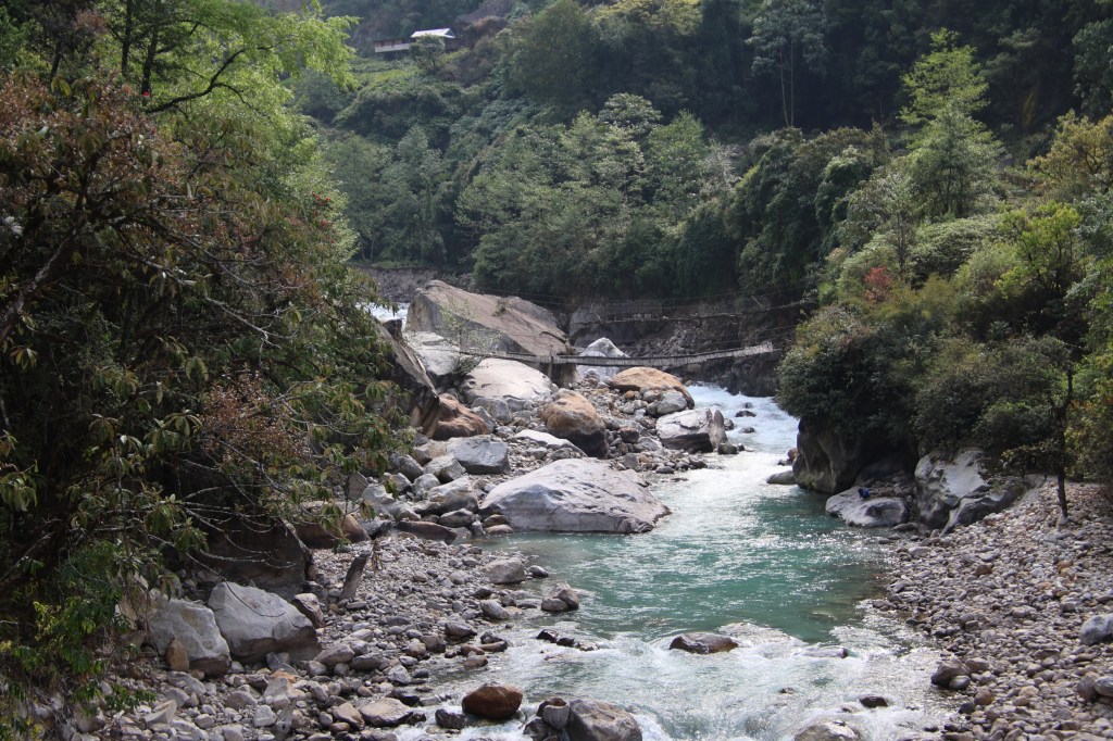
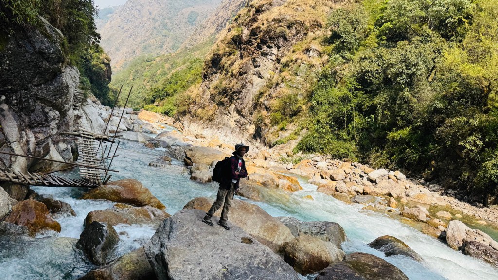
They appeared as matchboxes from the height. The flowing Ghunsa river was clearly visible behind the lodges. Fertile fields were lush green. Most of the cultivation was of cardamom. The track was adulating and after sometime we faced our first suspension bridge on the route. After crossing over, we went along the right bank of the Ghunsa river.

Limbu kept ahead of us. Right after starting from the lodge, Dhananjoy drew my attention to the feet of Limbu. He was wearing rubber slippers! Hiking the slopes while carrying a load of 20-22 kg, wearing slippers, Limbu appeared unfazed. While we were wearing two layers clothes, Limbu was down to a T-shirt. Very soon he went out of our sights. The villages on the other side were no different. Cardamom fields, houses nestled among them with sloping roofs, animal sheds – and sight of a contained life.

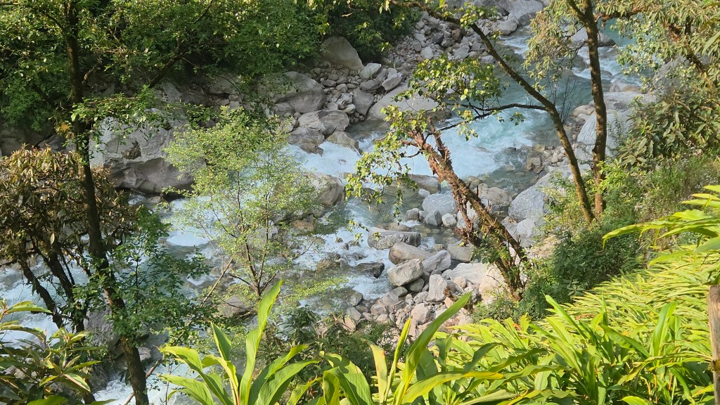
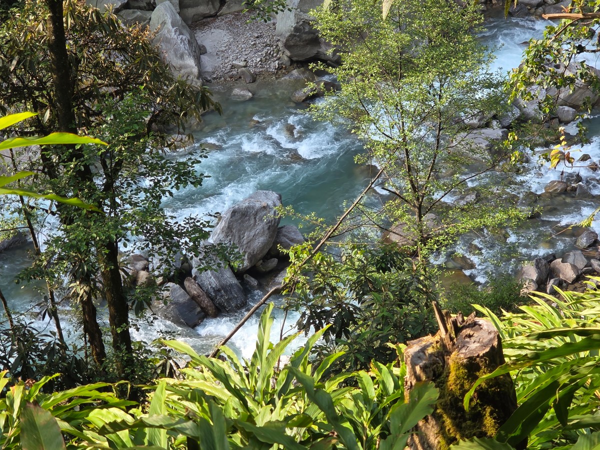
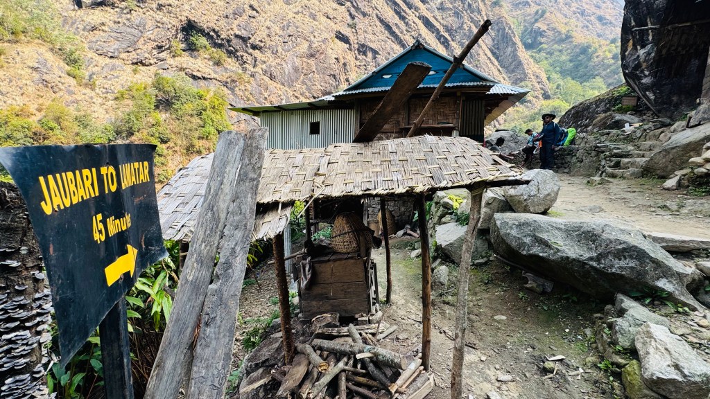
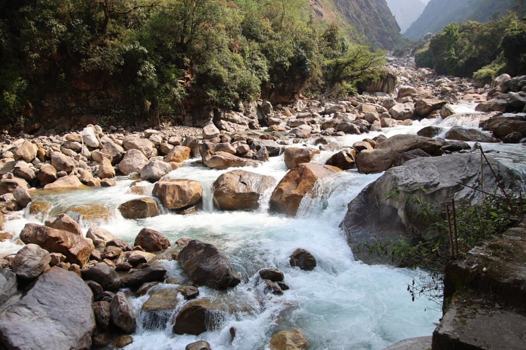
The Ghunsa river showered its blessings in the form of water & sediments over these villages. It’s violent torrent with multiple rapids told us that it was moving over a rough bed. We came to a village called Jaubari. The name sounded familiar. The name also features in the famous Sandakfu trail in the neighboring state of West Bengal in India. Could it be possible that a route exists towards Sandakfu from here? The fact that the Sandakfu trail passes along the Nepal border, increased that possibility. It was revealed to me later that this assumption was wrong. There are multiple places in Nepal with the same name in its different regions. For example, there are many Deuralis & Tatopanis. This was one such example. My wrong assumption was corrected, incidentally, by a man from none other than the Darjeeling district, which is where Sandakfu lies.
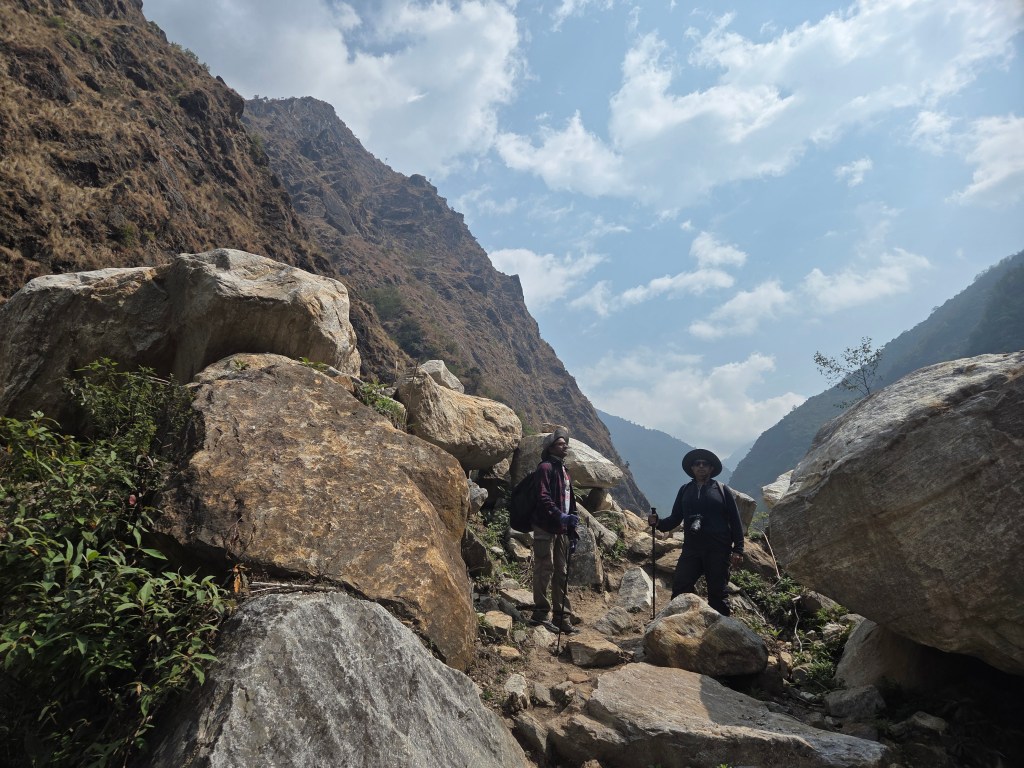
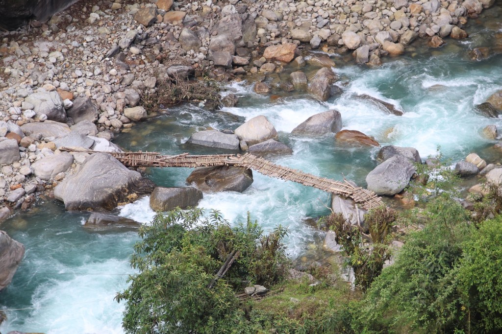
We climbed some stairs to reach an elevated field and guess what. We saw Limbu resting by leaning against a rock, basking in the bright sunshine. We continued along. The trail started descending under a huge overhanging rock. It exited at a place where the Ghunsa river was flowing just under our feet. We stood over a a wooden bridge made up of loosely strewn logs. We literally walked above the gushing stream. The makeshift bridge led us from one rock to another, while the torrent roared below our feet.
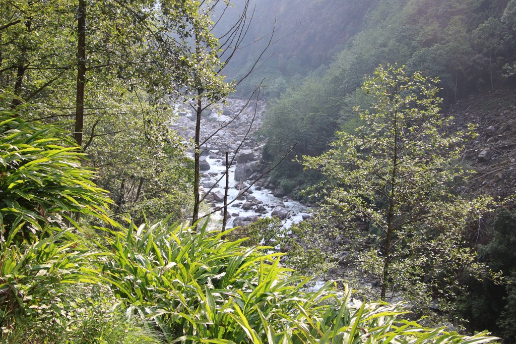
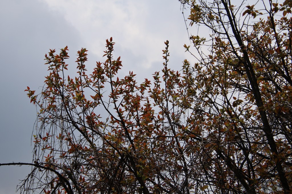
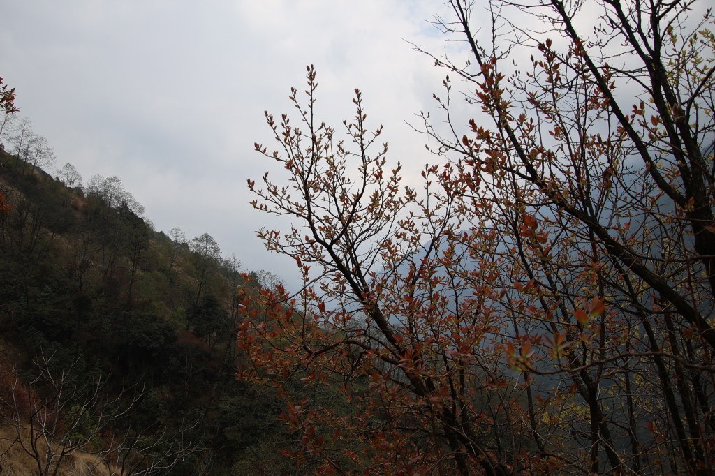
En-route Amjilosa
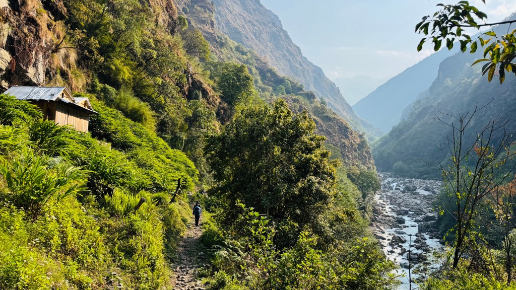
After one rock, it climbed up to regain the trail on the other side. We breathed a sigh of relief. But I didn't lose the chance of filming a video. I asked Dhananjoy to shoot the video. When I moved, he shot. He then went back to the starting point to follow the trail once more. This time, Dilal played the cinematographer. After reaching the other side, the trail continued. After sometime, we reached Lamatar. It was initially planned that if time permitted, we would have tried to reach here the day before. We rested there for sometime and resumed our journey. The trail now started to rise and we started climbing stairs. These set of stairs went up through a few swirls to reach the base of a bridge. After crossing over, the trail descended. It was a bit steep so we had to be careful. It was broken at places but was manageable. Descending such trails require more care than ascending. We went down to the banks of the Ghunsa river, deep into the gorge. After crossing over, we looked at the path that lay beyond the bridge. It went up through a set of rocky stairs. There were multiple switchbacks as the stairs moved up through the dense forest.
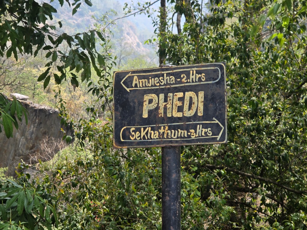
We started climbing. From hereon, we walked under the canopy of a dense forest. After sometime we reached Phedi. This is another common name in Nepal. Every trail in Nepal has a Phedi. It means the bottom of a hill or a mountain. There are two Phedis on either side of the Thorong La on the Annapurna circuit. There's a Phedi after descending from the Larkya La on the Manaslu circuit. Just like others, this place too justified its name.
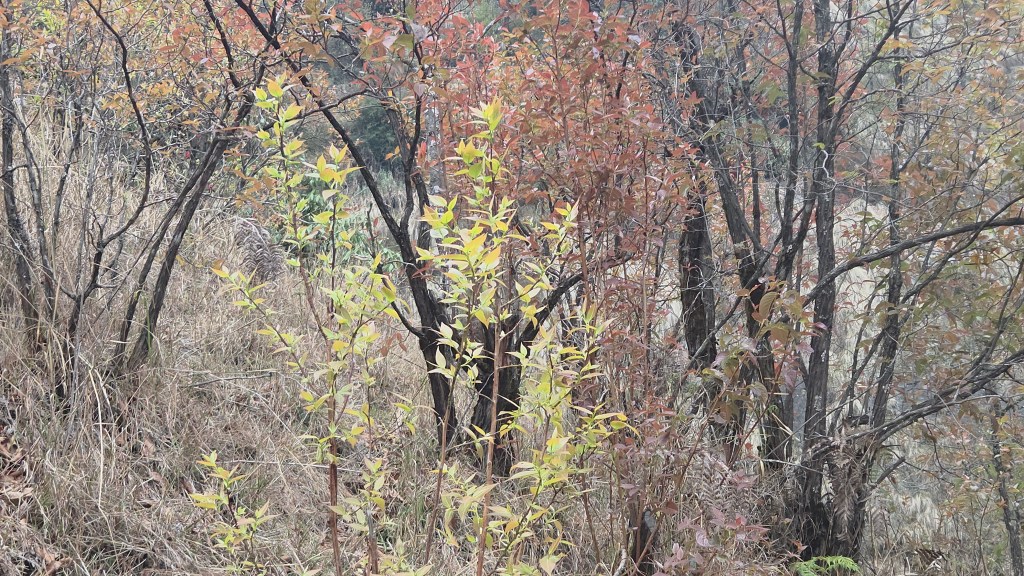
There was a small lodge. After removing our backpacks, we sat in its lawn for some rest, while our dal-bhat meals were being prepared. A dog was sleeping in the sunlight. Cool breeze flowed through the leaves of the surrounding trees. Chickens roamed around the place searching for grains. A goat was also there giving curious looks at Dhananjoy's bag. An old saying goes that there's nothing in this world that goats can't eat. We kept a cautious look while it inspected the bag from a distance. Finding it to be uninteresting, it's attention turned elsewhere. The lady of the lodge fetched some freshly harvested leafy green vegetables (called Rai Saag in local language). That raised our interest in the lunch. We're aware of this delicious dish of Nepal. It takes time to prepare lunch as they prepare it afresh. After about 40 minutes, we were invited to the dining place. Rice, lentils, Rai Saag, a vegetable curry and some pickles. Coupled with freshly cut onions & green chillies, the lunch was perfect. We pounced upon it and were quite satisfied at the end. A hike for another 2.5 hours awaited us after the lunch. Though not tough, hiking after lunch can be tiring. We strapped our backpacks & resumed our hike. By that time clouds started taking over. We navigated the stairs. A few rhododendron trees appeared.
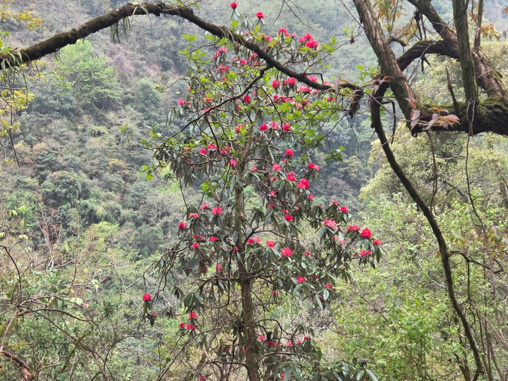
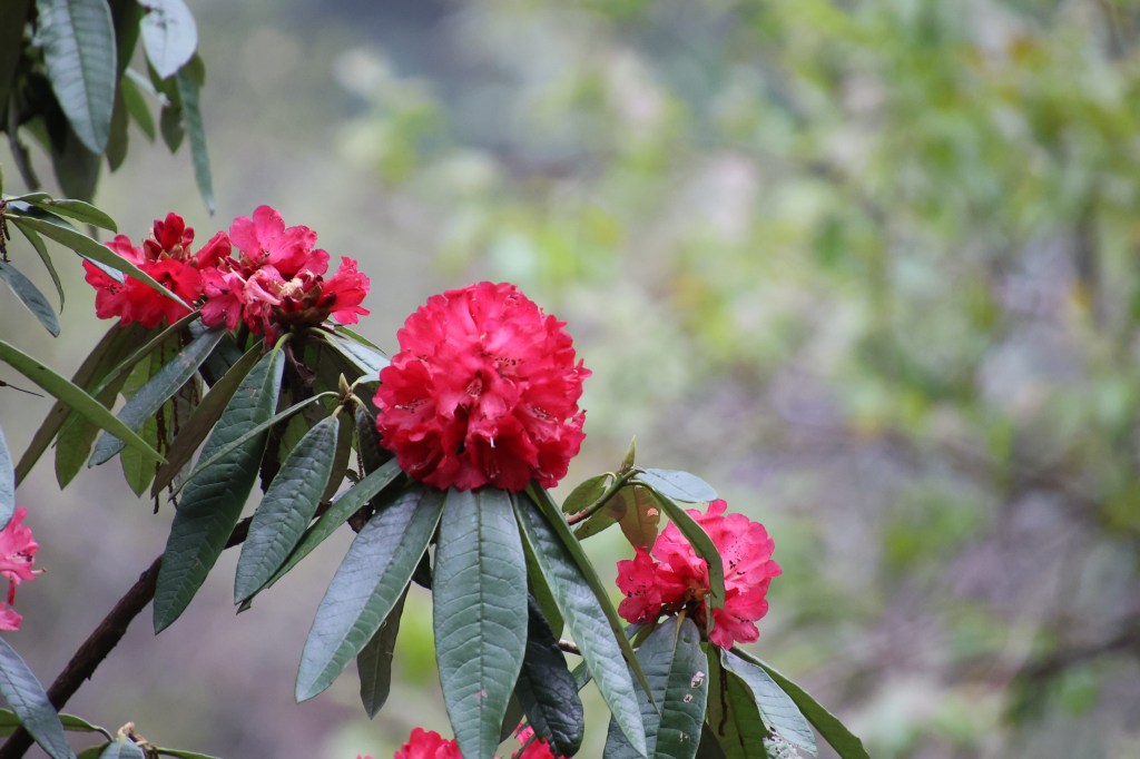
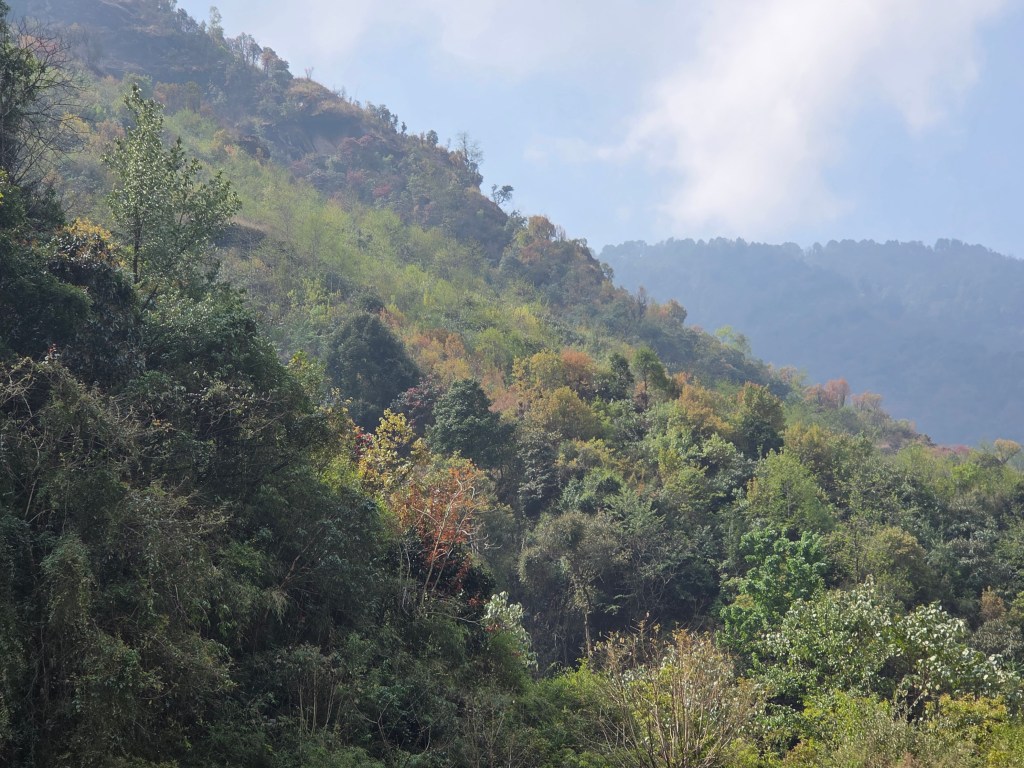
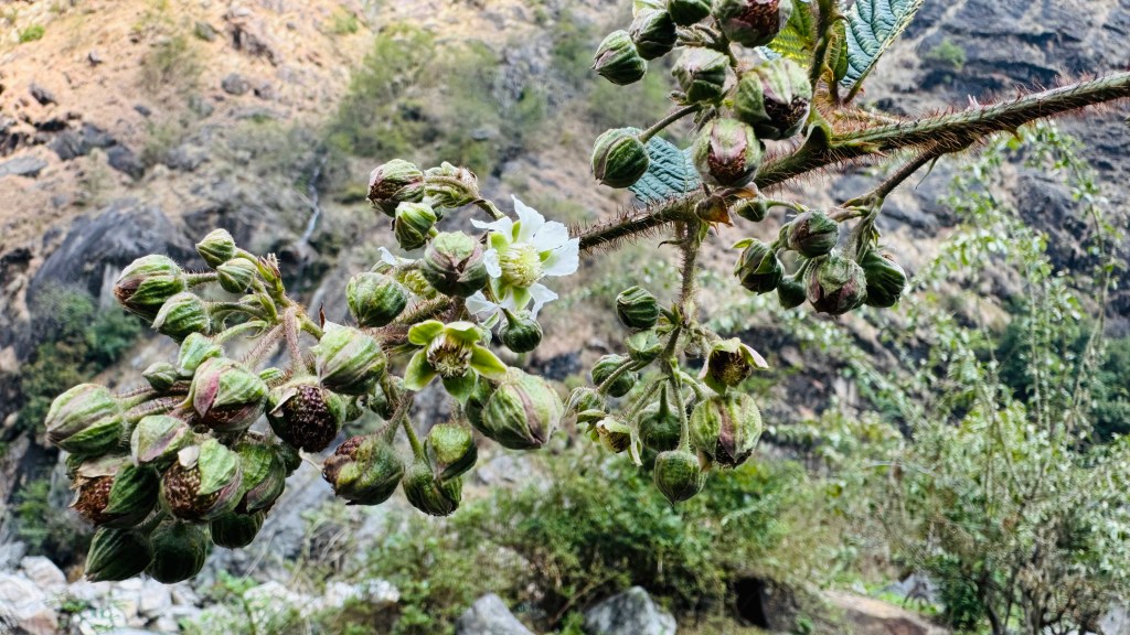
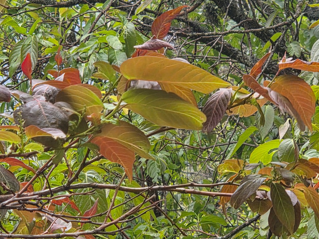
Flowers were few but bright red in color. We saw some trees with foliage of different colors (similar to what we saw on our way before reaching Taplejung. Though light was less, but we couldn't resist taking photographs. Such trees increased in numbers. We would see many more on successive days. Though time was passing by, there was no hurry as the total duration of walk was not to exceed 6 hours. We stopped at every bend for photographs. Just when we thought we saw the most beautiful color, another one turned up at the corner. The trunks & branches were covered with thick moss.
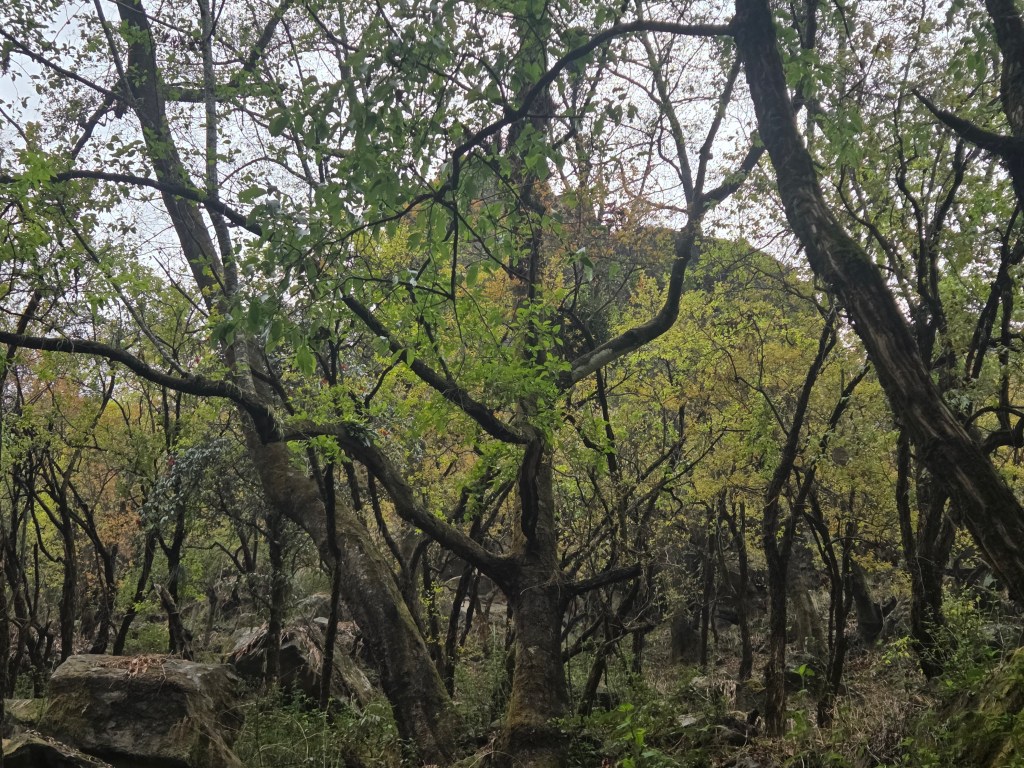
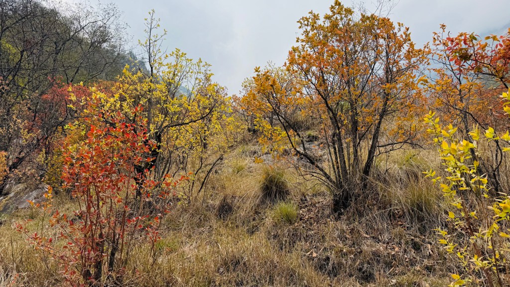

These forests must be a treat for eyes during monsoons. It's a separate aspect though, that most of the areas become inaccessible due to the swelling torrents of the Ghunsa river or the landslides brought on by incessant rains. We kept moving up under the canopy. The sky also bore a dark appearance. I was wondering whether we need our rain covers but Dilal assured that it won't be necessary.
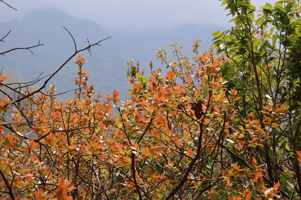
En-route Amjilosa
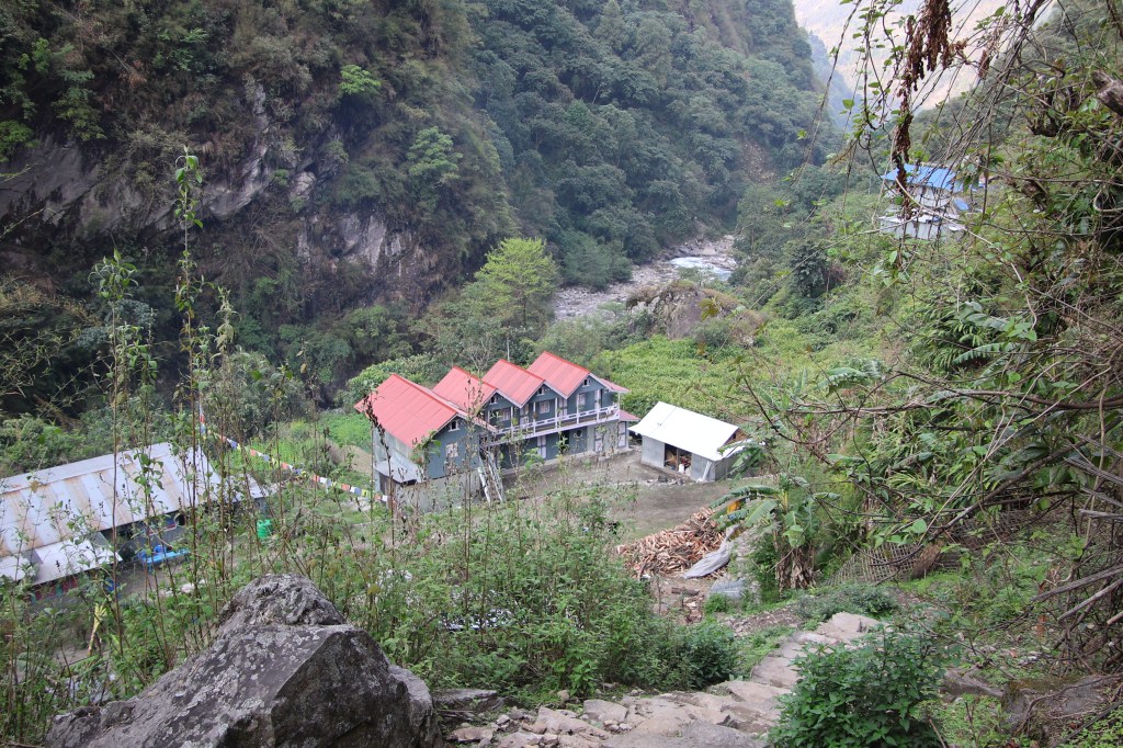
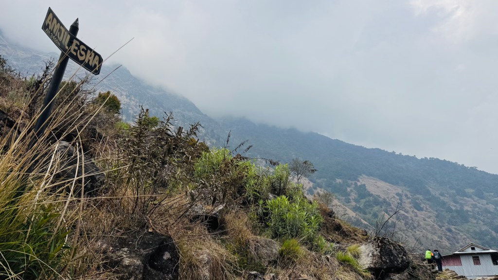
After hiking for a couple of hours we came out in the open. The track now moved along flatly. The lodge (there was only one) of Amjilosa was now visible at some distance. It was still some way to go, but the sight of destination always gives satisfaction and energy. The lodge was spread across terraced slopes. It's dining room & kitchen was at the lowest level, the next level had some rooms for porters and guides. The room for us was at the highest rung. There was a flat ground. To the left, lay the rooms, the toilets lay to the right. When we were unlocking the room keys, we heard sounds of thunder. We thanked our luck for arriving just in time as a light drizzle started immediately. After changing to our room wears, we hung our trekking clothes in the balcony. There were some clips (which reminded me of forgetting to pack them, despite planning to do so much earlier). Then we headed to the dining space (as is the norm for tea house treks in Nepal).
We met a group of French trekkers there. They were a group of aged friends who have been coming to Nepal for at least 30 years. Every year they bring & distribute "items of relevance" to the inhabitants of every village they stop along the route. This time around, they were distributing sunglasses which could protect against ultra violet radiation and snow blindness. Their target recipients were porters, guides and potentially yak/sheep herders who often travel to higher echelons of the Himalayas in search of pastures for feeding their animals. Such routes often involve crossing high passes, traversing glaciers and sometimes climbing as well. The Frencg group always travel with the same set of guides & porters. They've worked out a reciprocal program where these porters & guides travel to France and work there for a few months. This time, this travel has been adversely affected because of shooting costs of air travel due to the ongoing West Asian crisis. This cultural exchange was apparent from the fluent bidirectional French conversation between the French travelers and their porters and guides. We'd meet many other French groups as well as travelers from other countries during the trek but not any other Indian. I was talking to one of the members. They've been on every known trail of Nepal, even in the Dolpo area of Western Nepal about 20 years ago. Dolpo was the hotbed of Maoist insurgency in those days. There weren't any tea houses in those days, all was about camping or residing in local village homes or schools. They visited the Shey Phoksundo lake, stayed at the Rimgmo village on its banks and even at Saldang. That's an area of immemse interest of mine. Hence, I spent a lot of time discussing this topic with him. The previous evening, while having beer, Dilal cautioned against alcohol consumption in the higher areas.
Dilal speach:
"You will having beer in low place. You will not having beer in high place. Not good."
Here's one small addition to Dilal's English grammar, just so it doesn't sound like an order, which wasn't his intention. "Will" here equates to "can". Got it? Wonderful, rest is a cake walk for you. When asked to provide a concrete boundary that separates low from high, he put Amjilosa at high. Immensely disappointed with that decree, we negotiated hard and were able to trade in Amjilosa. We were able to shift the boundary further by another two by inviting Dilal to join us, but it came at a price. With that somewhat weak "trade deal", he stuck to us for the rest of the trek for the drinks sessions, which we found hard to escape from. Coming back to the current phase, we enjoyed a few beers. Dinner was served at 7.30 PM and we retired to our rooms after that. By this time, the drizzle has transformed to proper rain. I tossed around the bed, thinking about it. I normally don't like rains in these parts of the world (however selfish it may sound). They could wreck havoc by closing trails, adding to delays, thereby upsetting plans. We faced it at Goecha La as well as the Annapurna circuit. On the latter ocassion, it cost my visit to the Tilicho lake (by playing on my fear of snow), but the plan somehow survived its onslaught after some adjustments. Could Goecha La repeat here? Is Kangchenjunga still not ready to accept me at her premises? The sound of the rain on the roofs sounded strong. I silently ventured out of the room to check the situation as well as visit the toilet. Coming out in the open, removed many of my concerns. The rain didn't feel that strong as it sounded on the roofs. But what if it continues raining throughout the night? Though I scaled down the intensity apparent from the sounds by the factor observed by me by going out, the concern remained about the duration. Also, rains at lower altitude implies snow at higher. There was a contrast between my states of mind at Itahari and here. It was at a high there driven by expectations. It dipped somehow by the rains but I forced them out to concentrate on sleep. We were at 2400 m.

wow, such beautiful words and images! we met on trek and we too are still working through our pictures & experiences. thanks for posting this incredibly detailed account, it brings our trip right back to life.
LikeLiked by 1 person
You went to south basecamp trail as well, right? How was it? Would like to see pics from that trail too
LikeLike