In the land of the sherpas – the plight of Lukla

Gokyo

12th May, 2016

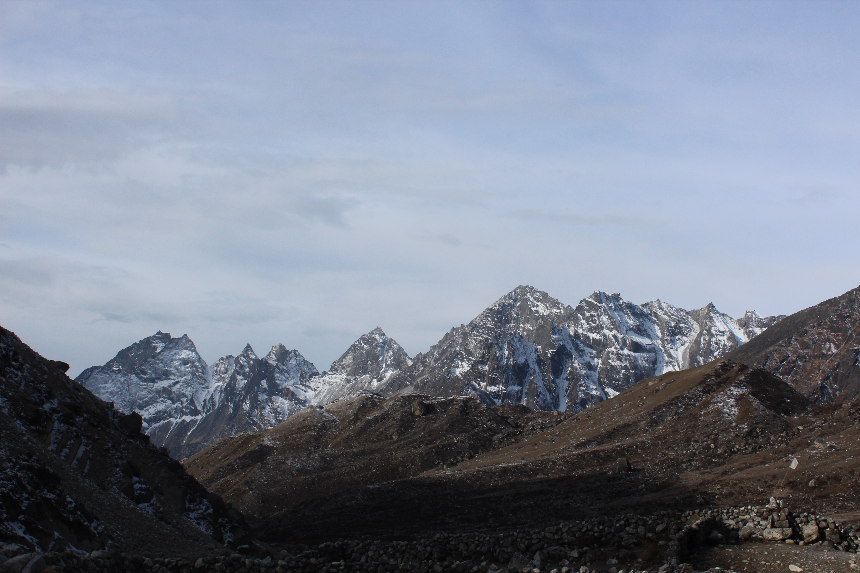
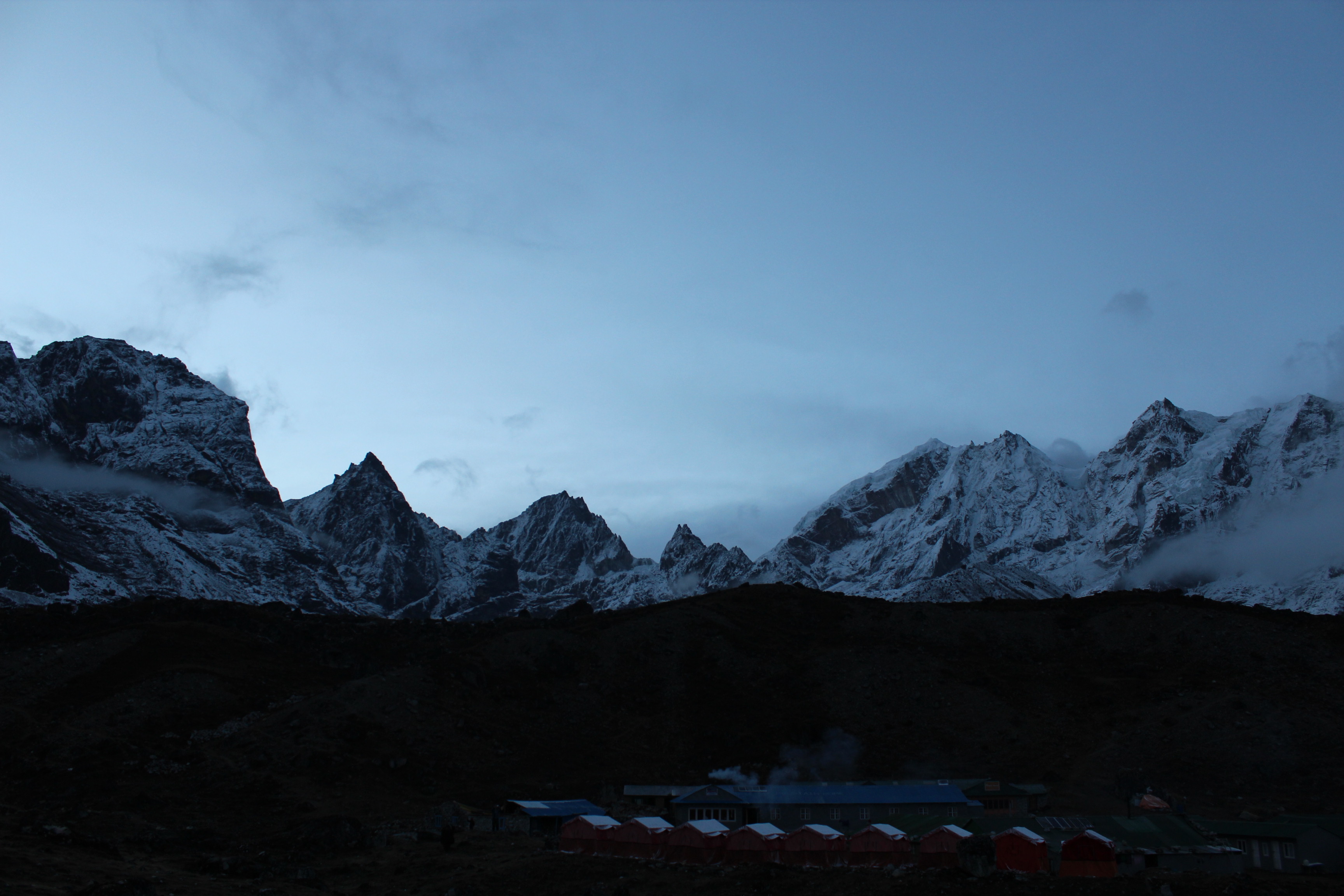
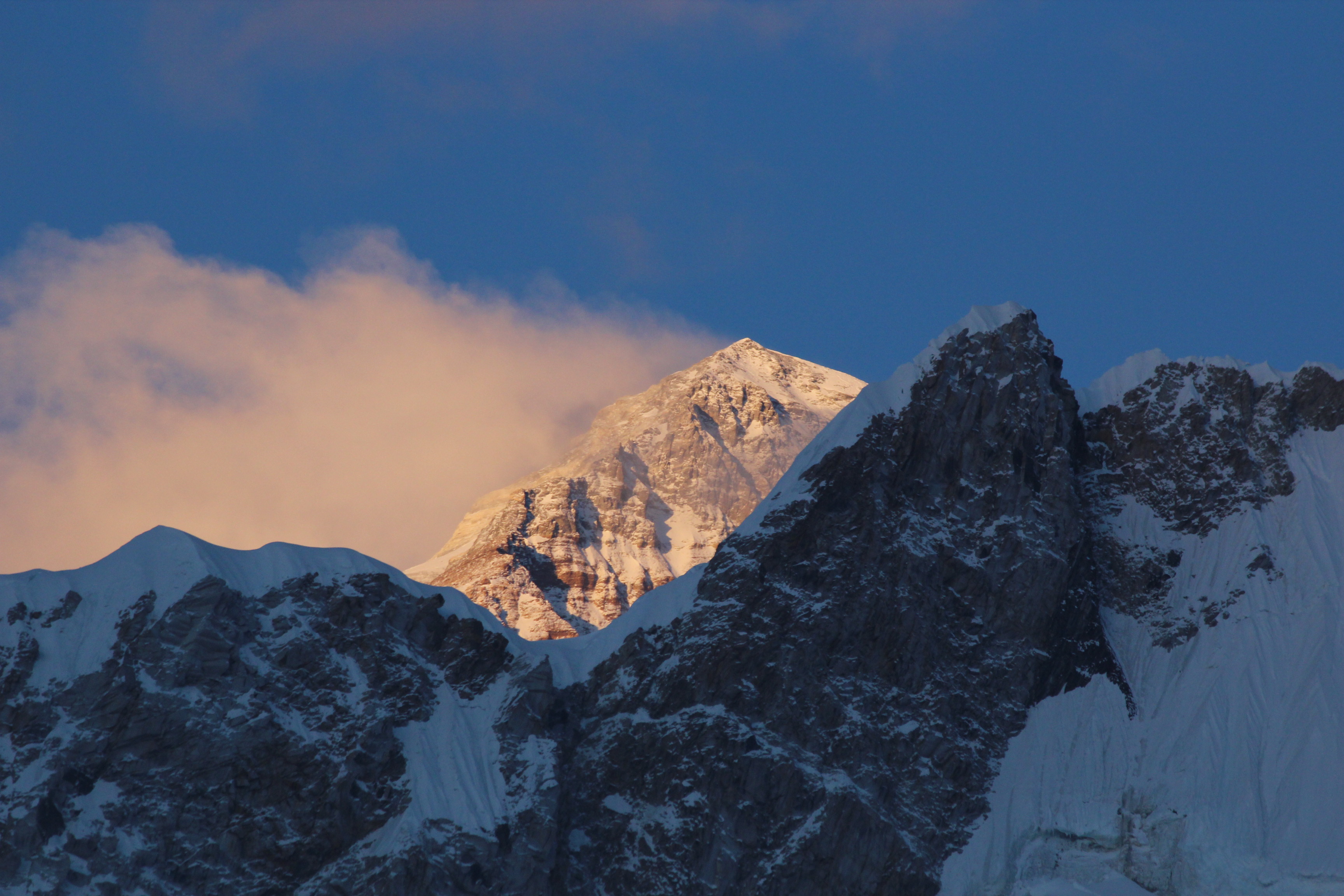
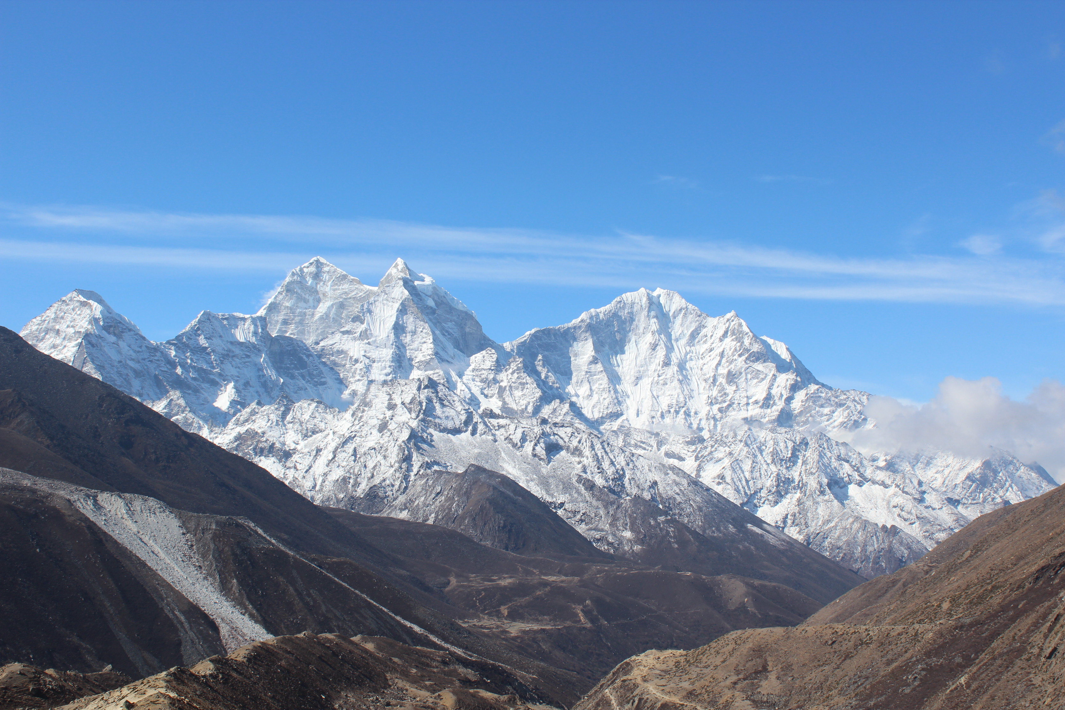
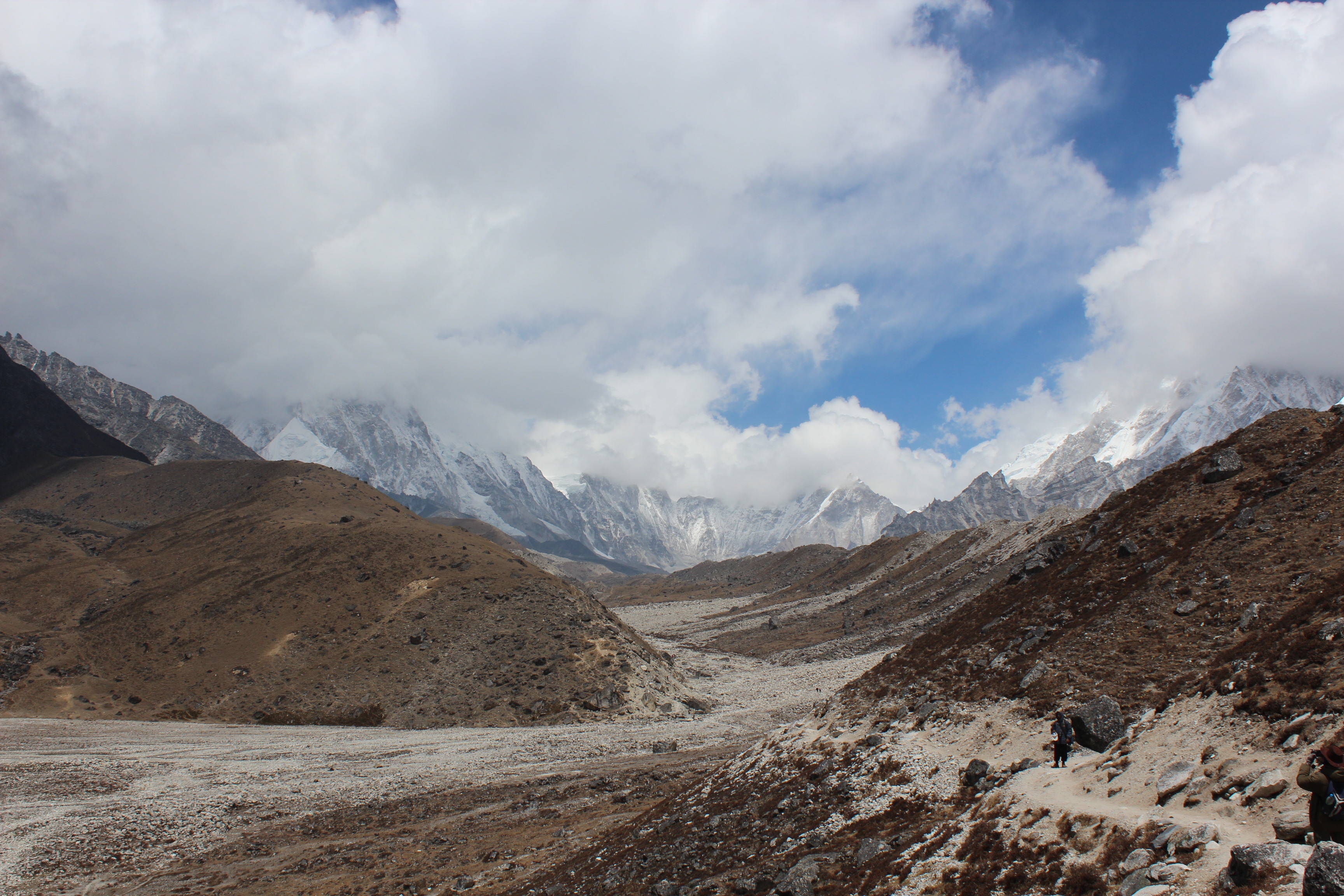
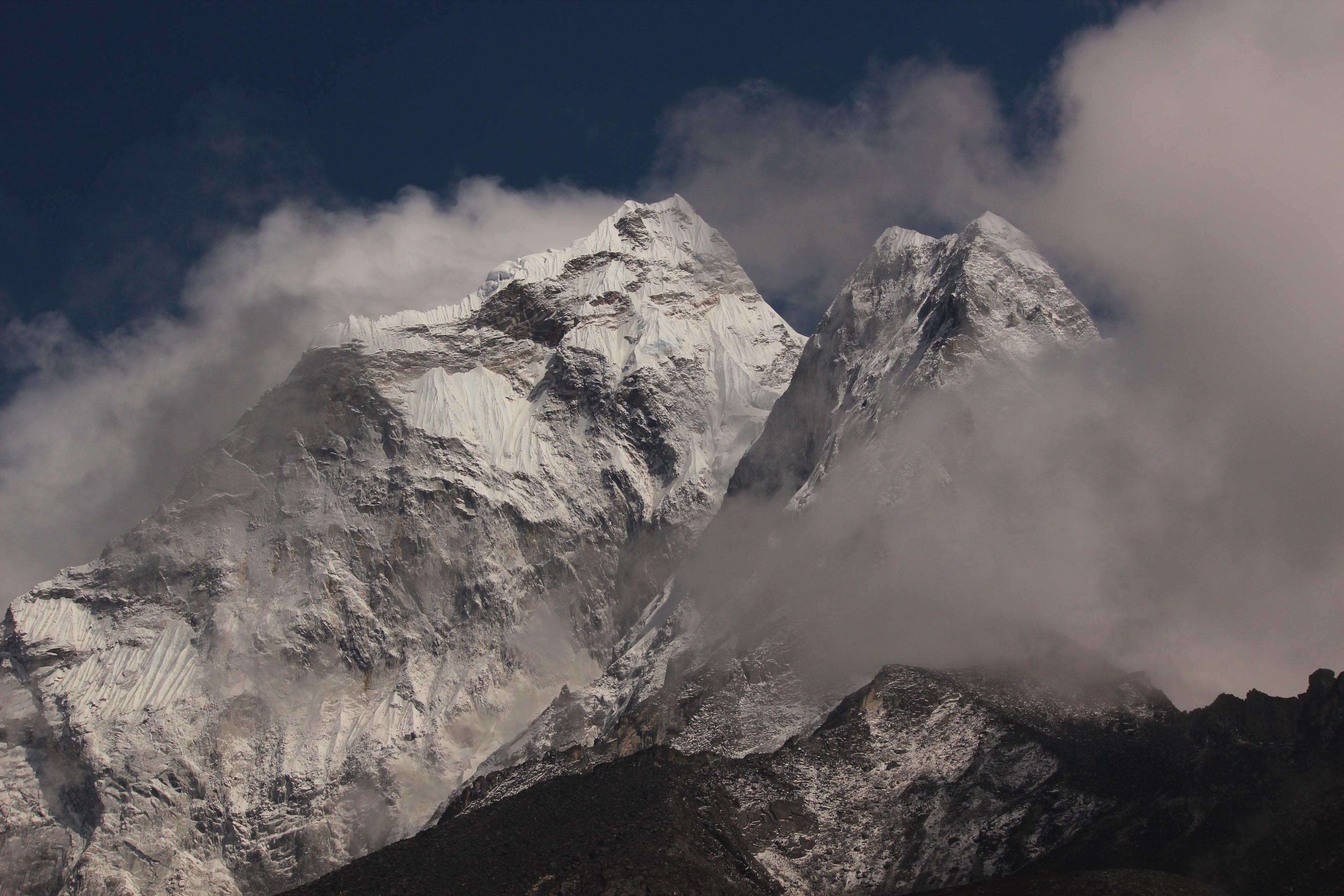
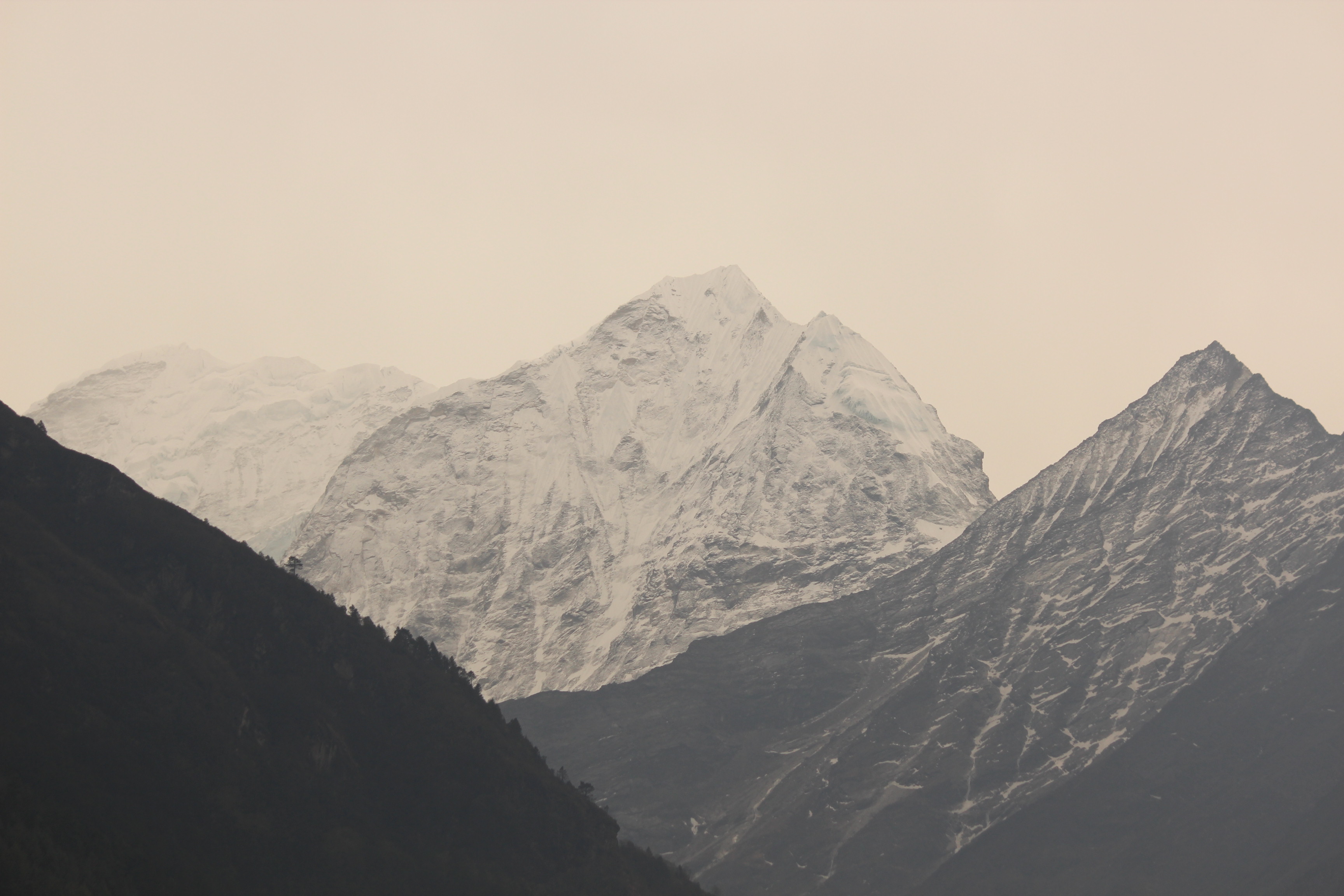
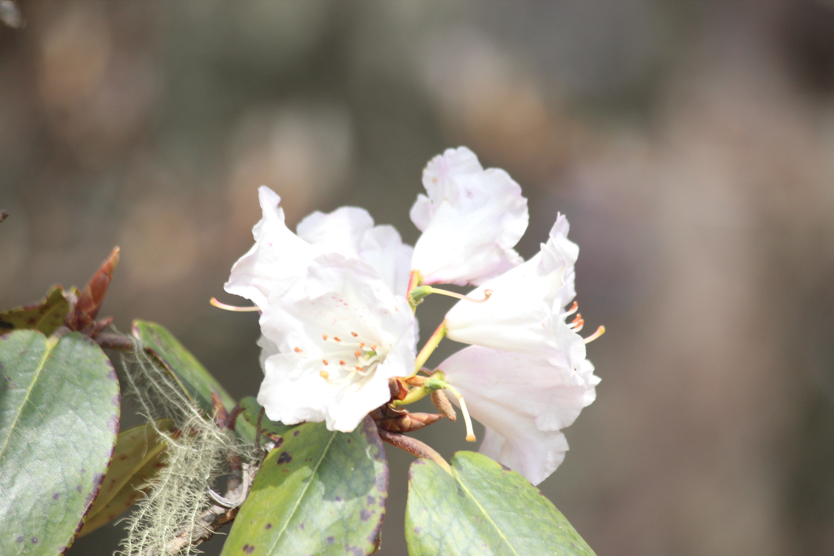
As we moved out of Dole, the next morning, trees started to reappear. They increased in numbers and we could once again see the blooming Rhododendron flowers, though lesser in numbers than what we saw on our way up to Tengboche from Namche. That told us, we were re-entering the reaches of the forests near Namche. The Khumjung village (the place that has a monastery with supposedly a “Yeti scalp”) is not far from Dole. Forest cover increased and it gave a refreshing feeling of homecoming of sorts with the increasing Oxygen levels.

IMG_3987

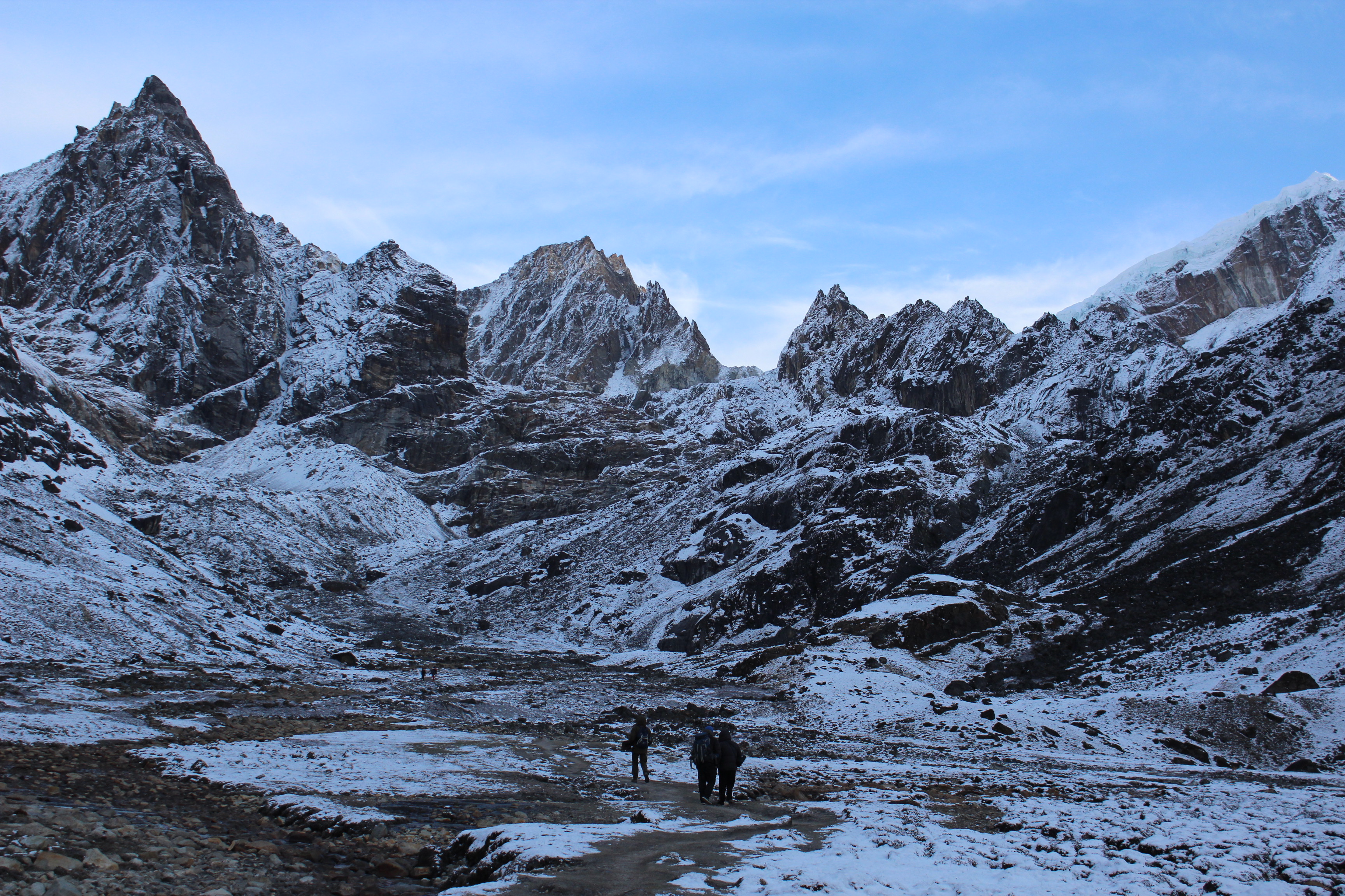
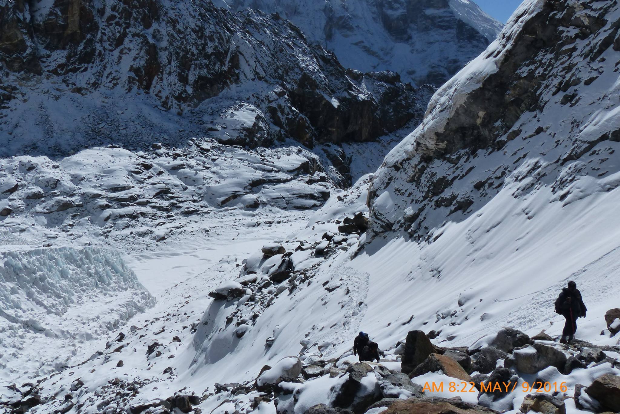
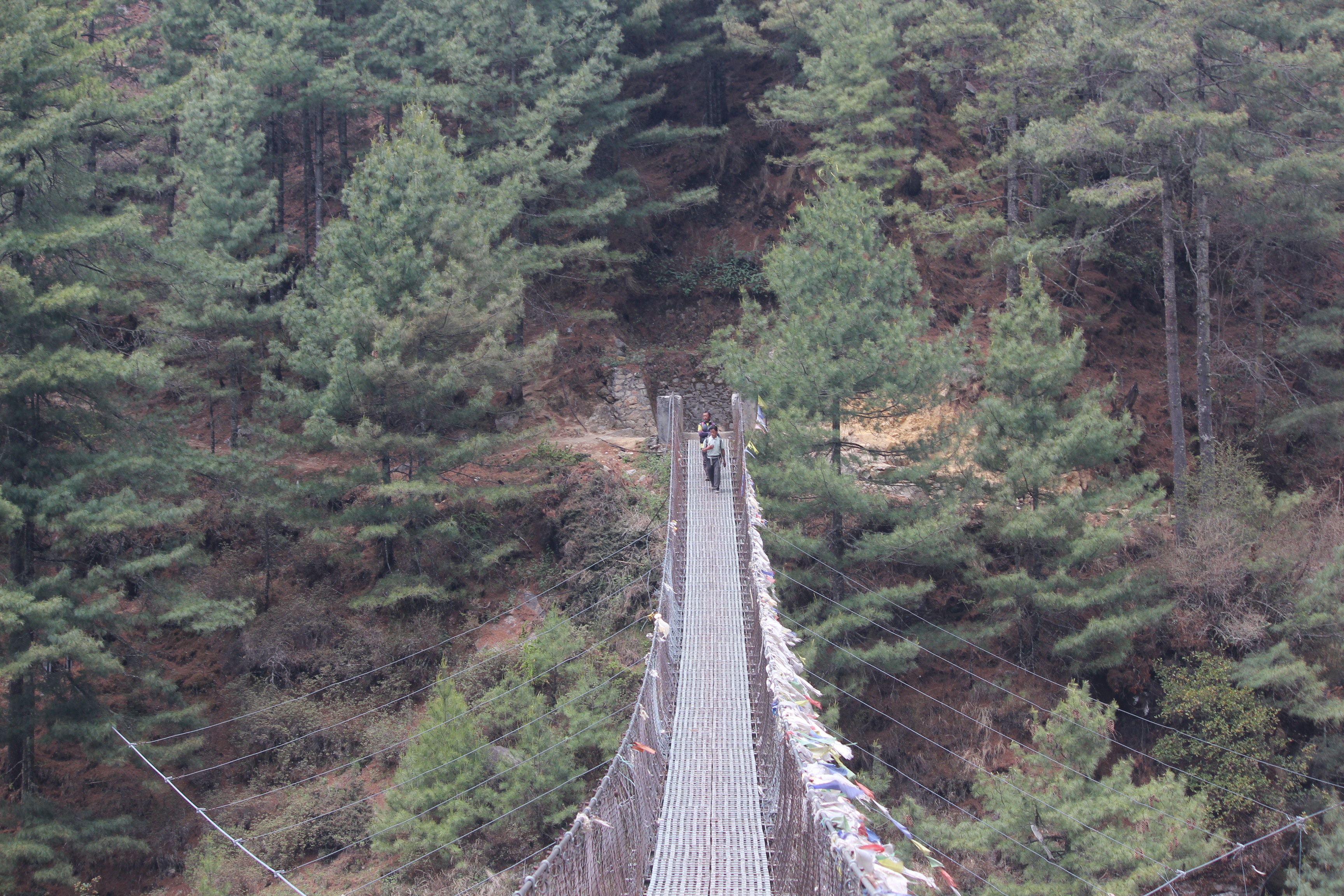
En-route Namche from Dole

We kept moving through the forests in the outskirts of Dole till we reached a junction. There were some tea stalls. Our cellphones started capturing their signals again and we spoke to our respective homes after a gap of eight days! We were very excited to tell our tales and to their relief, they came to know we were safe and sound! Raju pointed towards a steep hike that would take us to a top, our place for lunch. That would probably be the last hike of the day and the good part was, after lunch, the trail went down the slopes. We continued our hike till we reached a lodge and spread our legs and arms on the chairs out in the sunshine as we waited for our lunch to be served.

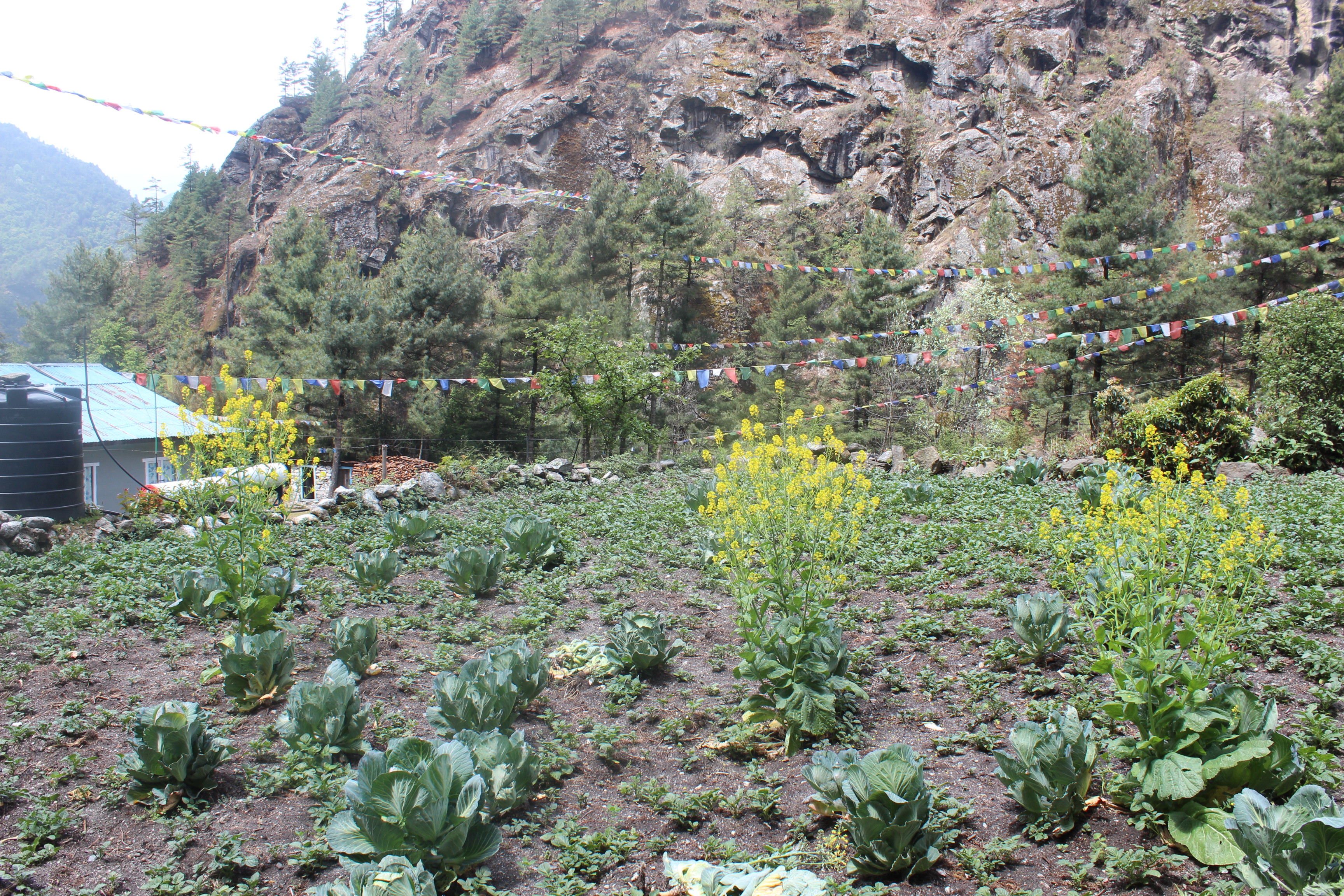
After lunch, it was an easy stroll down the slopes. The terrain looked familiar to the regions we crossed on our way to Tengboche. We reached a junction where one trail moved up towards the Khumjung village. We headed down the other trail to reach another junction. This was familiar to us. We crossed this on our way up to Everest Base Camp. Now we reached the same place coming down the other trail from Gokyo. Our trail now merged with the main path that led to Namche. The sky was overcast and it started to drizzle. The minor ups and downs, corners and bends, were all familiar to us. After taking a turn, we could see the helipad of Namche on a distant slope. We found ourselves at the Hil-Ten lodge once again and made ourselves comfortable in its dining space. This was almost like homecoming. The hotel staff asked us about our journey and we shared our experiences. It had the same buzz as we found on our way up.

13th May, 2016

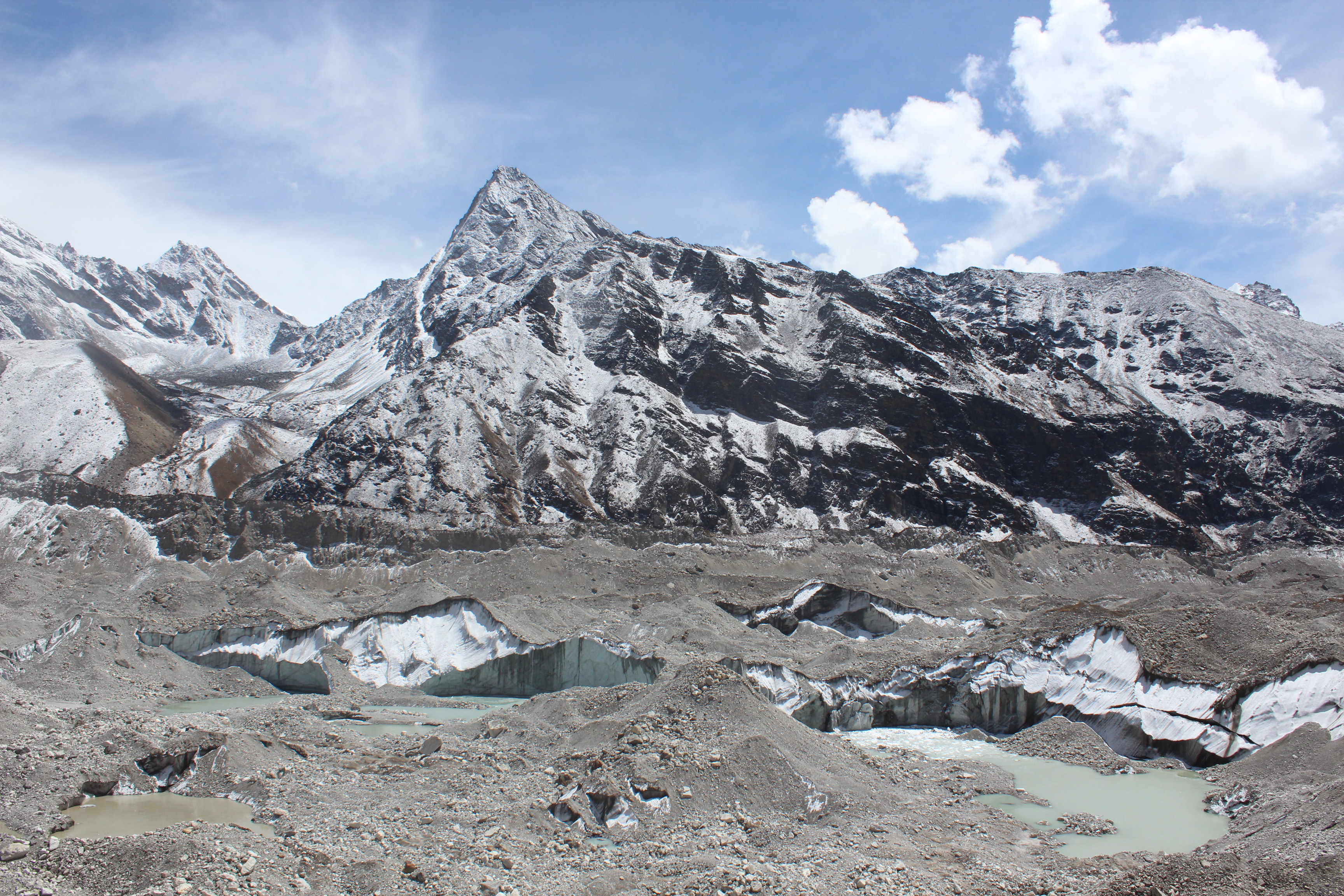
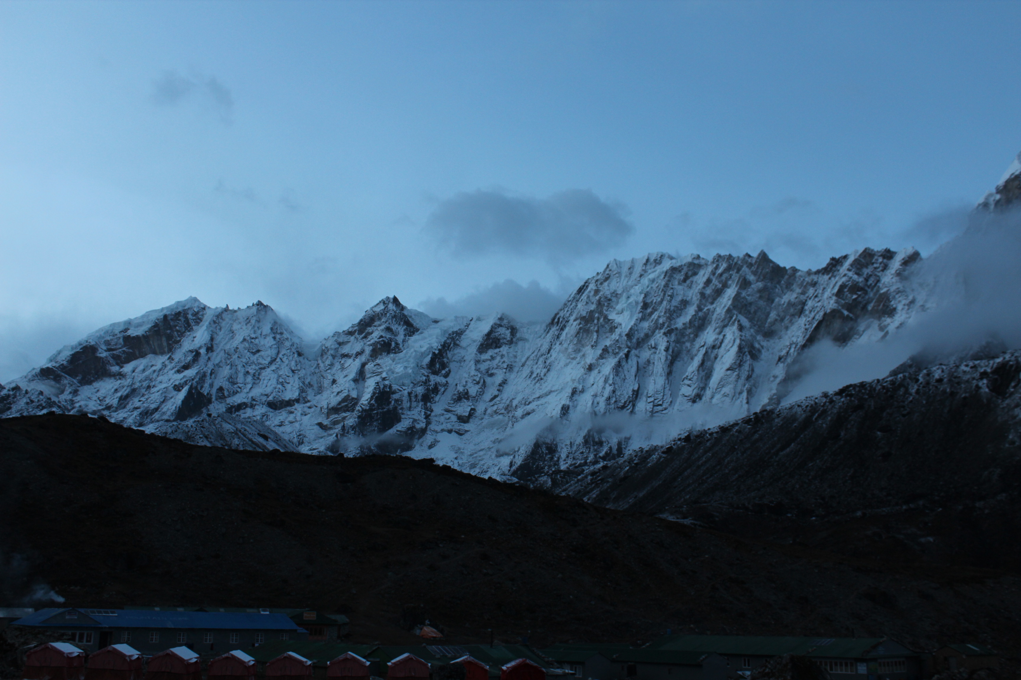
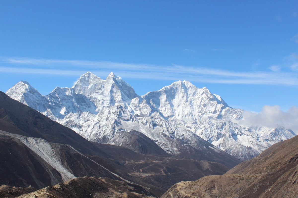
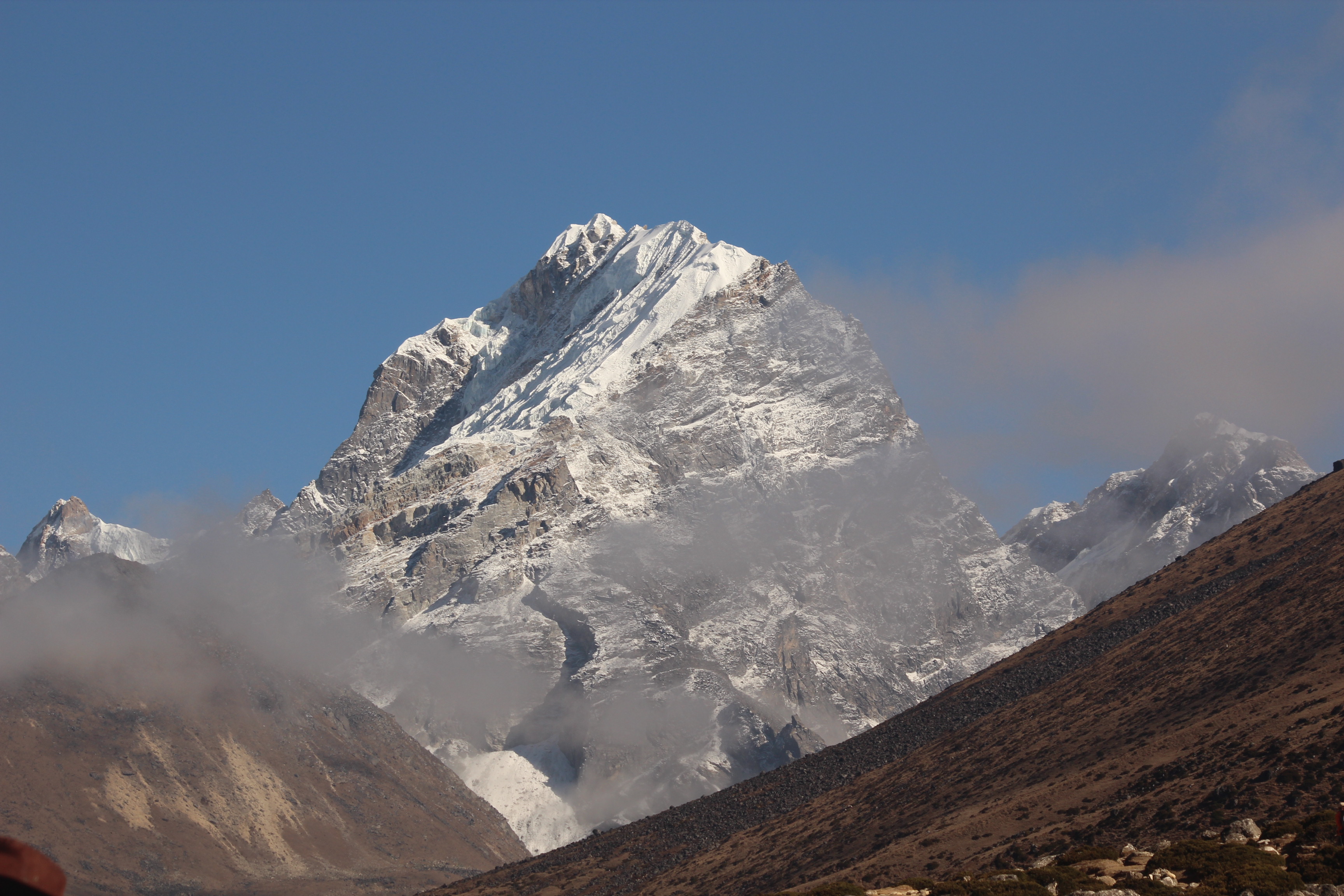
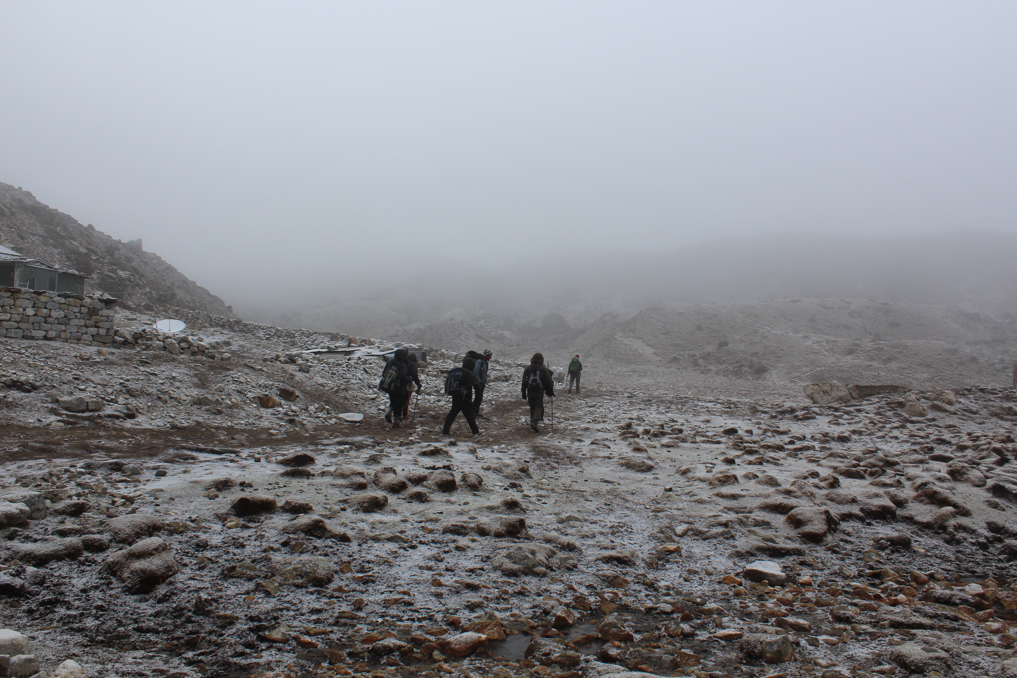
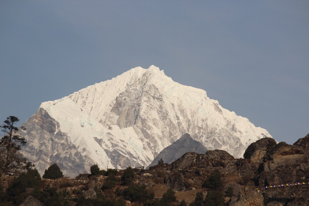
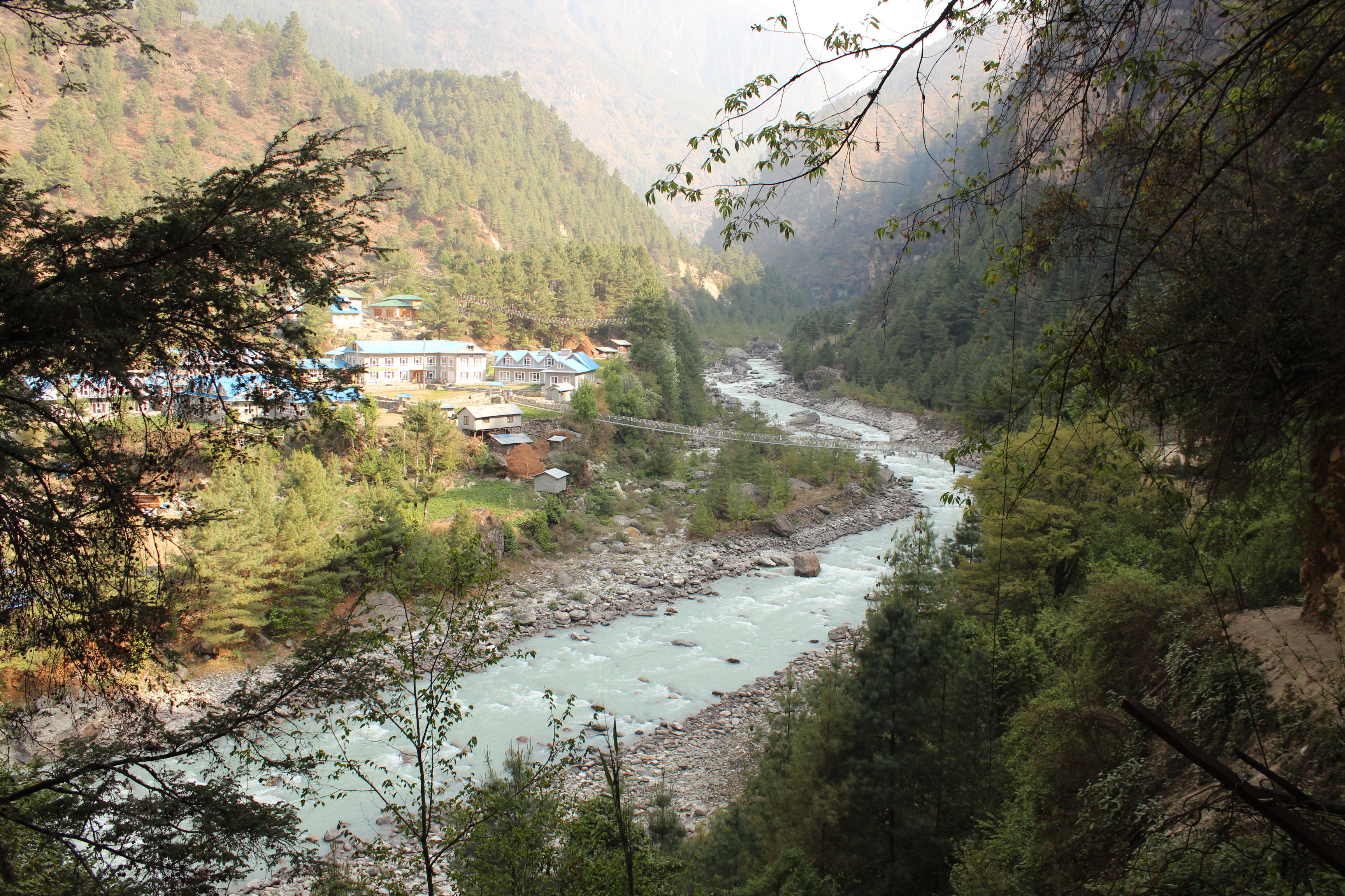
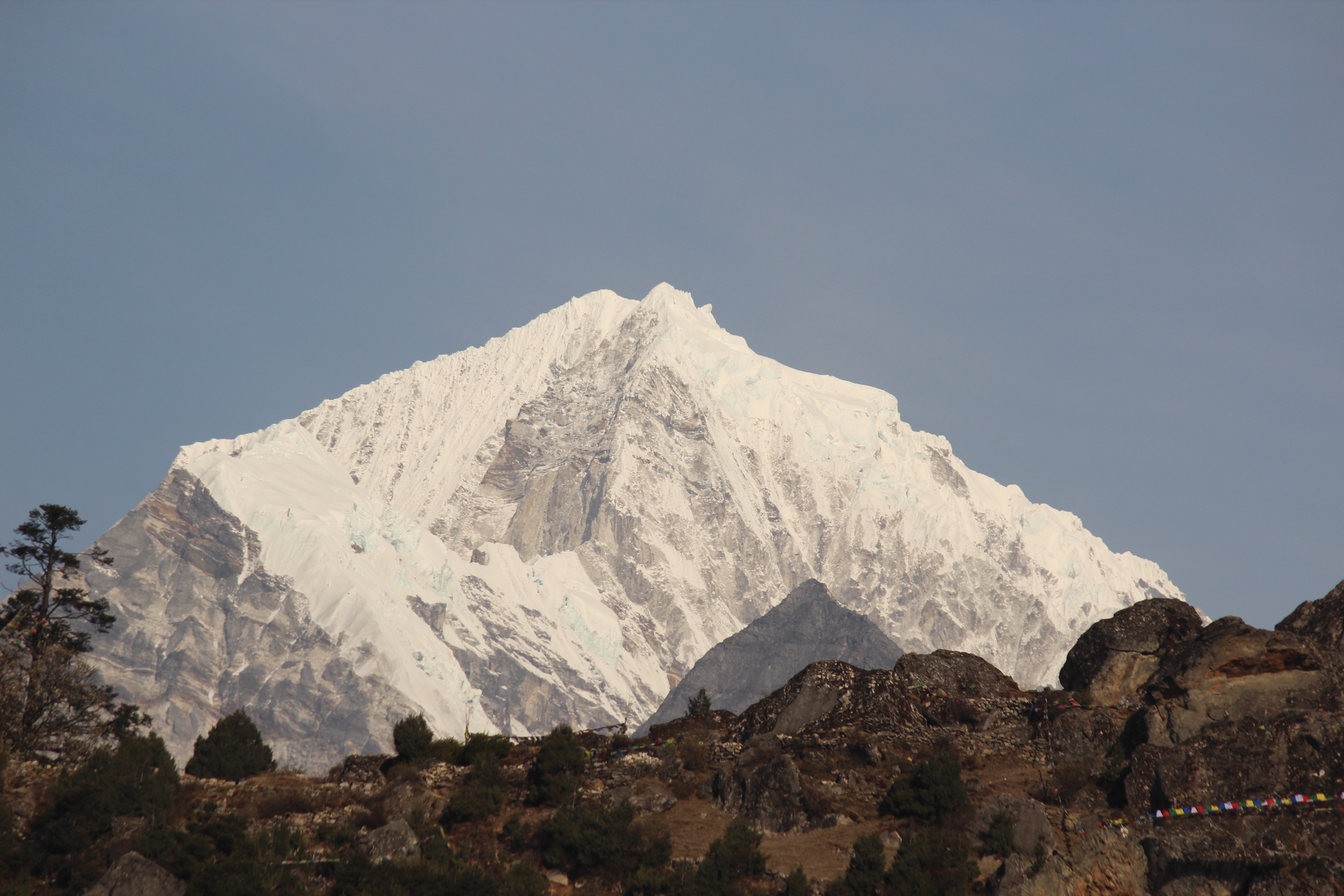
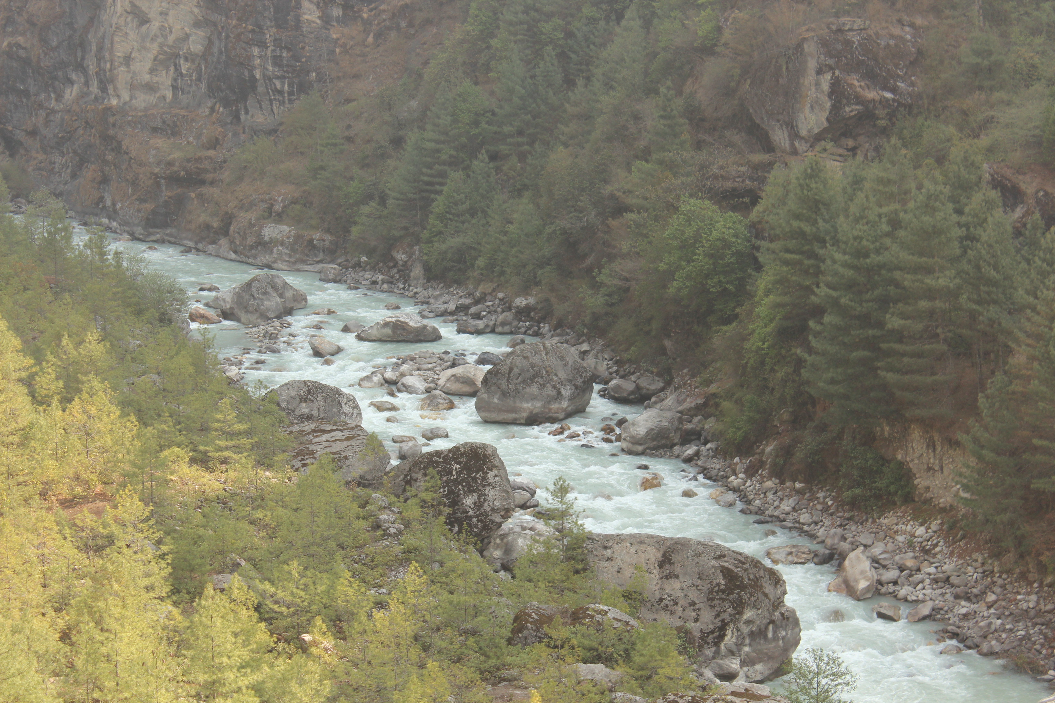
It was time to bid goodbye to the Hil-Ten lodge and the main Sherpa town of Namche Bazaar. We spent sometime taking snaps with the lodge owner while he shared some of his mountaineering experiences. Apart from Everest, he has been to the Annapurna and other regions of Nepal. However, he realized that the risks involved far outweighed the gains. Hence, he setup this lodge and now runs it successfully. We left the outskirts of Namche on our way down. The day was going to be long for us. We had to reach Lukla, the same day. The trail that took us 2 days to hike, had to be covered in a single day. It was going to be tiring. We entered the woods and walked down its slopes. It was a steep walk down which put pressure on our legs. It was in these woods, we came across the huge fat person on our way up. He was being assisted from both sides by his guides. Not sure how far he was able to get beyond Namche. Then came the double-decker bridge at the confluence of Dudhkosi and Imja Khola rivers. It was here where the Japanese trekker suddenly skid across the edges and was promptly saved by his guide. We walked along the banks of Dudhkosi to reach Jorsalle and hiked up to reach the gate of Sagarmatha National park.
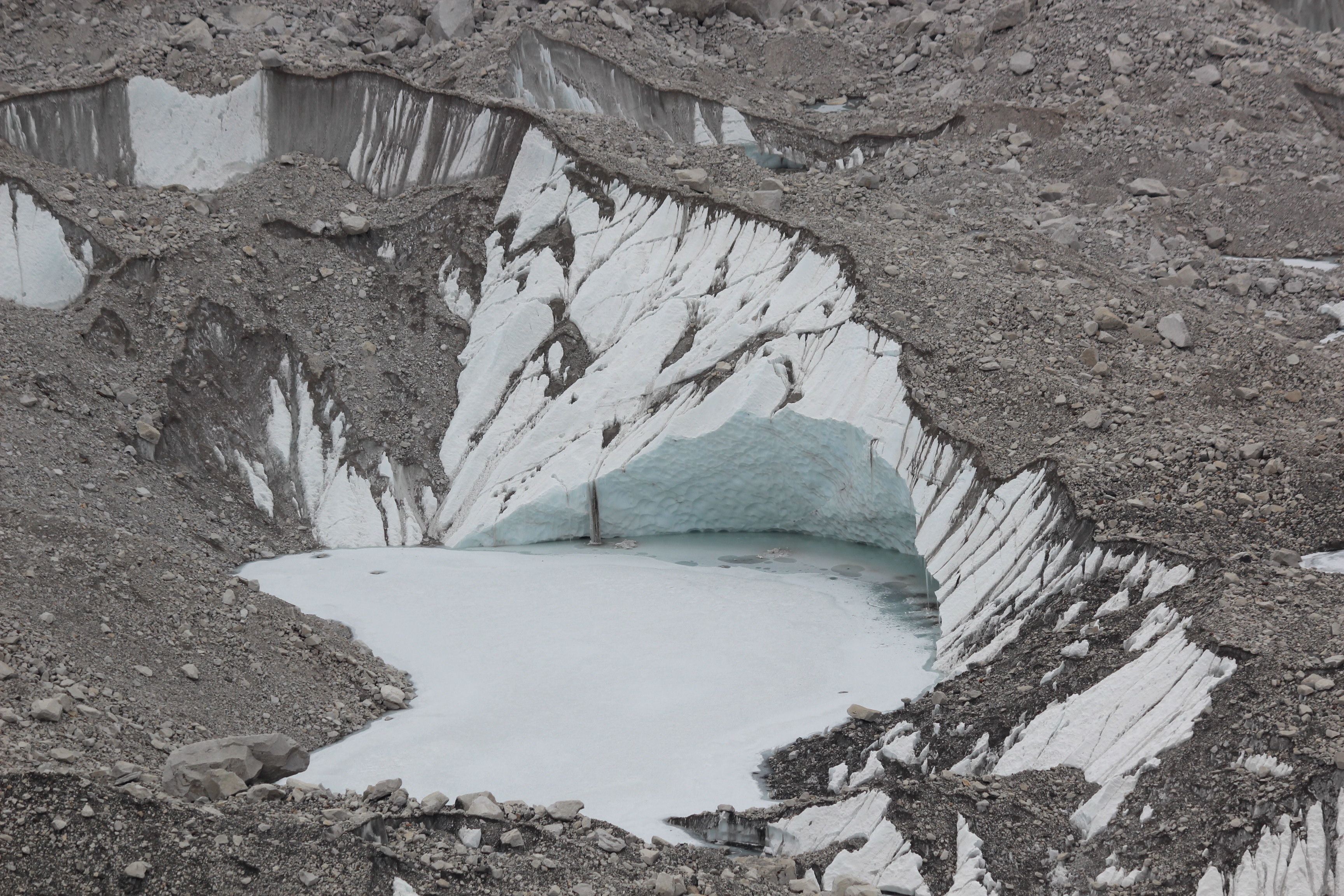
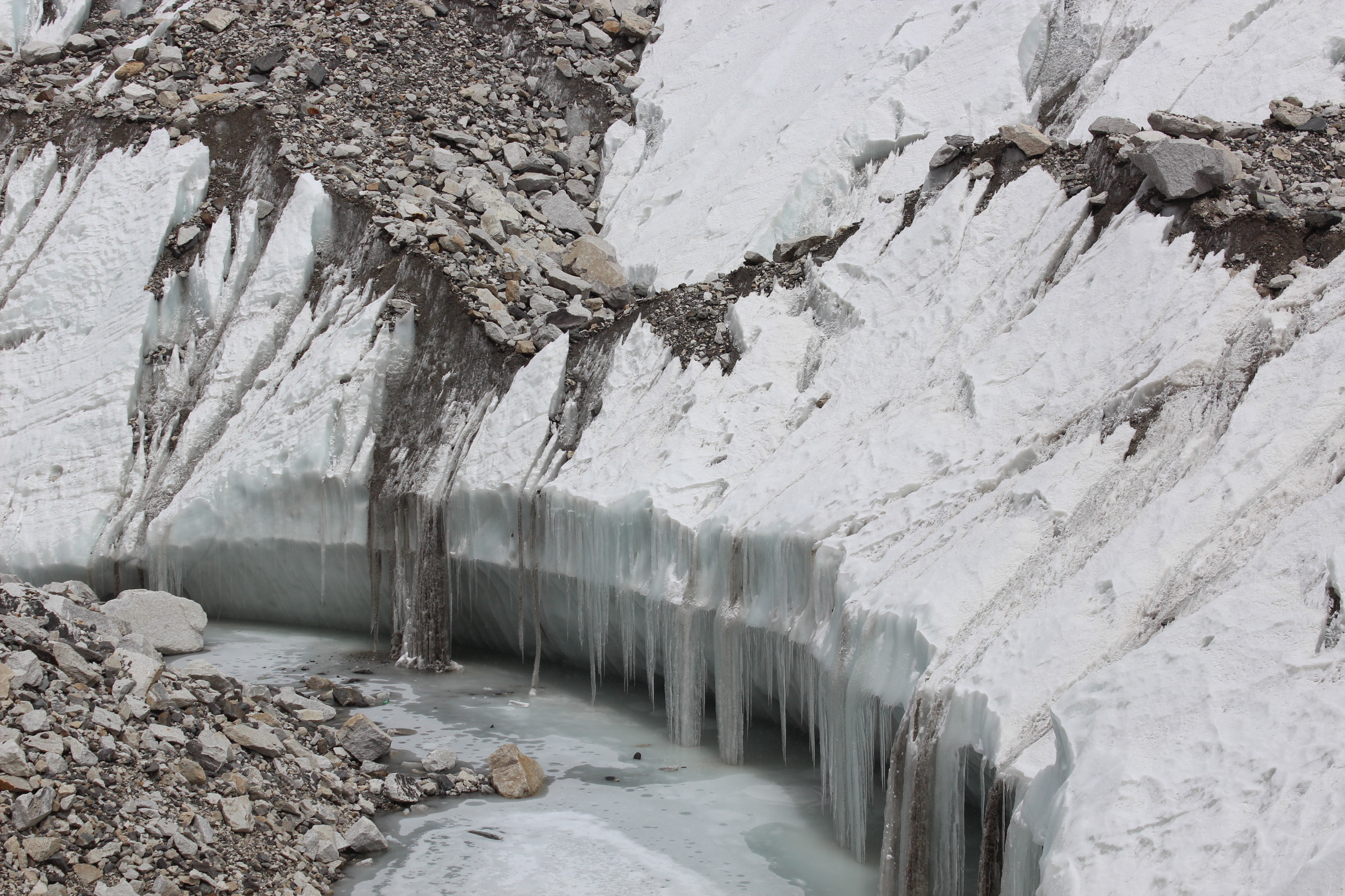
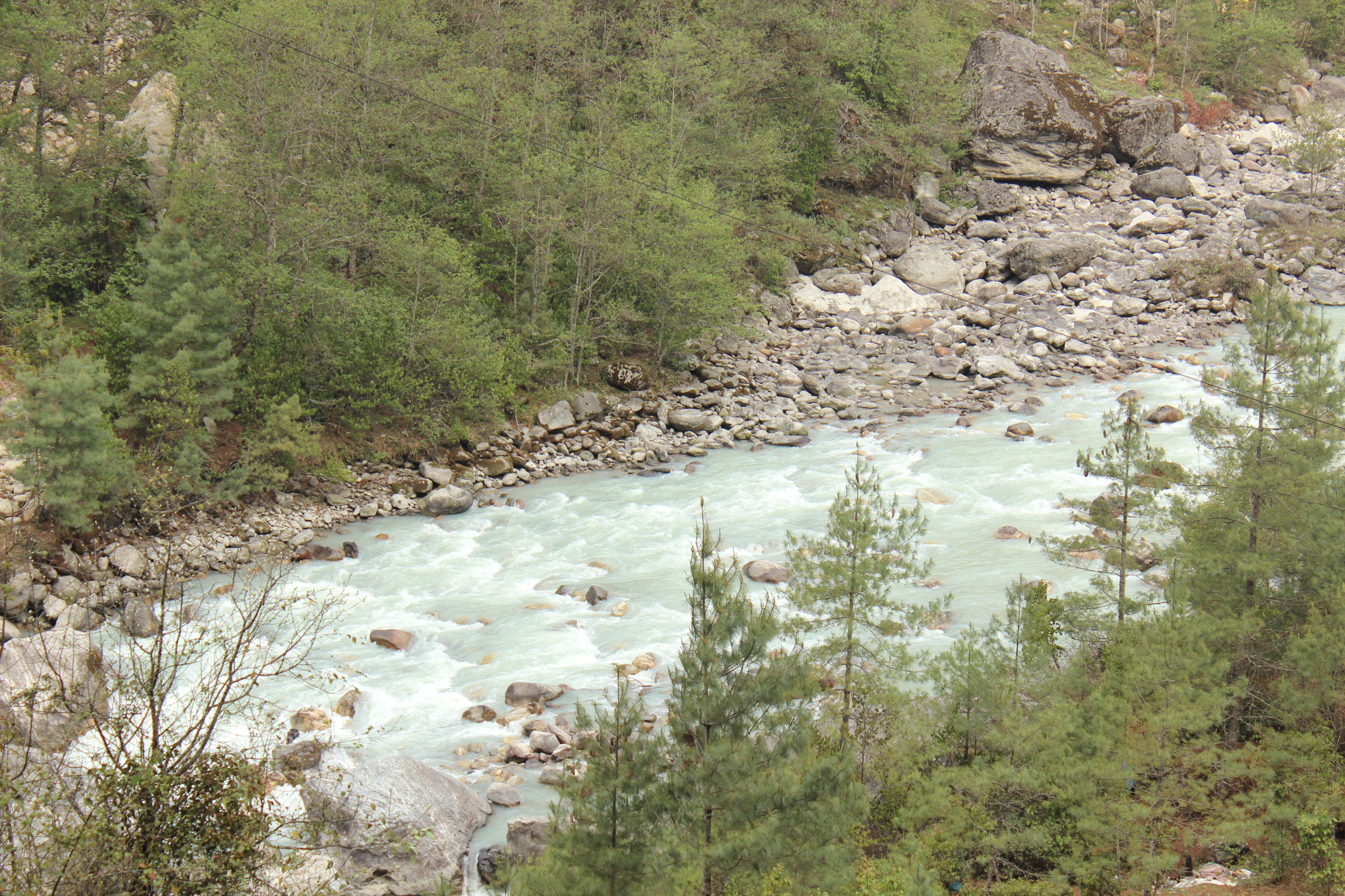
IMG_4296

Dudhkosi

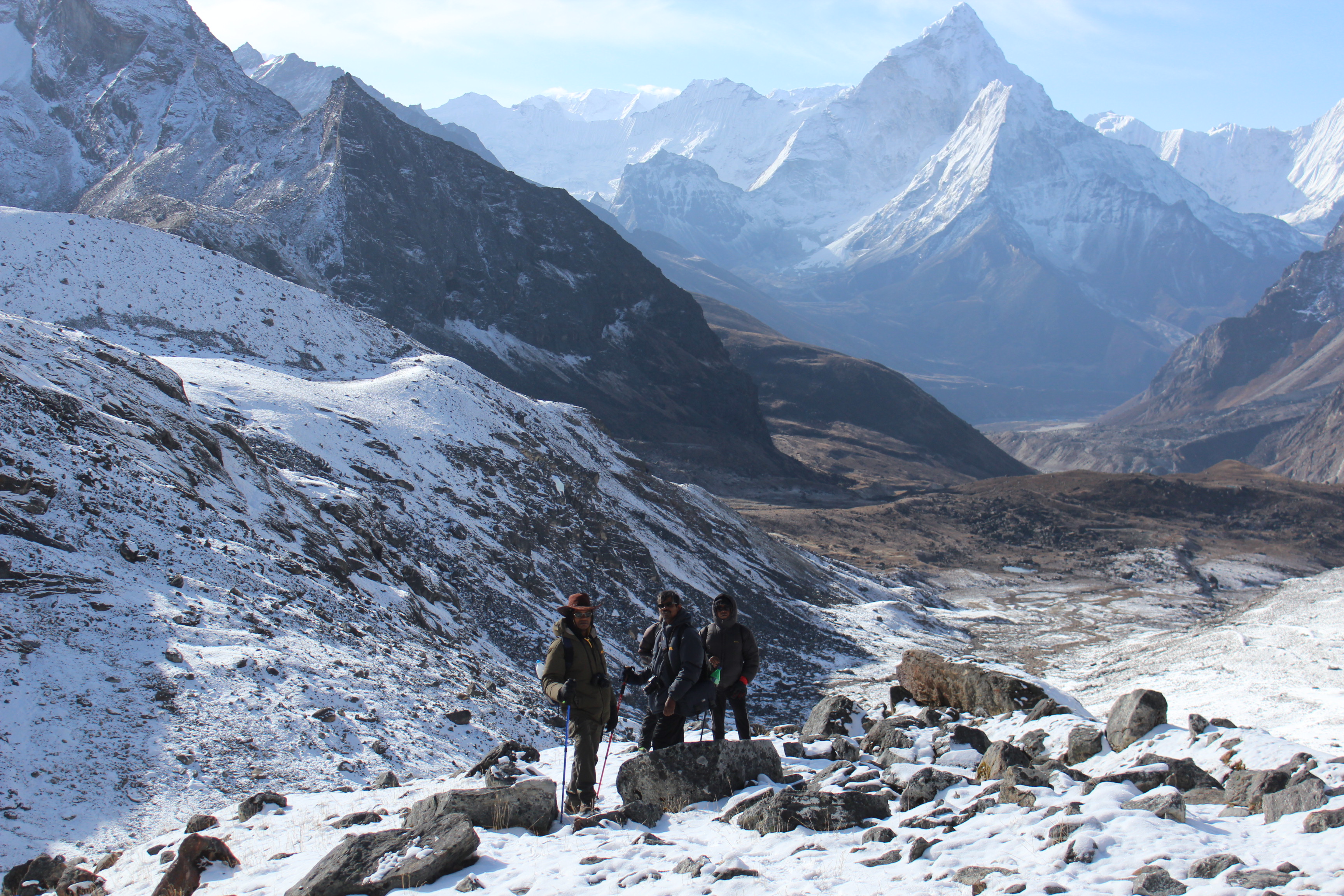
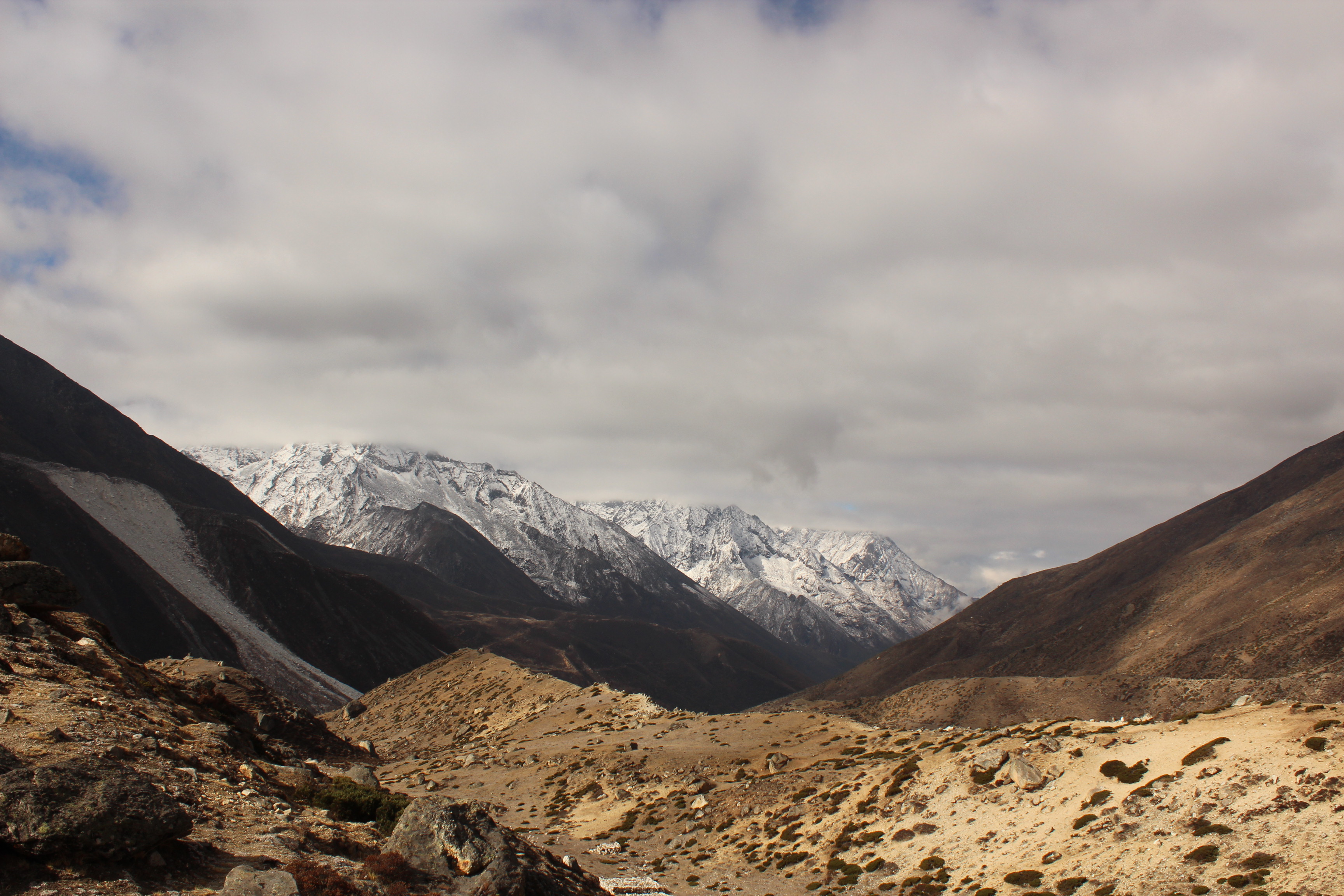
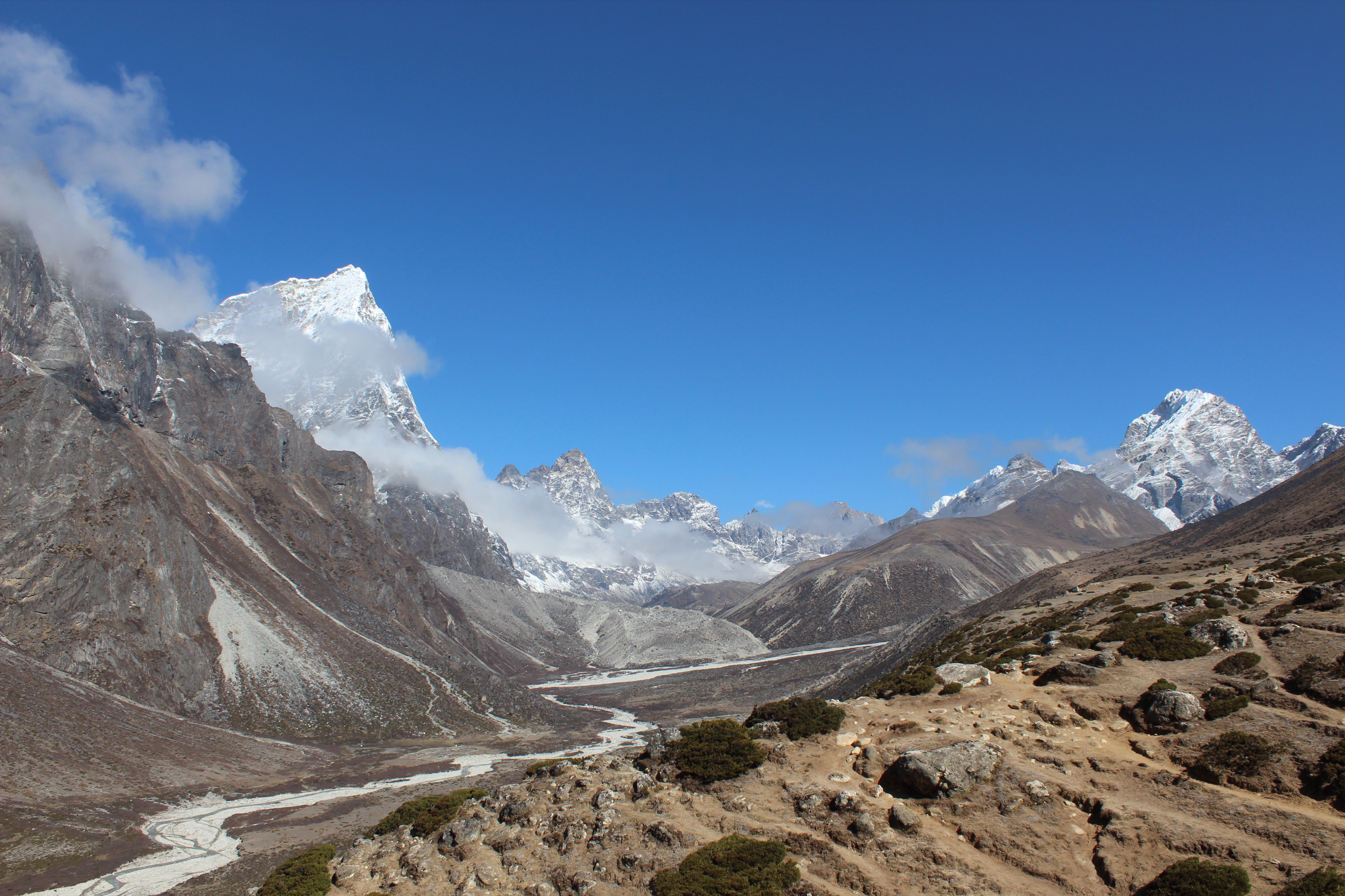
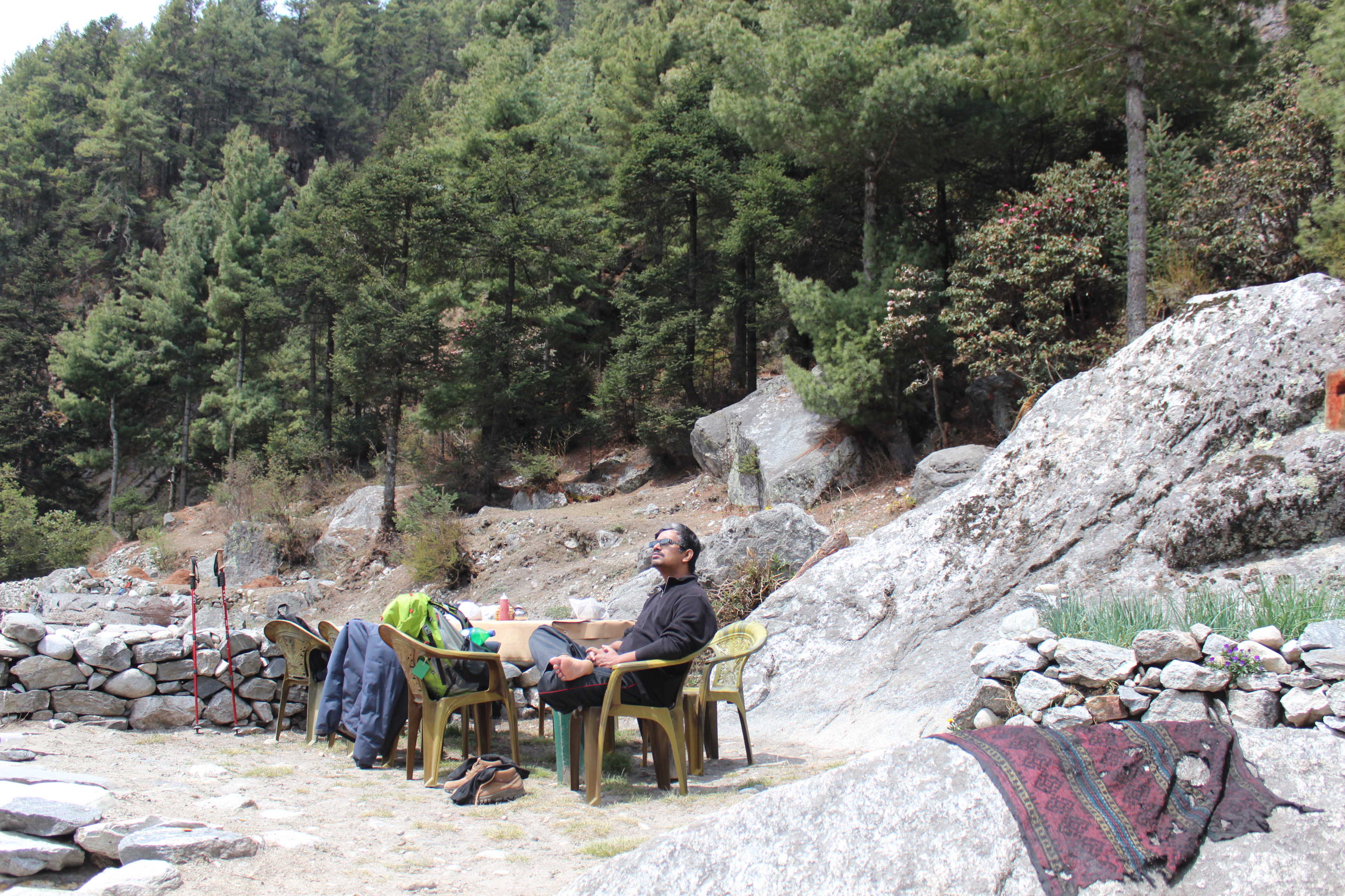
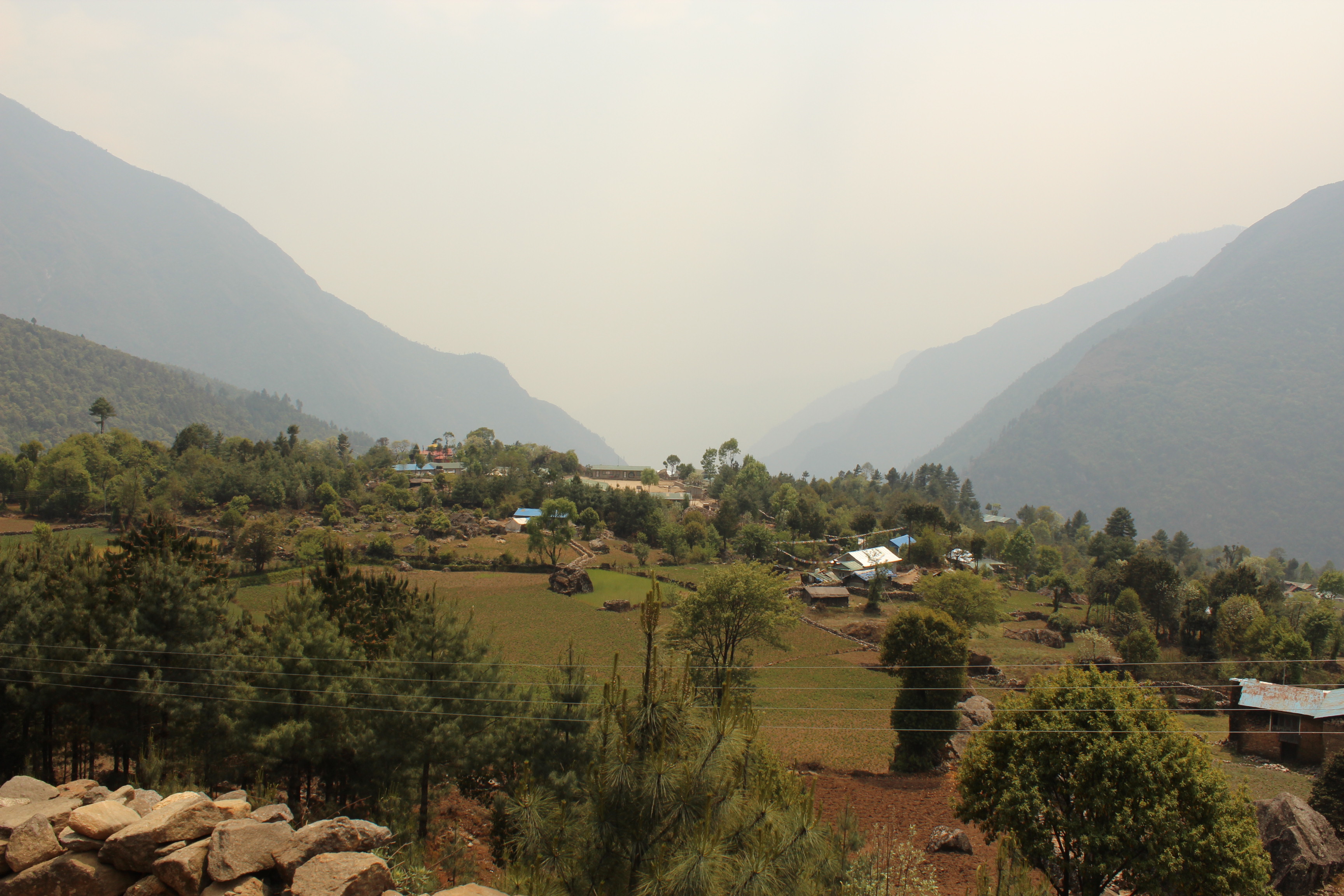
As we exited the gate, it felt we were bidding goodbye to the Everest region. Then came the cultivated fields of the Sherpa villages. It all looked so familiar and we reminisced the memories and incidents from the days when we went through these regions on our way up. As if, a movie was being played out in reverse from its last to the opening scenes. We stopped at Phakding for lunch. This is where we inquired about the status of Lukla flights for the last few days. Answers were mixed but at least they were operating with some being canceled, which was the norm. All of us had a hidden tension about the flights for the next day. Everyone hoped to leave this place early in the morning before clouds start playing spoilsport in the later half.
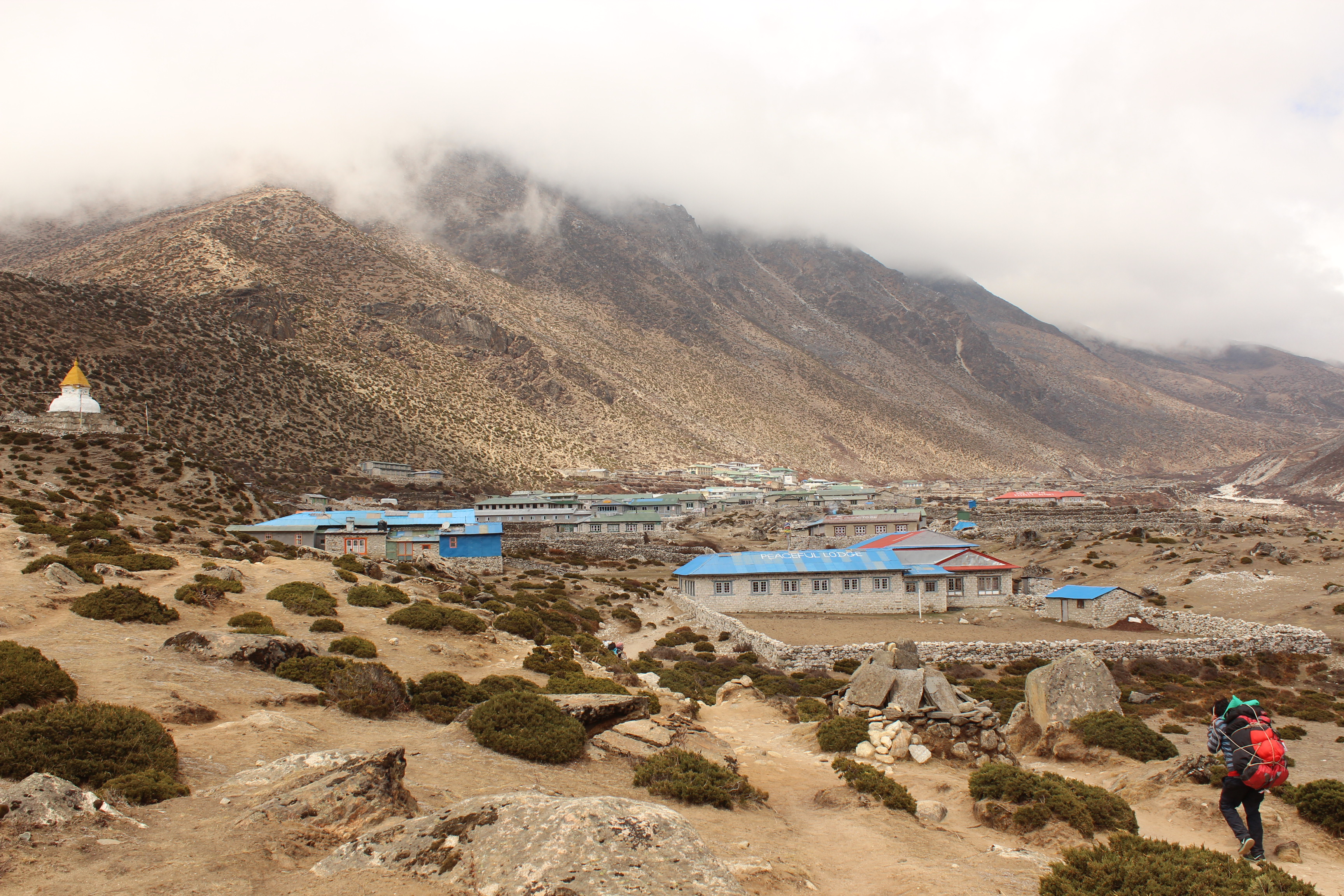
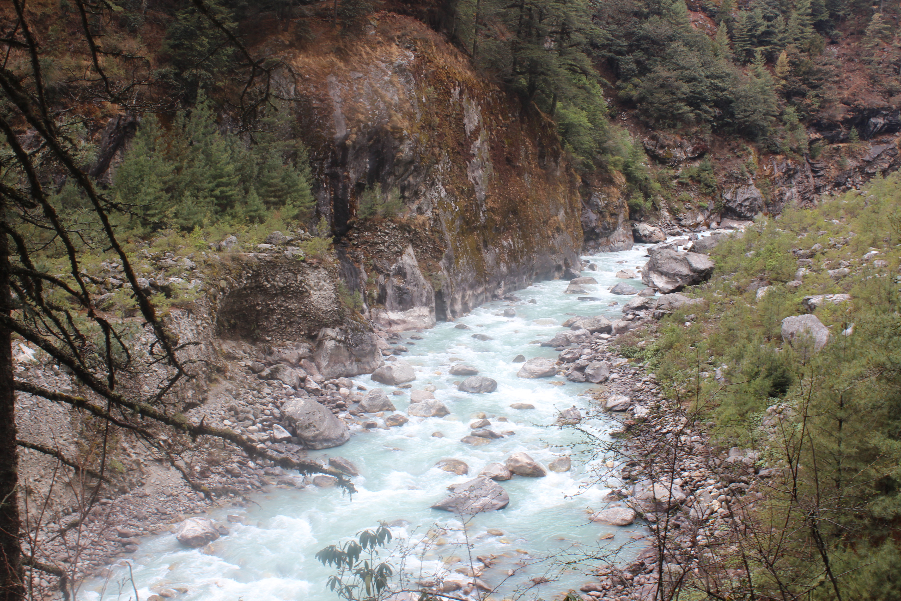
IMG_4297

Fields – SoluKhumbu

It started raining and we had to put on our raincoats. Though the track was level, our legs were tired. We dragged on and finally, reached the outskirts of Lukla. As we meandered through the clumsy lanes of Lukla towards our lodge, I came across a pub that was named “MalloryIrvine” pub! Even after eighty years of their disappearance, they continue to be remembered by the people of this region despite the fact that they never took this route to reach the mountain which made them famous. The evening was spent at the lodge, dining with the porters and guide. It was our last days with the porters. It was time for some celebrations by treating them with food and beer and giving tips for their help in making this trek successful. We subsided to our beds with the hopes of hopping on an early morning flight, the next day.

14th May, 2016

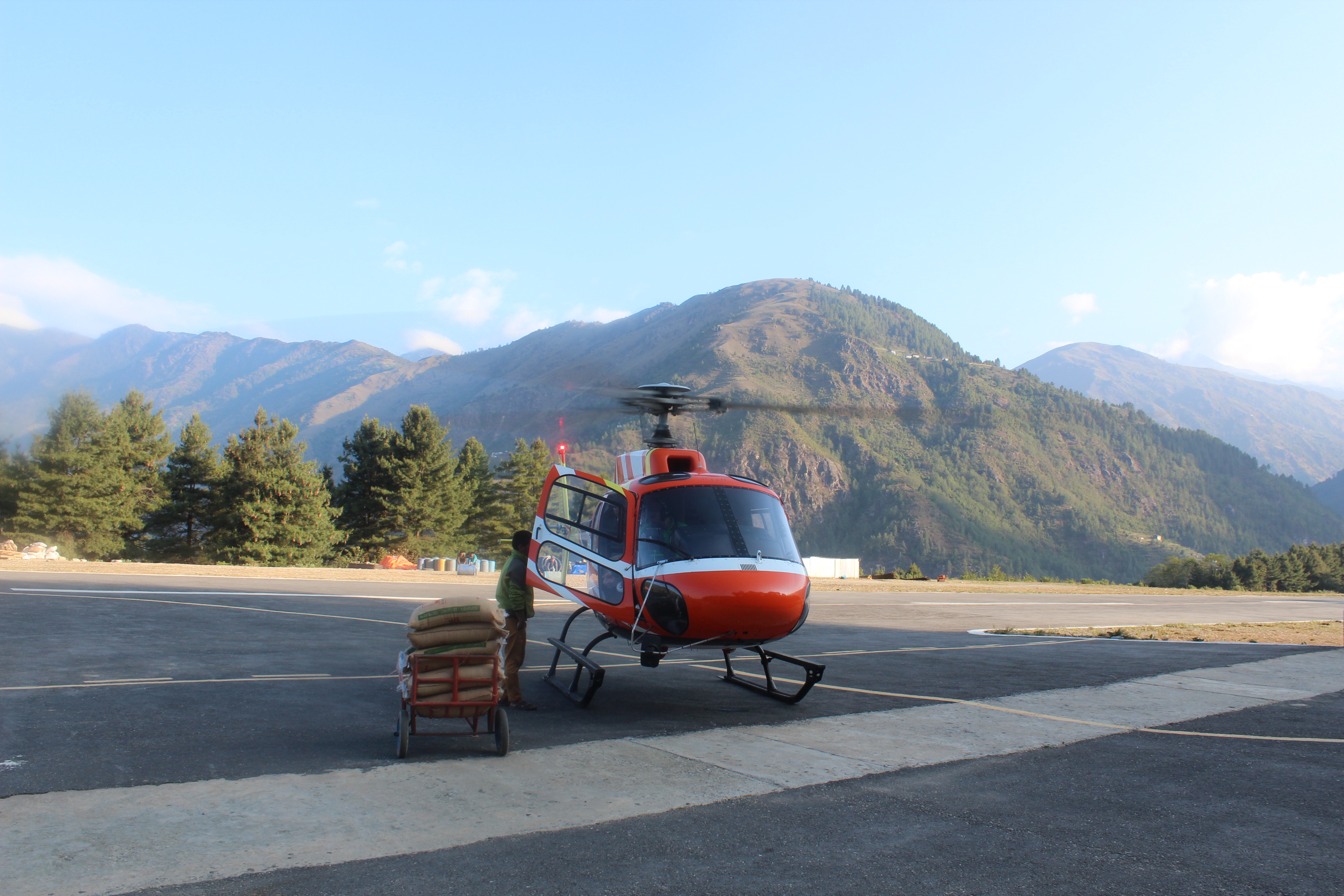
In spite of the tiredness, all of us woke up early. We could hear the ear-splitting roar of the morning Lukla flights which gave us hope. At least they were operating. Our flight was slated at 10 AM. Flights in Lukla operates in batches of four. For every batch, four flights take off from Kathmandu one after another. After reaching Lukla, the same head back to Kathmandu. Similar patterns repeat for subsequent batches till they are allowed to operate (by the weather?). After breakfast, we left our lodge for the airstrip, which was just a few steps away. We stood in a queue and checked in our baggage in the make-shift check in counters. Well, at least they were checking in the luggage, so the flight must be on. After security checking, we went to the departure area eagerly waiting for our flight. Boarding was on and passengers were getting into the aircraft. We followed them in a queue, which is when guide Raju told us that this wasn’t our flight. Our turn was to come next, i.e. in the next batch. Which implied that these aircrafts will fly to Kathmandu to off-board the passengers and come back again to Lukla with passengers from there, which is when we’d get chance to board. It appeared just to be a matter of a couple of hours as it takes just about 25 minutes to fly to Kathmandu.

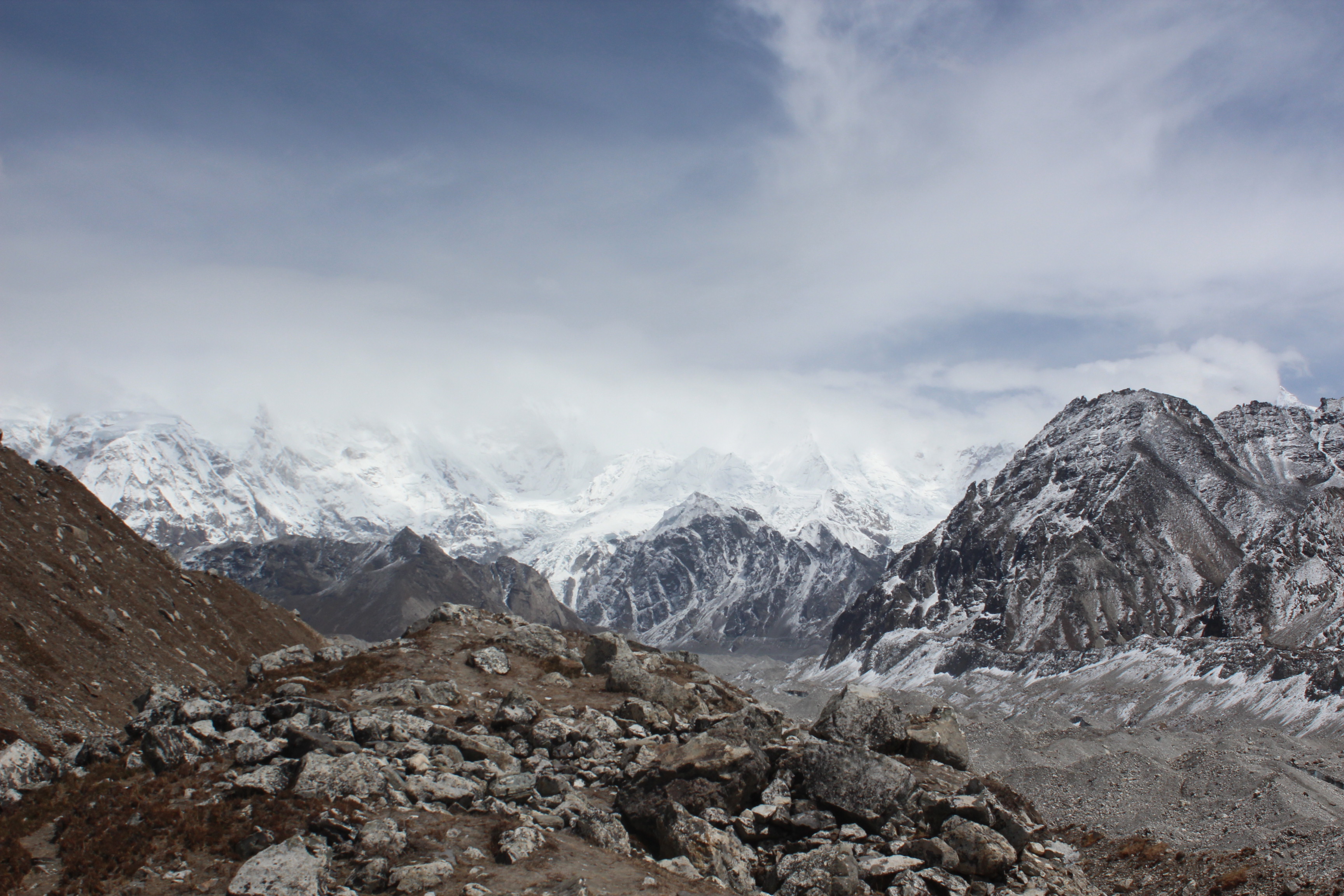
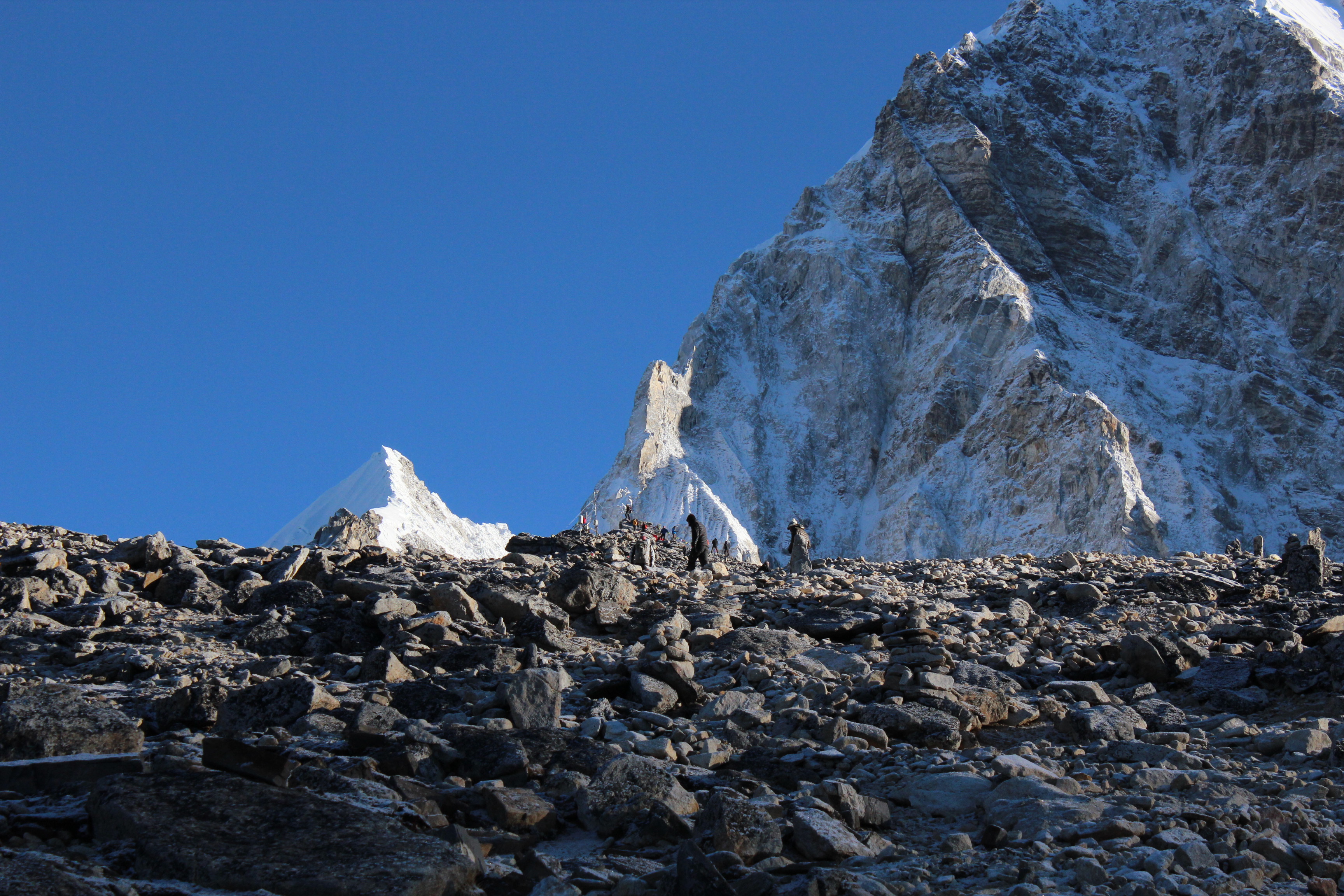
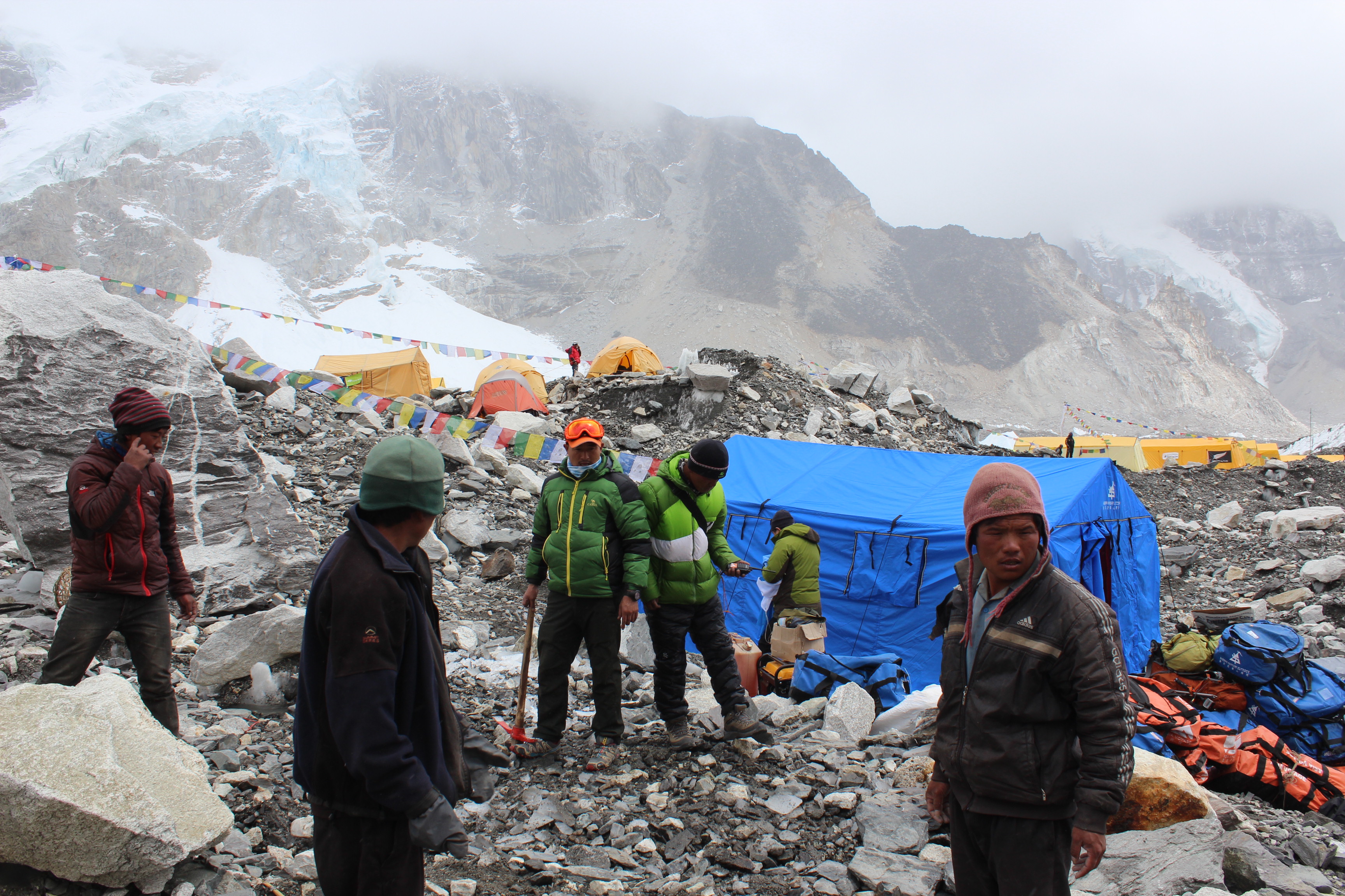
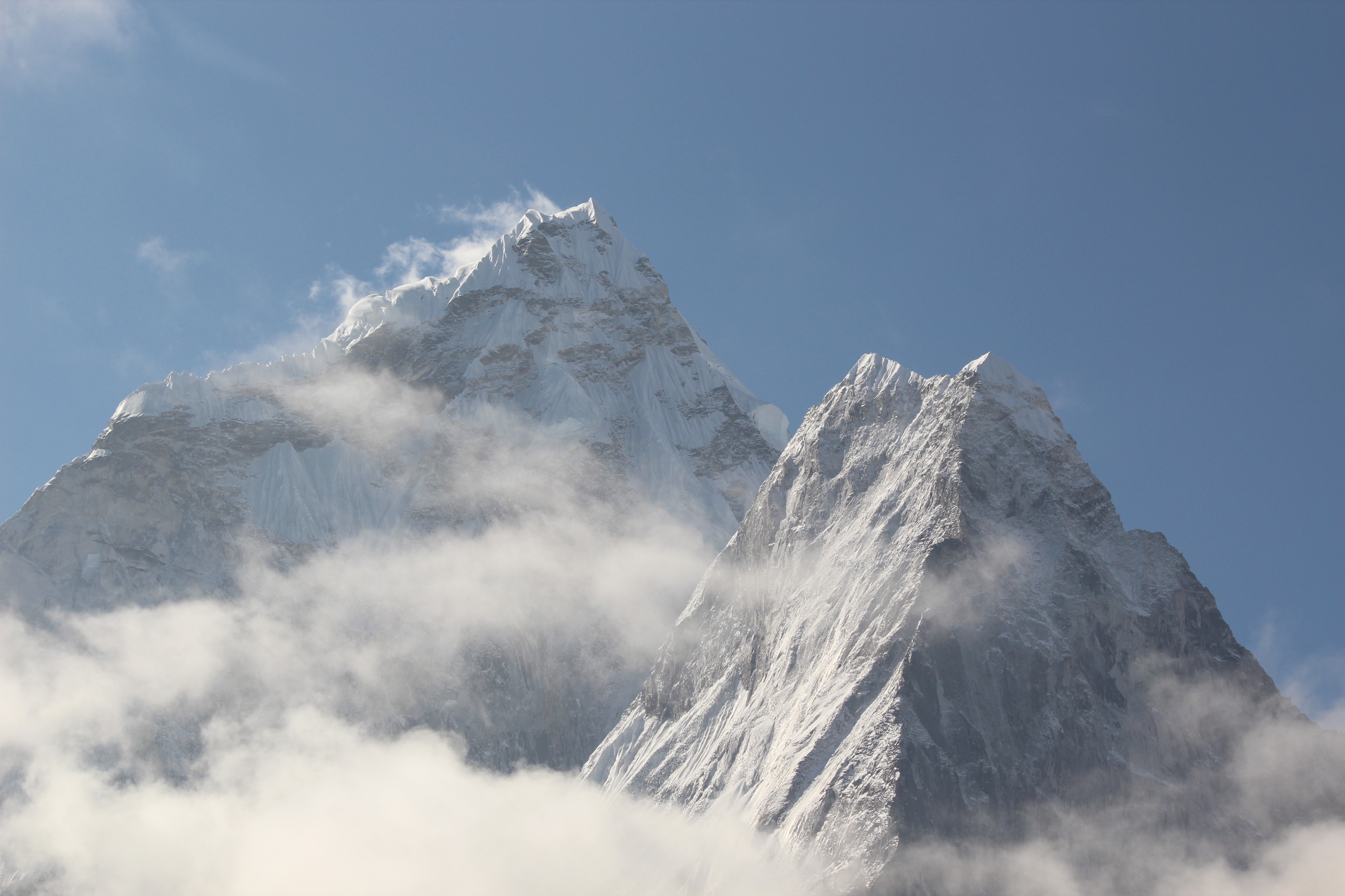
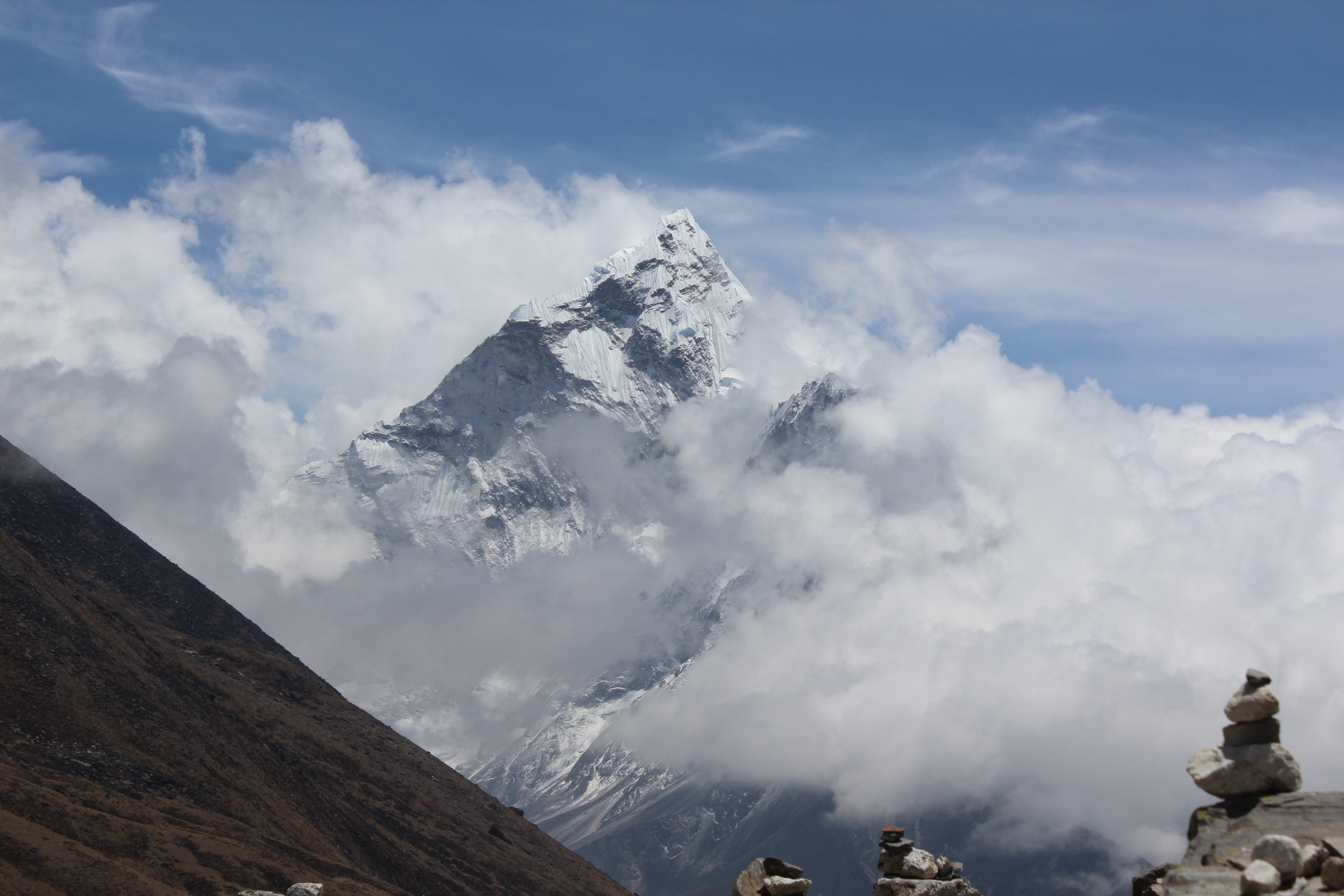
We eagerly awaited the flights from Kathmandu. The expected time came and went away, but there were no signs of an aircraft. We heard sounds of rotors, but they turned out to be from helicopters that were landing on a helipad near the airstrip. In the hours that followed, anxiousness and agony started building up. We met people who were stranded at Lukla for four to five days, some even more than a week, without any chance of getting on a flight. Everyday they’d come hoping for a seat, only to get frustrated and return to their lodges. There was a group from Indonesia who had to cancel and re-book their connecting international flights from Kathmandu just because of this delay. They were at the end of their wits and appeared helpless. Time and most importantly, money, was depleting thick and fast. People come to this remote land with limited money and there’s a limit beyond which that cushion ceases to exist. Every extra day spent implies extra cost for lodging and food. While flights were not to be seen, but there were no dearth of helicopters. Every now and then, one or two helicopters appeared on the horizon, landed on the helipad only to fly back again. Most of these were bound for Kathmandu, some to the higher reaches of Namche, Gorakshep and other places for rescue operations. Cancelled flights at Lukla means a significant section of those passengers shift to helicopters as an emergency measure. But every ride costs at least $2500. It has to be a group of at least five people to make that cost reasonable. Finally, the Indonesians gave in as they couldn’t afford to miss their flight from Kathmandu and opted for helicopter rides. In the meantime, it was declared that rest of the flights have been cancelled for the day. We went back to reclaim our baggage and headed back to the lodge with frustrated, dreary steps.

IMG_3864

Lukla airstrip – awaiting that non-existent flight

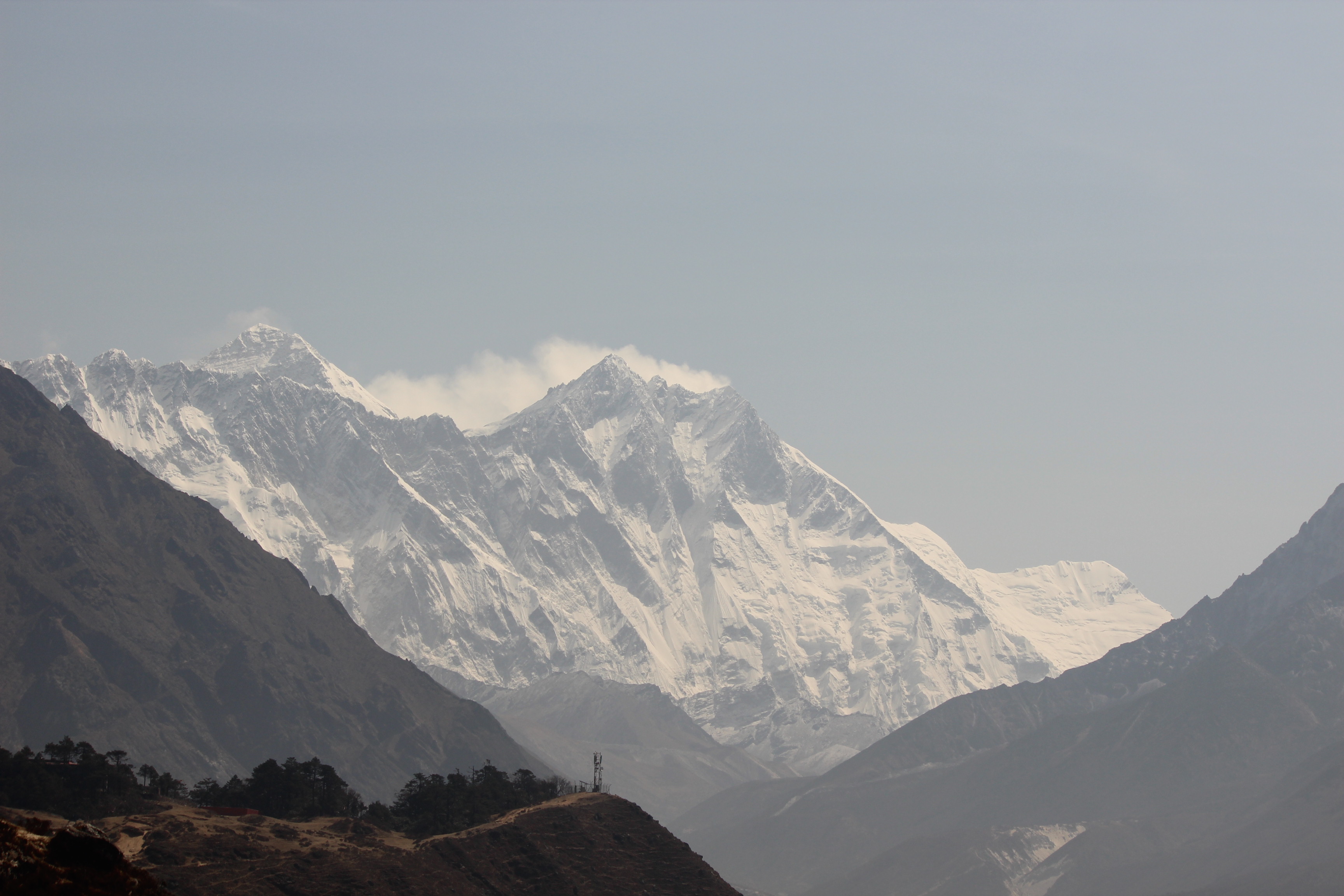
The freshness and the sense of achievement that was prevalent in the previous evening, gave its way to anxiousness. Our return train tickets were booked from Raxaul on 17th May. Which meant, we had to reach Kathmandu no later than 16th. That evening, we huddled to discuss the situation. If we were to reach Kathmandu by flight, the next day was our last chance. But the system of allocating seats for delayed passengers gave us little chance. If flights were to resume the next day, the passengers slated for regular flights for the day would get first chance to board and the ones from delayed flights will be allocated in rear batches. That implied, the passengers from delayed flights could only be allocated in the third slot of the flights at the earliest, depending on the queue that gets augmented everyday with each cancelled flight. Moreover, people from AASEAN nations were offered flights at discounted rates, but it also meant that the first two batches were reserved for Europeans, Americans and other non- AASEAN citizens. So, it’s close to impossible to get a flight in successive days, once you miss your normal slated flight. That’s when the helicopter companies kick in. The rush of passengers then shift to helicopter and they charge them at their will. Limits cease to exist for hikes to the fares. Someones’ necessity turns into lucrative cash business for others. Charges get paid in hard cash, but the rates are in US dollars. Local guys start playing foreign exchanges deciding exchange rates on the spot.

The lodge owner gave us a suggestion to cancel our return flight tickets and book for a helicopter ride to Phaplu, a nearby airstrip and from there, embark on a road journey to Kathmandu. That seemed logical, looking at the grim situation of flight queue. But for that, we’d have to pay $200 each with some extra money to the lodge owner for extending this offer. We agreed and went to sleep with tense minds.

15th May, 2016

Next day we inquired about the helicopter ride for Phaplu and were told that we would get our chance after a few rescue rides by the copters to the higher reaches of the region. No flights landed at Lukla that morning and it was cloudy all around. Our decision for the Phaplu ride appeared to be judicious. The lodge owner asked us to go to the lounge at the airstrip to wait for further information but nothing came our way. He crossed us multiple times, but couldn’t offer any encouraging news. Standing at the lounge proved fruitless, so we moved to the helipad. All of us stood there waiting for that seemingly illusive Phaplu ride. Every now and then, helicopters landed on the helipad, they were fueled from drums from a nearby storage, only to fly back again to Kathmandu. Given the flight cancellations, copter rides were in high demands. Rides to Kathmandu can fetch much more, so the copter companies weren’t interested in Phaplu rides. I and Niladri kept standing there, showing our faces to the copter pilots and the coordinator who was managing the rides and collecting fares. We even requested him multiple times, but he paid no heed to our cause. We were at the end of our wits. Clouds cleared and the sun came out in the afternoon. Snow peaks peeped out beyond the nearby hills, but we had no mood to muse over such scenery, given the ground reality. Meters were running down for us, resources were at the end, but no solution in sight. The entire day went waste and once again we returned to the lodge. We contacted Tej Gurung, the organizer of this trek, but he couldn’t be of any help either. Once out of Kathmandu, things get beyond his reaches and he can just be a spectator to the events that unfold. Up here, in this village, its the locals who hold the sway. That night, everyone was tensed. To get out of that mental state, we tried playing cards, but I couldn’t concentrate. We decided not to extend any further stay at Lukla, even if it meant walking down to Phaplu, which would take another two days to reach.

16th May, 2016

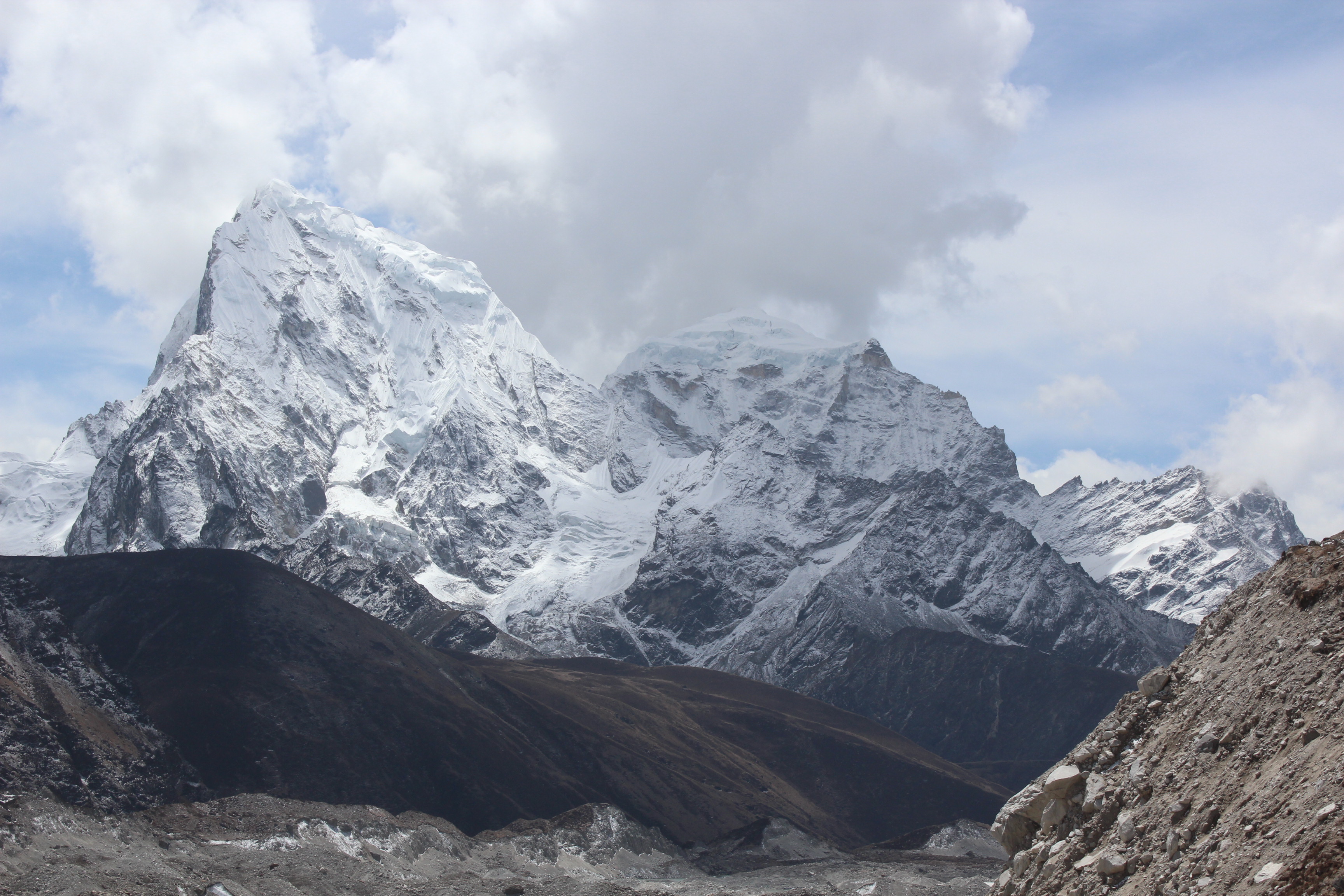
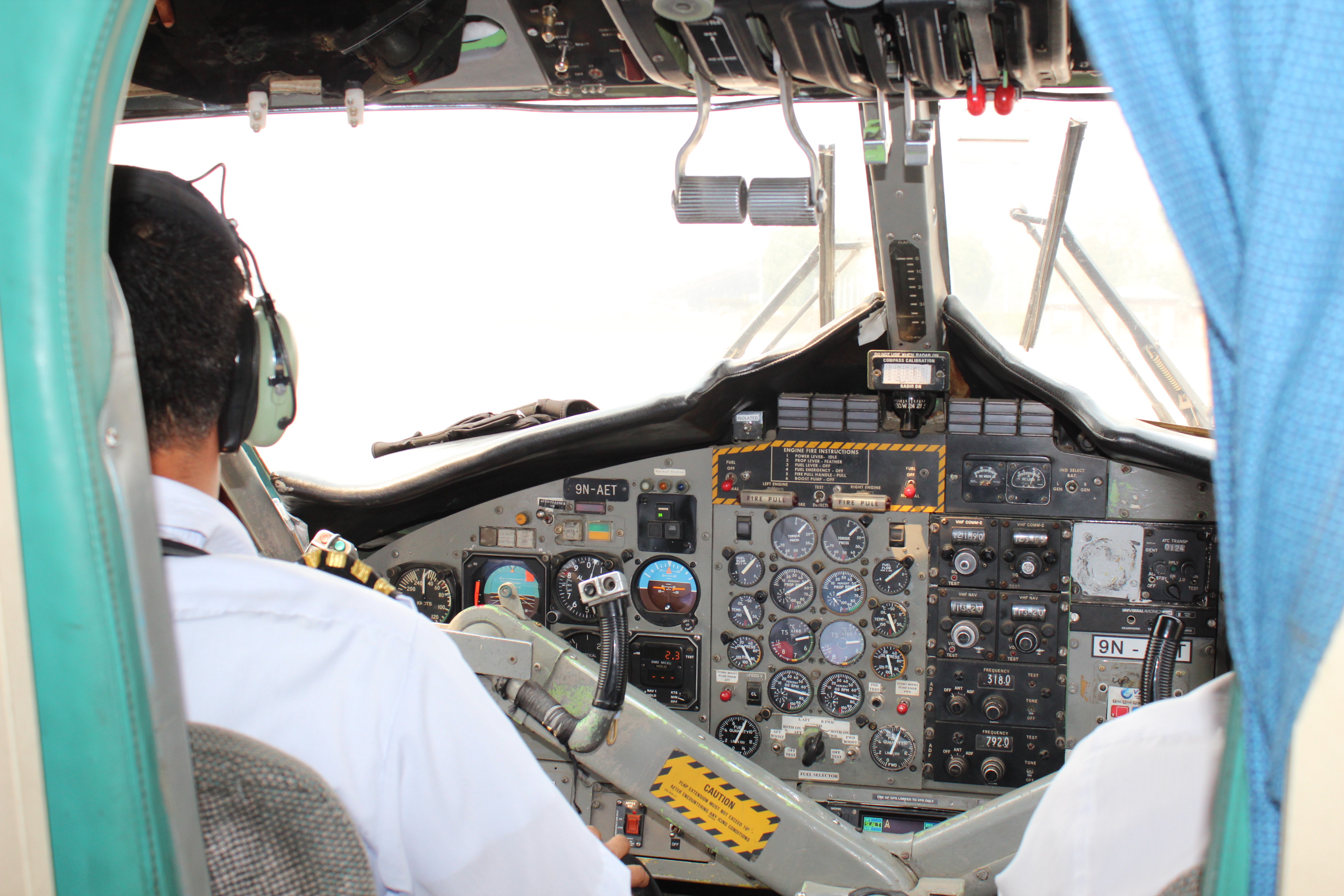
Next morning, another local guy turned up at the lodge and claimed that he could arrange for that ever illusive Phaplu ride, but in exchange of another $200. We had no option as declining that offer would imply extra two days of walking (and more importantly, missing the train from Raxaul) which would have thrown up the entire schedule into a toss. We went to the helipad and saw a helicopter standing. But we were not the only consumers. There was a bigger group of at least fifteen people. They too, approached the coordinator with their request and it was up to him to oblige. Here, he gave his weight behind us mentioning to the other group that we were waiting for two whole days at the helipad waiting for a ride (finally, laying siege by me and Niladri paid off). Once we boarded the cockpit, there was no other person in this world who was more free than us! It was the first helicopter ride for me. It took to the sky and sailed over the hills covered with dense forests in the lower reaches. Bright sunshine bathed the mountains and the forests. Chances were ripe for Lukla flights to resume that day, but given the waiting queue, we had no guarantee of a place in any of them. After about 15 minutes, we landed at Phaplu.

IMG_4299

Phaplu

The lodge owner at Lukla arranged for a jeep. We immediately boarded it and started off for Kathmandu. As the jeep meandered through the snaky roads that embraced the hills, the only feeling that reigned in our hearts was freedom! It was unfortunate, after being awarded with such breathtaking views in the higher reaches, the only feeling that remained, at least for that moment was freedom from the Lukla maze. The jeep took us to Kathmandu, where Tej Gurung greeted us with certificates of accomplishment. We headed to the bus stand and the night bus took us to the border town Birganj, the next morning. There we crossed over the Indian border to reach Raxaul railway station to board our train for Kolkata. During our trek, we crossed Dugh la, Cho la and hiked to Kala pathhar, but it was not them. The toughest pass to cross in this region posing most of the troubles, was Lukla! The so-called modern facilities and humans gave us most of the pain, not the distant villages in the higher reaches under the constant watch of Chomolungma, the Goddess mother of earth! We bowed to her and bade goodbye.

Gokyo

In the land of the sherpas – Gokyo

Crossing the Cho la

The plight of Lukla

10th May, 2016

Our group was a relieved lot, now that Cho La was behind us and with it, probably the last of the risks involved in this trek or so we thought at that time. Readers who’ve been patient enough to stay with me till now might have noticed this disclaimer “so we thought” at multiple places. The reason for that will become clear when I describe the end of this long-awaited trek. The heaviest blow was dealt to us by humans and not nature. Coming back to the story now, we slept a little longer last night since the travel to Gokyo from Dragnak wasn’t supposed to be very long and shouldn’t pose much difficulty. We woke up to a bright sunny morning. As usual, after breakfast, we hit the trail.

IMG_4262

Dragnak

The route from Dragnak went through a valley strewn with boulders. There wasn’t any track as such, we just followed the porters who started before us. Patches of snow lay here and there from last night’s snowfall. Though the gradient wasn’t steep, we had to be careful because of melting snow. The boulders too were slippery. It was an act of hopping over them. The high mountains on both sides of the valley prevented the sunlight but the distant peaks at the end of the valley were bathing in bright sunshine.

IMG_4263

En-route Gokyo

We kept moving through the valley till the route started moving up along the left ridge. As we reached the top of the ridge, an entirely different view greeted us. Vast swathes of tracts were dotted with cracks and crevasses, with pools of water lying in between. The gaping crevasses exposed the underlying snow beneath the layer of dust and rocks that camouflaged the surface of the vast Ngozumpa glacier, one of the sources that fed the Gokyo lakes system.

IMG_4264

Ngozumpa glacier

Our track descended into the bed of the glacier. The descent was steep and we had to go one by one on the skiddy surface of dust and pebbles. I had to take the help of Doranath, one whose help proved crucial on the Cho La pass, the day before. After he guided me down, we all started to walk along the edge of the glacial bed. The tract was uneven. It was essentially an act of stepping up on a stack of boulders, come down to go up again. There wasn’t any track per se, we just followed our porters who made their way through this maze. Tracks and routes in these regions often change over days, at times within a day. New cracks open up, rocks fall from the top of the mountains, a new glacial pool emerges – these are everyday events. A route in a particular year ceases to exist in the next. One then has to find a new one. We were told, this was one of the areas severely affected by the earthquake of 2015. Even the porters found it difficult to find the route.

IMG_4265

En-route Gokyo

We kept on following the porters up and down the stack of boulders as we traveled through the glacial bed to cross over and move to the other side. We were told, beyond the ridge on the other side, lay Gokyo. In order to reach there, we would have to climb up the ridge and descend on the other side. The ridge on the other side appeared to be very dusty and fragile by its look. When we reached near it, the porters told us to hike as soon as possible in a diagonal fashion. The entire area was a rock fall zone and we had to cross it as soon as possible. Their words were supported by boulders and pebbles that kept coming down the slopes. It was a tough ask. The gradient was steep which slowed us down, but we didn’t have the luxury to move at our own pace as we had to get out of this rock fall zone as soon as possible. We did our best to hike and after sometime, the gradient eased a little and to our relief, the porters signaled to us that we were out of danger. As we neared the top of the ridge, mountains from the other side started to appear.

IMG_4266

En-route Gokyo

As we reached nearer to the top, mountains from other side kept leaping up as if someone was taking the curtains up and a beautiful pristine lake at their base started to appear. We were seeing the second largest lake of the Gokyo lake system, which comprises of six lakes. The pristine lake with its turquoise blue water was spread out at the bases of the high mountains that surrounded its banks. Light breeze was sweeping over the surface raising ripples in its waters. It appeared as a huge amphitheater surrounded by high mountains with the lake at its base. I was thankful to our friend Santanu, who suggested to include Gokyo in our itinerary. All the pain went down the drain with the view at our disposal.

IMG_4268

Gokyo Lake

Gokyo lakes are a system of lakes in the higher regions of Nepal’s Sagarmatha National Park. Their waters have lower algal production and hence, is clean with high drinking water quality. Such waters also have high quantities of Oxygen. Gokyo lakes form the highest fresh water lake system in the world and is composed of six main lakes. Out of them Thonak lake is the largest, followed by Gokyo lake (or Gokyo Cho as it is called locally). The village of Gokyo lies on the eastern flanks of the Gokyo lake, which is where we were headed. These lakes are fed by nearby glaciers and are considered to be highly unstable. This is because they lie in a very ecologically unstable zone. One of the main sources of water for these system of lakes is the Ngozumpa glacier which lies to its east. A stream coming down from the Renzo La lying in the North-West of the region, is also one of the main sources.

While standing at the top, we made a decision on the spot. We would be taking a stroll around the lake’s circumference. We followed the porters towards the lodge. It was a big new structure right on the banks of the lake. The furniture and its polish were smelling fresh. After settling in our rooms, we went to the dining hall for tea. The dining place was covered with glass windows on all sides with the lake visible from all angles. It was tempting to just relax, enjoying the views, sipping a cup of tea. After all the hard walking in the last several days, the body yearned to have rest in this beautiful place and do nothing else. But someone said weather will change quickly and its likely to snow. With the lake bathing in bright sunshine, it was difficult to believe, but locals knew this place as the palm of their hands and distant clouds did appear ominous to them. Hence, if we were to take a stroll around the lake, we had to depart immediately.

It was just an act of treading along amidst the boulders on the banks. At times we walked over the sand along its banks, while in other cases, the trail moved way above the banks. As we moved along, the lake kept changing its appearance, both because of the angle as well as the changing mood of the sun, which gradually started to hide behind the clouds. Winds gathered pace and swept along the surface of the water.

IMG_4274

Gokyo lake

Niladri went ahead, while I carried along with Dhananjoy. The tracks gradually moved up along the slopes and we found ourselves walking along a narrow edge. To be able to enjoy the view of the lake, we often had to stop as it wasn’t possible to walk without having a close and concentrated look on the path. The lodges on the banks got dwarfed by the huge mountains. They appeared as matchboxes from a distance amidst this huge amphitheater.

IMG_4276

Gokyo

Clouds started closing in and within moments, the bright sunshine gave way to a setting of a dark evening (though it was just past noon). Fluffy innocuous clouds that were floating around moments before, now started looking ominous. We were only half way through our stroll, but were far enough from the reaches of the lodges. Suddenly, it started to look like a race against time. We still had to cover the remaining half of the lake. The urgency among us didn’t seem to reflect on the yaks those were grazing lazily along the banks. They had faith in their thick fur for their protection and continued enjoying the grass.

IMG_4282

Grazing yaks – Gokyo

As we reached the other bank, snow balls started coming down our way in thick and thin. We kept moving and finally just about reached the doors of the lodge when it started to snow in full flow. We sat at the dining place enjoying the snow outside. It snowed with intensity for about half an hour and by then the entire nature changed from color to a black and white film. The yaks too changed their skins to white.

IMG_4290

Gokyo

We had to abandon our plans to hike to the Gokyo Ri (a nearby top which offers a panoramic view of the mountain ranges and glaciers of the Khumbu region) and spent the evening at the lodge playing cards. It was a day with most leisurely time with us. We reached Gokyo relatively early in the day and had the entire day to rest and enjoy the views. No other day on this trail was as relaxing as this one. Given that the lodge was new and there weren’t any other occupants, we got to use the power points to charge our cell phones and cameras – the only place on this trail where we had this luxury. After reaching Gokyo, our trip reached a turning point. The next day would see us descending on our way back to Dole. Successive days would take us to Namche and Lukla. We’d be sleeping at 4750 m.

11th May, 2016

The sleep was peaceful last night and probably the best I had on this trail. The morning was bright. Clouds stayed away. I came out of the lodge to have another view of the lake. As I turned to my right, I was stunned with the majestic appearance of a snow peak! I didn’t realize yesterday that it was that close! It appeared almost within a stone throwing distance. It was crowned with silver. Snow covered its entire body, right to the base. “Mt Cho Oyu” – whispered a local as I was gazing at it, awestruck! The sixth highest mountain in the world at 8188 m, stood right in front of us!

IMG_4293

Cho Oyu

Cho Oyu translates to “Turquoise Goddess” in the Tibetan language. It is considered to be the easiest to climb in the 8000 m club among the mountaineers and registers the second highest number of climbs, second only to Mt Everest. It is the western most peak in the Khumbu section of Mahalangur Himal, a section of the Himalayas lying in North-Eastern Nepal bordering Tibet. Thinking about climbing, Rheinhold Messner’s name crossed my mind. He, just as he did for all other thirteen 8000 m peaks, must have stood at the top of this mountain, some day! He was the first to climb all fourteen sans artificial Oxygen, a feat achieved even before the Sherpas.

Back to the story, we exited the lodge at Gokyo carrying lovely memories of the place. I looked upwards along the mountain on the opposite bank and saw the little figure of a man coming down the zig-zag trail down the slopes. It was the trail coming down from Gokyo Ri. The lodge owner told us about him. He was from Japan. He woke up early in the wee hours, hiked up to Gokyo Ri and was now coming down. A hike that takes half a day to complete, was completed by him in just a few hours. But little did we realize, he had more surprises in store for us!

IMG_4295

On our way out – Gokyo region

We walked beside the Gokyo lake on our way out, but instead of turning with the banks as we did the day before, we took a different route on our way out. It was a level terrain with the gradient moving gradually downwards. We crossed another small lake and reached a crossroad where two tracks moved in two different directions. We waited for our guide Raju who was coming behind with some of our members in the rear. Following Raju’s instructions, we took one of those trails till we reached a small pool over a thundering stream. After we crossed the pool, the trail narrowed, but was wide enough for two persons to walk together. Though we moved downhill, the tracks were still devoid of any vegetation. We were still above the treeline. On our way down, I thought of taking some snaps, which is when I discovered that my lens cover was missing. It was loosening for last few days and must have fallen somewhere on our way. Later on, Raju found it on his way and returned it to me. That gave me some relief!

We saw a stupa with Mani stones and prayer flags round the corner. Raju said, we would have go down beyond that point deep into a gorge between two hills. We could see houses and lodges. That was Machermo, our place for lunch. We gradually went down, crossed the houses and fields to reach a lodge. It was a pleasant walk so far, but our legs were aching. One the way up, its your lungs and joints who bear the brunt. One the way down, its the turn of the lower limbs to feel the force of gravitation. After having tea and lunch, we hit the trail again. This time it was climbing up the opposite hill to regain the trail again which we left to come down to Machermo. There was another stupa with prayer flags. This pattern of a stupa marking the beginning and another one, the end of a village would repeat for the villages to come. They are meant to act as guards to protect the villagers from all perils. These customs remind us that the Sherpas are the descendants of early Tibetans who came to Nepal from the Tibetan plateau, lying to the north of the Himalayas. The Sherpas were a nomadic tribe, who came from Tibet, crossing the Himalayas through many high mountain passes, Nangpa La being one of them, about 600 years ago. They settled in the SoluKhumbu region of North-Eastern Nepal. But later on, different groups moved from one place to another within Nepal and settled in other parts of it. In earlier days, their main source of income was raising yaks (both for dairy products as well as meat). That forced them to migrate around in search of pastures. Traditionally they are used to living in extreme altitudes and harsh weathers. From the early days of expeditions, they were trusted aides to expedition teams as guides, porters and climbing assistants. In those days, many of them migrated to the Darjeeling area in India with hopes of getting hired as expedition porters and guides. Darjeeling was the base where most of the expeditions started. Later on, with Nepal opening its doors to the Western world, the SoluKhumbu region saw major growth in adventure sports, tourism and mountaineering with Everest being the primary source of attraction. With Nepalese government granting more and more expedition permits, Everest became one of the main sources of their livelihood. With no other source of income to sustain their lives throughout the year, the Sherpas were forced to risk their lives in such expeditions. What the Westerners view as adventures and their dream of life, is viewed as necessity by the Sherpas with many of them summitting Everest multiple times. Apa Sherpa holds the world record of 21 summits to Mt Everest.

They start their mountaineering career pretty early in their age as porters, cooks and guides, gradually gaining prominence as climbing sirdars (the Sherpa who leads the other Sherpas in an expedition and leads the summit attempt). Their value (and hence, the pay) in the trade gets amplified with each successful summit of Everest. Despite the risks involved, each Sherpa in this trade yearns for opportunities to summit. They are held in high regards by the mountaineering fraternity because of their tremendous climbing skills (part of which comes from their genetic adaptability to high altitudes because of staying at these places for years) and their strength. Often they carry loads amounting more than double their own body weights to camps at high altitudes along the slopes of the mountains. A climber, on an average, has to cross the deadly Khumbu ice-fall four to five times during an expedition, whereas the Sherpas have to cross it at least 15-20 times, with tremendous loads in order to stock resources up in the higher camps, which they setup themselves. They are the ones who are prone to most of the risks posed by Everest. The money they make during one/two months of climbing season, is just enough to sustain them for the rest of the year. Things have changed to some extent after the relentless efforts of Sir Edmund Hillary through his Edmund Hillary trust and the Himalayan trust. Many schools and hospitals have been built in the Khumbu region. In spite of all that, Everest remains as their main economic source even to the present day. A mountain, to which they pay respect as Goddess mother of Earth, Chomolungma. Everest remains as their main savior and a guardian who keeps guarding the slopes of SoluKhumbu region from all evils. They leave no stone un-turned to keep it happy. At the start of every expedition, they organize a religious prayer to seek permission from the revered mountain to enter into its interiors. They believe that no human can set foot atop the mountain unless it grants permission to do so.

We kept crossing many such Sherpa villages on our way through the Khumbu region till we reached a point from where the trail moved down below into a river gorge. We stood at the corner to have a look below. There were lodges on the other side of the river. It was the Dole village, our place of stay. As we waited for other members in the rear, our Japanese friend from Gokyo (who hiked the Gokyo Ri in early morning, the same day) crossed us, shared a smile and sped down the slope. Within minutes, he was on the banks of the river below. He kept hiking its other bank and went out of our sight. We came to know later, that he was headed for Namche, the same day! The distance which we would cover in 2 days, will be covered by him in a single day and that too, after an early morning hike to the Gokyo Ri!

Later, in the evening, when we sat for tea at the dining space of the lodge at Dole, suddenly, the entire lodge and its furniture got a sudden jolt. Before even we could react properly, the vibration ceased. The lodge staff said with a cool head that it was an earthquake tremor! Memories of devastation in 2015 came back back to haunt us for a few moments. That night, I had some sleepless moments, still thinking about the jolt and the mayhem it could cause in these parts of the world. It was a reminder from nature that we were at its mercy. We may forget amid the daily events of life, but it’s there, very much there! No one knows when it can strike! We were sleeping at 4038 m.

Crossing the Cho la

The plight of Lukla

In the land of the sherpas – crossing the Cho la

Gorakshep, Kalapathhar, Dzongla

Gokyo

9th May, 2016

We woke up in the wee hours and started preparing. After completing the regular morning duties, we made sure our luggage was packed and ready to be handed over to the porters. Bottles were being filled up, sun creams and lotions applied to save ourselves from sunburns at these high altitudes. In my case though, sunburn already had an effect. I brought my own sun cream but abstained from applying it. I thought I’d apply it once sunburn showed it’s symptoms. Quite foolishly, I didn’t realize that applying the cream was a preventive measure rather than reactive. As a result, the skin on my forehead, nose and cheeks started to turn black and some parts of it was already peeling off. We often ridiculed Dhananjoy about his overprotective measures for his body (he had a ‘guard’, i.e. a cream for every exposed part of his body – e.g. a lip guard, toe guard etc.), but now it seemed that he was smarter than rest of us. Throughout the morning, I was a bit tensed about the day ahead. We were supposed to cross the Cho La, deemed the most tough part of the trek. Guide Raju also felt, this was going to be the D-Day. Since yesterday, he was gathering news about the amount of snow on the pass and whether people were able to cross it without problems. At the back of his mind, he was well aware that our group wasn’t experienced and the responsibility entirely lay on him to keep us safe. After breakfast, we ventured out of the lodge through the backside. It had snowed last night and every mountain surrounding us and the route that lay ahead, was covered with patches of white. The sight, although spectacular, added to the frowns on Raju’s forehead. He was extrapotating to gauge the amount of snow expected on the pass.

IMG_4247
En-route Cho La

I tried not to worry much about it and concentrated on the trail, which was flat to start with. But we had to be careful as some of the snow had started to transform into ice, making it slippery. Looking around, Dzongla was still waking up from sleep as the sky gradually started to clear. It was critical for us to cross the pass as early as possible and definitely before noon. After that, not only the snow starts to melt with intensifying solar rays, the weather too can turn bad anytime with fresh snow reducing visibility to zero. The last thing anyone wants is to get stranded on the pass with no way forward.

IMG_4245
Dzongla

The trail moved on a flat ground, but we could see that it won’t be so for long as it moved up the slopes crossing different layers of hills till it reached a small gap on the ridge of the highest slope visible from the ground. I thought that must be the Cho La. Being able to see your destination is always exciting and somehow everything seems to be within reach. We started climbing gradually. It wasn’t very tough yet, but we needed to ensure we didn’t waste much time on such tracts which were easy to tread upon. It was an act of balance trying not to hurry to the extent of getting tired but at the same time making sure we reach the pass early enough. As we moved up, the amount of snow increased. We had to be careful while stepping on the boulders. Some of them were loose enough to topple with our load, while others, slippery enough to send us down the slopes. We climbed a few steps to halt for a few breaths. The pattern continued from thereon. Guide Raju and the porters kept a close vigil on us. They made sure we were always within their reach. As we gained height, some of us needed their hands to ensure safe passage.

IMG_4250
Up the slopes – En-route Cho La

The gap on the distant ridge was getting nearer and I asked one of the porters how long should it take to reach the pass. His answer came as a bolt from the blue. We were not even half way through and to my horrors, he said that the gap on that ridge wasn’t the actual pass, which lay beyond a valley that lay on the other side of the ridge!

IMG_4253
The gap wrongly assumed to be Cho La

The boulders stacked up more and more to an extent, that we couldn’t walk over them, but had to use both our legs and hands to gain some purchase. On some of the steps, the porters had to drag me up. I was breathing harder and gulping down gobbles of water after every climb. Even with so much snow around us, the air was dry and thin and it was telling on our bodies.

IMG_4258
En-route Cho La

I took sometime to look around. The entire trail from Dzongla was visible. It was a collage of white and brown. Not a single rock surface was spared from snow. Each of them appeared to wear white woolens over brown pullovers.

IMG_4251
En-route Cho La

I couldn’t do justice to the views as my mind was constantly thinking about what lay in store for us beyond the gap on the ridge above. I continued plodding till I reached the gap and an entirely new valley unfolded. Unlike the slopes that we just came up along, the valley was pristine white with shades of blue. It was a glacier that stretched till the end. There, at the end, rose the brown mountains and on top of it, I could see some people standing atop with colorful prayer flags flapping around. It all appeared to be a silent movie playing out the acts far away from us. That was definitely Cho La. Which meant that we had to cross the glacier to reach there.

IMG_4254
En-route Cho La

We would need to go down the slopes to the bed of the glacier, walk across it to reach its end. That would bring us to the base of the hill that we’d need to climb to reach the pass. The trail that went down the slopes sent shivers down the spine. The entire slope was covered with thick and fresh powdery snow. It had a steep incline and there was space just enough to place a single step at a time. When I tried to place a step, the snow immediately gave way and I skid down the slope. Fortunately, it was arrested quickly and I retracted my step to give a hard long look and think about it. The porters advised to have one hand on the sloping wall on our left and tilt our bodies towards the wall to have some grip while walking. There wasn’t any established trail, just a row of footsteps from travelers who have crossed this route just before us.

EnrouteChola2
Down the slopes – courtesy Dhananjoy De

One of our porters, Doranath, gave me a hand and I closely followed him down the slopes. While traversing it, there were constant threats of avalanches coming down from the top or even worse, one of us could skid and hence, trigger an avalanche down the slopes below. Just like everything has an end, so did the slope. We could again see boulders to step on reliably. The tension took a toll and I started tiring. When I reached the bed of the glacier, my steps were already sloth but I kept moving. I was breathing hard and fast.

EnrouteChola
En-route Cho La – courtesy, Dhananjoy De

We were walking on the glacial bed. It wasn’t steep but was slippery. We were fortunate that the layer of fresh snow over the hard glacial ice below, gave us some grip. Nevertheless, I slipped once and found myself all over the floor. Dhananjoy and the porters came rushing, but I indicated that I was fine. We turned our heads to a call from Niladri and saw him filming our journey. He kept insisting to move in certain angles or directions so that he could cover the background properly. At that time, I felt that to be an unnecessary waste of time since we were all tired and the only thought was to cross the pass as soon as possible. But today, I look back and thank him. We now cherish watching the video seating on comfortable armchairs describing the incidents to our families as if they were from a nail-biting thriller.

IMG_4259
En-route Cho La

I kept moving with tired steps. Dhananjoy and the porters were heading up the slopes towards the pass. When I reached at the base, they were already waving at me from the top. The slope wasn’t that high, but was steep and I was almost at the end of my strength. Suddenly, I heard a cracking sound. I turned around to my horror to see a series of boulders and pebbles coming down the slopes we were to go up. It’s very common in these areas to have such landslides triggered by winds sweeping the pass. I wondered how fragile The Himalayas are. As if they are a cluster of rocks somehow piled together, which, at any time, without any notice, could be dislodged to trigger slides. I saw porter Doranath coming down the slope. Once he reached me, I held his hand and followed him to climb to the top. Finally, we were standing atop Cho La (5420 m).

Chola
Cho La – courtesy, Dhananjoy De

It was 10 AM. There was a stupa with Mani stones. Colorful prayer flags flapped around in the wind. It was a familiar sight on a high Himalayan pass. I was feeling dizzy. As if someone placed a heavy stone on my head. The world seemed to move in slow motion as I turned my head around. I guess, that’s what they call mountain sickness. It was the first time on this trek, I felt sick. Guide Raju handed out packed sandwiches to us from his bag (which were to serve as our lunch). It was hard to chew and more importantly, I had no desire left to eat. But I knew that I had to gobble something down (if needed, pushed down by gulps of water) my throat if I were to stay fit enough to reach the day’s destination, which was more than half way ahead. The porters headed down the slopes first. After resting for sometime, we started to descend, but soon discovered that the entire slope down the other side of the pass, was covered with snow. We didn’t have crampons on our boots, which made it a difficult task to traverse down the slippery slopes. Guide Raju asked me to stay behind while others moved ahead. Everyone else went down, but I waited. Then I saw Doranath coming up and I started to go down with him. Doranath embarked on an impossible task of walking backwards down the slope while holding my hand. At every step, he kicked the snow and ice with his boot to carve out flat steps for me to place my feet upon. Once I did, he started doing the same for my next step and this pattern continued till we reached a place where the steepness was somewhat less. That’s where he handed the baton to Raju and went down with the loads. I continued while Raju kept vigil from behind. On one of the slopes, Raju himself slipped and toppled. His legs went through the gap between mine. The slide was arrested just in time so that he didn’t push me over the rocks. We both breathed a sigh of relief!

Descending
Descending – Cho La

The clouds already started gathering and when I looked back towards the pass, it was already covered. I reached the base, finally. As we halted briefly to take some rest, my mouth went dry. Water was precious and there was very little left of it. We kept moving. The trail was not steep and most importantly, the pass and its snow was now behind us. But we still had a long way to go. My ears were blocked and everything I heard, appeared to come from behind a wall. As if, I was stranded canned within a drum and others spoke around it. Raju pointed towards the top of a hill in front and said, Dragnak (our destination for the day) lay beyond it. As I moved up the slopes towards the top, Niladri was ahead of me and rest came behind us. My ears would unclog only to be blocked again and it continued throughout the rest of the day. That said, I wasn’t feeling that bad as I was, on the pass. As we crossed the top, we saw no signs of any village. Raju was ahead of us and he signaled the way we had to take towards Dragnak. The slope was gentle beyond the top and we kept going down at a brisk speed till we reached a river flowing through the gorges. There was no sign of Raju as he moved ahead to arrange for our stay at Dragnak. We were in a dilemma. Are we on the right track? Niladri was confident that we were, but I had my doubts. We kept moving along the river banks, sometimes walking over the rocks and boulders that dotted its bed. It was getting darker and it started snowing. Snow balls of the sizes of tapioca sago kept coming down upon us. As we moved along, it intensified. We were going along, with no signs of a village in sight, the sky was getting darker with the snowfall intensifying. Finally, midway through our journey, we met Doranath. He was going back up with a flask of warm water. We heard that Siddhartha da was stranded at the top (from where we came down to the river gorge) with all his water exhausted and he wasn’t able to move further without it. For all that, Doranath had to go back up at least 5-6 km and bring him down again! Imagine, if we had to do the same! Doranath confirmed that we were on the right path and after sometime, we could see the roofs of the lodges at Dragnak.

IMG_4261
Dragnak

By the time we entered the lodge, we were drenched to our bones. We quickly changed and headed towards the dining place. As usual, it was warm and filled with trekkers. We ordered our tea. It was a different feeling altogether. The final hurdle on this trek was behind us (or so we thought!). Rest of our members also arrived one after another. To celebrate the safe passage of Cho La, we drank beer. The porters and guide Raju joined the party. We were at 4700 m.

Gorakshep, Kalapathhar, Dzongla

Gokyo

In the land of the sherpas – Gorakshep, Kalapathhar, Dzongla

Everest Base Camp

Crossing the Cho la

8th May, 2016

I woke up at 3.30 AM. Dhananjoy was already strapping up his backpack. I could hear him speak in the next room. His words revealed that Sidhhartha da was yet to start his proceedings. After completing the natural duties, the next thing I looked for was my head torch. I purchased it from the Decathlon store at Noida before the trek. It was going to be put to use for the first time. I strapped it around my forehead, dressed on with the inner thermals, the trek pant, down jacket and covered my neck and ears as far as possible. Others did their best to put off the biting cold and then we ventured out. It was pitch dark. We crossed the bed of sand once again, but this time in the direction of the mountain walls on its edge and then started climbing up the slope. In the light of the overhead torch, we could follow a narrow trail created by footsteps of other people who might have traversed the route. When it comes to walking up such slopes, I normally try to stay away from thinking about the distance and concentrate only up to the next bend and once I reach there, I fix my eyes on the next one and so on. It was still dark. The height of the place didn’t allow us to talk much and after sometime, we got separated from each other by our respective speeds and each one of us was on our own. Though I’ve been going by the bend, I did have the thought in my mind about reaching the top just in time to see the first rays of sun on the surrounding mountain ranges and the Khumbu glacier, the entire panorama which is visible only from Kalapathhar top. With height, our speed slowed down and pretty soon the pattern changed to walking a few steps followed by a few gasps of breath, at times a few gobbles of water down our throat. We could sense the dark outlines of the mountain ranges against the sky. Darkness gradually started to subside. The outlines of Nuptse became clearer and other mountain peaks started to appear from behind it. The pyramid just beyond the Nuptse wall was Everest, unmistakably.

IMG_4191
Mt Everest

It started to gain in size and stature as we continued to move up. So did Mt Pumori, with a greater magnitude. Pumori lies on Nepal-Tibet border, just 8 km to the west of Everest. The word “Pumo” means a young girl or daughter and “Ri” means a mountain in the Sherpa language. Because of its proximity, Pumori is often referred to as Everest’s daughter. The name, interestingly, was given the famous mountaineer George Leigh Mallory.

Kalapathhar (meaning black rock in the Nepali/Hindi language) is located on the southern ridge of Pumori in the Nepalese Himalayas. It’s popularity among the trekkers is mainly because of the close view of the Everest summit. Because of the structure and location of the Everest massif, it lies hidden behind Nuptse from much of the trail to and at Everest base camp. Kalapathhar is the place which offers its best possible view to the trekkers, apart from views of Lhotse and a panoramic view of the Khumbu glacier. We were actually walking along the slopes that led to the southern ridge of Pumori, on which the summit of Kalapathhar lay.

IMG_4192
Mt Pumori – en-route Kalapathhar

The sky brightened up with morning rays of sun, which was yet to be seen. But its presence could be felt behind the Everest summit as its rays spanned out illuminating the outline of the summit from behind. Signs of gold started to appear on the outlines of some of the peaks.

IMG_4193
En-route Kalapathhar

Pumori too started to acquire a golden touch on its upper horizon. As I turned my head clockwise, I saw the rays have now fallen on the beautiful peak of Ama Dablam where a huge plume of snow and cloud emerged from the top forced by the morning winds sweeping its top. It appeared like a bright silk scarf flying around it.

IMG_4225
Mt Ama Dablam

As I looked around, the distant mountain peaks were illuminated by the morning sun. We could see a 180-degree panoramic view of Himalayan peaks around us. Pumori appeared like a huge wall just beyond the ridge that we were climbing with its outline acquiring a golden tinge.

IMG_4204
Morning rays of sun – Mt Pumori

As I turned my attention back on Everest, the sun appeared like a diamond ring from behind the summit illuminating its entire outline. The Himalayas were gradually awakening from sleep. The Everest massif stood upright as a huge block of pyramid. It’s edges were getting clearer with the rising sun. A plume of cloud hung above its head, looking like an umbrella. Looking at the summit, I thought that somewhere up there, lay the south-east ridge route which has been taken by numerous climbers. Not everyone of them have been fortunate enough to reach the top. Others did, but some of them couldn’t come back. Up there on its slopes, lay Rob Hall, Scott Fischer and many others. So does Doug Hansen, Yasuko Namba and Andy Harris. On its northern flanks, which wasn’t visible, lay Mallory and Irvine, lay Paljor and the other Ladakhi climbers from their fateful 1996 climb. Lopsang Jhangbu, the charismatic sherpa from Fischer’s team, also lay somewhere in the deep gorges after falling off the ridge, attempting the summit in the autumn of 1996. The Goddess mother of earth, Chomolungma keeps providing shelter to them. As if she repented after unleashing her wrath on her helpless children and now keeps coddling them in their last abode hidden from the eyes of the world.

By this time, the sun was up in the sky and it illuminated the peaks all around us – a true silver blaze! We kept plodding upwards towards the summit of Kalapathhar. We could see the prayer flags on the top. However, it was still a long way to reach there.

IMG_4223
Mt Everest – Kalapathhar
IMG_4218

From Kalapathhar

IMG_4213
Kalapathhar

Assessing our speed and the remaining distance, our guide Raju suggested to turn around. The other reason was that the day was going to be long for us. We had to go back to Gorakshep, pick our bags and then head back to Lobuche for lunch and then all the way to Dzongla. I couldn’t accept it at the first go. How could we turn around from here? But a careful thought at the day that lay ahead for us told that it was just about time that we turned around if we were to reach our destination at the end of the day. Even on descent, I kept looking around to capture the last glimpses of the mountains from this height. There aren’t many places on this route that offer such a wide range of views.

IMG_4231
From Kalapathhar

It appeared that the mountains were towering from all sides to carefully guard the place from intruders like us. It’s their place and we begged for a glimpse into their interiors. The towering snow peaks, the huge swathes of snow coming down their slopes in the form of glaciers, the hide and seek of their appearances between the clouds, all seemed out of the world. We were standing on one of the highest amphitheaters of the world. The huge Khumbu glacier traced its way down through the gorges till it disappeared into the fluffy clouds that clad the distant valleys. I wished if we could have climbed to Kalapathhar in the evening as that’s when it offers the best views of sunset, provided clouds stay clear off the mountains. It’s also very windy at that time and that’s one of the reason, trekkers prefer the morning to do the hike. But there’s no point ruing about what could have been. What was there at our disposal, was no less spectacular.

We descended to Gorakshep, had our breakfast, packed our bags and hit the trail once again. It was about 12 PM when we reached Lobuche and ordered our lunch. After that, it was the familiar trail back to the wide valley of rocks from where our path deviated from the Everest Base camp trail and moved along the slopes of the mountain on the other side towards Dzongla. The trail moved up the slopes from the valley and after sometime it became gradual and walking was easy. Though we always had to be careful as the path wasn’t wide enough to allow even two persons to walk side by side. Like every other day, clouds started appearing and the weather changed immediately. A mild drizzle started but we kept on with our speed. So far, on the trail, we didn’t have to cope with rain or snow as we were lucky enough to reach our destinations “just in time”. However, today, the dark clouds looked ominous. We couldn’t see any shelter nearby. The trail descended the slopes of the hill into a valley. But we could see it moving up the other side. Dhananjoy was ahead of us and I was with Niladri. We could see the huts of Dzongla in the distant horizon up on the slopes on the other side of the valley, but there was a long way to go. The drizzle by this time intensified and showers of snowballs started coming down. We decided to stop as visibility was reduced almost to zero. Niladri took out a sheet of plastic and we both cuddled beneath it, while the showers continued. After sometime, the intensity reduced somewhat but it was still enough to drench us. But we decided to move on as it was getting dark. We finally reached Dzongla, which was a mere collection of a few lodges with towering snow peaks overlooking it. The dining place was cosy with the owner making sure that enough yak dung gets poured into the fire-place.

IMG_4239
Dzongla

While I ventured out into the surroundings to take some snaps, rest of the group concentrated on playing cards. The guide and porters joined them.

IMG_4243
Dzongla

Guide Raju was a tad nervous about the next day, which was the day to cross Cho-la, the highest pass that we’d have to cross on our trail. The amount of snow on both sides of the pass would be crucial. Though I tried to keep tensions at bay, but they kept coming back. I started to think, the next night, if everything goes well, we’d be sleeping at Dragnak and the woes of Cho-la pass would be behind us. But why only think about the dangerous, the pass would also offer some of the breathtaking views on this route and beyond it, lies the Gokyo lakes! Why not think about them? We needed to start early the next day so as to cross the pass within the first half. No one dares to face the weather in the later half at the heights of the pass. We were sleeping at 4830 m.

Everest Base Camp

Crossing the Cho la

In the land of the sherpas – Everest Base Camp

Dingboche to Lobuche

Gorakshep, Kalapathhar, Dzongla

7th May, 2016

We left the last traces of green on our way to Lobuche. Now it was all boulders, rocks & dust (or so we thought). We left our lodge in the morning and went past others. The trail moved upwards and we found ourselves walking along the edge of what appeared to be a river of boulders. It really looked as if it was the bed of a river that had dried up long ago, but the track was clear enough. There wasn’t any path per se. One could only gauge the approximate route by following other trekkers and guides. The entire route was about climbing up a heap of boulders, coming down only to climb up again. Mountains on both sides were coming ever closer to us as we moved on. It wasn’t a clear weather. Clouds covered the top of the snow peaks nearby. We could see rivers of snow and ice coming down their slopes and merge into the river of boulders. The sight all around was that of destruction and debris and yet so beautiful.

IMG_4096
En-route Gorakshep

It was apparent that the landscape we were looking at was very unstable and the contours & alignments could change in moments. What must have gone through this region during the devastating earthquake of 2015. The mere thoughts sent shivers down my spine. What appeared to be a river of boulders, started to show cracks which were white in color with tinges of blue. Width of such cracks gradually increased. We realized what we thought to be a river of boulders, was actually a glacier with tons of ice accumulated over many years but its surface was camouflaged with rocks and dust.

IMG_4101
The Khumbu glacier

As we moved towards Gorakshep, such cracks increased in their frequency and width. The entire bed was dotted with cracks and pools of ice. The edges of the cracks around such pools were filled with frozen icicles hanging from the roof. We knew at once that we were walking along the edge of the famous Khumbu glacier that is formed by the ice and snow draining down the slopes between Everest and Lhotse-Nuptse ridge. It is the world’s highest glacier and it originates in the Western Cwm near Everest. The name was familiar to me thanks to the abundant literature about Everest expeditions and treks. No such description can be complete without a mention of this glacier and the large Khumbu ice-fall at its source. All members of the group were very excited as they kept taking snaps. We’ve heard so much about the glacier and reaching at its base meant Everest wasn’t far behind. It was there, but hidden behind Nuptse. Its an irony that one cannot see the Everest summit from its own base camp! We kept plodding on for about 2.5 hours till we reached the top of a hill. From there we could look down and see the lodges that formed the village of Gorakshep.

IMG_4105
En-route Gorakshep
IMG_4110
Gorakshep and the route to Kalapathhar

There was a vast stretch of flat and sandy area just beyond the lodges. At the edge of that area, steep walls climbed up the mountains and one could clearly see a track of thin line moving up the slopes. That was the trail to Kalapathhar, our destination for the morrow.

Gorakshep is actually a frozen lake bed at about 5130 m covered with sand. In the 1952 Swiss expedition (the expedition just before the first ever successful British expedition in 1953), Gorakshep was used as the base camp. From next year on, the base camp on the Nepalese side moved to where it currently resides. We took a breath or two and gradually descended the hill to reach our lodge. There was bright sunshine but clouds covered the mountain tops. We entered the dining space of the lodge which was very similar to every other lodge in the route. It was a long rectangular space at the center of which there was the chimney. That’s where dried yak dung gets burned to generate much needed warmth after the sun goes down. The chimney opens beyond the roof of the lodge so that all the smoke gets exhausted outside while leaving the place inside warm enough to sustain at this altitude. After we were allotted the rooms, we kept our backpacks and headed for the dining space to have our favorite honey, lemon tea sprinkled with pieces of ginger. There wasn’t much time for leisure and we ordered our lunch as we still had to travel almost the same distance after lunch to reach the Base Camp and come back here before the sun sets. I settled for mashed potatoes, while Niladri and Dhananjoy went for bread and omelets. Siddhhartha da was not eating well as he was suffering from indigestion for last few days. We tried to persuade him to gobble down some more as it was crucial to eat and drink enough to prevent high altitude sickness from creeping in. We mused around as we had our lunch and then it was time to hit the trail again. For the first time on this trail our backpacks were off our backs and we just had to carry our own bodies and bottles of water. We moved along the bed of loose sand that covered the flat surface and then moved upwards to reach the top of the ridge beside the Khumbu glacier once again.

IMG_4102
Glacial pool – en-route Everest Base Camp
IMG_4114
En-route Everest Base Camp

We were on a trail dotted by huge rocks and boulders. The glacier was ever nearer and we could now see its trajectory filled with gaping cracks and cave-ins that exposed the underlying frozen ice and the glacial pools. The place around us gave enough evidence that it was not meant for human habitation and their presence was forcefully thrust upon the mountain. After about 2 hours of walk, the dusty glacial bed gradually gave way first to small and then large towers of ice and fresh snow. The bed was not covered with dust and boulders but with dazzling white towers of ice with tinges of blue. That told us were approaching the (in)famous Khumbu ice-fall.

IMG_4132
En-route Everest Base Camp

Dhananjoy attracted our attention towards a faint yellow object in the distant horizon amidst ice on the glacial bed. As we moved along, the object kept growing in size till we recognized it as one of the many tents pitched on the bed of the glacier. They kept growing in numbers dotting the entire landscape, some were blue and others, yellow. They were the tents of the numerous expeditions attempting to scale Mt Everest from the most frequented South Col-South East ridge route.

IMG_4135
Expedition tents – Everest Base Camp

We reached the end of the ridge from where the trail moved down towards the bed of the glacier. We could see the entire area dotted with hundreds of tents, numerous porters and Sherpas from different expeditions. The peaks of Pumori, Khumbutse and Nuptse surrounded the entire area but they weren’t visible because of the clouds. We descended the trail to reach right at the middle of the “township” called Everest Base Camp. We were finally there!

If someone expects to be in a secluded place amidst nature or to find one alone with just the mountains, then Everest Base Camp is not the place to be in. With all its natural beauty and the amazing landscape, it was everything else, but secluded. It was a place bustling with activity.

IMG_4151
Expedition tents – Everest Base Camp

We learnt later that there were as many as eighteen expeditions attempting Everest in the summer of 2016 from the Nepalese side. Everest has two base camps. The south base camp is in Nepal at an altitude of 5364 m, whereas the north base camp lies in Tibet at an altitude of 5150 m. These base camps are the places where the expedition teams lay siege for about two months. During this time, they take on multiple voyages up the mountain only to come back down to the base camp. Each voyage takes them to successively higher camps on the mountain. They are called acclimatization sorties and are meant to get the body adjusted to the lower levels of Oxygen higher up on the mountain. It is said that the summit only has a third of the amount of Oxygen that is available at the base camp. Finally, they take up the final ascent, which is called the summit push. Interestingly, in Nepal, the same site serves as the base camp for expeditions to Pumori and Lhotse (and potentially to other neighboring peaks), but it is Everest that has stamped its name on the base camp! If mountains were humans, then Lhotse might well have refused entries to its interior in protest against this humiliation. Fortunately, for the climbers, they are not!

IMG_4145
Glacial pool – Everest Base Camp

We were (and in fact, everybody else was) standing on top of the hardened ice of the glacial bed. The rocks and dust that covered its surface, gave a false impression of standing on rock surface, but a few kicks on the floor removes the dust and reveals the hardened ice below. In fact, the entire base camp is housed on the bed of Khumbu glacier. We were now standing at 5364 m above the sea level. We were standing on the floor of a huge amphitheater surrounded by the huge swathes of ice coming down the slopes of Pumori, Nuptse, Khumbutse and others. As far as our eyes could see, the entire Khumbu glacier was dotted with innumerable tents of the different expedition teams.

IMG_4154
Everest Base Camp

We went till the edge where the hard ice of the glacier gave way to random, uneven & often precariously placed masses of ice with a maze of tracks zigzagging through them. That was the Khumbu ice-fall, the first hurdle to overcome for anyone attempting to scale Everest from the Nepalese side.

IMG_4163
The Khumbu ice-fall
IMG_4160
The Khumbu ice-fall

I was gazing at the ice-fall when I noticed a few moving black spots amidst the towers of snow and ice. They were some of the climbers who were traversing through this maze of ice – one of their practices as part of their summit attempt.

This apparently beautiful ice-fall has proved to be the deathbed of way too many climbers and Sherpas over the years. As the Khumbu glacier moves with speed over the uneven rocky bed, huge masses of ice and snow that accumulates over it, splits up into cracks and crevasses. It results in creation of towers of ice with varying sizes and proportions. These are called seracs. Some of these are as high as multi storeyed buildings. These towers are very unstable and can collapse without any indication whatsoever. The first leg of the South Col-South East ridge route goes through a maze passing between and underneath such seracs. As the day bores on and rays of sun gets more intense, these become more unstable due to melting of snow at their bases. Climbers always try to cross the ice-fall early in the morning (they need to cross it multiple times during an expedition). The ice-fall claimed its first victim in the form of Jake Breitenbach, one of the members of the famous American expedition team of 1963. Though the expedition began with this fateful incident, it turned out to be one of the most successful in the history of climbing of Everest. Apart from placing the first American on the summit of Everest in the form of Jim Whittaker, the expedition also carried out many research works related to effects of high altitude on human physiology. However, the greatest feat of this expedition was achieved by Thomas Hornbein and Willi Unsoeld who became the first ever mountaineers to ascend Mt Everest by the West Ridge route. By the time they reached the summit, it was very late and they thought their best bet was to cross over and descend down the South Col-South East ridge route. Which they did and became the first ever mountaineers to traverse Everest.

On 18th April, 2014, a serac collapsed, triggering a huge avalanche burying sixteen climbing Sherpas in the Khumbu ice-fall.

At the start of the climbing season, every year, a team of Sherpas take up the task of establishing the route through the ice-fall to be taken up by subsequent expeditions. The route through the ice-fall changes every year and this team of Sherpas (quite aptly named “Ice-fall Doctors” by the famous climber Rob Hall) have the dangerous task of traversing the ice-fall, placing aluminium ladders over the gaping crevasses and roping up the high slopes. At the end of the season, they have an equally dangerous task of cleaning all that to take the ladders and ropes back to be used in the following season. The route thus established, is treated as a toll road of sorts. Every expedition has to pay a sum to this team of Sherpas before they traverse the route. Initially, this was slammed by some climbers as a practice of commercializing something which was essential for the safety of expeditions. But later, they came to realize the risk and danger involved in this task and agreed to it.

After spending sometime, we then turned around and started moving up the edge of the glacier to reach the ridge from where we descended earlier. Guide Raju waited for us there. The trail back to Gorakshep now appeared to be mostly flat and downhill. When we reached there, the sky cleared up suddenly and the fading rays of the sun bathed the peaks of Nuptse and Everest (peaking behind the Nuptse wall) with gold. I wished if we could be at the top of Kalapathhar at that moment. However, the view we were presented with was no less spectacular. The peaks around and in front of us appeared as a gold mine.

IMG_4189
Mt Everest at sunset – Gorakshep
IMG_4185
Sunset – Gorakshep
IMG_4188
Nuptse at sunset – Gorakshep

As the sun started setting, the color gradually turned scarlet, then red before turning white after the sun went down. We went to our beds earlier than the other days as the next day, we’d have to start our ascent to Kalapathhar as early as 4.30 AM.

Dingboche to Lobuche

Gorakshep, Kalapathhar, Dzongla

In the land of the sherpas – Dingboche to Lobuche

Up the slopes, Tengboche and Dingboche

Everest Base Camp

6th May, 2016

So far, sleep hasn’t eluded me. Though it wasn’t proportionate to the daily exhaustion we were going through, but was good enough to keep us fresh (at least in my case). Next morning, the sky was clear. The peaks, however, slid behind the clouds but they appeared to be innocuous and gave us hope of clearing up by the day. We stuck to our plan to skip the acclimatization day at Dingboche. Dhananjoy’s knees were behaving properly (he had a fall in the afternoon of our 2nd day of stay at Namche which caused a sprain). Given that the health parameters seemed reasonable, we decided to ply on and the rest day, if required, could be taken at higher altitudes. Else, we stand to gain a day which might prove helpful for our return flight from Lukla (even that proved to be insufficient, but that’s a story to be told later).

IMG_4042
Dingboche

We’ve already spent five days on the trail and Mt Everest was still elusive except a small appearance from behind the Nhuptse wall which we were blessed with from the lawn of Everest View hotel at Namche. That was three days ago. We won’t get to see even an inch of it again till we reach Kalapathhar. Not even from the base camp. That’s the irony of this trek. In spite of its name, the least visible peak on this trail in Everest itself. However, given the views we were presented with, we couldn’t have complained. After completing the daily natural rituals of the morning and breakfast, we strapped our back packs and got ready to embark for Lobuche, our destination for the day. The route gradually moved up from the village of Dingboche climbing the nearby hill and then took a turn around the corner. As we looked upon Dingboche, which was spread out below, nature started to pull up the curtains. As clouds cleared, the twin peaks of Ama Dablam (that’s how it appeared from Dingboche, which was distinctively different from how it appeared from Namche) expressed themselves before us. Boy, what a view! That’s what you come for in this distant land. That’s what makes the Himalayas so different from any other mountain range of the world.

IMG_4046
Mt Ama Dablam – Dingboche

Yesterday, when we were on our way to Dingboche, trees gave way to bushes and scrubs. Today, gradually, scrubs and bushes gave way to boulders and rocks. We walked through a valley with a river gorge to our left. The other side of the gorge was lined up with mountains. We met with a German lady, who, like many others, was carrying all her luggage on a backpack and wasn’t using the service of any porter. We exchanged pleasantries, each others’ plans for the day and helped each other with snaps at the majestic backdrop of snow peaks surrounding us in the valley.

IMG_4063
The Himalayas – Dingboche to Lobuche

Down in the valley, lay the village of Pheriche. Many trekkers opt for that instead of Dingboche, for a halt. Pheriche has a medical unit served voluntarily by medical professionals from across the world. It is specialized in treating trekkers and mountaineers suffering from high altitude sickness. Thanks to the unit, the number of casualties have reduced drastically from previous years. From Namche onward, every now and then the silence of the terrain was broken by sounds of the rotors of Helicopters that were plying around, mostly for rescue operations. What takes days to reach, will take 30 minutes to an hour to rescue someone from as far as base camp to a Kathmandu hospital or a hotel. So far, we’ve been unaffected by it. Keeping to the advice given before, we were constantly gulping down water to keep our blood circulations going.

IMG_4043
Mt Taboche

We spent sometime in the valley to soak in the breathtaking views of the surrounding mountains.

IMG_4056
Mt Thamserku

The walk was on almost level ground but there were no signs of any vegetation. We were now travelling towards the Thukla village. That would be our stop for lunch. After that, there was a steep hike towards the Thukla pass.

IMG_4059
Mt Lobuche

After walking for about 2.5 hours, the trail gradually moved down towards the river till we reached a small pool, beyond which lay the small village of Thukla – our stop for lunch.

IMG_4061
En-route Thukla

When we sat for a cup of tea (after ordering our lunch), guide Raju pointed upwards beyond the lodges of Thukla. We saw a faint line dotting through the mountains on the other side. That was the route to Dzongla and further on towards Cho La pass. The route for today though, moved up in front of us to the top of the Thukla pass, which was dotted by Chortens (indicating the top) which we were to cross to reach the other side. That was supposed to be the only remaining hike for the day and the walk after that, as assured by Raju, was downhill, followed by a gradual stroll till Lobuche. We had our lunch musing about the hike ahead. After lunch, it was time to strap up our backpacks again and start the hike. The hike, though not very tough by standards, was tiring, especially after lunch. Clouds started hovering above as the day wore on. All of us in our group were separated by our respective speeds. The porters were already waving at us from the top. Dhananjoy and Niladri were ahead of me and Raju was accompanying Sidhhartha da at the rear – a pattern that would repeat for most of the trail. I would typically walk a few steps till I reached a bend, rest for a while and then plod up till I reached the next one. At each bend, I looked down to gauge the height that I ascended. Finally, I crossed a narrow gap between two heaps of Mani stones to enter the flat top of the Thukla pass.

IMG_4079
Thukla pass

We were at the doors of the Khumbu glacier. The two mountains that housed the two trails were separated in between with a wide valley strewn with boulders and rocks. The pass had many memorials erected with inscriptions depicting the names of the mountaineers who lost their lives in their attempts to scale Mt Everest over the years, some on their way up, but most, on their way down. Almost every part of the world had their representation with the Sherpas from Nepal having their numbers disproportionately high. This was a testament of the role they play in all these expeditions aiming to tame the roof of the world. Each of the memorials were decorated with colorful prayer flags scripted with Tibetan mantras flapping in the wind that swept the pass. Out of the memorials, I could find one that had the name of Scott Fischer, one of the expedition leaders of the year 1996. On that fateful day, he reached the summit of Everest at the very last (after all of his paying clients and guides), totally fatigued. By that time, clouds already started to engulf the lower reaches of the summit ridge. He had to bear more than his share of load which resulted in his fatigue but he kept putting up a brave face keeping to his reputation of unparalleled strength. He even wished good luck to every climber on their way up and down past him after their successful summit bid but was depleted to his last bit of strength. On his way down, his body finally gave up and after descending through some parts of the summit ridge, he couldn’t move further. His trusted aide, the climbing Sherpa Lopsang Jhangbu tried his best to keep his morale up and even attempted to drag him down. But, up there, in that altitude, that was an impossible ask. Fischer finally pleaded Lopsang to move on to save himself and his clients. Quite against his wishes, Lopsang heeded to Fischer’s suggestion and moved on with tears in his eyes (by then, he was quite sure that he was probably seeing Fischer alive for the last time).

Same was the fate met by Rob Hall, the celebrated leader of the Adventure Consultants expedition team. He was caught in the storm on the south summit on his way down. Doug Hansen, one of his clients and Andy Harris, a guide on his team were also with him. Both of his compatriots were quite debilitated and out of their wits due to depleted oxygen supplies to their brains. Rob had to spend more than a day on the south summit. Both of his mates were dead by then. The base camp manager Helen and Guy Cotter (Rob’s colleague on Adventure Consultants team, who was guiding another expedition on Mt Pumori during that time) pleaded him to make an attempt to move on his own towards the South Call, where support and resources lay in store. Rescue attempts were made by Sherpas but had to be abandoned due to hostile weather and Rob had to be left on his own to fend for himself. The fight didn’t last long. Days later, when the Imax team (another expedition that was filming an ascent to the Everest summit via the South call-South-east ridge route and who helped other teams in their times of distress) were making their summit attempt, they came across the frozen bodies of Scott Fischer and Rob Hall. They spent sometime to pay their respect and moved on.

Three Ladakhi climbers, Subedar Tsewang Samanla, Lance Naik Dorje Morup, and Head Constable Tsewang Paljor from an expedition conducted by Indo-Tibetan Border Police, were on their way to the summit via the North-North-East ridge route when they were hit by a storm near the summit ridge. It was the same storm that resulted in fatal outcomes for Rob and Scott’s teams on the Nepalese side of the mountain. In late afternoon by Nepalese time, they communicated with other members of their expedition in the camps below to say that they reached the summit. However, it later turned out that they may have stopped some distance short of the summit but couldn’t realize it because of poor visibility. After this, there was no further communication with the camps below and the three never reached their camps. Ever since, an unidentified corpse of a climber (famously called Green Boots) is encountered in a cave near the yellow band (about 8500 m). It later became a landmark on the North-North-East ridge route as every climber has to pass around it on their way up. The term Green Boots came from the color of the boots worn by the corpse. It is widely believed to be Tsewang Paljor but could never be confirmed officially.

IMG_4081
Memorials – Thukla pass

I took a moment to look around. In the direction from where we just reached the top, lay the village Thukla down below in the valley, the pool and behind it, lay the entire trail which we traversed to reach Thukla. Beyond all that stood Ama Dablam amidst the clouds that have started to shield it. When I turned about 90 degrees clockwise, I landed upon a clear view of the trail along the slopes of the mountain on the other side of the pass that led towards Cho la pass. Another 90 degrees turn clockwise showed me the trail that lay ahead of us, which went downwards from the pass and descended amidst the moraine of dust, rocks and boulders. We could clearly see the trails of two routes converging, one from Dzongla and the other from the pass which we were standing upon. After convergence, the trail continued amidst the moraine towards Lobuche.

IMG_4084
Route to Lobuche from Thukla pass

As we started our descent from the pass, a look at the near and far mountains showed huge bodies of snow lying on their slopes. Their colors were white that wore a tinge of bluish-green. We could even see the cracks as the glaciers came down the slopes and the bends above the rocky surface. We were already into the territory of Everest and its peers.

IMG_4092
En-route Lobuche

After the descent from the pass, our path moved besides the rumbles of dust and rocks, but it was considerably level considering the circumstances. We heard the sound of flowing water as we walked, but couldn’t see a stream or river nearby. After sometime, it was evident that the sound was coming from water flowing under the rocks. The trail had a gradual ascent till we reached a bend and the lodges of Lobuche were just below it. We reached our lodge, tired and exhausted and just collapsed into the chairs of the dining space. Just as we ordered tea, it started to snow outside.

IMG_4095
Lobuche

As with all the lodges, the dining space was filled with hustle and bustle of trekkers who were sitting in groups, enjoying their respective drinks. The wall was adorned with photographs of 14 highest peaks of the world that reached 8000 meters or higher. They were split almost evenly between Nepal Himalayas and the Karakoram. After some rest and tea, Dhananjoy suggested we go for a nearby hike to reach a top from where we could see the bed of the Khumbu glacier. By that time, the drizzle had stopped. We garnered enough strength to plow on, however, after going a few steps, it started snowing again and we had to turn back.

At dinner, I had mashed potatoes and a glass of honey, ginger lemon tea. Others had omelets with slices of bread. The next day, we were to start for Gorakshep in the morning, leave our bags at the lodge there, have lunch and then plow towards Everest Base Camp. We were all excited at the prospects for the morrow as it was going to be sort of “D-Day” as we’d get to witness “The Base Camp”. We slid into the blankets in our respective rooms. We were now sleeping at 4940 m.

Up the slopes, Tengboche and Dingboche

Everest Base Camp

In the land of the sherpas – up the slopes, Tengboche and Dingboche

Thadekoshi to NamcheBazaar

Dingboche to Lobuche

4th May, 2016

The next morning, we left Namche and reached the same junction with sign boards pointing to two different routes. We headed towards Tengboche/Gokyo. The path left the outskirts of Namche and moved through the forests of Rhododendron with blooming flowers of different colors. Their season was coming to an end and their numbers were on the decline but it was still a treat to our eyes.

IMG_3978
Rhododendrons

Colors of purple, yellow and white were abundant. The path moved up and down but the slope was gradual. Walking is always easier when you have forest cover. It’s tranquil, with ample shade and oxygen. Porters passed by with loads on their backs. Some others led a gang of yaks ferrying loads to the higher reaches of the region. They are the backbones of this route. Every comfort you enjoy, has to be carried to great heights from lower plains. No wonder, every item gains in price by leaps and bounds with altitude. We reached another junction. The straight one led to Tengboche, while the one on the left went to Gokyo along the higher slopes. On our return journey, we’d be coming back by that route to meet with the main route to Namche. Mt Ama Dablam kept company along the route. Dudhkoshi flowed through the gorges down below. The path gradually started to move down towards its banks. As in every other day on the mountains, though we started together, we got divided into groups, some of us even on our own. Walking in the Himalayas often leads to phases where you’re just alone with the mountains. You are responsible for your own decisions (how fast you walk, how often you rest) – very similar to life, where you own your decisions and their consequences. There’s no one else to turn to. I was walking with Niladri. Dhananjoy, normally an avid walker, was behind. That told me he was facing problems with his sprained knee. At around 1 PM, we reached a lodge near the banks of Dudhkoshi for lunch. We ordered tea and sat down in the bright sun to rest and enjoy the surroundings.

IMG_3994

Dhananjoy reached a bit later, followed by Sidhhartha da. Ranjan da was the last to reach with Raju. He looked okay with no apparent signs of tiredness. Herds of yaks, carrying loads on their backs were crossing a hanging bridge (the last of them on this trail) heading towards Tengboche.

IMG_3989

With the sun shining bright, we spent time sitting outside, sipping lemon tea. All our tiredness seemed to go away. Some trekkers went for hot showers to rejuvenate. It crossed my mind too, but the cost forbade it. The route that lay ahead after lunch was steep and that’s the last hike before Tengboche. It started right after the end of the suspension bridge on the other banks of the river. After completing the lunch, I, Niladri and Dhananjoy resumed walking, while others spent some more time at the lodge. After the bridge, the trail moved upwards, which wasn’t comfortable at all after lunch. Porters carried loads that included items ranging from food items to large plywood chunks. They were bent by the loads they carried. The sight overwhelmed us but as we passed by, we heard songs from their pocket transistors! What we deemed as adventure, was routine for them. We still walked through the forests, but the density of trees gradually thinned as we gained height. We were nearing end of the tree line. Asking one of the passing porters about the remaining distance, we heard “5 more minutes”. We couldn’t believe it since we’re accustomed to such “5 minutes” actually translating to hours (assessment of time by people from the hills normally doesn’t take the speed and stamina of us, from the plains, into account). But when we saw the stupas after a bend, we realized that we were almost there. The revered Himalayan traveler Uma Prasad’s description didn’t hold relevance to us (he saw a magnificent amphitheater surrounded by majestic Himalayan peaks of the region as soon as he arrived at Tengboche). The sky was overcast and it was drizzling. After the stupas, we saw the gates of the famous Tengboche monastery, the largest in the Solu Khumbu region.

IMG_4007
Tengboche Monastery

It is also called Dawa Choling Gompa. In 1916, Gulu Lama built this monastery and it has links with its mother monastery, the Rongbuk monastery that resides on the northern flanks of Mt Everest in Tibet. It was destroyed by an earthquake in 1934, but was rebuilt. In 1989, fire destroyed it once again, but the hard-working locals rebuilt it again with international assistance though it lost much of its old scriptures, murals, statues and wooden carvings. It gained prominence in the world because of its location on the Everest Base Camp route. Members of all Everest expeditions visit the monastery on their way up to light candles and perform rituals to seek blessings from the Lama for their successful and safe ascent. John Hunt, the leader of the first successful expedition in 1953 was no exception to this tradition and this is what he had to say:

Thyangboche must be one of the most beautiful places in the world. The height is well over 12,000 feet. The Monastery buildings stand upon a knoll at the end of a big spur, which is flung out across the direct axis of the Imja river. Surrounded by satellite dwellings, all quaintly constructed and oddly medieval in appearance, it provides a grandstand beyond comparison for the finest mountain scenery that I have ever seen, whether in the Himalaya or elsewhere.

Beyond it, there was the Tashi Delek (it means welcome, in the Sherpa language) lodge. We headed to our allotted rooms with tired steps. We were now at 3850 m, an ascent of 410 m from Namche. This was the last site where one could see trees. Beyond this, they’d disappear drastically. I had an unpleasant experience in the evening when one of the employees of the lodge tumbled a bowl of hot simmering soup on my lap. I was enraged. Clothes were limited and washing them wasn’t an option due to scarcity of water. However, I had to control myself as after all, it was an honest mistake. The kind of comforts we get in these altitudes, is made possible by immense hard work done by the locals and we saw some of that while crossing the trail.

IMG_4009
The dining room – Tengboche

5th May, 2016

Skies weren’t clear the next day as well. A hearty breakfast, hot ginger-lemon-honey tea got us going. We walked through ever depleting forests of Rhododendron and were now moving gradually above the tree line. The walk led us to a roaring river. An older metallic bridge lay broken and we had to work our way around by the banks of the river to travel some distance ahead downstream and cross it by another newly built bridge to reach the other bank. The sky was overcast which was good in a way as walking was comfortable without the sun’s dominant presence. As the trail moved along the left bank of the river, trees gave way to shrubs, greenery was replaced by shades of brown and black. Mani stones often came across our way and we kept crossing them keeping them to our right.

IMG_4017
En-route Dingboche

The terrain wasn’t steep. In fact, at places, we were almost walking on level grounds but I noted that the speed didn’t match the slope, at least in my case. After every 3-4 steps, I had to breathe in mouthfuls of air. That told me that the air was getting thinner by every step. We were now walking through a valley, wide open with the river flowing through it with its trail visible for a long distance up and downstream.

IMG_4020
En-route Dingboche

Our path gradually descended towards the banks of the river, where another river came down the slopes of the mountains in leaps and bounds eager to meet it from the opposite side. There was a wooden bridge near the confluence.

IMG_4027
En-route Dingboche

After crossing the bridge, there was a steep ascent along the slopes. That would take us to Dingboche. The slopes were covered with boulders and pebbles that had come down from the top in the form of landslides. After moving up a steep slope, the trail gradually dipped into a valley only to move up again to the top of a hill. Standing on it, we saw the lodges of Dingboche spread across the left banks of the river. It was just about 2 PM.

IMG_4034
Dingboche

We were pleased as we had the entire afternoon at our disposal to rest at the lodge. After keeping our backpacks at the rooms, we changed our trekking gears to casuals and came to the lawn for some tea. It was a bright, sunny afternoon on the ground, but the mountain peaks were all hidden behind thick clouds. There were patches of snow scattered on the ground from last night’s snowfall. We sat around a table to reminisce about the day’s walk. Suddenly we saw white patches through the clouds that hid the mountains. The patches widened as the clouds cleared and a majestic peak began to take shape.

IMG_4037
Mt Ama Dablam – Dingboche

The rays of the fading sun gave a yellow tinge to the snow, which gradually started to turn golden. Just when we were preparing for a colorful sunset, our first on this trip, clouds gathered steam and covered all. Nevertheless, nature was kind enough for us to capture some frames in that short window. After heading back to our room, I found the room keys missing. There ensued a search in the room, the adjoining areas and dining room but it couldn’t be found. We informed the lodge owner. Preparations were almost on to break the door, when we suddenly found them on the seat where we were having our tea earlier. Everyone breathed a sigh of relief!

Dingboche has some interesting side treks and hikes. One such hike takes you up to Chukhung Ri, from where you can get a magnificent view of Mt Makalu, the 4th highest peak in the world. This is the only place on this route where one can get a glimpse of it. However, that’d take an extra 2 days, so we abandoned the idea. Our initial plan included an extra acclimatization day here (the 2nd one on this trip). However, guide Raju felt our progress was good enough. With none of us showing any signs of altitude sickness, he felt we should move on. That’d carve out an extra day, which could be utilized later in Kathmandu (or so we thought!).

As night bore on, we entered the dining space which was filled with tourists from all over the world, as was the case for any lodge on this route. Different groups were into discussions, some planning for their next day’s trek, others simply relaxing. A Russian group started to sing accompanied by guitars. I was amazed to see that they could manage space for guitars on this trail where everyone trims down luggage to the bare minimum just enough to sustain them. But, as they say, it all depends on priority. Niladri has been trying out different cuisines at the lodges. I kept myself contained with mashed potatoes sprinkled with black pepper. The dining space was kept warm by a chimney in the middle. It was constantly being fed with burning yak dung. After dinner, I retired into my room that I shared with Niladri, while Dhananjoy and Siddhartha da subsided into another (a pattern that would repeat for the rest of the trip till we were to reach Namche on our comeback trail). We would be sleeping at 4400 m tonight.

Thadekoshi to NamcheBazaar

Dingboche to Lobuche

In the land of the sherpas – Thadekoshi to NamcheBazaar

Lukla to Thadekoshi

Up the slopes, Tengboche and Dingboche

2nd May, 2016

We woke up to a bright morning with clear skies. While looking around, my eyes were attracted to a snow peak strutting beyond the hills behind the lodge. The first sight of snow is always exciting on a trip. Over the days to come, we’d get only closer to them and everything will fall in place. “Kusum Kangru” – someone replied to my query about its name. We couldn’t feel it was this close the day before, thanks to the clouds. People gradually strode out of their rooms with toothbrushes. By the looks, Ranjan da appeared better. Rest of them also seemed to have gotten over the miss-adventure of Roxy (the local brew). At breakfast though, it was obvious that Ranjan da’s appetite hasn’t quite returned. We urged him to force down slices of bread and jam along with tea. That was critical, more so because he was on medication. We geared up with our backpacks and sticks for a long day’s walk. As we moved up from the hotel premises, the trail zig-zagged through a forest with birds chirping around to welcome the morning. Ranjan da trained his 600 mm lens on the bushes & hills for bird sightings. A good sign. At least his focus was now on something what we had come for, rather than his ailment. After a walk of about 20 minutes, we reached Phakding and met with our porters who reached there the day before. After a small break to have some tea & juice, we resumed our journey. As we moved around a bend, the valley suddenly opened up and we could see wide swathes of it along with the river Dudhkoshi flowing though it glittering in the morning rays of sun.

IMG_3879
Phakding

Many lodges spread out along both the banks of the river connected by a suspension iron bridge (the 2nd of the route). The bridge was strong enough, but it swayed a lot as people walked over it. As we reached the middle of it, it offered a spectacular sight of the roaring Dudhkoshi flowing beneath. I tried to take some snaps but the lateral movement triggered by footsteps of people & yaks crossing over it, gave me little comfort. I hurried with the snaps and tried to cross over as quickly as I could. There were 4-5 more such bridges in the entire route, but I never quite got comfortable with them. Our trail passed through Sherpa villages and barley fields. Time and again, we came across Mani stones (boulders with Tibetan mantras scripted over them). We had to cross them keeping them on our right keeping with the Sherpa custom. The route often led us to a series of steps, which we had to ascend – an indication that we were gaining height. Finally, we reached the entrance gate of Sagarmatha National Park at Jorsalle. We had to wait for guide Raju to come along who was giving company to our members at the rear. Clouds were gathering gradually and the bright morning gave way to a gloomy afternoon. After the formalities at the gate (checking of our trekking cards, paying fees etc.), we formally entered into the territory of Everest (Sagarmatha, as it is known in Nepal). While we were waiting at the gate, Ranjan da’s face looked tired. We knew, beyond this gate, we would need to descend for some time to reach the lodges of Jorsalle, have our lunch and post that, there was the steep climb to Namche. The climb started to play on his mind. At the lunch table, he was reluctant to eat and we forced him to gulp down as much as he could. Another chat over phone with Snehasis did some good and he seemed to garner some strength.

IMG_3877

After lunch, we resumed walking amidst a slight drizzle. We crossed another suspension bridge (4th of the day) to come down on the banks of the river. Hills rose one after another up the river gorge with two more suspension bridges up there. Double Decker bridges (as they are commonly called) appeared in front of us. We had to cross the upper one to get to the other bank of Dudhkoshi. Namche, as Raju told us, was nestled behind the topmost hill that was in front of us. It was literally an uphill task. The route gradually climbed to the base of the bridge where we gave a halt. We watched people crossing the bridge from the other side. One of them, a middle-aged Japanese man, crossed over. His steps were tired and while walking, suddenly, one of his shoes skid off the edge. Within moments he slid down the slope. Fortunately, his slide was arrested when his body came to rest at a gap between a few rocks. His head could have easily smashed against rocks protruding out of the slopes. A Sherpa guide quickly moved down the slopes and bailed him out of trouble. While it took me sometime to describe these incidents, it all happened within a matter of few seconds. As the guide rescued him, all of us who were there, breathed a sigh of relief. It reminded how close we were on the edge and what was at stake!

IMG_3893
En-route Namche Bazaar

After crossing over, the trail climbed up the slopes. A young Japanese couple were climbing the slopes with us. They would often overtake me and later at some bend, I’d come across them resting with the man smoking a few puffs. They appeared so healthy & I wondered why can’t people enjoy & nurture the gift of nature, their own health, but destroy it with smoking. Niladri and Dhananjoy were ahead, while Ranjan da and Siddhartha da were at the rear with Raju accompanying them. As we gained height, our walks were interspersed with increasing halts, a few more breaths, followed by steps – a pattern that would repeat for rest of the day till Namche. I saw at least 3-4 persons walking besides each other, a few meters ahead of me. A strange sight in the mountains. All of them took a couple of steps, stopped and then moved again. The group was moving at snail’s pace. Reaching closer, I found that the man in the middle was an obese person (weighing at least 150 kg). His physique suggested that even in the plains, he couldn’t move along seamlessly without help and up here, it was a daunting ask. Two Sherpa guides were almost dragging him. Regardless of how impractical it was, I had to admire the spirit of the person to even dream about walking on this trail and here he was, prodding ahead (though with assistance from guides). Their aim was to get as far as they could. A few bends later, we arrived at a place that displayed a map of Namche Bazaar. At last, we were there. Our lodge was still a few meters up the hill, but at least we had reached within the bounds of Namche. I waited there for a while for Ranjan da and Sidhhartha da to appear, while Niladri and Dhananjoy went ahead. After waiting for long, Raju appeared from the bend down under and said that Ranjan da was just round the corner. When his figure finally appeared, I gave a thumbs up to which he responded. It was a feat achieved by him indeed, considering his state. We ascended some more steps to reach our lodge Hil-Ten, not a miss-spelled version of Hilton, but named after Hillary (Hil) and Tenzing (Ten).

The dining room of the hotel had a cozy atmosphere. A couple of electric heaters provided the much-needed warmth. Buzzing with trekkers from all corners of the world and their guides, it could easily qualify as a United Nations fair. After gaining approximately 800 m in altitude in a single day, saying that we were all tired, was an understatement. We didn’t even have enough energy to carry our backpacks to our allotted rooms. We occupied a table, while Ranjan da went to his room for some sleep. Though he garnered enough strength to come up here, he hasn’t fully recovered. At the same time, it’s important to keep one’s body active enough to keep high altitude sickness at bay. Some of us ordered honey lemon ginger tea (a pattern that would repeat for the trek from there on), rest made themselves comfortable with coffee. Walls of the dining room were studded with pictures of magnificent peaks of the Everest and Annapurna regions. Almost every lodge and shop in this route has a picture with panoramic view of the peaks from Kalapathhar including the full view of the Khumbu glacier. Then there was Ama Dablam, the pointed peak admired by Sir Edmund Hillary as one of the most beautiful in the world. Suddenly, one of the pictures caught our attention. It was a summit pose of a few mountaineers from a successful Everest expedition in 2008. One of the faces bore a striking similarity with the owner of the lodge. Yes, he was indeed the man in the picture. He has been part of many expeditions to different peaks of Nepal till he realized that the risk involved far outweighed the financial gains.

At dinner, we talked about our plans for the next day, which was an acclimatization day. We will walk up to the Everest View hotel (about 400 m above the place where we were staying) and return. My preference was to do the hike after lunch so that we could be there right in time for a sunset view, but I had to abandon the idea as weather normally turns worse in the afternoon. We went to bed. I thought it was just a matter of getting to bed and tiredness would take care of the rest. But it proved quite contrary to that. In spite of tossing around in the bed, sleep eluded me. Probably, altitude (and hence, less oxygen) had a part to play. A bell in a nearby monastery rang every hour keeping us informed about the hour of the night.

3rd May, 2016 – Namche Bazaar

IMG_3916
Namche Bazaar

The sky was crystal clear with a bright view of Kusum Kangroo right in front of us. At the breakfast table, our eyes got stuck on “Everest Base Camp Trekkers’ breakfast” on the menu.

IMG_3913
Breakfast – Namche Bazaar

It included slices of bread, French fries, scrambled/boiled egg, honey, porridge and fruit juice. It was more than heavy for a single person and when I took a sip of orange juice, I was surprised to find that it was served hot! The first place in this world where I found it to be so. The walk started with a gentle climb to a junction where there were two sign boards. One pointed towards Tengboche/Gokyo (our destination for the next day) and another pointed upwards and read “Khumjung/Khunde”. The day’s plan included a visit to Khumjung monastery where it is claimed to have a Yeti skull.

IMG_3917

We plodded upwards gradually till we reached a point from where entire Namche bazaar town appeared like a slanted bowl dotted with lodges, houses and monasteries interspersed with zigzagged lanes. At the far end of the hill on the opposite side, there was a helipad. As we gained height, the surrounding hills with forests gave way to barren rocks till the snow peaks started to appear from behind. As if curtains were being taken off in phases revealing new scenes of a play. After a couple of hours, we reached a point from where one could see a 180-degree view of the Himalayan peaks of the Everest region. Out of them, I could easily recognize Mt Ama Dablam (thanks to the pictures on internet) and Thamserku but there were many more familiar shapes which I couldn’t recollect.

IMG_3959
Mt Ama Dablam

Suddenly, our eyes were fixed on a small cone that was visible just enough beyond the ridge that connected the peaks in front. Its shape was unmistakable and it was indeed, the lord himself. Mt Everest, peeping from behind the Nuptse wall. No matter how small it appeared or to what extent it appeared dwarfed by the mountains in front, it was, nevertheless, our first view of Mt Everest! One of the primary reasons for which we’re here. The next few days will take us closer to it. We all were thrilled. Thoughts ran through my mind. The objective of so many failed expeditions, broken hopes, successes, failures, triumph and despair, lay before us. Was that the mountain whose slopes are dotted by footsteps of the likes of Hillary, Tenzing, Hornbein and Messner?

IMG_3954
Mt Everest

It appeared so quiet and serene. Everest hotel was still about a km walk and a gradual trail took us there. It’s a lavish hotel with great views of Everest, Lhotse, Nuptse, Ama Dablam, Thamserku and other peaks of the Everest region. We sat for a cup of tea at the hotel’s balcony. Few of us were prompt to share the pictures via WhatsApp to our loved ones at home.

IMG_3931
Mt Lhotse

After tea and our first date with Chomolungma (as Everest is referred to by the Tibetans), we reached Khumjung, in a wide valley dotted with houses & lodges, surrounded by barley fields. We gradually descended into the valley, walked past the fences of the fields & reached a lodge. By that time, a slight drizzle started. Dining places of every lodge on this route bore a similar structure. It has a square room lined by tables around its corners. The center of it has a chimney with its outlet going beyond roof top. In the evening, dried yak dung pellets are burnt to generate warmth. After lunch and a short visit to the Khumjung monastery, we strayed down the paths between the fields. We came across a broken stupa (a remnant of the devastating earthquake) and a school. Kids were rendering prayers. The school was established by Sir Edmund Hillary – one of many such institutions that he built or helped build in the Solu Khumbu region. The route gradually moved up and we reached a green meadow amidst the surrounding hills. Yaks grazed around amidst lush green fields.

IMG_3968
Grazing yaks – Khumjung

Clouds started closing in and light snowfall started. Just before he was about to reach the lodge, Dhananjoy slipped on a rock and sprained one of his knees. Not a very good way to end a day which was otherwise very rewarding. I gave him a pain-killer and he applied some medicated sprays. As we entered the beds, his injury gave some tense moments thinking about the next day’s trail that would take us to Tengboche.

Lukla to Thadekoshi

Up the slopes, Tengboche and Dingboche

In the land of the Sherpas – Lukla to Thadekoshi

Kathmandu

Thadekoshi to NamcheBazaar

1st May, 2016

We woke up in the morning, had our bath (for the last time before next 13-14 days) and descended to the hotel lounge for breakfast. Our flight was at 9 AM. Raju came in and we headed off for the airport after keeping the baggage deemed extra at the hotel’s locker room. The cab sneaked through the, now familiar, streets of Kathmandu, around the parks, the boundaries of Pashupatinath temple to arrive at the domestic terminal of Tribhuvan International Airport. The word “Domestic Terminal” was a misnomer. The place was crowded with people and their luggage dumped across the floor. Makeshift check in counters for different airlines resembled book stalls more than anything else. Flights destined for different places of Nepal (Jomsom, Pokhara, Lukla, Viratnagar etc.) were listed on a board. We headed towards one of the desks that read “Tara Air”. After the guy at the desk checked the tickets, we submitted our baggage and were given a hand written boarding pass bearing the flight number. The words “computer” and “print” seemed out of the world at this place. There was no mention of seat numbers as passengers were expected to occupy any seat which they deemed fit.

IMG_3858
Kathmandu airport

Our ears were tied to the announcements and we yearned to hear the words “Tara Air” and “Lukla”. It was already well past 9 AM (the slated time for departure). When asked, Raju said, our turn was yet to come. Perplexed by that answer, I asked how can it be? The reply from Raju and answers from a few others waiting at the lounge, made it clear that all the times mentioned for this route are “potential” and everything gets determined at run-time based on actual departures and takeoffs. An inquiry at the desk revealed, weather at Lukla was clear and the delay was mainly due to air traffic. We met a family from Hyderabad, husband, wife and their 7-year-old kid who were going for Everest Base Camp. They had done Annapurna circuit trekking earlier. Though it was a departure lounge of a domestic terminal, but it had passengers from all over the world, most of them destined for Lukla. No wonder, the Everest Base Camp trail is called the trekking highway of the world. Our time came at 10.40 AM. We were about to cross our first hurdle – i.e. to board a Kathmandu-Lukla flight as planned (may be not exactly on time, but nevertheless, the same day and with enough time for us to reach Phakding the same day – which in itself was a big deal considering the circumstances that prevail on this route). I started getting goosebumps as a bus took us to the aircraft. It was a small 25 seater. We could identify and count our bags as the luggage was getting loaded to the belly of the carrier. The interior was just tall and wide enough for a single person to bend his/her way to the seat. We were handed over a leaflet carrying safety instructions and a pair of cotton pads to stash in our ears. Seeing the leaflet, another passenger mused “We’re supposed to read it! eh?” After we all settled in, the pilots took their seats (the cockpit with all its apparatus and the front window pane was visible to all of us who were seated in front rows). As the aircraft taxied around for some time, the sound of its engine amplified till it reached a head-splitting roar just as it took off.

IMG_3861

It sailed over the hills surrounding Kathmandu. Clouds floated over the cultivated fields, houses and nearby forests. As we soared above successive valleys nestled in the ever-increasing heights of the mountains, the river DoodhKoshi appeared as a strip of silk, meandering through the gorges. It would be our companion for the majority of our trail from Lukla.

At 2845 m, the Lukla airstrip is the starting point for the trek to Everest Base Camp. Sir Edmund Hillary, one of the first ascendants of Mt Everest and a highly revered figure in the Solu-Khumbu region because of his contributions towards improving the life of this region and the Sherpa community, was the primary person responsible for this airport becoming a reality. Hillary devoted majority of his life in helping the Sherpa community. He even lost his wife in an air crash in this region. He founded the Himalayan Trust, which is responsible for building numerous schools and hospitals in the region. It was the construction of these, that required huge amounts of raw materials to be ferried from lowlands and plains of Nepal to the remote villages high up in the Khumbu region. As a part of that effort, Hillary and his team of extremely hard-working sherpas built this air strip to help ferrying the loads, which, otherwise had to be transported by porters and yaks that took weeks to reach their destination. After completion, it was handed over to the Nepal Government. It was renamed to Tenzing-Hillary airport in January 2008 to honor the first climbers of the peak and also for their efforts behind construction of this airport. Today, a flight to this airstrip will take out 2 weeks of arduous trek, which was the norm in the initial days of Everest expeditions. In a program called “Most Extreme Airports” aired on the History Channel in 2010, Lukla was rated as the most dangerous in the world. The flight to Lukla from Kathmandu is not more than 25-30 minutes under normal circumstances. However, its highly probable that while Kathmandu bathes in bright sunshine, Lukla gets lashed by rains. High velocity winds, cloud cover and changing visibility often results in delays and cancellation of flights. Such delays can extend up to weeks. In its current form, the airport’s runway is 527 m long with a 11.7% gradient. It is accessible to helicopters and small, fixed wing, short takeoff and landing aircrafts. There is a high terrain to the immediate north of the runway and a steep drop at the southern end into the valley below. What it means for the pilot is, he has to apply the brakes immediately as the aircraft touches the southern end of the runway so that it slows down just enough to take a right turn to avoid crashing into the high terrain in the north. There have been many accidents during landing or takeoff at the Lukla runway with luck residing with passengers and crews on some occasions, while nature claiming its forfeit on others.

Suddenly, there was some urgency among the passengers seated in front and the buzz seemed to suggest that we were about to land. Looking through the front window pane, I still saw high hills surrounded in part by clouds with no signs of the runway. People started training their lenses. That’s when I saw a faint image of a straight line which gradually increased in length and width till I got a clear view of the asphalt runway with its markings clear enough, nestled among the high hills. As the aircraft approached the runway, one of the pilots had his hand on the handle that dangled from the ceiling of cockpit and just as the aircraft touched the southern end, he pulled it. It was just enough to allow the aircraft to take a right turn and come to a halt. All of the passengers clapped after the successful landing!

The small air strip was a treat to watch. With mountains surrounding it on all sides, there were lodges right beside the runway. The departure lounge (if you may call it so!) was just a small room. We collected the baggage and headed out of the airport. As we strode down a small alley dotted by lodges, Lukla was buzzing with mountaineers and trekkers from different expeditions. All freshly arrived, were either heading off straight away on the trail or having their lunch. It is a crowded place with lots of pubs (including one bearing the name “Mallory Irvine pub”). We went to a lodge and ordered lunch while guide Raju went out scouring for porters. As we sat around a table in the lawn after lunch, two porters arrived. Passang and Doranath, who were to be our companions from now on, were young and jovial. Doranath was youngest of the two, just done with his class X exams, was out in search of work in this trekking season. 14 days of hard toil carrying approximately 30 kg on their backs in this high altitude terrain will hopefully yield the money they need to support their families. Like most of them, our porters came from villages from lower regions of Nepal as far as a week’s walk away (by local standards). Like every year, in this spring season, they were staying at a rented place in Lukla, waiting to be hired. While Passang had been on this trail before, it was the first time for Doranath. That raised some questions but we were happily proved wrong. If I’m able to tell my story today, I owe a lot of that to him. That’s a tale to be told later. With majority of our baggage distributed between the porters, putting our respective backpacks on our shoulders, we started off. For the next 14 days, we’d be on mountain tracks, gaining altitude by the day, reaching closer to the lap of Everest.

Ranjan da didn’t quite enjoy his lunch. I learnt that he had a bit of food poisoning and was also running slight fever in the morning at the Kathmandu hotel, but now he seemed okay. We were supposed to reach Phakding which wasn’t more than 2-2.5 hours of walk by our standards. As we moved out of Lukla, the route traversed through a countryside with lush green fields with houses tucked amidst them. It was more or less level (as it can be, on a mountain trail) with no such hurdles posed. As it always happens in the mountains, we soon separated from each other in groups of one or two, depending on our respective walking speed and soon I found myself alone with the Himalayas! The Doodhkoshi thundered down the valley through the deep gorges.

IMG_3868
In the outskirts of Lukla

The route was dotted with hotels and lodges owned predominantly by the Sherpa community. There were tourists from all over the world from every possible country we knew of, all headed towards or coming from The Everest Base Camp. They were from all age groups. Looking at some of the elderly people, who were trekking alone, carrying their entire luggage by themselves, gave us a bit of shame. After a good hour of walking, we sat down at a lodge to have some rest & a few chats. We waited for a long time, but there were still no signs of Ranjan da. We asked a few co-passengers who came after us and they confirmed that he was just around the corner. That gave us peace for some time but time was running out. I and Dhananjoy went back on the trail and as we turned around a bend, we saw him sitting beside, looking worn out. His stomach wasn’t playing well and he had vomited. Having an upset stomach is the last thing you want on this route. After sometime, he seemed to have recovered and a few pep up talks from rest of us got him back on the road but he was very slow. Though we were not in a marathon aiming to clock record times, there’s a limit beyond which we can’t afford to drag behind schedule, if we were to reach Phakding, out first place of halt for the day. As we walked along, Ranjan da kept getting weaker & finally gave up, when we still had about half an hour’s walk left. He reached a state where he couldn’t lift his legs for a single step without support from either us or the guide. We had to stop before Phakding. It was a village called ThadeKoshi (meaning straight up on the hill emerging from the river Koshi or DoodhKoshi as it is called). It was a forced change in the schedule which meant we would have to cover extra miles on the next day to reach Phakding and continue on to Namche Bazaar. A day already known to be long enough and one of the most tough days of walking on this route, had another 30 minutes to an hour added on top of it. We went to a lodge and had Ranjan da settle on a bed as early as possible. Our bag of medicines, foolishly enough, were with the porters who already have reached Phakding (which was a norm for them to have the place ready with our luggage before our arrival). What was worrying, was Ranjan da’s weakness and a feeling getting strong within him, that with this state of health, he probably can’t carry on. A big setback right at the start. Anyways, we had to give our best shot in boosting him up.

We met a young woman from US, who suggested we should give him doses of electral (a mixture of medicated and somewhat flavored salt and sugar) at regular intervals. She had left her job to come to Nepal and has been staying here for last one year to provide voluntary service to the distressed Sherpa people in these remote villages after the earthquake. She kept a repertoire of limited set of medicines, which needs regular replenishment from Lukla. She gracefully offered one pack of electral and I bought a few more from her. Niladri, in the meantime, spoke to one of his Doctor friends, Snehasis, in Kolkata, who suggested an antibiotic along with regular doses of salt and sugar mixture in water. Doranath, one of our porters, came back from Phakding, carrying our bag of medicines. The first of his many acts that had us awe-struck! At the fag-end of the day, after an arduous day of walking with loads on his back, just when he reached Phakding, a phone call came asking him to bring the bag of medicines half way back down the road which he had just ascended. A call to which he readily responded. All such efforts bore fruits and Ranjan da’s health improved. He was still reluctant to eat and had to literally force some down his throat. After he settled in his bed, Niladri, Sidhhartha da and Dhananjoy thought about experimenting with a local brew Roxy but it proved to be a costly affair with most of them wobbling out whatever they ate at dinner. I wasn’t feeling good either. It was the first day and the start was far from ideal. The next day was going to be critical and we had to be at our physical best. The trek was supposed to be from Phakding (2650 m) to Namche Bazaar (3440 m), a gain of approximately 800 m in a single day and we were not even at Phakding, but a good 30 minutes before it. Ranjan da’s state was a cause of worry. I went to sleep hoping for a better tomorrow.

Kathmandu

Thadekoshi to NamcheBazaar

In the land of the Sherpas – Kathmandu

The preparation

Lukla to Thadekoshi

30th April, 2016

It was a Saturday. I woke up early in the morning, got prepared and was ready to be picked up by Ranjan da, with whom I was to travel to Indira Gandhi International airport terminal 3 for our flight to Kathmandu. When we boarded the car, my mother uttered silent prayers. My wife, Anindita and daughter Srijita bade goodbye (I was to miss her birthday bash which was to be held on 2nd May). Ranjan da went ahead with his check in for his Royal Nepal Airlines flight, while I waited for Dhananjoy to arrive. I had a tension about the amount of cash I was carrying with me (majority of it was in denominations of Rs 100). We’ve read mixed opinions about the legitimate amount of cash that we could carry. Not many international ATM/Debit/Credit cards operate in Nepal (the customer care of all banks with whom I held accounts, said their cards would operate seamlessly everywhere except Nepal or Bhutan) – a strange complication in a country so close to our culture and philosophy, where we, as Indians, don’t even require tourist visas to travel. However, everything went well and we were finally on board the aircraft. Dhananjoy was a tad disappointed when he heard that we would be staying at lodges throughout the trail and there won’t be any opportunity to camp anywhere! Well, that’s what you have to forego in Nepal, especially on this trail, dubbed as the “trekking highway” by some, considering the earthly comforts one can get, otherwise absent at places that are much less remote elsewhere in The Himalayas.

IMG_3905
Everest calling – Kusum Kangroo peak

Kathmandu! The word took me back to the days when I was in class V. I went to Kathmandu with my parents. All I remember from that trip was the sumptuous breakfast and meals at the Yak and Yeti hotel, the notorious monkeys and bulls at the Pashupatinath temple and the big eyes painted on the top of Swayambhunath temple about which people say that it has witnessed all ups and downs of the Kathmandu valley in front of its eyes. How is the city coming out of the devastation wrought on its face by nature? Amidst all those thoughts, our aircraft landed at the Tribhuvan International Airport which nestles amidst the surrounding hills. As I and Dhananjoy waited for our luggage, we conveyed the news of our arrival at our respective homes. We were to arrive in distinct groups, with Ranjan da to be the first one to land via Nepal Airlines, followed by two of us via Indigo and finally, Niladri and Siddhartha da to arrive in the evening (they started from Kolkata, a day earlier and reached Raxaul in the morning, from where they took a jeep for Kathmandu). We met a “garlanded” Ranjan da outside the airport (an expected custom for anyone who arrives as Tej Gurung’s trekking guest). This was a fact I knew prior, going by Facebook posts of all trekking teams that are guided by Tej’s organization. They would all be received with garlands and scarves, followed by a photograph with a “Nepal Alternative Treks and Expeditions” banner that read “I am in Nepal now” in bold. All that to make way to a Facebook post by Tej Gurung, in an effort to make the trekkers of the world (Tej’s potential clients) aware that Nepal was now safe enough to travel.

As soon as we exited the airport, we came across the Pashupatinath shrine that looked like a pagoda with a golden dome (as most of the temples in Nepal do). It brought mixed emotions ranging from childhood memories of the temple where I saw myself going to it with my parents with a puja carefully guarding it from being confiscated by surrounding barrage of monkeys. It also had a fairly large number of bulls, who were fed regularly with care by the temple priests who viewed them as direct incarnations of “Nandi”, one of the famous disciples of Lord Shiva (aka Lord Pashupatinath). Then came the dreadful thought of the funerals of the ill-fated king Virendra and his family who were killed in a mad shooting spree at the royal palace. The vehicle meandered through the maze of crowded streets and lanes of Thamel, the tourist district of Kathmandu and we finally arrived at hotel Tayoma (our accommodation for the night). The entire route didn’t throw up any signs of destruction from the earthquake, which was a surprise and I still couldn’t make out if I were to rejoice or we were travelling through an area somehow unaffected by it, but how could that be possible?

After keeping our luggage, we went out hunting for lunch at the surrounding restaurants. Steaming Thukpas at a Tibetan restaurant did the job for the day. We were a bit anxious about the fact that our hotel was changed at the last-minute and we had no way to convey that to Niladri and Siddhartha da who were supposed to reach by road in the evening and they did not have a working mobile SIM. Tej Gurung came to meet us along with the guide Raju Gurung, who would accompany us starting the next day. As Tej had other groups to handle on the same day, he started off with an introduction to the trek and its nuances. He re-iterated the itinerary detailing out the schedule for every day. I asked whether it was possible to visit Kalapathhar in the afternoon since it offers the most majestic sunset views of the Everest range but the guide rightly advised to take that decision when the time comes as it often turns cloudy in the afternoon with strong winds blowing the Kalapathhar top. In the midst of our discussion, Niladri and Sidhhartha da arrived at the hotel. It was a refreshing feeling to see them in a “technically foreign” land! There was a time when a single day didn’t go by without a chat with him and other friends from my native place, but now work has split us physically by miles and my occasional trips to home and these travels are the only options of reunion and every bit of it seems insufficient!

We made our balance payments to Tej while he shared the air tickets for Lukla, trekking permits and cards to enter Sagarmatha National Park, which would cover the majority of this route. All of these would reside with Raju, the guide. Tej had some advice for us. While we could order any food item (food & tea/beverage for the main three courses during each day were to be included in the cost of the trek), we should try to avoid wastage as much as possible. It made sense and it acquired more significance as we saw porters carrying back wrenching loads up the trail for our comfort. The cost too, multiplied with the gaining altitude.

The evening was spent in the market to get our down jackets and sleeping bags from an equipment store. It was warm (rather hot) in Kathmandu. Wasn’t it supposed to be a hill station? I saw a lot of residents going around with masks covering their face. I was taken aback by that sight, in a valley amidst The Himalayas! This is a sight we’re used to in places like Delhi. Thamel is crowded with shops of tour and trekking operators with their windows filled with photographs of major Himalayan peaks from different ranges. Majority of them were panoramic views of the Everest range along with the Khumbu glacier as viewed from Kalapathhar top. The next in reckoning were the ones from the Annapurna range from central Nepal. After the gears were sorted, we exchanged some of the Indian currency into Nepalese and got hold of a local Nepalese SIM card. Any gear needed during the trek was suggested to be bought from here, primarily because of cost. We thought we had sufficient till one pointed out “Sticks? Can we do without them”? We bought one for each member. These were not made of ordinary bamboo, but were a combination of wood and metal that could be folded to adjust the height. Some even had a compass. Our evening roam concluded with dining at an Indian restaurant with familiar kormas & pulaos.

I was constantly obsessed with the size of my backpack. Is it too big to carry on my back for 14 days? Do I need all that has been stuffed in it? A quick re-prioritization led to stripping out a few clothes. Others did the same and all of that were combined in a bag to be left at the hotel. Batteries and phones were getting charged as this was the last chance to do so without extra cost. Up there on the trail, cost for charging could go up to Rs 100-200 per hour (all currency should be assumed to be Nepalese unless stated otherwise).

IMG_3882
Dudhkosi

As I settled in my bed, my thoughts were occupied with the next day’s flight to Lukla. There are ample records (texts, images and videos) on the internet about the inherent dangers and uncertainties of flights to Lukla. After sometime, I had to shove off the thoughts to have some sleep going.

The preparation

Lukla to Thadekoshi