

10th May, 2016
Our group was a relieved lot, now that Cho La was behind us and with it, probably the last of the risks involved in this trek or so we thought at that time. Readers who’ve been patient enough to stay with me till now might have noticed this disclaimer “so we thought” at multiple places. The reason for that will become clear when I describe the end of this long-awaited trek. The heaviest blow was dealt to us by humans and not nature. Coming back to the story now, we slept a little longer last night since the travel to Gokyo from Dragnak wasn’t supposed to be very long and shouldn’t pose much difficulty. We woke up to a bright sunny morning. As usual, after breakfast, we hit the trail.
Dragnak
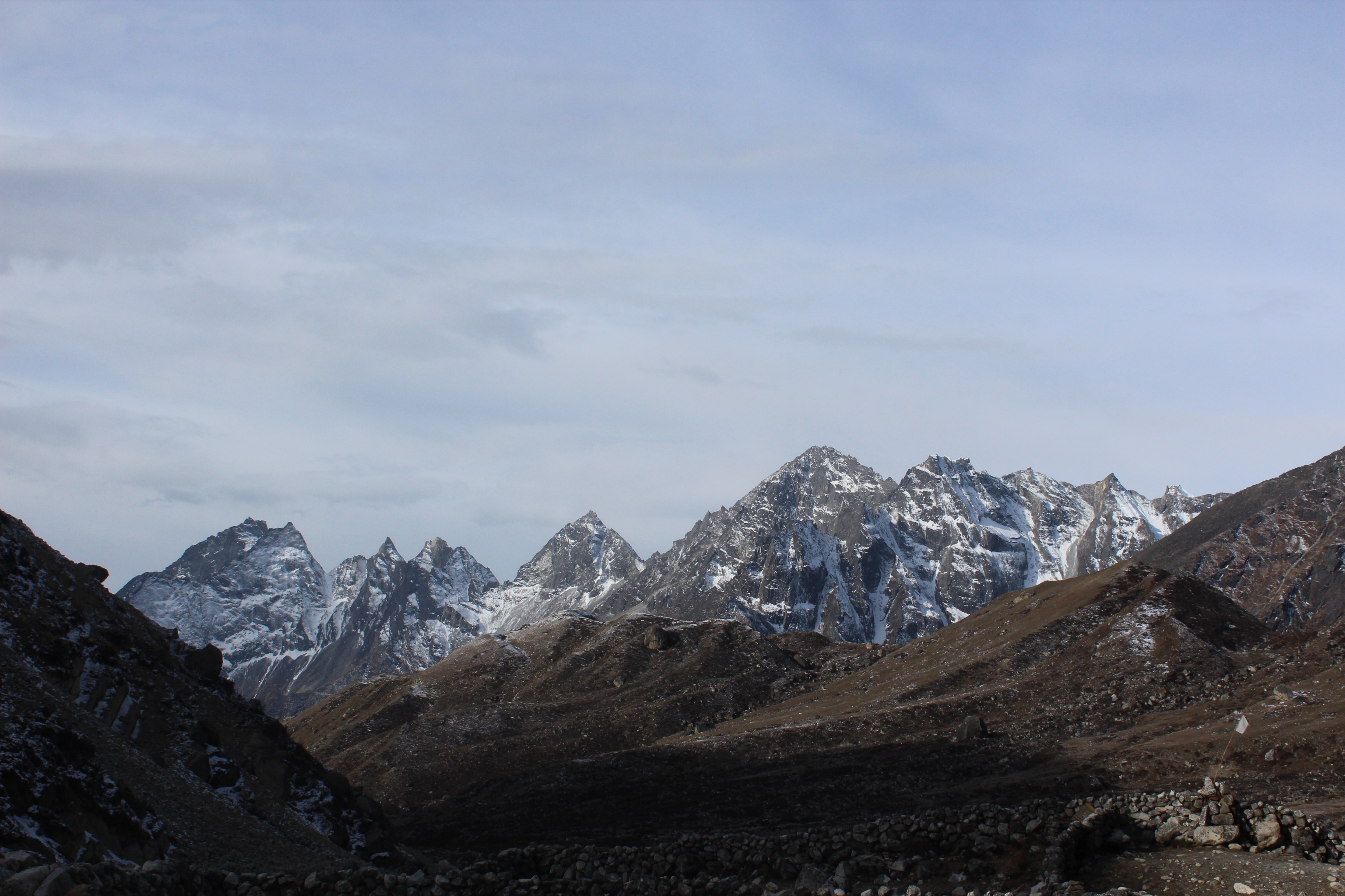
The route from Dragnak went through a valley strewn with boulders. There wasn’t any track as such, we just followed the porters who started before us. Patches of snow lay here and there from last night’s snowfall. Though the gradient wasn’t steep, we had to be careful because of melting snow. The boulders too were slippery. It was an act of hopping over them. The high mountains on both sides of the valley prevented the sunlight but the distant peaks at the end of the valley were bathing in bright sunshine.

En-route Gokyo
We kept moving through the valley till the route started moving up along the left ridge. As we reached the top of the ridge, an entirely different view greeted us. Vast swathes of tracts were dotted with cracks and crevasses, with pools of water lying in between. The gaping crevasses exposed the underlying snow beneath the layer of dust and rocks that camouflaged the surface of the vast Ngozumpa glacier, one of the sources that fed the Gokyo lakes system.
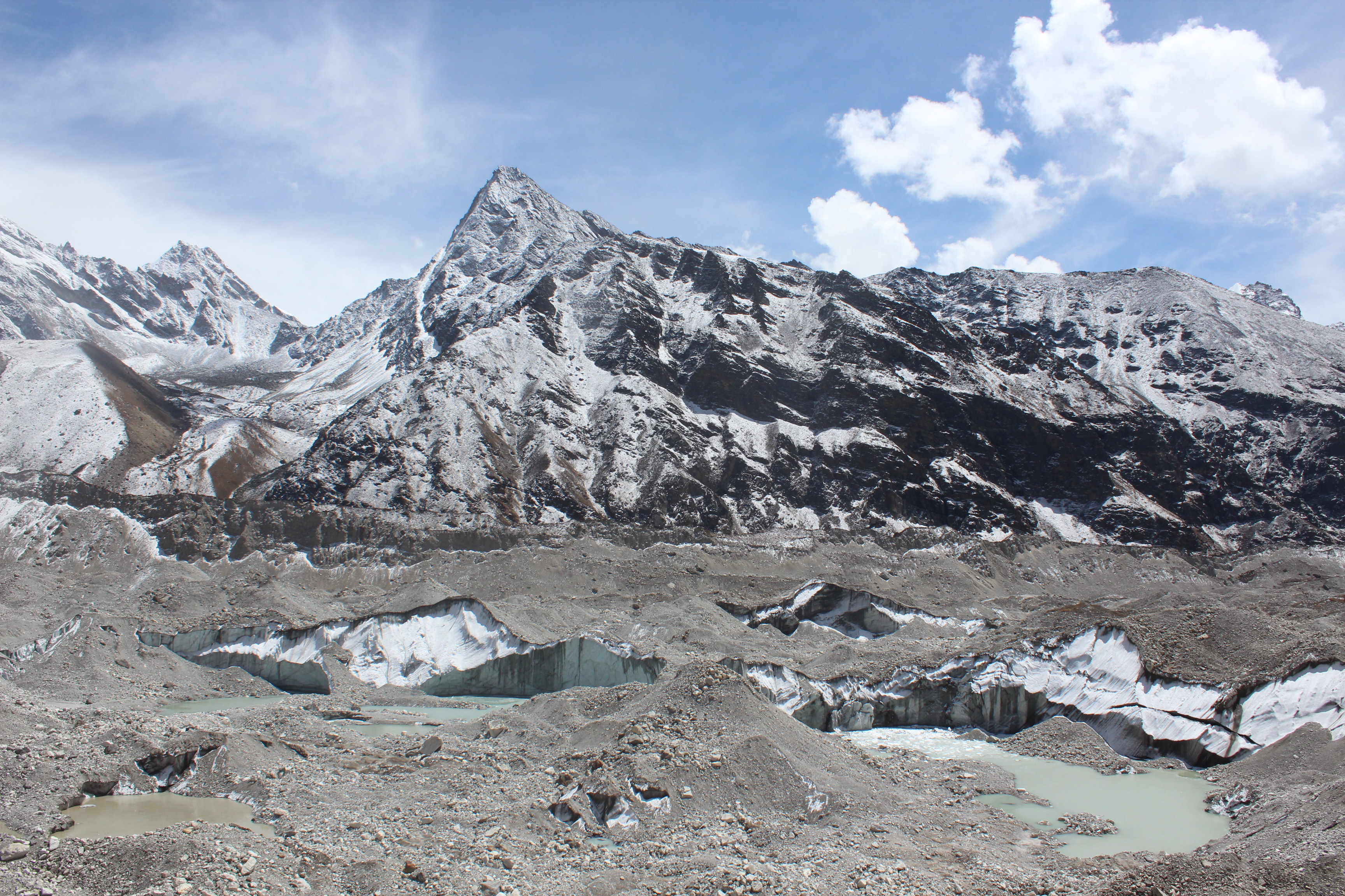
Ngozumpa glacier
Our track descended into the bed of the glacier. The descent was steep and we had to go one by one on the skiddy surface of dust and pebbles. I had to take the help of Doranath, one whose help proved crucial on the Cho La pass, the day before. After he guided me down, we all started to walk along the edge of the glacial bed. The tract was uneven. It was essentially an act of stepping up on a stack of boulders, come down to go up again. There wasn’t any track per se, we just followed our porters who made their way through this maze. Tracks and routes in these regions often change over days, at times within a day. New cracks open up, rocks fall from the top of the mountains, a new glacial pool emerges – these are everyday events. A route in a particular year ceases to exist in the next. One then has to find a new one. We were told, this was one of the areas severely affected by the earthquake of 2015. Even the porters found it difficult to find the route.
En-route Gokyo
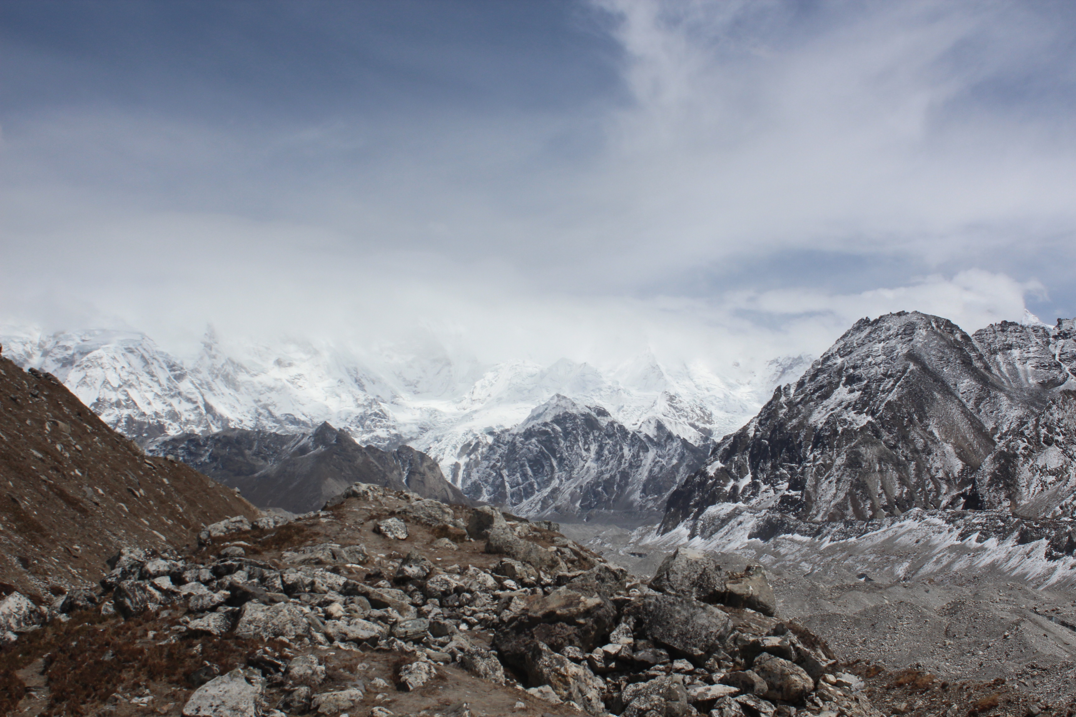
We kept on following the porters up and down the stack of boulders as we traveled through the glacial bed to cross over and move to the other side. We were told, beyond the ridge on the other side, lay Gokyo. In order to reach there, we would have to climb up the ridge and descend on the other side. The ridge on the other side appeared to be very dusty and fragile by its look. When we reached near it, the porters told us to hike as soon as possible in a diagonal fashion. The entire area was a rock fall zone and we had to cross it as soon as possible. Their words were supported by boulders and pebbles that kept coming down the slopes. It was a tough ask. The gradient was steep which slowed us down, but we didn’t have the luxury to move at our own pace as we had to get out of this rock fall zone as soon as possible. We did our best to hike and after sometime, the gradient eased a little and to our relief, the porters signaled to us that we were out of danger. As we neared the top of the ridge, mountains from the other side started to appear.
En-route Gokyo
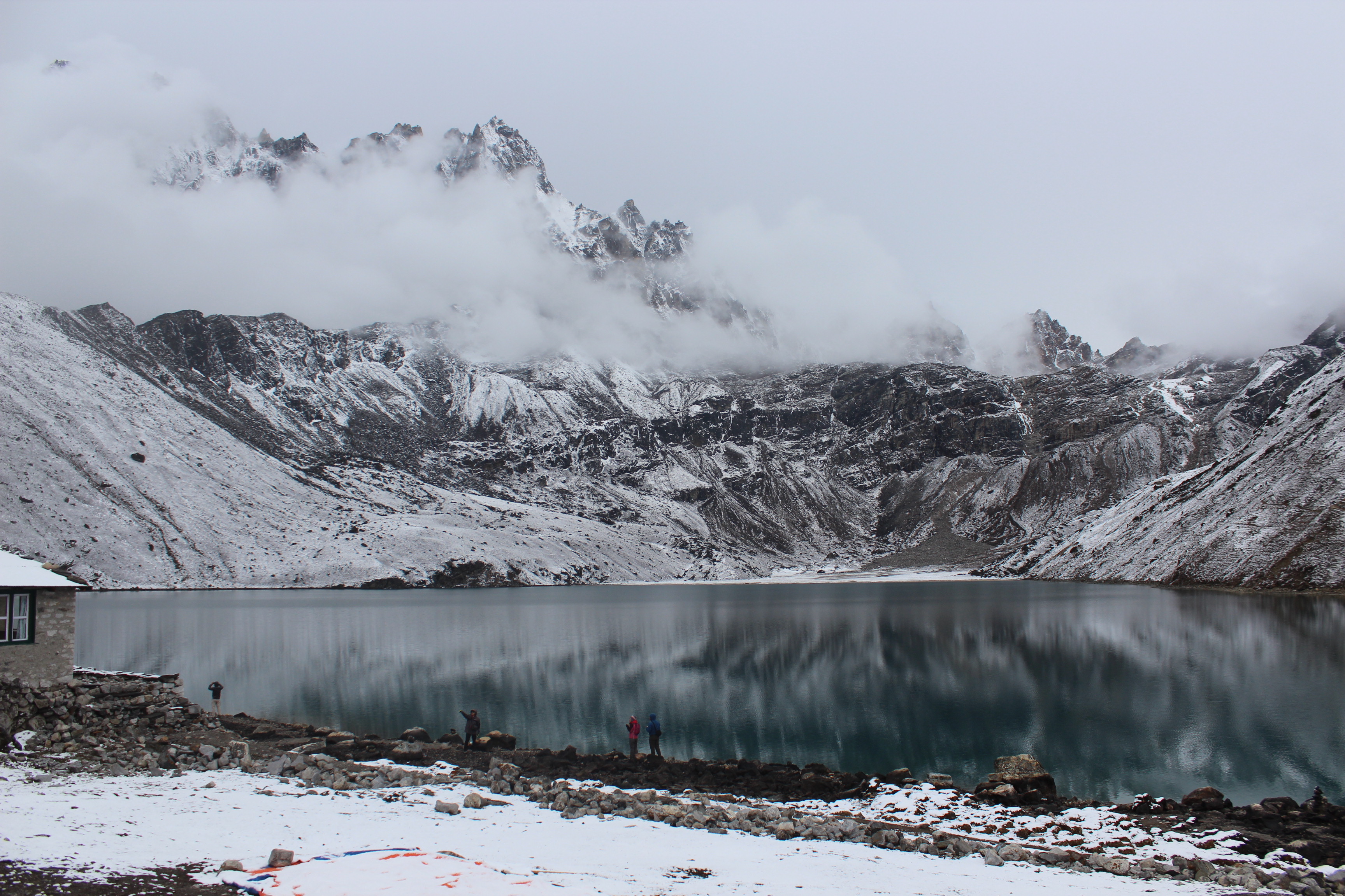
As we reached nearer to the top, mountains from other side kept leaping up as if someone was taking the curtains up and a beautiful pristine lake at their base started to appear. We were seeing the second largest lake of the Gokyo lake system, which comprises of six lakes. The pristine lake with its turquoise blue water was spread out at the bases of the high mountains that surrounded its banks. Light breeze was sweeping over the surface raising ripples in its waters. It appeared as a huge amphitheater surrounded by high mountains with the lake at its base. I was thankful to our friend Santanu, who suggested to include Gokyo in our itinerary. All the pain went down the drain with the view at our disposal.
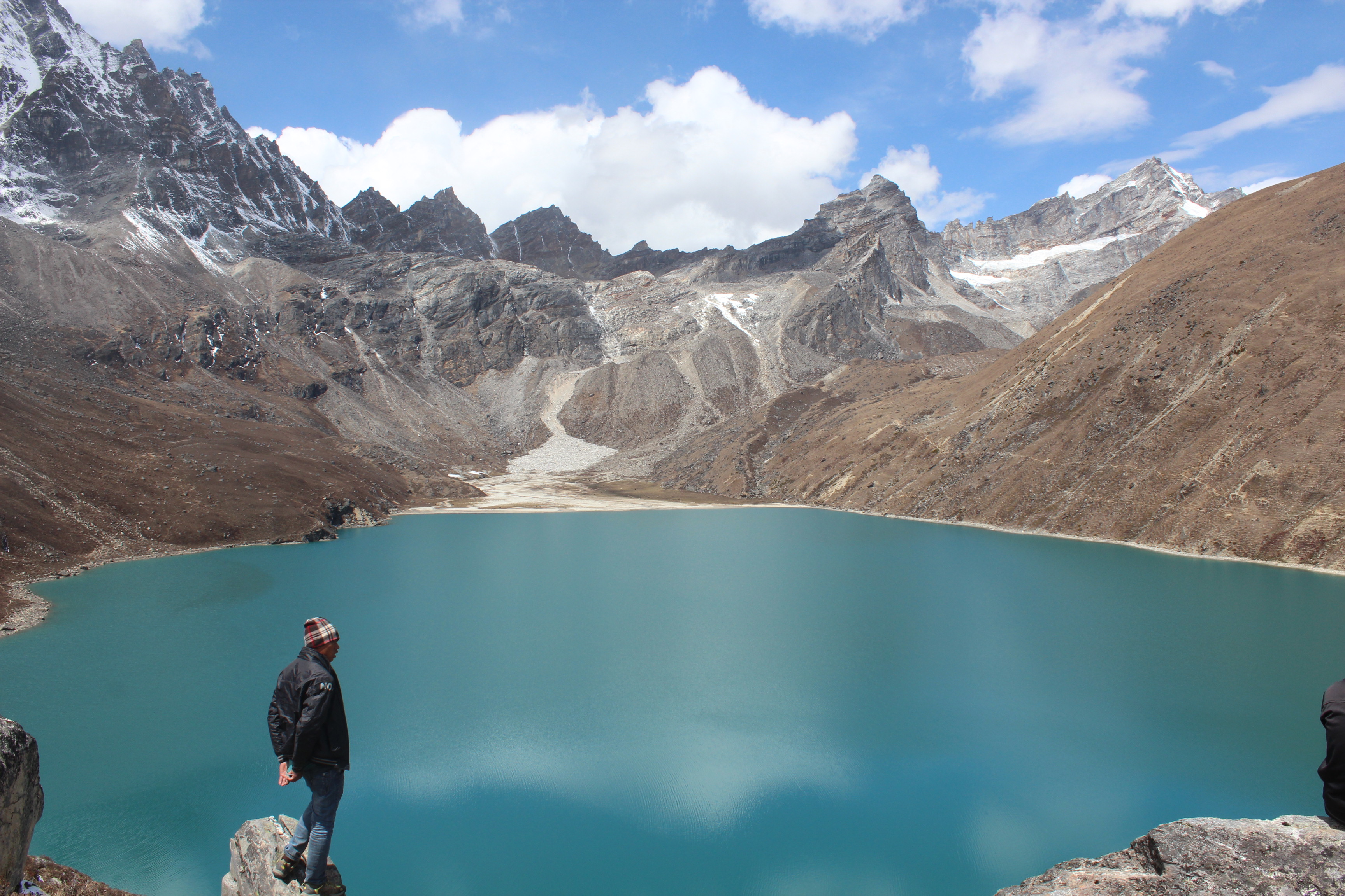
Gokyo Lake
Gokyo lakes are a system of lakes in the higher regions of Nepal’s Sagarmatha National Park. Their waters have lower algal production and hence, is clean with high drinking water quality. Such waters also have high quantities of Oxygen. Gokyo lakes form the highest fresh water lake system in the world and is composed of six main lakes. Out of them Thonak lake is the largest, followed by Gokyo lake (or Gokyo Cho as it is called locally). The village of Gokyo lies on the eastern flanks of the Gokyo lake, which is where we were headed. These lakes are fed by nearby glaciers and are considered to be highly unstable. This is because they lie in a very ecologically unstable zone. One of the main sources of water for these system of lakes is the Ngozumpa glacier which lies to its east. A stream coming down from the Renzo La lying in the North-West of the region, is also one of the main sources.
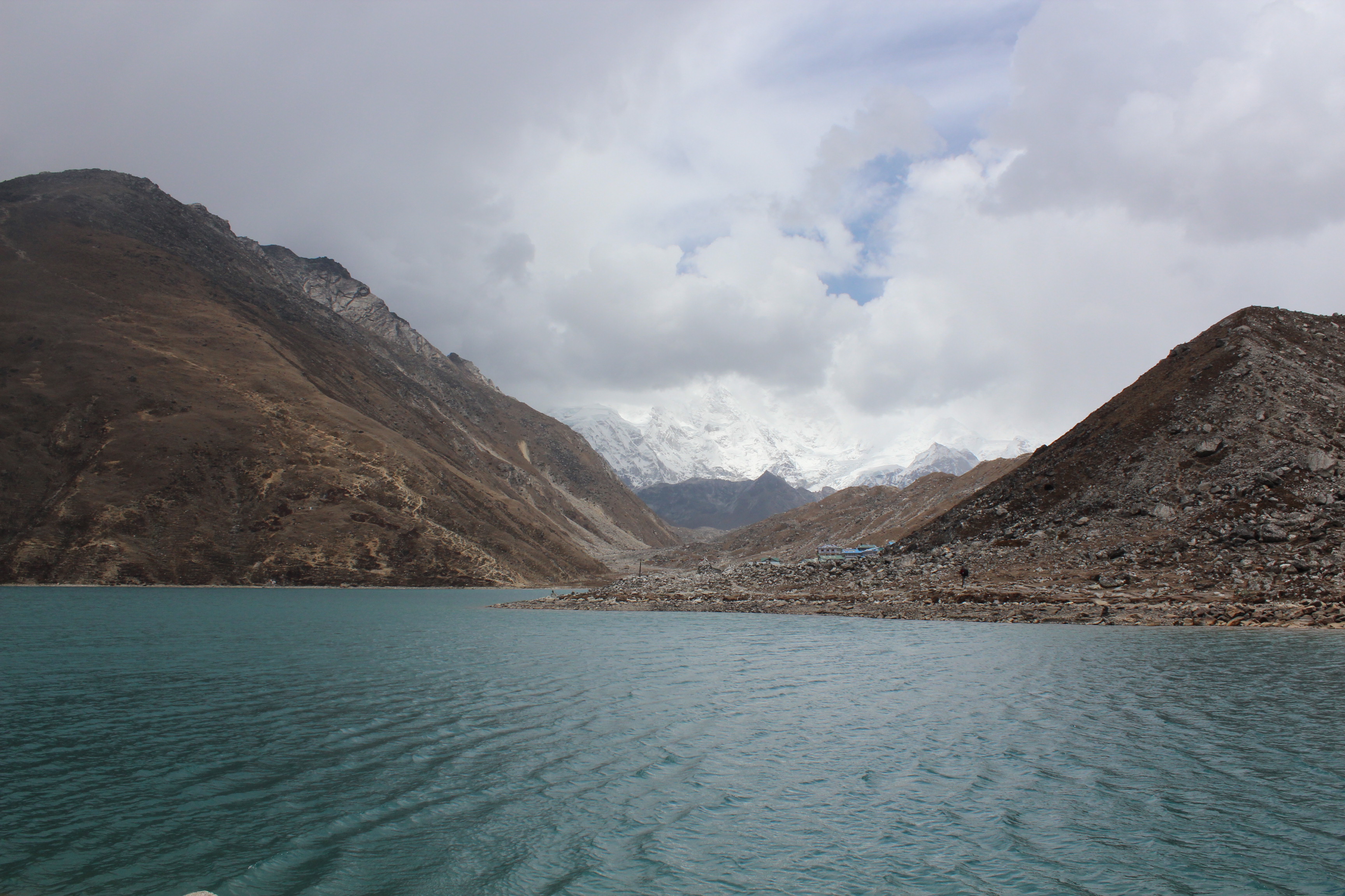
While standing at the top, we made a decision on the spot. We would be taking a stroll around the lake’s circumference. We followed the porters towards the lodge. It was a big new structure right on the banks of the lake. The furniture and its polish were smelling fresh. After settling in our rooms, we went to the dining hall for tea. The dining place was covered with glass windows on all sides with the lake visible from all angles. It was tempting to just relax, enjoying the views, sipping a cup of tea. After all the hard walking in the last several days, the body yearned to have rest in this beautiful place and do nothing else. But someone said weather will change quickly and its likely to snow. With the lake bathing in bright sunshine, it was difficult to believe, but locals knew this place as the palm of their hands and distant clouds did appear ominous to them. Hence, if we were to take a stroll around the lake, we had to depart immediately.
It was just an act of treading along amidst the boulders on the banks. At times we walked over the sand along its banks, while in other cases, the trail moved way above the banks. As we moved along, the lake kept changing its appearance, both because of the angle as well as the changing mood of the sun, which gradually started to hide behind the clouds. Winds gathered pace and swept along the surface of the water.
Gokyo lake
Niladri went ahead, while I carried along with Dhananjoy. The tracks gradually moved up along the slopes and we found ourselves walking along a narrow edge. To be able to enjoy the view of the lake, we often had to stop as it wasn’t possible to walk without having a close and concentrated look on the path. The lodges on the banks got dwarfed by the huge mountains. They appeared as matchboxes from a distance amidst this huge amphitheater.
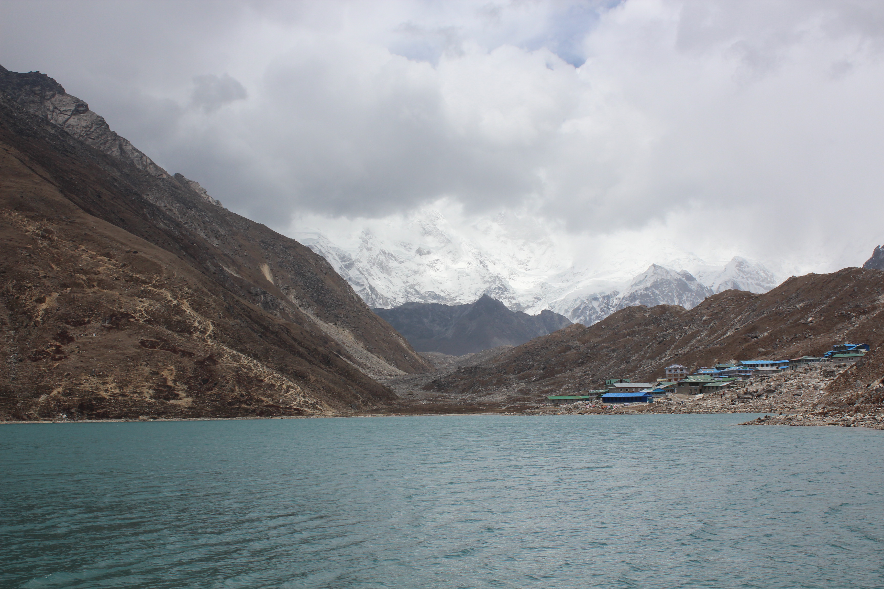
Gokyo
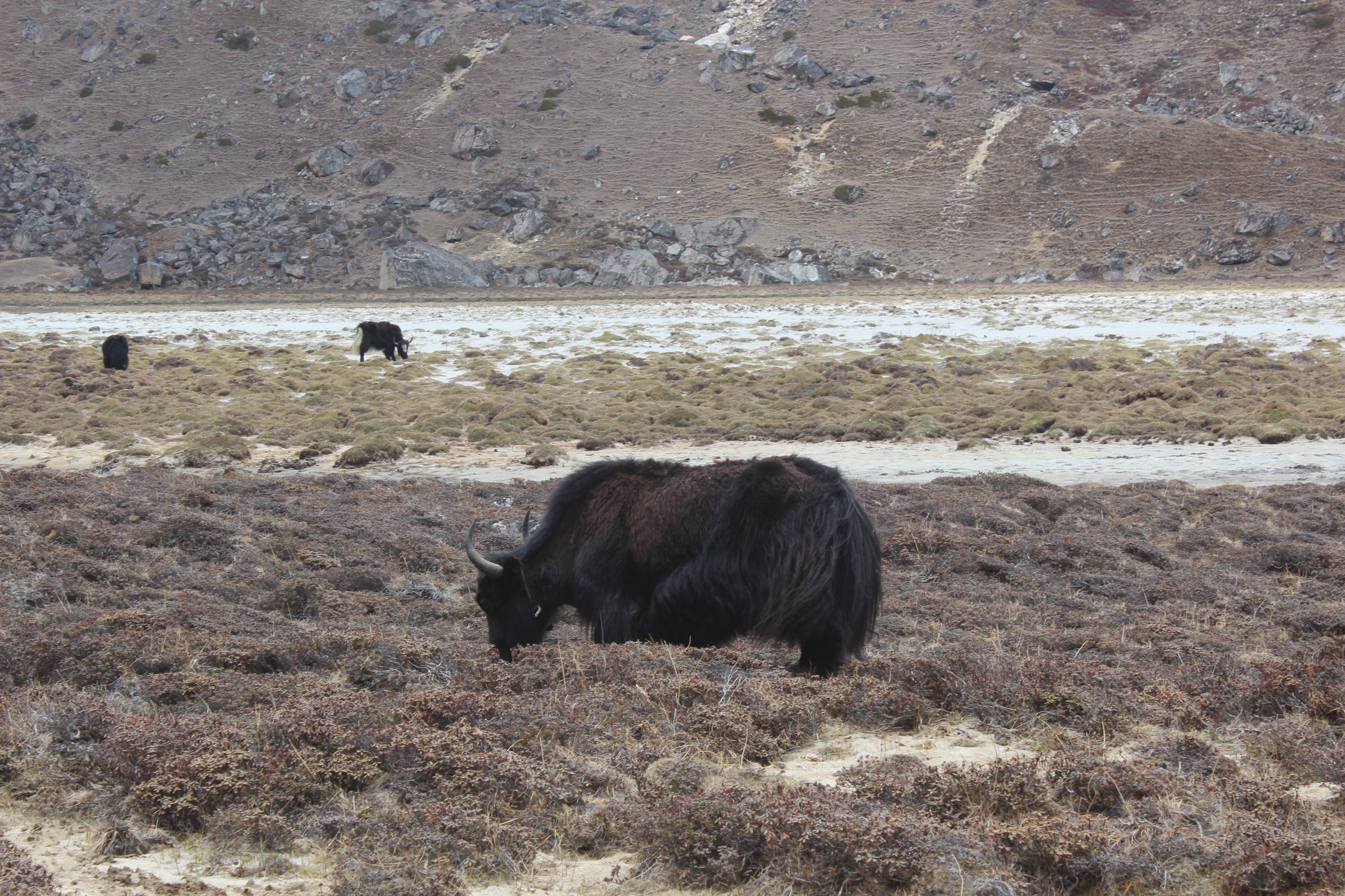
Clouds started closing in and within moments, the bright sunshine gave way to a setting of a dark evening (though it was just past noon). Fluffy innocuous clouds that were floating around moments before, now started looking ominous. We were only half way through our stroll, but were far enough from the reaches of the lodges. Suddenly, it started to look like a race against time. We still had to cover the remaining half of the lake. The urgency among us didn’t seem to reflect on the yaks those were grazing lazily along the banks. They had faith in their thick fur for their protection and continued enjoying the grass.
Grazing yaks – Gokyo
As we reached the other bank, snow balls started coming down our way in thick and thin. We kept moving and finally just about reached the doors of the lodge when it started to snow in full flow. We sat at the dining place enjoying the snow outside. It snowed with intensity for about half an hour and by then the entire nature changed from color to a black and white film. The yaks too changed their skins to white.
Gokyo
We had to abandon our plans to hike to the Gokyo Ri (a nearby top which offers a panoramic view of the mountain ranges and glaciers of the Khumbu region) and spent the evening at the lodge playing cards. It was a day with most leisurely time with us. We reached Gokyo relatively early in the day and had the entire day to rest and enjoy the views. No other day on this trail was as relaxing as this one. Given that the lodge was new and there weren’t any other occupants, we got to use the power points to charge our cell phones and cameras – the only place on this trail where we had this luxury. After reaching Gokyo, our trip reached a turning point. The next day would see us descending on our way back to Dole. Successive days would take us to Namche and Lukla. We’d be sleeping at 4750 m.
11th May, 2016
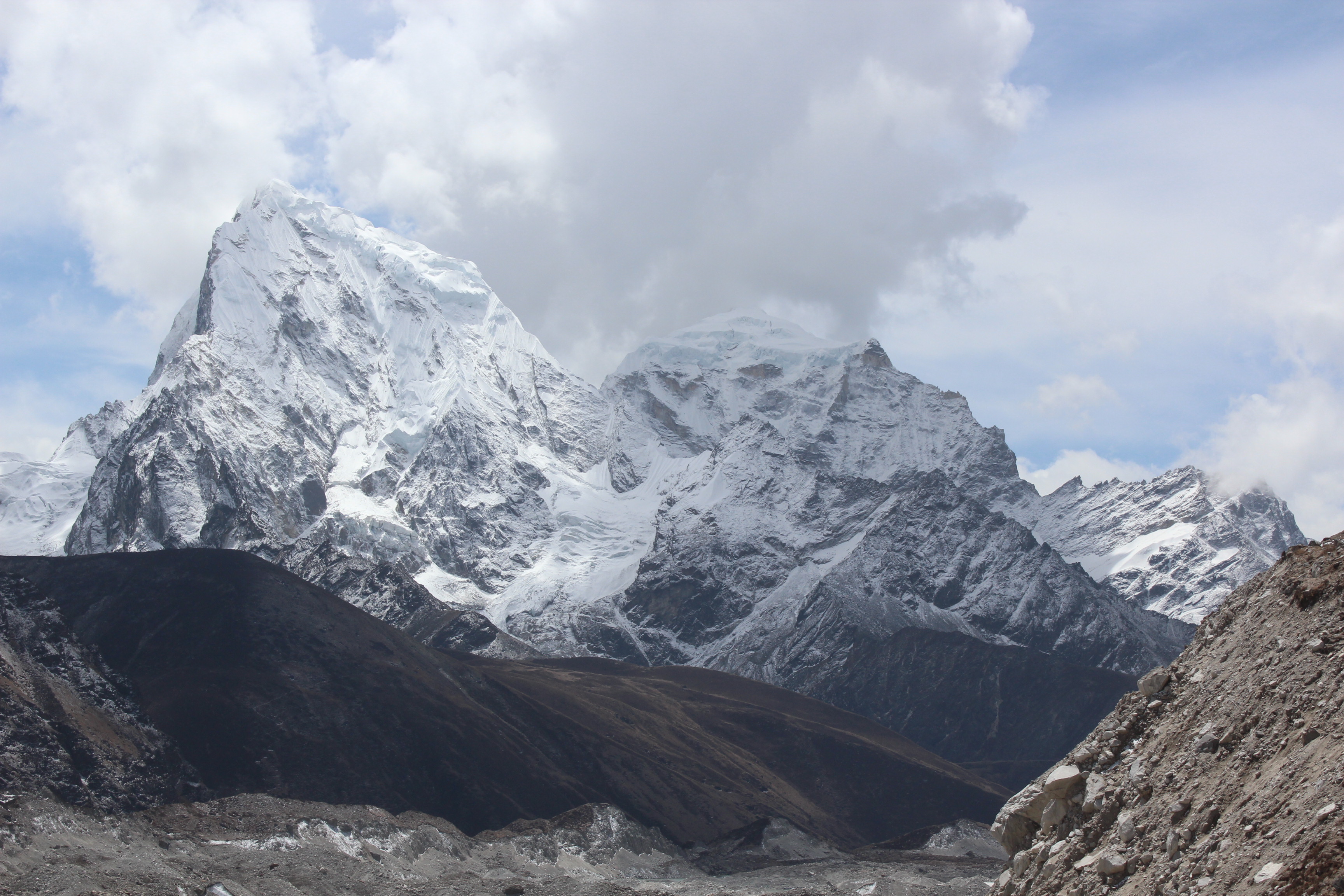
The sleep was peaceful last night and probably the best I had on this trail. The morning was bright. Clouds stayed away. I came out of the lodge to have another view of the lake. As I turned to my right, I was stunned with the majestic appearance of a snow peak! I didn’t realize yesterday that it was that close! It appeared almost within a stone throwing distance. It was crowned with silver. Snow covered its entire body, right to the base. “Mt Cho Oyu” – whispered a local as I was gazing at it, awestruck! The sixth highest mountain in the world at 8188 m, stood right in front of us!
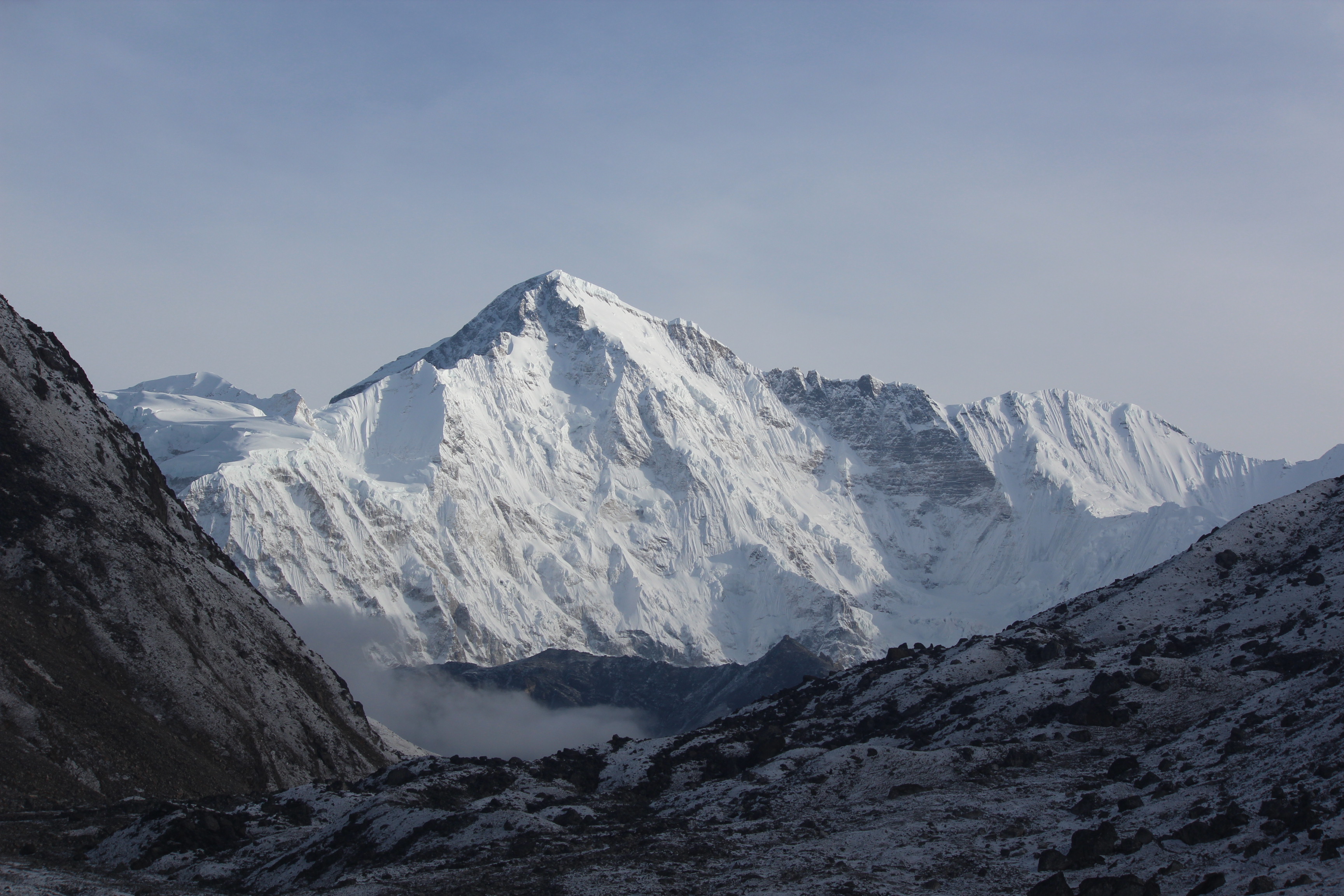
Cho Oyu
Cho Oyu translates to “Turquoise Goddess” in the Tibetan language. It is considered to be the easiest to climb in the 8000 m club among the mountaineers and registers the second highest number of climbs, second only to Mt Everest. It is the western most peak in the Khumbu section of Mahalangur Himal, a section of the Himalayas lying in North-Eastern Nepal bordering Tibet. Thinking about climbing, Rheinhold Messner’s name crossed my mind. He, just as he did for all other thirteen 8000 m peaks, must have stood at the top of this mountain, some day! He was the first to climb all fourteen sans artificial Oxygen, a feat achieved even before the Sherpas.
Back to the story, we exited the lodge at Gokyo carrying lovely memories of the place. I looked upwards along the mountain on the opposite bank and saw the little figure of a man coming down the zig-zag trail down the slopes. It was the trail coming down from Gokyo Ri. The lodge owner told us about him. He was from Japan. He woke up early in the wee hours, hiked up to Gokyo Ri and was now coming down. A hike that takes half a day to complete, was completed by him in just a few hours. But little did we realize, he had more surprises in store for us!
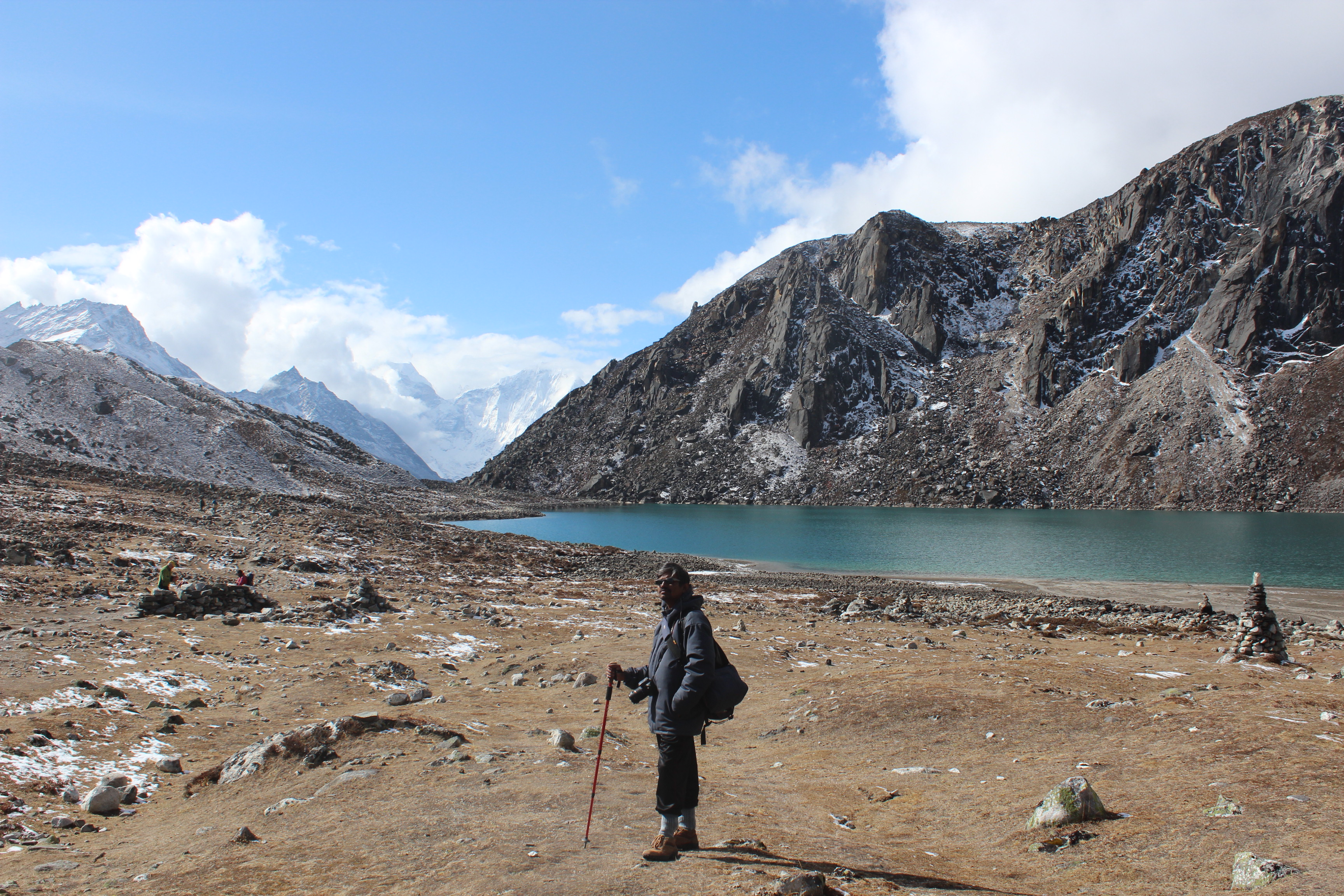
On our way out – Gokyo region
We walked beside the Gokyo lake on our way out, but instead of turning with the banks as we did the day before, we took a different route on our way out. It was a level terrain with the gradient moving gradually downwards. We crossed another small lake and reached a crossroad where two tracks moved in two different directions. We waited for our guide Raju who was coming behind with some of our members in the rear. Following Raju’s instructions, we took one of those trails till we reached a small pool over a thundering stream. After we crossed the pool, the trail narrowed, but was wide enough for two persons to walk together. Though we moved downhill, the tracks were still devoid of any vegetation. We were still above the treeline. On our way down, I thought of taking some snaps, which is when I discovered that my lens cover was missing. It was loosening for last few days and must have fallen somewhere on our way. Later on, Raju found it on his way and returned it to me. That gave me some relief!
We saw a stupa with Mani stones and prayer flags round the corner. Raju said, we would have go down beyond that point deep into a gorge between two hills. We could see houses and lodges. That was Machermo, our place for lunch. We gradually went down, crossed the houses and fields to reach a lodge. It was a pleasant walk so far, but our legs were aching. One the way up, its your lungs and joints who bear the brunt. One the way down, its the turn of the lower limbs to feel the force of gravitation. After having tea and lunch, we hit the trail again. This time it was climbing up the opposite hill to regain the trail again which we left to come down to Machermo. There was another stupa with prayer flags. This pattern of a stupa marking the beginning and another one, the end of a village would repeat for the villages to come. They are meant to act as guards to protect the villagers from all perils. These customs remind us that the Sherpas are the descendants of early Tibetans who came to Nepal from the Tibetan plateau, lying to the north of the Himalayas. The Sherpas were a nomadic tribe, who came from Tibet, crossing the Himalayas through many high mountain passes, Nangpa La being one of them, about 600 years ago. They settled in the SoluKhumbu region of North-Eastern Nepal. But later on, different groups moved from one place to another within Nepal and settled in other parts of it. In earlier days, their main source of income was raising yaks (both for dairy products as well as meat). That forced them to migrate around in search of pastures. Traditionally they are used to living in extreme altitudes and harsh weathers. From the early days of expeditions, they were trusted aides to expedition teams as guides, porters and climbing assistants. In those days, many of them migrated to the Darjeeling area in India with hopes of getting hired as expedition porters and guides. Darjeeling was the base where most of the expeditions started. Later on, with Nepal opening its doors to the Western world, the SoluKhumbu region saw major growth in adventure sports, tourism and mountaineering with Everest being the primary source of attraction. With Nepalese government granting more and more expedition permits, Everest became one of the main sources of their livelihood. With no other source of income to sustain their lives throughout the year, the Sherpas were forced to risk their lives in such expeditions. What the Westerners view as adventures and their dream of life, is viewed as necessity by the Sherpas with many of them summitting Everest multiple times. Apa Sherpa holds the world record of 21 summits to Mt Everest.
They start their mountaineering career pretty early in their age as porters, cooks and guides, gradually gaining prominence as climbing sirdars (the Sherpa who leads the other Sherpas in an expedition and leads the summit attempt). Their value (and hence, the pay) in the trade gets amplified with each successful summit of Everest. Despite the risks involved, each Sherpa in this trade yearns for opportunities to summit. They are held in high regards by the mountaineering fraternity because of their tremendous climbing skills (part of which comes from their genetic adaptability to high altitudes because of staying at these places for years) and their strength. Often they carry loads amounting more than double their own body weights to camps at high altitudes along the slopes of the mountains. A climber, on an average, has to cross the deadly Khumbu ice-fall four to five times during an expedition, whereas the Sherpas have to cross it at least 15-20 times, with tremendous loads in order to stock resources up in the higher camps, which they setup themselves. They are the ones who are prone to most of the risks posed by Everest. The money they make during one/two months of climbing season, is just enough to sustain them for the rest of the year. Things have changed to some extent after the relentless efforts of Sir Edmund Hillary through his Edmund Hillary trust and the Himalayan trust. Many schools and hospitals have been built in the Khumbu region. In spite of all that, Everest remains as their main economic source even to the present day. A mountain, to which they pay respect as Goddess mother of Earth, Chomolungma. Everest remains as their main savior and a guardian who keeps guarding the slopes of SoluKhumbu region from all evils. They leave no stone un-turned to keep it happy. At the start of every expedition, they organize a religious prayer to seek permission from the revered mountain to enter into its interiors. They believe that no human can set foot atop the mountain unless it grants permission to do so.
We kept crossing many such Sherpa villages on our way through the Khumbu region till we reached a point from where the trail moved down below into a river gorge. We stood at the corner to have a look below. There were lodges on the other side of the river. It was the Dole village, our place of stay. As we waited for other members in the rear, our Japanese friend from Gokyo (who hiked the Gokyo Ri in early morning, the same day) crossed us, shared a smile and sped down the slope. Within minutes, he was on the banks of the river below. He kept hiking its other bank and went out of our sight. We came to know later, that he was headed for Namche, the same day! The distance which we would cover in 2 days, will be covered by him in a single day and that too, after an early morning hike to the Gokyo Ri!
Later, in the evening, when we sat for tea at the dining space of the lodge at Dole, suddenly, the entire lodge and its furniture got a sudden jolt. Before even we could react properly, the vibration ceased. The lodge staff said with a cool head that it was an earthquake tremor! Memories of devastation in 2015 came back back to haunt us for a few moments. That night, I had some sleepless moments, still thinking about the jolt and the mayhem it could cause in these parts of the world. It was a reminder from nature that we were at its mercy. We may forget amid the daily events of life, but it’s there, very much there! No one knows when it can strike! We were sleeping at 4038 m.
