30th April, 2025
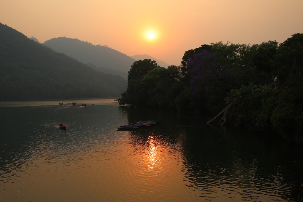
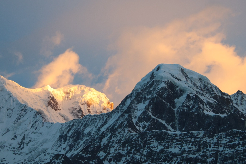
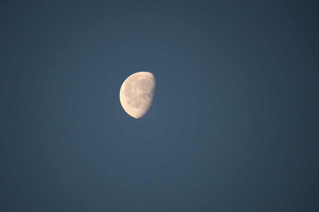
Sleep eluded me for initial part of the previous night and I kept tossing around. I wasn’t sure of the reason, but it wasn’t due to cold as the bed and blanket (along with the warm wears) kept me comfortable. It was these aspects that always made me thank the infrastructure that is available in Nepal. Nevertheless, I had a comfortable sleep during the latter part. Hopes went high in the previous evening. The guide promised to check on the clouds and wake me up if they stayed clear off the mountains. For my part, I set an alarm anyways and when it went off, I left the comfort of the bed. It was 5 AM. A quick glance out of the sole window of the room revealed a dark silhouette of the moiuntains against a feeble background of emerging sunlight. Their tops were devoid of any cloud and there was no mist or fog. Finally, nature did choose to reward our perseverance of hiking up to the ridge amidst clouds! I still had about an hour at my disposal before the first sun rays of the morning started acting out the drama of color shades on the mountains’ canvas. I chose to utilize this to prepare myself for the day’s travel and packed my things into the bag carried by Yugal. I then hung the camera around my neck and ventured out to the open space behind the tea house. Some people already stationed themselves at the helipad, which was at an elevated place, near the lodge, some others made their start towards Khayar lake. I chose the helipad (as there wasn’t enough time left for Khayar lake). I had to hurry as this is the time of the day when the intensity and color of the solar rays change drastically and every minute counts. After reaching the helipad, I turned a glance towards the distant Dhaulagiri range and there it was, the first rays of sun started gracing their tops. The dark silhouette started acquiring golden borders along the sharp edges. The Annapurna ranges still lay in darkness while the sky lit up behind them, indicating the sun would emerge from behind them.

The cold was biting and I couldn’t move my fingers freely. I had to expose them bare off and on to handle my camera, which proved tough, but I didn’t care. Everytime I panned the lens across the vista, the colors seemed to change and that resulted in many snaps for the same subject. It’s normall to err on the side of caution as there’s always the option to retain the prefered set after examining their quality at leisure. A quick glance to the left revealed that the valley below was still covered with thick dense clouds. For someone down in the valley, it’d be difficult to imagine the vista at display up here at the ridge.
I kept thanking my luck and nature’s kindness to have displayed its grandeur. Who would have thought about this, under the conditions that prevailed the afternoon before? The decision to hike yesterday, has paid off. Even if clouds engulf the views with the progress of the day, I’d have nothing to complain. These are the views for which one can hike for hours! Himalayan vultures kept flying around, a few crows kept screaming amidst this otherwise silent backdrop, which kept changing the canvas.
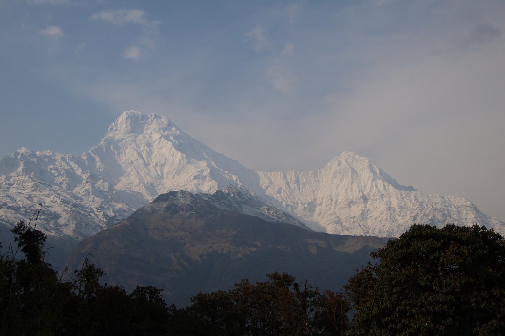
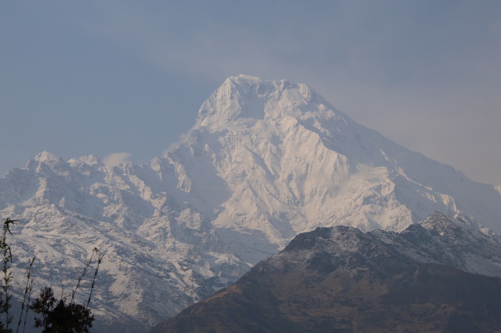
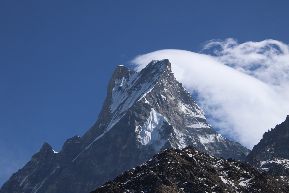
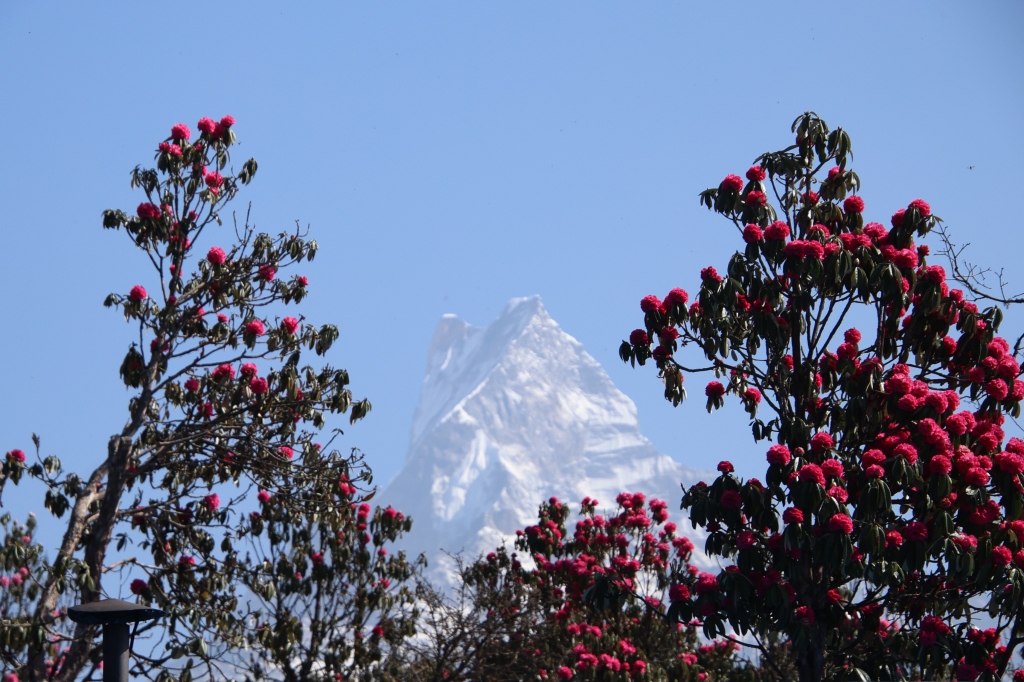
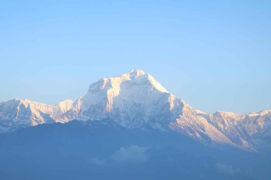
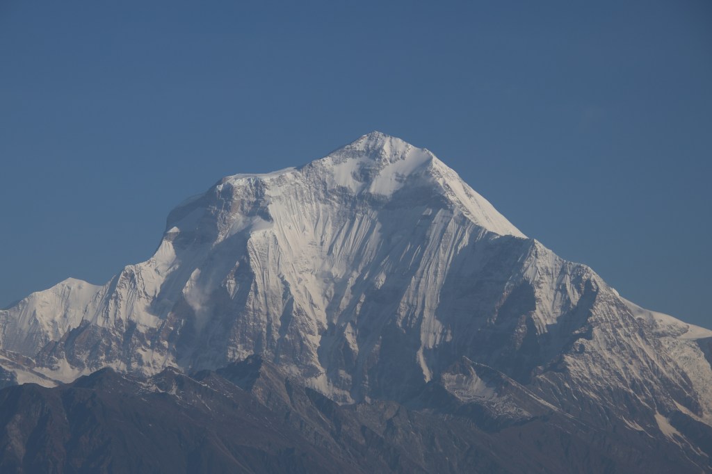
We’ve seen the Annapurna ranges from multiple angles, but it was the Dhaulagiri massif, which inspired the awe! Such a huge and imposing architecture. Mt Dhaulagiri (8167 m) is the highest mountain that is fully within the territories of Nepal. It is the seventh highest mountain in the world, just behind Mt Cho Oyu (which sits on the Nepal-Tibet border) in the race for height. The other big-wigs (e.g. the likes of Mt Everest, Mt Lhotse or Mt Kanchenjunga) are shared either with Tibet or India.

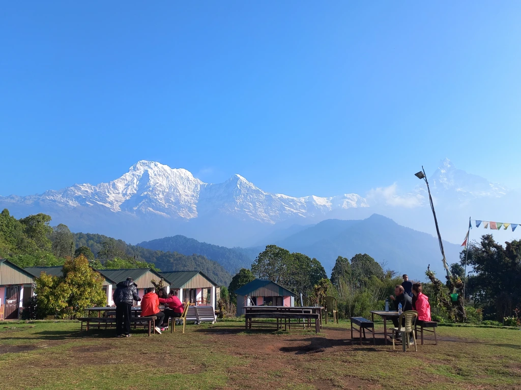
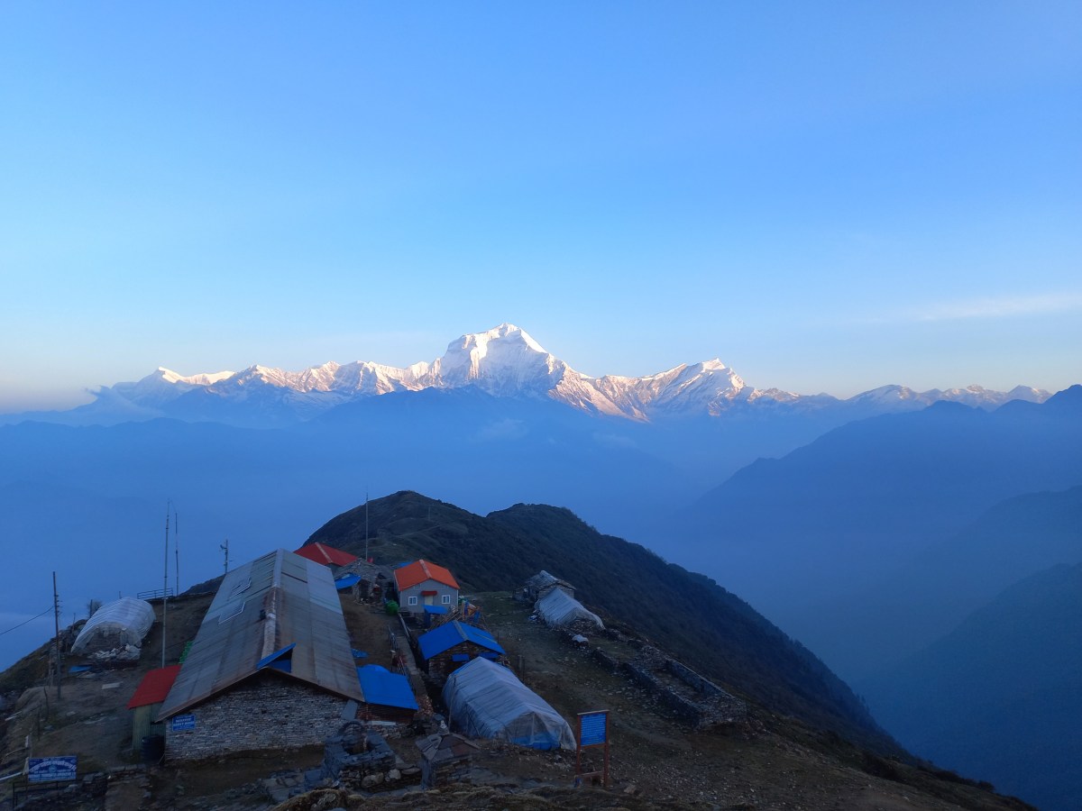
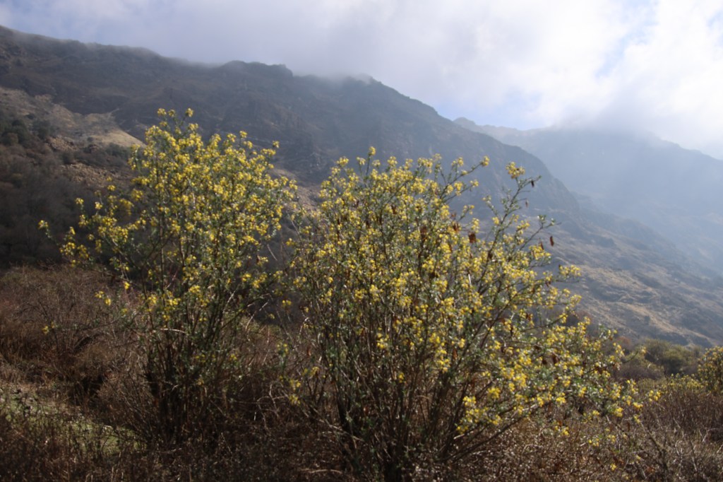
Our tea house, along with its associated supplementary structures, lay sprawling amidst the ridge, which expaned into a somewhat flat area. A deep valley lay beyond it and at the edge of it, hills rose above the horizon, gradually merging into the snow line of the Dhaulagiri range that ran from Gurja Himal in the west to Mt Tukuche in the east, now all bathing in the morning sun.
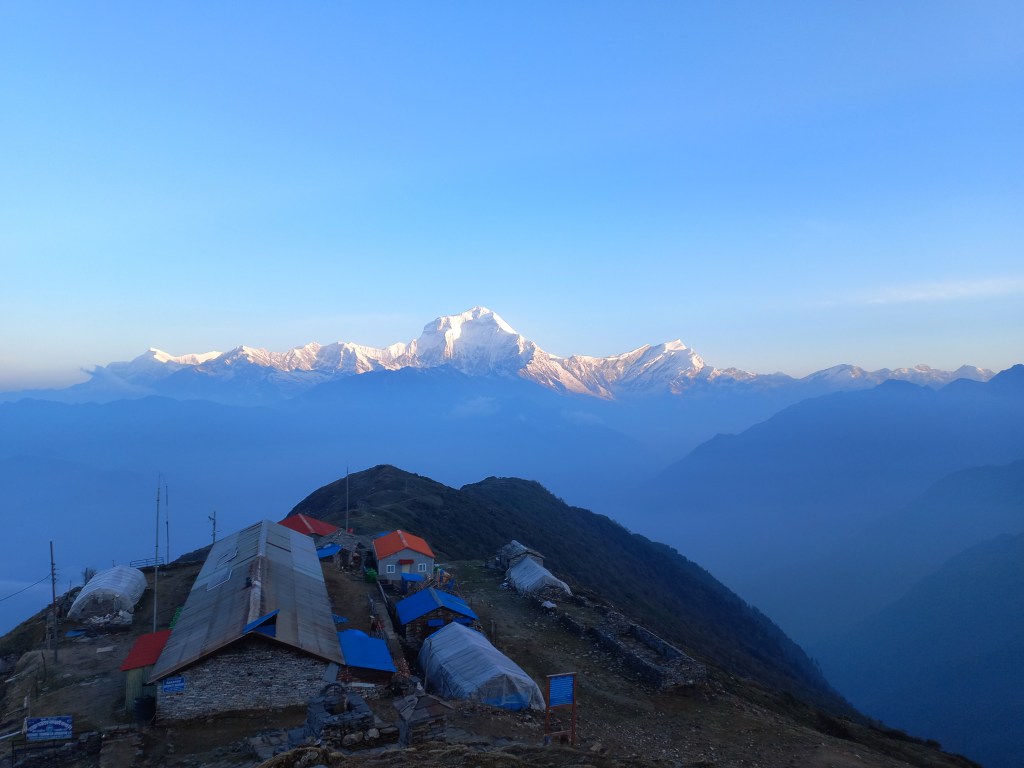
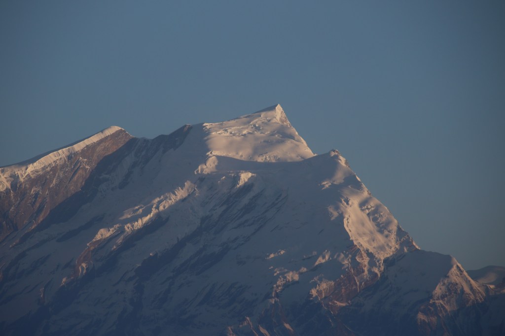
The main and supplementary structure of the lodge appeared like matchboxes amidst this huge amphitheatre. Everything, including us, seemed belittled amongst the wide panorama of nature. The mountains and the sun were the major actors in this play and we were mute spectators. The only act we could take up was to train our lenses and roll the shutters on. As morning wore on, the brightness and intensity of the solar rays increased and the mountain peaks dazzled in their silver crowns.
Sharp rays of sun emanated amidst the ridges around the Annapurna range, which still lay in the dark and going by the indications, would remain so.
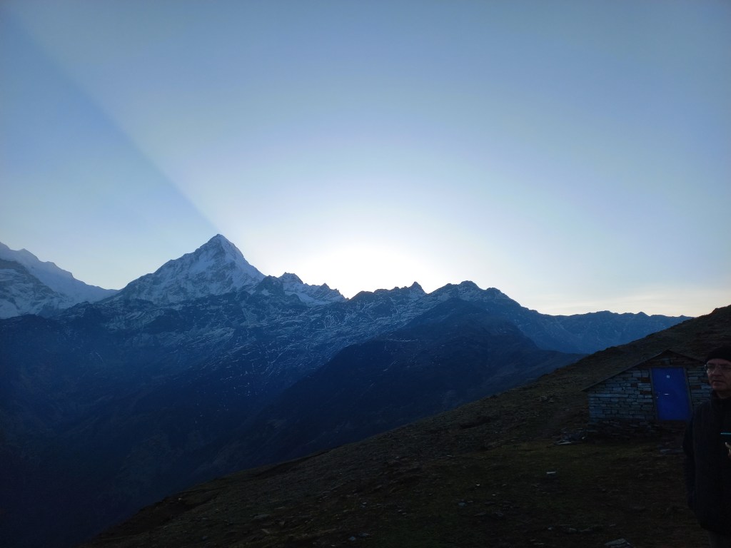
By this time, Yugal made his appearance. He came to knock at my door, only to find it locked and hence, he concluded that I was already awake and out in the open. As the sun came up from behind the Annapurna range, the rays fully illuminated the mountains. We made our way down the slopes towrds the tea house. Breakfast got served with hot tea and after paying our dues, I and Yugal, started our journey down the slopes we hiked up yesterday. The valley too, was now cleared up and we could see deep down into it, even the distant homes along the slopes of the hills. Pointing at a red roof top, almost at the valley floor, Yugal mentioned that was Swanta, our destination for the day.
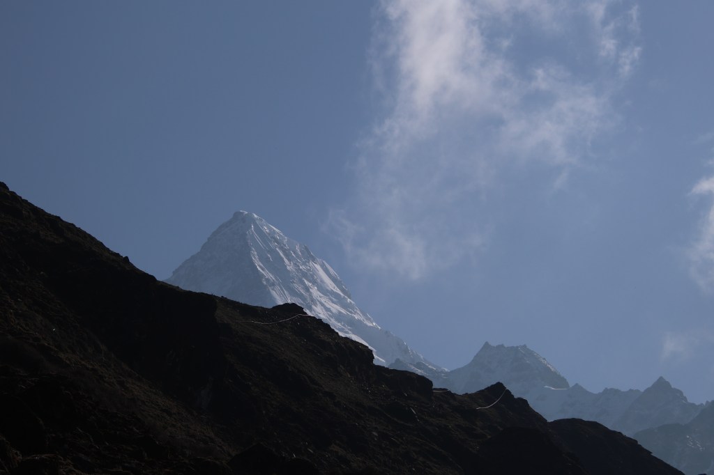
We gradually moved along the flat trail to reach the place marked by Chortens (Tibetan flags) and then started our descent along the same switchbacks we traversed on our way up, the afternoon before. By this time, the Annapurna ranges too, were illuminated. As we lost altitude, the ridge walls rose above us and mountains went away from our views. The same tract, that appeared gloomy on our way up, now was shining bright with flowers and colors at display in the bright norning sun. Birds too, were more chirpy than they were the day before.
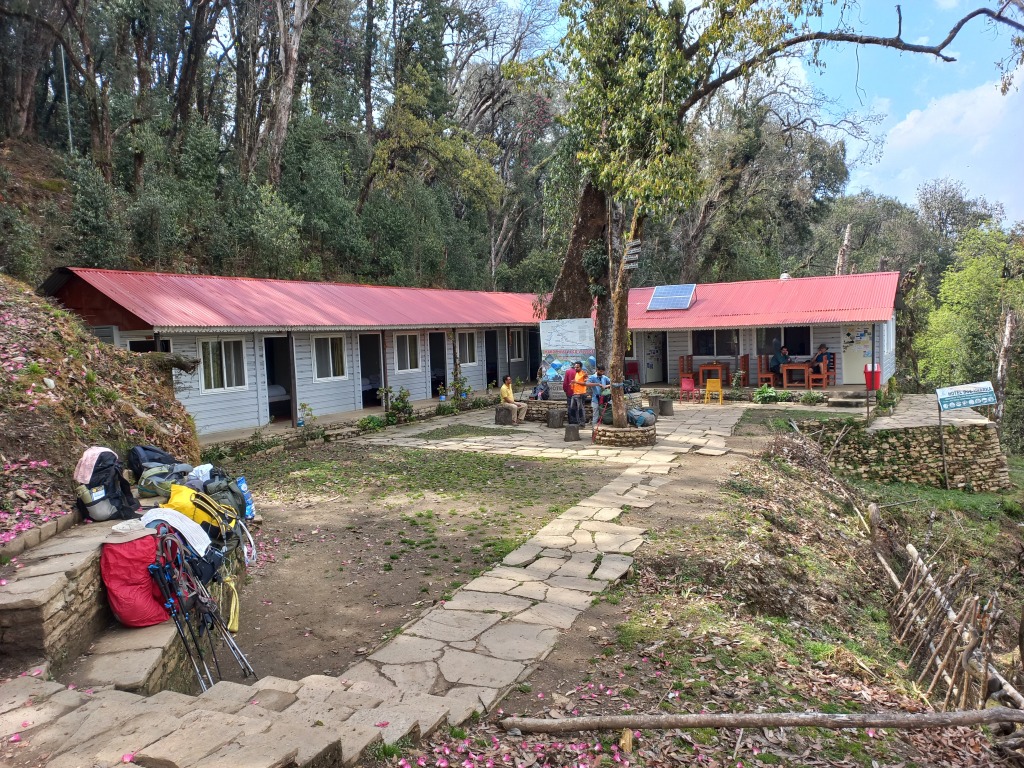
On our way down, we covered the same slopes much faster and with clear visibility, it felt all the more safe. The feeling of loneliness which accompanied me on the way up, was now absent. After a few more switchbacks, we could see the roofs of the tea houses at Chishtibung. They kept increasing in magnitude as we went further down the slopes. We met the Swiss group, on their way up to Khopra danda. They stopped at Chishtibung yesterday. It took one and half hours for us to be at the dining space of the lodge at Chishtibung once again. We reunited with Ranjan da and Ramesh. They were excited to know about our luck at the morning. The sun was still shining bright. As the luggage was being merged and re-sorted, we suddenly saw a rodent, which though appeared like a rat in its color and appearance, but resembled a rabbit in terms of its physical structure. It moved swiftly along the cracks and gullies of the tracks, tipping along at the small plants that came its way. As we tried to move a bit closer for a better snap, it hid away, only to reappear to resume its activities. After some trade off, we settled at a distance that gave us descent snaps of the animal.

After a small halt at Chishtibung, we resumed our descent from that tri-junction where the trail from Bailey kharka joined from the left. We now moved along the other one heading down towards Swanta. The trail now entered the tree line and once again we found ourselves amidst the dense forests. Given the cold during the morning at the heights of Khopra danda, I had my jacket on till Chishtibung, which I now transferred into my back pack. Though it increased its load, but walking was much lighter. At this time of the day, clouds started hovering again. Nature’s window of liberalism started to down its shutters. Yugal informed us that we’d have lunch at Bhainsi kharka one our way down. We kept descending through the woods and after about another couple of hours, we came across a solitary tea house amidst the surrounding forests. It had an open space around the dining room with chairs and tables. Terraced fields surrounded the main area of the lodge where cultivations were being carried out. I asked the owner of the lodge about the name of the place. It was “Al kharka”. Initially, I thought of moving further down, but then I thought of asking him again whether Bhainsi kharka was further down. According to him, there was no Bhainsi kharka along the route. That put me in a dilemma. Since there was only one trail coming down the slopes, there wasn’t any question of veering away, but the information from the lodge owner was contrary to that of Yugal. So, I prefered to wait for them to catchup. The place was quiet and tranquil. The greenery around was soothing to the eyes.

I kept my trekking gear on the table and sat to soak in the surroundings. Sound of a flowing stream kept murmuring, birds kept chriping in the woods, clouds acquired a darker shade, a cool breeze brushed my face. I casted regular glances at the higher slopes to look out for the rest of the group. They finally appeared on the slopes, made their way down to join me at the lodge. This was indeed, the slated place for our lunch. Yugal got the name wrong. We ordered sandwiches and french fries along with ginger lemon tea, while Yugal and Ramesh opted for standard “dal-bhat” meals. While we finished our lunch, their lunches were still being prepared and after waiting a while, they suggested us to move ahead and they would catch up along the way.

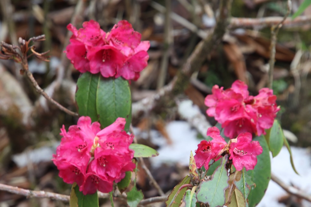
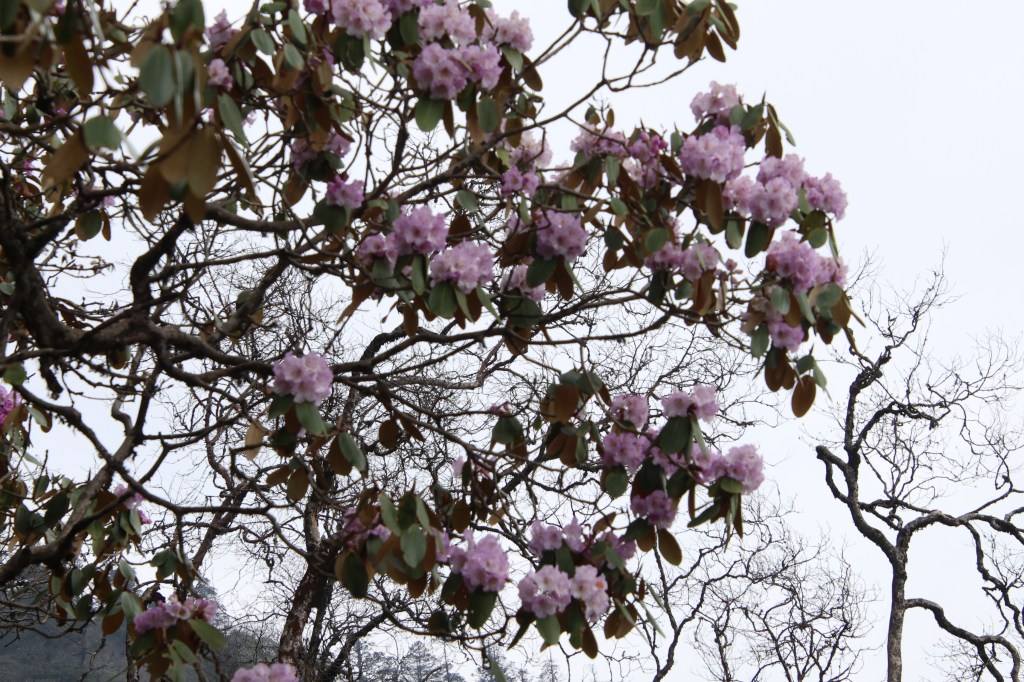
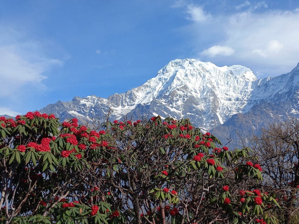
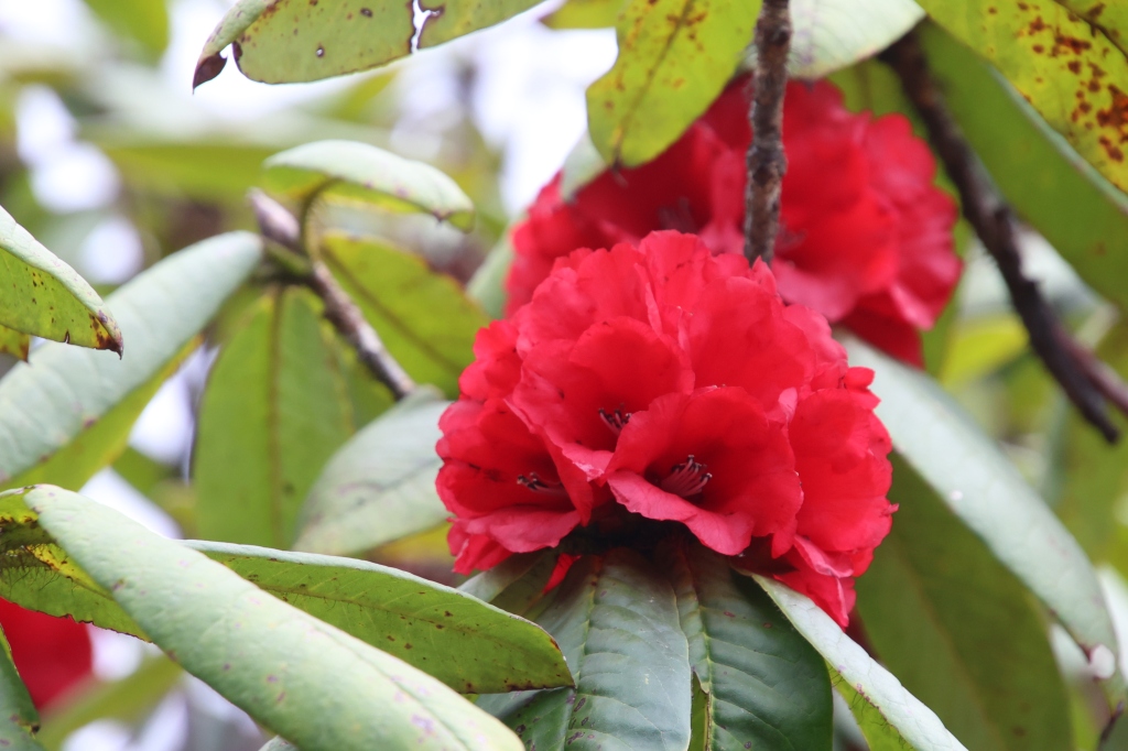
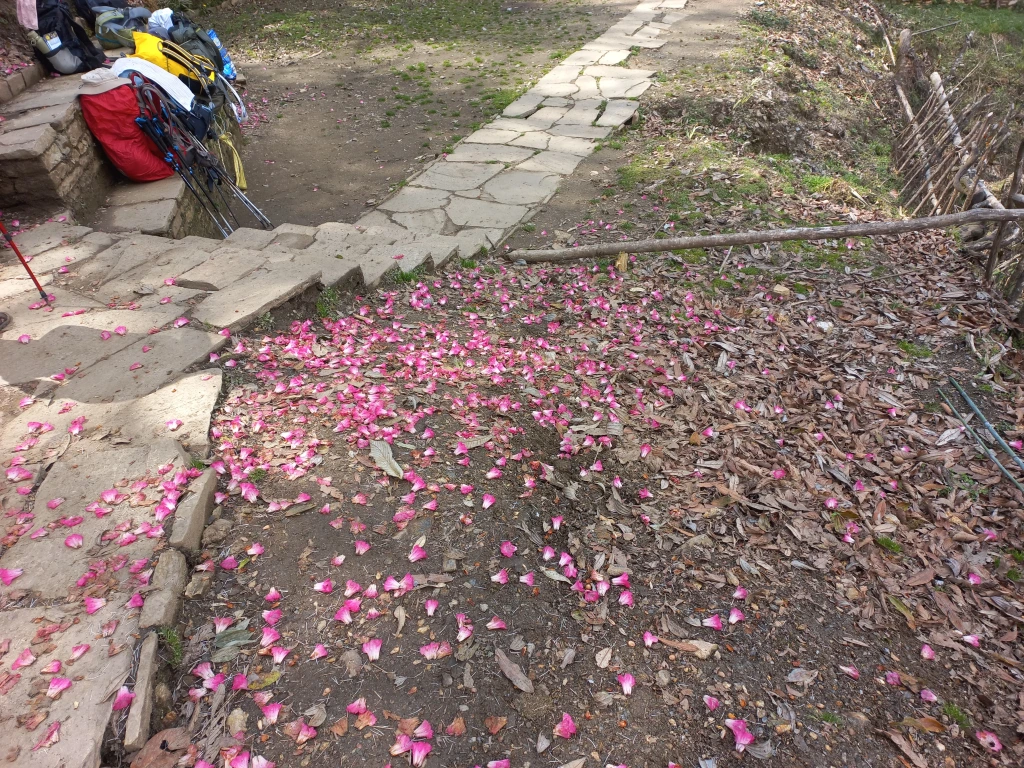
After the lodge, we moved down the slopes till we reached at a small hydo-electric power generation center where a gushing stream moved a few turbines which generated some electric power. After crossing the stream, the trail moved up for a few distance and then became adulating. We were once again amidst dense forests. The trunks of the large trees (many of them were Rhododendrons) were covered by green mosses. I also saw bushes of thin bamboo plants. We saw something similar at the place called “Bamboo” on the Annapurna base camp trail. Lush green vegetation looked freshly bathed in the rains falling for the last few days.
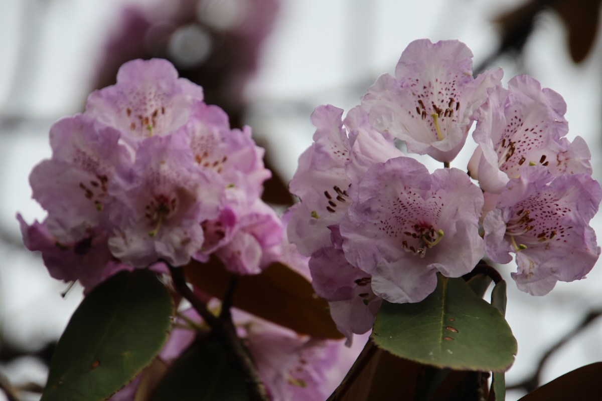
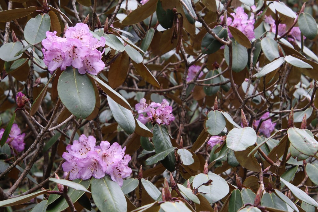
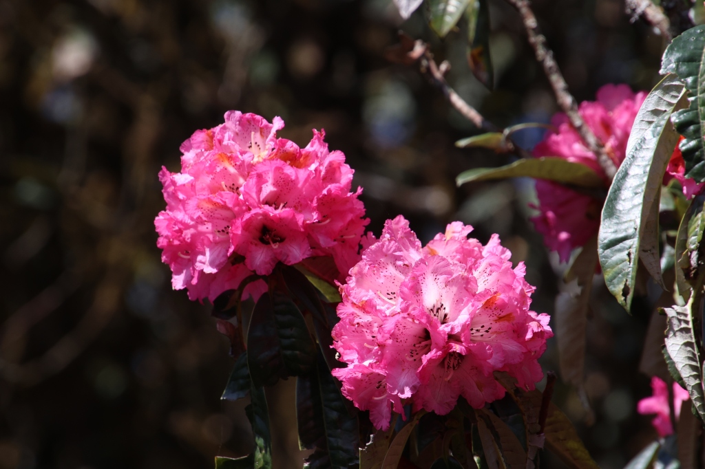
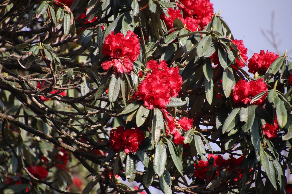
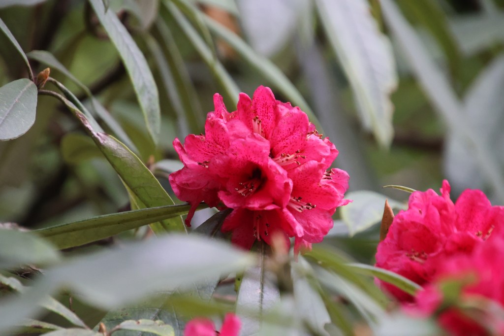
Small flowers dotted the bushes that lined the trail. Rhodododendrons too, re-appeared in their dark pink shades. This was to our surprise as we thought their blooms were over at these lower altitudes.
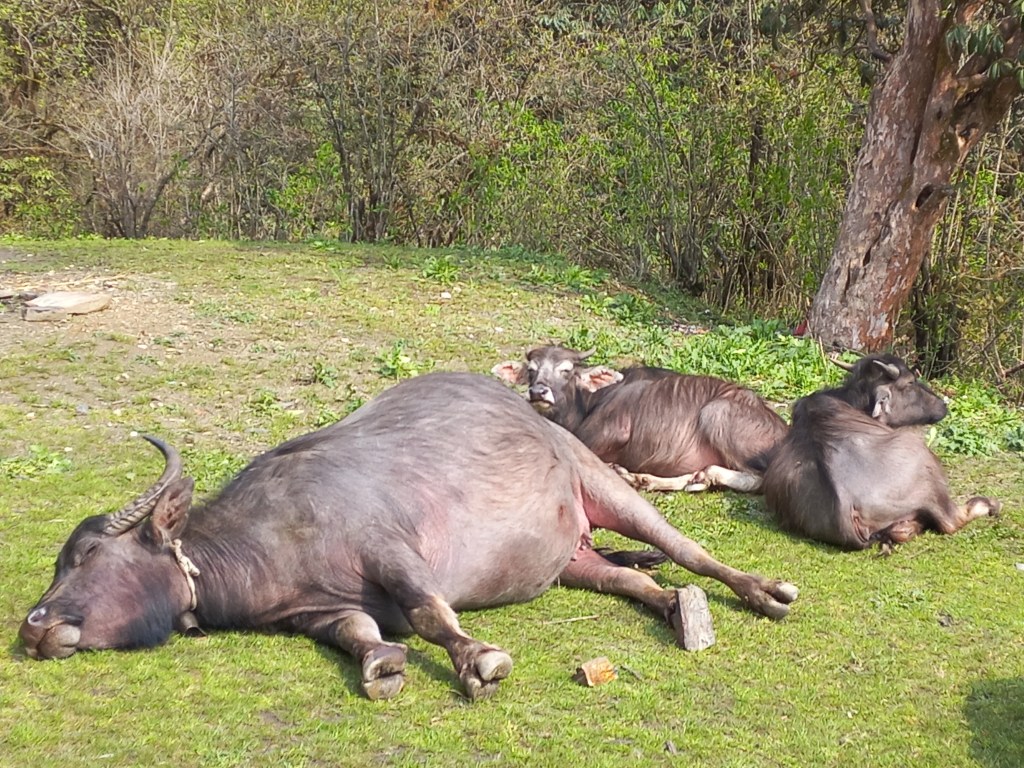
With the slopes either adulating or moving down, my speed increased and I kept going down fast, at times, almost running. But, after a while, I thought to wait for Ranjan da as the woods were deep and there could be chances of veering away, especially, there were still no signs of our guide and porter. I waited at a bend where two distinct paths diverged. Though I had a sense of taking one of them, but thought of waiting at least for Ranjan da. After waiting for a considerable time, he apeeared around the bend. We chatted for a while, gulped down a few sips of water and contemplated waiting for our guide and porter. However, we both thought that the choice was clear enough and kept moving ahead. After sometime, we saw a suspension bridge deep down in the valley and a few houses dotted the hill slopes on the other side. That made us think, we somehow had to reach the bridge as we were confident that that homes on the other side, belonged to Swanta. However, despite looking around, we couldn’t find a way down towards the bridge. We thought it better to wait for Yugal and Ramesh. It seemed ages before we finally heard their sounds and they appeared around the corner. Their lunches were served much later than we thought, but they came down swiftly to catch up with us. They assured us that we were still on the right path and Swanta was not on the other side (as we thought), but round the corner of the hill that we were travelling down. After sometime, fences started to appear, bellows of buffaloes were heard and a wide valley opened up with terraced fields.


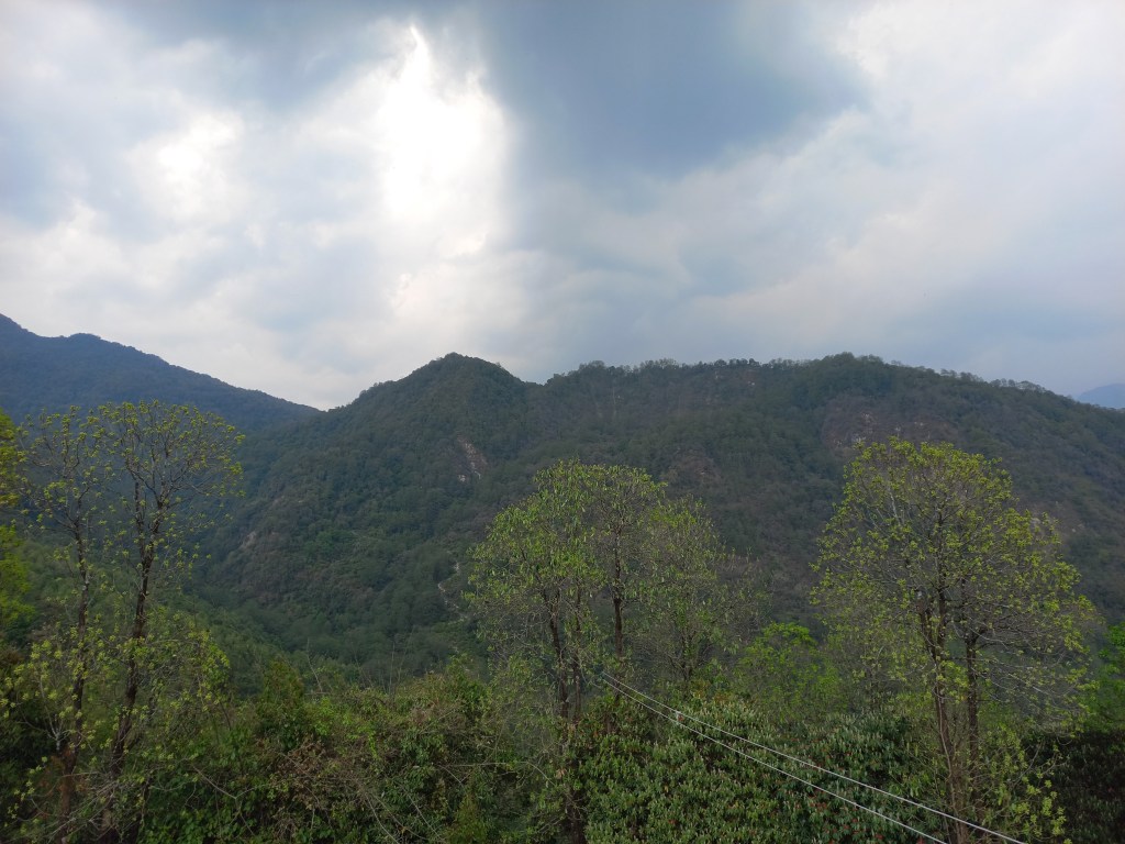
A few houses made their appearance and more appeared nestled between the fields, as we moved into the valley. We could also spot a monastery. This was the place we looked down upon from the Khopra ridge, in the morning. I tried looking upwards to see if Khopra ridge was visible, but in vain. Our path went through the fields and reached the gates of Hotel Candle Inn, our place of stay for the night. The lodge was charming. We reclined to the open space outside its dining room where some chairs and tables were placed. We had our tea served there but clouds started looking ominous and it started drizzling. Our rooms were at the first floor with balconies opening into the wide valley. Sights of terraced fields greeted us and almost immediately, hails started pounding the roofs. We were just in time to reach our destination. For the first time in the trail, we had chicken and egg curries at dinner, which we enjoyed immensely. After drying our clothes and shoes at the fire place, we reclined to our room and slid under the blankets. Rain and hail storm was still on. We were sleeping at 2270 m.