
11th November, 2019
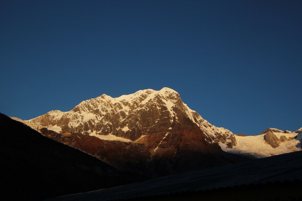
Our last evening at Samagaun was spent very well. Time just flew. There was some wonderful music presented by the porters & guides of different teams. Going by our guide’s statement, the walk from Samagaun to the next destination Samdo was supposed to be easy & short. More importantly, on level ground! It shouldn’t take us more than three hours to reach there. We could have left Samagaun a bit later after having some more sleep, but we chose not to. It’s always better to start early. We could spend time en route with photography, reach the day’s destination with enough time in our hands to relax. Manaslu didn’t disappoint us in the second morning as well. The same acts of sunlight was repeated as we enjoyed our morning tea.
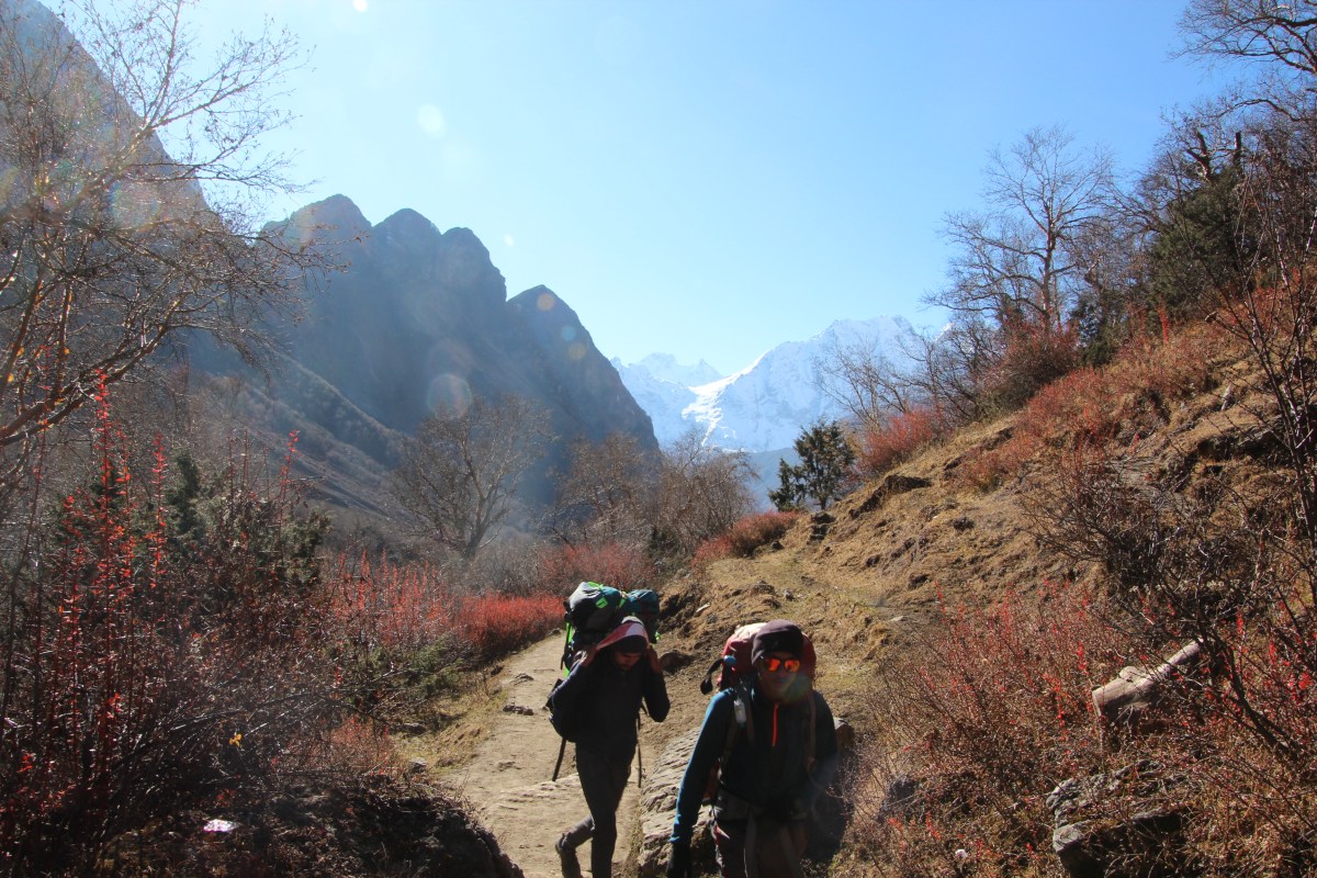
The breakfast had the same items. None of us enjoyed it much as it was mainly a matter of forcing something down the throats to fill our stomachs. Just enough with some fluids to keep our blood circulation going. Appetite wasn’t great at these high altitudes. We handed over the bags to our porters and hit the trail which meandered through the streets of Samagaun village before entering a wide valley.

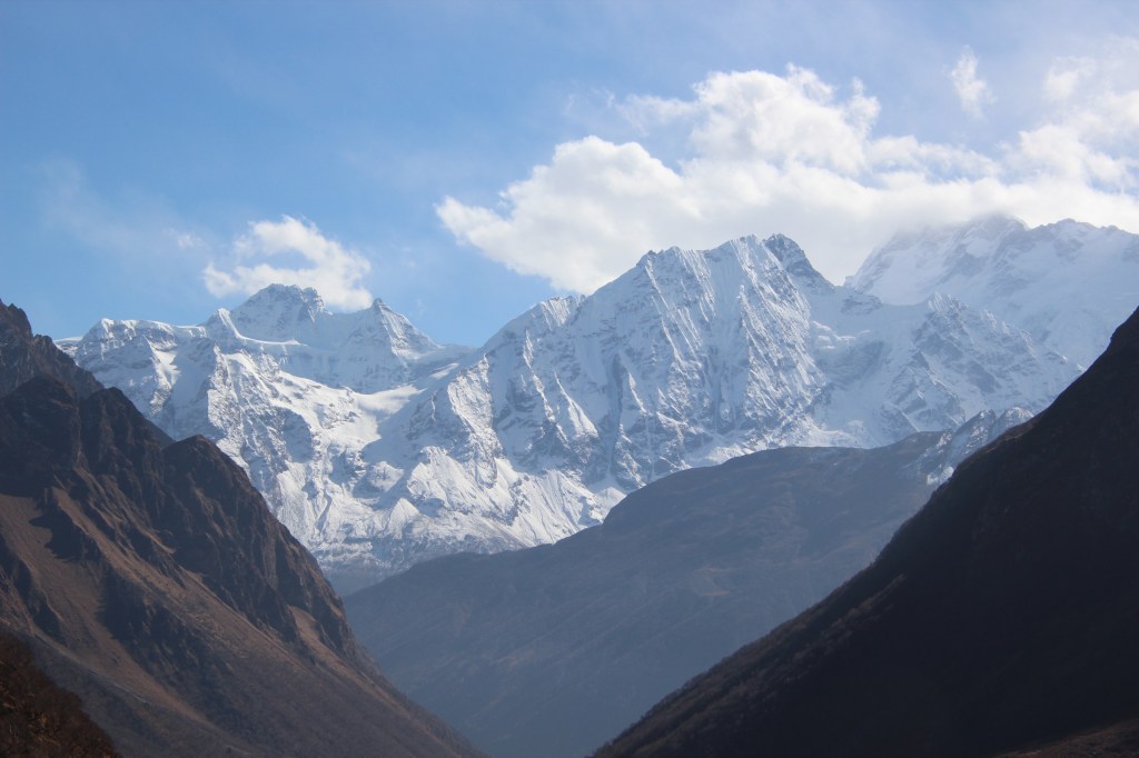
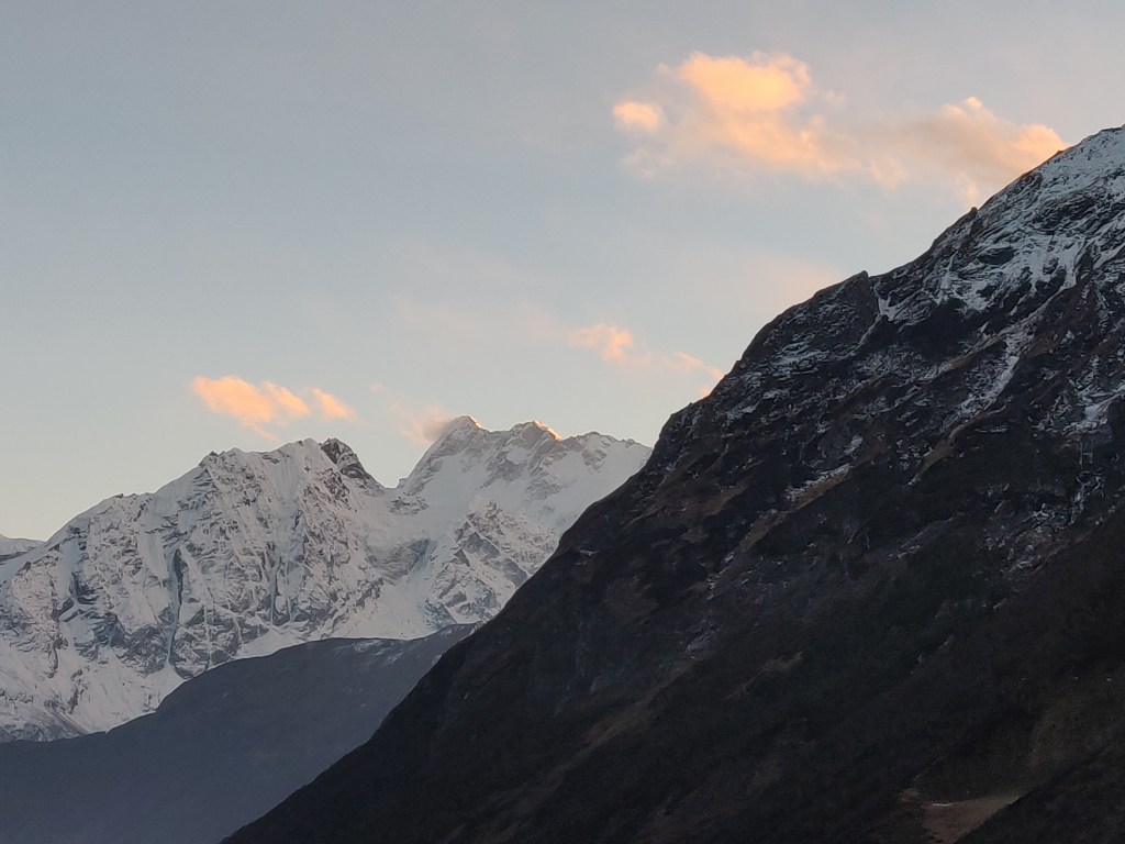
Manaslu was shining like a silver blaze and was visible from everywhere, as if keeping a strict vigil on us, the foreigners in her territory.

We were still in the Gorkha district, but were gradually nearing its end as we moved closer towards the Larkya pass. The day would take us to Samdo and the day after, to Dharamsala, which was at the base of Larkya pass (or Larkya la, as they call it in Tibetan language).
As we moved on, the valley widened and it almost gave us a feeling of walking on level ground, but for the boulders spread across the tracks. We could still see trees around us, but their heights kept diminishing, but the flora was colorful.

Members of our group kept rolling their shutters on and rightly so. The surroundings offered ample opportunity. The morning was bright with no trace of clouds. I too had my share of photography but I kept plodding ahead and after sometime I found myself walking alone.

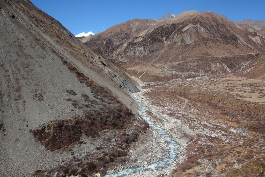
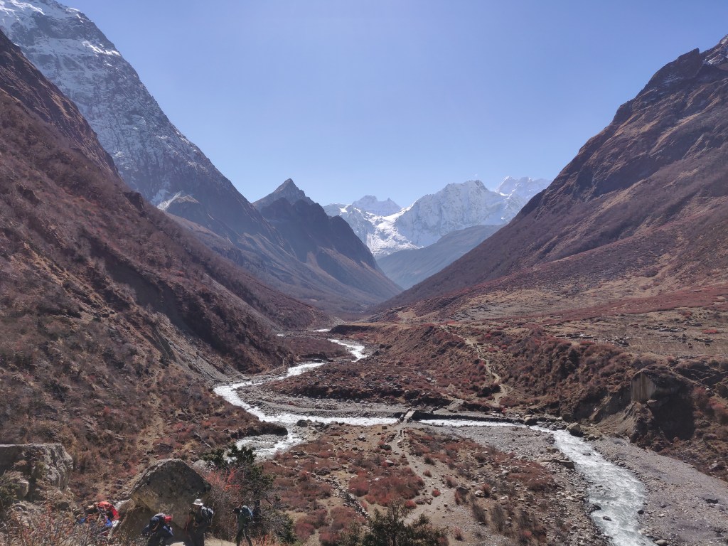
Members of some other trekking groups, who started later than us, caught up and moved ahead. All of their faces were now familiar. I watched the German couple walking past. They always started late, but reached the destination way ahead of us and also had time for side excursions & hikes in the afternoon. The valley was wide open and the river Budhi Gandaki flowed through one of its sides. We were approaching towards it’s origin. It has its origin in the glaciers coming down the slopes of Larkya La.
The vegetation acquired a red color, but it wasn’t the flowers, but the leaves. It was that period of the year which was just before the winters when these leaves would drop off and the entire area was to get blanketed by snow. The thought of snow gave me some worries about the quantities we were likely to face at the pass. Going by the narration of our guide, the ascent to the pass is relatively gradual but after crossing it, there lies a large rockfall zone which is expected to be steep and the presence of snow could add to the challenge. I brushed aside those thoughts and diverted my attention towards nature’s gorgeous display of splendor.
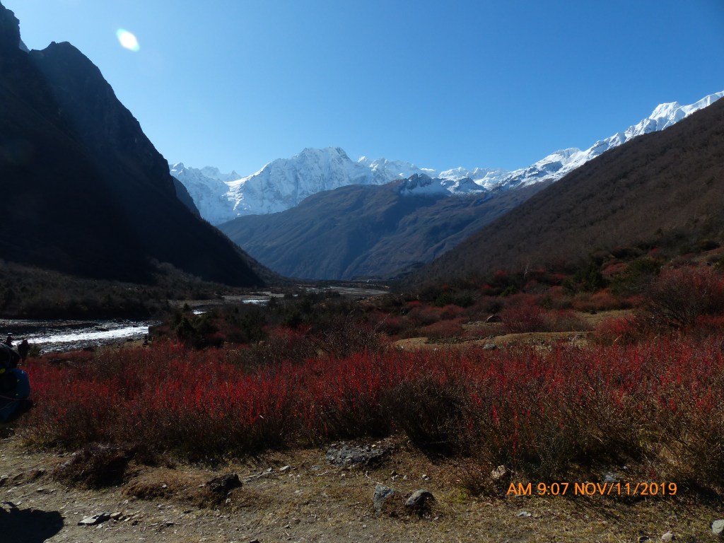
The sun was now high in the sky, which forced us to peel off our jackets. The trees diminished in their size & stature, giving way to shrubs, bushes & finally it led to the barren land of boulders. That’s when I saw the huts of Samdo which lay at a great distance adoring the top of a hill, still a long distance away.

That hill was to be the only hike for us in a day which was otherwise marked by walking on relatively level grounds. I could see trekkers (who were reduced to the stature of ants from this great distance) and lines of mules dotting the switchback trail that moved up the slopes of the hill towards Samdo. We gradually started to move down towards the banks of the river and reached a wooden bridge. Budhi Gandaki criss-crossed the trail to move towards the left and we started to hike the hill.
The trail was barely wide enough for one person and one had to be careful while giving passage to others coming down from the opposite direction. After crossing a few bends, I heard the “now disturbing” sounds of the bells. It was obvious that I was in front of a line of mules with loads on their backs, fast catching up. I wasn’t particularly welcoming them but I had no choice. A quick look below revealed that they were just reaching the previous bend and I had to reach the next, as fast as possible to get to a place which would just about allow me to stand to give passage to the herd. I hiked as fast as I could to reach there as early as possible and just as I reached there, still gasping for breath, the first of the mules appeared at the bend. They moved upwards, hopping, jumping and at times, skidding on the slopes. At times more than one of them tried to move in parallel, giving a tough time to me, who was just about aligned to the wall. The herd seemed never ending. Every time I thought I’d seen the last one through and attempted to get rid of the place, another one popped up at the bend, forcing me to abandon the idea. Finally, I heard the whistle of the man who was bringing up the rear. Once he passed over, I resumed my journey. After a few more bends, I finally arrived at the top of the hill and was glad to find the ground relatively level and wide.
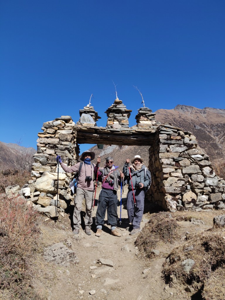
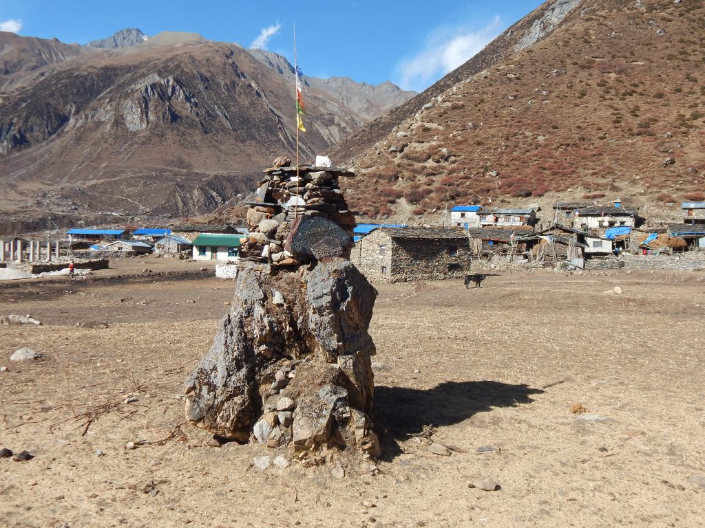
The entrance gate of Samdo greeted us as we entered the village. I now had sometime to take a break to look down the trail and the wide valley below, which we just traversed to reach Samdo.
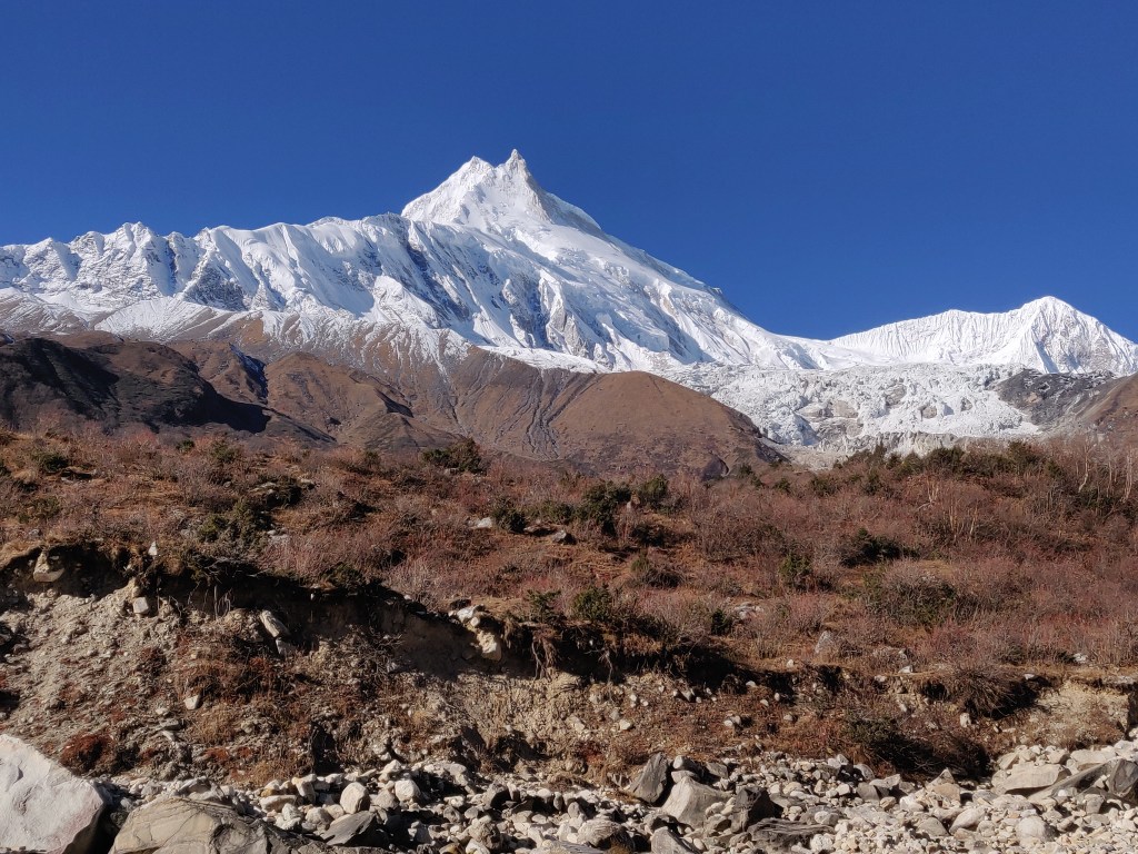
The group members and our guide & porters were yet to reach. I had to wait for them to be able to get to the tea house designated for us. It gave me some opportunity for photography. Straight down the valley, right at the end of it, a mountain peak dazzled in the backdrop of pastel blue sky.
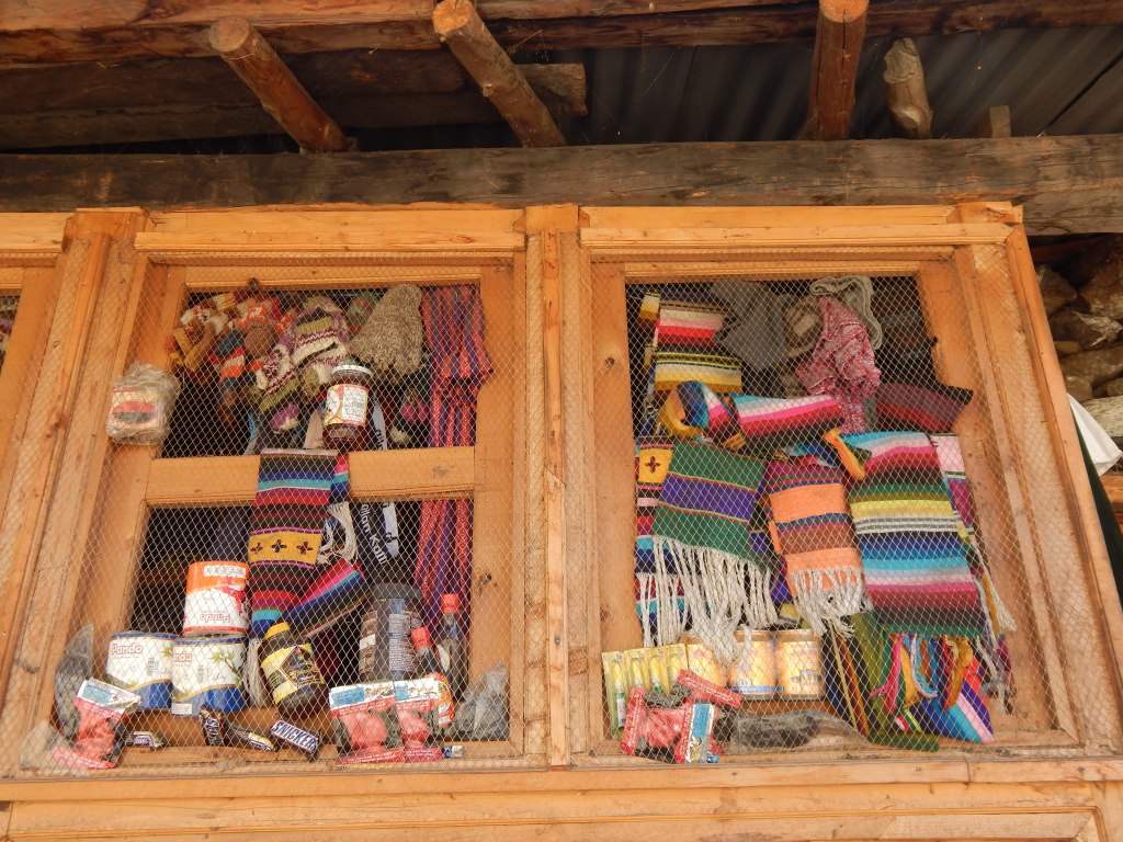
Towards my right, I could clearly see the track of Budhi Gandaki river. Samdo just comprised of a few tea houses and beyond that, the trail moved along the sides of the mountains to reach a junction point. From there, two distinct routes were visible. The one towards north, went towards the Tibet border, a five hour walk. The other, went Westwards, towards Dharamsala, our destination for the morrow. After reaching the hill top, I walked in the company of a Sherpa guide who hailed from the Limbu region of eastern Nepal, the region famous for the trek towards the base camp of the world’s third highest mountain, Mt Kanchenjunga. He was a sturdy guy. I inquired about that trail, which isn’t frequented by many, but is beautiful with its flora, fauna and above all, the majestic views of the mountains of the Kanchenjunga group. From his narration, it appeared that the region is not as well equipped with tea houses as other parts of Nepal and trekkers have to resort to tents at many places. Their destination was Larkya Bazar, a place just ahead of Samdo. We parted ways and I rejoined my group. By now, the porters had arrived and placed our bags at the tea house. We went ahead and occupied our respective rooms. We still had a good half a day at our disposal and got engaged in hanging our clothes in the bright sunshine with the hope of drying them up. At this stage of the trek, we were down to 2-3 sets of attires, having to alternate them every other day. Hence, drying them up was very crucial. The dining place was not at the same tea house. We had to walk down to the neighboring one for lunch. Fortunately for us, since Namrung, our days of walking has been short, leaving the second half mostly for rest. This day was even shorter.
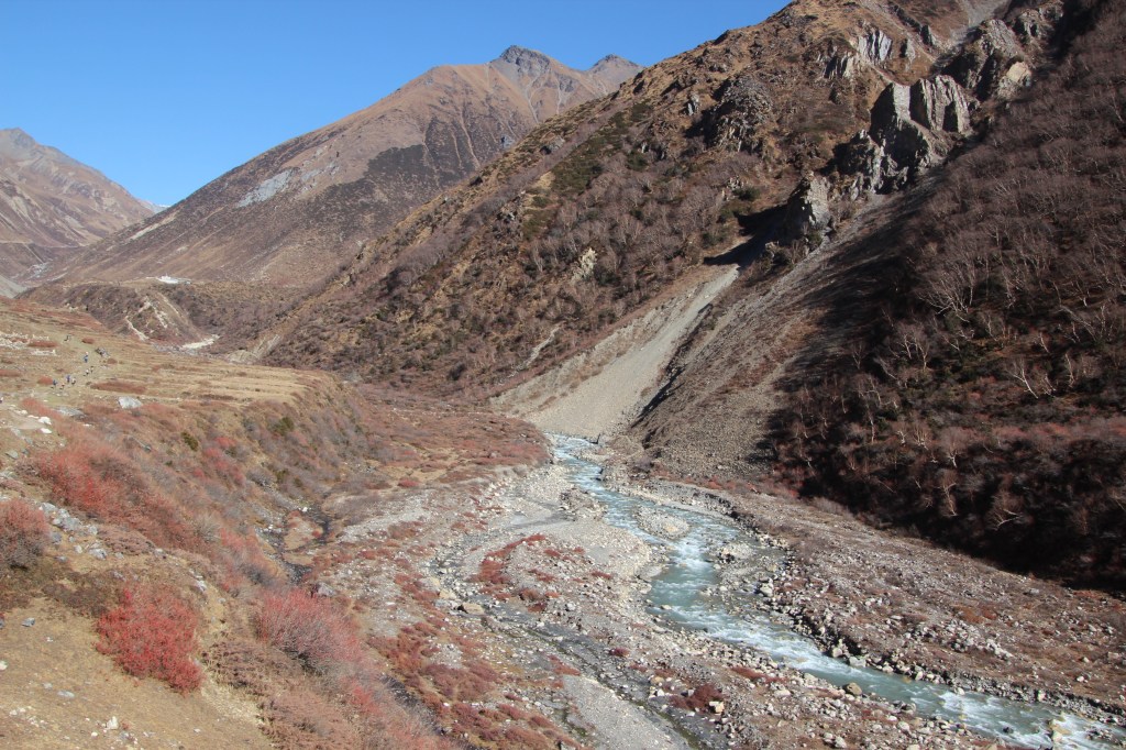
After lunch, many trekkers (including the German couple) headed for hiking a nearby mountain. We never could muster the energy and rather preferred to relax. But that didn’t stop us from venturing on level grounds, which took us to a nearby barley field from where we could see through the valley which we traversed.
We could clearly see the trail towards Samagaun and the trajectory of the river Budhi Gandaki. It was a strange feeling to think about the river which gave us company right from Soti Khola, through the lower reaches of the trail and now, its almost time to bid adieu to her when we embark for Dharamsala.
Same goes for the Gorkha district which has provided hospitality to us through these arduous days of trekking. The sunshine attained a golden yellow shade and so did the mountain slopes and the distance peaks. The color told us that time was ripe for sunset, but the place was not suitable for such views with the peaks just peeping from behind the towering walls of the mountain nearby. The glow of the fading rays of sun showered on the fields instead and also on the trail of the river which disappeared at the far end behind a bend.
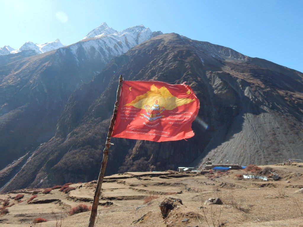
Around us, there were many places where streams of rocks and boulders came down from the top exposing the bare interior of the mountains. They bore the signs of past devastation, sudden landslides, which are very common in these ecologically and geologically unstable areas. The slope of the hills on which these tea houses reside aren’t much safer either. It’s just by the grace of nature, they’ve been spared its wrath, but that’s never a guarantee. Trails and villages in these areas are ever changing. I looked at the trail for the next day, which moved gradually upwards in the Westerly direction. It appeared as a narrow tape along the slopes till it disappeared behind a bend on the wall of the distant mountain. My mind went along with it. The next day, just as we reached Samdo, we’ll take the exit route, following that trail. Somewhere beyond that bend, and after crossing many of them, lies Dharamsala, nestled somewhere in the slopes. The launching pad for our ascent to Larkya La.
As evening wore on, we headed to the dining place. Biting cold gripped the place. After dinner, our guide gave us a glimpse of the next day’s trail. It should take us about 4-5 hours to reach Dharamsala. The slope is expected to rise, though somewhat gradually in most of the cases, steep at times. After all that, a landslide area should greet us. After crossing it for about two kms, we should be at Dharamsala. Landslides again! They never seem to end and why should they? We’re now approaching the pass and they have all the more reason to be around. With some speculations about the next day’s trail, we went under the blankets at 3690 m.

You seem to have got very good weather all along and that is high altitude luck, makes everything a little easier. Those days of less distance, when you have nearly half a day to your disposal to rest, hang around and do whatever you wish are so welcome when you’re on the trail. I just love those kind of days. I could visualize your giving way to the unending line of mules at the narrow section of the trail.
LikeLiked by 1 person
Yes, the line of mules do pose challenges, especially at the narrow switchback bends!
LikeLiked by 1 person