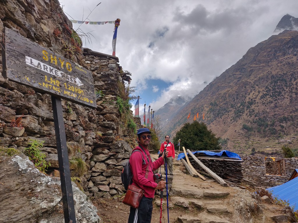
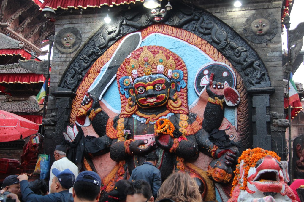
I understand it’s difficult to collate the threads (both for me as well as the readers) to stitch the way back to the story when there’s a significant gap between episodes. I apologize to my readers for that. Okay, so we paused at Dharamsala and had to resume our journey towards “the” Larkya La, the important pass that connects the Manaslu region with the Annapurna region of Central Nepal.
13th November, 2019
The pain in my throat kept increasing through the previous night as I kept tossing around in search of some elusive sleep. I only know too well, the pattern of these pains & infections. Swallowing will get tougher and a feeling of a growing lump will keep increasing and will reach it’s peak in the morning hours. However, as the day progresses, it will subside giving a false feeling of comfort only to return at night. I never actually got to sleep, but was able to reach some sort of half-consciousness and that’s when the alarm went off at 3 AM (tuned an hour earlier than previous days). As I sat up, I saw the dark outline of Dhananjoy engrossed in his meditation. Niladri and Ranjan da were still asleep. I mustered enough courage to venture out of the hut, dark into the night. The place was bustling with many travelers already awake, some even about to start their hike. The kitchen was also active. The flashing head torches from different travelers as well as support staff made the place appear as a coal mine, albeit the temperature reaching the opposite extreme. As expected, the stream of water near the toilet had already frozen. After my return to the room, I saw rest of the members also underway with their preparations. While they went about with theirs, I thought of utilizing the “valuable lead” that I had over them to lie down within the blanket which now appeared more cosy.
After sometime, our guide made an appearance at the door and asked if we were prepared to go. The initial plan was to start at 4 AM, but since we were all ready, he proposed to start even immediately and we readily agreed. We eventually started at 3.45 AM through the darkness through the meandering path beyond the tea house which gradually moved up the slopes. The sky had nothing more than a soft glow coming out of the moon, which was no more than a couple of days past the new moon phase.

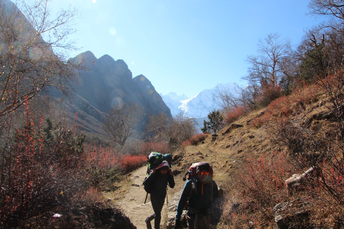
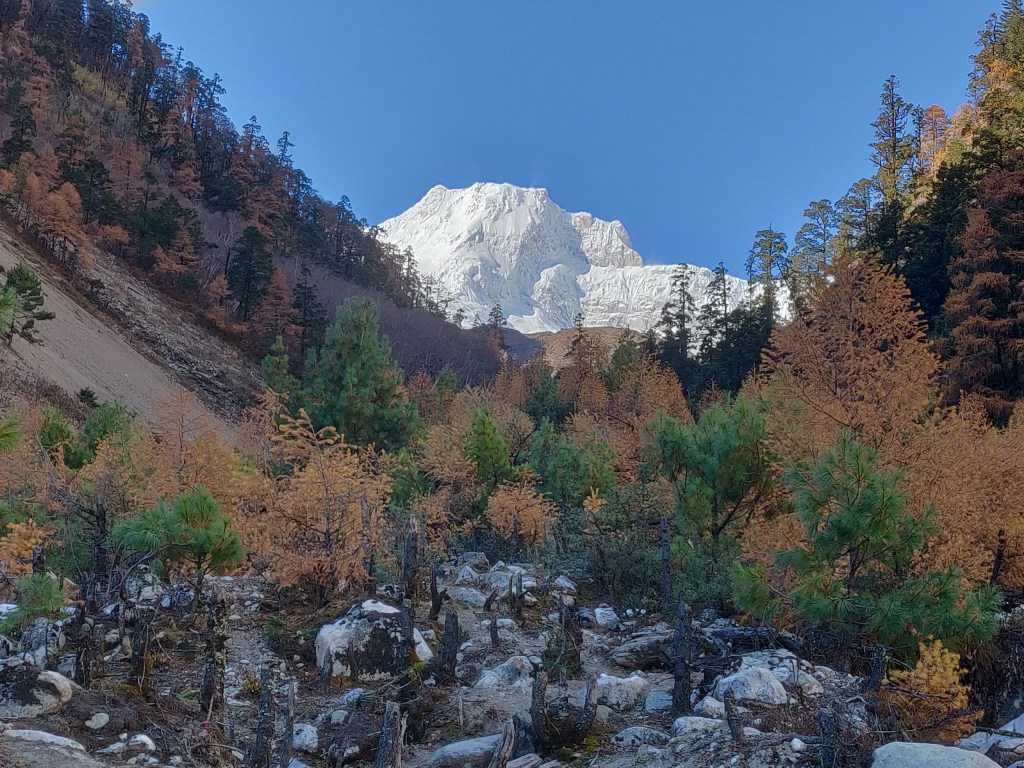
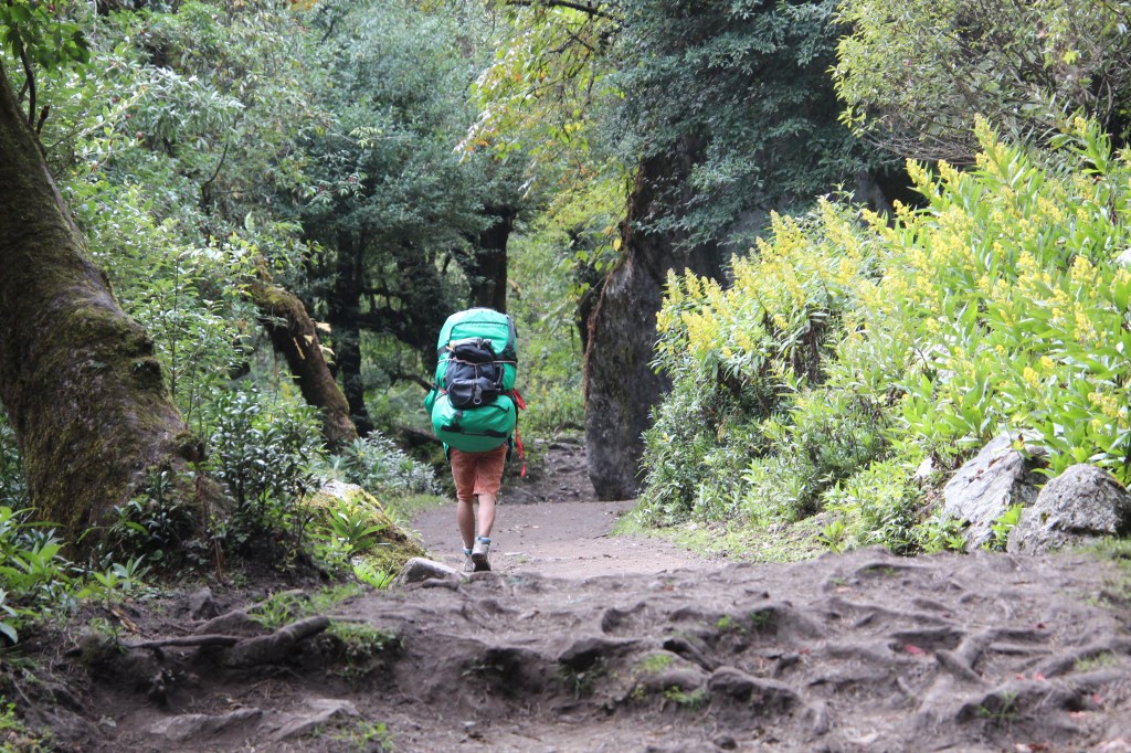
As planned earlier, our pockets were loaded with cashew nuts, raisins, almonds and a few chocolate bars. The store of nuts and raisins were given to us by Dhananjoy after diligently creating packs for all of us during the previous evening. There won’t be any tea houses till we descend to the other side of the pass and that wasn’t likely to be before lunch. Hence, the idea was to keep munching these along with gulps of water. It was better said than done. In practical, it wasn’t easy to pull out the gloves, then put our hands to the pockets to bring out the nuts. All that seemed to be a load of work which was best kept at bay in the bitter cold. What ended up happening was we kept plodding ahead for sometime to take a halt. All the activities of food and drink was completed as early as possible and then resume the journey. This pattern kept repeating. There were no sounds other than heavy breathing of our fellow travelers. We could see a moving beeline of head torches ahead of us, which gave us a rough idea of the path ahead. The trail was fairly gradual considering the altitude. Tinkling bells hanging from the necks of grazing yaks kept coming along. Our breaths condensed as soon as they left our nostrils, but our clothing, by and large, kept us decently warm. Nights are anyways longer during this part of the year and we were in Central Nepal. Hence, sunlight was still somewhat distant. The ascent to the pass and the descent beyond, kept looming around (going by my prior experience with Cho La, another high altitude pass that connects the Everest Base Camp trail to the Gokyo region) in my mind. I tried to force them away, but the darkness around, didn’t help the cause as there wasn’t much to look upon to divert the mind. After plodding ahead for some more time, a feeble light started to trickle in on the eastern horizon and the outline of the mountain ranges started getting clearer. Our steps skidded at times over the frozen mist and ice that lay on the trail and we tried to avoid those patches carefully as we moved along. The morning light started to spread fast which added to our energy levels.

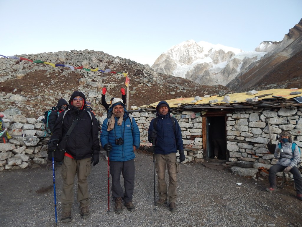
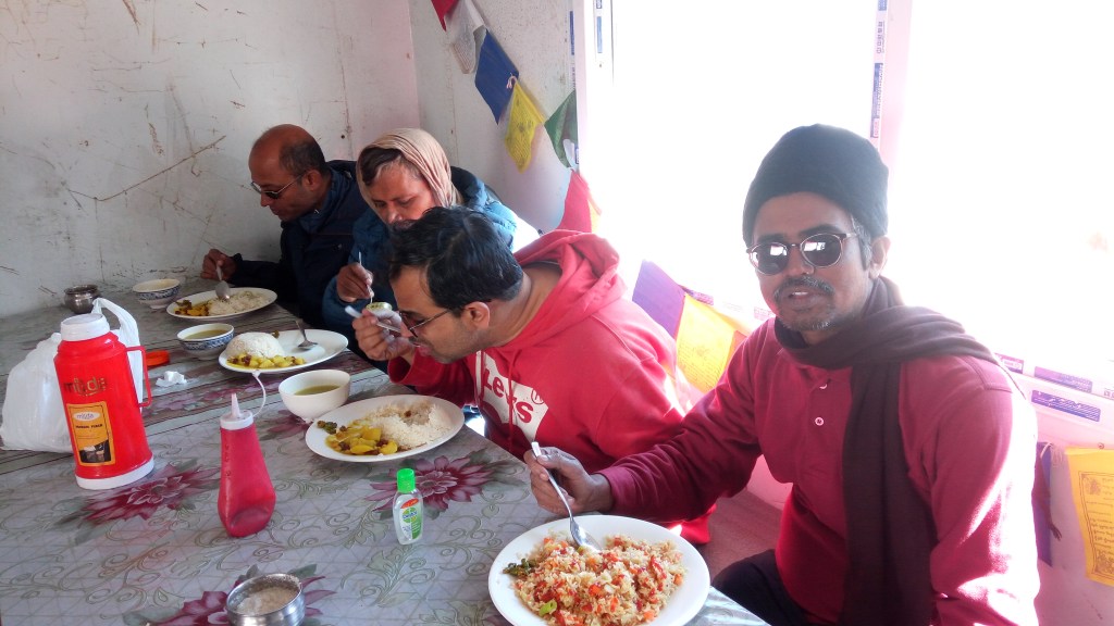
At about 6 AM in the morning, we reached a temporary tea stall (yes, you’ve heard it right, a teat stall indeed in that God forsaken high altitude). Trekkers flocked around the place. It was a make shift shelter created by stacking up boulders on all sides with a tin shed. When asked about the price, it came out as a bolt from the blue, 300/- in Nepalese currency for every cup of tea. But, considering the circumstances, it gradually settled in and suddenly the price started looking “cheaper”. At first, we went inside where a kerosene stove was burning with a pan of water constantly getting boiled. The place was covered with smoke resulting due to insufficient combustion of fuel at the high altitude. A number of people cramming in that small place in the hope to get some warmth (not just from the steaming mug of tea/coffee, but also from the burning stove) also didn’t help the cause and we were forced to come outside to get some fresh (though rarefied) air. Every hot sip literally helped bolstering our energy levels (as if every sip gulped down helped reducing the trembling by some proportion). Despite our want to spend some more time at the place, we continued our journey with the aim of reaching the pass before the sun started melting the overnight snow.

The route now meandered through rocks and boulders which were now more increasingly covered with overnight snow, but fortunately, the trail was still somewhat clear, mainly due to footsteps of earlier travelers. Iron poles were erected at regular intervals. At sometime they must have had metal plates to indicate direction or distance towards the impending pass, but snow and wind must have reduced them to their current state. Though we couldn’t assess the distance, but merely their presence indicated progress in some imaginary units. The sun was now up in the sky, which made the cold somewhat bearable.

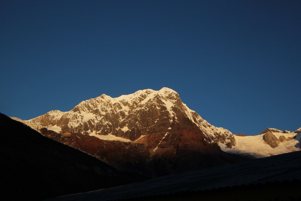
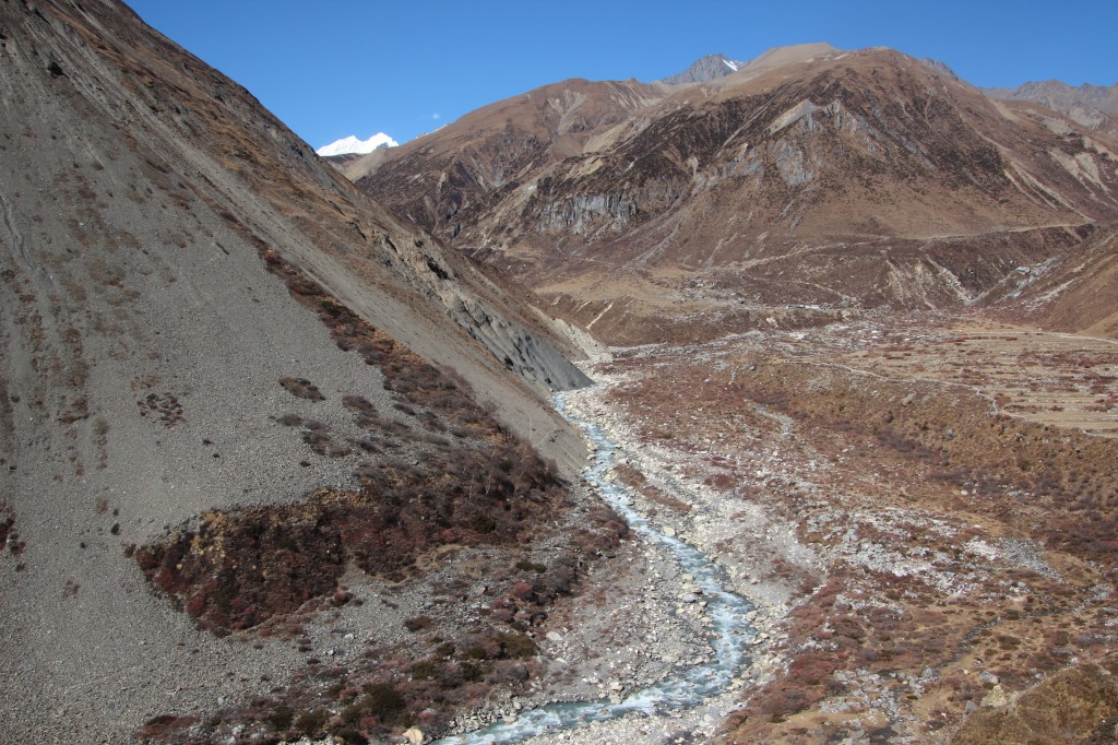
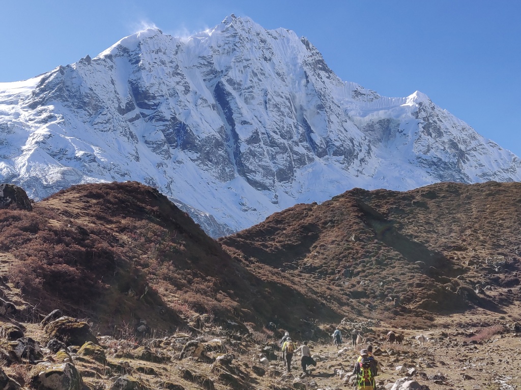
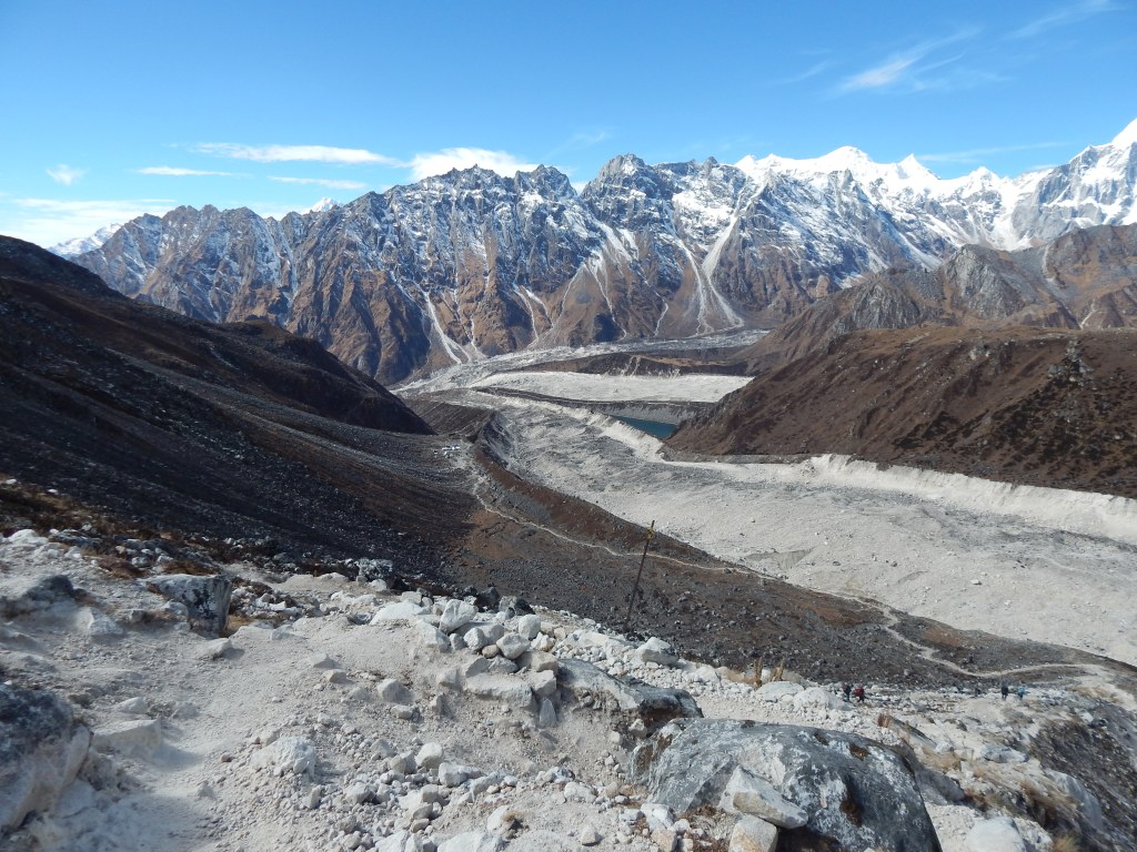
However, at the same time, it kept playing on my mind that melting snow, especially on the side of descent would pose an increasing challenge. Guides and porters had already warned us about the presence of a large rock fall area on the way of descent as soon as one crosses over the pass. I tried hard to keep such thoughts at bay and bask in the fact that the ascent to the pass was relatively gradual (as far as it can be in such altitudes). There was no trace of vegetation (not even a slice of grass) all around as snow and boulders held their sway. We could clearly see the tracts of the glaciers coming down the slopes of the mountain peaks surrounding the place. A slightest of glance around could tell anybody that these are not stable landscapes. The topography, shape and size keeps changing constantly aided by avalanches, land slides which bring down the debris from the upper slopes down to the bed of the glacier camouflaging its surface under which lies years of accumulated and solidified ice.

After sometime, the trail headed down towards a small and relatively flat ground that appeared unusually white in appearance and it turned out, part of it was due to snow and the rest due to white sand and gravel. It appeared almost like a football ground and we were amazed to walk on “level” grounds at such an altitude, though walking was not as easy, thanks to the hardened ice over its surface.

We spent sometime taking snaps of each other. When we cast a glance around the place, we found it to be encircled by mountain peaks, glaciers came down their slopes right to the ground where we stood upon. Narrow streams also made their way through the slopes and over the ground (a clear sign of melting ice in the sun).

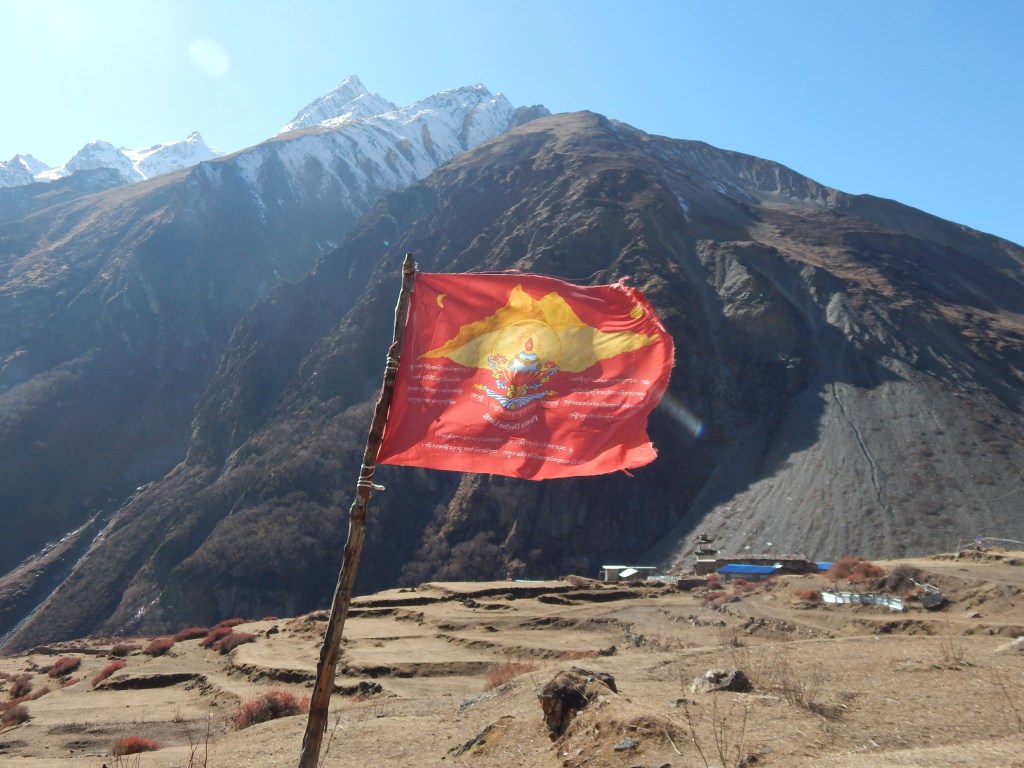
After crossing the place, we started moving up along the slopes on the other side of the ground. I trained by eyes towards a distant iron pole, the next milestone. My sense told me that the pass shouldn’t be far from there. I could also see other climbers moving up the slopes (though diminished in stature because of the distance). After reaching that pole, I was very pleased. Not because I could see the pass in front (which was still beyond my sight, possibly a few more such poles away), but I saw some prayer flags, a welcome sign in such areas that informs the travelers about the proximity of a mountain pass.

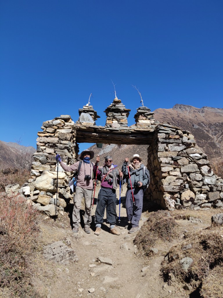
We could see some Mani stones, which were nothing more than some stones stacked up together just strong enough to hoist a string of prayer flags. Regardless of the regions, all passes in the higher Himalayas or Karakoram bears the same look. Their frequency gradually increased as we crossed a few more poles till we finally got to see a crowd who were shouting and celebrating their arrival at the most coveted Larkya La.
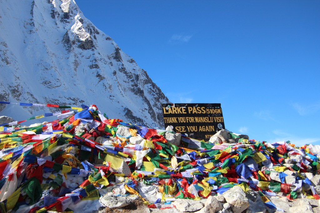
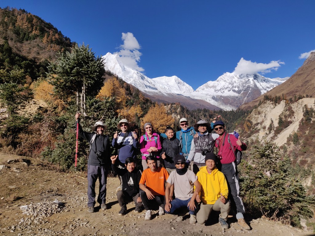
It was unlike Cho La, where the ascent was very steep and here a gentle slope gradually ascended to a place, which was flat enough to house significant number of people and prayer flags. We too, finally entered the pass. The photograph point (the place where there is a signboard that announces the name of the pass and its height 5106 m) was already occupied with different teams taking their turns to take snaps with the writing in the background. We also had to await our turn and we four went up along with our guide and porters. Members from other teams helped us out with snaps as we returned the favor to them.

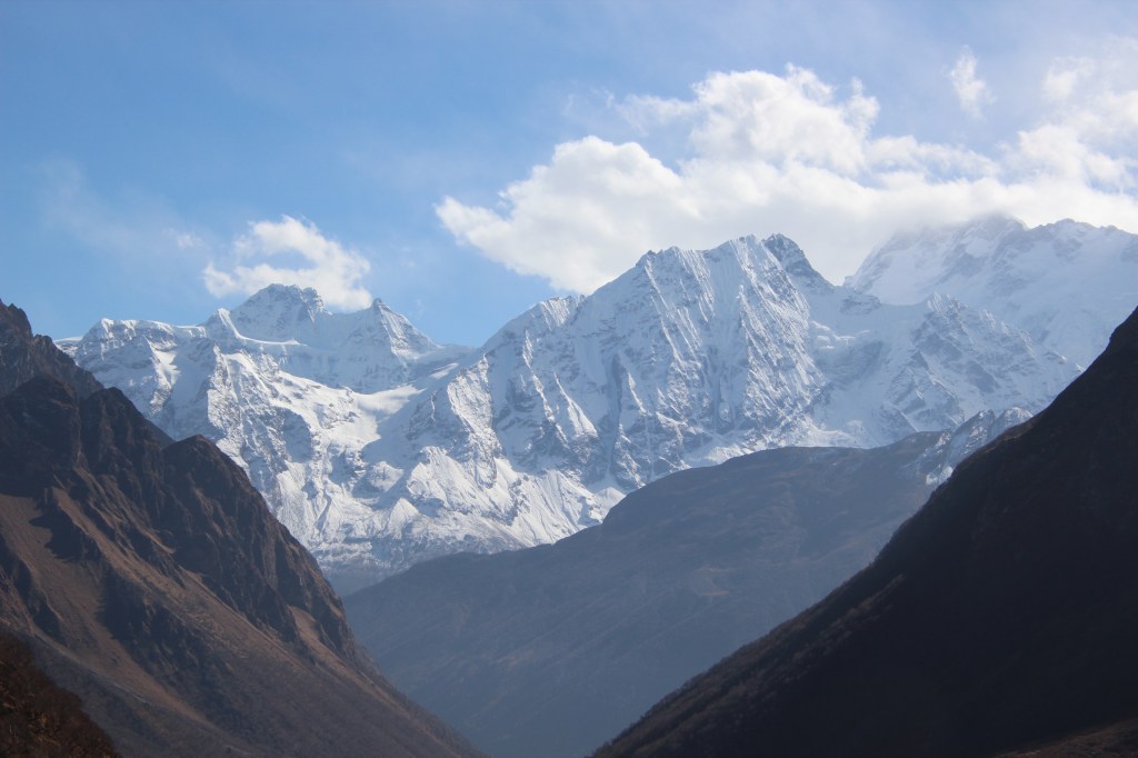
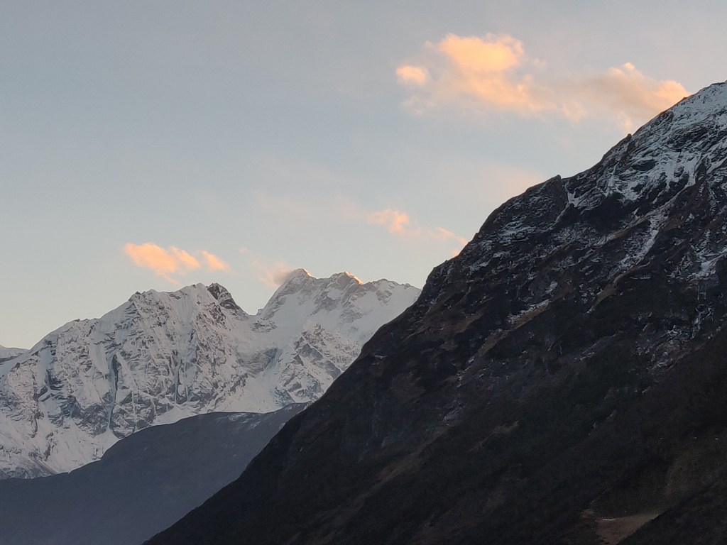
I cast a glance at both sides of the pass and looked at the metal plate that announced the end of Manaslu Conservation Area and welcomed us to the Annapurna Conservation Area. The pass also marked an end to the Gorkha district and the beginning of the Manang district. The Western horizon was marked with numerous mountain peaks of the Annapurna region.

We started our descent on a ground that was somewhat gradual to start with, but very soon the slopes increased and the majority of the surface was covered with snow (fresh and soft, which was a relief). The trail again was created by footsteps of earlier travelers.

On our left, lay a huge glacier. The trail over the snow covered part was relatively less steep, but the one that avoided the snow, had steeper slopes, but I chose to stick to that part. Despite the grand view at our disposal all around us, we had to focus on the track that led us down to the valley below. The snow, fortunately didn’t cover a large section of the descent and I was elated to find that. However, my excitement didn’t last long as snow gave way to extremely unstable, gravel laden, skiddy and narrow path that moved steeply downwards. The trail was marred with multiple switch back bends.

These kind of tracks demand good balance. You can’t walk too slow by pressing on your feet, trying to gain grip, which is non-existent (and can, in fact, trigger small slides over loosely placed gravels). Hence, it is advisable to maintain a reasonable speed so that you don’t rest your feet too long on a surface that inevitably fails you. The caution there is to control the momentum which can go out of control. The local guides and porters virtually ran down the surfaces and I often had to make passage for them on their way down, especially when they had loads on their backs.

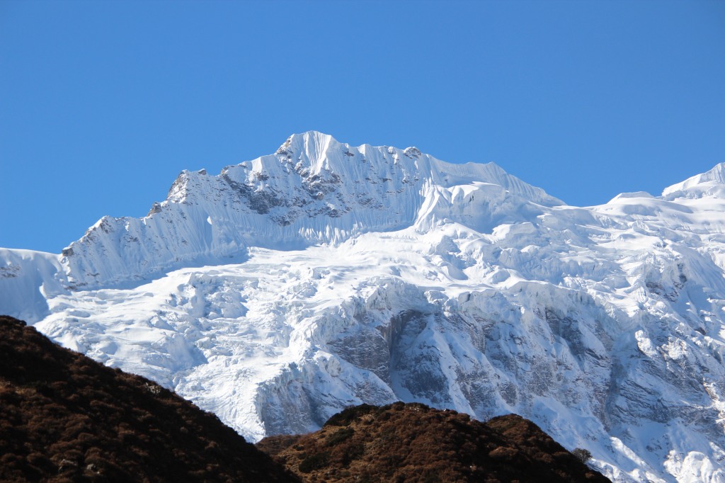
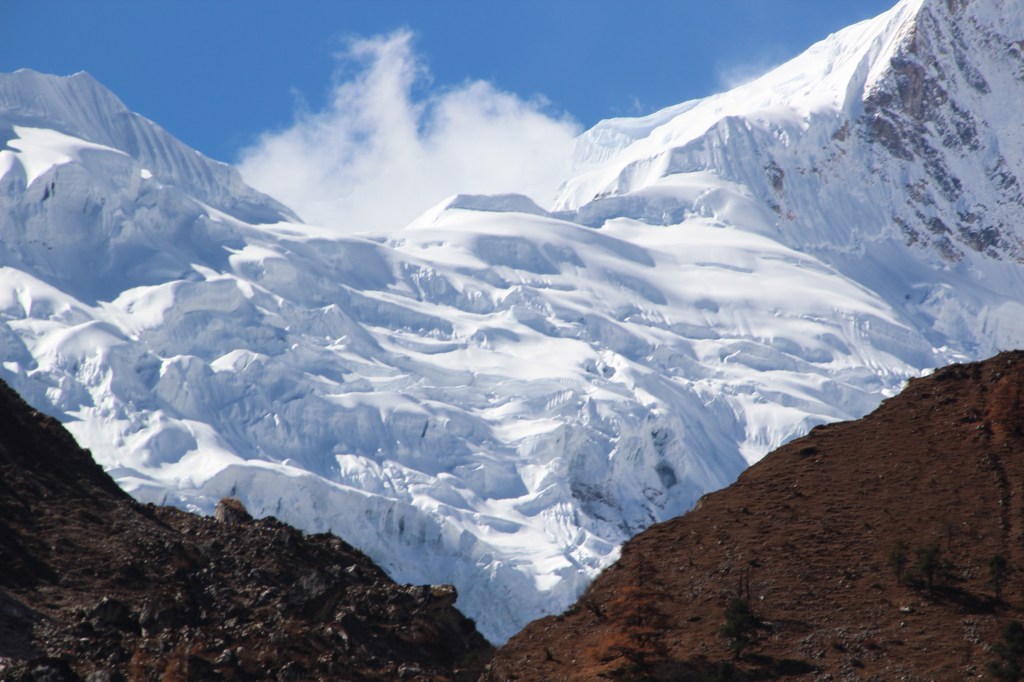
At this stretch, all of our members got separated from each other by their respective speeds, but all were in sight of each other, regardless of their positions (the ones with faster pace were visible two or three levels below, while others were behind by the same distance). It was a treacherous ground to tread upon. As if nature deliberately sprinkled the track with loosely placed gravels and was trying to relish your fall. Our guide kept a constant vigil on me and on more than one occasion, had to hold me by my backpack in order to prevent me from slipping. After crossing a few bends, I heard a sound which appeared to me as a thunder coming from a distant place. Many other travelers too heard it and were looking at a particular direction. The sky was clear, so there was no chance of a storm. After peeping out from behind of other travelers, I understood the cause. Dust of snow was still rising up from the debris that came down the slopes of a distant glacier. Avalanche!

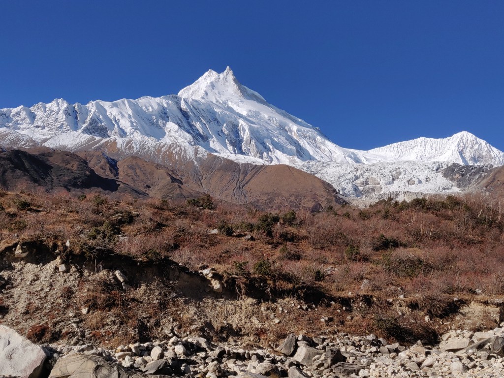
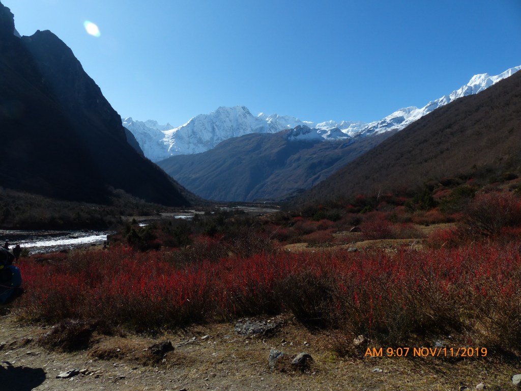
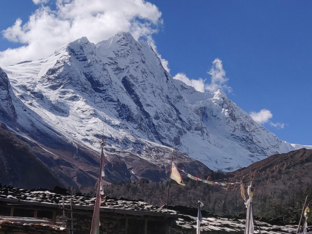
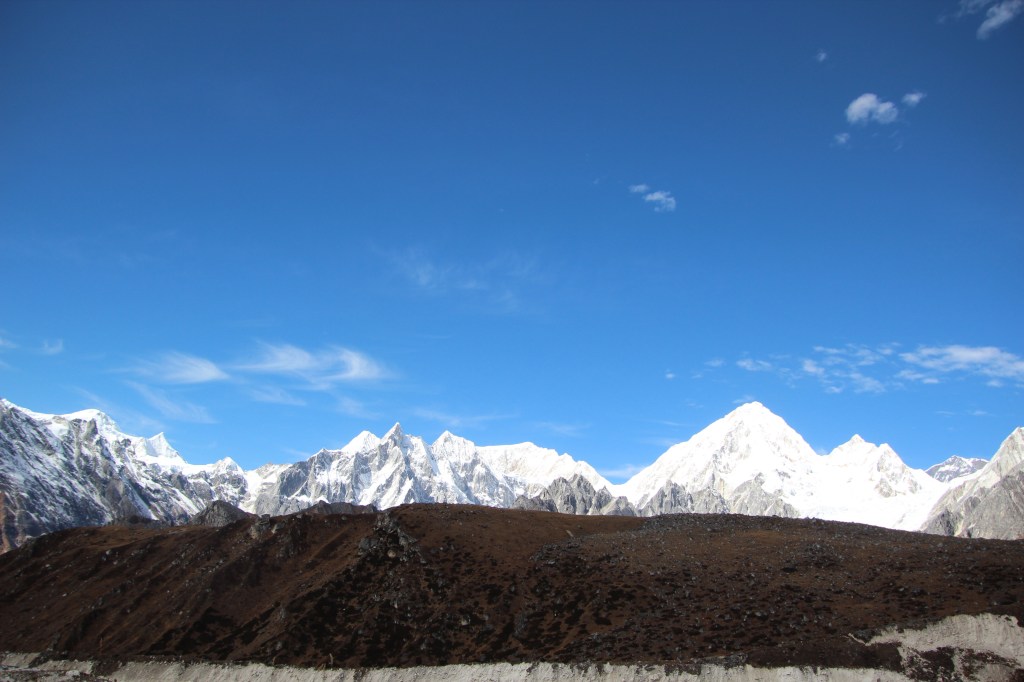
As we stood there, more bursts of it came down the slopes to add to the snow dust and rubble in the glacial bed. No doubt it was a treat to watch with your own eyes, but at the same time, you thank nature for not serving it down the place where you stood. A quick recall of the videos that came out of the Everest Base camp in May 2015 sent a chill down the spine. Keeping those thoughts aside, we looked around to see the awe-inspiring views of the snow peaks of the Annapurna range. We mused over the fact that the previous year, we saw them from the Annapurna base camp and this time around, we were looking at them from a different angle altogether!
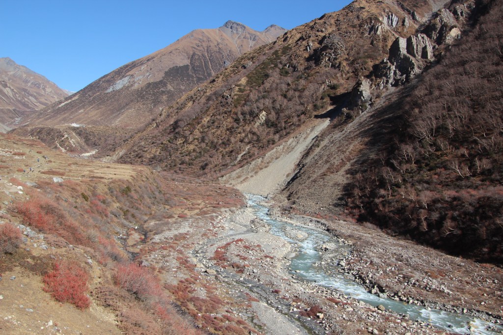
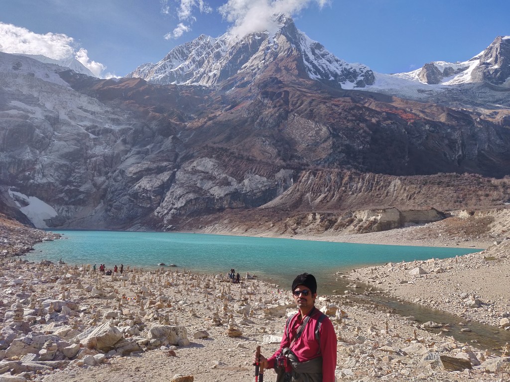
After moving down further, we could see a glacial lake among the accumulated debris all around. It was soothing for our eyes amidst the sights of destruction all around. As if, nature was protesting our intrusion in an area entirely private to her. After many more minor slides, I finally reached a relatively stable place where our guide asked me to move down slowly, while he moved back up again to assist another member of our group who was still up the slopes. If we are able to tell our tales today, it’s because of their tiring and often thankless support on these tough terrains.

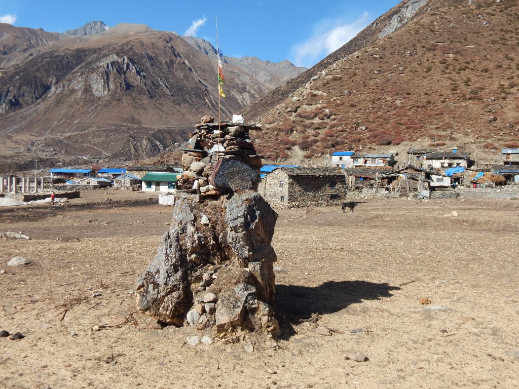
Every ordeal has an end and so did this. The slopes gradually reduced and after sometime, we reached a place called Larke Fedi, the first set of tea houses one encounters immediately after the descent from Larkya La. We gradually made our way into a tea house and ordered our lunch. We were in no hurry for the lunch to get served despite the fact of not having a formal breakfast in the morning. More time taken implies more rest at the place. All of our minds were much lighter because of the fact that Larkya La was now behind us.
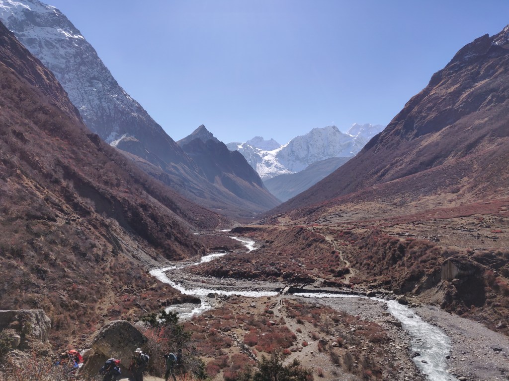
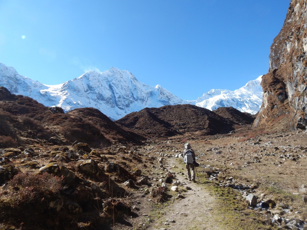
The trail from here on, was going to head down successively. The travel would be long, but we’d be losing altitude by the day. During lunch, we recalled our journey from Dharamsala all through the way down to the place where we were sitting at that point, the thicks and thins of it. A couple of travelers entered the inn and straight away went for the beds without even bothering to remove their gears and they enjoyed their sleep all through the time when we were having our lunch. After lunch, we didn’t lose much time as there was still about a couple of hours of travel left to reach Bimthang. So, we hit the trail once again. After moving down for sometime we saw tree trunks (not leaves) reappearing – a sign of decreasing altitude. Niladri and Dhananjoy strode ahead while me and Ranjan da followed them at our own pace. Now the restlessness was to finish off the remaining track as fast as possible to reach Bimthang to have some time to relax at the end of a tiring day of walk. We kept crossing multiple bends with the hope of sighting the houses of Bimthang after every crossover, but it kept us guessing. Asking about the remaining distance to our guide was of no use as they have their own standards of measuring distance which often doesn’t match with those of us from the plains. But as they say, whatever has a start, meets its end, we finally got to see the tea houses of Bimthang from a long distance but that was enough to get us energized and we sped ahead towards the hutments.

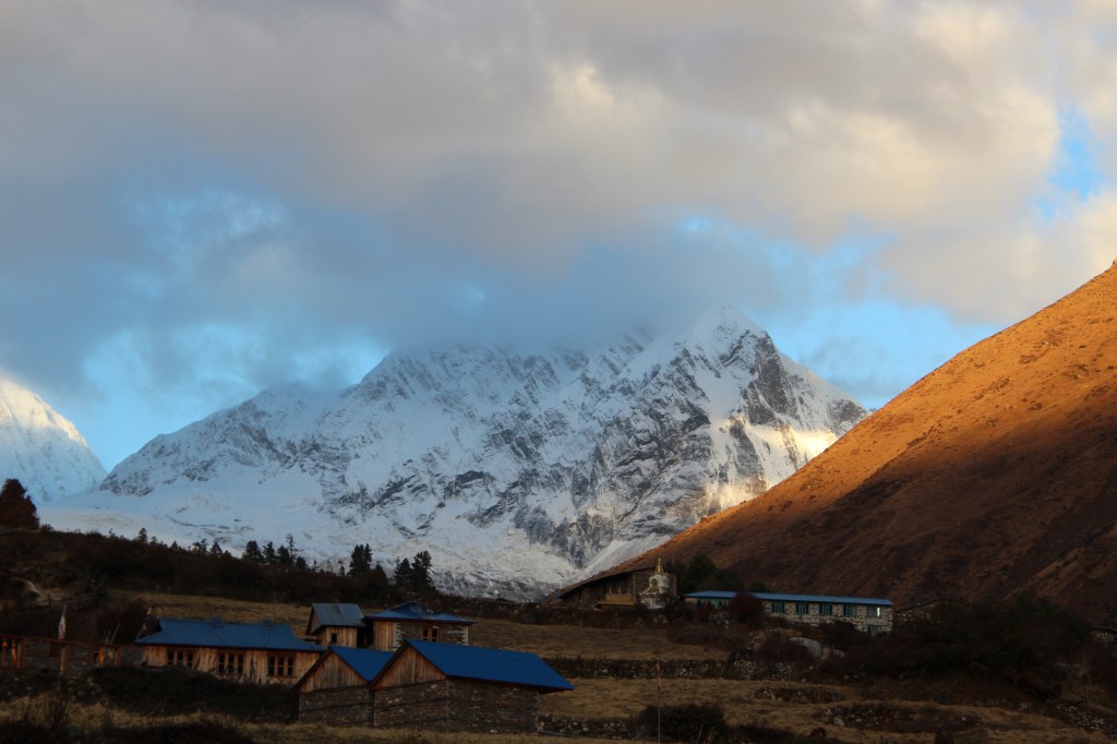
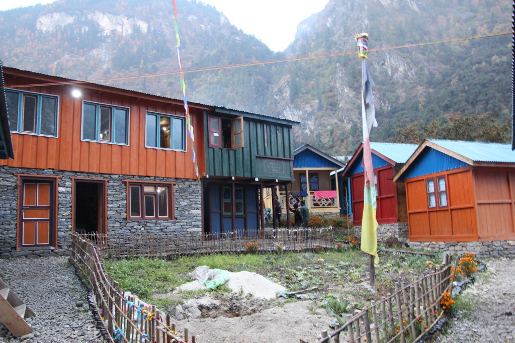
Bimthang is located in a wide valley surrounded by high mountains all around and offered spectacular views all around it. We retired to our respective rooms. Temptation was there to immediately lie down on the bed for sometime, but I resisted it and changed my gears and prepared the backpack for the morrow till the inertia lasted.

The evening tea party of that day was really enjoyable. All of our minds were light and filled with a sense of achievement. At the dinner table, a Sherpa guide from a different team showed us some magic tricks using playing cards. After that, we subsided under our blankets and for the first time in this trek, I immersed into deep sleep. We were sleeping at 3590 m. The nest day’s walk would take us to Dharapani, the last place to be reached by foot.