
29th April, 2025
Yugal (our guide) took the responsibility of checking on the weather early in the morning & letting us know about the feasibility of hiking to the Muldai viewpoint. My own interest prompted me to check myself & that revealed that the effort was to go futile. Similar to the morning before, every object was hidden behind fog & mist, which simply refused to let go of the hold. One famed viewpoint got eliminated from our list without any alternative. Nevertheless, we focused on what remained. Today was supposed to be the longest. From Dobato, an adulating trail over the ridge should take us to the Bailey kharka, beyond which the trail would take us down into the river gorge. A crossover there would be followed by an uphill hike to Chishtibung, our place of lunch. This whole trail would lead us 400 m downhill. After lunch, we’d have to hike 600 m to reach the top of a ridge. A leisurely walk of about 500 m along the ridge should take us to Khopra danda, the second famed viewpoint of the trek. Looking at the gloomy weather, Ranjan da contemplated stopping at Chishtibung unless there was significant improvement justifying the contrary. I deferred the decision till I reached Chishtibung and a hunch in my mind told me not to stop there as that’d at least give me a chance with the views, which, otherwise stood to be forfeited. Even if views can’t be obtained, why should I give away the chance to hike, which was another goal of this trek? How frequently do you get a chance to walk on pristine forest trails in the mountains?
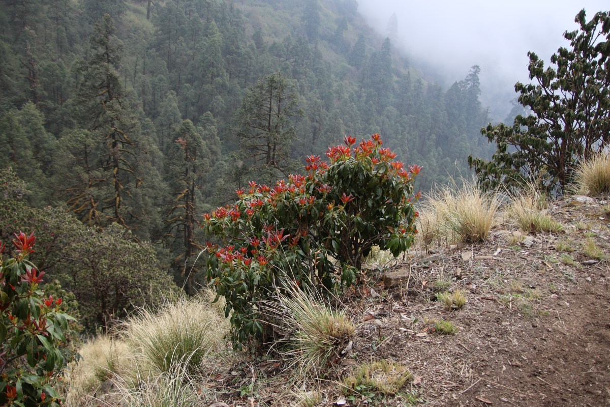
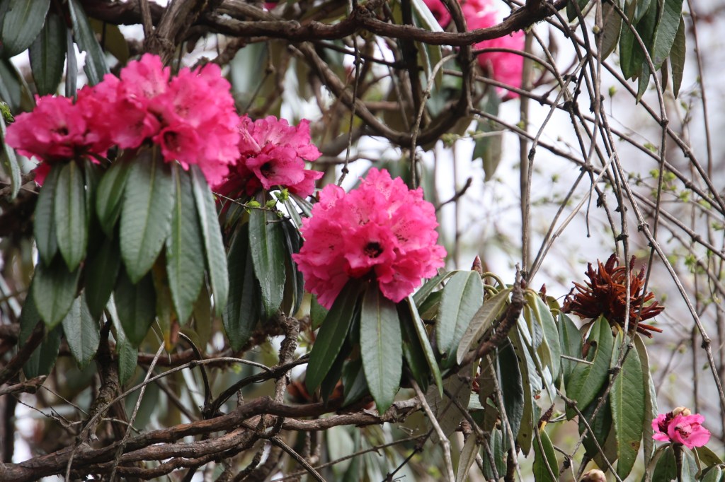
After regular preparation, we started. After the teahouse premises, one trail moved up towards the Muldai viewpoint. We took a right turn to take the other one. It moved a little down to cross a small landslide area. The trail was slightly wet, thanks to a small stream of water that crossed over it. We circumvented it carefully & after a small hike, we reached the top of a ridge with slopes sliding down from both sides of it. The ridge had a considerable cover of Rhododendron trees which were in their full bloom.

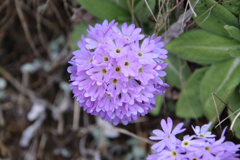
Since the previous day, the bloom was on the rise. We could realize what a marvellous walk it would have been, in absence of the prevailing fog. Though not fully, the Rhododendron blooms somewhat compensated for the lack of views of the Himalayan peaks. Apart from the flowers, we also saw some unique vegetation.

While I walked, I felt warm, but whenever I stopped (either to take snaps or to gulp down sips of water), the wind swept my face. As during every morning, I kept my jacket on, despite the sweat it generated inside. We heard some tinkle of bells that told us that mules were approaching us from the other side. One always needs to be careful to give passage to these animals at suitable places, else they could pose challenges as trails aren’t wide enough at every place. We saw a mule being chased down by its owner as it attempted to stray away from the established route. As we went past it, there were three more standing around a bend. That told us that the mule we encountered earlier, had turned rogue, giving it’s owner, a run for his money. The shades of Rhododendron flowers turned lighter.
After a while, we reached a point where there was a board with arrows pointing to three directions. One pointed towards Dobato (from where we were coming), another towards the hidden lake & the third towards Bailey kharka. I looked towards the arrow that pointed towards hidden lake, thinking about the two unfortunate laborers who lost their lives to lighting strikes, day before yesterday. I then moved ahead towards Bailey kharka. After a while, the trail entered into the woods and we were surrounded by Rhododendrons & we found ourselves walking under a canopy of branches with blooming flowers. Patches of snow lay by the way side.

After walking through these for half an hour, we entered an open amphitheatre. It was an open pasture where yaks grazed around and the horizons were lined by blooming Rhododendron trees. The ground below our feet were covered with small yellow flowers, so many in their numbers that it was difficult walking without trampling them. The mist played hide & seek with the distant Rhododendron bushes while yaks grazed around in leisure. This was the famed Bailey pastures (or Bailey kharka, as they’re known in Nepal).

I roamed around the pastures, taking snaps while the rest of the group caught up with me. I could imagine what a backdrop it would have constituted, had the Himalayan peaks been on their displays. Nevertheless, we thanked nature for whatever was placed by it at our disposal.

After some rest, we resumed our journey, which now headed downhill, first through the woods, then along an exposed trail along a ridge. Yellow grasses filled the slopes and the trail, though narrow, was safe enough. There were places with just enough space for one pair of legs, which made one conscious, but by & large it was okay. After sometime, I saw our porter Ramesh signalling me to stop from behind. I heeded to his signals & stopped at a site which had a small temple. Apparently, our guide asked to stop and move together from hereon. After the rest of the group caught up with me, we headed downhill, along the open grassy slopes.

After sometime, woods reappeared on both sides. Presence of trees along both sides has a psychological effect of safety (as opposed to open ridges or slopes) though slip ups are unlikely to be arrested from such heights. After winding down through the woods, we reached a junction where we saw the Swiss team (they stayed at Dobato, the precious night), taking rest amidst a meadow where there were arrows pointing to two opposite directions. The left one pointed downhill towards the village of Swanta, while the right, again downhill, pointed towards Chishtibung. We knew that the downhill was till a waterfall, after which, it was a steady uphill towards Chishtibung. I headed down towards the right, traversing some steep switchbacks, heading towards the waterfall. The more I headed down, the more I felt acquiring some debt as I thought, we had to traverse all this way up, the following day, to reach the junction at the meadow, to take the other route towards the Swanta village. After walking for quite a while, I thought of waiting for the group, just to ensure I wasn’t straying away from the trail. The reason to think so was that there wasn’t any marked trail to follow (just some stray paintings on tree trunks to mark the way). While waiting, my eyes went towards the lush green trunks of the trees covered with mosses. The ground too, was covered with small but strange vegetation. Ferns & mosses with unique features dotted the ground.
After I saw Ranjan da emerging from a corner, I went further down towards the gushing stream, crossed over it via a wooden bridge & started the uphill hike towards Chishtibung. It was considerably steep, going by the switchbacks we had to traverse. I kept an eye towards the top of the hill and it seemed we were being dragged towards the top. But that was misleading. As soon as we reached the point which seemed like the top, the trail opened up beyond that point only to lead further up. After many such traversals, the trees started decreasing and once again we moved beyond the tree line. I now found myself walking through the terraced cultivation fields. A glance above the slopes led me to the place yet further up, where I saw a lodge. I then set it as a milestone & started advancing towards it, in small installments (to give enough rest & strength to my lungs) and finally reached there. Profuse sweating prompted me to remove my jacket while I was waiting for the group to catch up, but the gushing winds forced me not just to put it back on, but also to rush to the covered dining space to take refuge. The place was called Isharu.
The entire trail up to this place from the woods below, was visible & I could watch other members of my group making their way up. I tried waving my hands but their eyes were firmly focused on the trail. I waited till they reached the tea house, took some time to rest after the uphill hike and then resumed our hike once again. The trails kept moving upwards in the form of switchbacks and now it was exposed on one side, given that we were treading above the tree line. Our strides became ever smaller as we gained altitude, with ever increasing stress on our lungs. As every ordeal comes to an end, so did this and finally, we reached a junction from where three routes met (or emanated, depending on how you saw it). One pointed down towards the village of Swanta, the other towards Bailey kharka (the one which we traveled) and the third pointed upwards towards Khopra danda. We had to opt the third to hike some more distance till we reached a tea house by the way side. Finally, Chishtibung was there.

As we settled in the dining space, Ranjan da declared that his hike was to halt at this place. I decided to continue to Khopra danda after lunch. We had to make some adjustments accordingly as there was no point carrying all the luggage up for just one night. I split the luggage to retain just enough for a night and stuffed in a small packet which Yugal was generous enough to carry. Ramesh was to stay behind with Ranjan da at Chishtibung and so was to be the case with rest of the luggage. As usual, “dal-bhat” was being prepared while we took some rest. We were hungry and did justice to the hot food that got served after sometime. After lunch, we filled out bottles, Yugal and I strapped our respective backpacks (admittedly, his was much heavier, given that he was carrying some of my luggage) and both of us resumed our hike towards Khopra danda after bidding a temporary good bye to Ranjan da and Ramesh.
There were some trees scattered around the trail for some distance, but they disappeared very soon as soon as we moved up. After hiking for some time, we came to a resting place where some tibetan flags (chortens, as they’re called) docorated the area. We rested for sometime as walking proved a bit more difficult right after lunch. But we were careful not to waste much time as clouds started closing in on us. The trail was marked by a narow strip of stones laid by the side, which went through some bushes and trees with very sparse foliage. Their colors too, started to take a yellowish tinge, giving an indication that we were approaching the ridge, hence, lower levels of Oxygen. Gradually, trees gave way to yellow grasses and the trail became steeper lining the bare slopes. As we moved up, we could see that the valley below us, was covered entirely by dense white clouds. A slight drizzle also fell on us, but it was still not a downpour. The width of the trail became narrower. We could see other hikers treading the path way above us, amidst the prevailing mist. It gave us an idea of how far we still had to cover before reaching the top of the ridge, beyond which, as promised by Yugal, the path was supposed to be flat along the top for about 500 m. I kept trodding ahead till I reached the next bend, rest for a while, only to move up to the next bend. This pattern repeated till we reached the top, which was adorned by chortens. They flapped through the strong winds that dashed the place. Despite being cold, we sat there for sometime to soak in the surroundings. Thanks to the mist and clouds, there wasn’t much to view. The trail indeed, as promised by Yugal, ran through flat terrain and the roof of the tea house appeared before us. Khopra danda, at last!.
We moved down a few stairs to reach the compound and entered the dining space, which was buzzing with other hikers. It was a community lodge. The alloted room was descent. After changing the clothes, I informed Ranjan da & our homes, about our arrival through WhatsApp calls. That’s when, as I looked through the window panes, I was greeted with the appearance of the mountains amidst the hovering clouds! Their enormity overwhelmed us. They were so near as if at a stone’s throw distance. Right there, in front of us, though somewhat shielded by the engulfing mist, was Mt Annapurna South and Annapurna Main.

To their left, stood Mt Nilgiri and as one turned their eyes to the left, there was Tukuche, followed by the mighty Dhaulagiri massif. Though it’s top was cut off from our views by the ensuing clouds, it inspired awe! Yet to it’s left, there were other peaks of the Dhaulagiri range, with the vista ending finally at Gurja Himal. The Annapurna peaks were clear enough but the Dhaulagiri ranges were faintly visible though the veil of the clouds. More then their actual views, their presence and a possibility of their appearance in full glow, stirred us and we kept training our lenses to capture as many snaps as possible, despite the clouds. One never knows if this was to be the best or even better was in store for the morrow. Given the day’s view, our hopes were up for the next day. Would nature reward us for our toil to reach this place, despite the clouds (as they say, would patience and perseverance pay off)? Well, we hoped so. At least it doesn’t take money to hope for the best. After all, we descended 400 m to Chishtibung, only to hike up 600 m to reach Khopra danda, all in one day. Would that all be in vain? As we slept at 3640 m, we certainly hoped not.

2 thoughts on “The solitude of Khopra ridge – Khopra danda”