
Ever since I started my ventures in Nepal, I had the challenge to maintain a proper balance between family trips & trekking. The latter normally didn’t involve family members. The Diwali break was coming up & I planned to use it judiciously. Most of my Himalayan getaways started with long weekends. But over the last ten years, most of the common hill stations of Uttarakhand & Himachal have been covered. Also, over these years I’ve preferred to stay away from common destinations as their accessibility has led to their “downfall”. Swarm of travelers flock to these places leading to massive build up of hotels & deforestation. Traffic snarls are very common in places like Manali, Simla or Nainital. Some years ago, I’ve tried my hands with shot treks with family. It started with a hike to Chopta from the picturesque Deoriatal through the woods of the Kedarnath wildlife sanctuary. I thought about exploring that option once again. This was in November 2017, a year ago before Annapurna happened. While scouting for options of easy to moderate grade treks, I came across “Dayara Bugyal”. It’s in the Uttarkashi district of the state of Uttarakhand. The accounts available on internet seemed to suggest that it easy, often done with family. I reached out to my contacts (guides whom I knew) in other parts of Uttarakhand & at the same time my search continued on internet. Finally, I came across Balbir Singh Negi. Discussions continued with him. Finally, an itinerary was drawn up. We were to start from Dehradun. A vehicle was to take us to the town of Uttarkashi. The next day would see us hiking up to Raithal, our first halt. The next day would take us to Dayara Bugyal, a high altitude meadow in the upper Himalayas. We’d camp there for a night & then come down via a different route via Barnala. We still had two additional days at our disposal & we thought to spend them at Harsil, a beautiful hill station before Gangotri. I booked the GMVN rest house at Harsil & the railway tickets to Haridwar. Later, based on Balbir Ji’s advice, I changed them to Dehradun. That would save us about 2 hours of travel.
Ever since I started my ventures in Nepal, I had the challenge to maintain a proper balance between family trips & trekking. The latter normally didn’t involve family members. The Diwali break was coming up & I planned to use it judiciously. Most of my Himalayan getaways started with long weekends. But over the last ten years, most of the common hill stations of Uttarakhand & Himachal have been covered. Also, over these years I’ve preferred to stay away from common destinations as their accessibility has led to their “downfall”. Swarm of travelers flock to these places leading to massive build up of hotels & deforestation. Traffic snarls are very common in places like Manali, Simla or Nainital. Some years ago, I’ve tried my hands with shot treks with family. It started with a hike to Chopta from the picturesque Deoriatal through the woods of the Kedarnath wildlife sanctuary. I thought about exploring that option once again. This was in November 2017, a year ago before Annapurna happened. While scouting for options of easy to moderate grade treks, I came across “Dayara Bugyal”. It’s in the Uttarkashi district of the state of Uttarakhand. The accounts available on internet seemed to suggest that it easy, often done with family. I reached out to my contacts (guides whom I knew) in other parts of Uttarakhand & at the same time my search continued on internet. Finally, I came across Balbir Singh Negi. Discussions continued with him. Finally, an itinerary was drawn up. We were to start from Dehradun. A vehicle was to take us to the town of Uttarkashi. The next day would see us hiking up to Raithal, our first halt. The next day would take us to Dayara Bugyal, a high altitude meadow in the upper Himalayas. We’d camp there for a night & then come down via a different route via Barnala. We still had two additional days at our disposal & we thought to spend them at Harsil, a beautiful hill station before Gangotri. I booked the GMVN rest house at Harsil & the railway tickets to Haridwar. Later, based on Balbir Ji’s advice, I changed them to Dehradun. That would save us about 2 hours of travel.
On the day, Mussourie Express was running late. After leaving Haridwar it moved on gradually through the dense forests of Rajaji National Park. The solar rays made their way through the dense canopy of the forests. At some places it was even dark during the day. I’ve traveled this section many times before but it never fails to fascinate. Phases of dense forests are interspersed by river beds & streams which came down the slopes of the Shivalik hills that are visible on the horizon. Finally, the train reached Dehradun station about 3 hours late. It was 12 PM. Though I enjoyed the journey, but at the station I felt we were robbed off at least 2 hours. We could have reached our destination by noon, but it will be at least afternoon. We boarded the vehicle which started it’s journey from the railway station.
At first it struggled to make it’s way through the crowded streets of Dehradun, but as it hit the Mussourie road, the ride was smooth. This section of the road was familiar to me as I’ve traveled in this region on multiple occasions. On one occasion we drove to Mussourie all the way from Noida. That was the first time I drove on the mountain roads. It was a thrilling experience but I didn’t enjoy the traffic snarls at Mussourie. Places like Kempty falls near Mussourie are now notorious for long queue of vehicles, thanks to the weekend rush from Delhi, Punjab, Haryana and other areas of the plains. The vehicle moved up the road that winds itself along the mountain slopes. After a few bends, houses of Mussourie started to appear. Fortunately, the road still has some forest cover and concrete hasn’t quite swallowed the forests to the extent it as done in other hill stations. But Mussourie is known for the pomp and show of its hotels. As salaries increased, so did the living standards and the allied expectations of comforts of urban life. With increase in accessibility to hill stations like Mussourie, more and more people flocked towards them on long weekends. With them, they carried their ever-increasing expectations from modern urban life. The tourism industry hoped to cash in on this by attempting to meet them. Little did they or the governments and local authorities realize that these places cannot sustain such demands, not at least by keeping their serenity intact. This is a harsh truth faced by almost all the areas of the Himalayas which has become more accessible due to increased connectivity. Mussourie, for example, was a place known to receive snowfalls regularly. However, over the years, uncontrolled constructions has seen it losing a large section of its forest cover and today, in some years, winters go by without any snowfall. Fans and air conditioners are common in the hotels and lodges there, which people never had to install earlier. But, with some of the territories earmarked under forest department, Mussourie has been able to put some check to uncontrolled urbanization and fares a little better than places like Simla.
The vehicle meandered around the serpentine roads of Mussourie town. It kept off the Mall road and followed the streets that took us through the cantonment area and we came out of the Town to hit the road that goes towards Dhanaulti. It was a short cut through the town, avoiding the crowded tourist areas. We kept moving till we reached a junction. At the junction, one road goes ahead towards Dhanaulti. But we took the left turn that is headed towards Uttarkashi. It was now going down down the slopes through the forests. This is a relatively new section of road that connects Dehradun, Mussourie to the road leading to Uttarkashi and Gangotri. The road took us to the banks of the Tehri dam reservoir, a large dam built on the Ganges, causing much disbalance in the local ecosystem. The rising waters of the reservoir drowned the old town of Tehri and it had to be relocated to higher reaches of the hills as “New Tehri”. The vehicle moved along the banks to reach Chiniyalisaur, an important junction town on the route. It is here, the road from Haridwar and Rishikesh joins the Gangotri road. It is also where a different road takes pilgrims and tourists towards Yamunotri, another important pilgrimage site which is also one of the famous “Char Dhams” of the state of Uttarakhand. After Chiniyalisaur, the road went by the banks of the Ganges, a pattern to be followed for rest of the trip. It was our first view of the river on this route and here it appeared no different than any other river in the mountains, making its way down the rocky and bumpy slopes of boulders through the gorges. Gradually, we passed the town of Uttarkashi, the district headquarters and reached Gangori (not to be confused with Gangotri). Balbir Singh met us at a nearby market and boarded the vehicle, which left the Gangotri highway to move up the slopes of a narrow road. This is the route that goes towards the famous Doditaal lake. The vehicle took us to a place where paved road ends. Beyond this, it is a trekking route to Doditaal and beyond. We disembarked here and headed up towards our place of stay, the Kaflon camp.
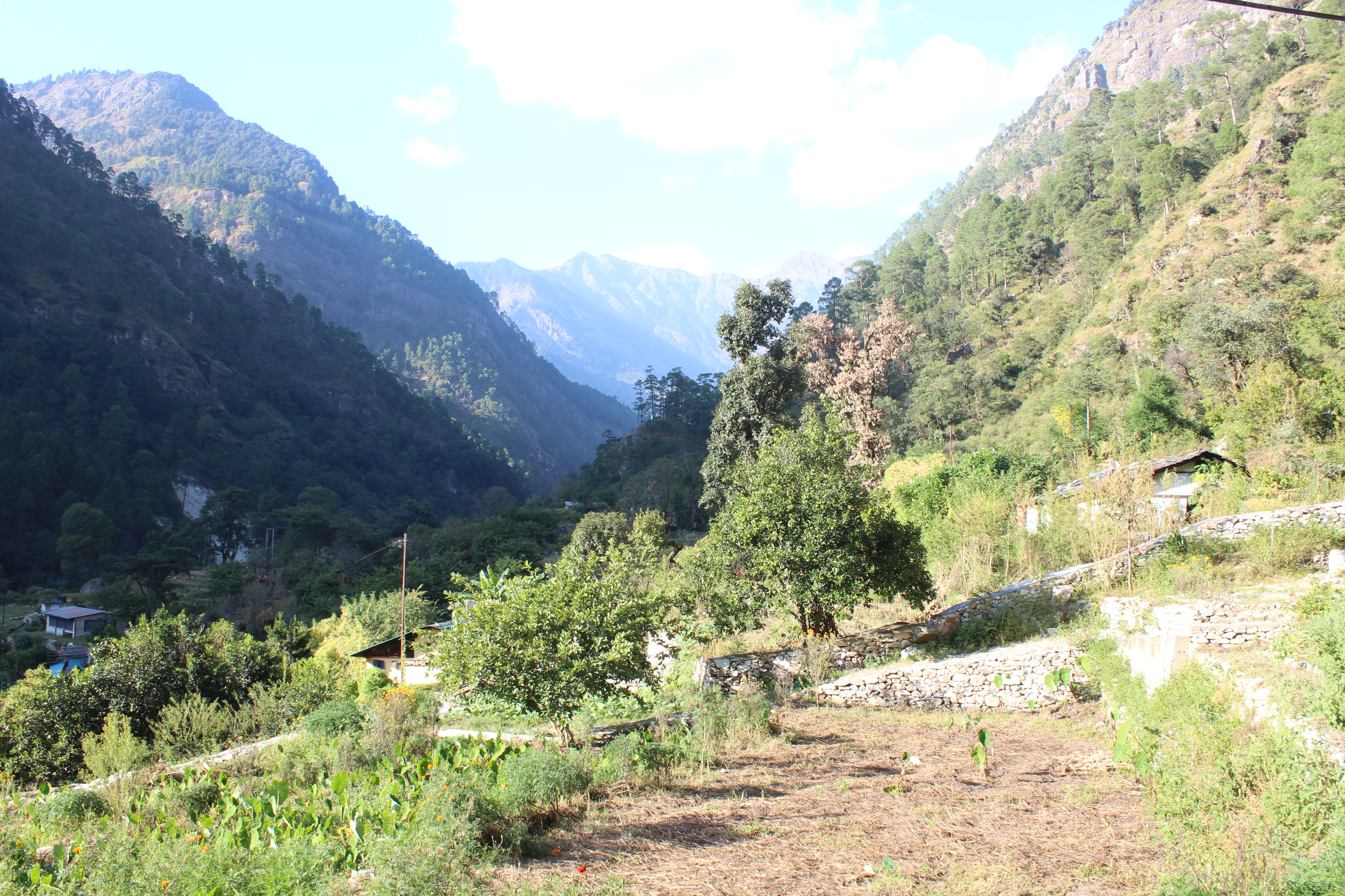
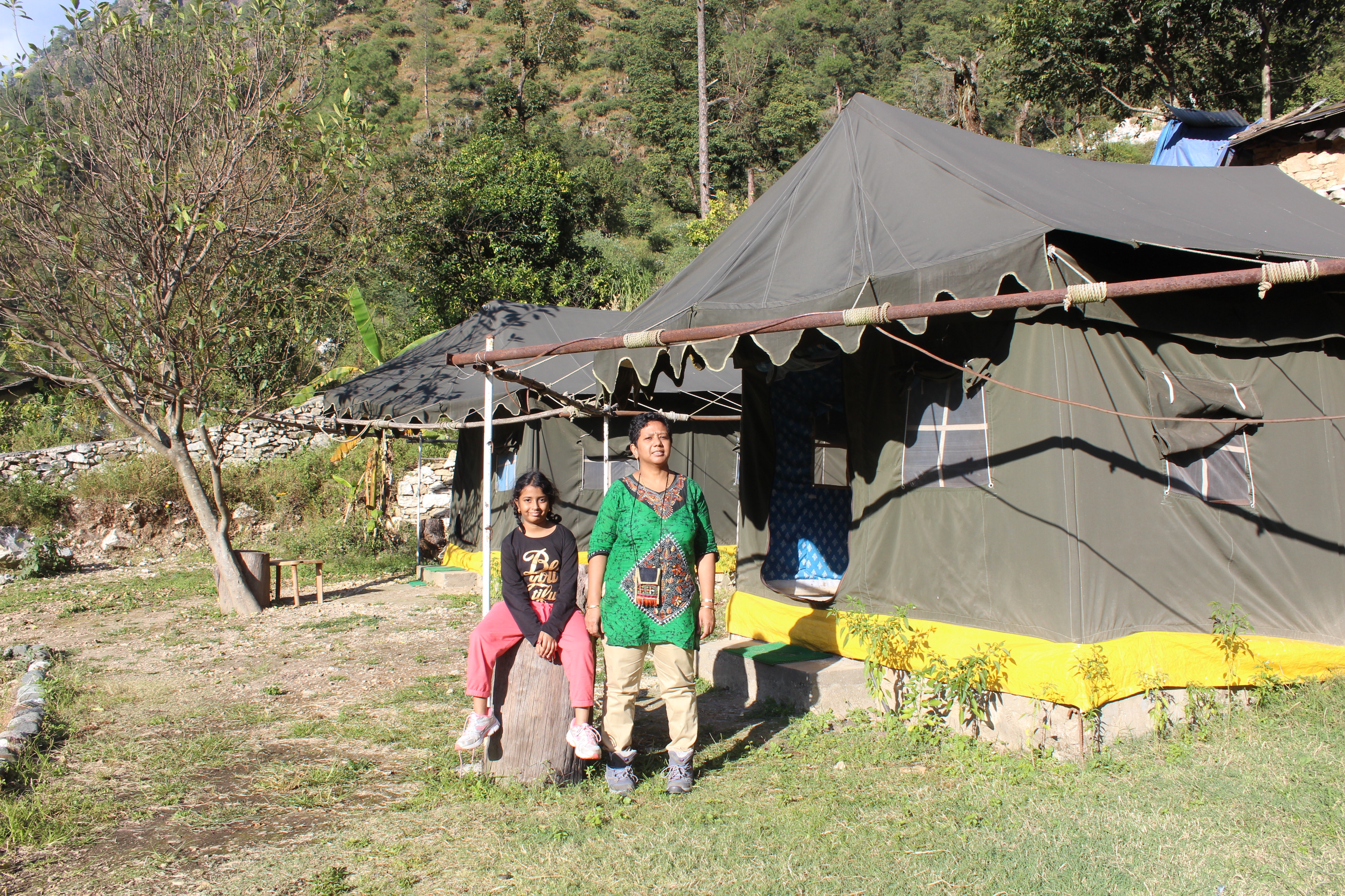
The Kaflon camp is located in a valley surrounded by high hills on all sides. They have a few tents set up with comfortable beds and attached toilets. The lawn in front bathed in bright afternoon sun. We were greeted with lemon juice by the staff at the camp. As we were shown the tent, it lifted our spirits. The tent had a proper bed, was very clean, airy and there was enough sunlight in it.

We had the entire afternoon at our disposal, at least 2-3 hours of bright sunshine to bask in. However, a quick conversation with the camp staff revealed that sunshine doesn’t stay that long in this camp, thanks to the high mountains that surrounds the place. They are also the reason due to which sunlight reaches late in the valley in the morning. Nevertheless, we still had sometime and we sat on the chairs to enjoy the afternoon. Tea was served with delicious onion fries (pakodas, as they call it, in this part of the world). We sipped the warm tea and the pakodas played a perfect match.
As evening wore on, the chill increased and we subsided to out tent and after dinner at 7 PM, we slid under the blankets. After chatting for sometime, sleep overran us.
The next morning, when we were served breakfast and tea, it was already 8 AM, but the sunlight was yet to reach the valley. Balbir Singh came over to meet us along with his son Arvind, who’d be our guide on this trek. We left some of our luggage at the camp and carried just the essentials along. We walked down the trail and reached the road head, where a vehicle was waiting to carry us to Raithal, the point where our trekking was to start from. The jeep moved down the road to reach Gangori, where rations and supplies were loaded (raw materials for food, cooking utensils, tents, sleeping bags, matrices, kerosene and other equipment). A drive of two hours took us to Raithal, where we were surprised to find a GMVN tourist rest house. Had I known about it before, we could have halted here instead of Kaflon. That could have saved us sometime. Nevertheless, we started our hike at about 11 AM. It was a bit hot, but a nice cool breeze gave us some comfort after we started. The initial route went amidst the houses and the fields of the Raithal village.
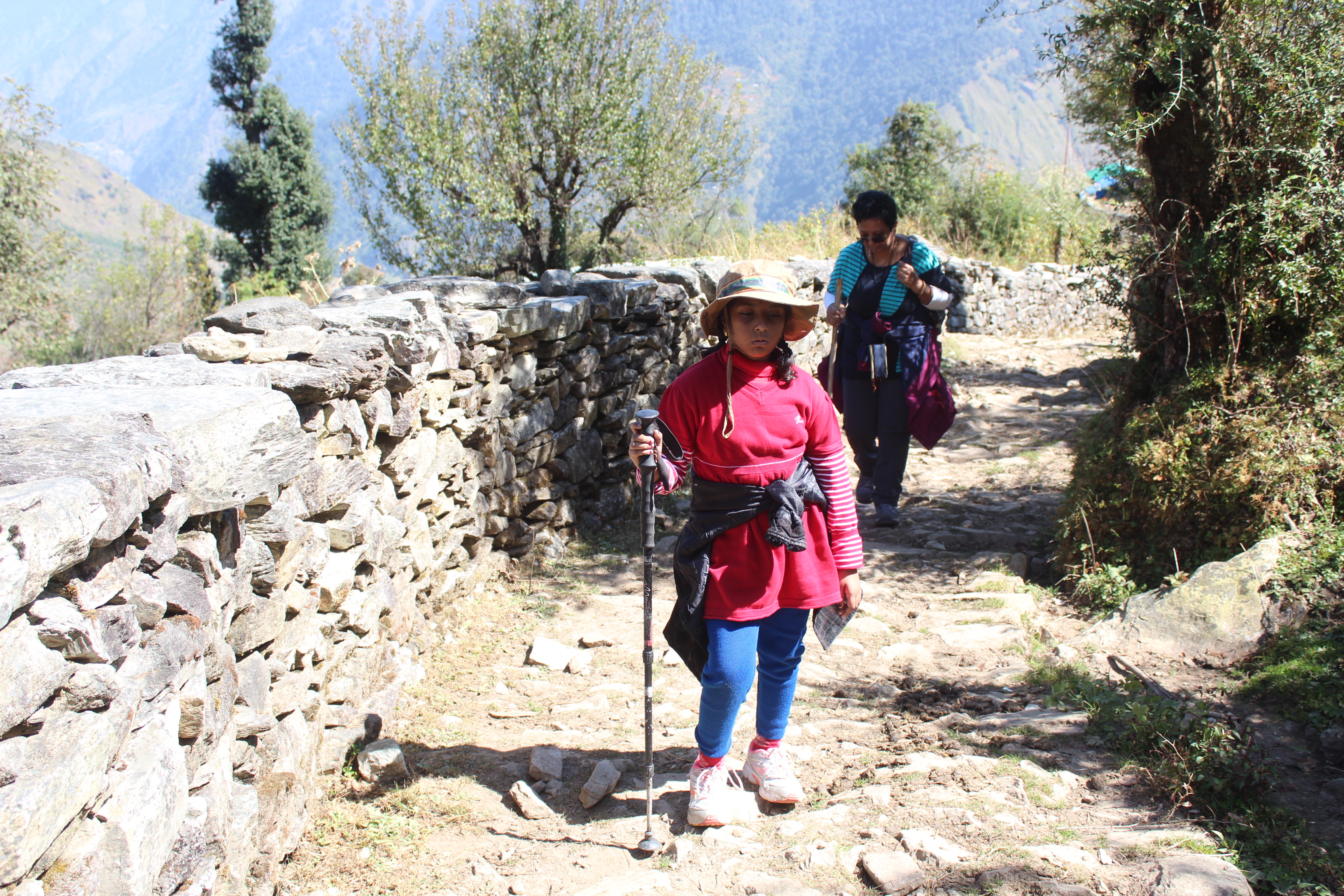
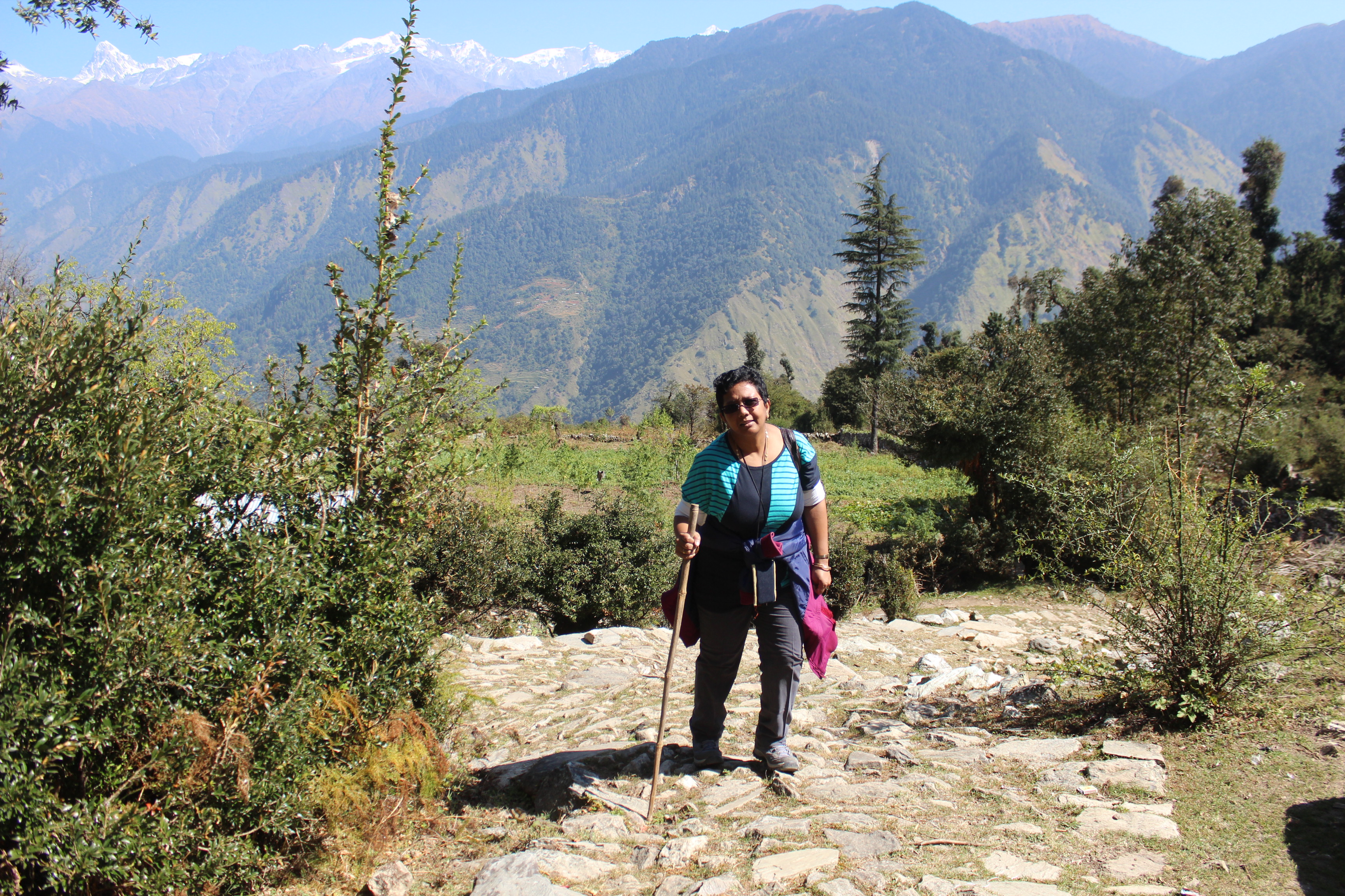
The route was paved with stones, but over a period of time, it has worn out, but it was still a well laid trail that zig-zagged upwards. We couldn’t keep our jackets on for long. So, we had to fasten them around our hips to give us some comfort while walking. My daughter and wife were faring well. It was just the start and there was some way to reach our camp. The distance wasn’t anything compared to what we’re accustomed to during treks of a higher grade. The walk for the day wasn’t likely to exceed 4 kms, whereas 8-10 or even 15 kms a day is quite normal in treks. Clouds stayed clear off the sky where we could see the peaks of the Bhairathi range of the Garhwal Himalayas.
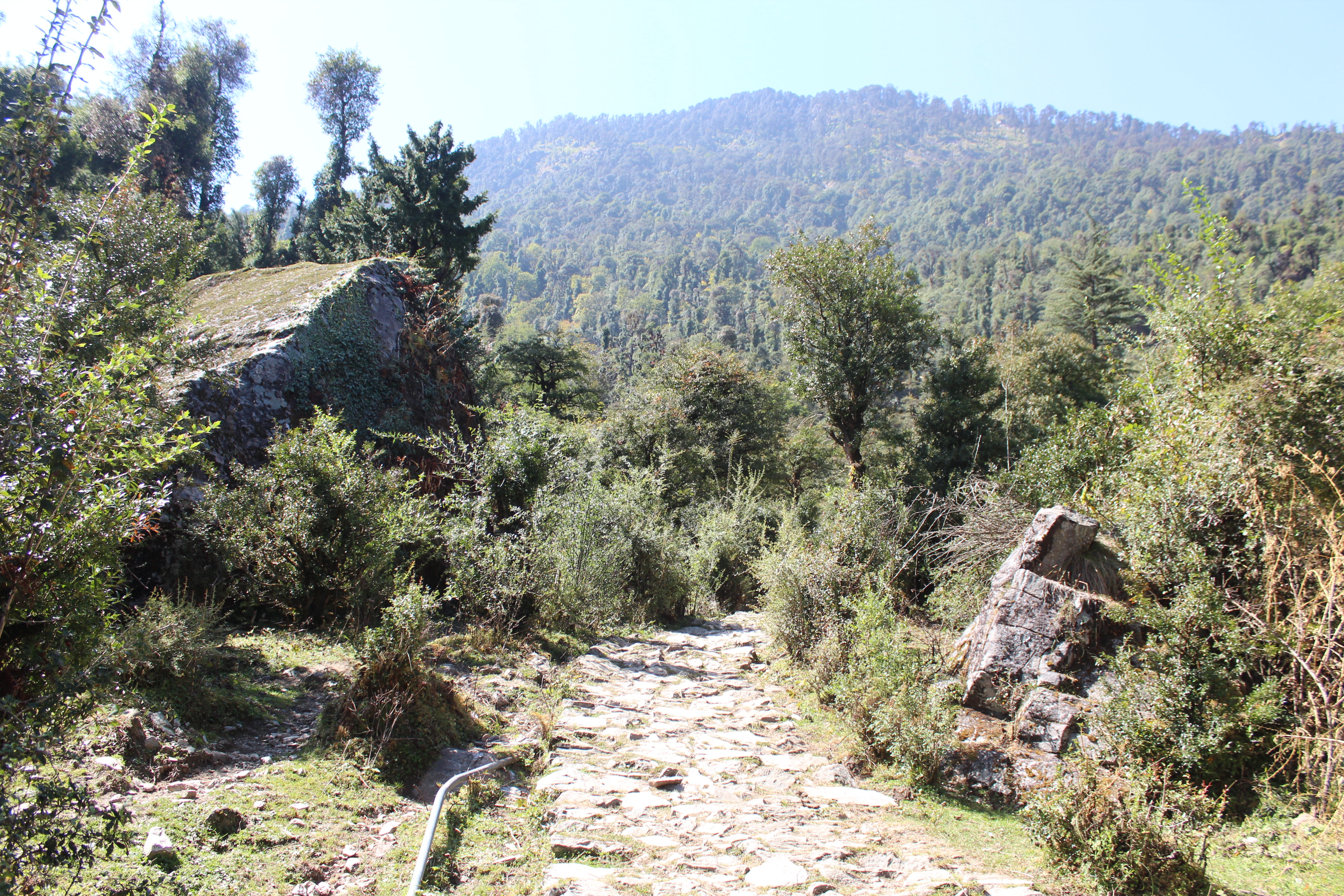
After crossing the Raithal village, we entered the woods that covered the route right up to the top where Dayara Bugyal lay. That gave us some respite from the blazing sun, whose rays were intense even in this time of the year when winter was knocking the doors.
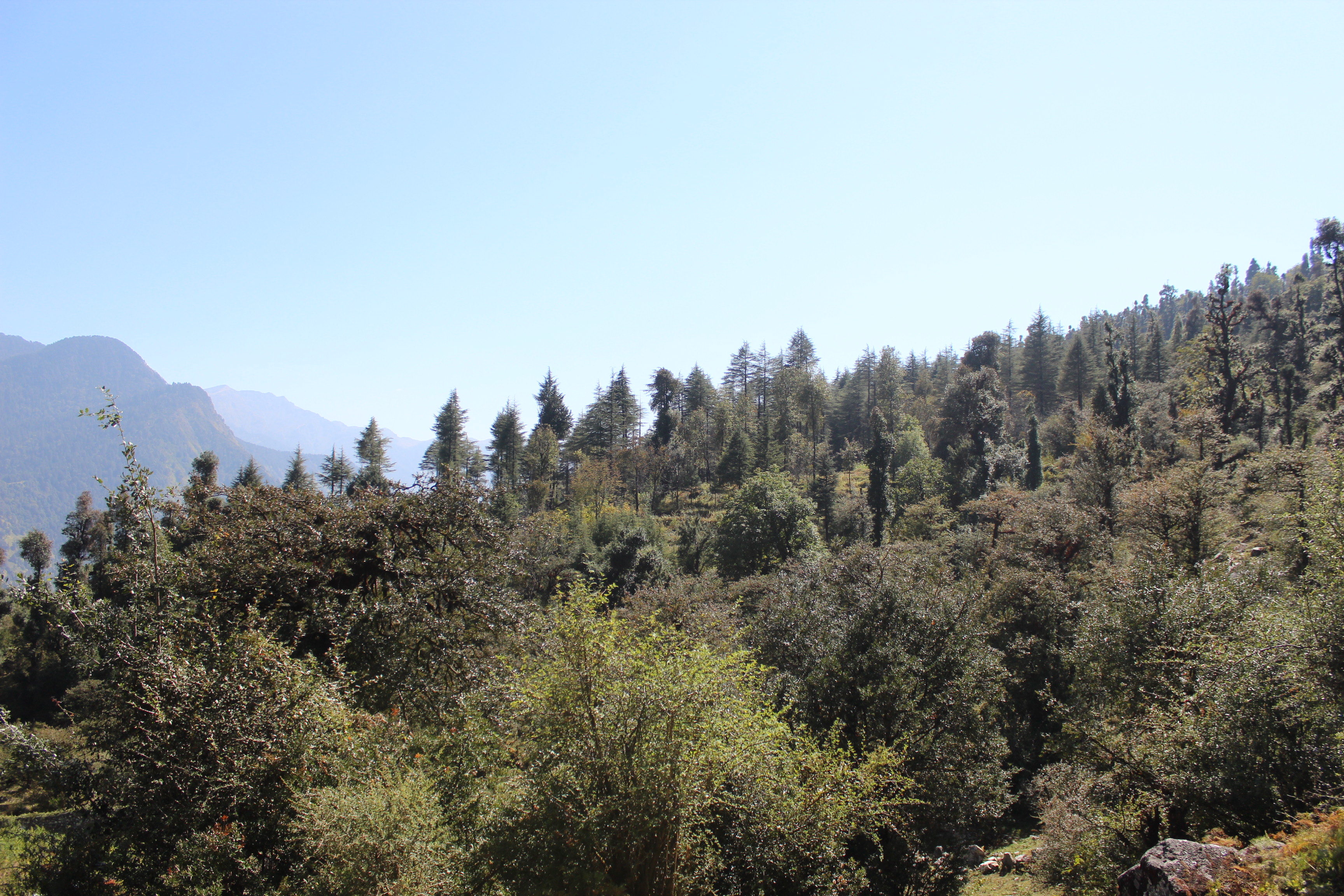
As the gradient increased, breathing became harder and halts increased for my daughter. They increased to a point where I had to intervene and take her along with me instead of letting her progress on her own pace. Though we had time at our disposal, but it had to be kept under control. At her age, one cannot expect the urgency and maturity that is required for treks. I urged her to look around in the surroundings where, on the horizon, Mt Bandarpoonch was visible in clear sky.

After sometime, guide Arvind handed over the packed lunches to us. We had our lunch at one of the bends, chapatis and sabzi (curry). I didn’t have much appetite and confined myself to minimum. After lunch, its always difficult to regain the momentum to walk but we got into our grooves again. The rays of sun acquired a tinge of yellow as afternoon wore on. My daughter became increasingly impatient , but the camp was nowhere to be seen.

We dragged on for another hour till we reached a point where we could see our tents at Goee, our place of halt for the day. The tents were in front of a shepherd hut, which was to serve as the kitchen fr the night. It was a small meadow spread out on the laps of the hills that led to Dayara Bugyal. Sun was preparing to leave the stage.
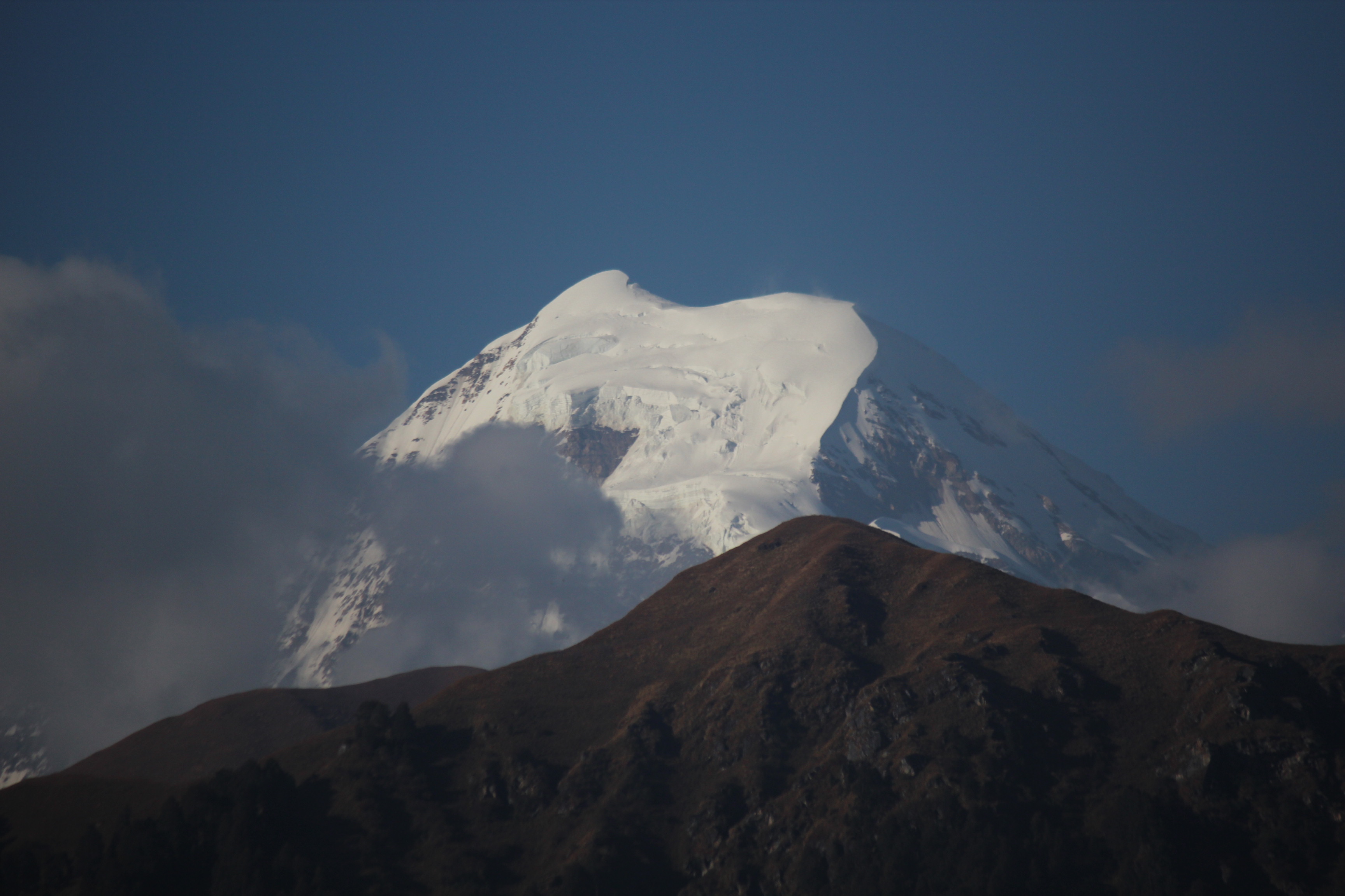

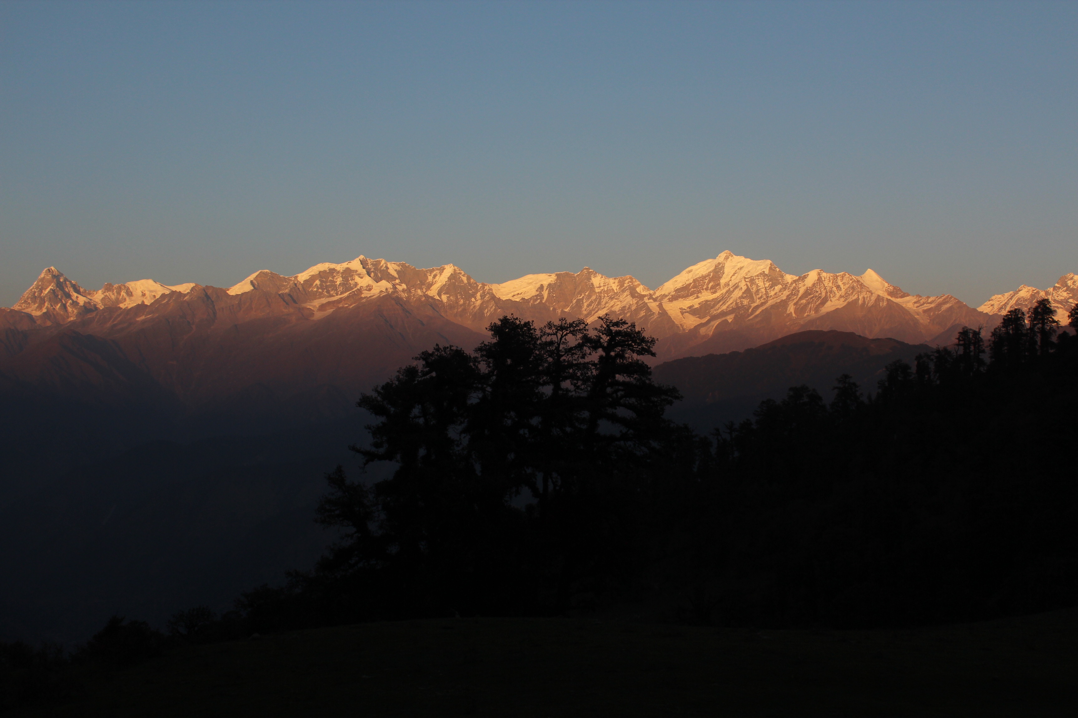
Shadows gained grounds quickly, but the peaks beyond the distant hills still bathed in the afternoon sun. My years spent earlier in the laps of the Himalayas told me the time was ripe for the sunset colors to play our their drama over the snow clad peaks. The yellow tinge of the solar rays acquired intensity and then crimson came in the mix. Mt Bandarpoonch was the nearest and largest visible from the camp.

We were handed our evening tea. I kept my focus on the distant mountains where the sunset scene was being played out. The entire Bhagirathi-Gangotri range turned crimson in the fading rays of sun.
The guides and porters set up camp fire with the help of twigs collected from the nearby forest. We spent time sipping our evening tea and warming our hands till the fire died out. As soon as it was dark, dinner got served, after which, we subsided to our tent. The tent proved inadequate for two adults and a kid. There wasn’t enough space to turn around, especially with the sleeping bags, which I never felt comfortable with. Silence engulfed the place with only strange sounds coming from nearby forests. My daughter kept asking whether tigers or leopards were a common occurrence in the surrounding forests. She went crazy with sounds around the tent which came from a stray dog which was roaming around and finally as he slept with his back against the wall of the tent, my wife got the jitters as she was leaning against the other side. But, we soon got used to it and the rest of the night was peaceful.

Good going dada, will sync up with you for advice for the next trip to the hills.
LikeLike
I am delighted to see your daughter. She will have all these posts as stories of her adventurous parents 🙂
Its sad that all these hill stations have turned into what they are just because they didn’t care about sustainable tourism. It saddens me to see the same situation in my home town. The NE used to be off normal travelers until recently and the effects are literally on the face but neither does the administration care nor do the locals – at least not to the extent they should. It’s very upsetting.
Those pictures are awesome. Will wait to read further.
LikeLike
Quite an adventure. The mountains look beautiful!
LikeLike
Thanks a lot
LikeLike